Scarborough

Settlement in Yorkshire Scarborough

England

Scarborough

Scarborough - South Sands
Scarborough - South Sands Credit: Colin Park

Scarborough is a vibrant coastal town located in North Yorkshire, England. Situated on the North Sea coast, it is around 200 kilometers northeast of Manchester and 80 kilometers east of York. With a population of approximately 61,000 residents, it is one of the largest settlements in the county.

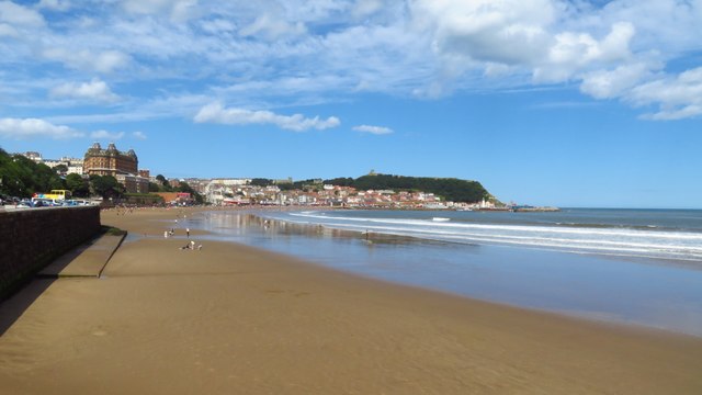
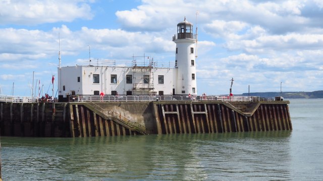
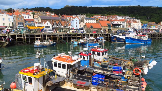
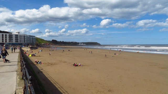
Scarborough has a rich history that dates back to Roman times, and its iconic medieval castle stands proudly on a headland overlooking the town. The town became a popular seaside resort during the Victorian era, with the opening of a railway line that connected it to the rest of the country. Today, Scarborough continues to be a popular destination for tourists, attracting visitors with its sandy beaches, stunning cliffs, and picturesque harbor.

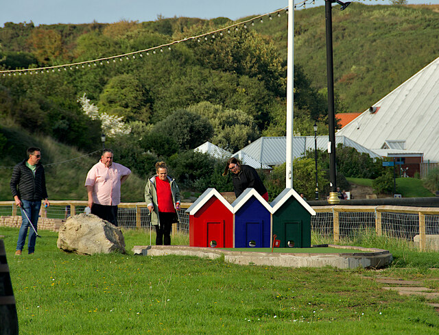
The town boasts a range of attractions and activities for visitors of all ages. The Sea Life Centre, located on the North Bay, is home to a variety of marine creatures, while the Scarborough Spa Complex hosts a range of events, including concerts, theater productions, and conferences. Peasholm Park, with its oriental-themed gardens and boating lake, provides a tranquil escape from the bustling town center.

Scarborough offers a wide range of amenities, including a diverse selection of shops, restaurants, and cafes. The town also has excellent transport links, with regular train services to York and beyond, as well as good road connections to nearby cities and towns.

Overall, Scarborough is a charming coastal town that seamlessly blends its rich history and natural beauty with modern attractions, making it a delightful destination for visitors and a wonderful place to live.

If you have any feedback on the listing, please let us know in the comments section below.

Scarborough Images

Images are sourced within 2km of 54.281578/-0.40220855 or Grid Reference TA0488. Thanks to Geograph Open Source API. All images are credited.

Scarborough - South Sands
Scarborough - South Sands and Lifeboat Station
Scarborough Lighthouse
Scarborough Old Harbour
Scarborough - North Sands
A Dreary morning in Scarborough Huntriss Row.
A Dreary morning in Scarborough
Huntriss Row.
Scarborough North Bay Looking towards the colourful beach huts (or chalets) and the Chalet Café.
Scarborough North Bay
Looking towards the colourful beach huts (or chalets) and the Chalet Café.
Crazy golf at Scarborough North Bay Crazy golf is an enduringly popular game, forever associated with British seaside holidays. This rather dilapidated hut is at the start of a course sandwiched between the North Bay Miniature Railway and the beach. Apparently it hosted the Yorkshire Championship Crazy Golf competition, the winner scoring a very creditable 32. 'Can you do better?' the sign asks, to which the answer is 'no'.
Crazy golf at Scarborough North Bay
Crazy golf is an enduringly popular game, forever associated with British seaside holidays. This rather dilapidated hut is at the start of a course sandwiched between the North Bay Miniature Railway and the beach. Apparently it hosted the Yorkshire Championship Crazy Golf competition, the winner scoring a very creditable 32. 'Can you do better?' the sign asks, to which the answer is 'no'.
Crazy golf at Scarborough North Bay The crazy golf course, closed here for the winter, is sandwiched between the beach and the North Bay Miniature Railway. The lighthouse is a notable feature.
Crazy golf at Scarborough North Bay
The crazy golf course, closed here for the winter, is sandwiched between the beach and the North Bay Miniature Railway. The lighthouse is a notable feature.
Path to Northstead Manor Gardens Alongside the path leading up from the beach are the remains of Scarborough's chair lift that transported passengers to the zoo (which later became Marvel's Amusement Park). The system opened in 1972 and closed down 30 years later in 2002 when the amusement park ceased operations.
Path to Northstead Manor Gardens
Alongside the path leading up from the beach are the remains of Scarborough's chair lift that transported passengers to the zoo (which later became Marvel's Amusement Park). The system opened in 1972 and closed down 30 years later in 2002 when the amusement park ceased operations.
Colourful beach huts on North Bay Promenade
North Bay Promenade The tented roofs in the distance are those of the Sea Life Centre with the cliffs of Long Nab beyond.
North Bay Promenade
The tented roofs in the distance are those of the Sea Life Centre with the cliffs of Long Nab beyond.
Descending to North Bay, Scarborough Looking down to the North Bay promenade. One of the former chair lift support columns stands on the grass. Three columns nearer the beach have been removed since 2017. See <a href="https://www.geograph.org.uk/photo/5450595">TA0390 : Disused chair lift, Scarborough North Bay</a>, looking up the path past the now removed machinery.
Descending to North Bay, Scarborough
Looking down to the North Bay promenade. One of the former chair lift support columns stands on the grass. Three columns nearer the beach have been removed since 2017. See TA0390 : Disused chair lift, Scarborough North Bay, looking up the path past the now removed machinery.
Passenger train on Scarborough North Bay Heritage Railway A diesel powered imitation steam locomotive pulling a short rake of carriages on Scarborough's North Bay Heritage Railway.
Passenger train on Scarborough North Bay Heritage Railway
A diesel powered imitation steam locomotive pulling a short rake of carriages on Scarborough's North Bay Heritage Railway.
Scarborough North Bay Beach Looking along Scarborough's North Bay beach.
Scarborough North Bay Beach
Looking along Scarborough's North Bay beach.
North Bay promenade, Scarborough Looking across the bay, with the green strip of The Holms below the castle in the distance
North Bay promenade, Scarborough
Looking across the bay, with the green strip of The Holms below the castle in the distance
North Bay Adventure Golf, Scarborough At the northern end of the bay near Scalby Mills. The white structure on the right is part of the Sea Life Centre.
North Bay Adventure Golf, Scarborough
At the northern end of the bay near Scalby Mills. The white structure on the right is part of the Sea Life Centre.
November, no takers The beach huts along North Bay are closed for the winter.
November, no takers
The beach huts along North Bay are closed for the winter.
Show me another place!

Scarborough is located at Grid Ref: TA0488 (Lat: 54.281578, Lng: -0.40220855)

Division: North Riding

Administrative County: North Yorkshire

District: Scarborough

Police Authority: North Yorkshire

What 3 Words

///film.pushes.notice. Near Scarborough, North Yorkshire

Related Wikis

Borough of Scarborough

The Borough of Scarborough () was a non-metropolitan district with borough status in North Yorkshire, England. In addition to the town of Scarborough,...

Brunswick Shopping Centre

The Brunswick Shopping Centre, with over 30 shops, is in the centre of Scarborough, North Yorkshire, England. It was built on the site of a former Debenhams...

Scarborough, North Yorkshire

Scarborough () is a seaside town in the district and county of North Yorkshire, England. With a population of 61,749, Scarborough is the largest town on...

Albemarle Baptist Church, Scarborough

Albemarle Baptist Church is a Grade II listed church located on Albemarle Crescent, central Scarborough, North Yorkshire, England. It was designed in the...

Coast & County Radio

Coast & County Radio (also referred to as Coast and County Radio) is an FM community radio station, primarily serving the Yorkshire Coast in England. It...

Stephen Joseph Theatre

The Stephen Joseph Theatre is a theatre in the round in Scarborough, North Yorkshire, England that was founded by Stephen Joseph and was the first theatre...

Scarborough Town Hall

Scarborough Town Hall, originally St Nicholas House, is a red brick Jacobean Revival mansion in Scarborough, North Yorkshire, England, currently used as...

Grand Hotel, Scarborough

The Grand Hotel is a large hotel in Scarborough, North Yorkshire, England, overlooking the town's South Bay. It is a Grade II* listed building and owned...

Nearby Amenities

Located within 500m of 54.281578,-0.40220855
Source: PGS
Lat/Long: 54.2780043/-0.397736
Source: PGS
Lat/Long: 54.2788515/-0.3978286
Source: PGS
Lat/Long: 54.279458/-0.3976509
Source: PGS
Lat/Long: 54.2800553/-0.3973034
Source: PGS
Lat/Long: 54.2820115/-0.3958947
Source: PGS
Lat/Long: 54.2824782/-0.395361
Scarborough
Alt Name Zh: 斯卡布罗
Is In: UK,England,Yorkshire,North Yorkshire,resort towns
Name Ru: Скарборо
Name Zh: 斯卡伯勒
Place: town
Population: 61749
Wikidata: Q743521
Wikipedia: en:Scarborough, North Yorkshire
Lat/Long: 54.2820009/-0.4011868
Traffic Signals
Lat/Long: 54.2812859/-0.4066184
Traffic Signals
Lat/Long: 54.2805187/-0.4051452
Traffic Signals
Source: survey
Lat/Long: 54.2841725/-0.4034119
Crossing
Crossing: traffic_signals
Crossing Ref: puffin
Lat/Long: 54.2841454/-0.4033184
Traffic Signals
Lat/Long: 54.2804508/-0.4052888
Traffic Signals
Lat/Long: 54.281228/-0.4066749
Scarborough, adjacent to Aquarium Top Stop Y
Bus: yes
Naptan Bearing: NESW
Operator: NYCC
Public Transport: stop_position
Ref: 32006551
Shelter: yes
Lat/Long: 54.2789452/-0.3990659
Crossing: informal
Lat/Long: 54.2816394/-0.3964918
Traffic Signals
Lat/Long: 54.2793733/-0.4040061
Scarborough
Naptan AtcoCode: 9100SCARBRO
Network: National Rail
Network Website: https://www.nationalrail.co.uk/stations/sca/
Network Wikidata: Q26334
Operator: First Transpennine Express
Public Transport: station
Railway: station
Ref Crs: SCA
Toilets Wheelchair: yes
Train: yes
Wheelchair: yes
Wikidata: Q2394227
Wikipedia: en:Scarborough railway station
Lat/Long: 54.2799474/-0.4056223
Barrier: lift_gate
Lat/Long: 54.2779645/-0.4052431
Parking
Created By: Potlatch 0.5a
Lat/Long: 54.2807781/-0.4016979
Barrier: bollard
Lat/Long: 54.2812547/-0.4018113
Mini Roundabout
Lat/Long: 54.2811999/-0.4017452
Parking
South Bay Underground
Layer: -1
Parking: underground
Lat/Long: 54.27882/-0.3986992
Post Box
Brand: Royal Mail
Brand Wikidata: Q638098
Collection Times: Mo-Fr 16:30; Sa 13:20
Note: location approx. inside shopping centre
Operator: Royal Mail
Operator Wikidata: Q638098
Ref: YO11 191
Source: survey
Lat/Long: 54.281013/-0.402544
Pub
West Riding Hotel
Addr City: Scarborough
Addr Housenumber: 26
Addr Postcode: YO11 1XA
Addr Street: Castle Road
Operator: Stonegate
Operator Wikidata: Q7619176
Source: survey
Website: https://www.craftunionpubs.com/west-riding-hotel-scarborough
Lat/Long: 54.284066/-0.4037747
Pub
Prince of Wales
Addr City: Scarborough
Addr Housenumber: 2
Addr Postcode: YO11 1XA
Addr Street: Victoria Road
Source: survey
Lat/Long: 54.2835399/-0.4047102
Post Box
Post Box Type: pillar
Ref: YO11 34D
Royal Cypher: VR
Royal Cypher Wikidata: Q33102356
Source: survey
Lat/Long: 54.2824722/-0.3959091
Bus Stop
Bus: yes
Public Transport: platform
Lat/Long: 54.2813086/-0.3990368
Restaurant
Cafe Fish
Lat/Long: 54.2800089/-0.4025798
Bicycle Parking
Capacity: 6
Lat/Long: 54.2799977/-0.3981717
Bicycle Parking
Bicycle Parking: stands
Capacity: 6
Check Date: 2023-10-16
Covered: no
Lat/Long: 54.2810469/-0.3998294
Bus Stop
Scarborough West Square Stop (T)
Bench: yes
Bin: yes
Bus: yes
Naptan AtcoCode: 3200YNA01220
Naptan Bearing: NESW
Naptan NaptanCode: 32001220
Operator: NYCC
Public Transport: platform
Ref: 32001220
Shelter: no
Lat/Long: 54.2800038/-0.4058241
Bus Stop
Scarborough West Square Stop (V)
Bench: yes
Bus: yes
Naptan AtcoCode: 3200YNB00627
Naptan Bearing: NE
Naptan NaptanCode: 32000627
Operator: NYCC
Public Transport: platform
Ref: 32000627
Shelter: yes
Lat/Long: 54.2799464/-0.4063533
Entrance: main
Lat/Long: 54.2804962/-0.40555
Funicular: yes
Public Transport: stop_position
Lat/Long: 54.280828/-0.3971771
Disused Railway: station
Lat/Long: 54.279785/-0.3982363
Funicular: yes
Public Transport: stop_position
Lat/Long: 54.2809713/-0.3982385
Disused Railway: station
Lat/Long: 54.2796354/-0.3980703
Barrier: bollard
Lat/Long: 54.2817921/-0.4070826
Pharmacy
Boots
Addr City: Scarborough
Addr Postcode: YO11 2NP
Addr Street: York Place
Brand: Boots
Brand Wikidata: Q6123139
Brand Wikipedia: en:Boots UK
Dispensing: yes
Healthcare: pharmacy
Note: In the Castle Health Centre
Wheelchair: limited
Lat/Long: 54.2807476/-0.4034775
Library
Scarborough Library
Addr City: Scarborough
Addr Postcode: YO11 2NN
Addr Street: Vernon Road
Toilets Wheelchair: yes
Wheelchair: yes
Lat/Long: 54.2811629/-0.4013224
Bike It
Addr City: Scarborough
Addr Housename: Victoria Courtyard
Addr Housenumber: 131A
Addr Postcode: YO11 1SP
Addr Street: Victoria Road
Shop: bicycle
Website: https://www.bikeitcyclewarehouse.com/
Lat/Long: 54.2799857/-0.4086104
Railway: buffer_stop
Lat/Long: 54.2793829/-0.406253
Taxi
Check Date: 2023-09-10
Wheelchair: yes
Lat/Long: 54.2799733/-0.4055572
Railway: buffer_stop
Lat/Long: 54.2794424/-0.4060491
Railway: switch
Lat/Long: 54.2781863/-0.4071245
Railway: buffer_stop
Lat/Long: 54.2799195/-0.4049125
Railway: buffer_stop
Lat/Long: 54.2798142/-0.404838
Railway: buffer_stop
Lat/Long: 54.2798913/-0.404883
Post Box
Brand: Royal Mail
Brand Wikidata: Q638098
Collection Times: Mo-Fr 16:00; Sa 13:15
Operator: Royal Mail
Operator Wikidata: Q638098
Post Box Apertures: 2
Post Box Design: type_c
Post Box Type: pillar
Ref: YO11 2;YO11 1002
Royal Cypher: EIIR
Royal Cypher Wikidata: Q33102113
Lat/Long: 54.2807993/-0.4046601
Bench
Lat/Long: 54.2792105/-0.3989314
Bench
Lat/Long: 54.2792406/-0.3988633
Entrance: yes
Lat/Long: 54.2793269/-0.3991823
Entrance: yes
Lat/Long: 54.2793545/-0.399207
Disused Railway: station
Lat/Long: 54.2796511/-0.3980268
Disused Railway: station
Lat/Long: 54.2797992/-0.398196
Entrance: main
Lat/Long: 54.28083/-0.397086
Funicular: yes
Public Transport: stop_position
Lat/Long: 54.2808484/-0.3971671
Funicular: yes
Public Transport: stop_position
Lat/Long: 54.2809988/-0.3982242
Bus: yes
Public Transport: stop_position
Lat/Long: 54.2820507/-0.3961304
Bus Stop
Bus: yes
Public Transport: platform
Shelter: yes
Lat/Long: 54.2820384/-0.3962518
Atm
Fee: no
Note: In a phone booth
Lat/Long: 54.2821413/-0.3961608
Restaurant
Scarborough Balti House
Addr City: Scarborough
Addr Housenumber: 37
Addr Postcode: YO12 7SN
Addr Street: Dean Street
Opening Hours: See menu
Phone: +44 1723 506199
Smoking: outside
Source: http://take-a-way.co.uk/browse-restaurants/City-Scarborough/
Website: https://take-a-way.co.uk/menu/3584/scarborough-balti-house-raj-balti/
Lat/Long: 54.2847806/-0.4047186
Post Box
Brand: Royal Mail
Brand Wikidata: Q638098
Operator: Royal Mail
Operator Wikidata: Q638098
Post Box Type: pillar
Ref: YO11 13
Royal Cypher: GR
Royal Cypher Wikidata: Q33102273
Lat/Long: 54.2854164/-0.4013002
Crossing
Crossing: unmarked
Crossing Island: yes
Crossing Markings: no
Tactile Paving: yes
Lat/Long: 54.2854576/-0.4007718
Crossing
Crossing: unmarked
Crossing Island: yes
Crossing Markings: no
Tactile Paving: yes
Lat/Long: 54.2855136/-0.4007948
Crossing
Crossing: unmarked
Crossing Island: yes
Crossing Markings: no
Tactile Paving: yes
Lat/Long: 54.2855469/-0.4011101
Crossing
Crossing: unmarked
Crossing Island: yes
Crossing Markings: no
Tactile Paving: yes
Lat/Long: 54.2855695/-0.4010161
Telephone
Booth: KX100
Operator: BT
Operator Wikidata: Q593786
Lat/Long: 54.2851652/-0.4008992
Bus Stop
Bus: yes
Naptan AtcoCode: 3200YNA01159
Naptan NaptanCode: 32001159
Public Transport: platform
Shelter: yes
Lat/Long: 54.2850069/-0.4020999
Bus: yes
Public Transport: stop_position
Lat/Long: 54.285066/-0.4021706
Vending Machine
Vending: parking_tickets
Lat/Long: 54.2852462/-0.4018256
Crossing
Crossing: traffic_signals
Crossing Ref: puffin
Lat/Long: 54.2843034/-0.4032784
Telephone
Booth: KX100
Operator: BT
Operator Wikidata: Q593786
Lat/Long: 54.2840568/-0.4036823
Vending Machine
Vending: parking_tickets
Lat/Long: 54.2840645/-0.4032771
Crossing
Crossing: traffic_signals
Crossing Ref: puffin
Lat/Long: 54.284118/-0.4034961
Bench
Backrest: yes
Material: wood
Lat/Long: 54.2847613/-0.4023139
Crossing
Crossing: unmarked
Crossing Island: yes
Crossing Markings: no
Tactile Paving: yes
Lat/Long: 54.283517/-0.4042617
Crossing
Crossing: unmarked
Crossing Island: yes
Crossing Markings: no
Tactile Paving: yes
Lat/Long: 54.28354/-0.4044399
Fused Design
Note: Within "The Bookshelf" bookshop
Website: http://www.fused-design.co.uk/
Lat/Long: 54.2832764/-0.4046458
Barrier: bollard
Foot: yes
Lat/Long: 54.2830381/-0.405145
Crossing
Crossing: unmarked
Crossing Island: yes
Crossing Markings: no
Tactile Paving: yes
Lat/Long: 54.2834398/-0.4044063
Vending Machine
Ref: 4670
Vending: parking_tickets
Lat/Long: 54.2822214/-0.4057907
Telephone
Booth: KX100
Operator: BT
Operator Wikidata: Q593786
Lat/Long: 54.2824713/-0.4055696
Telephone
Booth: KX200
Operator: BT
Operator Wikidata: Q593786
Lat/Long: 54.2810096/-0.4067349
Crossing
Crossing: traffic_signals
Crossing Ref: puffin
Tactile Paving: yes
Lat/Long: 54.2811433/-0.4067638
Crossing
Crossing: traffic_signals
Crossing Ref: puffin
Tactile Paving: yes
Lat/Long: 54.2811597/-0.4065334
Crossing
Crossing: traffic_signals
Crossing Ref: puffin
Tactile Paving: yes
Lat/Long: 54.2812085/-0.4064428
Crossing
Crossing: traffic_signals
Crossing Ref: puffin
Tactile Paving: yes
Lat/Long: 54.2812918/-0.4068215
Crossing
Crossing: traffic_signals
Crossing Ref: puffin
Tactile Paving: yes
Lat/Long: 54.2813383/-0.4067649
Barry Denton
Office: architect
Website: https://www.dentonanddenton.com/
Lat/Long: 54.2792199/-0.4069593
Belinda Denton
Office: building_surveyor
Website: https://www.dentonanddenton.com/
Lat/Long: 54.2792003/-0.4069982
The Victoria Hotel
Addr City: Scarborough
Addr Housenumber: 79
Addr Postcode: YO11 1TP
Addr Street: Westborough
Note: Located in same building as 'Old Vic' pub
Tourism: hotel
Lat/Long: 54.2797624/-0.4067257
Recycling
Note: Mixed glass
Recycling Glass: yes
Recycling Type: container
Lat/Long: 54.2795003/-0.4065773
Crossing
Button Operated: yes
Crossing: traffic_signals
Crossing Island: yes
Crossing Ref: pelican
Kerb: lowered
Tactile Paving: yes
Traffic Signals Sound: no
Traffic Signals Vibration: yes
Lat/Long: 54.2803759/-0.4054145
Telephone
Booth: K6
Covered: booth
Listed Status: Grade II
Operator: BT
Operator Wikidata: Q593786
Lat/Long: 54.2804018/-0.4056488
Crossing
Crossing: traffic_signals
Crossing Ref: pelican
Lat/Long: 54.2805188/-0.4049123
Crossing
Check Date Crossing: 2023-11-16
Crossing: traffic_signals
Crossing Ref: pelican
Tactile Paving: yes
Lat/Long: 54.2805646/-0.4050262
Crossing
Check Date Crossing: 2023-11-16
Crossing: traffic_signals
Crossing Ref: pelican
Tactile Paving: yes
Lat/Long: 54.2805845/-0.4055307
Crossing
Check Date Crossing: 2023-11-16
Crossing: traffic_signals
Crossing Ref: pelican
Lat/Long: 54.2805847/-0.4052759
Traffic Signals
Lat/Long: 54.2806609/-0.4047236
Bicycle Parking
Bicycle Parking: stands
Capacity: 12
Covered: no
Lat/Long: 54.2806715/-0.4048221
Bench
Lat/Long: 54.2806784/-0.4051133
Bus Stop
Westborough
Bench: yes
Bin: yes
Bus: yes
Lit: yes
Naptan AtcoCode: 3200YNA01166
Naptan NaptanCode: 32001166
Public Transport: platform
Shelter: yes
Tactile Paving: no
Lat/Long: 54.2806966/-0.4043326
Bus Stop
Bus: yes
Naptan AtcoCode: 3200YNA01165
Naptan NaptanCode: 32001165
Public Transport: platform
Shelter: yes
Lat/Long: 54.2807593/-0.4041778
Telephone
Booth: KX100
Covered: booth
Operator: BT
Operator Wikidata: Q593786
Lat/Long: 54.2807888/-0.4047031
Bus Stop
Bench: yes
Bus: yes
Naptan AtcoCode: 3200YNA01163
Naptan NaptanCode: 32001163
Public Transport: platform
Shelter: yes
Lat/Long: 54.2808146/-0.4040268
Thomas Cook
Brand: Thomas Cook
Brand Wikidata: Q2141800
Brand Wikipedia: en:Thomas Cook Group
Shop: travel_agency
Lat/Long: 54.2807366/-0.4039226
Bus Stop
Bus: yes
Naptan AtcoCode: 3200YNA04870
Naptan NaptanCode: 32004870
Public Transport: platform
Shelter: yes
Lat/Long: 54.2804073/-0.4027817
Bus Stop
Bus: yes
Naptan AtcoCode: 3200YNA04869
Naptan NaptanCode: 32004869
Public Transport: platform
Shelter: yes
Lat/Long: 54.2804917/-0.4028776
Bus Stop
Bus: yes
Naptan AtcoCode: 3200YNA04868
Naptan NaptanCode: 32004868
Public Transport: platform
Shelter: yes
Lat/Long: 54.2806366/-0.4030632
Cafe
Lat/Long: 54.2806449/-0.4033544
Tourist Information Centre
Information: office
Tourism: information
Lat/Long: 54.2809023/-0.4024875
Bicycle Parking
Bicycle Parking: stands
Covered: no
Lat/Long: 54.2811586/-0.4032166
Telephone
Booth: KX100
Operator: BT
Operator Wikidata: Q593786
Lat/Long: 54.2812167/-0.4030393
Camera Mount: building
Camera Type: dome
Man Made: surveillance
Surveillance Type: camera
Lat/Long: 54.2813469/-0.4025305
Information: map
Map Type: street
Tourism: information
Lat/Long: 54.2813917/-0.4024322
Bench
Backrest: yes
Lat/Long: 54.2814552/-0.4026633
Bicycle Parking
Bicycle Parking: stands
Lat/Long: 54.2814617/-0.4022129
Telephone
Booth: KX100
Operator: BT
Operator Wikidata: Q593786
Lat/Long: 54.2817728/-0.4017173
Telephone
Booth: KX100
Operator: BT
Operator Wikidata: Q593786
Lat/Long: 54.2821772/-0.4023363
Telephone
Booth: KX100
Operator: BT
Operator Wikidata: Q593786
Lat/Long: 54.2821888/-0.4023508
Vending Machine
Vending: stamps
Lat/Long: 54.2821994/-0.4022846
Bicycle Parking
Bicycle Parking: stands
Capacity: 14
Covered: no
Lat/Long: 54.2822068/-0.4023834
Post Box
Brand: Royal Mail
Brand Wikidata: Q638098
Operator: Royal Mail
Operator Wikidata: Q638098
Post Box Apertures: 2
Post Box Type: wall
Ref: YO11 2010;YO11 1001
Lat/Long: 54.282232/-0.4023339
Addr City: Scarborough
Addr Country: GB
Addr Housenumber: 11-15
Addr Postcode: YO11 1AB
Addr Street: Aberdeen Walk
Disused Amenity: post_office
Old Name: Scarborough Post Office
Wheelchair: yes
Lat/Long: 54.2823413/-0.4024625
Atm
Brand: Post Office
Fee: no
Lat/Long: 54.2824136/-0.4026141
Bus Stop
J Aberdeen Walk
Bus: yes
Naptan AtcoCode: 3200YNA01161
Naptan NaptanCode: 32001161
Public Transport: platform
Ref: J
Shelter: yes
Lat/Long: 54.2827959/-0.4031688
Bus: yes
Public Transport: stop_position
Lat/Long: 54.2825813/-0.403004
Bus Stop
Bus: yes
Public Transport: platform
Shelter: yes
Lat/Long: 54.282603/-0.4029761
Bus: yes
Public Transport: stop_position
Lat/Long: 54.2827322/-0.4031972
Bus: yes
Public Transport: stop_position
Lat/Long: 54.2829022/-0.4034349
Bus Stop
Bus: yes
Public Transport: platform
Shelter: yes
Lat/Long: 54.282946/-0.4033866
Vending Machine
Vending: parking_tickets
Lat/Long: 54.2831196/-0.4033032
Blue Plaque: William 'Strata' Smith
Erected By: Scarborough and District Civic Society
Historic: memorial
Inscription: William 'Strata' Smith 1769-1839 Father of English Geology Lived Here 1835-1839
Memorial: plaque
Openplaques Id: 1672
Lat/Long: 54.2822802/-0.4004001
Body Torque Gym
Leisure: fitness_centre
Level: 2
Lat/Long: 54.2823983/-0.4013168
Disused Shop: variety_store
Old Name: Goodwins
Lat/Long: 54.2827886/-0.4002969
Royal Rangers Supporters Club
Leisure: social_club
Lat/Long: 54.2822272/-0.3999651
Trail Explorers
Addr City: Scarborough
Addr Housename: 5-8 Balmoral Centre
Addr Postcode: YO11 1LU
Addr Street: Westborough
Description: So you want to know about us, we don’t just want to be another shop we want to be different and to do that we need to support you more, so why not come down and see just how much different we are. We understand that you need space to roam.
Opening Hours: Mo-Sa 09:30-17:00
Operator: Trail Explorers
Payment American Express: yes
Payment Cash: yes
Payment Coins: yes
Payment Credit Cards: yes
Payment Debit Cards: yes
Payment Maestro: yes
Payment Mastercard: yes
Payment Notes: yes
Payment Visa: yes
Payment Visa Debit: yes
Payment Visa Electron: yes
Phone: +44 1723 370557
Shop: outdoor
Start Date: July 2018
Website: https://www.trailexplorers.co.uk
Lat/Long: 54.2823627/-0.4014784
TK Maxx
Brand: TK Maxx
Brand Wikidata: Q23823668
Brand Wikipedia: en:TK Maxx
Shop: department_store
Wheelchair: yes
Lat/Long: 54.2828504/-0.4005603
Disused Shop: variety_store
Note: Located somewhere in the Balmoral Centre
Old Name: Wilko
Wheelchair: yes
Lat/Long: 54.2825011/-0.4014667
Bench
Backrest: yes
Lat/Long: 54.2820606/-0.4012597
Bench
Backrest: yes
Lat/Long: 54.2820798/-0.4012028
Telephone
Booth: KX100
Operator: BT
Operator Wikidata: Q593786
Lat/Long: 54.2821374/-0.4008981
Camera Mount: roof
Camera Type: panning
Man Made: surveillance
Surveillance: outdoor
Surveillance Type: camera
Lat/Long: 54.282167/-0.4010747
Historic: memorial
Inscription: Newborough Gate. Main gateway to mediaeval town crossed Newborough near here
Memorial: plaque
Openplaques Id: 29954
Scheme: Scarborough Heritage Trail
Lat/Long: 54.2822908/-0.4003971
Bench
Backrest: yes
Lat/Long: 54.2822996/-0.4006715
Clock
Display: analog
Lat/Long: 54.2823509/-0.4005767
Bicycle Parking
Bicycle Parking: stands
Lat/Long: 54.2826713/-0.4002509
Blue Plaque: Sir Edward James Harland
Erected By: Scarborough and District Civic Society
Historic: memorial
Inscription: Sir Edward James Harland 1831-1895 Shipbuilder was born in a house on this site
Memorial: plaque
Openplaques Id: 1666
Lat/Long: 54.2825356/-0.3996276
Bench
Backrest: yes
Lat/Long: 54.282648/-0.399369
Crossing
Crossing: traffic_signals
Crossing Ref: puffin
Lat/Long: 54.2826662/-0.3991324
Camera Mount: pole
Camera Type: panning
Man Made: surveillance
Surveillance: public
Surveillance Type: camera
Lat/Long: 54.2827067/-0.3990877
Crossing
Crossing: traffic_signals
Crossing Ref: puffin
Lat/Long: 54.2827733/-0.3990483
Taxi
Lat/Long: 54.2828131/-0.3988085
Crossing
Crossing: traffic_signals
Crossing Ref: puffin
Lat/Long: 54.2828387/-0.3992742
Telephone
Booth: KX100
Operator: BT
Operator Wikidata: Q593786
Lat/Long: 54.2828757/-0.398951
Bicycle Parking
Bicycle Parking: stands
Capacity: 16
Covered: no
Lat/Long: 54.2832332/-0.399887
Vending Machine
Payment Coins: yes
Vending: parking_tickets
Lat/Long: 54.2843826/-0.399751
Bus Stop
D St Thomas Street
Bus: yes
Naptan AtcoCode: 3200YNA00939
Naptan NaptanCode: 32000939
Public Transport: platform
Ref: D
Shelter: yes
Lat/Long: 54.2837659/-0.4002507
Bus Stop
Bus: yes
Naptan AtcoCode: 3200YNA96545
Naptan NaptanCode: 32096545
Public Transport: platform
Ref: C
Shelter: yes
Lat/Long: 54.2835999/-0.4000759
Bus Stop
Bus: yes
Public Transport: platform
Shelter: yes
Lat/Long: 54.2839185/-0.4003896
Man Made: surveillance
Surveillance: public
Surveillance Type: camera
Lat/Long: 54.2839817/-0.4004546
Crossing
Crossing: traffic_signals
Crossing Ref: puffin
Lat/Long: 54.2841639/-0.4004703
Bus Stop
Bus: yes
Public Transport: platform
Shelter: no
Lat/Long: 54.2843115/-0.4006396
Vending Machine
Vending: parking_tickets
Lat/Long: 54.2846676/-0.4008889
Vending Machine
Vending: parking_tickets
Lat/Long: 54.2847334/-0.4007438
Information: map
Tourism: information
Lat/Long: 54.2812217/-0.3984011
Access: private
Barrier: lift_gate
Lat/Long: 54.2820111/-0.3985238
Blue Plaque: Thomas Hinderwell
Erected By: Scarborough and District Civic Society
Historic: memorial
Inscription: Thomas Hinderwell 1744-1825 Historian and Philanthropist was born in a house on this site
Memorial: plaque
Openplaques Id: 29899
Lat/Long: 54.2809611/-0.3986201
Walker Landray Ltd
Website: https://www.andrewcowen.com/management.html
Lat/Long: 54.281107/-0.3994444
Bus Stop
Bus: yes
Public Transport: platform
Shelter: no
Lat/Long: 54.2810638/-0.3993631
The Beachcomber Kiosk
Layer: -1
Note: Accessed from the footway, the roundabout is above the shop. Shutters were down at time of survey, perhaps is only open seasonally
Shop: kiosk
Lat/Long: 54.279308/-0.397767
Bench
Backrest: yes
Lat/Long: 54.281275/-0.4000219
Bench
Backrest: yes
Lat/Long: 54.2812987/-0.400054
Clock
Display: analog
Support: wall_mounted
Lat/Long: 54.2813481/-0.3999775
Bench
Backrest: yes
Lat/Long: 54.2814343/-0.4001401
Bench
Backrest: yes
Lat/Long: 54.281459/-0.4001598
Fixme: Continues, signed "Leading to Vernon Road (Library)"
Lat/Long: 54.2815359/-0.4009375
Bench
Backrest: yes
Lat/Long: 54.2816178/-0.4003392
Bench
Backrest: yes
Lat/Long: 54.2816403/-0.4003692
Post Box
Brand: Royal Mail
Brand Wikidata: Q638098
Collection Times: Mo-Fr 09:00; Sa 07:00
Operator: Royal Mail
Operator Wikidata: Q638098
Post Box Type: pillar
Ref: YO11 73
Royal Cypher: EVIIR
Royal Cypher Wikidata: Q33102324
Lat/Long: 54.2817008/-0.4005645
Nightclub
Studio 1 Nightclub
Lat/Long: 54.2818485/-0.400512
Bench
Backrest: yes
Lat/Long: 54.2817436/-0.4005707
Bench
Backrest: yes
Lat/Long: 54.2818106/-0.4006472
Bench
Backrest: yes
Lat/Long: 54.2818305/-0.4006707
Bench
Backrest: no
Lat/Long: 54.2808236/-0.3994777
Telephone
Booth: KX100
Operator: BT
Operator Wikidata: Q593786
Lat/Long: 54.2808378/-0.3998667
Vending Machine
Vending: parking_tickets
Lat/Long: 54.2829826/-0.3984812
Bench
Backrest: yes
Lat/Long: 54.2833164/-0.3970485
Telephone
Booth: KX100
Covered: booth
Operator: BT
Operator Wikidata: Q593786
Lat/Long: 54.2833244/-0.3980959
Telephone
Booth: KX100
Covered: booth
Operator: BT
Operator Wikidata: Q593786
Lat/Long: 54.2833339/-0.3981016
Bicycle Parking
Bicycle Parking: stands
Capacity: 3
Lat/Long: 54.2833474/-0.3970608
Clock
Display: analog
Lat/Long: 54.2835373/-0.3982149
Bus Stop
Bus: yes
Public Transport: platform
Shelter: no
Lat/Long: 54.2836896/-0.3984136
Addr City: Scarborough
Addr Housenumber: 6
Addr Street: Eastborough
Lat/Long: 54.2835434/-0.3956577
Camera Mount: wall
Man Made: surveillance
Surveillance: public
Surveillance Type: camera
Lat/Long: 54.2832692/-0.3965863
Post Box
Brand: Royal Mail
Brand Wikidata: Q638098
Drive Through: no
Operator: Royal Mail
Operator Wikidata: Q638098
Post Box Type: pillar
Ref: YO11 41
Lat/Long: 54.2830547/-0.3978137
Bus Stop
Bench: no
Bus: yes
Departures Board: timetable
Public Transport: platform
Shelter: no
Lat/Long: 54.2831403/-0.3973344
Bar
Biederbecke's
Lat/Long: 54.2798301/-0.4025631
Sarah's Salon
Addr City: Scarborough
Addr Housenumber: 14
Addr Postcode: YO11 2PF
Addr Street: Valley Bridge Parade
Shop: hairdresser
Lat/Long: 54.2788537/-0.4035326
Cafe
Eat Me Cafe
Lat/Long: 54.2804552/-0.4065447
Restaurant
La Lanterna
Addr City: Scarborough
Addr Housenumber: 33
Addr Postcode: YO11 1HQ
Addr Street: Queen Street
Capacity: 45
Cuisine: italian
Opening Hours: Mo-Sa 19:00-21:30
Phone: +44 1723 363616
Smoking: no
Source: survey
Takeaway: no
Website: https://www.lanterna-ristorante.co.uk/
Lat/Long: 54.2844673/-0.3990844
Post Box
Post Box Type: pillar
Ref: YO11 4
Royal Cypher: GR
Royal Cypher Wikidata: Q33102273
Lat/Long: 54.2775385/-0.3989144
Bench
Backrest: yes
Lat/Long: 54.2797343/-0.3977864
Bench
Backrest: yes
Lat/Long: 54.2796889/-0.3978118
Bench
Backrest: yes
Lat/Long: 54.2797734/-0.3977661
Bench
Backrest: yes
Lat/Long: 54.279815/-0.3977458
Bench
Backrest: yes
Lat/Long: 54.2798529/-0.3977234
Waste Basket
Lat/Long: 54.2800346/-0.397343
Waste Basket
Lat/Long: 54.2801573/-0.3975111
Bench
Backrest: yes
Lat/Long: 54.2802745/-0.3974458
Bench
Backrest: yes
Lat/Long: 54.2803686/-0.3973921
Bus Stop
Bench: yes
Bus: yes
Covered: yes
Public Transport: platform
Shelter: no
Lat/Long: 54.2804395/-0.3973313
Parking
Parking: lane
Lat/Long: 54.2808934/-0.3968247
Waste Basket
Check Date: 2024-04-12
Lat/Long: 54.2811429/-0.3968854
Waste Basket
Lat/Long: 54.2815818/-0.3966589
Waste Basket
Lat/Long: 54.2819608/-0.396381
Bus Stop
Bench: yes
Bus: yes
Covered: yes
Public Transport: platform
Shelter: no
Lat/Long: 54.282048/-0.3962059
Waste Basket
Lat/Long: 54.2822511/-0.3959957
Bench
Lat/Long: 54.2823316/-0.3960354
Bench
Lat/Long: 54.2823738/-0.3960097
Waste Basket
Lat/Long: 54.282748/-0.3953784
Waste Basket
Lat/Long: 54.2823565/-0.3956171
Bench
Backrest: yes
Check Date: 2024-04-12
Lat/Long: 54.2824348/-0.3955394
Bench
Backrest: yes
Lat/Long: 54.2825116/-0.3954508
Waste Basket
Check Date: 2024-04-12
Lat/Long: 54.2826384/-0.3952121
Waste Basket
Check Date: 2024-04-12
Lat/Long: 54.2828623/-0.3948769
Post Box
Post Box Type: pillar
Ref: YO11 194
Royal Cypher: EIIR
Royal Cypher Wikidata: Q33102113
Lat/Long: 54.2781778/-0.4053666
Post Box
Post Box Type: pillar
Ref: YO11 28
Royal Cypher: EIIR
Royal Cypher Wikidata: Q33102113
Lat/Long: 54.2796607/-0.4085386
Post Box
Post Box Type: pillar
Ref: YO11 19
Royal Cypher: EIIR
Royal Cypher Wikidata: Q33102113
Lat/Long: 54.2798498/-0.4022859
Post Box
Post Box Type: pillar
Ref: YO11 18
Royal Cypher: EIIR
Royal Cypher Wikidata: Q33102113
Lat/Long: 54.2807486/-0.3986619
Waste Basket
Lat/Long: 54.2822035/-0.4025263
Post Box
Note: was a Type K
Operator: Royal Mail
Operator Wikidata: Q638098
Post Box Type: pillar
Ref: YO11 1
Lat/Long: 54.2835243/-0.4046036
Bench
Source: Survey
Lat/Long: 54.2799498/-0.3982546
Bench
Source: Survey
Lat/Long: 54.2800281/-0.3982438
Bench
Source: Survey
Lat/Long: 54.280108/-0.3982599
Entrance: yes
Lat/Long: 54.284434/-0.3965753
Entrance: yes
Lat/Long: 54.2842194/-0.3963911
Premier Inn
Addr City: Scarborough
Addr Postcode: YO11 2EN
Addr Street: Falconers Road
Brand: Premier Inn
Brand Wikidata: Q2108626
Internet Access: wlan
Internet Access Fee: customers
Internet Access Operator: Virgin Media
Internet Access Ssid: Premier Inn Free Wi-Fi
Tourism: hotel
Website: https://www.premierinn.com/
Lat/Long: 54.2808022/-0.4007336
Scarborough
Length: 186
Local Ref: 3
Public Transport: stop_position
Railway: stop
Train: yes
Lat/Long: 54.2797231/-0.4052969
Restaurant
Kam Sangs, Chinese
Name En: Kam Sangs, Chinese
Wheelchair: yes
Lat/Long: 54.2856401/-0.4008689
Barrier: bollard
Lat/Long: 54.2848234/-0.4049544
Post Box
Post Box Type: pillar
Ref: YO12 53
Royal Cypher: GR
Royal Cypher Wikidata: Q33102273
Lat/Long: 54.2848572/-0.405105
Cafe
Kay's Cafe
Lat/Long: 54.2850246/-0.4054054
Entrance: main
Lat/Long: 54.2799436/-0.4054051
Vending Machine
Check Date: 2023-11-16
Vending: drinks;food
Lat/Long: 54.2797782/-0.4054655
Cafe
Pumpkin
Brand: Pumpkin
Brand Wikidata: Q27825961
Brand Wikipedia: en:Pumpkin Café Shop
Cuisine: coffee_shop
Opening Hours: Mo-Fr 06:15-18:00; Sa 07:00-18:00; Su 09:00-16:00
Takeaway: yes
Wheelchair: yes
Lat/Long: 54.2800449/-0.4052
Vending Machine
Check Date: 2023-11-16
Payment Coins: yes
Payment Debit Cards: yes
Payment Notes: yes
Vending: public_transport_tickets
Lat/Long: 54.279732/-0.4056399
Scarborough
Length: 293
Local Ref: 1
Public Transport: stop_position
Railway: stop
Train: yes
Lat/Long: 54.2790906/-0.4065375
Scarborough
Length: 177
Local Ref: 2
Public Transport: stop_position
Railway: stop
Train: yes
Lat/Long: 54.2792398/-0.4062323
Scarborough
Length: 152
Local Ref: 4
Public Transport: stop_position
Railway: stop
Train: yes
Lat/Long: 54.2797037/-0.4052515
Scarborough
Length: 149
Local Ref: 5
Public Transport: stop_position
Railway: stop
Train: yes
Lat/Long: 54.2796421/-0.4051691
The Poulter Hotel
Addr City: Scarborough
Addr Housenumber: 20
Addr Postcode: YO11 1TW
Addr Street: West Square
Toilets Wheelchair: no
Tourism: guest_house
Website: https://www.thepoulterhotel.co.uk/
Wheelchair: no
Lat/Long: 54.2799755/-0.4071093
Telephone
Booth: K6
Covered: booth
Listed Status: Grade II
Operator: BT
Operator Wikidata: Q593786
Lat/Long: 54.2804194/-0.4056254
Clock
Display: analog
Lat/Long: 54.2838138/-0.3985148
Entrance: yes
Wheelchair: yes
Lat/Long: 54.2843252/-0.3999635
Cafe
Relish Kitchen & Coffee
Lat/Long: 54.2828405/-0.3997076
Fast Food
Sabroso
Addr Housenumber: 13
Addr Street: Dean Road
Description: Mexican Food (Burrito & Nacho Bar)
Opening Hours: Tu-Su 12:00-22:00
Phone: +44 1723 501346
Lat/Long: 54.2844778/-0.4040368
Nicholsons Lettings
Addr City: Scarborough
Addr Housenumber: 4
Addr Postcode: YO11 2PF
Addr Street: Valley Bridge Parade
Check Date: 2019-01-22
Not Brand Wikidata: Q113130666
Shop: yes
Lat/Long: 54.2791908/-0.4037067
Thorpe & Co Solicitors
Addr City: Scarborough
Addr Housenumber: 17
Addr Postcode: YO11 2JX
Addr Street: Valley Bridge Parade
Shop: yes
Lat/Long: 54.2785405/-0.4033672
Sports Direct
Brand: Sports Direct
Brand Wikidata: Q7579661
Brand Wikipedia: en:SportsDirect.com
Shop: sports
Lat/Long: 54.2802336/-0.4043135
Pub
Hole In The Wall
Addr City: Scarborough
Addr Housenumber: 26
Addr Postcode: YO11 2PS
Addr Street: Vernon Road
Lat/Long: 54.2798604/-0.3997961
Parking
Access: customers
Parking: surface
Lat/Long: 54.2777111/-0.4054162
Mind
Brand: Mind
Brand Wikidata: Q3314763
Brand Wikipedia: en:Mind (charity)
Shop: charity
Wheelchair: no
Lat/Long: 54.2859181/-0.4009501
Pot-2-doodle-do
Shop: pottery
Lat/Long: 54.2858554/-0.400934
Crossing
Crossing: unmarked
Crossing Island: yes
Crossing Markings: no
Tactile Paving: yes
Lat/Long: 54.2852796/-0.4011553
Crossing
Crossing: unmarked
Crossing Island: yes
Crossing Markings: no
Tactile Paving: yes
Lat/Long: 54.2852905/-0.4010579
Noexit: yes
Lat/Long: 54.2855932/-0.3998839
Noexit: yes
Lat/Long: 54.2852323/-0.4008816
Crossing
Crossing: unmarked
Crossing Island: yes
Crossing Markings: no
Tactile Paving: yes
Lat/Long: 54.2854095/-0.4012304
Crossing
Crossing: unmarked
Crossing Island: yes
Crossing Markings: no
Tactile Paving: yes
Lat/Long: 54.2853388/-0.4012773
Vending Machine
Vending: parking
Lat/Long: 54.2807185/-0.3989868
Atm
Lat/Long: 54.2810801/-0.4039134
Atm
Brand: Nationwide
Brand Wikidata: Q846735
Cash In: yes
Check Date: 2023-06-27
Operator: Nationwide
Operator Wikidata: Q846735
Lat/Long: 54.2806475/-0.4043117
Bank
Nationwide
Brand: Nationwide
Brand Wikidata: Q846735
Brand Wikipedia: en:Nationwide Building Society
Contact Website: https://locations.nationwidebranches.co.uk/scarborough/50-westborough
Opening Hours: Mo,Fr 09:00-16:30; We 10:00-16:30; Sa 09:00-12:00
Lat/Long: 54.2806215/-0.4042832
Atm
Lat/Long: 54.280867/-0.403715
Life Ring
Emergency: life_ring
Lat/Long: 54.278097/-0.3977815
William Hill
Brand: William Hill
Brand Wikidata: Q4053147
Brand Wikipedia: en:William Hill (bookmaker)
Opening Hours: Mo-Su 08:00-21:30
Shop: bookmaker
Lat/Long: 54.280464/-0.4046556
Fast Food
Mother hubbards
Cuisine: regional
Lat/Long: 54.2806701/-0.4038196
Ryman
Brand: Ryman
Brand Wikidata: Q7385188
Brand Wikipedia: en:Ryman
Shop: stationery
Wheelchair: limited
Lat/Long: 54.2807463/-0.4038777
Bench
Backrest: yes
Lat/Long: 54.2821962/-0.400939
Bicycle Parking
Bicycle Parking: stands
Capacity: 4
Covered: no
Lat/Long: 54.2826609/-0.3993104
Waste Basket
Lat/Long: 54.2826339/-0.399428
Bus: yes
Public Transport: stop_position
Lat/Long: 54.28062/-0.4031166
Bus: yes
Public Transport: stop_position
Lat/Long: 54.2803766/-0.4028109
Bus: yes
Public Transport: stop_position
Lat/Long: 54.2804688/-0.4029268
Addr City: Scarborough
Addr Housenumber: 4
Addr Postcode: YO11 1HA
Addr Street: Queen Street
Disused Amenity: bicycle_rental
Note: part of Betta Motoring
Phone: +44 1723 376245
Website: https://www.bikehirescarborough.co.uk/
Lat/Long: 54.2833083/-0.3982657
Doctors
Brook Square Surgery
Addr City: Scarborough
Addr Housename: Trafalgar House
Addr Housenumber: 41-44
Addr Postcode: YO12 7AS
Addr Street: Trafalgar Street West
Healthcare: doctor
Phone: +44 1723 360098
Lat/Long: 54.2816834/-0.4092274
Samaritans
Addr City: Scarborough
Addr Housename: Trafalgar House
Addr Housenumber: 40
Addr Postcode: YO12 7AS
Addr Street: Trafalgar Street West
Office: yes
Phone: +44 330 094 5717
Lat/Long: 54.2815863/-0.4092891
Doctors
Northway Clinic
Addr City: Scarborough
Addr Postcode: YO12 7AF
Addr Street: Northway
Healthcare: doctor
Lat/Long: 54.2818008/-0.4087499
Dentist
Alma Square Dental Practice
NHS: yes
Addr City: Scarborough
Addr Housenumber: 19
Addr Postcode: YO11 1JR
Addr Street: Alma Square
Healthcare: dentist
Lat/Long: 54.2812041/-0.4054751
Waste Basket
Lat/Long: 54.2810584/-0.4050379
Bench
Lat/Long: 54.2812486/-0.4052875
Bench
Lat/Long: 54.2810851/-0.4048287
Bench
Lat/Long: 54.2810318/-0.4049306
Bench
Lat/Long: 54.2811853/-0.4049601
Waste Basket
Lat/Long: 54.2840571/-0.4016341
Bench
Lat/Long: 54.2840795/-0.401687
Barrier: bollard
Lat/Long: 54.2842063/-0.400639
Waste Basket
Lat/Long: 54.2833086/-0.3951287
Bench
Lat/Long: 54.2832977/-0.3951823
Barrier: bollard
Bollard: fixed
Lat/Long: 54.2787494/-0.3982927
Barrier: bollard
Bollard: fixed
Lat/Long: 54.2797608/-0.3984298
EY Scarborough Bus Garage
Addr Street: Westwood
Depot: bus
Industrial: depot
Landuse: industrial
Website: http://eyms.co.uk
Lat/Long: 54.2788412/-0.4056464
Barrier: bollard
Motor Vehicle: no
Lat/Long: 54.2854293/-0.401906
Barrier: bollard
Lat/Long: 54.2859919/-0.4031548
Barrier: bollard
Lat/Long: 54.2859164/-0.403133
Fix: Presumably continues under trees
Lat/Long: 54.2813384/-0.3975795
Cafe
The Cat’s Pyjamas Bar & Eatery
Lat/Long: 54.2810219/-0.3984726
Bench
Backrest: yes
Lat/Long: 54.2819945/-0.4043446
Bench
Lat/Long: 54.282191/-0.4041314
Bench
Backrest: yes
Lat/Long: 54.2821785/-0.4045552
Bench
Backrest: yes
Lat/Long: 54.2820219/-0.4046424
Restaurant
Love Brew Cafe
Addr Housenumber: 20
Cuisine: coffee_shop
Diet Vegan: yes
Lat/Long: 54.2835745/-0.3955129
Cafe
Koda Coffee
Addr Housenumber: 17
Addr Street: Northway
Cuisine: asian;coffee_shop;sandwich
Diet Vegan: yes
Lat/Long: 54.2810406/-0.4058622
Defibrillator
Access: yes
Check Date: 2023-03-10
Defibrillator Location: On Exterior Wall of McDonalds
Emergency: defibrillator
Indoor: no
Lat/Long: 54.2817665/-0.400629
Wood End Gallery
Tourism: gallery
Lat/Long: 54.2783376/-0.4025587
Woodend Creative Workspace
Office: coworking
Lat/Long: 54.278511/-0.4026868
Entrance: yes
Lat/Long: 54.2784796/-0.4024629
Place Of Worship
Kagyu Samye Dzong - Tibetan Buddhist Meditation Centre
Religion: buddhist
Lat/Long: 54.2791009/-0.4012119
Entrance: yes
Lat/Long: 54.2781512/-0.4053658
Parking Entrance
Lat/Long: 54.2804169/-0.4006977
Bus Stop
Scarborough Railway Station
Bench: yes
Bus: yes
Naptan AtcoCode: 3200YNB00628
Naptan Bearing: NE
Naptan NaptanCode: 32000628
Operator: NYCC
Public Transport: platform
Ref: 32000628
Shelter: yes
Lat/Long: 54.2798722/-0.4064485
Bus Stop
Scarborough West Square Stop (U)
Bench: yes
Bus: yes
Naptan AtcoCode: 3200YNA06580
Naptan Bearing: NESW
Naptan NaptanCode: 32006580
Operator: NYCC
Public Transport: platform
Ref: 32006580
Shelter: no
Lat/Long: 54.2797839/-0.406143
Bus Stop
Scarborough West Square Stop (S)
Bench: yes
Bin: yes
Bus: yes
Naptan AtcoCode: 3200YNA01221
Naptan Bearing: NESW
Naptan NaptanCode: 32001221
Operator: NYCC
Public Transport: platform
Ref: 32001221
Shelter: no
Lat/Long: 54.2801538/-0.4055467
Bus Stop
Scarborough, adjacent to Aquarium Top Stop Y
Bus: yes
Naptan AtcoCode: 3200YNA06551
Naptan Bearing: NESW
Naptan NaptanCode: 32006551
Operator: NYCC
Public Transport: platform
Ref: 32006551
Shelter: yes
Lat/Long: 54.278873/-0.398982
Bus Stop
Scarborough Railway St (V)
Bench: yes
Bus: yes
Naptan Bearing: NE
Operator: NYCC
Public Transport: stop_position
Ref: 32000627
Shelter: yes
Lat/Long: 54.2798889/-0.4061993
Restaurant
Gianni's Italian Restaurant
Addr Housenumber: 13
Addr Street: Victoria Road
Opening Hours: Mo-Sa 17:00-21:00
Phone: +44 1723 507388
Website: https://www.giannisrestaurant.co.uk/
Lat/Long: 54.28322/-0.4051951
Defibrillator
Access: yes
Defibrillator Location: On the wall on platform three near the entrance.
Emergency: defibrillator
Indoor: no
Lat/Long: 54.2798329/-0.4054023
Cafe
Sitwell by Eat Me
Lat/Long: 54.2784364/-0.4023009
Cafe
Lat/Long: 54.2793989/-0.3991588
Pub
Craft
Addr Street: Northway
Floor Material: wood
Real Ale: 4 or so draught beers, lots of craft in fridge
Wheelchair: yes
Wheelchair Description: Flat entrance and flat throughout
Lat/Long: 54.2808398/-0.4055185
Defibrillator
Access: yes
Defibrillator Location: Scarborough Town Hall, in the building passage off St Nicholas Street
Emergency: defibrillator
Indoor: no
Lat/Long: 54.2820182/-0.3985935
Bicycle Parking
Bicycle Parking: stands
Capacity: 6
Covered: no
Lat/Long: 54.2818181/-0.3984982
Charging Station
Capacity: 4
Operator: InstaVolt
Operator Wikidata: Q111173904
Lat/Long: 54.2799948/-0.4041471
Restaurant
Rice & Spice
Cuisine: indian
Source: survey
Takeaway: yes
Lat/Long: 54.2796253/-0.4037531
Post Office
Addr City: Scarborough
Addr Country: GB
Addr Housenumber: 106-107
Addr Postcode: YO11 1LD
Addr Street: Westborough
Brand: Post Office
Brand Wikidata: Q1783168
Opening Hours: Mo-Sa 08:30-18:00; Su 10:30-14:30
Operator: WHSmith
Operator Wikidata: Q1548712
Ref Pol Id: 149691
Lat/Long: 54.2818139/-0.4025956
Restaurant
India The Restaurant
Cuisine: indian
Phone: 01723 267866
Website: www.indiatherestaurant.co.uk
Lat/Long: 54.2844297/-0.4033141
Castle Road Mini Market
Shop: convenience
Wheelchair: yes
Lat/Long: 54.2843439/-0.4034115
P & S Hobbies & Models
Shop: model
Lat/Long: 54.2843832/-0.4033814
SG Beauty & Nails Studio
Addr City: Scarborough
Addr Housenumber: 31
Addr Postcode: YO12 7SN
Addr Street: Dean Road
Beauty: nails
Shop: beauty
Lat/Long: 54.2846839/-0.4044644
The data included in this document is from www.openstreetmap.org. The data is made available under ODbL.

Have you been to Scarborough?

Leave your review of Scarborough below (or comments, questions and feedback).