Healey

Settlement in Lancashire

England

Healey

Former Rochdale to Bacup Railway Trackbed at Shawclough Start of trail on trackbed with Dell Road retaining wall to the left
Former Rochdale to Bacup Railway Trackbed at Shawclough Credit: Kevin Waterhouse

Healey is a small village located in the county of Lancashire, England. Situated on the outskirts of the town of Rochdale, it is part of the Metropolitan Borough of Rochdale. Healey is nestled within the picturesque Pennines, offering stunning views of the surrounding countryside.

The village is known for its quaint and peaceful atmosphere, making it an ideal destination for those seeking a tranquil retreat. Healey is home to a tight-knit community, with a population of around 1,000 residents. The village has a rich history, dating back to medieval times, and some of its buildings still retain their original charm.

Despite its small size, Healey boasts several amenities for its residents. These include a local primary school, a village hall, and a church. Additionally, the village is well-served by public transportation, providing easy access to nearby towns and cities.

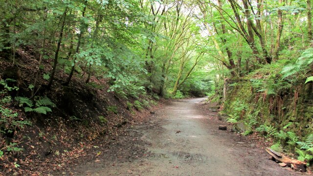
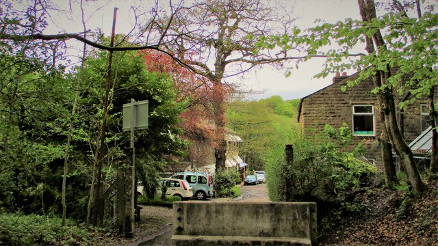
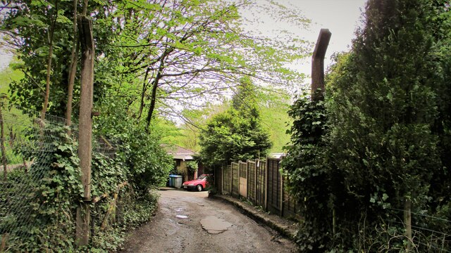
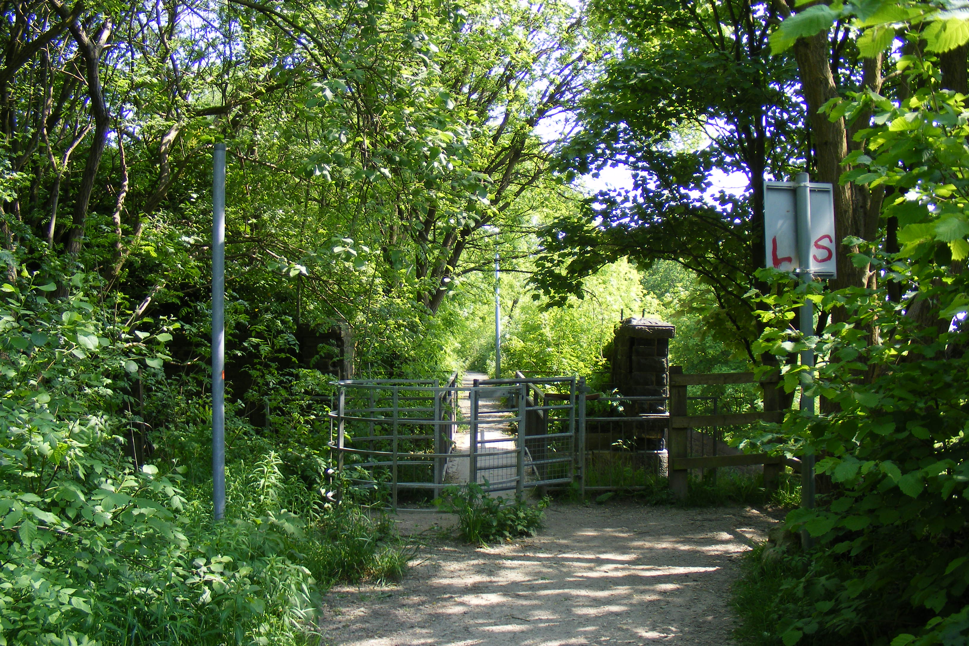
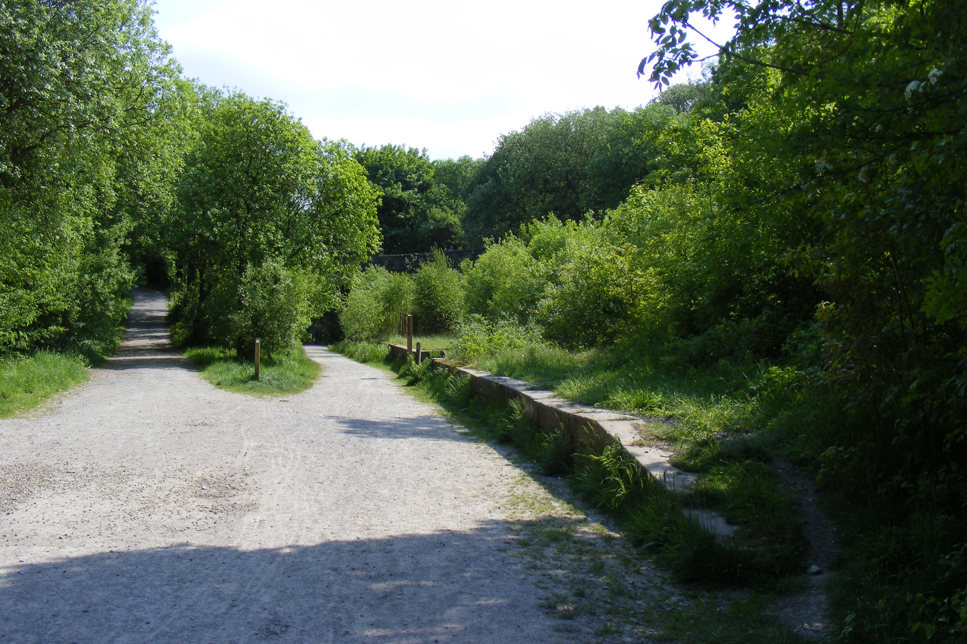
Healey is surrounded by beautiful natural landscapes, making it a popular destination for outdoor enthusiasts. The area offers numerous walking and cycling routes, allowing visitors to explore the stunning countryside and enjoy the fresh air.

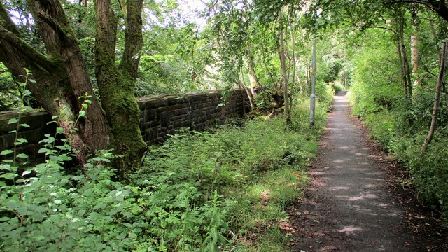
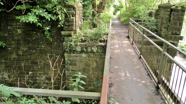
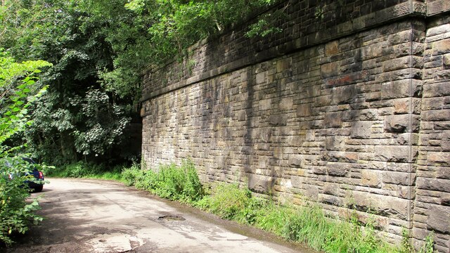
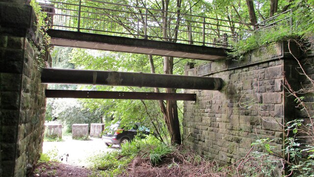
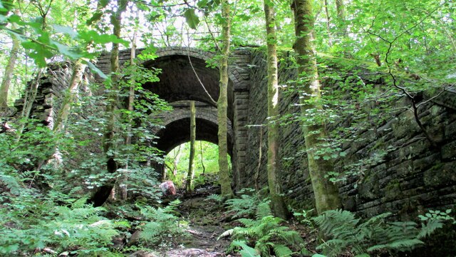
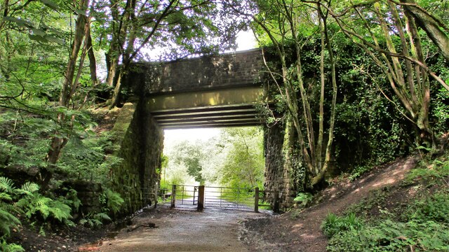
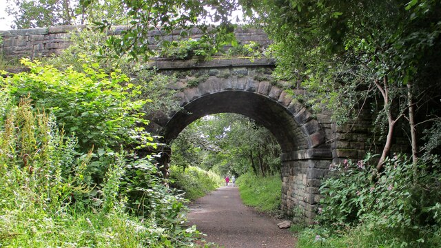
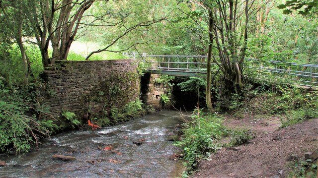
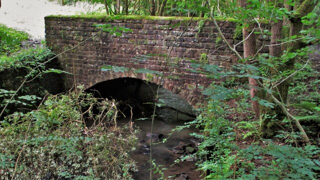
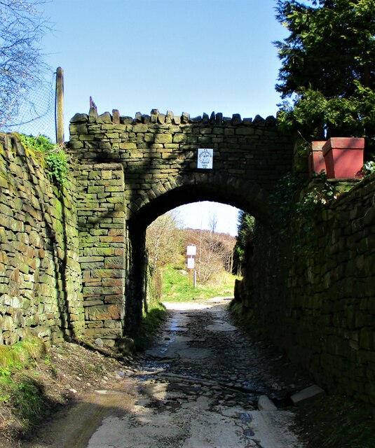
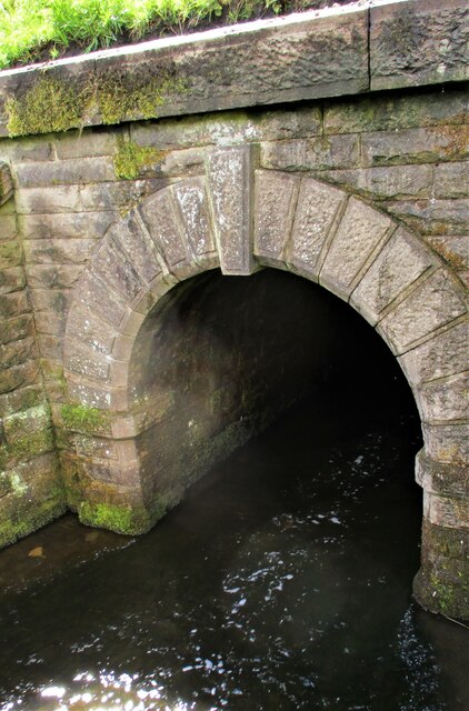
Nearby attractions include Healey Dell Nature Reserve, which offers picturesque walks along the River Spodden and features a delightful Victorian railway viaduct. The village is also within close proximity to Hollingworth Lake, a popular spot for water-based activities such as sailing, kayaking, and fishing.

In summary, Healey is a charming village in Lancashire, offering a peaceful retreat in a picturesque setting. With its rich history, natural beauty, and close-knit community, it is an ideal location for those seeking a tranquil lifestyle.

If you have any feedback on the listing, please let us know in the comments section below.

Healey Images

Images are sourced within 2km of 53.63859/-2.170877 or Grid Reference SD8815. Thanks to Geograph Open Source API. All images are credited.

Former Rochdale to Bacup Railway Trackbed at Shawclough Start of trail on trackbed with Dell Road retaining wall to the left
Former Rochdale to Bacup Railway Trackbed at Shawclough
Start of trail on trackbed with Dell Road retaining wall to the left
Footbridge replacement for Railway Bridge at Shawclough View towards Rochdale over former Shawclough Station access road
Footbridge replacement for Railway Bridge at Shawclough
View towards Rochdale over former Shawclough Station access road
Retaining Wall for Railway on Dell Road Shawclough Retaining Wall for Rochdale to Bacup Railway, view North
Retaining Wall for Railway on Dell Road Shawclough
Retaining Wall for Rochdale to Bacup Railway, view North
Railway Bridge Abutments at Shawclough Station Access Road Footbridge has replaced original Railway Bridge. Concrete Block barriers stop vehicle entry to Woodland Road from Dell Road
Railway Bridge Abutments at Shawclough Station Access Road
Footbridge has replaced original Railway Bridge. Concrete Block barriers stop vehicle entry to Woodland Road from Dell Road
Former Rochdale to Bacup Railway Trackbed after Shawclough Adverse Gradient after heading North from the former Shawclough Station at Dell Road bridge
Former Rochdale to Bacup Railway Trackbed after Shawclough
Adverse Gradient after heading North from the former Shawclough Station at Dell Road bridge
Siamese Railway Bridges at Healey The original bridge was found to be slipping down the hillside so another was built for the Rochdale to Bacup Railway.
Siamese Railway Bridges at Healey
The original bridge was found to be slipping down the hillside so another was built for the Rochdale to Bacup Railway.
Typical Rochdale/Whitworth Boundary Stone On the former Rochdale to Bacup Railway on the Boundary. The Boundary Stones in this area of Healey Corner had metal plates on the stones all now mainly removed.
This stone is typical but it may not be what it seems.
Typical Rochdale/Whitworth Boundary Stone
On the former Rochdale to Bacup Railway on the Boundary. The Boundary Stones in this area of Healey Corner had metal plates on the stones all now mainly removed. This stone is typical but it may not be what it seems.
Milestone 14 on Rochdale to Bacup Railway Close to Rochdale/Whitworth Boundary on former Railway Trackbed
Milestone 14 on Rochdale to Bacup Railway
Close to Rochdale/Whitworth Boundary on former Railway Trackbed
LYR Boundary Stone This stone is close to the former railway trackbed so may be re-positioned. South of Dell Road access to Healey Dell Viaduct.
LYR Boundary Stone
This stone is close to the former railway trackbed so may be re-positioned. South of Dell Road access to Healey Dell Viaduct.
Station Road Railway Bridge Broadley The Bridge from the South on the former trackbed. On the North side is the site of Broadley Station
Station Road Railway Bridge Broadley
The Bridge from the South on the former trackbed. On the North side is the site of Broadley Station
Railway Bridge on Rochdale to Bacup Line View South along former trackbed. The Bridge is now a footpath to the Wallbank Housing Estate
Railway Bridge on Rochdale to Bacup Line
View South along former trackbed. The Bridge is now a footpath to the Wallbank Housing Estate
Footbridge over River Spodden Metal Footbridge for numerous routes around Spodden Valley North of Healey Dell
Footbridge over River Spodden
Metal Footbridge for numerous routes around Spodden Valley North of Healey Dell
Bridge over River Spodden near Former Station Yard Substantial Bridge now footpath but gave alternative access perhaps to the Station Yard at Broadley. It is also the site of Broadley Mill.
Bridge over River Spodden near Former Station Yard
Substantial Bridge now footpath but gave alternative access perhaps to the Station Yard at Broadley. It is also the site of Broadley Mill.
Private Footbridge over Ending Rake Footbridge for Mount Ending residence where Ending Rake goes on to the moorland.
Private Footbridge over Ending Rake
Footbridge for Mount Ending residence where Ending Rake goes on to the moorland.
Culvert Portal under Prickshaw Lane Prickshaw Brook emerges
Culvert Portal under Prickshaw Lane
Prickshaw Brook emerges
Stone Rubbing Mill Remains The Southern Pit used in connection with grinding and finishing quarried stone.
The mill at Broadley Sidings was connected with Bagden Quarry by a railway.
Stone Rubbing Mill Remains
The Southern Pit used in connection with grinding and finishing quarried stone. The mill at Broadley Sidings was connected with Bagden Quarry by a railway.
Modern & WWII Pole Barriers Modern concrete block across Dell Road and WWII pole barrier still surviving from when the mill beyond was a munitions filling factory.
Modern & WWII Pole Barriers
Modern concrete block across Dell Road and WWII pole barrier still surviving from when the mill beyond was a munitions filling factory.
Dell Road North entrance to former WWII ROF Site MoD fencing poles mark entrance to former WWII munitions filling factory site in Healey Hall Mill
Dell Road North entrance to former WWII ROF Site
MoD fencing poles mark entrance to former WWII munitions filling factory site in Healey Hall Mill
Show me another place!

Healey is located at Grid Ref: SD8815 (Lat: 53.63859, Lng: -2.170877)

Unitary Authority: Rochdale

Police Authority: Greater Manchester

What 3 Words

///moons.rips.alarm. Near Whitworth, Lancashire

Related Wikis

Healey, Greater Manchester

Healey is part of the Metropolitan Borough of Rochdale, Greater Manchester, England. Historically part of Lancashire, it includes Shawclough, Syke and...
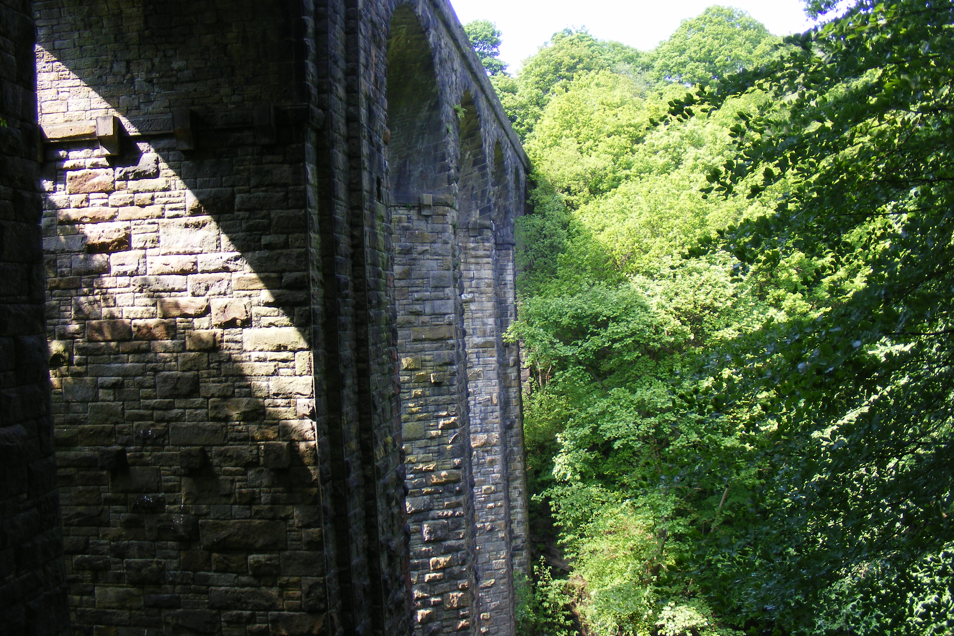
Healey Dell Viaduct

Healey Dell Viaduct is a viaduct situated in Healey Dell Nature Reserve in the Spodden Valley, on the outskirts of Rochdale in Greater Manchester, England...

Shawclough and Healey railway station

Shawclough & Healey railway station served the townships of Shawclough and Healey in Rochdale, in the Metropolitan Borough of Rochdale in Greater Manchester...

Broadley railway station

Broadley railway station served Broadley in Rochdale, England, from 1870 until closure in 1947. It was situated at Healey Dell. == References == Lost Railways...

Nook Farm, Rochdale

Nook Farm (sometimes called Syke Estate) is an estate of council houses situated within the area of Syke, part of Rochdale, in Greater Manchester, England...

Shawclough

Shawclough is a mainly residential area north of Rochdale, Greater Manchester, England. Its boundaries are roughly Whitworth Road, Shawclough Road, and...

Falinge Park High School

Falinge Park High School is an 11–16 mixed comprehensive school in Shawclough area of the Metropolitan Borough of Rochdale in Greater Manchester, United...

Falinge Park

Falinge Park is a Grade II listed public park located in Rochdale, Greater Manchester. Opened to the public in 1906, it lies in the historic grounds of...

Nearby Amenities

Located within 500m of 53.63859,-2.170877
Bus Stop
Holstein Avenue/Shawclough Way
Bus: yes
Naptan AtcoCode: 1800NE01311
Naptan Bearing: NW
Naptan CommonName: Holstein Avenue/Shawclough Way
Naptan Indicator: Sub Station
Naptan Landmark: SUB STATION
Naptan NaptanCode: mandwdam
Naptan PlusbusZoneRef: MNCRPIC
Naptan ShortCommonName: Shawclough Way
Naptan Street: HOLSTEIN AVENUE
Naptan Verified: no
Network: TfGM
Public Transport: platform
Source: naptan_import
Lat/Long: 53.6364265/-2.1715834
Bus Stop
Whitworth Road/Thrum Hall Lane
Bus: yes
Naptan AtcoCode: 1800NE46091
Naptan Bearing: SE
Naptan CommonName: Whitworth Road/Thrum Hall Lane
Naptan Indicator: O/s House 592
Naptan Landmark: HOUSE 586
Naptan NaptanCode: mangdtda
Naptan Notes: LOCATION AMENDED
Naptan PlusbusZoneRef: MNCRPIC
Naptan ShortCommonName: Thrum Hall Lane
Naptan Street: WHITWORTH ROAD
Naptan Verified: no
Network: TfGM
Public Transport: platform
Source: naptan_import
Lat/Long: 53.6352651/-2.1665425
Bus Stop
Whitworth Road/Thrum Hall Lane
Bus: yes
Naptan AtcoCode: 1800NE46101
Naptan Bearing: NW
Naptan CommonName: Whitworth Road/Thrum Hall Lane
Naptan Indicator: O/s House 535
Naptan Landmark: HOUSE 535
Naptan NaptanCode: mangdtdg
Naptan PlusbusZoneRef: MNCRPIC
Naptan ShortCommonName: Thrum Hall Lane
Naptan Street: WHITWORTH ROAD
Naptan Verified: no
Network: TfGM
Public Transport: platform
Source: naptan_import
Lat/Long: 53.6353545/-2.1669512
Bus Stop
Whitworth Road/The Oxford
Bus: yes
Naptan AtcoCode: 1800NE46111
Naptan Bearing: SE
Naptan CommonName: Whitworth Road/The Oxford
Naptan Indicator: O/s House 632
Naptan Landmark: HOUSE 646
Naptan NaptanCode: mangdtdj
Naptan PlusbusZoneRef: MNCRPIC
Naptan ShortCommonName: The Oxford
Naptan Street: WHITWORTH ROAD
Naptan Verified: no
Network: TfGM
Public Transport: platform
Source: naptan_import
Lat/Long: 53.6370596/-2.1688334
Bus Stop
Whitworth Road/The Oxford
Bus: yes
Naptan AtcoCode: 1800NE46121
Naptan Bearing: NW
Naptan CommonName: Whitworth Road/The Oxford
Naptan Indicator: O/s House 619
Naptan Landmark: HOUSE 685
Naptan NaptanCode: mangdtdm
Naptan Notes: LOCATION AMENDED
Naptan PlusbusZoneRef: MNCRPIC
Naptan ShortCommonName: The Oxford
Naptan Street: WHITWORTH ROAD
Naptan Verified: no
Network: TfGM
Public Transport: platform
Source: naptan_import
Lat/Long: 53.6370951/-2.1691965
Bus Stop
Whitworth Road/Shawclough Way
Bus: yes
Naptan AtcoCode: 1800NE46131
Naptan Bearing: SE
Naptan CommonName: Whitworth Road/Shawclough Way
Naptan Indicator: Op House 701
Naptan Landmark: HOUSE 693
Naptan NaptanCode: mangdtdp
Naptan PlusbusZoneRef: MNCRPIC
Naptan ShortCommonName: Shawclough Way
Naptan Street: WHITWORTH ROAD
Naptan Verified: no
Network: TfGM
Public Transport: platform
Source: naptan_import
Lat/Long: 53.6379291/-2.1705611
Bus Stop
Whitworth Road/Shawclough Way
Bus: yes
Naptan AtcoCode: 1800NE46141
Naptan Bearing: W
Naptan CommonName: Whitworth Road/Shawclough Way
Naptan Indicator: O/s House 721
Naptan Landmark: O/S HOUSE 721
Naptan NaptanCode: mangdtdt
Naptan PlusbusZoneRef: MNCRPIC
Naptan ShortCommonName: Shawclough Way
Naptan Street: WHITWORTH ROAD
Naptan Verified: no
Network: TfGM
Public Transport: platform
Source: naptan_import
Lat/Long: 53.6384752/-2.1720758
Bus Stop
Whitworth Road/Whambottom Lane
Bus: yes
Naptan AtcoCode: 1800NE46151
Naptan Bearing: E
Naptan CommonName: Whitworth Road/Whambottom Lane
Naptan Indicator: O/s House 708
Naptan Landmark: O/S HOUSE 708
Naptan NaptanCode: mangdtdw
Naptan Notes: LOCATION AMENDED
Naptan PlusbusZoneRef: MNCRPIC
Naptan ShortCommonName: Whambottom Lane
Naptan Street: WHITWORTH ROAD
Naptan Verified: no
Public Transport: platform
Source: naptan_import
Lat/Long: 53.6393709/-2.1742272
Bus Stop
Whitworth Road/Whambottom Lane
Bus: yes
Naptan AtcoCode: 1800NE46161
Naptan Bearing: W
Naptan CommonName: Whitworth Road/Whambottom Lane
Naptan Indicator: Nr Open Land
Naptan Landmark: NR OPEN LAND
Naptan NaptanCode: mangdtga
Naptan PlusbusZoneRef: MNCRPIC
Naptan ShortCommonName: Whambottom Lane
Naptan Street: WHITWORTH ROAD
Naptan Verified: no
Network: TfGM
Public Transport: platform
Source: naptan_import
Lat/Long: 53.6379704/-2.1717691
Bus Stop
Shawclough Way/Whitworth Road
Bus: yes
Naptan AtcoCode: 1800NE07381
Naptan Bearing: NW
Naptan CommonName: Shawclough Way/Whitworth Road
Naptan Indicator: O/s House 142
Naptan Landmark: O/S HOUSE 142
Naptan NaptanCode: mantgtjd
Naptan PlusbusZoneRef: MNCRPIC
Naptan ShortCommonName: Whitworth Road
Naptan Street: SHAWCLOUGH WAY
Naptan Verified: no
Network: TfGM
Public Transport: platform
Source: naptan_import
Lat/Long: 53.6372266/-2.1714808
Bus Stop
Shawclough Way/Glenavon Drive
Bus: yes
Naptan AtcoCode: 1800NE07391
Naptan Bearing: N
Naptan CommonName: Shawclough Way/Glenavon Drive
Naptan Indicator: O/s House 96
Naptan Landmark: HOUSE 89
Naptan NaptanCode: mantgtjg
Naptan PlusbusZoneRef: MNCRPIC
Naptan ShortCommonName: Glenavon Drive
Naptan Street: SHAWCLOUGH WAY
Naptan Verified: no
Network: TfGM
Public Transport: platform
Source: naptan_import
Lat/Long: 53.6363963/-2.1738519
Bus Stop
Shawclough Way/Hillside Walk
Bus: yes
Naptan AtcoCode: 1800NE08111
Naptan Bearing: E
Naptan CommonName: Shawclough Way/Hillside Walk
Naptan Indicator: Op House 111
Naptan Landmark: HOUSE 109
Naptan NaptanCode: mantjadm
Naptan PlusbusZoneRef: MNCRPIC
Naptan ShortCommonName: Hillside Walk
Naptan Street: SHAWCLOUGH WAY
Naptan Verified: no
Network: TfGM
Public Transport: platform
Source: naptan_import
Lat/Long: 53.6369017/-2.1724021
Bus Stop
Shawclough Way/Whitworth Road
Bus: yes
Naptan AtcoCode: 1800NE49831
Naptan Bearing: SE
Naptan CommonName: Shawclough Way/Whitworth Road
Naptan Indicator: O/s House 142
Naptan Landmark: O/S HOUSE 142
Naptan NaptanCode: mangjdma
Naptan PlusbusZoneRef: MNCRPIC
Naptan ShortCommonName: Whitworth Road
Naptan Street: SHAWCLOUGH WAY
Naptan Verified: no
Network: TfGM
Public Transport: platform
Source: naptan_import
Lat/Long: 53.6372178/-2.1713598
Bus Stop
Shawclough Way/Hillside Walk
Bus: yes
Naptan AtcoCode: 1800NE49841
Naptan Bearing: W
Naptan CommonName: Shawclough Way/Hillside Walk
Naptan Indicator: Op House 111
Naptan Landmark: HOUSE 114
Naptan NaptanCode: mangjdmg
Naptan PlusbusZoneRef: MNCRPIC
Naptan ShortCommonName: Hillside Walk
Naptan Street: SHAWCLOUGH WAY
Naptan Verified: no
Network: TfGM
Public Transport: platform
Source: naptan_import
Lat/Long: 53.6368389/-2.1723716
Bus Stop
Shawclough Way/Glenavon Drive
Bus: yes
Naptan AtcoCode: 1800NE49851
Naptan Bearing: S
Naptan CommonName: Shawclough Way/Glenavon Drive
Naptan Indicator: O/s House 96
Naptan Landmark: HOUSE 80
Naptan NaptanCode: mangjdmp
Naptan PlusbusZoneRef: MNCRPIC
Naptan ShortCommonName: Glenavon Drive
Naptan Street: SHAWCLOUGH WAY
Naptan Verified: no
Network: TfGM
Public Transport: platform
Source: naptan_import
Lat/Long: 53.6364055/-2.1737007
Mini Roundabout
Lat/Long: 53.638271/-2.1715401
Barrier: bollard
Lat/Long: 53.6365588/-2.177545
Generator Method: photovoltaic
Generator Output Electricity: yes
Generator Source: solar
Generator Type: solar_photovoltaic_panel
Location: roof
Power: generator
Lat/Long: 53.6369405/-2.1773586
Generator Method: photovoltaic
Generator Output Electricity: yes
Generator Source: solar
Generator Type: solar_photovoltaic_panel
Location: roof
Power: generator
Lat/Long: 53.6354741/-2.1758066
Generator Method: photovoltaic
Generator Output Electricity: yes
Generator Source: solar
Generator Type: solar_photovoltaic_panel
Location: roof
Power: generator
Lat/Long: 53.6371393/-2.1717734
Addr City: Rochdale
Addr Housenumber: 615
Addr Street: Whitworth Road
Lat/Long: 53.6368685/-2.1691135
Addr City: Rochdale
Addr Housenumber: 631
Addr Street: Whitworth Road
Lat/Long: 53.6372925/-2.1699571
Generator Method: photovoltaic
Generator Output Electricity: yes
Generator Source: solar
Generator Type: solar_photovoltaic_panel
Location: roof
Power: generator
Lat/Long: 53.6378792/-2.1711692
Addr City: Rochdale
Addr Housenumber: 627
Addr Street: Whitworth Road
Lat/Long: 53.6371901/-2.169751
Generator Method: photovoltaic
Generator Output Electricity: yes
Generator Source: solar
Generator Type: solar_photovoltaic_panel
Location: roof
Power: generator
Lat/Long: 53.6366377/-2.1705572
Addr City: Rochdale
Addr Housenumber: 613
Addr Street: Whitworth Road
Lat/Long: 53.6368097/-2.169015
Addr City: Rochdale
Addr Housenumber: 632
Addr Street: Whitworth Road
Lat/Long: 53.637102/-2.1687706
Addr City: Rochdale
Addr Housenumber: 623
Addr Street: Whitworth Road
Lat/Long: 53.6370898/-2.1695212
Addr City: Rochdale
Addr Housenumber: 619
Addr Street: Whitworth Road
Lat/Long: 53.636979/-2.1693223
Addr City: Rochdale
Addr Housenumber: 617
Addr Street: Whitworth Road
Lat/Long: 53.6369156/-2.1692139
Generator Method: photovoltaic
Generator Output Electricity: yes
Generator Source: solar
Generator Type: solar_photovoltaic_panel
Location: roof
Power: generator
Lat/Long: 53.6390155/-2.1723491
Addr Housenumber: 535
Addr Street: Whitworth Road
Lat/Long: 53.6352763/-2.1671674
Addr City: Rochdale
Addr Housenumber: 629
Addr Street: Whitworth Road
Lat/Long: 53.6372337/-2.1698074
Addr City: Rochdale
Addr Housenumber: 621
Addr Street: Whitworth Road
Lat/Long: 53.6370191/-2.1693958
Addr City: Rochdale
Addr Housenumber: 611
Addr Street: Whitworth Road
Lat/Long: 53.6367645/-2.1689159
Addr City: Rochdale
Addr Housenumber: 625
Addr Street: Whitworth Road
Lat/Long: 53.6371255/-2.1696125
The data included in this document is from www.openstreetmap.org. The data is made available under ODbL.

Have you been to Healey?

Leave your review of Healey below (or comments, questions and feedback).