Headington Hill
Settlement in Oxfordshire Oxford
England
Headington Hill

Headington Hill is a prominent hill located in the county of Oxfordshire, England. Situated to the east of the city of Oxford, it forms part of the larger Shotover Hill range. Rising to a height of about 175 meters (574 feet), Headington Hill offers picturesque views of the surrounding countryside and the city below.
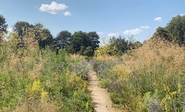
The hill is characterized by its lush greenery, with a mix of grassy slopes and dense woodland. It is a popular spot for outdoor activities such as walking, hiking, and picnicking. The area is home to diverse wildlife, including various bird species and small mammals.
One of the notable features on Headington Hill is the Headington Hill Park, a public park that covers a significant portion of the hill. The park offers open spaces for recreation, with well-maintained pathways for walking and jogging. It also features a children's play area, making it a family-friendly destination.
Headington Hill is also home to some significant buildings. The historic Headington Hill Hall, now part of Oxford Brookes University, is an imposing mansion that adds to the charm of the area. The hill is also adjacent to the renowned Headington Hill Campus of Oxford Brookes University, contributing to the academic atmosphere of the region.
Due to its elevated position, Headington Hill is easily visible from various vantage points in Oxford. Its beauty and accessibility make it a popular place for both locals and visitors to enjoy the natural surroundings and take in the scenic views of Oxfordshire.
If you have any feedback on the listing, please let us know in the comments section below.
Headington Hill Images
Images are sourced within 2km of 51.751953/-1.237134 or Grid Reference SP5206. Thanks to Geograph Open Source API. All images are credited.


Headington Hill is located at Grid Ref: SP5206 (Lat: 51.751953, Lng: -1.237134)
Administrative County: Oxfordshire
District: Oxford
Police Authority: Thames Valley
What 3 Words
///poker.themes.agreed. Near Oxford, Oxfordshire
Nearby Locations
Related Wikis
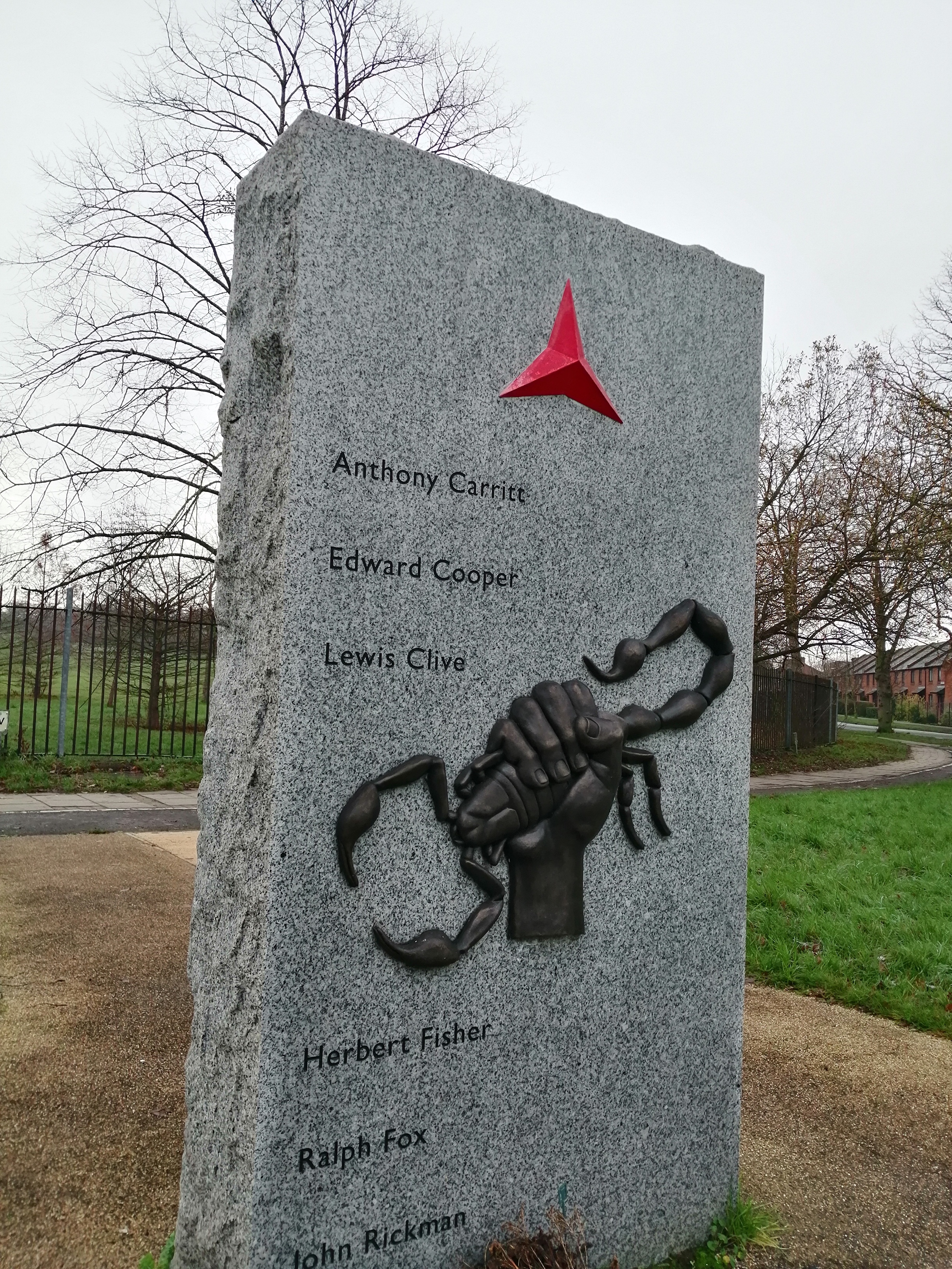
Oxford Spanish Civil War memorial
The Oxford Spanish Civil War memorial is a monument in Oxford dedicated to the 31 known local residents who fought in the Spanish Civil War (1936–1939...
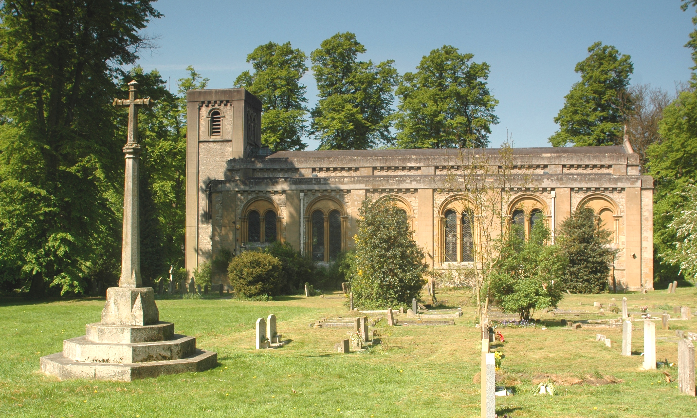
St Clement's Church, Oxford
St Clement's Church is an evangelical Church of England parish church situated just to the east of central Oxford, England. == History == The present church...

Headington Road
Headington Road is an arterial road in the east of Oxford, England. The road connects the junction of St Clements and Marston Road with the suburb of Headington...
St Clement's, Oxford
St Clement's is a district in Oxford, England, on the east bank of the River Cherwell. "St Clement's" is usually taken to describe a small triangular area...

Angel & Greyhound Meadow, Oxford
Also known as Angel Meadow, the Angel & Greyhound Meadow is a flood-meadow adjoining the River Cherwell just north of Magdalen Bridge, Oxford, England...

Headington Hill Park
Headington Hill Park is a park on Headington Hill in the east of Oxford, England.The park is part of the grounds of Headington Hill Hall, previously owned...

Ultimate Picture Palace
The Ultimate Picture Palace is an independent cinema in Oxford, England. It is Oxford's only surviving independent cinema, showing a mixture of independent...
Royal Microscopical Society
The Royal Microscopical Society (RMS) is a learned society for the promotion of microscopy. It was founded in 1839 as the Microscopical Society of London...
Nearby Amenities
Located within 500m of 51.751953,-1.237134Have you been to Headington Hill?
Leave your review of Headington Hill below (or comments, questions and feedback).