Great Meadow
Wood, Forest in Oxfordshire Oxford
England
Great Meadow

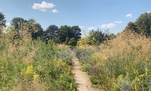
Great Meadow is a captivating woodland located in Oxfordshire, England. Spanning over a vast area, this forested area is a haven for nature enthusiasts and those seeking a peaceful escape from the bustling city life. The meadow is situated in the heart of the picturesque village of Great Tew, surrounded by rolling hills and quaint countryside.
The woodland itself is a mix of ancient oak trees, dense vegetation, and various wildlife species. Walking through the forest, one can witness the towering trees reaching towards the sky, creating a stunning canopy overhead. The forest floor is adorned with a carpet of vibrant wildflowers, adding a splash of color to the serene surroundings. The meandering pathways within the woods offer a chance to explore and discover hidden nooks and crannies, making it an ideal spot for hikers and nature lovers.
Great Meadow is not only a haven for flora and fauna, but also a place of historical significance. The remnants of an old Roman road can still be seen within the forest, serving as a reminder of the area's rich past.
Visitors to Great Meadow can enjoy a range of activities, including picnicking, birdwatching, and photography. The peaceful ambiance of the woodland provides an ideal setting for relaxation and contemplation. With its serene beauty and historical significance, Great Meadow in Oxfordshire is a must-visit destination for those seeking a tranquil escape into nature.
If you have any feedback on the listing, please let us know in the comments section below.
Great Meadow Images
Images are sourced within 2km of 51.757821/-1.2420922 or Grid Reference SP5206. Thanks to Geograph Open Source API. All images are credited.


Great Meadow is located at Grid Ref: SP5206 (Lat: 51.757821, Lng: -1.2420922)
Administrative County: Oxfordshire
District: Oxford
Police Authority: Thames Valley
What 3 Words
///obey.brave.cloth. Near Oxford, Oxfordshire
Nearby Locations
Related Wikis

Mesopotamia, Oxford
Mesopotamia is a narrow ait (about 800 yards by 30 yards) that forms part of the University Parks in Oxford, England. It lies between the upper and lower...
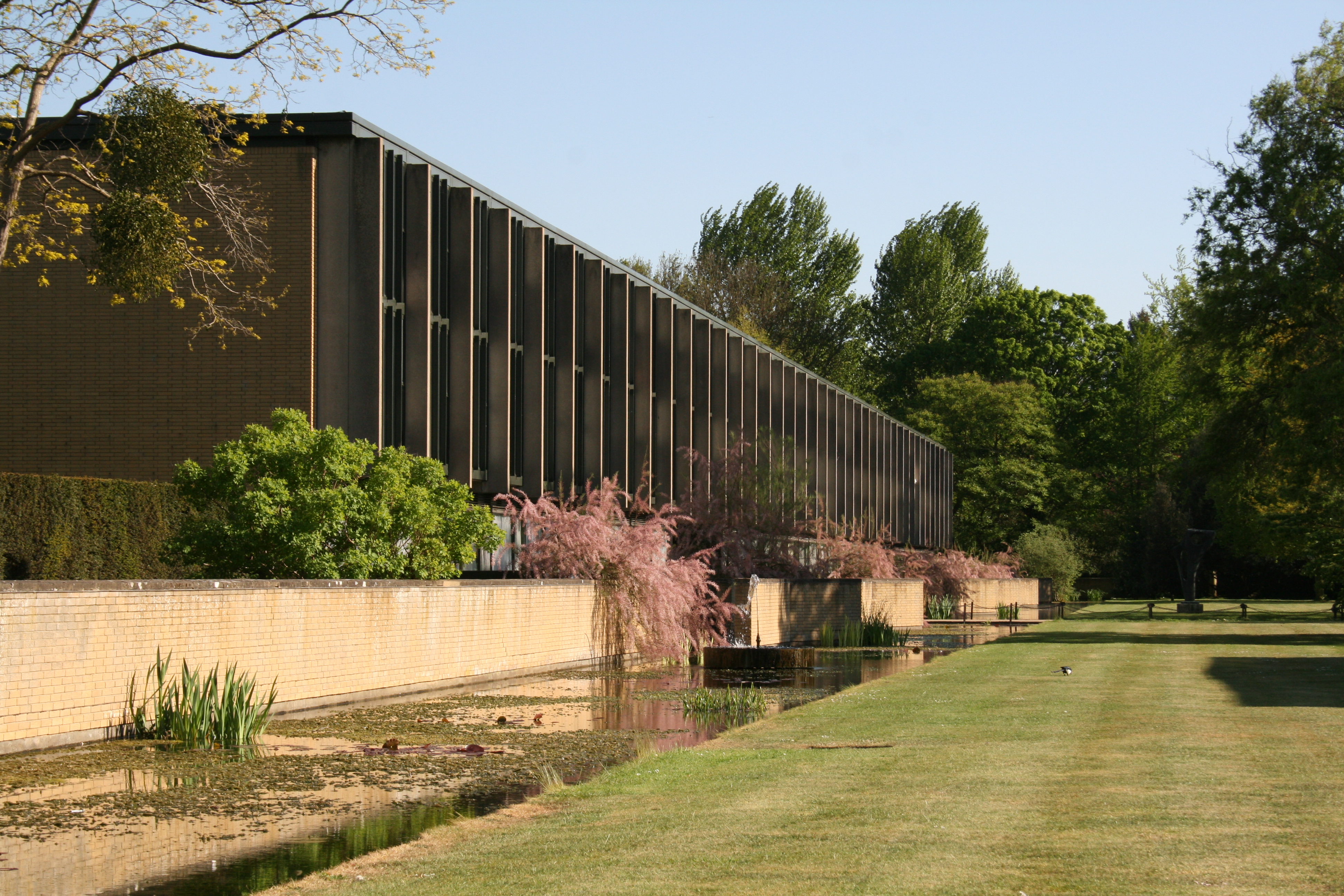
St Catherine's College, Oxford
St Catherine's College (colloquially called St Catz or Catz) is one of the constituent colleges of the University of Oxford. In 1974, it was also one of...
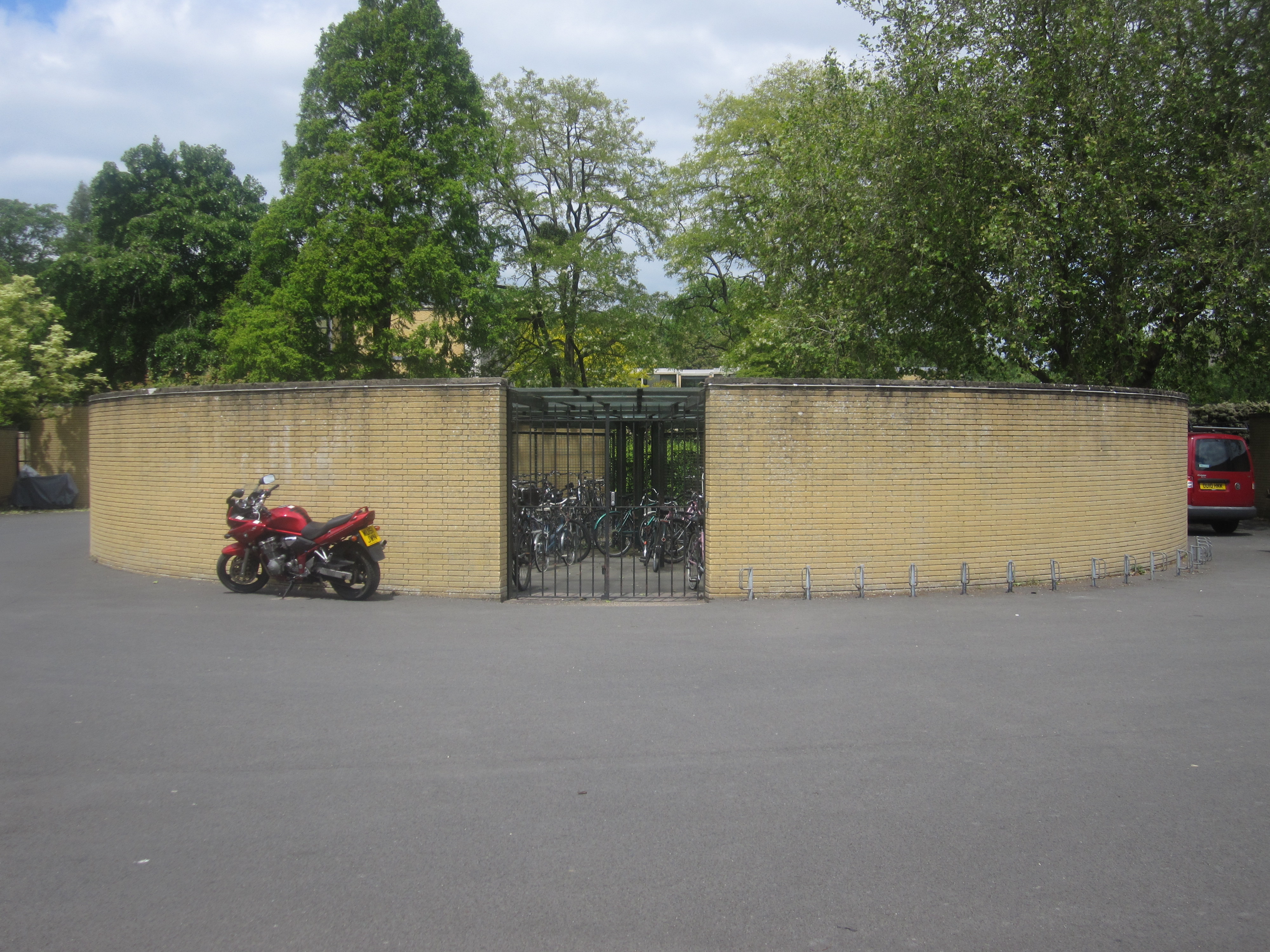
St Catherine's College Bicycle Store
St Catherine's College Bicycle Store is located at St Catherine's College in the city of Oxford, in England. Designed by Arne Jacobsen in the 1960s, the...

Reuters Institute for the Study of Journalism
The Reuters Institute for the Study of Journalism (RISJ) is a UK-based research centre and think tank founded in 2006, which operates Thomson Reuters Journalism...
Nearby Amenities
Located within 500m of 51.757821,-1.2420922Have you been to Great Meadow?
Leave your review of Great Meadow below (or comments, questions and feedback).