Far Moor

Downs, Moorland in Yorkshire Hambleton

England

Far Moor

Ford at Scugdale This is the first of two fords on the Scugdale Beck at Piper Grain.
Ford at Scugdale Credit: John Walton

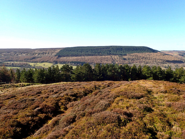
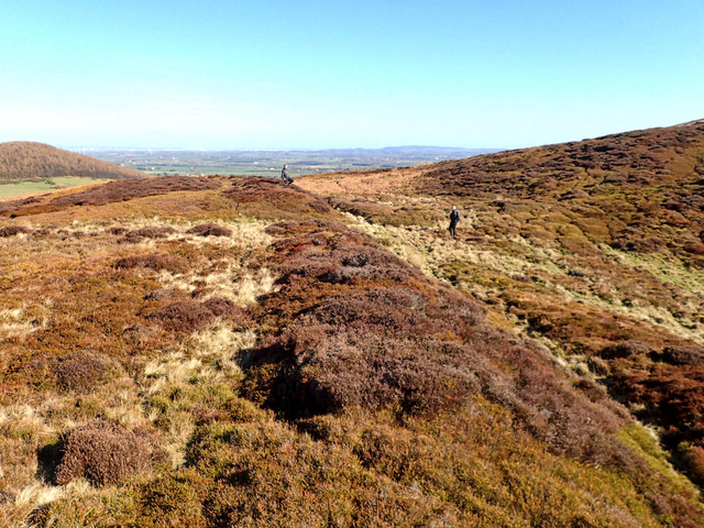
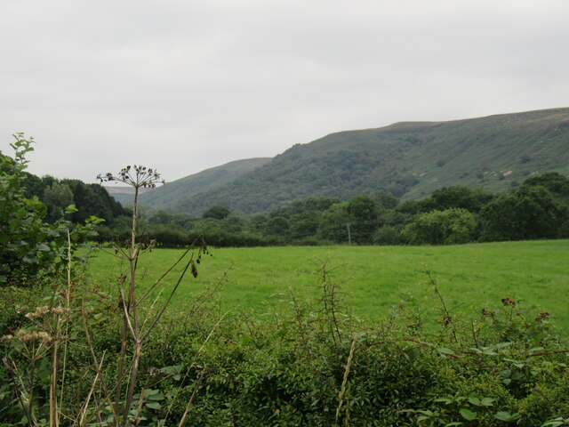
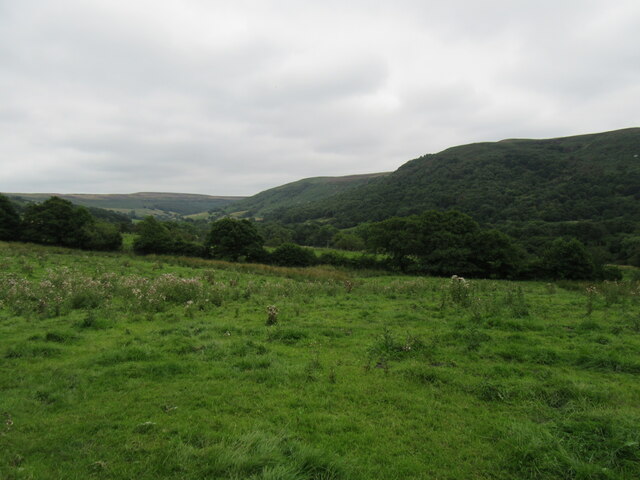
Far Moor is a picturesque region located in Yorkshire, England. It is characterized by its vast expanse of rolling downs and moorland, making it a popular destination for nature enthusiasts and hikers. The area is known for its stunning natural beauty, with panoramic views that extend for miles.

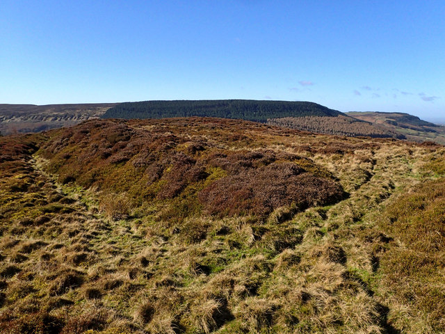
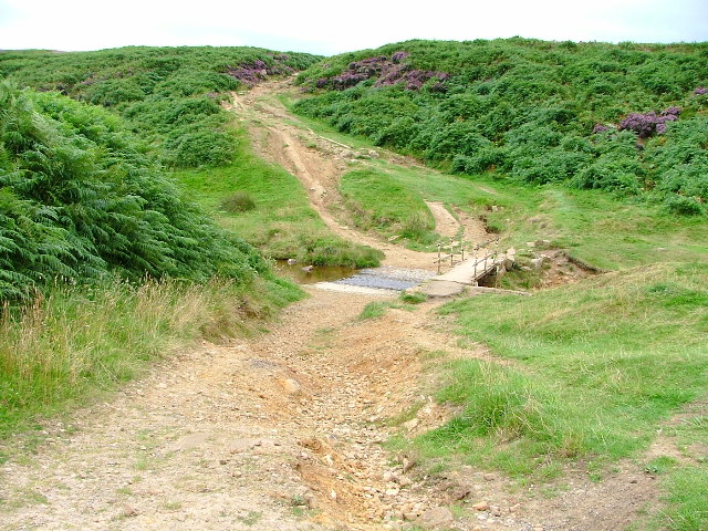
The landscape of Far Moor is dominated by open grasslands and heather-covered moorland, creating a unique and diverse ecosystem. The moorland is home to a variety of plant and animal species, including rare birds such as curlews and lapwings. Visitors to the area can enjoy peaceful walks along the well-maintained footpaths, taking in the breathtaking scenery and observing the local wildlife.

In addition to its natural beauty, Far Moor also boasts a rich history. The area is dotted with ancient stone circles and burial mounds, providing a glimpse into its past. These archaeological sites offer a fascinating insight into the lives of the people who once inhabited the region.

Far Moor offers a tranquil escape from the hustle and bustle of city life. Its remote location and unspoiled landscapes make it a haven for those seeking peace and solitude. Whether you're looking for a leisurely stroll or a challenging hike, Far Moor has something to offer for everyone.

Overall, Far Moor in Yorkshire is a stunning destination that combines natural beauty, rich history, and a sense of tranquility. It is a must-visit location for anyone looking to explore the beauty of the English countryside.

If you have any feedback on the listing, please let us know in the comments section below.
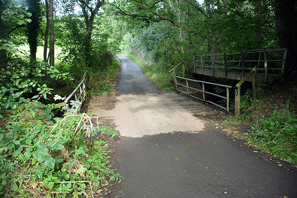
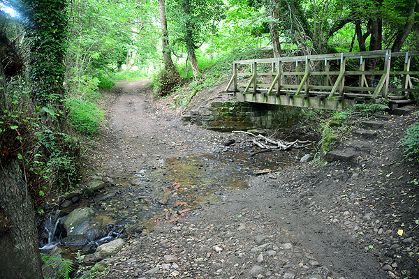
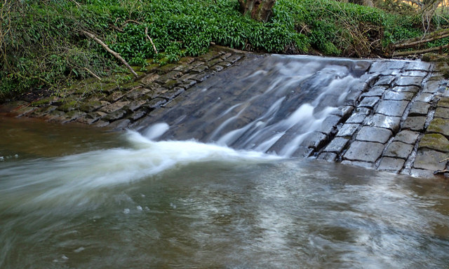
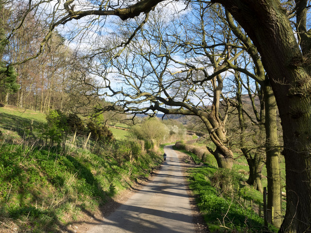
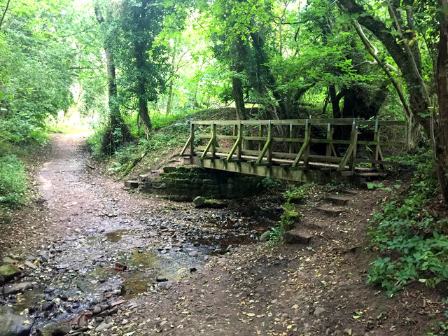
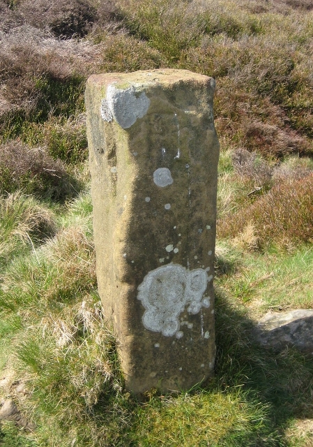
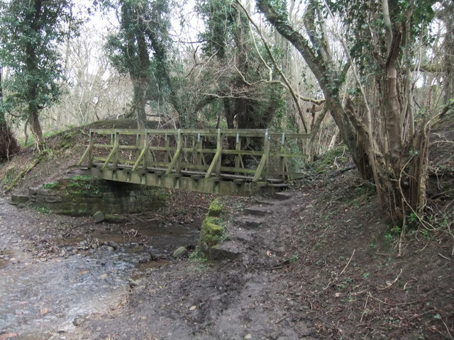
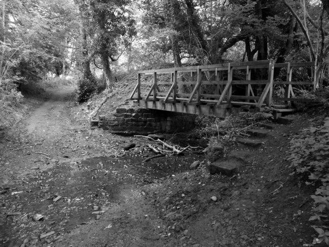
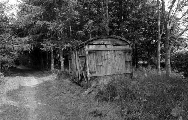
Far Moor Images

Images are sourced within 2km of 54.386899/-1.22955 or Grid Reference SE5099. Thanks to Geograph Open Source API. All images are credited.

Ford at Scugdale This is the first of two fords on the Scugdale Beck at Piper Grain.
Ford at Scugdale
This is the first of two fords on the Scugdale Beck at Piper Grain.
Piper Beck Ford This ford is found on the Piper Beck at Scugdale. The track is part of the Cleveland Way.
Piper Beck Ford
This ford is found on the Piper Beck at Scugdale. The track is part of the Cleveland Way.
Live Moor Hillfort Quoted from <span class="nowrap"><a title="http://www.themodernantiquarian.com/site/4314/live_moor_hill_fort_whorlton.html" rel="nofollow ugc noopener" href="http://www.themodernantiquarian.com/site/4314/live_moor_hill_fort_whorlton.html">Link</a><img style="margin-left:2px;" alt="External link" title="External link - shift click to open in new window" src="https://s1.geograph.org.uk/img/external.png" width="10" height="10"/></span>

"A previously unrecorded promontory fort was identified by D. Smith on air photographs and later surveyed by him and G. W. Goodall. A single rampart with external ditch extends across the west-facing spur of Live Moor to enclose an area of approximately 2 acres known as Knolls End. Where best preserved the rampart is 7.3m wide and 2.3m high externally and .5m internally, while the ditch is up to 1.5m wide and .6m deep with a fragmentary counter scarp bank. The work has been mutilated by quarrying and associated trackways, but a gap in the rampart and ditch at NZ 49640126 probably represents an original entrance" YAS 51, 1978.

And from Prehistoric and Roman Archaeology of North-East Yorkshire edited by D A Spratt, 1990

"The small promontory fort at Live Moor (0.8 ha) stands on the north-west corner of the moors. It has two visible ramparts, an earlier one just inside the outer, later one at its south-western end. There is a central entrance, whence a hollow- way runs up the hill slope to the Live Moor cairnfield. This is the highest of any of these early field systems (315m) and as such is arguably Bronze Age, unlikely to persist into the Iron Age, which might suggest an early date for the fort. The fort, only recently discovered (Smith, 1979), has not been excavated, but shows no signs of hut structures."
Live Moor Hillfort
Quoted from LinkExternal link "A previously unrecorded promontory fort was identified by D. Smith on air photographs and later surveyed by him and G. W. Goodall. A single rampart with external ditch extends across the west-facing spur of Live Moor to enclose an area of approximately 2 acres known as Knolls End. Where best preserved the rampart is 7.3m wide and 2.3m high externally and .5m internally, while the ditch is up to 1.5m wide and .6m deep with a fragmentary counter scarp bank. The work has been mutilated by quarrying and associated trackways, but a gap in the rampart and ditch at NZ 49640126 probably represents an original entrance" YAS 51, 1978. And from Prehistoric and Roman Archaeology of North-East Yorkshire edited by D A Spratt, 1990 "The small promontory fort at Live Moor (0.8 ha) stands on the north-west corner of the moors. It has two visible ramparts, an earlier one just inside the outer, later one at its south-western end. There is a central entrance, whence a hollow- way runs up the hill slope to the Live Moor cairnfield. This is the highest of any of these early field systems (315m) and as such is arguably Bronze Age, unlikely to persist into the Iron Age, which might suggest an early date for the fort. The fort, only recently discovered (Smith, 1979), has not been excavated, but shows no signs of hut structures."
Live Moor Hillfort  - entrance on the right Quoted from <span class="nowrap"><a title="http://www.themodernantiquarian.com/site/4314/live_moor_hill_fort_whorlton.html" rel="nofollow ugc noopener" href="http://www.themodernantiquarian.com/site/4314/live_moor_hill_fort_whorlton.html">Link</a><img style="margin-left:2px;" alt="External link" title="External link - shift click to open in new window" src="https://s1.geograph.org.uk/img/external.png" width="10" height="10"/></span>

"A previously unrecorded promontory fort was identified by D. Smith on air photographs and later surveyed by him and G. W. Goodall. A single rampart with external ditch extends across the west-facing spur of Live Moor to enclose an area of approximately 2 acres known as Knolls End. Where best preserved the rampart is 7.3m wide and 2.3m high externally and .5m internally, while the ditch is up to 1.5m wide and .6m deep with a fragmentary counter scarp bank. The work has been mutilated by quarrying and associated trackways, but a gap in the rampart and ditch at NZ 49640126 probably represents an original entrance" YAS 51, 1978.

And from Prehistoric and Roman Archaeology of North-East Yorkshire edited by D A Spratt, 1990

"The small promontory fort at Live Moor (0.8 ha) stands on the north-west corner of the moors. It has two visible ramparts, an earlier one just inside the outer, later one at its south-western end. There is a central entrance, whence a hollow- way runs up the hill slope to the Live Moor cairnfield. This is the highest of any of these early field systems (315m) and as such is arguably Bronze Age, unlikely to persist into the Iron Age, which might suggest an early date for the fort. The fort, only recently discovered (Smith, 1979), has not been excavated, but shows no signs of hut structures."
Live Moor Hillfort - entrance on the right
Quoted from LinkExternal link "A previously unrecorded promontory fort was identified by D. Smith on air photographs and later surveyed by him and G. W. Goodall. A single rampart with external ditch extends across the west-facing spur of Live Moor to enclose an area of approximately 2 acres known as Knolls End. Where best preserved the rampart is 7.3m wide and 2.3m high externally and .5m internally, while the ditch is up to 1.5m wide and .6m deep with a fragmentary counter scarp bank. The work has been mutilated by quarrying and associated trackways, but a gap in the rampart and ditch at NZ 49640126 probably represents an original entrance" YAS 51, 1978. And from Prehistoric and Roman Archaeology of North-East Yorkshire edited by D A Spratt, 1990 "The small promontory fort at Live Moor (0.8 ha) stands on the north-west corner of the moors. It has two visible ramparts, an earlier one just inside the outer, later one at its south-western end. There is a central entrance, whence a hollow- way runs up the hill slope to the Live Moor cairnfield. This is the highest of any of these early field systems (315m) and as such is arguably Bronze Age, unlikely to persist into the Iron Age, which might suggest an early date for the fort. The fort, only recently discovered (Smith, 1979), has not been excavated, but shows no signs of hut structures."
Scugdale Beck Weir Scugdale takes its name from the Danish skygger meaning to overshadow, referring  to the sheltered nature of the dale.

And the waters of the beck that flows down the dale must have some mysterious properties, for it was in this secluded valley that Harry Cooper was brought up. At a height of 8 feet 6 inches in height and weighing 29 stone Harry was reputed to be the tallest man in the world. He toured America as a star of in Barnum’s circus. He died about 1900 and is buried in Calgary, Canada.
Scugdale Beck Weir
Scugdale takes its name from the Danish skygger meaning to overshadow, referring to the sheltered nature of the dale. And the waters of the beck that flows down the dale must have some mysterious properties, for it was in this secluded valley that Harry Cooper was brought up. At a height of 8 feet 6 inches in height and weighing 29 stone Harry was reputed to be the tallest man in the world. He toured America as a star of in Barnum’s circus. He died about 1900 and is buried in Calgary, Canada.
Minor road in Scugdale The road is seen looking east; it ends as a public road about two kilometres distant at Scugdale Hall.
Minor road in Scugdale
The road is seen looking east; it ends as a public road about two kilometres distant at Scugdale Hall.
Track on Limekiln Bank
Track below Limekiln Bank Used by both the Cleveland Way and Wainwright's Coast to Coast Walk.
Track below Limekiln Bank
Used by both the Cleveland Way and Wainwright's Coast to Coast Walk.
Ford on Piper Beck
Ford on Piper Beck
Wall rising on Whorlton Moor The wall and the hill road beside are rising to a local high point at 320 m. which is above Limekiln Bank, the steep slope descending on the far side of the trees.
Wall rising on Whorlton Moor
The wall and the hill road beside are rising to a local high point at 320 m. which is above Limekiln Bank, the steep slope descending on the far side of the trees.
Old Boundary Marker on Round Hill by the Cleveland Way Boundary Marker on Round Hill, by the Cleveland Way, in parish of Faceby (Hambleton District).

Surveyed

Milestone Society National ID: YN_FACWHO04bm
Old Boundary Marker on Round Hill by the Cleveland Way
Boundary Marker on Round Hill, by the Cleveland Way, in parish of Faceby (Hambleton District). Surveyed Milestone Society National ID: YN_FACWHO04bm
Footbridge and ford
Footbridge and ford
The Ash Near Huthwaite Green in Scugdale a fine specimen of the Common or European Ash, Fraxinus excelsior, one of Britain’s most majestic trees. In Norse mythology, the tree is Yggdrasil, a great ash at the centre of the cosmos where its branches and roots connect different places and time, allowing passage from the underworld to heaven.

The wood is strong and flexible and traditionally used for spears and axe handles. In fact, the name derives from the Anglo-Saxon word aesc for a spear.

But the Ash is under threat from the fungus known as Ash Dieback, a disease from Asia that was first recognised in the UK in 2012. The fungus is spread by the wind and there are outbreaks in North Yorkshire but this tree seems healthy enough. Then I am no expert.

From my photo-diary for 23rd October 2019 see <span class="nowrap"><a title="http://www.fhithich.uk/?p=21810" rel="nofollow ugc noopener" href="http://www.fhithich.uk/?p=21810">Link</a><img style="margin-left:2px;" alt="External link" title="External link - shift click to open in new window" src="https://s1.geograph.org.uk/img/external.png" width="10" height="10"/></span>
The Ash
Near Huthwaite Green in Scugdale a fine specimen of the Common or European Ash, Fraxinus excelsior, one of Britain’s most majestic trees. In Norse mythology, the tree is Yggdrasil, a great ash at the centre of the cosmos where its branches and roots connect different places and time, allowing passage from the underworld to heaven. The wood is strong and flexible and traditionally used for spears and axe handles. In fact, the name derives from the Anglo-Saxon word aesc for a spear. But the Ash is under threat from the fungus known as Ash Dieback, a disease from Asia that was first recognised in the UK in 2012. The fungus is spread by the wind and there are outbreaks in North Yorkshire but this tree seems healthy enough. Then I am no expert. From my photo-diary for 23rd October 2019 see LinkExternal link
Ford and footbridge over Piper Beck This track is part of The Cleveland Way.
Ford and footbridge over Piper Beck
This track is part of The Cleveland Way.
A shed alongside The Cleveland Way near Huthwaite Green The Cleveland Way runs 110 miles (177 km) between Helmsley and the Brigg at Filey, skirting the North York Moors National Park. Its highest point is at Urra Moor, 1,489 ft (454 m).
A shed alongside The Cleveland Way near Huthwaite Green
The Cleveland Way runs 110 miles (177 km) between Helmsley and the Brigg at Filey, skirting the North York Moors National Park. Its highest point is at Urra Moor, 1,489 ft (454 m).
Heathwaite view in Scugdale Looking SE from the road junction at Heathwaite.
Heathwaite view in Scugdale
Looking SE from the road junction at Heathwaite.
Scugdale near Sparrow Hall Looking SE from the road.
Scugdale near Sparrow Hall
Looking SE from the road.
Show me another place!

Far Moor is located at Grid Ref: SE5099 (Lat: 54.386899, Lng: -1.22955)

Division: North Riding

Administrative County: North Yorkshire

District: Hambleton

Police Authority: North Yorkshire

What 3 Words

///task.lawyer.broads. Near Bilsdale, North Yorkshire

Related Wikis

Sheepwash, North Yorkshire

Sheepwash is a popular tourist spot in the North York Moors, North Yorkshire, England. It is located on Cod Beck which flows into Cod Beck Reservoir near...

Whorlton, North Yorkshire

Whorlton is a hamlet and civil parish in the Hambleton District of North Yorkshire, England. It is very near Swainby and the A19, and 6 miles south west...

Swainby

Swainby is a village in the Hambleton District of North Yorkshire, England. It is situated on the A172 road, 8 miles (13 km) north-east from Northallerton...

Whorlton Castle

Whorlton Castle is a ruined medieval castle situated near the abandoned village of Whorlton (at grid reference NZ4802) in North Yorkshire, England. It...

Cleveland Hills

The Cleveland Hills are a range of hills on the north-west edge of the North York Moors in North Yorkshire, England, overlooking Cleveland and Teesside...

Cod Beck Reservoir

Cod Beck Reservoir is a man-made lake situated within the North York Moors National Park and near the village of Osmotherley in the English county of North...

Faceby

Faceby is a small village and civil parish in North Yorkshire, England. It is at the north-west corner of the North York Moors and near Stokesley. ��2...

The Shrine of Our Lady of Mount Grace

The Shrine of Our Lady of Mount Grace is a place of Marian devotion and pilgrimage sited in the North Yorkshire village of Osmotherley. Christians have...

Nearby Amenities

Located within 500m of 54.386899,-1.22955
Far Moor
Place: locality
Lat/Long: 54.3870514/-1.2299006
The data included in this document is from www.openstreetmap.org. The data is made available under ODbL.

Have you been to Far Moor?

Leave your review of Far Moor below (or comments, questions and feedback).