Scugdale

Valley in Yorkshire Hambleton

England

Scugdale

Ford at Scugdale This is the first of two fords on the Scugdale Beck at Piper Grain.
Ford at Scugdale Credit: John Walton

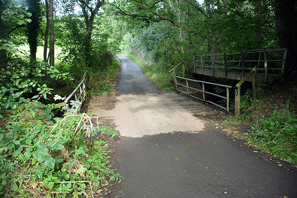
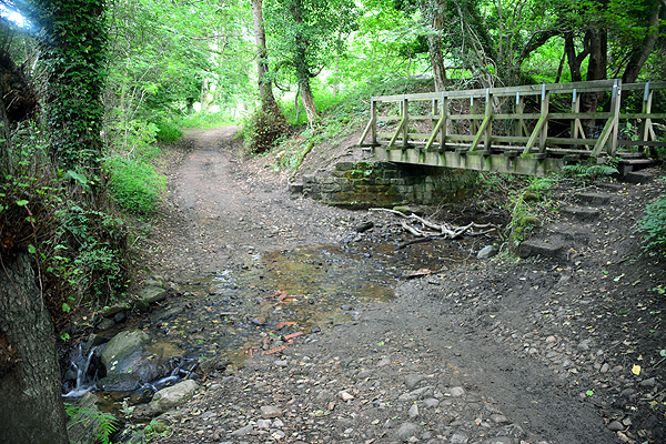
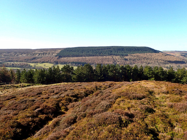
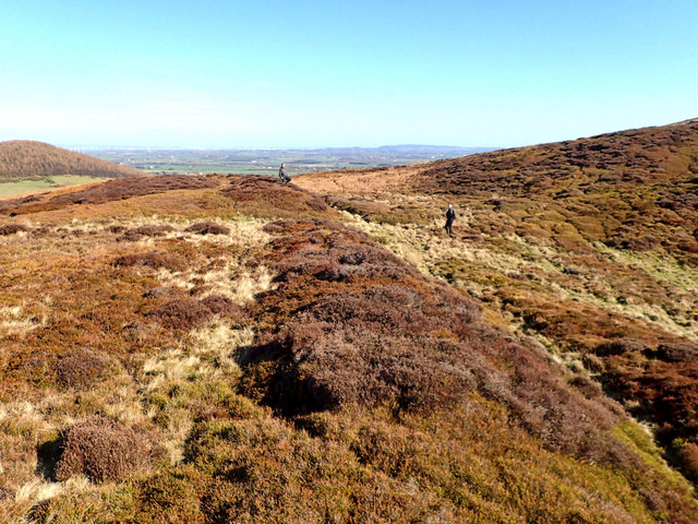
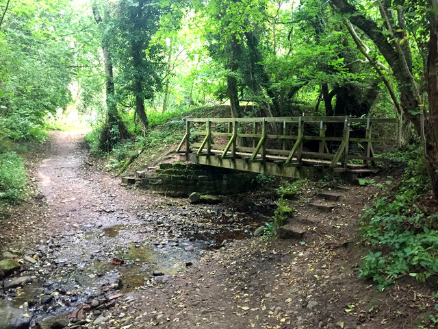
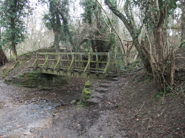
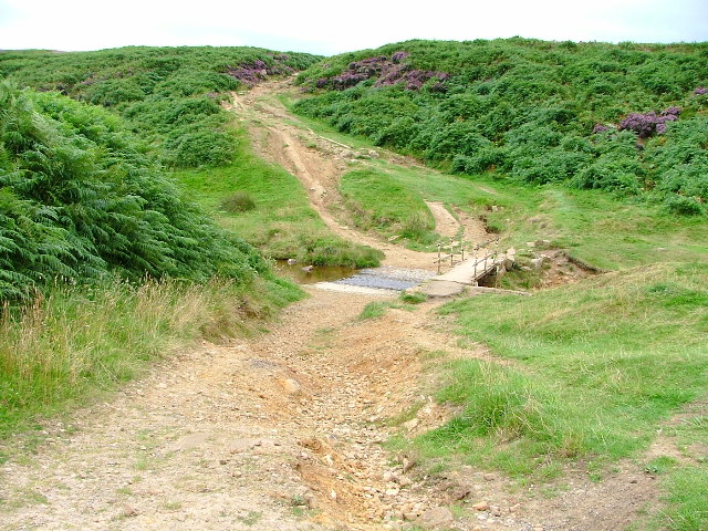
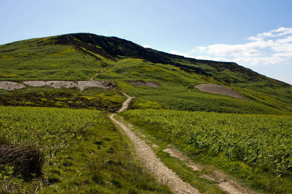
Scugdale is a beautiful valley located in the North York Moors National Park, in the county of Yorkshire, England. It is a picturesque and tranquil area that attracts visitors with its stunning natural scenery and opportunities for outdoor activities.

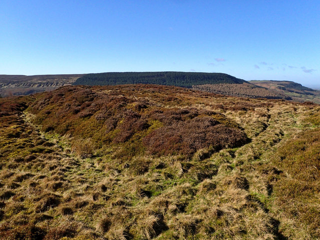
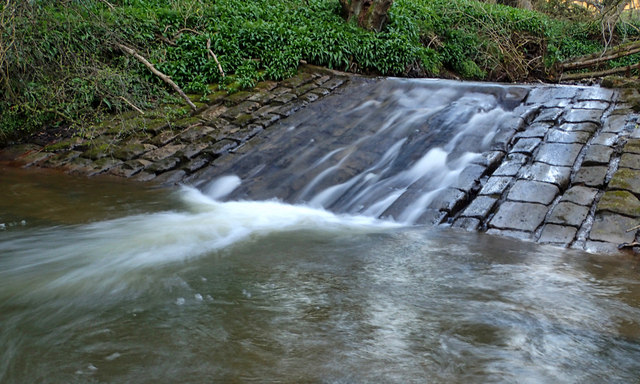
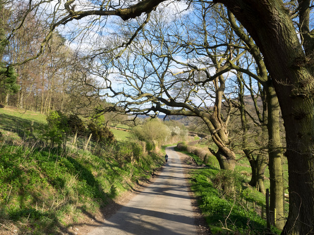
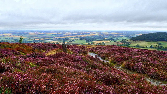
Nestled between the small villages of Swainby and Carlton-in-Cleveland, Scugdale is known for its rolling hills, dense woodlands, and meandering streams. The valley is dominated by heather-covered moorland, providing a rich habitat for a variety of wildlife, including birds, deer, and rare plant species.

The valley is a popular destination for nature enthusiasts, hikers, and climbers. Scugdale offers several walking trails that cater to different levels of difficulty, allowing visitors to explore the surrounding countryside. The valley is also well-known for its rock climbing routes, attracting climbers from all around the country. The craggy limestone cliffs offer a range of challenging climbs for both beginners and experienced climbers.

Aside from its natural beauty, Scugdale is also home to historical landmarks. The ruins of Whorlton Castle, a medieval fortress, can be found on a hillside overlooking the valley. The castle, built in the 12th century, provides a glimpse into the region's rich history.

Scugdale is a haven for those seeking peace and tranquility in the midst of nature. Its unspoiled landscapes, diverse wildlife, and outdoor recreational opportunities make it a must-visit destination for anyone exploring the Yorkshire region.

If you have any feedback on the listing, please let us know in the comments section below.

Scugdale Images

Images are sourced within 2km of 54.391936/-1.2204001 or Grid Reference SE5099. Thanks to Geograph Open Source API. All images are credited.

Ford at Scugdale This is the first of two fords on the Scugdale Beck at Piper Grain.
Ford at Scugdale
This is the first of two fords on the Scugdale Beck at Piper Grain.
Piper Beck Ford This ford is found on the Piper Beck at Scugdale. The track is part of the Cleveland Way.
Piper Beck Ford
This ford is found on the Piper Beck at Scugdale. The track is part of the Cleveland Way.
Live Moor Hillfort Quoted from <span class="nowrap"><a title="http://www.themodernantiquarian.com/site/4314/live_moor_hill_fort_whorlton.html" rel="nofollow ugc noopener" href="http://www.themodernantiquarian.com/site/4314/live_moor_hill_fort_whorlton.html">Link</a><img style="margin-left:2px;" alt="External link" title="External link - shift click to open in new window" src="https://s1.geograph.org.uk/img/external.png" width="10" height="10"/></span>

"A previously unrecorded promontory fort was identified by D. Smith on air photographs and later surveyed by him and G. W. Goodall. A single rampart with external ditch extends across the west-facing spur of Live Moor to enclose an area of approximately 2 acres known as Knolls End. Where best preserved the rampart is 7.3m wide and 2.3m high externally and .5m internally, while the ditch is up to 1.5m wide and .6m deep with a fragmentary counter scarp bank. The work has been mutilated by quarrying and associated trackways, but a gap in the rampart and ditch at NZ 49640126 probably represents an original entrance" YAS 51, 1978.

And from Prehistoric and Roman Archaeology of North-East Yorkshire edited by D A Spratt, 1990

"The small promontory fort at Live Moor (0.8 ha) stands on the north-west corner of the moors. It has two visible ramparts, an earlier one just inside the outer, later one at its south-western end. There is a central entrance, whence a hollow- way runs up the hill slope to the Live Moor cairnfield. This is the highest of any of these early field systems (315m) and as such is arguably Bronze Age, unlikely to persist into the Iron Age, which might suggest an early date for the fort. The fort, only recently discovered (Smith, 1979), has not been excavated, but shows no signs of hut structures."
Live Moor Hillfort
Quoted from LinkExternal link "A previously unrecorded promontory fort was identified by D. Smith on air photographs and later surveyed by him and G. W. Goodall. A single rampart with external ditch extends across the west-facing spur of Live Moor to enclose an area of approximately 2 acres known as Knolls End. Where best preserved the rampart is 7.3m wide and 2.3m high externally and .5m internally, while the ditch is up to 1.5m wide and .6m deep with a fragmentary counter scarp bank. The work has been mutilated by quarrying and associated trackways, but a gap in the rampart and ditch at NZ 49640126 probably represents an original entrance" YAS 51, 1978. And from Prehistoric and Roman Archaeology of North-East Yorkshire edited by D A Spratt, 1990 "The small promontory fort at Live Moor (0.8 ha) stands on the north-west corner of the moors. It has two visible ramparts, an earlier one just inside the outer, later one at its south-western end. There is a central entrance, whence a hollow- way runs up the hill slope to the Live Moor cairnfield. This is the highest of any of these early field systems (315m) and as such is arguably Bronze Age, unlikely to persist into the Iron Age, which might suggest an early date for the fort. The fort, only recently discovered (Smith, 1979), has not been excavated, but shows no signs of hut structures."
Live Moor Hillfort  - entrance on the right Quoted from <span class="nowrap"><a title="http://www.themodernantiquarian.com/site/4314/live_moor_hill_fort_whorlton.html" rel="nofollow ugc noopener" href="http://www.themodernantiquarian.com/site/4314/live_moor_hill_fort_whorlton.html">Link</a><img style="margin-left:2px;" alt="External link" title="External link - shift click to open in new window" src="https://s1.geograph.org.uk/img/external.png" width="10" height="10"/></span>

"A previously unrecorded promontory fort was identified by D. Smith on air photographs and later surveyed by him and G. W. Goodall. A single rampart with external ditch extends across the west-facing spur of Live Moor to enclose an area of approximately 2 acres known as Knolls End. Where best preserved the rampart is 7.3m wide and 2.3m high externally and .5m internally, while the ditch is up to 1.5m wide and .6m deep with a fragmentary counter scarp bank. The work has been mutilated by quarrying and associated trackways, but a gap in the rampart and ditch at NZ 49640126 probably represents an original entrance" YAS 51, 1978.

And from Prehistoric and Roman Archaeology of North-East Yorkshire edited by D A Spratt, 1990

"The small promontory fort at Live Moor (0.8 ha) stands on the north-west corner of the moors. It has two visible ramparts, an earlier one just inside the outer, later one at its south-western end. There is a central entrance, whence a hollow- way runs up the hill slope to the Live Moor cairnfield. This is the highest of any of these early field systems (315m) and as such is arguably Bronze Age, unlikely to persist into the Iron Age, which might suggest an early date for the fort. The fort, only recently discovered (Smith, 1979), has not been excavated, but shows no signs of hut structures."
Live Moor Hillfort - entrance on the right
Quoted from LinkExternal link "A previously unrecorded promontory fort was identified by D. Smith on air photographs and later surveyed by him and G. W. Goodall. A single rampart with external ditch extends across the west-facing spur of Live Moor to enclose an area of approximately 2 acres known as Knolls End. Where best preserved the rampart is 7.3m wide and 2.3m high externally and .5m internally, while the ditch is up to 1.5m wide and .6m deep with a fragmentary counter scarp bank. The work has been mutilated by quarrying and associated trackways, but a gap in the rampart and ditch at NZ 49640126 probably represents an original entrance" YAS 51, 1978. And from Prehistoric and Roman Archaeology of North-East Yorkshire edited by D A Spratt, 1990 "The small promontory fort at Live Moor (0.8 ha) stands on the north-west corner of the moors. It has two visible ramparts, an earlier one just inside the outer, later one at its south-western end. There is a central entrance, whence a hollow- way runs up the hill slope to the Live Moor cairnfield. This is the highest of any of these early field systems (315m) and as such is arguably Bronze Age, unlikely to persist into the Iron Age, which might suggest an early date for the fort. The fort, only recently discovered (Smith, 1979), has not been excavated, but shows no signs of hut structures."
Scugdale Beck Weir Scugdale takes its name from the Danish skygger meaning to overshadow, referring  to the sheltered nature of the dale.

And the waters of the beck that flows down the dale must have some mysterious properties, for it was in this secluded valley that Harry Cooper was brought up. At a height of 8 feet 6 inches in height and weighing 29 stone Harry was reputed to be the tallest man in the world. He toured America as a star of in Barnum’s circus. He died about 1900 and is buried in Calgary, Canada.
Scugdale Beck Weir
Scugdale takes its name from the Danish skygger meaning to overshadow, referring to the sheltered nature of the dale. And the waters of the beck that flows down the dale must have some mysterious properties, for it was in this secluded valley that Harry Cooper was brought up. At a height of 8 feet 6 inches in height and weighing 29 stone Harry was reputed to be the tallest man in the world. He toured America as a star of in Barnum’s circus. He died about 1900 and is buried in Calgary, Canada.
Minor road in Scugdale The road is seen looking east; it ends as a public road about two kilometres distant at Scugdale Hall.
Minor road in Scugdale
The road is seen looking east; it ends as a public road about two kilometres distant at Scugdale Hall.
On Faceby Bank There’s only a week or two of the purple haze so I have to make the most of the heather, providing some colour on a wet morning when the horizon is lost to the mist. The view is down to Swainby with wooded Whorl Hill on the right.

From my blog <span class="nowrap"><a title="http://www.fhithich.uk/?p=20075" rel="nofollow ugc noopener" href="http://www.fhithich.uk/?p=20075">Link</a><img style="margin-left:2px;" alt="External link" title="External link - shift click to open in new window" src="https://s1.geograph.org.uk/img/external.png" width="10" height="10"/></span>
On Faceby Bank
There’s only a week or two of the purple haze so I have to make the most of the heather, providing some colour on a wet morning when the horizon is lost to the mist. The view is down to Swainby with wooded Whorl Hill on the right. From my blog LinkExternal link
Ford on Piper Beck
Ford on Piper Beck
Flagged path on Live Moor Very easy walking on the Cleveland Way.
Flagged path on Live Moor
Very easy walking on the Cleveland Way.
Old Boundary Marker on Round Hill by the Cleveland Way Boundary Marker on Round Hill, by the Cleveland Way, in parish of Faceby (Hambleton District).

Surveyed

Milestone Society National ID: YN_FACWHO04bm
Old Boundary Marker on Round Hill by the Cleveland Way
Boundary Marker on Round Hill, by the Cleveland Way, in parish of Faceby (Hambleton District). Surveyed Milestone Society National ID: YN_FACWHO04bm
Old Boundary Marker on Live Moor, Faceby parish Boundary Marker by the Cleveland Way, in parish of Faceby (Hambleton District), Live Moor.

Surveyed

Milestone Society National ID: YN_FACWHO03bm
Old Boundary Marker on Live Moor, Faceby parish
Boundary Marker by the Cleveland Way, in parish of Faceby (Hambleton District), Live Moor. Surveyed Milestone Society National ID: YN_FACWHO03bm
Footbridge and ford
Footbridge and ford
Path from Live Moor
Path from Live Moor
Wood store This wooden cattle truck probably dates from before the First World War.
Wood store
This wooden cattle truck probably dates from before the First World War.
Old Boundary Marker in Faceby Plantation, Faceby parish Boundary Marker by the Cleveland Way, in parish of Faceby (Hambleton District), Faceby Plantation, by bend in track.

Surveyed

Milestone Society National ID: YN_FACWHO02bm
Old Boundary Marker in Faceby Plantation, Faceby parish
Boundary Marker by the Cleveland Way, in parish of Faceby (Hambleton District), Faceby Plantation, by bend in track. Surveyed Milestone Society National ID: YN_FACWHO02bm
Old Boundary Marker on Live Moor, Faceby parish Boundary Marker in parish of Faceby (Hambleton District), Live Moor, North of Cleveland Way.

Surveyed

Milestone Society National ID: YN_FACWHO09bm
Old Boundary Marker on Live Moor, Faceby parish
Boundary Marker in parish of Faceby (Hambleton District), Live Moor, North of Cleveland Way. Surveyed Milestone Society National ID: YN_FACWHO09bm
The Ash Near Huthwaite Green in Scugdale a fine specimen of the Common or European Ash, Fraxinus excelsior, one of Britain’s most majestic trees. In Norse mythology, the tree is Yggdrasil, a great ash at the centre of the cosmos where its branches and roots connect different places and time, allowing passage from the underworld to heaven.

The wood is strong and flexible and traditionally used for spears and axe handles. In fact, the name derives from the Anglo-Saxon word aesc for a spear.

But the Ash is under threat from the fungus known as Ash Dieback, a disease from Asia that was first recognised in the UK in 2012. The fungus is spread by the wind and there are outbreaks in North Yorkshire but this tree seems healthy enough. Then I am no expert.

From my photo-diary for 23rd October 2019 see <span class="nowrap"><a title="http://www.fhithich.uk/?p=21810" rel="nofollow ugc noopener" href="http://www.fhithich.uk/?p=21810">Link</a><img style="margin-left:2px;" alt="External link" title="External link - shift click to open in new window" src="https://s1.geograph.org.uk/img/external.png" width="10" height="10"/></span>
The Ash
Near Huthwaite Green in Scugdale a fine specimen of the Common or European Ash, Fraxinus excelsior, one of Britain’s most majestic trees. In Norse mythology, the tree is Yggdrasil, a great ash at the centre of the cosmos where its branches and roots connect different places and time, allowing passage from the underworld to heaven. The wood is strong and flexible and traditionally used for spears and axe handles. In fact, the name derives from the Anglo-Saxon word aesc for a spear. But the Ash is under threat from the fungus known as Ash Dieback, a disease from Asia that was first recognised in the UK in 2012. The fungus is spread by the wind and there are outbreaks in North Yorkshire but this tree seems healthy enough. Then I am no expert. From my photo-diary for 23rd October 2019 see LinkExternal link
Show me another place!

Scugdale is located at Grid Ref: SE5099 (Lat: 54.391936, Lng: -1.2204001)

Division: North Riding

Administrative County: North Yorkshire

District: Hambleton

Police Authority: North Yorkshire

What 3 Words

///drivers.merely.variation. Near Bilsdale, North Yorkshire

Related Wikis

Cleveland Hills

The Cleveland Hills are a range of hills on the north-west edge of the North York Moors in North Yorkshire, England, overlooking Cleveland and Teesside...

Whorlton, North Yorkshire

Whorlton is a hamlet and civil parish in the Hambleton District of North Yorkshire, England. It is very near Swainby and the A19, and 6 miles south west...

Faceby

Faceby is a small village and civil parish in North Yorkshire, England. It is at the north-west corner of the North York Moors and near Stokesley. ��2...

Whorlton Castle

Whorlton Castle is a ruined medieval castle situated near the abandoned village of Whorlton (at grid reference NZ4802) in North Yorkshire, England. It...

Swainby

Swainby is a village in the Hambleton District of North Yorkshire, England. It is situated on the A172 road, 8 miles (13 km) north-east from Northallerton...

Sheepwash, North Yorkshire

Sheepwash is a popular tourist spot in the North York Moors, North Yorkshire, England. It is located on Cod Beck which flows into Cod Beck Reservoir near...

Cringle Moor

Cringle Moor (also known as Cranimoor), at 432 m (1,417 ft), is the third highest hill in the North York Moors, England, and the highest point west of...

Busby Hall

Busby Hall is a Grade II* listed Country House in Little Busby, North Yorkshire, England, close to the village of Carlton-in-Cleveland. The house and parkland...

Nearby Amenities

Located within 500m of 54.391936,-1.2204001
Barrier: stile
Lat/Long: 54.3959077/-1.2214591
Raikes Farm
Place: farm
Lat/Long: 54.3943145/-1.2161475
The data included in this document is from www.openstreetmap.org. The data is made available under ODbL.

Have you been to Scugdale?

Leave your review of Scugdale below (or comments, questions and feedback).