Hatfield Heath

Settlement in Essex Uttlesford

England

Hatfield Heath

The White Horse, Hatfield Heath A grade II listed pub, early 17th century.
The White Horse, Hatfield Heath Credit: Robin Webster

Hatfield Heath is a charming village located in the county of Essex, England. Situated approximately 25 miles northeast of London, it falls within the administrative district of Uttlesford. The village is surrounded by picturesque countryside, offering a tranquil and idyllic setting.

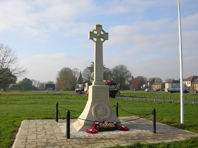
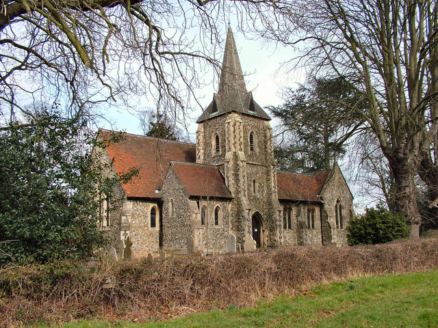
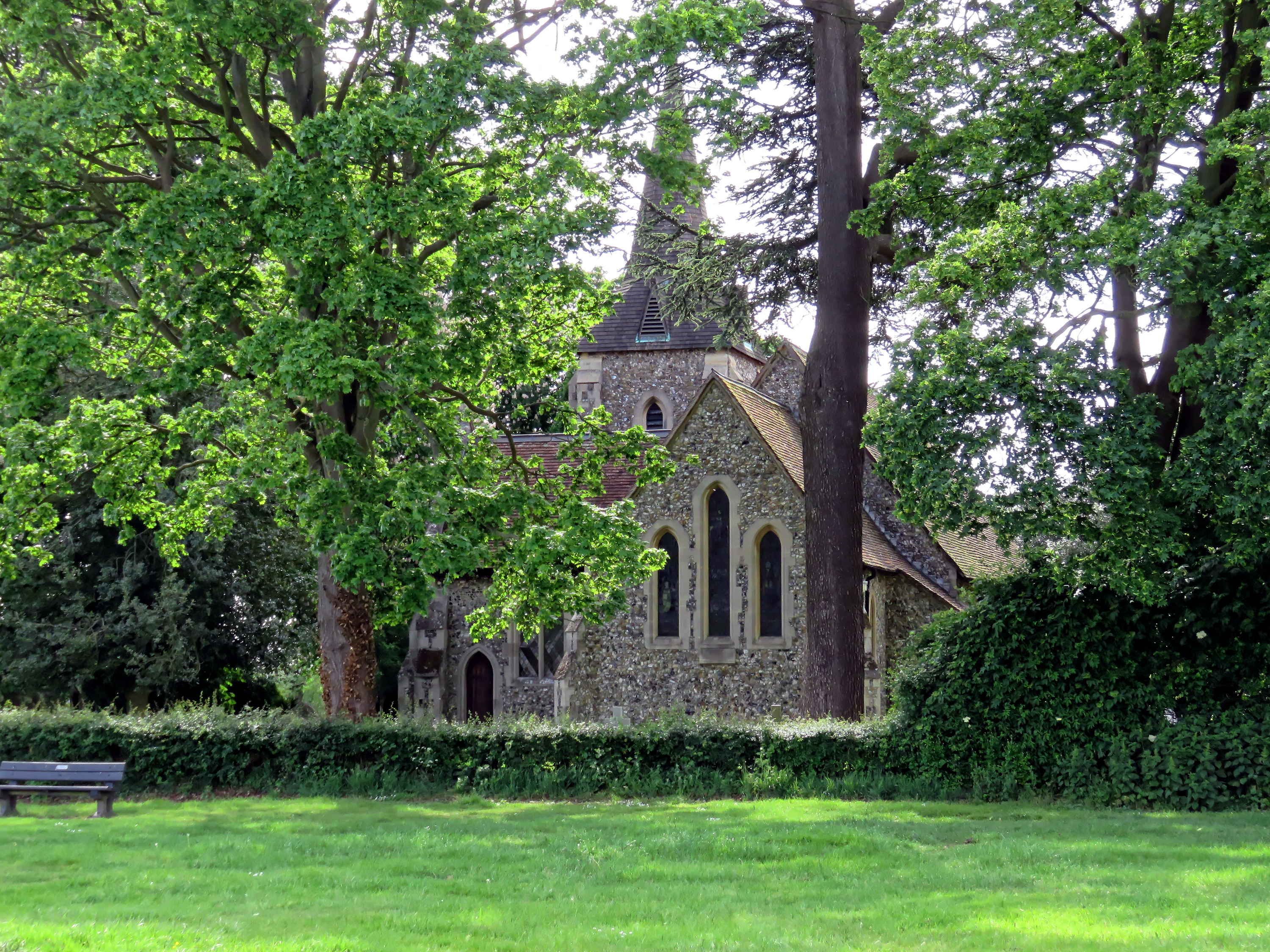
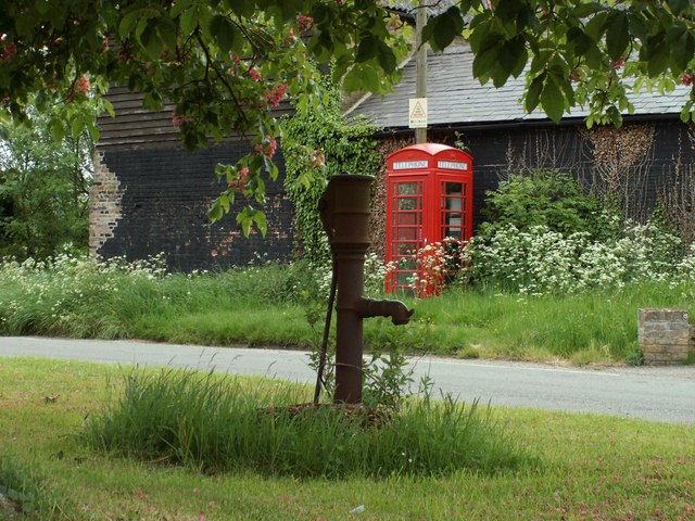
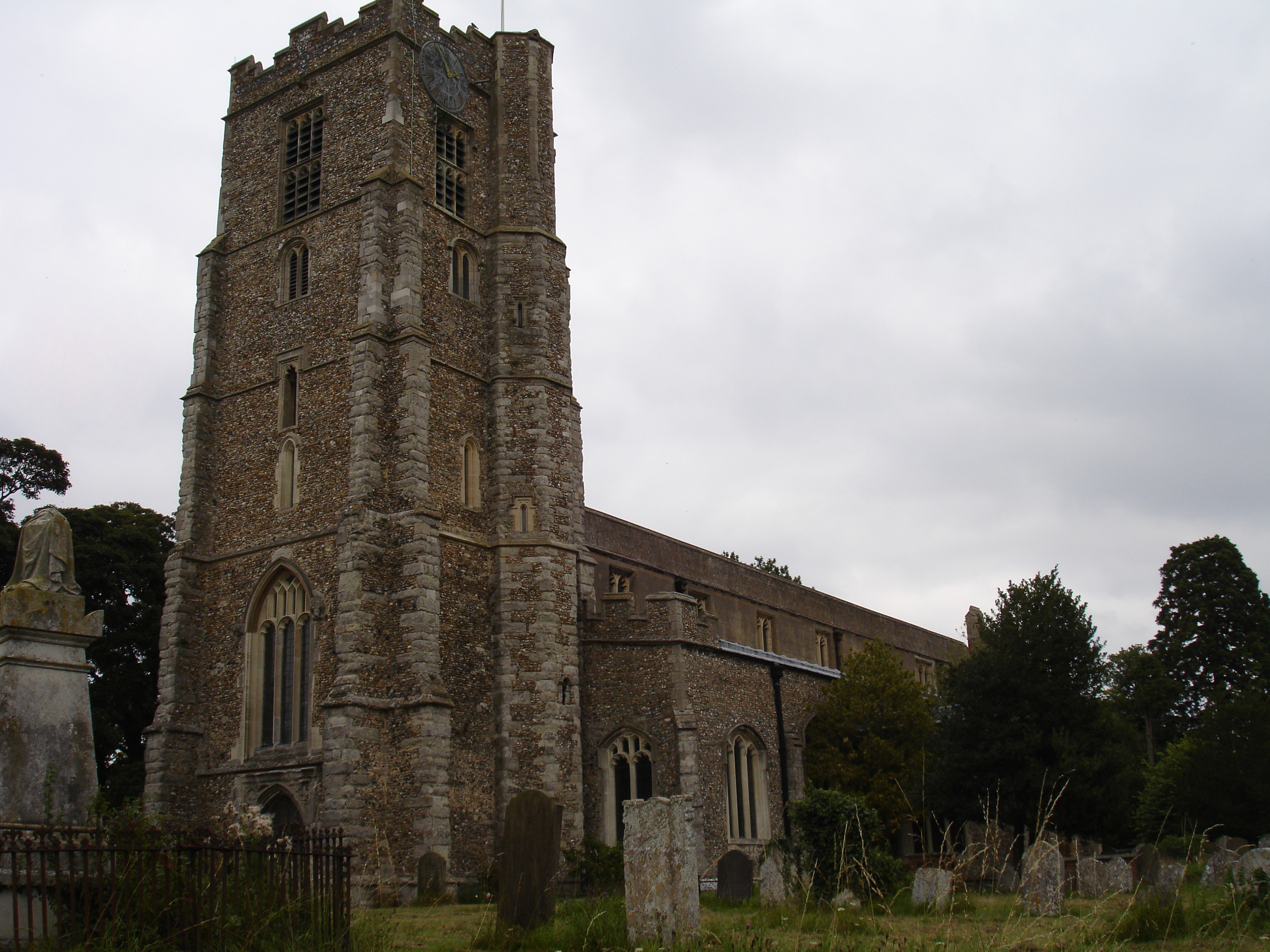
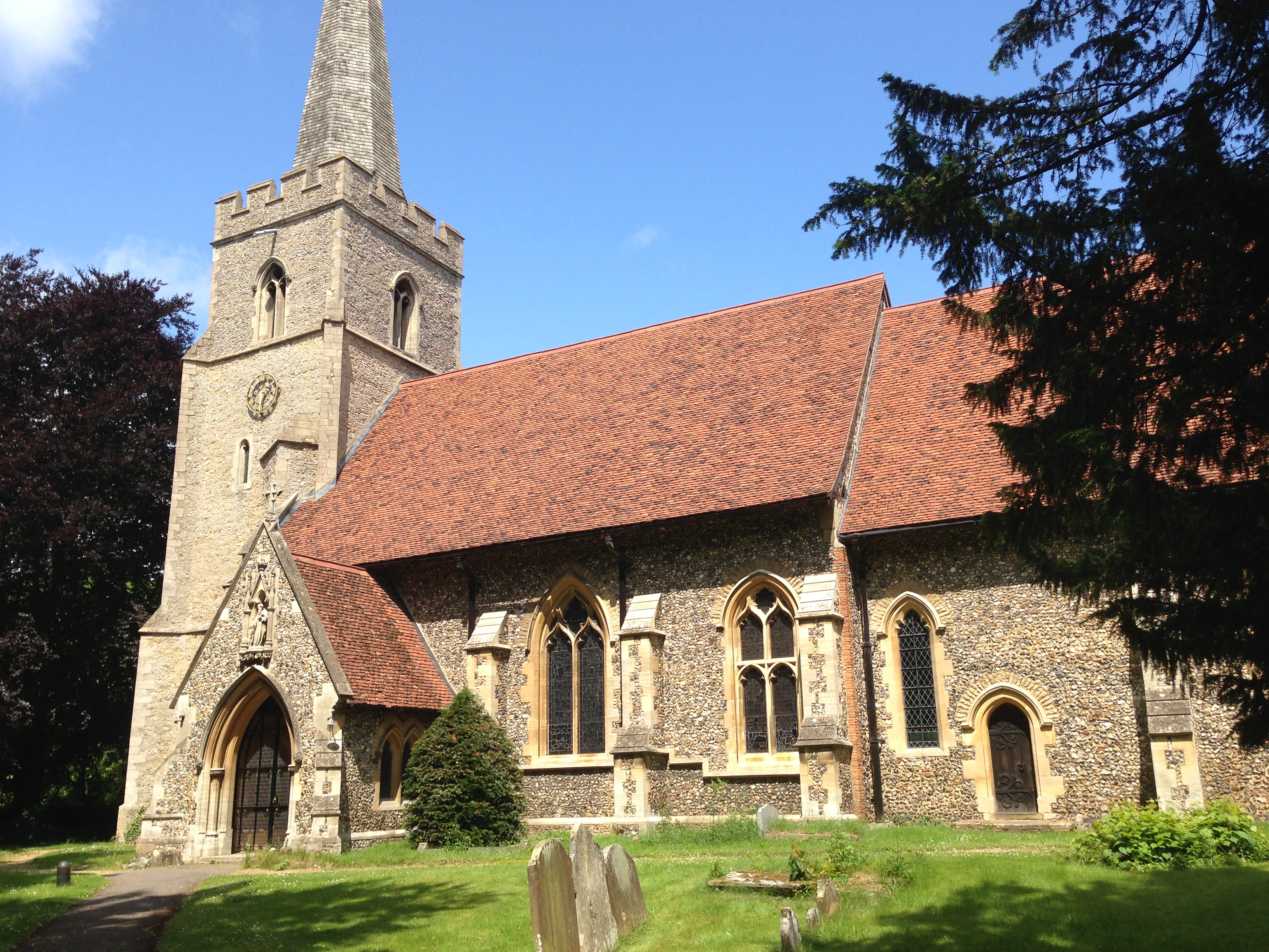
One of Hatfield Heath's notable features is its rich history, dating back to medieval times. The village has several historic buildings, including St. Mary's Church, which dates back to the 13th century. The church features stunning architectural details and beautiful stained glass windows.

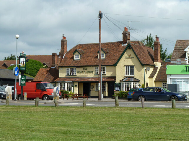
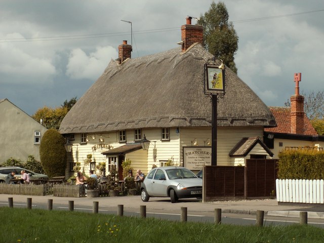
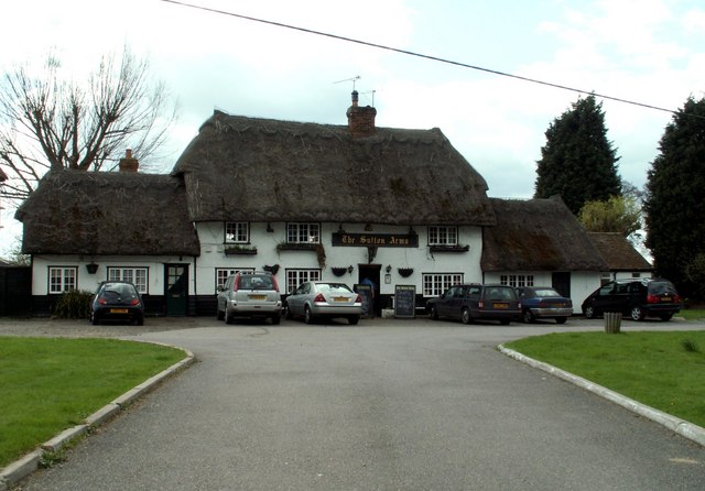
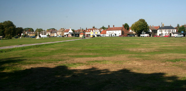
The village itself is small but vibrant, with a close-knit community. It offers a range of amenities and services, including a primary school, a village hall, a post office, and a convenience store. Additionally, there are several pubs and restaurants that provide a welcoming atmosphere for both locals and visitors.

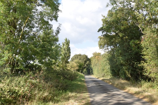
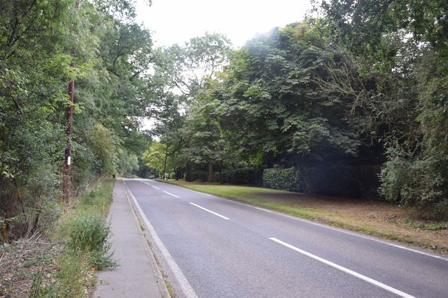
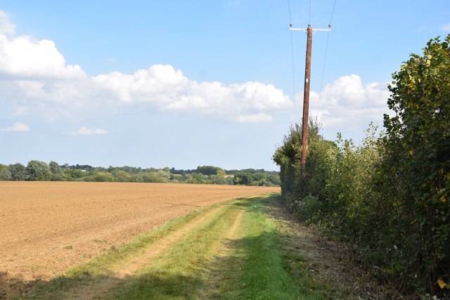
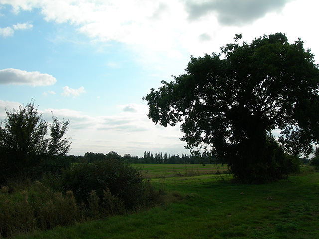
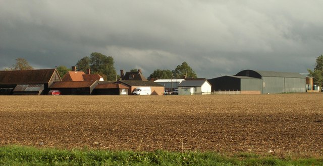
Hatfield Heath is also known for its beautiful natural surroundings. The village is surrounded by open fields, woodlands, and nature reserves, making it a haven for outdoor enthusiasts. There are numerous walking trails and cycling routes in the area, allowing residents and visitors to explore the stunning countryside.

Despite its peaceful setting, Hatfield Heath benefits from its proximity to major transportation routes. The village is conveniently located near the M11 motorway, providing easy access to London and other nearby towns. Furthermore, the nearby Stansted Airport offers excellent connections to various domestic and international destinations.

In summary, Hatfield Heath is a picturesque village in Essex, known for its rich history, natural beauty, and close-knit community. It offers a peaceful and rural lifestyle while still providing convenient access to nearby amenities and transportation links.

If you have any feedback on the listing, please let us know in the comments section below.

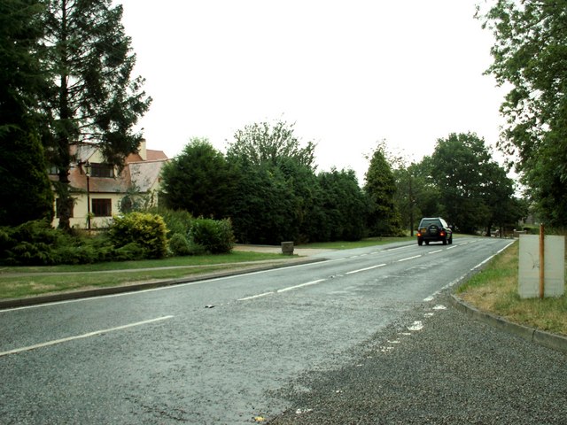
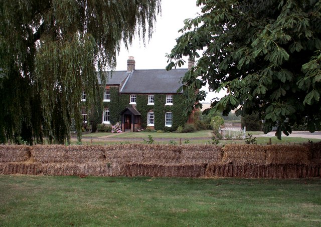
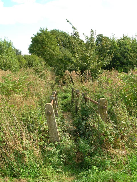
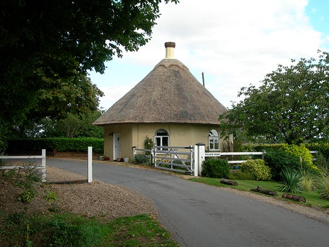
Hatfield Heath Images

Images are sourced within 2km of 51.812703/0.209009 or Grid Reference TL5214. Thanks to Geograph Open Source API. All images are credited.

The White Horse, Hatfield Heath A grade II listed pub, early 17th century.
The White Horse, Hatfield Heath
A grade II listed pub, early 17th century.
Ryes Lane Looking north from near Corringales.
Ryes Lane
Looking north from near Corringales.
On the road to Hatfield Heath Near Town Grove.
On the road to Hatfield Heath
Near Town Grove.
Field and footpath  North of Hatfield Heath. If you are sharp-eyed you may be able to spot the tower of St Mary the Virgin at Hatfield Broad Oak - on the skyline towards the left.
Field and footpath
North of Hatfield Heath. If you are sharp-eyed you may be able to spot the tower of St Mary the Virgin at Hatfield Broad Oak - on the skyline towards the left.
War memorial at Hatfield Heath The war memorial is on the village green adjacent to the A1060 road.  The parish church is in the background (still in square TL5214).
War memorial at Hatfield Heath
The war memorial is on the village green adjacent to the A1060 road. The parish church is in the background (still in square TL5214).
Holy Trinity Church, Hatfield Heath
'The Thatchers', public house at Hatfield Heath, Essex This pub stands on Stortford Road to the west of the Heath.
'The Thatchers', public house at Hatfield Heath, Essex
This pub stands on Stortford Road to the west of the Heath.
'The Sutton Arms' public house, Little Hallingbury, Essex This pub stands on the A1060 road at the southern end of Little Hallingbury in an area called Hall Green.
'The Sutton Arms' public house, Little Hallingbury, Essex
This pub stands on the A1060 road at the southern end of Little Hallingbury in an area called Hall Green.
Sawbridgeworth Road, Essex This part of Sawbridgeworth Road shows one of the M11 bridges. The view is towards Sawbridgeworth, away from Hatfield Heath.
Sawbridgeworth Road, Essex
This part of Sawbridgeworth Road shows one of the M11 bridges. The view is towards Sawbridgeworth, away from Hatfield Heath.
The A.1060 at Hatfield Heath, Essex This is the only section of this road that lies in this grid square. It shows the road travelling away from Hatfield Heath towards Chelmsford.
The A.1060 at Hatfield Heath, Essex
This is the only section of this road that lies in this grid square. It shows the road travelling away from Hatfield Heath towards Chelmsford.
Friars, Hatfield Heath, Essex
Footbridge This footbridge on the path Corringales is well overgrown, but accessible.
Footbridge
This footbridge on the path Corringales is well overgrown, but accessible.
The Round Lodge Situated at the entrance to a private road on the Forest Way.
The Round Lodge
Situated at the entrance to a private road on the Forest Way.
Footpath junction A well-disguised junction of the path to Little Hallingbury Park from the Harcamlow Way-Three Forests Way footpath.
Footpath junction
A well-disguised junction of the path to Little Hallingbury Park from the Harcamlow Way-Three Forests Way footpath.
'The Cock' inn and war memorial, Sheering, Essex
Shrubbs Farm, just east of Sheering, Essex
Hatfield Heath Hatfield Heath is strung along one side of a large village green.
Hatfield Heath
Hatfield Heath is strung along one side of a large village green.
Houses on the green, Hatfield Heath
Show me another place!

Hatfield Heath is located at Grid Ref: TL5214 (Lat: 51.812703, Lng: 0.209009)

Administrative County: Essex

District: Uttlesford

Police Authority: Essex

What 3 Words

///sorters.from.retail. Near Hatfield Heath, Essex

Related Wikis

Hatfield Heath

Hatfield Heath is a village, civil parish, and an electoral ward in the Uttlesford district of Essex, England, and at its west is close to the border with...

Ardley End

Ardley End is a hamlet in the Uttlesford area of Essex, England. It is approximately half a mile from the village of Hatfield Heath.

Down Hall

Down Hall is a Victorian country house and estate near Hatfield Heath in the English county of Essex, close to its border with Hertfordshire. It is surrounded...

Sheering

Sheering is a civil parish and village in the Epping Forest district of Essex, England. Sheering village is situated 2.8 miles (5 km) north-east from Harlow...

Newman's End

Newman's End is a hamlet in the civil parish of Matching, and the Epping Forest district of Essex, England. The hamlet, at the north of the parish, is...

Hatfield Broad Oak

Hatfield Broad Oak (also known as Hatfield Regis) is a village and civil parish in the Uttlesford district of Essex, England. The village is approximately...

Hatfield Regis Priory

Hatfield Broad Oak Priory, or Hatfield Regis Priory, is a former Benedictine priory in Hatfield Broad Oak, Essex, England. Founded by 1139, it was dissolved...

Great Hallingbury

Great Hallingbury is a village and a civil parish in the Uttlesford District of Essex, England. The population of the civil parish at the 2011 census was...

Nearby Amenities

Located within 500m of 51.812703,0.209009
Bus Stop
The Thatchers
Bus: yes
Naptan AtcoCode: 150020010006
Naptan Bearing: SE
Naptan CommonName: The Thatchers
Naptan Crossing: Sawbridgeworth Road
Naptan Indicator: Opp
Naptan Landmark: The Thatchers
Naptan NaptanCode: esxdgmpj
Naptan PlusbusZoneRef: BSHPSFD
Naptan Street: Stortford Road
Naptan Verified: no
Public Transport: platform
Source: naptan_import
Lat/Long: 51.8147912/0.2026243
Bus Stop
The Thatchers
Bus: yes
Naptan AtcoCode: 150020010007
Naptan Bearing: NW
Naptan CommonName: The Thatchers
Naptan Crossing: Sawbridgeworth Road
Naptan Indicator: o/s
Naptan Landmark: The Thatchers
Naptan NaptanCode: esxdgjtj
Naptan PlusbusZoneRef: BSHPSFD
Naptan Street: Stortford Road
Naptan Verified: no
Public Transport: platform
Source: naptan_import
Lat/Long: 51.814296/0.2036158
Bus Stop
The White Horse
Bus: yes
Naptan AtcoCode: 150020011012
Naptan Bearing: W
Naptan CommonName: The White Horse
Naptan Crossing: Beehive Court
Naptan Indicator: Opp
Naptan Landmark: The White Horse
Naptan NaptanCode: esxdgmpm
Naptan PlusbusZoneRef: BSHPSFD
Naptan Street: Chelmsford Road
Naptan Verified: no
Public Transport: platform
Shelter: yes
Source: naptan_import
Lat/Long: 51.8126652/0.2097832
Bus Stop
The White Horse
Bus: yes
Naptan AtcoCode: 1500IM2188
Naptan Bearing: E
Naptan CommonName: The White Horse
Naptan Crossing: Beehive Court
Naptan Indicator: o/s
Naptan Landmark: The White Horse
Naptan NaptanCode: esxdgmdw
Naptan PlusbusZoneRef: BSHPSFD
Naptan Street: Chelmsford Road
Naptan Verified: no
Public Transport: platform
Shelter: yes
Source: naptan_import
Lat/Long: 51.8128403/0.2083471
Little Heath
Naptan AtcoCode: 1500JMD039
Naptan Bearing: S
Naptan BusStopType: CUS
Naptan CommonName: Little Heath
Naptan Crossing: Little Heath
Naptan Indicator: Opp
Naptan Landmark: Little Heath
Naptan NaptanCode: esxjdpjt
Naptan PlusbusZoneRef: BSHPSFD
Naptan Street: Broomfields
Naptan Verified: no
Source: naptan_import
Lat/Long: 51.8161016/0.2046761
Hatfield Heath
Place: village
Wikidata: Q3242683
Lat/Long: 51.8126123/0.2065971
Cafe
The Village Tearoom
Lat/Long: 51.8130018/0.2082582
Hatfield Heath War Memorial
Historic: memorial
Wikidata: Q26672117
Lat/Long: 51.8122939/0.2097107
Barrier: stile
Lat/Long: 51.8093152/0.2056108
Barrier: kissing_gate
Lat/Long: 51.8124236/0.2068018
Bench
Lat/Long: 51.8126633/0.206866
Bench
Lat/Long: 51.812665/0.2067668
Police
Lat/Long: 51.8119863/0.2145062
Barrier: stile
Lat/Long: 51.8156759/0.211749
Barrier: kissing_gate
Lat/Long: 51.8148437/0.2077616
Note: 2016-09-26 There is a public footpath sign and a sign stating that it is not a public footpath!
Lat/Long: 51.8148608/0.2077711
Bus Stop
The White Horse
Bus: yes
Naptan AtcoCode: 1500200110Y2
Naptan BusStopType: CUS
Naptan NaptanCode: esxjpjpd
Naptan Verified: no
Public Transport: platform
Source: naptan
Lat/Long: 51.8125577/0.2088405
Cafe
Tea on the Heath
Lat/Long: 51.811997/0.2050821
The Little Seafood Bar
Shop: seafood
Lat/Long: 51.8119518/0.2050761
Co-op Food
Brand: Co-op Food
Brand Wikidata: Q3277439
Brand Wikipedia: en:Co-op Food
Operator: The Co-operative Group
Operator Wikidata: Q117202
Shop: convenience
Website: https://www.coop.co.uk/store-finder/CM22-7EB/the-heath
Lat/Long: 51.8129098/0.2095326
Bicycle Parking
Bicycle Parking: stands
Covered: no
Lat/Long: 51.8128751/0.2083405
Post Box
Lat/Long: 51.8128933/0.2082627
Bench
Backrest: yes
Lat/Long: 51.8128527/0.2083124
Waste Basket
Lat/Long: 51.812861/0.2082855
Crossing
Crossing: unmarked
Crossing Island: yes
Crossing Markings: no
Tactile Paving: yes
Lat/Long: 51.8127451/0.209314
Bench
Backrest: yes
Lat/Long: 51.8126347/0.2097353
Bench
Backrest: yes
Lat/Long: 51.8126297/0.2098211
Entrance: main
Lat/Long: 51.8145145/0.2034059
The data included in this document is from www.openstreetmap.org. The data is made available under ODbL.

Have you been to Hatfield Heath?

Leave your review of Hatfield Heath below (or comments, questions and feedback).