Cross Royd Plantation

Downs, Moorland in Yorkshire

England

Cross Royd Plantation

Disused quarry Disused quarry, off High Bank Lane, Thurlstone, South Yorkshire.
Disused quarry Credit: Dave Pickersgill

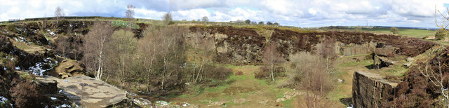
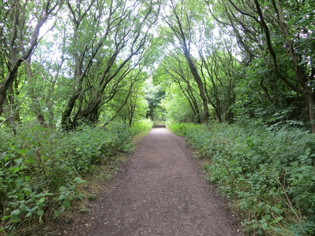
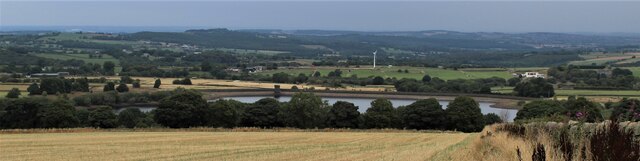
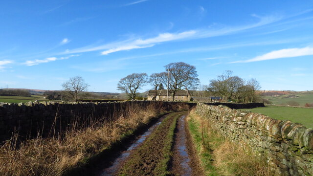
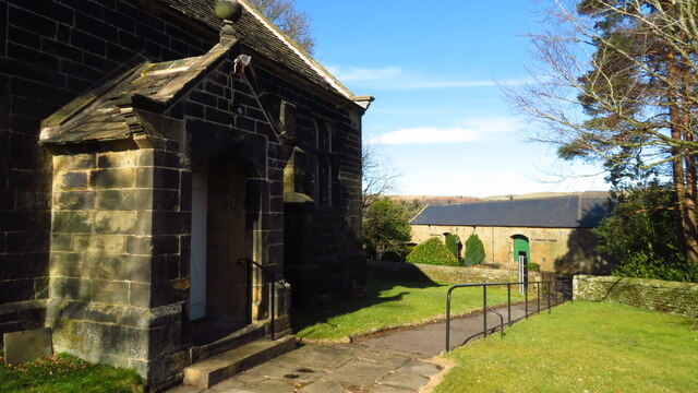
Cross Royd Plantation is a picturesque woodland located in Yorkshire, England. Situated amidst the stunning landscape of the Yorkshire Downs and Moorland, the plantation spans over a vast area, offering visitors a tranquil and immersive natural experience.

Covering an extensive range of tree species, Cross Royd Plantation boasts a diverse ecosystem. Oak, beech, and birch trees dominate the woodland, creating a dense canopy that provides shade and shelter for various wildlife species. The undergrowth is rich in ferns, mosses, and wildflowers, adding to the beauty of the plantation.

The plantation is a haven for birdwatchers and nature enthusiasts. It is home to a wide range of avian species, including the great spotted woodpecker, tawny owl, and various warblers. Visitors can often spot these birds perched on tree branches or hear their melodious calls echoing through the woods.

In addition to its natural beauty, Cross Royd Plantation offers several walking trails that allow visitors to explore its enchanting surroundings. These well-maintained paths wind through the woodland, offering glimpses of breathtaking vistas, babbling brooks, and serene meadows.

The plantation also plays a crucial role in environmental conservation. It serves as a carbon sink, absorbing and storing significant amounts of carbon dioxide from the atmosphere, contributing to the fight against climate change.

Whether one seeks solitude in nature, desires to observe wildlife, or wishes to embark on an adventure through the woods, Cross Royd Plantation in Yorkshire offers a captivating and enriching experience for all.

If you have any feedback on the listing, please let us know in the comments section below.

Cross Royd Plantation Images

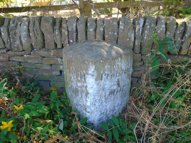
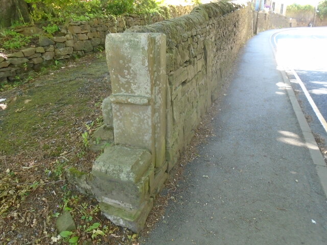
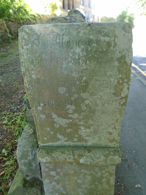
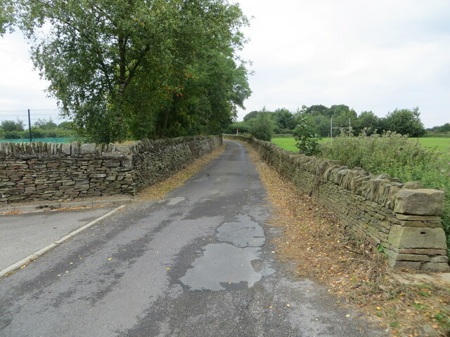
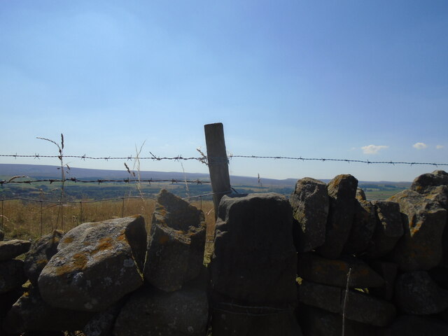
Images are sourced within 2km of 53.522108/-1.6575324 or Grid Reference SE2202. Thanks to Geograph Open Source API. All images are credited.

Disused quarry Disused quarry, off High Bank Lane, Thurlstone, South Yorkshire.
Disused quarry
Disused quarry, off High Bank Lane, Thurlstone, South Yorkshire.
Hartcliff Tower A true folly tower with no apparent reason for its construction in 1856
Hartcliff Tower
A true folly tower with no apparent reason for its construction in 1856
Old Milestone near Hartcliff Tower A gatepost with mileage to Penistone & Rotherham so probably was a guide stoup at one time (listed Grade II)
Old Milestone near Hartcliff Tower
A gatepost with mileage to Penistone & Rotherham so probably was a guide stoup at one time (listed Grade II)
Old milestone This milestone is on the south side of the road on the one way system down Church Street in Penistone.  It is under a large tree and must have been painted very many years ago judging by the remnants of white paint.  It is similar to the old stone <a href="https://www.geograph.org.uk/photo/7199866">SK3099 : Old milestone</a> down the passageway in Wortley, but slightly wider.  It is another stone for the benchmark enthusiasts.

Milestone Society National ID: YS_SFPN13
Old milestone
This milestone is on the south side of the road on the one way system down Church Street in Penistone. It is under a large tree and must have been painted very many years ago judging by the remnants of white paint. It is similar to the old stone SK3099 : Old milestone down the passageway in Wortley, but slightly wider. It is another stone for the benchmark enthusiasts. Milestone Society National ID: YS_SFPN13
Old milestone The tollroad from Huddersfield to Penistone leaves West Yorkshire just north of Ingbirchworth on the A629.   It enters South Yorkshire and dips down into the town on the B6462, still called Huddersfield Road.   This original tollroad stone 12 miles from Huddersfield is at the top of the hill above the Grammar School.   Grade II listed 1315077.
Old milestone
The tollroad from Huddersfield to Penistone leaves West Yorkshire just north of Ingbirchworth on the A629. It enters South Yorkshire and dips down into the town on the B6462, still called Huddersfield Road. This original tollroad stone 12 miles from Huddersfield is at the top of the hill above the Grammar School. Grade II listed 1315077.
Old milestone The pre-turnpike era milestone on Huddersfield Road, B6462, can just be seen in the wall almost opposite the second spot of sunshine.  The eroded legends are LONDON/177/Miles/Huddersfield/12/Penistone/1½  (6044122).   However the turnpike milestone a little further north (7226692) has the legends Huddersfield 12, Penistone ½ so the datum points in Penistone are different. The end stone is a memorial stone.
Old milestone
The pre-turnpike era milestone on Huddersfield Road, B6462, can just be seen in the wall almost opposite the second spot of sunshine. The eroded legends are LONDON/177/Miles/Huddersfield/12/Penistone/1½ (6044122). However the turnpike milestone a little further north (7226692) has the legends Huddersfield 12, Penistone ½ so the datum points in Penistone are different. The end stone is a memorial stone.
Memorial stone The memorial stone on Huddersfield Road, B6462, is to Joseph son of William and Margaret ? late of BRYNMAWR.   A connection to Penistone or the stone transported from Wales for some reason.
Memorial stone
The memorial stone on Huddersfield Road, B6462, is to Joseph son of William and Margaret ? late of BRYNMAWR. A connection to Penistone or the stone transported from Wales for some reason.
Woodland footpath giving access to Royd Moor Reservoir Looking north-westward.
Woodland footpath giving access to Royd Moor Reservoir
Looking north-westward.
Wall enclosed Long Lane near Penistone Grammar School Looking westward. The school playing fields are on both sides of the road.
Wall enclosed Long Lane near Penistone Grammar School
Looking westward. The school playing fields are on both sides of the road.
In the Inn The Old Crown, Penistone is one of my favourite British pubs.
In the Inn
The Old Crown, Penistone is one of my favourite British pubs.
The Old Crown Been in here a few times!
The Old Crown
Been in here a few times!
Old milestone The milestone on High Bank Lane which is probably about 250 years old.   It is the stone with the fence post at its left corner.   The large stone to the left can be moved to see the legend on that face, (P)enistone/(?) mile.   It still has barbed wire wrapped round it, 3 strands now.   In the distance is the eastern edge of the Pennines.   Grade II listed 1315076.
Old milestone
The milestone on High Bank Lane which is probably about 250 years old. It is the stone with the fence post at its left corner. The large stone to the left can be moved to see the legend on that face, (P)enistone/(?) mile. It still has barbed wire wrapped round it, 3 strands now. In the distance is the eastern edge of the Pennines. Grade II listed 1315076.
Royd Moor Reservoir
Royd Moor Reservoir
St. Saviour's Church, Thurlstone
Kibble Brewery, Thurlstone Located in old stables in the car park of the Crystal Palace.
Kibble Brewery, Thurlstone
Located in old stables in the car park of the Crystal Palace.
Ordnance Survey Cut Mark This mark can be found on a gatepost beside Royd Moor Road, Royd Moor.
The recorded details give a height of 261.5855 metres above sea level.
For more detail see : <span class="nowrap"><a title="https://www.bench-marks.org.uk/bm91414" rel="nofollow ugc noopener" href="https://www.bench-marks.org.uk/bm91414">Link</a><img style="margin-left:2px;" alt="External link" title="External link - shift click to open in new window" src="https://s1.geograph.org.uk/img/external.png" width="10" height="10"/></span>
Ordnance Survey Cut Mark
This mark can be found on a gatepost beside Royd Moor Road, Royd Moor. The recorded details give a height of 261.5855 metres above sea level. For more detail see : LinkExternal link
Track leading NW towards Ecklands near Millhouse Green
Bullhouse Green Chapel near Millhouse Green
Show me another place!

Cross Royd Plantation is located at Grid Ref: SE2202 (Lat: 53.522108, Lng: -1.6575324)

Division: West Riding

Unitary Authority: Barnsley

Police Authority: South Yorkshire

What 3 Words

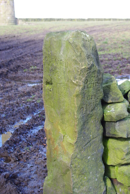
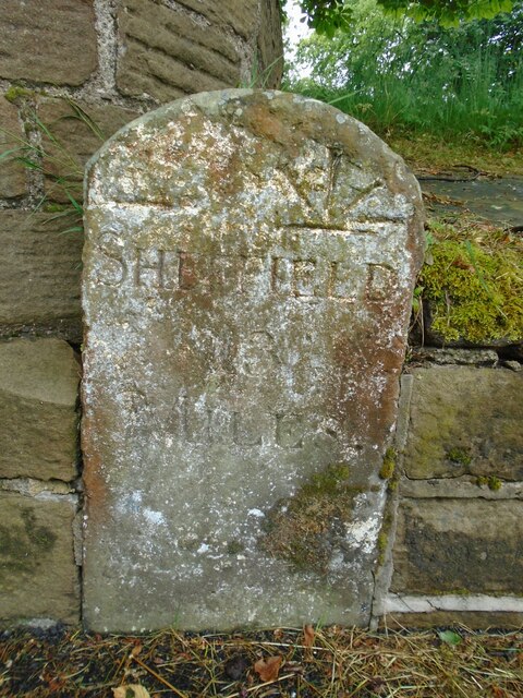
///loudness.bulk.workouts. Near Penistone, South Yorkshire

Related Wikis

Millhouse Green

Millhouse Green is a village on the north banks of the River Don on the A628 road west of Penistone in the English county of South Yorkshire. Administratively...
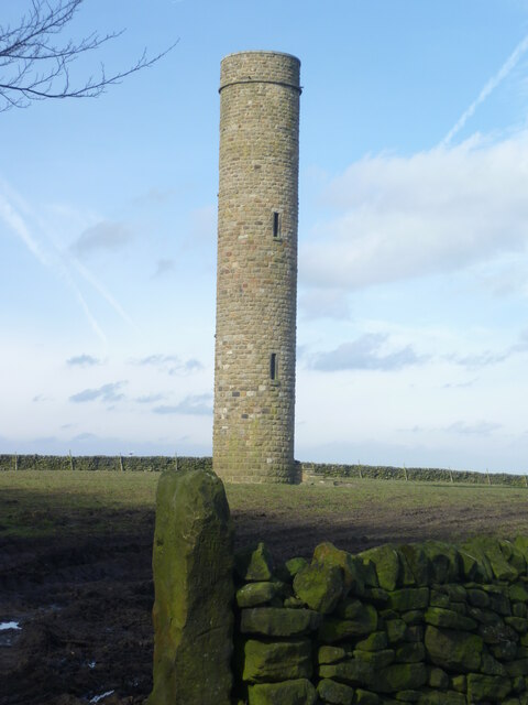
Hartcliff Folly

The Hartcliff Folly (or Tower) is a stone structure 1.2 miles (2 km) south-west of Penistone in South Yorkshire, England. The folly was built in 1856 by...

Cubley, South Yorkshire

Cubley is a village in the metropolitan borough of Barnsley in South Yorkshire, England. It is about a mile to the south of Penistone town centre and essentially...

Penistone Rural District

Penistone Rural District was a rural district in the West Riding of Yorkshire. It was named after but did not contain Penistone. The town itself was contained...

Nearby Amenities

Located within 500m of 53.522108,-1.6575324
Bus Stop
Manchester Road/Plumpton Way
Alt Name: Manchester Road/Plumpton Way
Bench: no
Bin: no
Bus: yes
Naptan AltCommonName: Manchester Road/Plumpton Way
Naptan AtcoCode: 370050996
Naptan Bearing: SW
Naptan CommonName: Manchester Road/Plumpton Way
Naptan Indicator: 50996
Naptan Landmark: OPPOSITE ST. SAVIOURS CHURCH
Naptan PlusbusZoneRef: ROTHCEN
Naptan Street: Manchester Road
Naptan Verified: no
Public Transport: platform
Shelter: no
Source: naptan_import
Lat/Long: 53.5262392/-1.6583217
Bus Stop
Manchester Road/Plumpton Way
Alt Name: Manchester Road/Plumpton Way
Bench: no
Bin: no
Bus: yes
Naptan AltCommonName: Manchester Road/Plumpton Way
Naptan AtcoCode: 370050997
Naptan Bearing: NE
Naptan CommonName: Manchester Road/Plumpton Way
Naptan Indicator: 50997
Naptan Landmark: OPPOSITE JAMES DURRANS
Naptan PlusbusZoneRef: ROTHCEN
Naptan Street: Manchester Road
Naptan Verified: no
Public Transport: platform
Shelter: no
Source: naptan_import
Lat/Long: 53.5262432/-1.6592049
Barrier: stile
Lat/Long: 53.5232166/-1.6517563
Barrier: stile
Lat/Long: 53.5223104/-1.6606696
Barrier: stile
Lat/Long: 53.5225789/-1.6611036
Barrier: stile
Stile: squeezer
Lat/Long: 53.5226702/-1.6565943
Barrier: stile
Stile: squeezer
Lat/Long: 53.5227042/-1.6565483
Barrier: stile
Lat/Long: 53.522137/-1.6544647
Ford: yes
Lat/Long: 53.5249908/-1.6578859
Parking
Access: customers
Parking: surface
Surface: gravel
Lat/Long: 53.5263479/-1.6593897
Barrier: bollard
Bollard: fixed
Material: wood
Lat/Long: 53.5250123/-1.6540327
Power: pole
Lat/Long: 53.5247815/-1.6520611
Hill Side
Place: hamlet
Lat/Long: 53.5207503/-1.6607884
Barrier: stile
Stile: squeezer
Lat/Long: 53.5216113/-1.6575757
Communication Mobile Phone: yes
Man Made: mast
Tower Construction: lattice
Tower Type: communication
Lat/Long: 53.5216592/-1.6551724
Barrier: cycle_barrier
Colour: yellow
Cycle Barrier: double
Cycle Barrier Installation: fixed
Foot: designated
Material: metal
Source: survey
Lat/Long: 53.5258295/-1.6545556
Crossing
Crossing: unmarked
Source: survey
Tactile Paving: no
Lat/Long: 53.525961/-1.6545538
Bench
Backrest: no
Lat/Long: 53.5218674/-1.6614276
Bench
Backrest: no
Lat/Long: 53.5247014/-1.6549231
Barrier: stile
Stile: stepover
Lat/Long: 53.5221931/-1.6603366
Board Type: nature
Information: board
Tourism: information
Lat/Long: 53.5207248/-1.6639487
Barrier: stile
Stile: stepover
Lat/Long: 53.5221321/-1.6599323
Bench
Backrest: yes
Lat/Long: 53.5207649/-1.6638719
Addr City: Sheffield
Addr Housenumber: 3
Addr Parentstreet: Cross Lane
Addr Postcode: S36 9SB
Addr Street: Cross Royd Farm
Addr Suburb: Thurlstone
Lat/Long: 53.5216502/-1.6559739
The data included in this document is from www.openstreetmap.org. The data is made available under ODbL.

Have you been to Cross Royd Plantation?

Leave your review of Cross Royd Plantation below (or comments, questions and feedback).