Heyshaw Moor

Downs, Moorland in Yorkshire Harrogate

England

Heyshaw Moor

Yorke's Folly
Yorke's Folly Credit: habiloid

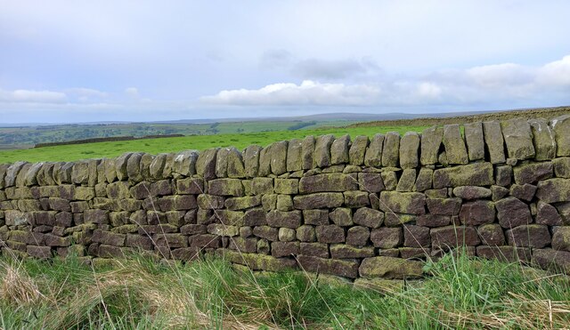
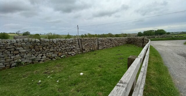
Heyshaw Moor is a picturesque area located in the county of Yorkshire, England. It is situated in the heart of the Yorkshire Dales National Park, specifically in the Nidderdale area. Spanning over 2,000 acres, this vast expanse of open land is primarily characterized by its rolling hills, heather-covered moorland, and stunning views of the surrounding countryside.

The moorland of Heyshaw Moor is known for its rich biodiversity, with a variety of plant and animal species calling this area their home. Visitors can spot a range of birds such as curlews, lapwings, and red grouse, as well as small mammals like hares and voles. The moorland is also dotted with patches of woodland, adding to its natural beauty.

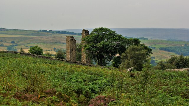
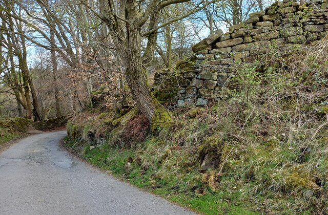
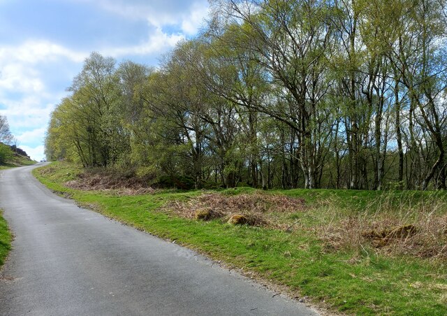
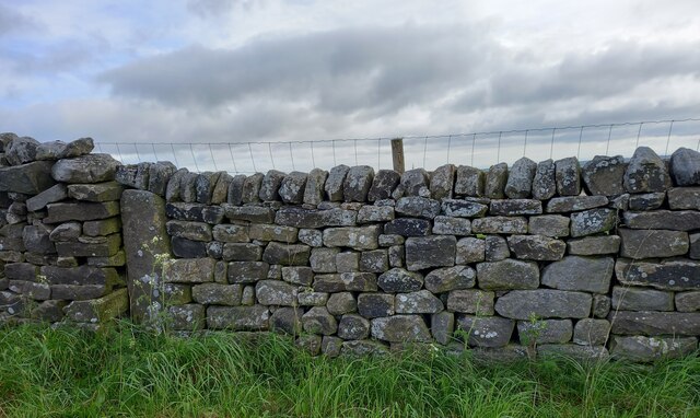
The landscape of Heyshaw Moor is largely untouched, offering a tranquil and peaceful environment for visitors to explore. Walking and hiking trails crisscross the area, allowing outdoor enthusiasts to take in the breathtaking scenery and experience the moorland up close. The panoramic views from the higher points of the moor are particularly spectacular, showcasing the vastness and natural splendor of the Yorkshire Dales.

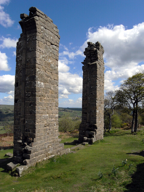
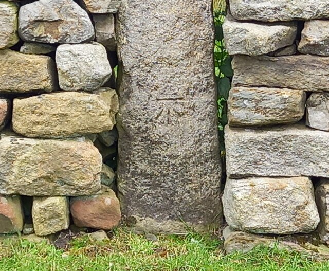
Heyshaw Moor is also steeped in history, with evidence of human activity dating back to the Bronze Age. Ancient burial mounds and stone circles can still be found in certain areas, serving as reminders of the area's past. The moorland is now managed by the Yorkshire Wildlife Trust, which aims to preserve and protect the unique ecosystem and heritage of Heyshaw Moor for future generations to enjoy.

If you have any feedback on the listing, please let us know in the comments section below.

Heyshaw Moor Images

Images are sourced within 2km of 54.058754/-1.7567438 or Grid Reference SE1662. Thanks to Geograph Open Source API. All images are credited.

Yorke's Folly
Yorke's Folly
Yorke's Folly A Georgian eye-catcher on Guyscliffe (Guise Cliff) for Mr Yorke from his home in Bewerley
Yorke's Folly
A Georgian eye-catcher on Guyscliffe (Guise Cliff) for Mr Yorke from his home in Bewerley
Bewerley, Peat Lane There is a benchmark cut into a house on the north side of the lane.
Bewerley, Peat Lane
There is a benchmark cut into a house on the north side of the lane.
Bewerley, Peat Lane There is a benchmark cut into the right hand side of the gable end of this house on the north side of the lane.
Bewerley, Peat Lane
There is a benchmark cut into the right hand side of the gable end of this house on the north side of the lane.
Bewerley, Peat Lane According to the OS benchmark database there is a boulder with a benchmark on the south side of the lane. Many of the boulders are coated in moss which makes searching difficult. Nothing was found on the largest boulders.
Bewerley, Peat Lane
According to the OS benchmark database there is a boulder with a benchmark on the south side of the lane. Many of the boulders are coated in moss which makes searching difficult. Nothing was found on the largest boulders.
Bewerley, Peat Lane According to the OS benchmark database there is a cutmark at ground level on a culvert. Today, after new road surfaces and improvements there is no obvious culvert or any running water. A few roadside large stones were uncovered but no mark was found.
Bewerley, Peat Lane
According to the OS benchmark database there is a cutmark at ground level on a culvert. Today, after new road surfaces and improvements there is no obvious culvert or any running water. A few roadside large stones were uncovered but no mark was found.
Bewerley, Low Moor The boulder with the rivet is on the north side of Peat Lane.
Bewerley, Low Moor
The boulder with the rivet is on the north side of Peat Lane.
Bewerley, Low Moor The boulder with the rivet is on the north side of Peat Lane, and it is very prominent.
Bewerley, Low Moor
The boulder with the rivet is on the north side of Peat Lane, and it is very prominent.
Bewerley, Peat Lane The boulder with the rivet is on the north-west side of the lane.
Bewerley, Peat Lane
The boulder with the rivet is on the north-west side of the lane.
Bewerley, Peat Lane There is a boulder with a benchmark/rivet on the north-west side of the lane.
Bewerley, Peat Lane
There is a boulder with a benchmark/rivet on the north-west side of the lane.
Bewerley, Heather Cottage There is a benchmark cut into a block to the left of the door, almost opposite the door handle. This is an outbuilding to Heather Cottage.
Bewerley, Heather Cottage
There is a benchmark cut into a block to the left of the door, almost opposite the door handle. This is an outbuilding to Heather Cottage.
Bewerley, Heather Cottage There is a benchmark cut into a block to the left of the door of the gable end of the outbuilding to Heather Cottage. It can be seen by peeping over the roadside wall.
Bewerley, Heather Cottage
There is a benchmark cut into a block to the left of the door of the gable end of the outbuilding to Heather Cottage. It can be seen by peeping over the roadside wall.
Peat Lane near to the disused Middle Tongue Quarry Looking north-eastward.
Peat Lane near to the disused Middle Tongue Quarry
Looking north-eastward.
Heyshaw, Dike Lane The benchmark is cut into one remaining gatepost on the east of Dike Lane. The field entrance has been filled with a drystone wall.
Heyshaw, Dike Lane
The benchmark is cut into one remaining gatepost on the east of Dike Lane. The field entrance has been filled with a drystone wall.
Heyshaw, Dike Lane There is a benchmark cut into the one remaining gatepost on the east of Dike Lane. The field entrance has been filled with a drystone wall.
Heyshaw, Dike Lane
There is a benchmark cut into the one remaining gatepost on the east of Dike Lane. The field entrance has been filled with a drystone wall.
Heyshaw, Dike Lane According to the OS benchmark database there is a benchmark on this stretch of drystone wall on the west side of Dike Lane. Nothing was found and the wall looked rebuilt, and the mark may have been destroyed.
Heyshaw, Dike Lane
According to the OS benchmark database there is a benchmark on this stretch of drystone wall on the west side of Dike Lane. Nothing was found and the wall looked rebuilt, and the mark may have been destroyed.
Heyshaw, Fouldshaw Farm The benchmark is cut into a gatepost on the north of the farm drive. The gatehole has been filled.
Heyshaw, Fouldshaw Farm
The benchmark is cut into a gatepost on the north of the farm drive. The gatehole has been filled.
Heyshaw, Fouldshaw Farm There is a benchmark cut into the left gatepost on the north of the farm drive. The gatehole has been filled.
Heyshaw, Fouldshaw Farm
There is a benchmark cut into the left gatepost on the north of the farm drive. The gatehole has been filled.
Show me another place!

Heyshaw Moor is located at Grid Ref: SE1662 (Lat: 54.058754, Lng: -1.7567438)

Division: West Riding

Administrative County: North Yorkshire

District: Harrogate

Police Authority: North Yorkshire

What 3 Words

///pump.verifying.subway. Near Pateley Bridge, North Yorkshire

Related Wikis

Bewerley

Bewerley is a village and civil parish in the Harrogate district of North Yorkshire, England, about twelve miles west of Ripon. The parish includes the...

Glasshouses, North Yorkshire

Glasshouses is a small village in Nidderdale, North Yorkshire, England. It lies 1 mile (1.6 km) south-east of Pateley Bridge on the east side of Nidderdale...

Pateley Bridge railway station

Pateley Bridge railway station is a disused railway station in North Yorkshire, England. The station was the terminating station on the North Eastern Railway...

Pateley Bridge

Pateley Bridge (known locally as Pateley) is a market town in Nidderdale in the county and district of North Yorkshire, England. Historically part of the...

Wilsill

Wilsill is a village in Nidderdale in the Harrogate district of North Yorkshire, England. It is about 2 miles (3 km) east of Pateley Bridge on the B6165...

Nidderdale AONB

The Nidderdale AONB is an Area of Outstanding Natural Beauty in North Yorkshire, England, bordering the Yorkshire Dales National Park to the east and south...

Nidderdale

Nidderdale, historically also known as Netherdale, is one of the Yorkshire Dales (although outside the Yorkshire Dales National Park) in North Yorkshire...

Pateley Playhouse

The Pateley Playhouse is a small amateur-run theatre in the town of Pateley Bridge in Nidderdale, North Yorkshire, England. The building was initially...

Nearby Amenities

Located within 500m of 54.058754,-1.7567438
Heyshaw Moor
Is In: UK,Yorkshire,North Yorkshire,Nidderdale
Is In Country: UK
Is In County: North Yorkshire
Is In Historical County: Yorkshire
Natural: moor
Source: NPE
Lat/Long: 54.0576693/-1.7587259
Old Wife Ridge
Ele: 341
Natural: peak
Lat/Long: 54.0598092/-1.7580913
Historic: mine_shaft
Note: not confirmed
Source: Bing
Lat/Long: 54.0556289/-1.7529853
Note: old mine shaft?
Source: Bing
Lat/Long: 54.0544377/-1.7549804
Hunting Stand
Lat/Long: 54.0585513/-1.7643949
Hunting Stand
Lat/Long: 54.0582362/-1.7627092
Hunting Stand
Lat/Long: 54.0578741/-1.7624276
Hunting Stand
Lat/Long: 54.0574931/-1.762154
Hunting Stand
Lat/Long: 54.057131/-1.7618509
Hunting Stand
Lat/Long: 54.0567468/-1.7615612
Hunting Stand
Lat/Long: 54.0563548/-1.7612421
Hunting Stand
Lat/Long: 54.0559974/-1.7609765
Hunting Stand
Lat/Long: 54.0556085/-1.7606547
Hunting Stand
Lat/Long: 54.0552212/-1.7603382
The data included in this document is from www.openstreetmap.org. The data is made available under ODbL.

Have you been to Heyshaw Moor?

Leave your review of Heyshaw Moor below (or comments, questions and feedback).