Harbottle

Settlement in Northumberland

England

Harbottle

The approach to Harbottle Castle From the neat drystone walled car park.
The approach to Harbottle Castle Credit: Russel Wills

Harbottle is a picturesque village located in the county of Northumberland, England. Situated on the southern edge of the Northumberland National Park, it is surrounded by stunning natural beauty and offers a tranquil retreat for residents and visitors alike.

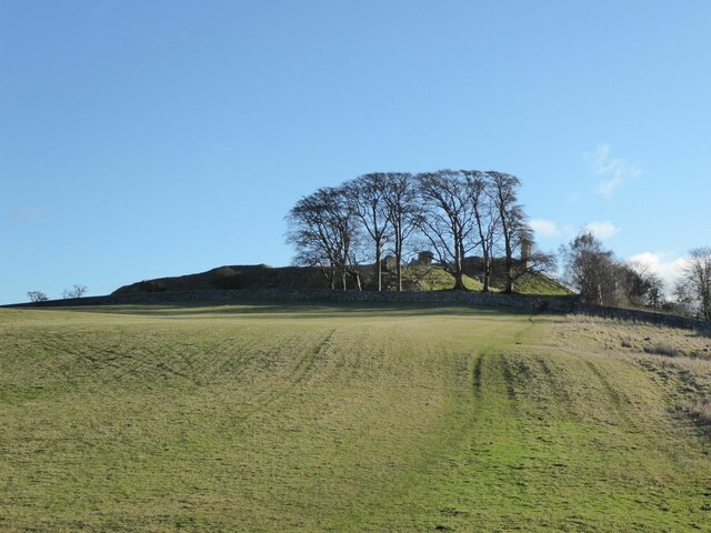
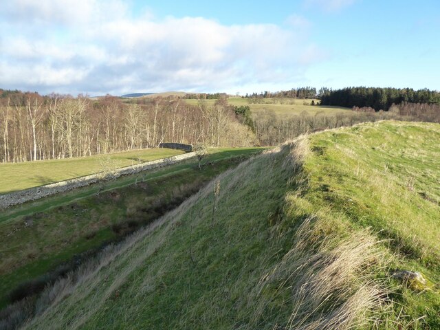
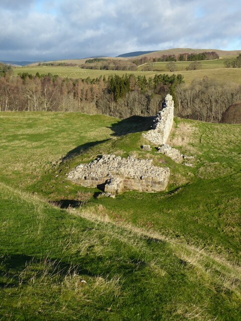
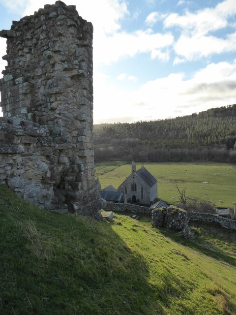
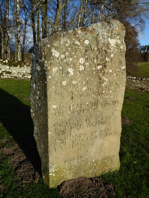
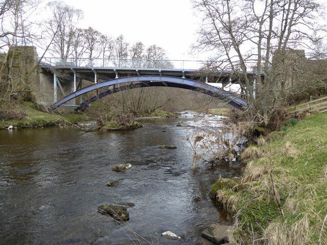
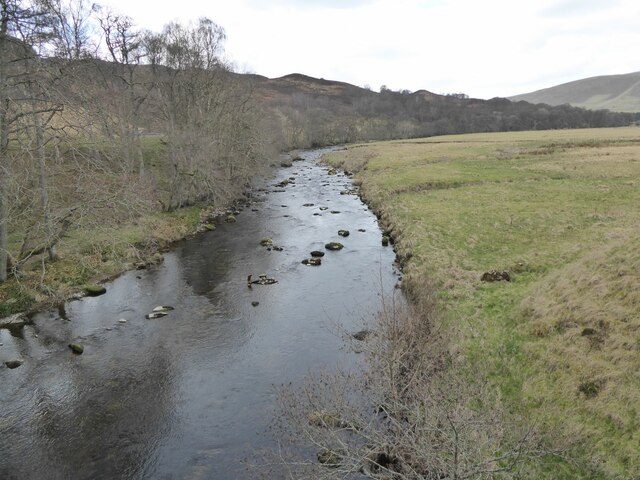
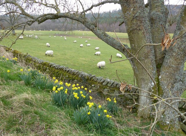
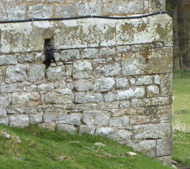
The village is nestled in the Coquet Valley, a region renowned for its scenic landscapes and historic sites. Harbottle is dominated by the ruins of Harbottle Castle, a medieval fortress that dates back to the 12th century. These ruins serve as a reminder of the area's rich history and provide a captivating backdrop for exploration and photography.

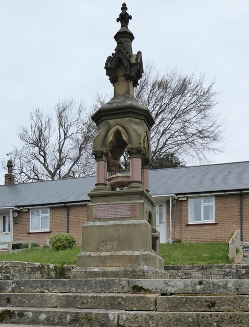
Although small in size, Harbottle boasts a close-knit community that takes pride in preserving its heritage and maintaining a welcoming atmosphere. The village is home to a charming church, St. Michael and All Angels, which is not only a place of worship but also a popular venue for local events and concerts.

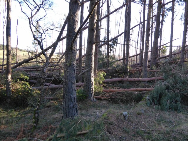
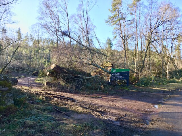
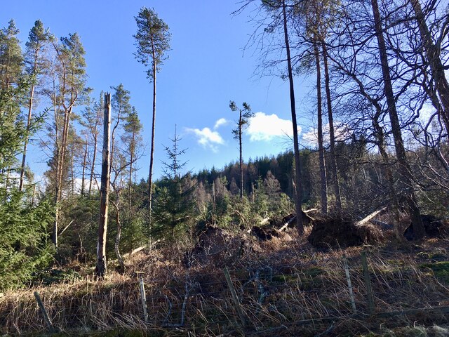
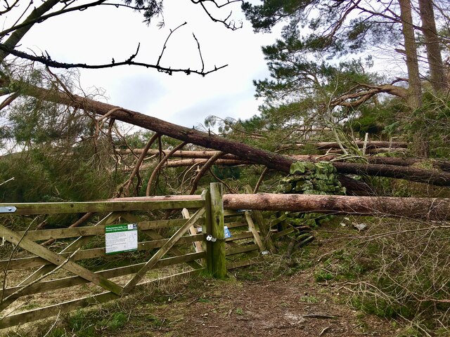
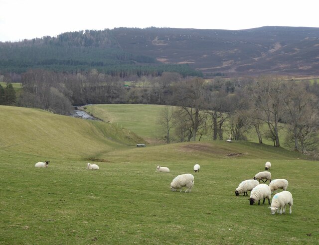
Nature enthusiasts will find Harbottle to be an ideal base for outdoor activities. The nearby Northumberland National Park offers a plethora of opportunities for hiking, cycling, and wildlife spotting. The surrounding moorland and forests are home to a variety of species, including the elusive red squirrel and various bird species.

Visitors to Harbottle will also appreciate the village's traditional pub, The Star Inn, which offers a warm and friendly atmosphere along with hearty meals and locally brewed ales. Overall, Harbottle is a hidden gem in Northumberland, offering a perfect blend of history, natural beauty, and community spirit.

If you have any feedback on the listing, please let us know in the comments section below.

Harbottle Images

Images are sourced within 2km of 55.336027/-2.103286 or Grid Reference NT9304. Thanks to Geograph Open Source API. All images are credited.

The approach to Harbottle Castle From the neat drystone walled car park.
The approach to Harbottle Castle
From the neat drystone walled car park.
Harbottle Castle Ramparts around the outer bailey.
Harbottle Castle
Ramparts around the outer bailey.
Harbottle Castle - the ruined gateway Looking down on some dressed masonry at the gateway.
The castle has been quarried for much of its stone.
Harbottle Castle - the ruined gateway
Looking down on some dressed masonry at the gateway. The castle has been quarried for much of its stone.
Looking down on the former Presbyterian Church From Harbottle Castle.
Looking down on the former Presbyterian Church
From Harbottle Castle.
The Sad Castle Stone In the neat drystone walled carpark for Harbottle Castle is a 'new' standing stone. 
On it is carved a poem by local schoolgirl Felicity Lane:

The Sad Castle
Who Made me/Into a ruin/like an old city?
Was it the soldiers who rode out on horseback?
Was it my old enemy the Scots?
Or was it those Border Reivers?
Perhaps it was just the centuries passing.

Felicity Lance

It was carved into the stone by local stonemason David Edwick.
The Sad Castle Stone
In the neat drystone walled carpark for Harbottle Castle is a 'new' standing stone. On it is carved a poem by local schoolgirl Felicity Lane: The Sad Castle Who Made me/Into a ruin/like an old city? Was it the soldiers who rode out on horseback? Was it my old enemy the Scots? Or was it those Border Reivers? Perhaps it was just the centuries passing. Felicity Lance It was carved into the stone by local stonemason David Edwick.
Windfall due to the Storm Arwen The timber falling across the road cut the village off for days.
It brought the villagers out with their chainsaws.
Windfall due to the Storm Arwen
The timber falling across the road cut the village off for days. It brought the villagers out with their chainsaws.
Same storm, different car park Forestry England's car parks seem to have been particularly badly hit by Storm Arwen.  Three months on, this one at Harbottle has been partially cleared although the evidence of the impact is still clearly visible.
<a href="https://www.geograph.org.uk/photo/7089675">NU0809 : Stating the obvious</a>
<a href="https://www.geograph.org.uk/photo/7095369">NT9502 : Hope the picnic tables are alright</a>
Same storm, different car park
Forestry England's car parks seem to have been particularly badly hit by Storm Arwen. Three months on, this one at Harbottle has been partially cleared although the evidence of the impact is still clearly visible. NU0809 : Stating the obvious NT9502 : Hope the picnic tables are alright
Storm Arwen destruction at West Wood, Harbottle Interestingly, this wood, like several others, sustained much more damage nearer the valley floor than at its higher sections.  Presumably this must be due to the Venturi Effect, where the wind from the north, having had a long 'fetch' across open land over  Alwinton,  funnelled down at lower levels, increasing its speed.
Storm Arwen destruction at West Wood, Harbottle
Interestingly, this wood, like several others, sustained much more damage nearer the valley floor than at its higher sections. Presumably this must be due to the Venturi Effect, where the wind from the north, having had a long 'fetch' across open land over Alwinton, funnelled down at lower levels, increasing its speed.
Storm Arwen demolition of woods boundary Storm Arwen damage at the point where the West Wood car park path leads on to the open moor.
Storm Arwen demolition of woods boundary
Storm Arwen damage at the point where the West Wood car park path leads on to the open moor.
Destruction of Ramshaugh Woods On November 26th/27th 2021 Storm Arwen slammed across the UK, with 100 mile an hour winds. One of the areas worst hit was Northumberland, including Rothbury and Coquetdale, where fallen trees across the valley left many without power and water for nearly a week. The Ramshaugh Woods - a diverse range of woodland including the Devil’s Elbow, the Fairy Wood, the Birch Wood and the Top End - was flattened, with almost 70% of mature trees torn down, broken or uprooted. 
We are raising £50,000 to make this diverse stretch of woodland safe for community access again and to save as much of the viable timber as possible. 
The sign links to <span class="nowrap"><a title="https://www.justgiving.com/crowdfunding/save-our-woodland" rel="nofollow ugc noopener" href="https://www.justgiving.com/crowdfunding/save-our-woodland">Link</a><img style="margin-left:2px;" alt="External link" title="External link - shift click to open in new window" src="https://s1.geograph.org.uk/img/external.png" width="10" height="10"/></span>
Destruction of Ramshaugh Woods
On November 26th/27th 2021 Storm Arwen slammed across the UK, with 100 mile an hour winds. One of the areas worst hit was Northumberland, including Rothbury and Coquetdale, where fallen trees across the valley left many without power and water for nearly a week. The Ramshaugh Woods - a diverse range of woodland including the Devil’s Elbow, the Fairy Wood, the Birch Wood and the Top End - was flattened, with almost 70% of mature trees torn down, broken or uprooted. We are raising £50,000 to make this diverse stretch of woodland safe for community access again and to save as much of the viable timber as possible. The sign links to LinkExternal link
Sheep on Ashy Bank The pasture slopes down to the River Coquet.
Harbottle Wood in the distance.
Sheep on Ashy Bank
The pasture slopes down to the River Coquet. Harbottle Wood in the distance.
Fine lime kiln beside the track to Park House Overlooking the River Coquet.
Fine lime kiln beside the track to Park House
Overlooking the River Coquet.
Low Alwinton kilns Well maintained or beautifully restored they were built about 1827 by the Selby family and had ceased to work by 1866.
Low Alwinton kilns
Well maintained or beautifully restored they were built about 1827 by the Selby family and had ceased to work by 1866.
Alwinton Bridge over the River Coquet 'A good-looking steel-arch bridge about half a mile south of the village, it replaced an earlier bridge when the road was widened. Painted in attractive colours the bridge blends well with the surrounding countryside.' 
<span class="nowrap"><a title="https://www.bridgesonthetyne.co.uk/alwinton.html" rel="nofollow ugc noopener" href="https://www.bridgesonthetyne.co.uk/alwinton.html">Link</a><img style="margin-left:2px;" alt="External link" title="External link - shift click to open in new window" src="https://s1.geograph.org.uk/img/external.png" width="10" height="10"/></span>
Constructed in 1937 with steel arch and stone abutments.
Alwinton Bridge over the River Coquet
'A good-looking steel-arch bridge about half a mile south of the village, it replaced an earlier bridge when the road was widened. Painted in attractive colours the bridge blends well with the surrounding countryside.' LinkExternal link Constructed in 1937 with steel arch and stone abutments.
The River Coquet upstream from Alwinton Bridge The river loops around the Angry Haugh.
The River Coquet upstream from Alwinton Bridge
The river loops around the Angry Haugh.
Sheep and daffodils  At Harbottle.
Sheep and daffodils
At Harbottle.
Jackdaw trying to build a nest in former church The twigs being used are just too large to fit in the hole. Previous failed attempts lay on the ground.
Jackdaw trying to build a nest in former church
The twigs being used are just too large to fit in the hole. Previous failed attempts lay on the ground.
Fountain Memorial to Mrs Clennell of Harbottle Castle The fountain was built in 1880 by McMillan of Alnwick in ashlar and marble. High Victorian Gothic style.
To read inscription see: <a title="https://www.geograph.org.uk/photo/7128993" href="https://www.geograph.org.uk/photo/7128993">Link</a>
Fountain Memorial to Mrs Clennell of Harbottle Castle
The fountain was built in 1880 by McMillan of Alnwick in ashlar and marble. High Victorian Gothic style. To read inscription see: Link
Show me another place!

Harbottle is located at Grid Ref: NT9304 (Lat: 55.336027, Lng: -2.103286)

Unitary Authority: Northumberland

Police Authority: Northumbria

What 3 Words

///pushing.movie.canoe. Near Rochester, Northumberland

Related Wikis

Harbottle

Harbottle is a village and civil parish in Northumberland, England about 10 miles (16 km) south-east of the Scottish border, in the southeastern part of...

Harbottle Castle

Harbottle Castle is a ruined medieval castle situated at the west end of the village of Harbottle, Northumberland, England, 9 miles (14 km) west-north...

River Alwin

The River Alwin is a short, steep upland river that drains the Kidland Forest on the southern flanks of the Cheviot Hills, in the Northumberland National...

Alwinton

Alwinton (previously named "Allenton" and sometimes still referred to as this) is a village and former parish in Northumberland, England. Alwinton is named...

Sharperton

Sharperton is a small settlement and former civil parish, now in the parish of Harbottle, in Northumberland, England. Sharperton is the site of a deserted...

Barrow Meadow

Barrow Meadow is a Site of Special Scientific Interest (SSSI) in north Northumberland, England. The site is a species-rich hay meadow of a sort now rare...

Clennell Hall

Clennell Hall is an historic manor house, now operated as a country hotel, situated at Clennell, near Alwinton, Northumberland, England. It is a Grade...

Holystone, Northumberland

Holystone is a small village and former civil parish, now in the parish of Harbottle, in Northumberland, England. It lies on the edge of (and just within...

Nearby Amenities

Located within 500m of 55.336027,-2.103286
Harbottle
Place: hamlet
Wikidata: Q776558
Wikipedia: en:Harbottle
Lat/Long: 55.335596/-2.105274
Pub
The Star
Addr City: Harbottle
Addr County: Northumberland
Addr Postcode: NE65 7DG
Fhrs Id: 288431
Wikidata: Q79461651
Lat/Long: 55.3362042/-2.1054311
Historic: memorial
Lat/Long: 55.3362466/-2.1056957
Telephone
Booth: KX100
Covered: booth
Lat/Long: 55.3362477/-2.1067339
Post Box
Brand: Royal Mail
Brand Wikidata: Q638098
Brand Wikipedia: en:Royal Mail
Collection Times: Mo-Fr 09:00, Sa 07:00
Drive Through: no
Operator: Royal Mail
Operator Wikidata: Q638098
Post Box Type: lamp
Ref: NE65 123D
Royal Cypher: EIIR
Royal Cypher Wikidata: Q33102113
Lat/Long: 55.3361848/-2.1053302
Generator Method: photovoltaic
Generator Output Electricity: yes
Generator Solar Modules: 16
Generator Source: solar
Generator Type: solar_photovoltaic_panel
Location: roof
Power: generator
Lat/Long: 55.336402/-2.1087044
The data included in this document is from www.openstreetmap.org. The data is made available under ODbL.

Have you been to Harbottle?

Leave your review of Harbottle below (or comments, questions and feedback).