Gateshaw Brae

Downs, Moorland in Roxburghshire

Scotland

Gateshaw Brae

Edge of Morebattle
Edge of Morebattle Credit: Richard Webb

Gateshaw Brae is a picturesque area located in the county of Roxburghshire, Scotland. Situated amidst rolling hills and breathtaking landscapes, this region offers a diverse and captivating natural environment that is a delight for outdoor enthusiasts.

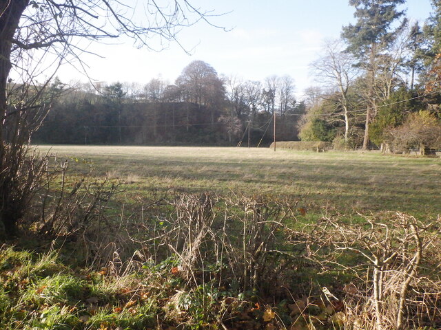
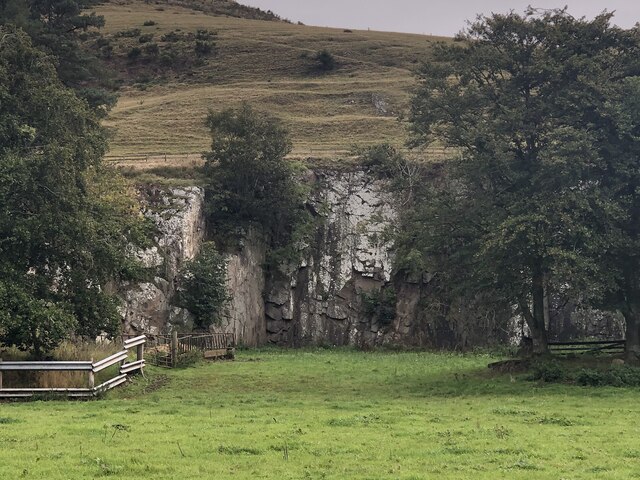
The Downs of Gateshaw Brae are characterized by their gently sloping terrain, covered with lush green grasses and dotted with vibrant wildflowers. These downs provide a tranquil setting for leisurely walks and picnics, offering panoramic views of the surrounding countryside.

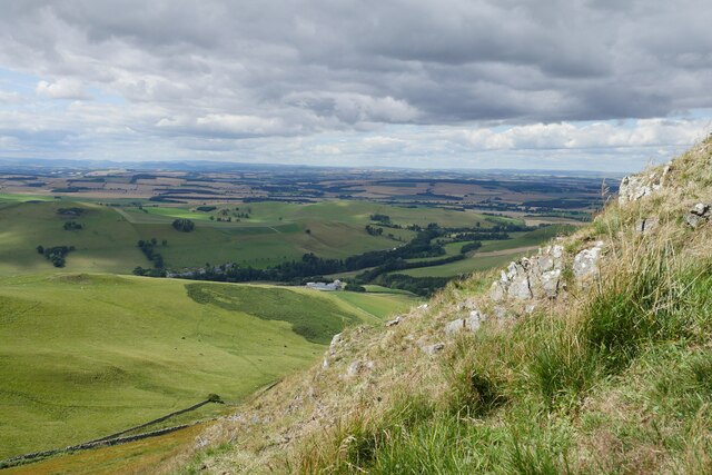
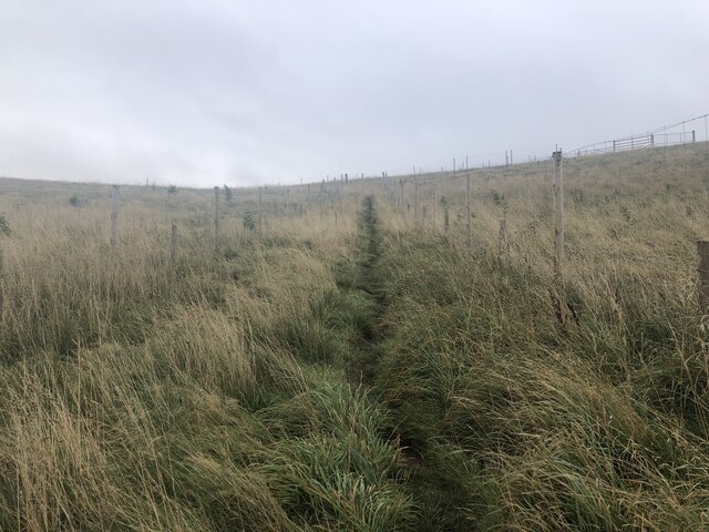
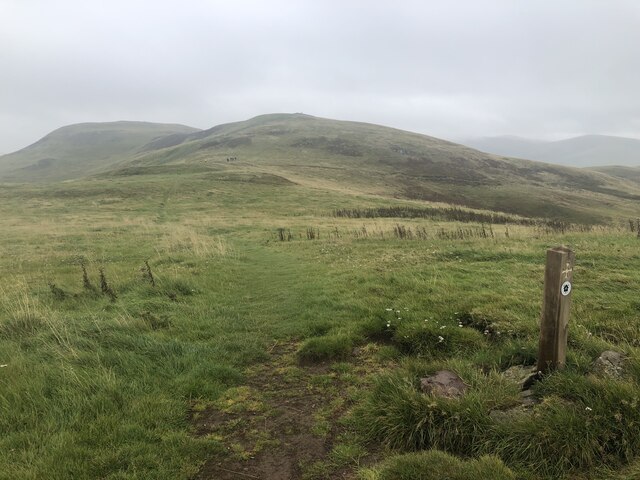
Moving towards the moorland, visitors are greeted by a more rugged and dramatic landscape. Here, heather-clad hills stretch as far as the eye can see, creating a captivating purple carpet during the summer months. The moorland is also home to an array of wildlife, including red grouse, curlews, and mountain hares, making it a haven for birdwatchers and nature lovers.

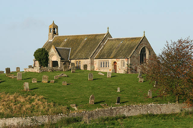
Gateshaw Brae is renowned for its rich history and cultural heritage. The area is scattered with ancient ruins, such as standing stones and burial cairns, which are a testament to its fascinating past. These historical landmarks offer visitors an opportunity to delve into the region's ancient roots and imagine the lives of those who once walked these lands.

For those seeking adventure, Gateshaw Brae offers ample opportunities for outdoor activities. Hiking, cycling, and horseback riding trails crisscross the area, allowing visitors to explore the landscape at their own pace. Additionally, the nearby rivers and lochs provide the perfect setting for fishing and boating, offering a peaceful retreat for anglers and water sports enthusiasts.

In summary, Gateshaw Brae in Roxburghshire is a captivating destination, where downs and moorland converge to create a stunning natural landscape. With its rich history, abundant wildlife, and a wide range of outdoor activities, this area offers something for everyone seeking a connection with nature and a taste of Scotland's beauty.

If you have any feedback on the listing, please let us know in the comments section below.

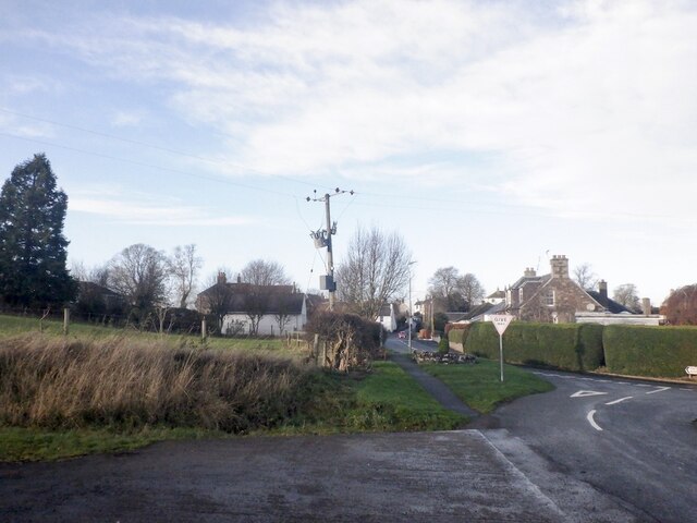
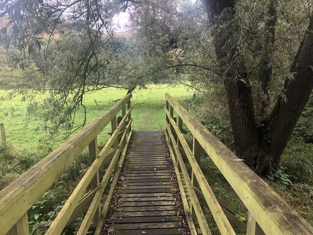
Gateshaw Brae Images

Images are sourced within 2km of 55.506772/-2.3550307 or Grid Reference NT7723. Thanks to Geograph Open Source API. All images are credited.

Edge of Morebattle
Edge of Morebattle
Field near Corbet Tower
Young trees, Gateshaw Behind a very elaborate electric fence.
Young trees, Gateshaw
Behind a very elaborate electric fence.
Harrow Law
Harrow Law
Farm track, Gateshaw
Beside the Kale Water Field downstream of Hownam
Beside the Kale Water
Field downstream of Hownam
The Kale valley from Howman Law Scree and outcrops can be found at the western and southern sides of Hownam Law. 
 Hownam Grange and Gateshaw are the farms in the foreground in the Kale valley.  Morebattle Hill obscures the village of Morebattle which lies behind it.
The Kale valley from Howman Law
Scree and outcrops can be found at the western and southern sides of Hownam Law. Hownam Grange and Gateshaw are the farms in the foreground in the Kale valley. Morebattle Hill obscures the village of Morebattle which lies behind it.
Bridge, St Cuthbert's Way Crossing the Kale Water. There is a ford downstream for farm traffic.
Bridge, St Cuthbert's Way
Crossing the Kale Water. There is a ford downstream for farm traffic.
Quarry Across the Kale Water from Corbet Tower
Quarry
Across the Kale Water from Corbet Tower
Corridor path Through a young woodland. Presumably the extra expense of fencing in the path was to allow the corridor to be used for moving stock, there are gates, but this has not happened.
Corridor path
Through a young woodland. Presumably the extra expense of fencing in the path was to allow the corridor to be used for moving stock, there are gates, but this has not happened.
Grubbit Law and Wideopen Hill
Towards Hownam Law from Grubbit Law
View towards Wideopen Hill A group of thru-hikers (they were from the USA) on St Cuthbert's Way.
View towards Wideopen Hill
A group of thru-hikers (they were from the USA) on St Cuthbert's Way.
Dyke on Wideopen Hill
Stile on Wideopen Hill The sign helpfully tells you that there is a gate a bit further along but with a height loss penalty.
Stile on Wideopen Hill
The sign helpfully tells you that there is a gate a bit further along but with a height loss penalty.
Wideopen Hill - Hownam Law ridge
Morebattle Parish Church This view of the church was taken from the steps down to the modern cemetery. The church, dating back to 1757, was repaired in 1840 and extended in 1899 and 1903. There are some good symbolic stones in the old part of the churchyard.
Morebattle Parish Church
This view of the church was taken from the steps down to the modern cemetery. The church, dating back to 1757, was repaired in 1840 and extended in 1899 and 1903. There are some good symbolic stones in the old part of the churchyard.
Show me another place!

Gateshaw Brae is located at Grid Ref: NT7723 (Lat: 55.506772, Lng: -2.3550307)

Unitary Authority: The Scottish Borders

Police Authority: The Lothians and Scottish Borders

What 3 Words

///sporting.heartburn.operated. Near Maxwellheugh, Scottish Borders

Related Wikis

Morebattle

Morebattle is a village in the Scottish Borders area of Scotland, on the B6401, seven miles south of Kelso, Scottish Borders, beside the Kale Water, a...

Linton, Scottish Borders

Linton is a small village in the Scottish Borders area of Scotland. It is situated a mile north of the village of Morebattle. == History == People have...

Cessford Burn

Cessford Burn is a small stream which eventually runs to meet the Kale Water and then joins the River Teviot, finally entering the River Tweed at Kelso...

Cessford Castle

Cessford Castle is a large ruined mid-15th century L-plan castle near the village of Cessford, midway Jedburgh and Kelso, in the historic county of Roxburghshire...

Nearby Amenities

Located within 500m of 55.506772,-2.3550307
Corbet Tower
Place: hamlet
Lat/Long: 55.5091963/-2.3563041
Power: pole
Lat/Long: 55.5047866/-2.3487839
Power: pole
Lat/Long: 55.5053407/-2.3501126
Power: pole
Lat/Long: 55.5055084/-2.3520798
Power: pole
Lat/Long: 55.5110939/-2.3535836
Power: pole
Lat/Long: 55.5099625/-2.3534497
Power: pole
Lat/Long: 55.5088295/-2.3533004
Power: pole
Lat/Long: 55.5076965/-2.3531356
Power: pole
Lat/Long: 55.5108708/-2.3538385
Power: pole
Lat/Long: 55.5102351/-2.3542943
Power: pole
Lat/Long: 55.5095863/-2.3547758
The data included in this document is from www.openstreetmap.org. The data is made available under ODbL.

Have you been to Gateshaw Brae?

Leave your review of Gateshaw Brae below (or comments, questions and feedback).