How Gill Moss

Downs, Moorland in Yorkshire South Lakeland

England

How Gill Moss

River Dee at Hud's House This is the small river Dee in Cumbria, not the better known larger rivers of that name in Cheshire or Aberdeen. Near the end of a fairly dry summer there was barely a trickle of water in it, though it is probably prone to flash flooding in times of storm.
River Dee at Hud's House Credit: Stephen Craven

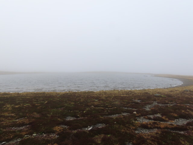
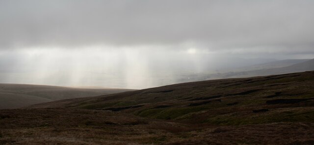
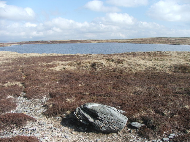
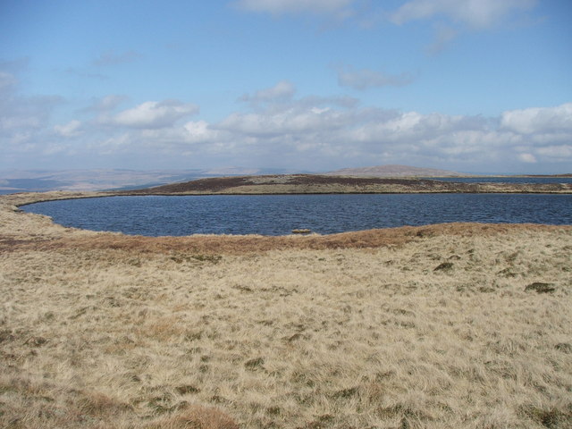
Gill Moss is a picturesque area located in Yorkshire, England, known for its stunning landscape that encompasses both downs and moorland. Situated in the heart of the Yorkshire Dales National Park, Gill Moss offers visitors a unique blend of natural beauty, wildlife, and outdoor recreational opportunities.

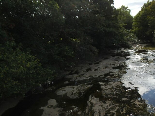
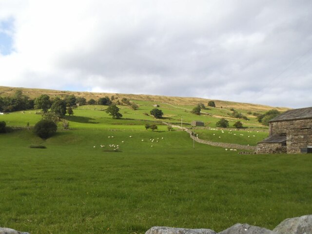
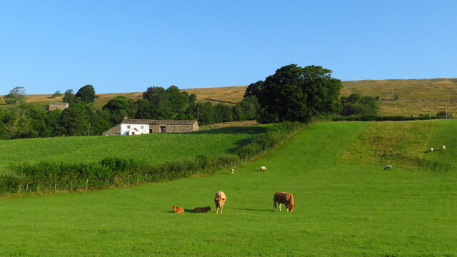
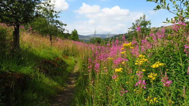
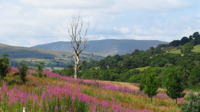
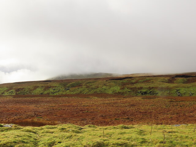
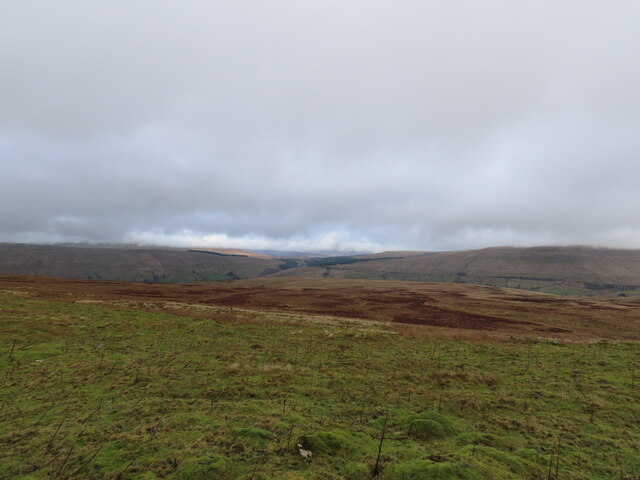
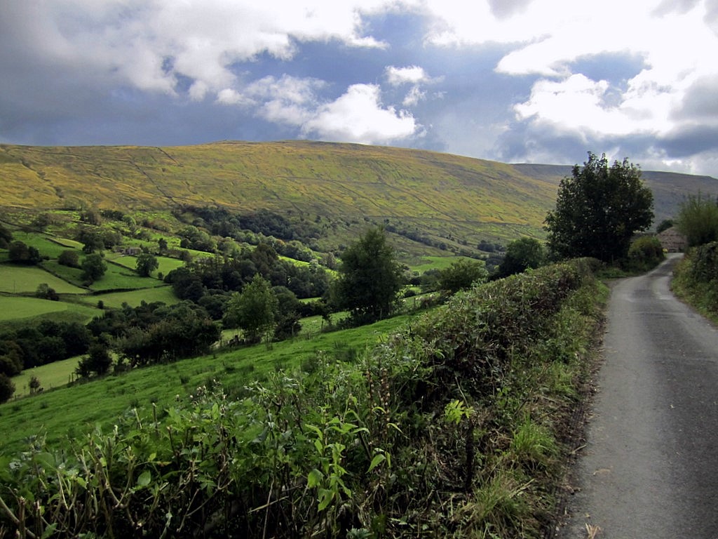
The area is characterized by rolling hills, vast open spaces, and heather-covered moorlands, creating a breathtaking panoramic view that stretches as far as the eye can see. The downs, with their gentle slopes and lush green grass, provide a perfect setting for leisurely walks or picnics, while the moorland offers a more rugged terrain for adventurous hikers and nature enthusiasts.

Gill Moss is home to a diverse range of flora and fauna, including rare bird species such as the curlew and lapwing, which thrive in the moorland habitat. The area also boasts an abundance of wildlife, with deer, rabbits, and various species of birds frequently spotted by visitors.

For those seeking outdoor activities, Gill Moss offers an extensive network of walking trails and hiking routes, catering to all levels of fitness and ability. The area is also popular for cycling, horse riding, and birdwatching, with designated paths and viewing points strategically placed for optimal wildlife sightings.

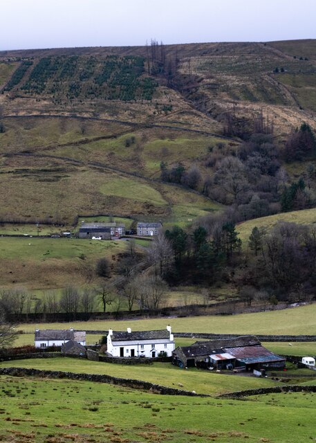
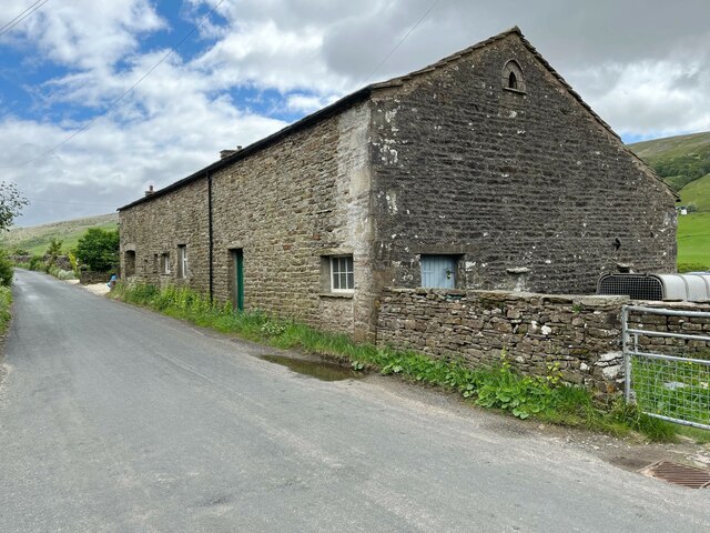
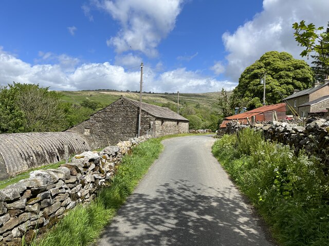
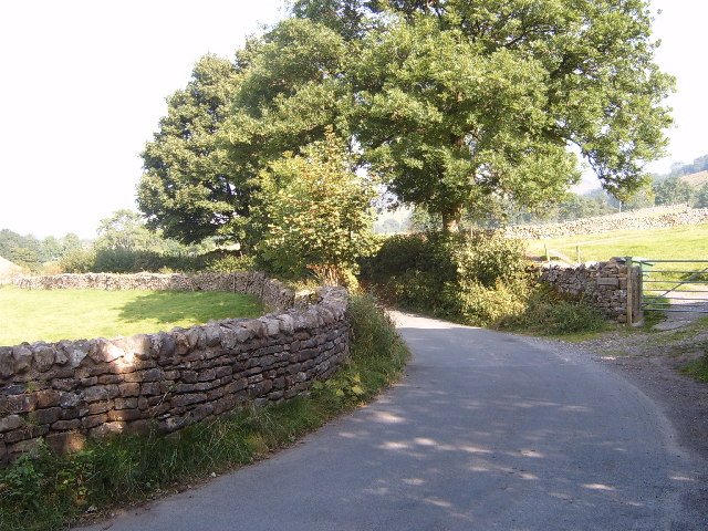
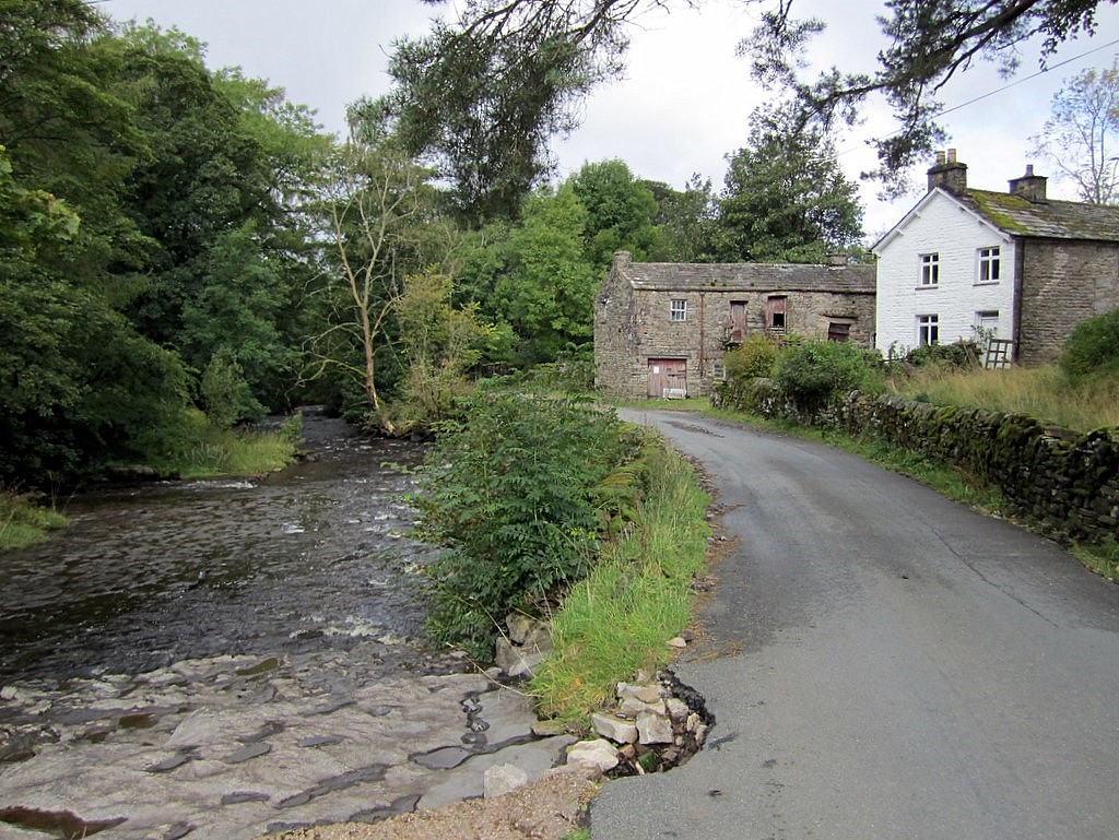
In addition to its natural beauty, Gill Moss is dotted with charming villages and historic landmarks, providing a glimpse into the rich heritage of Yorkshire. Visitors can explore quaint market towns, visit ancient castles, or indulge in traditional Yorkshire delicacies at local pubs and tearooms.

Overall, Gill Moss in Yorkshire is a haven for nature lovers and outdoor enthusiasts, offering a serene escape from the bustling city life and a chance to immerse oneself in the stunning beauty of the British countryside.

If you have any feedback on the listing, please let us know in the comments section below.

How Gill Moss Images

Images are sourced within 2km of 54.260303/-2.388104 or Grid Reference SD7485. Thanks to Geograph Open Source API. All images are credited.

River Dee at Hud's House This is the small river Dee in Cumbria, not the better known larger rivers of that name in Cheshire or Aberdeen. Near the end of a fairly dry summer there was barely a trickle of water in it, though it is probably prone to flash flooding in times of storm.
River Dee at Hud's House
This is the small river Dee in Cumbria, not the better known larger rivers of that name in Cheshire or Aberdeen. Near the end of a fairly dry summer there was barely a trickle of water in it, though it is probably prone to flash flooding in times of storm.
Sheep on the hillside above Hud's House Although in Cumbria, Dentdale is geologically and geographically part of the Yorkshire Dales, and this  scene could be found in any of the northern Dales.
Sheep on the hillside above Hud's House
Although in Cumbria, Dentdale is geologically and geographically part of the Yorkshire Dales, and this scene could be found in any of the northern Dales.
Datestone in the river wall opposite Hud's House The date 1928 may mark the last time the wall was rebuilt, or maybe of a major flood, or perhaps both. Other ideas?
Datestone in the river wall opposite Hud's House
The date 1928 may mark the last time the wall was rebuilt, or maybe of a major flood, or perhaps both. Other ideas?
Allen Haw, Dentdale
Allen Haw, Dentdale
On the Dales Way between Rivling & Little Town, Dentdale
On the Dales Way, west of Little Town, Dentdale
How Gill View of How Gill in Dentdale, seen from Lea Yeat Brow.  In the foreground is Hill Farm and Hill View and in the middle distance is Hobsons Cottage.
How Gill
View of How Gill in Dentdale, seen from Lea Yeat Brow. In the foreground is Hill Farm and Hill View and in the middle distance is Hobsons Cottage.
Gibs Hall, Barn The barn adjoins Gibs Hall Cottage at the far end.  The houses on the other side of the road use the more modern spelling of the place name ‘Gibbs’, which is also used by the Ordnance Survey.
There is an Ordnance Survey cut benchmark low down on the barn wall near the corner, facing the road (photograph <a href="https://www.geograph.org.uk/photo/7185964">SD7386 : Benchmark, Gibbs Hall Barn</a>).
Gibs Hall, Barn
The barn adjoins Gibs Hall Cottage at the far end. The houses on the other side of the road use the more modern spelling of the place name ‘Gibbs’, which is also used by the Ordnance Survey. There is an Ordnance Survey cut benchmark low down on the barn wall near the corner, facing the road (photograph SD7386 : Benchmark, Gibbs Hall Barn).
Benchmark, Gibbs Hall Barn Detail of an Ordnance Survey cut benchmark on the wall of a barn on the south side of the road at Gibbs Hall. The benchmark marks a height of 190.6097m above Ordnance Datum Newlyn last verified in 1953 (location photograph <a href="https://www.geograph.org.uk/photo/7185944">SD7386 : Gibs Hall, Barn</a>).
Benchmark, Gibbs Hall Barn
Detail of an Ordnance Survey cut benchmark on the wall of a barn on the south side of the road at Gibbs Hall. The benchmark marks a height of 190.6097m above Ordnance Datum Newlyn last verified in 1953 (location photograph SD7386 : Gibs Hall, Barn).
Ewegales The minor road is the route of the Dales Way long distance path.
Ewegales
The minor road is the route of the Dales Way long distance path.
Seavey Bottom
Seavey Bottom
Thorough Mea
Thorough Mea
Whernside Tarns
Whernside Tarns
Moorland at Seavey Bottom Walking up Whernside.
Moorland at Seavey Bottom
Walking up Whernside.
Dent Dale The road from Cowgill to Deep Dale.
Dent Dale
The road from Cowgill to Deep Dale.
Pool in the River Dee The river bed here is dry, apart from a deep pool known as Ibbeth Peril, where the witch "Ibby" is supposed to have drowned. Ibbeth Peril Cave is just above the figures.
Pool in the River Dee
The river bed here is dry, apart from a deep pool known as Ibbeth Peril, where the witch "Ibby" is supposed to have drowned. Ibbeth Peril Cave is just above the figures.
One of the Whernside Tarns. There are four Whernside tarns.  This is one of the larger ones and the most northerly.
One of the Whernside Tarns.
There are four Whernside tarns. This is one of the larger ones and the most northerly.
One of the Whernside Tarns. There are four Whernside tarns.  This one straddles two grid squares and is one of the larger ones and also the most westerly.
One of the Whernside Tarns.
There are four Whernside tarns. This one straddles two grid squares and is one of the larger ones and also the most westerly.
Show me another place!

How Gill Moss is located at Grid Ref: SD7485 (Lat: 54.260303, Lng: -2.388104)

Division: West Riding

Administrative County: Cumbria

District: South Lakeland

Police Authority: Cumbria

What 3 Words

///suggested.dentures.scan. Near Sedbergh, Cumbria

Related Wikis

St John the Evangelist's Church, Cowgill

St John the Evangelist's Church is the Church of England parish church of the village of Cowgill, Cumbria, England. It is in the deanery of Kendal, the...

Cowgill, Cumbria

Cowgill is a village in Westmorland and Furness, Cumbria, England. It is within the historic boundaries of the West Riding of Yorkshire, and is located...

Stone House, Cumbria

Stone House is a locality at Dent Head on the River Dee, in the county of Cumbria, England, to the south-east of Cowgill and to the north-west of Newby...

Deepdale, Cumbria

Deepdale is a side valley of Dentdale in the Yorkshire Dales National Park in Cumbria, England. It lies north west of the summit of Whernside. The dale...

Nearby Amenities

Located within 500m of 54.260303,-2.388104
The data included in this document is from www.openstreetmap.org. The data is made available under ODbL.

Have you been to How Gill Moss?

Leave your review of How Gill Moss below (or comments, questions and feedback).