Makinson Moor

Downs, Moorland in Lancashire

England

Makinson Moor

Edge Hill on Bridge Street A small group of houses on a pot-holed unadopted road alongside Bridge Street Horwich Local Nature Reserve. The house in view incorporates a letting apartment.
Edge Hill on Bridge Street Credit: Oliver Dixon

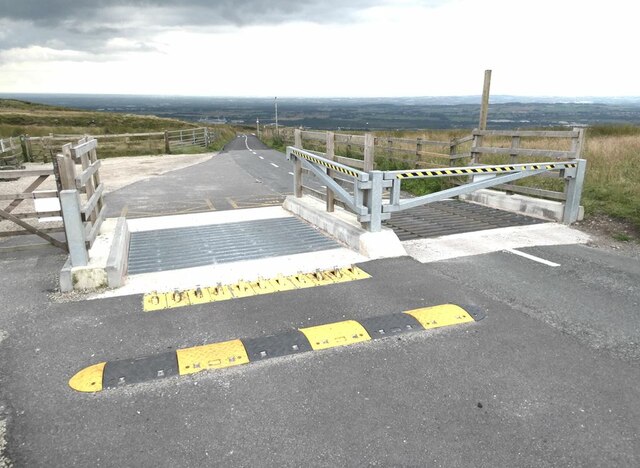
Makinson Moor is a picturesque area located in the county of Lancashire, England. Situated in the northwestern part of the country, Makinson Moor is primarily known for its stunning downs and moorland landscapes. Spanning over a large area, this region is a haven for nature enthusiasts, hikers, and birdwatchers.

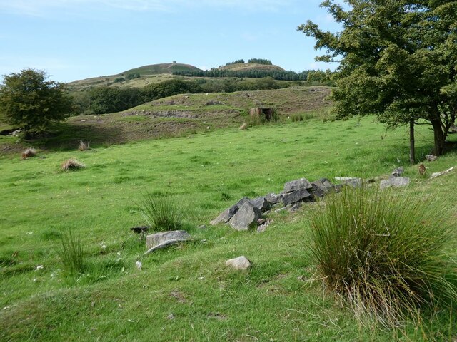
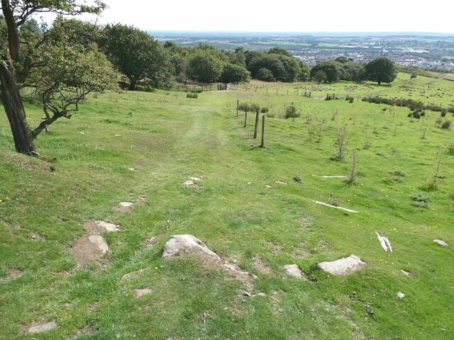
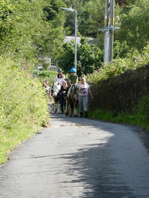
The downs of Makinson Moor offer breathtaking views of rolling hills covered in lush green grasses and dotted with wildflowers during the spring and summer months. These open expanses provide ample space for outdoor activities such as picnicking, horseback riding, and kite flying. Visitors to the downs can also enjoy panoramic vistas of the surrounding countryside, making it an ideal spot for photography enthusiasts.

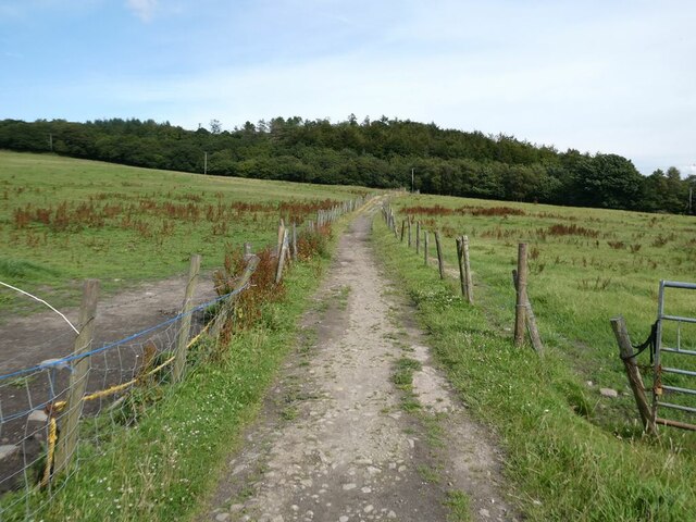
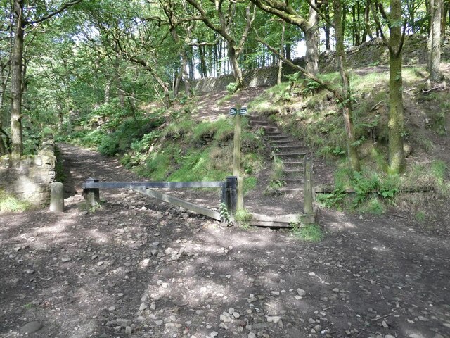
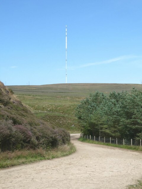
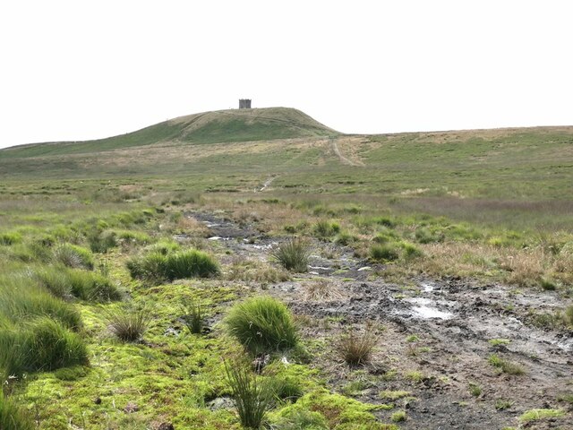
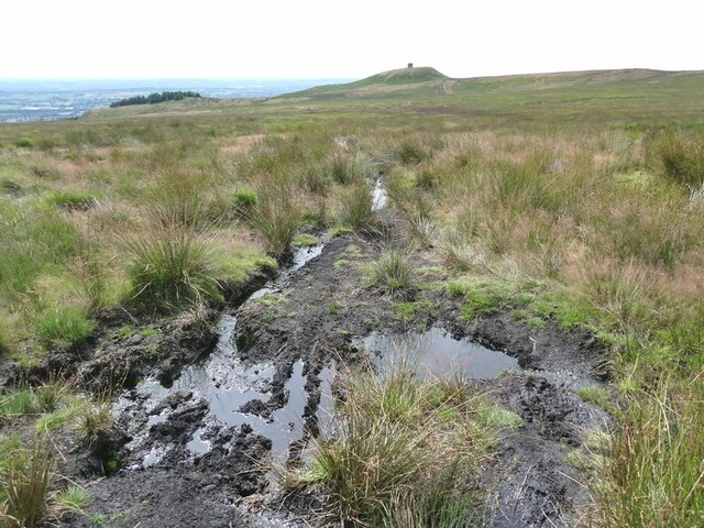
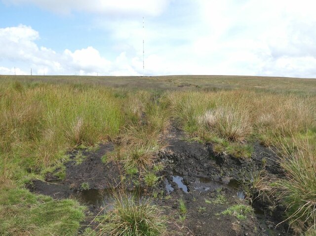
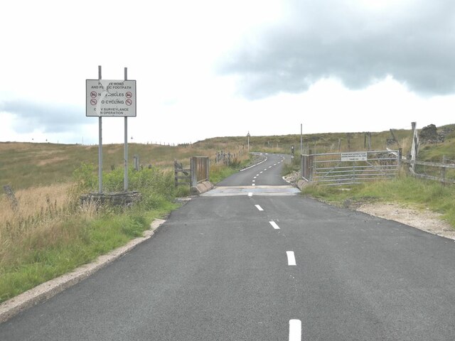
The moorland of Makinson Moor is characterized by its heather-covered hills and peat bogs. This unique ecosystem supports a diverse range of flora and fauna, including rare bird species such as curlews and lapwings. Nature lovers can explore the moorland on foot, following designated trails that wind through the rugged terrain. This area is also a designated Site of Special Scientific Interest, highlighting its ecological significance.

In addition to its natural beauty, Makinson Moor is home to several historic landmarks, including ancient burial mounds and remnants of Stone Age settlements. These archaeological sites provide a glimpse into the region's rich cultural heritage.

Overall, Makinson Moor in Lancashire offers a captivating blend of natural beauty, outdoor activities, and historical significance, making it a popular destination for locals and tourists alike.

If you have any feedback on the listing, please let us know in the comments section below.

Makinson Moor Images

Images are sourced within 2km of 53.605771/-2.5192082 or Grid Reference SD6512. Thanks to Geograph Open Source API. All images are credited.

Edge Hill on Bridge Street A small group of houses on a pot-holed unadopted road alongside Bridge Street Horwich Local Nature Reserve. The house in view incorporates a letting apartment.
Edge Hill on Bridge Street
A small group of houses on a pot-holed unadopted road alongside Bridge Street Horwich Local Nature Reserve. The house in view incorporates a letting apartment.
Entrance to Bridge Street Horwich Local Nature Reserve Well-wooded reserve alongside a stream.
Entrance to Bridge Street Horwich Local Nature Reserve
Well-wooded reserve alongside a stream.
Footpath from Ormstons Farm to Wilderswood
Fields adjacent to Ormstons Lane Ormstons Lane is now just a green path running across fields. Rivington Pike <a href="https://www.geograph.org.uk/gridref/SD6413">SD6413</a> on the skyline.
Fields adjacent to Ormstons Lane
Ormstons Lane is now just a green path running across fields. Rivington Pike SD6413 on the skyline.
Footpath junction on the west side of Wilderswood
Ormstons Lane The route known as "Ormstons Lane" is now no more than a green path leading down across fields. The plains of South Lancashire stretch away to the horizon.
Ormstons Lane
The route known as "Ormstons Lane" is now no more than a green path leading down across fields. The plains of South Lancashire stretch away to the horizon.
View of Winter Hill TV mast from Belmont Road The 310 metre high TV mast on Winter Hill <a href="https://www.geograph.org.uk/gridref/SD6614">SD6614</a> dominates the scene.
View of Winter Hill TV mast from Belmont Road
The 310 metre high TV mast on Winter Hill SD6614 dominates the scene.
Path from Winter Hill to  Rivington Pike Traversing some very boggy ground.
Path from Winter Hill to Rivington Pike
Traversing some very boggy ground.
The Pike Snack Shack A popular watering hole at Pike Cottage on the high road to Rivington Pike
The Pike Snack Shack
A popular watering hole at Pike Cottage on the high road to Rivington Pike
Path from Winter Hill to  Rivington Pike A very boggy section of the path. View of the South Lancashire plain beyond.
Path from Winter Hill to Rivington Pike
A very boggy section of the path. View of the South Lancashire plain beyond.
Path from Rivington Pike to Winter Hill A very boggy section of the path. The 315 metre high TV mast on Winter Hill <a href="https://www.geograph.org.uk/gridref/SD6614">SD6614</a> dominates the skyline.
Path from Rivington Pike to Winter Hill
A very boggy section of the path. The 315 metre high TV mast on Winter Hill SD6614 dominates the skyline.
A corner of the Life for a Life Memorial Forest at Horwich Trees and benches can be endowed to commemorate the lives of relatives.
A corner of the Life for a Life Memorial Forest at Horwich
Trees and benches can be endowed to commemorate the lives of relatives.
Horses  on Factory Hill An outing from the Foxfields Therapeutic Riding Centre for disabled children and children with special educational needs.
Horses on Factory Hill
An outing from the Foxfields Therapeutic Riding Centre for disabled children and children with special educational needs.
Water supply installation beside Factory Hill
House on George's Lane Somewhat over-extended residence as seen from the rear of the building. Fine views of the South Lancashire plain.
House on George's Lane
Somewhat over-extended residence as seen from the rear of the building. Fine views of the South Lancashire plain.
Spoilsports! No vehicles! No cycling! 

No cycling? What is the point of a smooth traffic-free tarmac road up to the aerial installations on top of Winter Hill if cyclists are not allowed to challenge themselves on the climb and enjoy the magnificent descent afterwards? In practice, the notice seems to be widely ignored.
Spoilsports!
No vehicles! No cycling! No cycling? What is the point of a smooth traffic-free tarmac road up to the aerial installations on top of Winter Hill if cyclists are not allowed to challenge themselves on the climb and enjoy the magnificent descent afterwards? In practice, the notice seems to be widely ignored.
Cattle grid and barrier on the road down from Winter Hill Downhill traffic can bypass the barrier by driving over the collapsible row of spikes to the left, but woe betide anyone trying to drive the other way! Extensive views of the South Lancashire plain beyond.
Cattle grid and barrier on the road down from Winter Hill
Downhill traffic can bypass the barrier by driving over the collapsible row of spikes to the left, but woe betide anyone trying to drive the other way! Extensive views of the South Lancashire plain beyond.
"Two Lads" The origin and the myths behind these "two lads" (two large cairns - actually there are three of them) remain obscure. What is certain is that the cairns have been extensively reconstructed since the last sighting on Geograph in 2015 - see <a href="https://www.geograph.org.uk/photo/4508379">SD6513 : Cairns on Two Lads</a>.
"Two Lads"
The origin and the myths behind these "two lads" (two large cairns - actually there are three of them) remain obscure. What is certain is that the cairns have been extensively reconstructed since the last sighting on Geograph in 2015 - see SD6513 : Cairns on Two Lads.
Show me another place!

Makinson Moor is located at Grid Ref: SD6512 (Lat: 53.605771, Lng: -2.5192082)

Unitary Authority: Bolton

Police Authority: Greater Manchester

What 3 Words

///speedily.measures.lingering. Near Horwich, Manchester

Related Wikis

Wallsuches

Wallsuches is a small district of Horwich, Greater Manchester, England. == Etymology == The etymology of the place-name itself is unclear, although it...

Holy Trinity Church, Horwich

Holy Trinity Church, commonly known as Horwich Parish Church, is a Grade II listed building in Horwich, Greater Manchester, England. It is an active Church...

Grundy Hill

Grundy Hill was the former home stadium of Horwich RMI association football club in Horwich, Greater Manchester, England, near the Horwich Leisure Centre...

Horwich railway station

Horwich railway station was located in Lancashire, England on a branch from the Manchester to Preston Line. It was closed to passengers on 27 September...

Rivington and Blackrod High School

Rivington and Blackrod High School in the North West region of England is a Leverhulme Trust multi-academy school alongside Harper Green School, it operates...

Horwich

Horwich ( HORR-itch) is a town and civil parish in the Metropolitan Borough of Bolton, Greater Manchester, England, within the Historic County Boundaries...

Horwich Urban District

Horwich was, from 1872 to 1974, a local government district centred on the town of Horwich in the administrative county of Lancashire, England. == History... ==
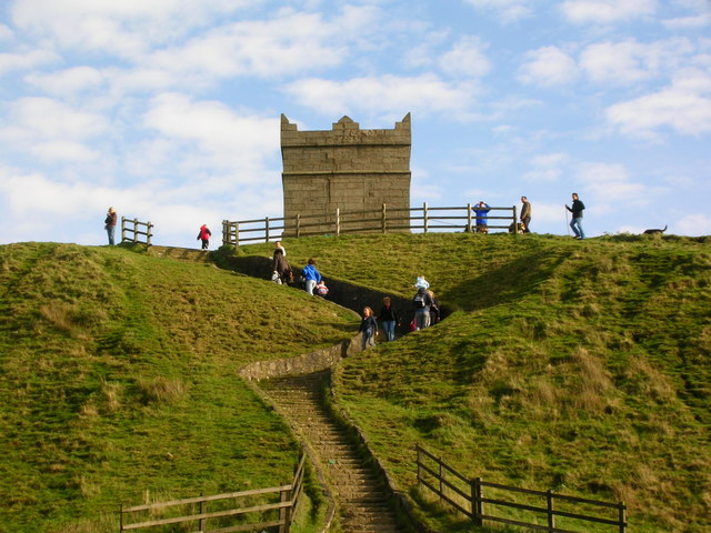
Rivington Pike

Rivington Pike is a hill on Winter Hill, part of the West Pennine Moors at Rivington, Chorley in Lancashire, England. The nearest towns are Adlington and...

Nearby Amenities

Located within 500m of 53.605771,-2.5192082
Barrier: cattle_grid
Lat/Long: 53.6100181/-2.5200176
Barrier: kissing_gate
Lat/Long: 53.6034798/-2.5252339
Barrier: block
Lat/Long: 53.6039239/-2.5260651
White Brow
Ele: 358
Natural: peak
Lat/Long: 53.6072011/-2.514452
Adam Hill
Ele: 360
Natural: peak
Lat/Long: 53.6094672/-2.5154927
Barrier: stile
Lat/Long: 53.6063111/-2.5119845
The data included in this document is from www.openstreetmap.org. The data is made available under ODbL.

Have you been to Makinson Moor?

Leave your review of Makinson Moor below (or comments, questions and feedback).