Memorial Forest

Wood, Forest in Lancashire

England

Memorial Forest

Edge Hill on Bridge Street A small group of houses on a pot-holed unadopted road alongside Bridge Street Horwich Local Nature Reserve. The house in view incorporates a letting apartment.
Edge Hill on Bridge Street Credit: Oliver Dixon

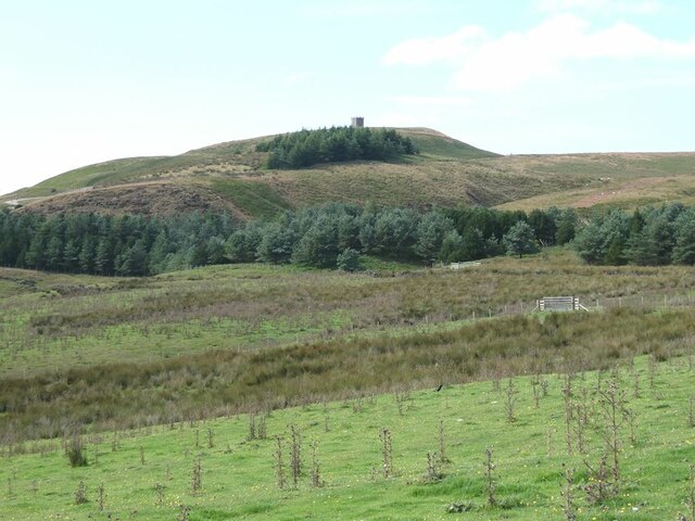
Memorial Forest, located in Lancashire, is a serene and picturesque woodland that spans over a vast area. This forest serves as a natural tribute to the fallen heroes and is dedicated to their memory. It is a place of reflection, tranquility, and solitude, drawing visitors from near and far.

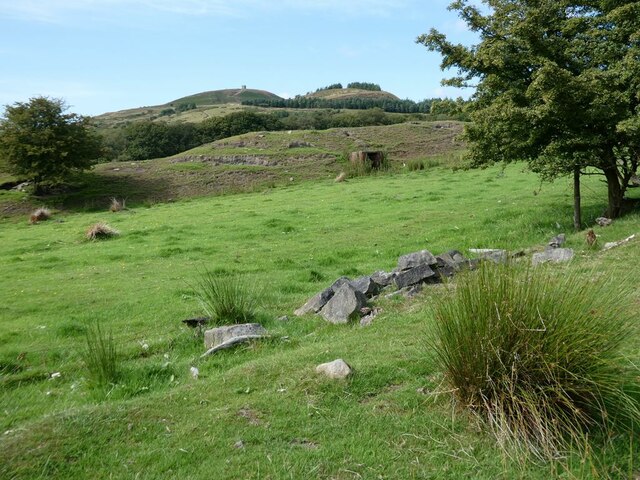
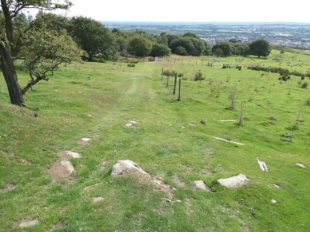
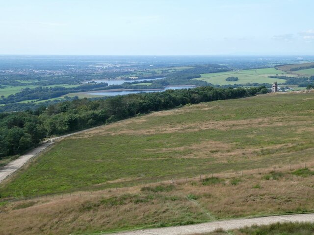
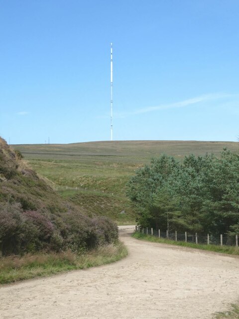
Covering an area of approximately 500 acres, Memorial Forest is home to a diverse range of flora and fauna, making it an ideal spot for nature enthusiasts and wildlife lovers. The forest boasts a rich variety of trees, including oak, beech, and birch, which create a lush canopy and provide shelter to various bird species. The forest floor is adorned with a colorful tapestry of wildflowers, adding to its natural beauty.

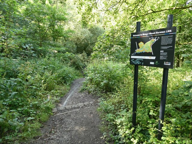
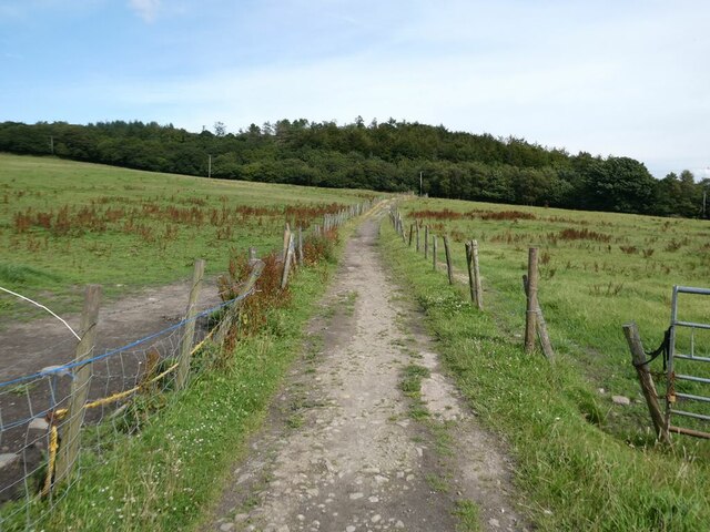
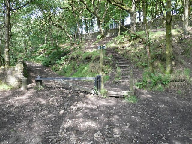
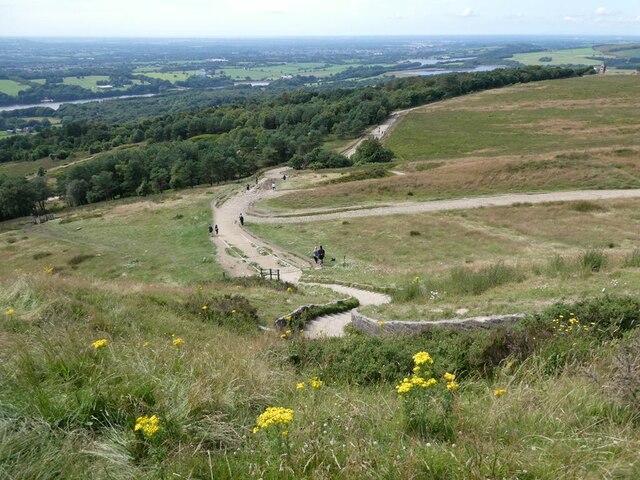
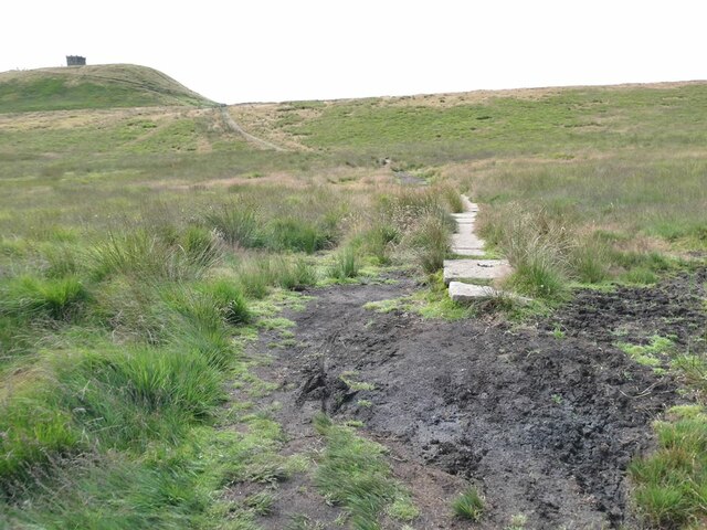
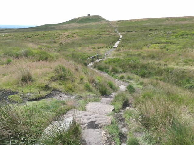
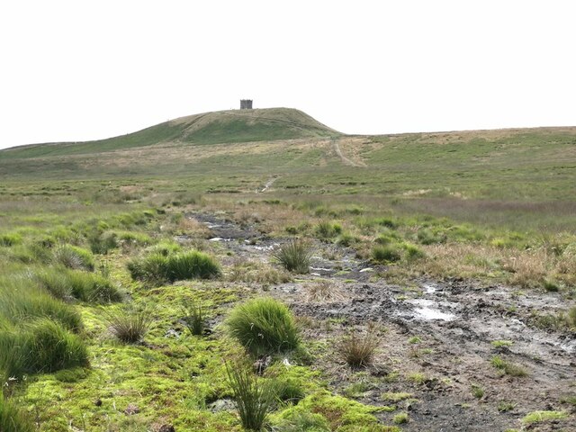
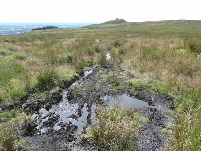
The forest offers a network of well-maintained trails, inviting visitors to explore and immerse themselves in the peaceful surroundings. These paths wind through the dense woods, revealing hidden clearings and secluded spots, perfect for picnics or moments of solitude. Many visitors take advantage of the opportunity to reconnect with nature, finding solace in the quietude and serenity of the forest.

Memorial Forest's significance as a memorial site is evident in the presence of commemorative plaques and memorials scattered throughout the woodland. These serve as a poignant reminder of the sacrifices made by those who fought for their country. Visitors often pause at these memorials, paying their respects and reflecting upon the bravery and dedication of these individuals.

Overall, Memorial Forest in Lancashire offers a unique and meaningful experience, combining natural beauty with a profound sense of remembrance. It is a place where visitors can find solace, connect with nature, and honor the memory of those who made the ultimate sacrifice.

If you have any feedback on the listing, please let us know in the comments section below.

Memorial Forest Images

Images are sourced within 2km of 53.604114/-2.52821 or Grid Reference SD6512. Thanks to Geograph Open Source API. All images are credited.

Edge Hill on Bridge Street A small group of houses on a pot-holed unadopted road alongside Bridge Street Horwich Local Nature Reserve. The house in view incorporates a letting apartment.
Edge Hill on Bridge Street
A small group of houses on a pot-holed unadopted road alongside Bridge Street Horwich Local Nature Reserve. The house in view incorporates a letting apartment.
Entrance to Bridge Street Horwich Local Nature Reserve Well-wooded reserve alongside a stream.
Entrance to Bridge Street Horwich Local Nature Reserve
Well-wooded reserve alongside a stream.
Footpath from Ormstons Farm to Wilderswood
Fields adjacent to Ormstons Lane Ormstons Lane is now just a green path running across fields. Rivington Pike <a href="https://www.geograph.org.uk/gridref/SD6413">SD6413</a> on the skyline.
Fields adjacent to Ormstons Lane
Ormstons Lane is now just a green path running across fields. Rivington Pike SD6413 on the skyline.
Footpath junction on the west side of Wilderswood
Ormstons Lane The route known as "Ormstons Lane" is now no more than a green path leading down across fields. The plains of South Lancashire stretch away to the horizon.
Ormstons Lane
The route known as "Ormstons Lane" is now no more than a green path leading down across fields. The plains of South Lancashire stretch away to the horizon.
Rivington Pike An 18th century folly built on a prominent hill overlooking Horwich with commanding views over the South Lancashire plains.
Rivington Pike
An 18th century folly built on a prominent hill overlooking Horwich with commanding views over the South Lancashire plains.
Path below Rivington Pike Path dropping steeply down below Rivington Pike to the west. Giving glimpses of the Upper and Lower Rivington Reservoirs and extensive views of the South Lancashire plain beyond
Path below Rivington Pike
Path dropping steeply down below Rivington Pike to the west. Giving glimpses of the Upper and Lower Rivington Reservoirs and extensive views of the South Lancashire plain beyond
View west-north-west from Rivington Pike Views of Upper Rivington Reservoir <a href="https://www.geograph.org.uk/gridref/SD6214">SD6214</a> with the South Lancashire plain beyond.
View west-north-west from Rivington Pike
Views of Upper Rivington Reservoir SD6214 with the South Lancashire plain beyond.
View north-north-west of Rivington Pike With views of the "Pigeon Tower" <a href="https://www.geograph.org.uk/gridref/SD6314">SD6314</a>, Yarrow Reservoir <a href="https://www.geograph.org.uk/gridref/SD6215">SD6215</a> and Anglezarke Reservoir <a href="https://www.geograph.org.uk/gridref/SD6116">SD6116</a> and the South Lancashire plain in the distance.
View north-north-west of Rivington Pike
With views of the "Pigeon Tower" SD6314, Yarrow Reservoir SD6215 and Anglezarke Reservoir SD6116 and the South Lancashire plain in the distance.
Path below Rivington Pike Rivington Pike is a popular, but steep, walk up from Horwich.
Path below Rivington Pike
Rivington Pike is a popular, but steep, walk up from Horwich.
View of Winter Hill TV mast from Belmont Road The 310 metre high TV mast on Winter Hill <a href="https://www.geograph.org.uk/gridref/SD6614">SD6614</a> dominates the scene.
View of Winter Hill TV mast from Belmont Road
The 310 metre high TV mast on Winter Hill SD6614 dominates the scene.
Path from Winter Hill to  Rivington Pike Stone flags have been laid where the path crosses the boggy bottom.
Path from Winter Hill to Rivington Pike
Stone flags have been laid where the path crosses the boggy bottom.
Path from Winter Hill to  Rivington Pike Steps, a footbridge, board walks and stone flags have been laid where the path crosses the boggy bottom.
Path from Winter Hill to Rivington Pike
Steps, a footbridge, board walks and stone flags have been laid where the path crosses the boggy bottom.
Path from Winter Hill to  Rivington Pike Traversing some very boggy ground.
Path from Winter Hill to Rivington Pike
Traversing some very boggy ground.
Rivington Pike viewed from Pike Cottage
The Pike Snack Shack A popular watering hole at Pike Cottage on the high road to Rivington Pike
The Pike Snack Shack
A popular watering hole at Pike Cottage on the high road to Rivington Pike
Path from Winter Hill to  Rivington Pike A very boggy section of the path. View of the South Lancashire plain beyond.
Path from Winter Hill to Rivington Pike
A very boggy section of the path. View of the South Lancashire plain beyond.
Show me another place!

Memorial Forest is located at Grid Ref: SD6512 (Lat: 53.604114, Lng: -2.52821)

Unitary Authority: Bolton

Police Authority: Greater Manchester

What 3 Words

///bricks.juggled.willing. Near Horwich, Manchester

Related Wikis

Wallsuches

Wallsuches is a small district of Horwich, Greater Manchester, England. == Etymology == The etymology of the place-name itself is unclear, although it...

Holy Trinity Church, Horwich

Holy Trinity Church, commonly known as Horwich Parish Church, is a Grade II listed building in Horwich, Greater Manchester, England. It is an active Church...

Grundy Hill

Grundy Hill was the former home stadium of Horwich RMI association football club in Horwich, Greater Manchester, England, near the Horwich Leisure Centre...

Horwich railway station

Horwich railway station was located in Lancashire, England on a branch from the Manchester to Preston Line. It was closed to passengers on 27 September...

Nearby Amenities

Located within 500m of 53.604114,-2.52821
Barrier: stile
Lat/Long: 53.6058266/-2.533838
Barrier: kissing_gate
Lat/Long: 53.6034798/-2.5252339
Barrier: block
Lat/Long: 53.6039239/-2.5260651
Power: pole
Lat/Long: 53.6036931/-2.5302574
Power: pole
Lat/Long: 53.6031217/-2.5285301
Power: pole
Lat/Long: 53.6042644/-2.530362
Power: pole
Lat/Long: 53.6039859/-2.5311398
Power: pole
Lat/Long: 53.6034177/-2.5293937
Power: pole
Lat/Long: 53.6046177/-2.5297505
Power: pole
Lat/Long: 53.6049376/-2.5291738
Grit Bin
Lat/Long: 53.602937/-2.5354111
Barrier: bollard
Lat/Long: 53.6029175/-2.5354385
Turning Circle
Lat/Long: 53.6033808/-2.5331795
The data included in this document is from www.openstreetmap.org. The data is made available under ODbL.

Have you been to Memorial Forest?

Leave your review of Memorial Forest below (or comments, questions and feedback).