The Park

Downs, Moorland in Lancashire Lancaster

England

The Park

Summer House, Hawes Water On the Gait Barrows National Nature Reserve. Restored in 2020 using authentic materials and incorporating bat-friendly features. Also see <a href="https://www.geograph.org.uk/photo/6905993">SD4776 : Cabin at Hawes Water</a> (2021), <a href="https://www.geograph.org.uk/photo/6627450">SD4776 : Attractive to Hansel and Gretel ?</a> (2020) and <a href="https://www.geograph.org.uk/photo/4384183">SD4776 : Ruined building by Hawes Water</a> (2015).
Summer House, Hawes Water Credit: Ian Taylor

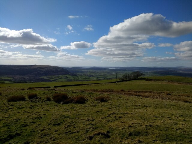
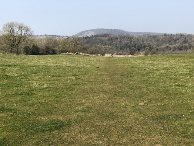
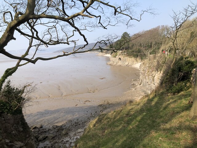
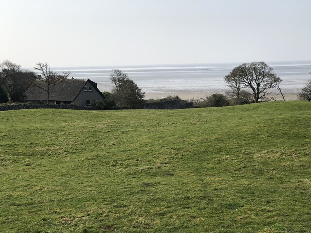
The Park, Lancashire is a picturesque and serene location nestled in the heart of the county in northwest England. Known for its stunning natural beauty and diverse landscapes, it encompasses both downs and moorland areas.

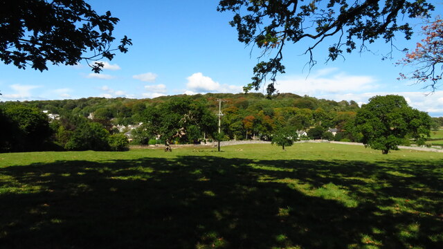
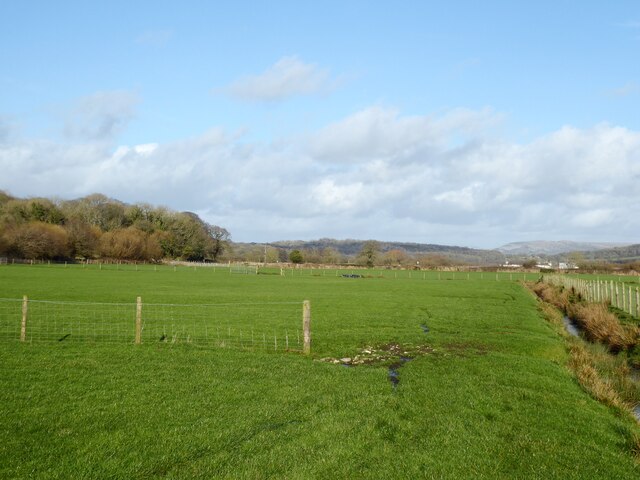
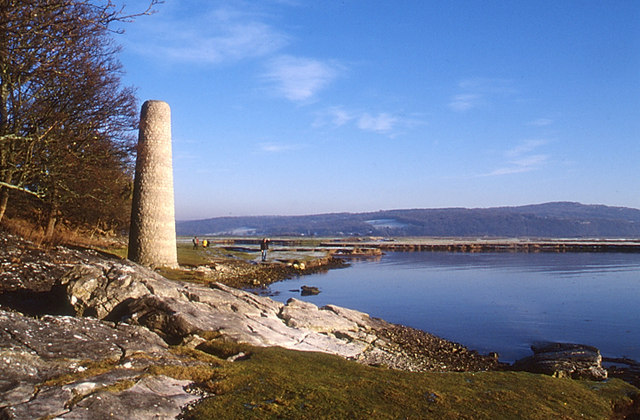
The downs in The Park are characterized by gently rolling hills covered in lush green grass, creating a peaceful and idyllic setting. These open spaces are perfect for leisurely walks and picnics, offering breathtaking panoramic views of the surrounding countryside. The downs are also home to a variety of wildlife, including rabbits, hares, and a wide range of bird species.

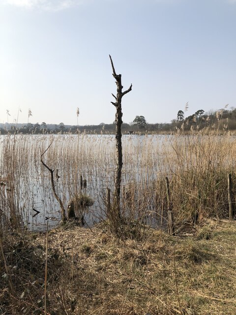
On the other hand, the moorland in The Park offers a stark contrast to the downs. Here, visitors will find vast expanses of heather-covered hills, interspersed with rocky outcrops and tranquil streams. The moorland is a haven for nature enthusiasts, providing opportunities for hiking, birdwatching, and exploring the unique flora and fauna that thrive in this rugged environment.

The Park is not only a haven for nature lovers but also a popular destination for outdoor activities. Its extensive network of walking trails and cycling routes attracts enthusiasts of all levels, offering a chance to immerse oneself in the peaceful surroundings and experience the beauty of the Lancashire countryside.

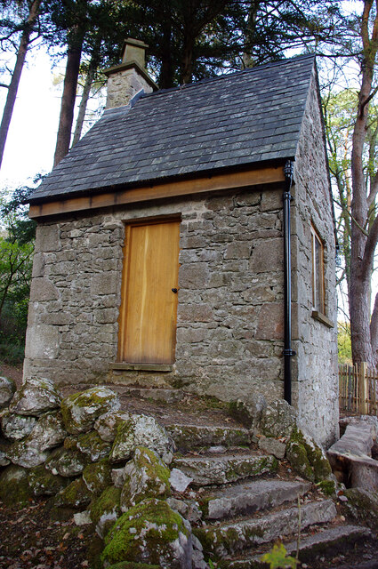
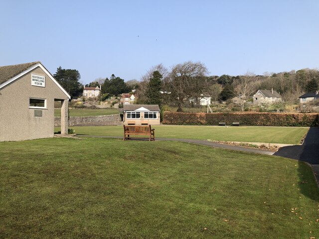
In addition to its natural wonders, The Park is also home to charming villages and historic landmarks. Visitors can explore quaint pubs, local shops, and immerse themselves in the rich history and culture of the area. The Park, Lancashire truly offers a unique and enriching experience for those seeking a tranquil escape amidst the beauty of nature.

If you have any feedback on the listing, please let us know in the comments section below.

The Park Images

Images are sourced within 2km of 54.176059/-2.816601 or Grid Reference SD4675. Thanks to Geograph Open Source API. All images are credited.

Summer House, Hawes Water On the Gait Barrows National Nature Reserve. Restored in 2020 using authentic materials and incorporating bat-friendly features. Also see <a href="https://www.geograph.org.uk/photo/6905993">SD4776 : Cabin at Hawes Water</a> (2021), <a href="https://www.geograph.org.uk/photo/6627450">SD4776 : Attractive to Hansel and Gretel ?</a> (2020) and <a href="https://www.geograph.org.uk/photo/4384183">SD4776 : Ruined building by Hawes Water</a> (2015).
Summer House, Hawes Water
On the Gait Barrows National Nature Reserve. Restored in 2020 using authentic materials and incorporating bat-friendly features. Also see SD4776 : Cabin at Hawes Water (2021), SD4776 : Attractive to Hansel and Gretel ? (2020) and SD4776 : Ruined building by Hawes Water (2015).
Potter Hill area of Silverdale
Fields near Heald Brow This fertile low lying land has been reclaimed from tidal salt marsh.
With the exception of the plants in the drain, the fields are entirely monoculture grass with no biodiversity, in sharp contrast to the RSBP Leighton Moss reserve nearby.
Fields near Heald Brow
This fertile low lying land has been reclaimed from tidal salt marsh. With the exception of the plants in the drain, the fields are entirely monoculture grass with no biodiversity, in sharp contrast to the RSBP Leighton Moss reserve nearby.
Benchmark, Leighton Moss, Myers Farm Detail of the Ordnance Survey rivet benchmark with a cut mark arrow on the stone window sill of Myers Farm.  The benchmark marks a height of 9.0258 m above sea level (Ordnance Datum Newlyn) last verified in 1970 (location photograph <a href="https://www.geograph.org.uk/photo/7109835">SD4775 : Myers Farm</a>).
Myers Farm is now the office, visitor centre and café for the Leighton Moss RSPB Reserve.
Benchmark, Leighton Moss, Myers Farm
Detail of the Ordnance Survey rivet benchmark with a cut mark arrow on the stone window sill of Myers Farm. The benchmark marks a height of 9.0258 m above sea level (Ordnance Datum Newlyn) last verified in 1970 (location photograph SD4775 : Myers Farm). Myers Farm is now the office, visitor centre and café for the Leighton Moss RSPB Reserve.
Myers Farm Formerly a working farm, Myers Farm is now the office, visitor centre and café for the Leighton Moss RSPB Reserve.
There is an Ordnance Survey rivet benchmark on the window sill in the centre of the photograph (detail photograph <a href="https://www.geograph.org.uk/photo/7109824">SD4775 : Benchmark, Leighton Moss, Myers Farm</a>).
Myers Farm
Formerly a working farm, Myers Farm is now the office, visitor centre and café for the Leighton Moss RSPB Reserve. There is an Ordnance Survey rivet benchmark on the window sill in the centre of the photograph (detail photograph SD4775 : Benchmark, Leighton Moss, Myers Farm).
Benchmark, Storrs Lane Railway Bridge Detail of the Ordnance Survey cut benchmark on the north parapet of Storrs Lane Railway Bridge.  The benchmark marks a height of 14.8791m above sea level (Ordnance Datum Newlyn) last verified in 1970 (location photograph <a href="https://www.geograph.org.uk/photo/7110063">SD4775 : Bridge Parapet</a>).
Benchmark, Storrs Lane Railway Bridge
Detail of the Ordnance Survey cut benchmark on the north parapet of Storrs Lane Railway Bridge. The benchmark marks a height of 14.8791m above sea level (Ordnance Datum Newlyn) last verified in 1970 (location photograph SD4775 : Bridge Parapet).
Bridge Parapet The parapet of Storrs Lane Railway Bridge with the clubhouse of Silverdale Golf Club in the background.
There is an Ordnance Survey cut benchmark just above ground level at the end of the bridge parapet (photograph <a href="https://www.geograph.org.uk/photo/7110057">SD4775 : Benchmark, Storrs Lane Railway Bridge</a>).
Bridge Parapet
The parapet of Storrs Lane Railway Bridge with the clubhouse of Silverdale Golf Club in the background. There is an Ordnance Survey cut benchmark just above ground level at the end of the bridge parapet (photograph SD4775 : Benchmark, Storrs Lane Railway Bridge).
Silverdale Station Built by the Ulverstone and Lancaster Railway and Silverdale Station opened in 1857.  The station building is now a private house but the platforms beyond are still in use.
There is an Ordnance Survey cut benchmark on one of the stone quoins to the left of the brown door (photograph <a href="https://www.geograph.org.uk/photo/7111705">SD4775 : Benchmark, Silverdale Station House</a>).
Silverdale Station
Built by the Ulverstone and Lancaster Railway and Silverdale Station opened in 1857. The station building is now a private house but the platforms beyond are still in use. There is an Ordnance Survey cut benchmark on one of the stone quoins to the left of the brown door (photograph SD4775 : Benchmark, Silverdale Station House).
Benchmark, Silverdale Station House Detail of the Ordnance Survey cut benchmark beside the door of Silverdale Station House. The benchmark marks a height of 10.2174m above mean sea level (Ordnance Datum Newlyn) last verified in 1970 (location photograph <a href="https://www.geograph.org.uk/photo/7111695">SD4775 : Silverdale Station</a>).
Benchmark, Silverdale Station House
Detail of the Ordnance Survey cut benchmark beside the door of Silverdale Station House. The benchmark marks a height of 10.2174m above mean sea level (Ordnance Datum Newlyn) last verified in 1970 (location photograph SD4775 : Silverdale Station).
View towards Silverdale from Scout Hill
RSPB Leighton Moss The Nature Reserve at Leighton Moss contains the largest area of reed beds in NW England. the reserve is owned and managed by the RSPB.
RSPB Leighton Moss
The Nature Reserve at Leighton Moss contains the largest area of reed beds in NW England. the reserve is owned and managed by the RSPB.
Path through field to Hawes Water
Hawes Water The small marl lake is a SSSI. Info from Wiki here: <span class="nowrap"><a title="https://en.wikipedia.org/wiki/Hawes_Water_(Silverdale)" rel="nofollow ugc noopener" href="https://en.wikipedia.org/wiki/Hawes_Water_(Silverdale)">Link</a><img style="margin-left:2px;" alt="External link" title="External link - shift click to open in new window" src="https://s1.geograph.org.uk/img/external.png" width="10" height="10"/></span>
Hawes Water
The small marl lake is a SSSI. Info from Wiki here: LinkExternal link
The Pepper Pot Stone folly tower built to commemorate the Golden Jubilee of Queen Victoria in 1887.
The Pepper Pot
Stone folly tower built to commemorate the Golden Jubilee of Queen Victoria in 1887.
Silverdale Bowling Club
Silverdale Cove
Silverdale Cove
Coastal houses, Silverdale
Woodwell The stone lined well is served by a spring in the outcrop behind.
Woodwell
The stone lined well is served by a spring in the outcrop behind.
Show me another place!

The Park is located at Grid Ref: SD4675 (Lat: 54.176059, Lng: -2.816601)

Administrative County: Lancashire

District: Lancaster

Police Authority: Lancashire

What 3 Words

///revealing.photo.truth. Near Silverdale, Lancashire

Related Wikis

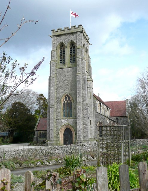
St John's Church, Silverdale

St John's Church is in Emesgate Lane, Silverdale, Lancashire, England. It is an active Anglican parish church in the deanery of Tunstall, the archdeaconry...

Silverdale railway station

Silverdale is a railway station on the Furness Line, which runs between Barrow-in-Furness and Lancaster. The station, situated 9+1⁄2 miles (15 km) north...

Silverdale Hoard

The Silverdale Hoard is a collection of over 200 pieces of silver jewellery and coins discovered near Silverdale, Lancashire, England, in September 2011...

Silverdale, Lancashire

Silverdale is a village and civil parish within the City of Lancaster district of Lancashire, England. The village stands on Morecambe Bay, near the border...

Hazelwood Hall

Hazelwood Hall, sometimes spelt Hazlewood, is a nineteenth-century country house set in 18.5 acres of woodland and gardens in the village of Silverdale...

Hawes Water (Silverdale)

Hawes Water, sometimes called Hawes Tarn, is a lake in north west Lancashire, England, in the parish of Silverdale, the Arnside and Silverdale AONB, and...
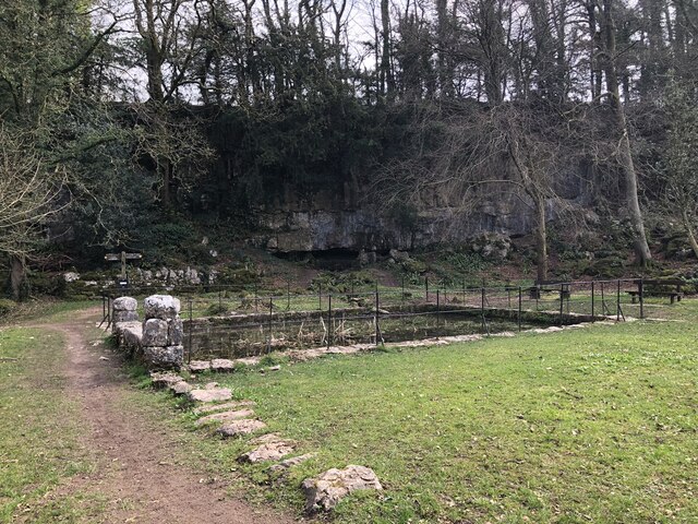
Trowbarrow Quarry

Trowbarrow Quarry is a disused limestone quarry near Silverdale, Lancashire, England, which is a geological Site of Special Scientific Interest and a Local...
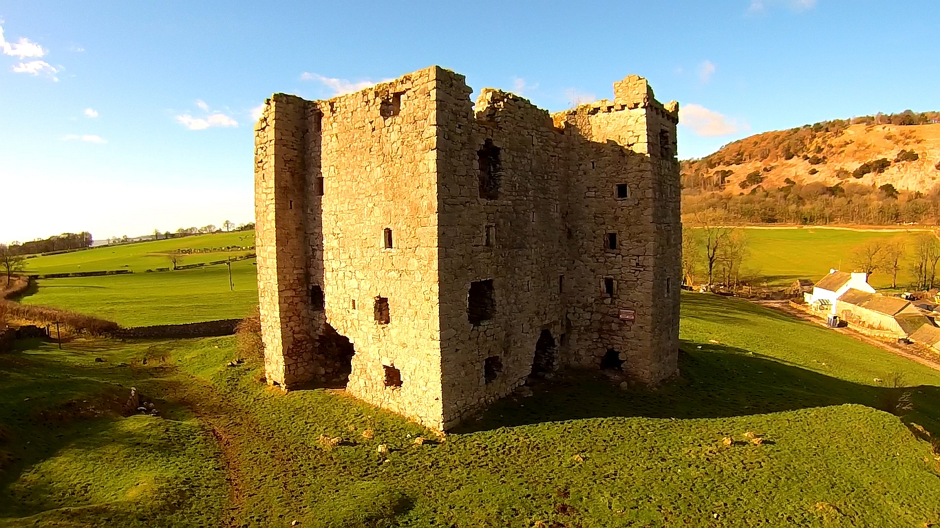
Arnside Tower

Arnside Tower is a late-medieval tower house (or Pele tower) between Arnside and Silverdale immediately to the south of Arnside Knott in Cumbria, England...

Nearby Amenities

Located within 500m of 54.176059,-2.816601
Silverdale (The Row)
Bus: yes
Public Transport: stop_position
Lat/Long: 54.1727098/-2.8119604
Barrier: kissing_gate
Source: GPS, photo and recent walk
Lat/Long: 54.1770521/-2.8120946
Parking
Capacity: 12
Fee: no
Source: GPS, photo and recent walk
Lat/Long: 54.1765496/-2.8116903
Waste Basket
Lat/Long: 54.1767065/-2.8107116
Bus Stop
Silverdale (The Row)
Bus: yes
Naptan AtcoCode: 250013120
Naptan Bearing: E
Naptan BusStopType: MKD
Naptan CommonName: The Row
Naptan Indicator: opp
Naptan Landmark: Park Road/Eaves Wood
Naptan LocalityCode: E0047449
Naptan NaptanCode: lanajwgp
Naptan Street: Chapel Lane
Naptan Verified: no
Public Transport: platform
Ref: lanajwgp
Shelter: yes
Lat/Long: 54.1766923/-2.8107326
Beech Circle
Lat/Long: 54.1777806/-2.8187624
Barrier: stile
Material: stone
Stile: squeezer
Lat/Long: 54.1728911/-2.8158264
Barrier: kissing_gate
Source: survey;gps
Lat/Long: 54.1750121/-2.820555
Give Way
Direction: backward
Lat/Long: 54.176767/-2.8102682
Silverdale (The Row)
Bus: yes
Public Transport: stop_position
Lat/Long: 54.1766647/-2.810671
Give Way
Direction: backward
Lat/Long: 54.1763789/-2.8112888
Post Box
Collection Times: Mo-Fr 16:00; Sa 10:30
Drive Through: no
Post Box Type: wall
Ref: LA5 63
Lat/Long: 54.176664/-2.8104443
Generator Method: photovoltaic
Generator Orientation: south
Generator Output Electricity: yes
Generator Solar Modules: 12
Generator Source: solar
Generator Type: solar_photovoltaic_panel
Location: roof
Power: generator
Lat/Long: 54.1734106/-2.8118367
Give Way
Direction: forward
Lat/Long: 54.1740578/-2.820601
Generator Method: photovoltaic
Generator Orientation: south_west
Generator Output Electricity: yes
Generator Solar Modules: 16
Generator Source: solar
Generator Type: solar_photovoltaic_panel
Location: roof
Power: generator
Lat/Long: 54.1746308/-2.823068
Bus Stop
Silverdale (Clevelands Avenue)
Bus: yes
Public Transport: platform
Lat/Long: 54.1738302/-2.8232462
Silverdale (Clevelands Avenue)
Bus: yes
Public Transport: stop_position
Lat/Long: 54.1738561/-2.8232513
Bus Stop
Silverdale (Clevelands Avenue)
Bus: yes
Naptan AtcoCode: 2500981
Naptan NaptanCode: landajwd
Public Transport: platform
Lat/Long: 54.17396/-2.8223431
Silverdale (Clevelands Avenue)
Bus: yes
Public Transport: stop_position
Lat/Long: 54.1739017/-2.8223352
Bus Stop
Silverdale (The Row)
Bus: yes
Public Transport: platform
Lat/Long: 54.1726905/-2.8120212
Silverdale (The Row)
Bus: yes
Public Transport: stop_position
Lat/Long: 54.1766506/-2.8107258
Bus Stop
Silverdale (The Row)
Bus: yes
Naptan AtcoCode: 2500LAA07473
Naptan NaptanCode: lanjpgjm
Public Transport: platform
Lat/Long: 54.1766322/-2.810699
Bus Stop
Silverdale (Cemetery)
Bus: yes
Naptan AtcoCode: 250013117
Naptan NaptanCode: lanajwgj
Public Transport: platform
Lat/Long: 54.1740133/-2.8207058
Silverdale (Cemetery)
Bus: yes
Public Transport: stop_position
Lat/Long: 54.1740589/-2.8207331
The data included in this document is from www.openstreetmap.org. The data is made available under ODbL.

Have you been to The Park?

Leave your review of The Park below (or comments, questions and feedback).