Elmslack

Settlement in Lancashire Lancaster

England

Elmslack

Summer House, Hawes Water On the Gait Barrows National Nature Reserve. Restored in 2020 using authentic materials and incorporating bat-friendly features. Also see <a href="https://www.geograph.org.uk/photo/6905993">SD4776 : Cabin at Hawes Water</a> (2021), <a href="https://www.geograph.org.uk/photo/6627450">SD4776 : Attractive to Hansel and Gretel ?</a> (2020) and <a href="https://www.geograph.org.uk/photo/4384183">SD4776 : Ruined building by Hawes Water</a> (2015).
Summer House, Hawes Water Credit: Ian Taylor

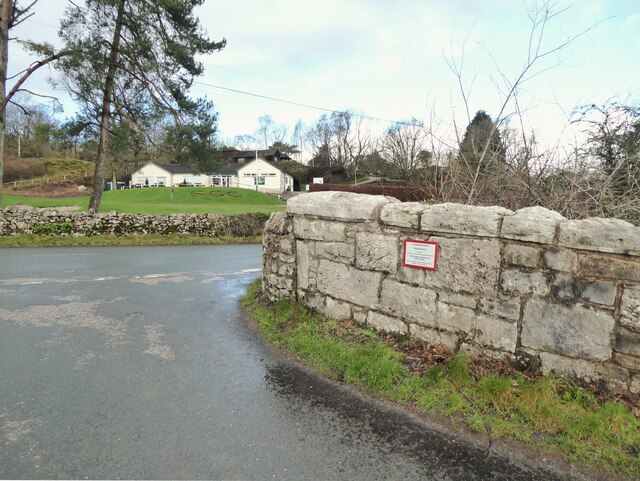
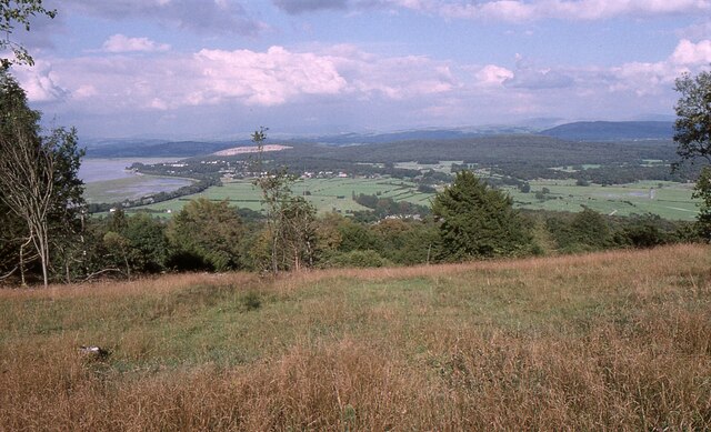
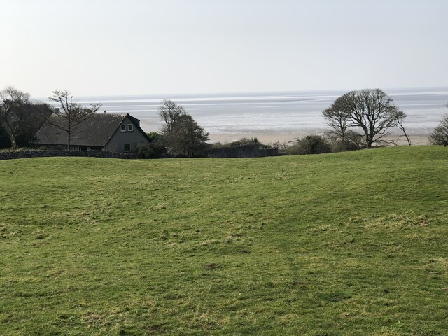
Elmslack is a small village located in the county of Lancashire, in the North West of England. Situated near the coast, it is nestled within the picturesque countryside and offers residents and visitors alike a peaceful and idyllic setting. With a population of around 500 people, Elmslack is known for its tight-knit community and friendly atmosphere.

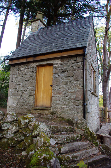
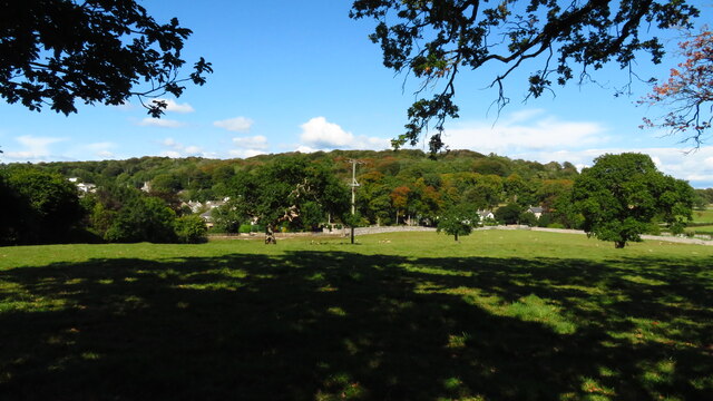
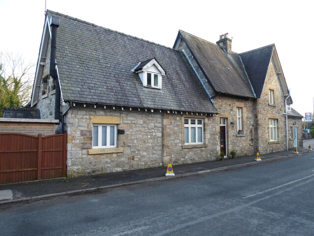
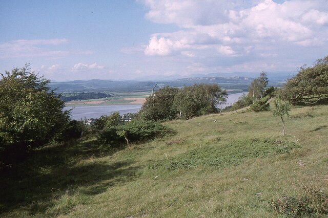
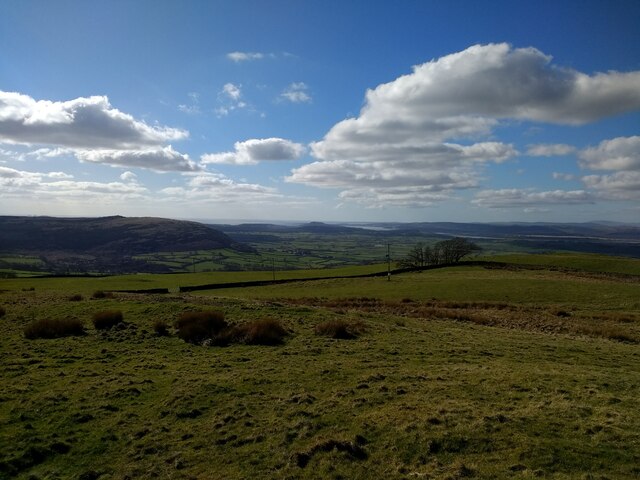
The village is characterized by its charming cottages and traditional architecture, which adds to its quaint and timeless appeal. The surrounding landscape is dominated by lush green fields, rolling hills, and scenic views, making it a popular destination for nature lovers and outdoor enthusiasts. Elmslack is also home to a number of well-maintained footpaths and trails, providing ample opportunities for hiking, cycling, and exploring the countryside.

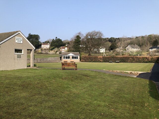
Despite its small size, Elmslack boasts a few local amenities to cater to the needs of its residents. These include a village hall, a primary school, a post office, and a local pub, which serves as a social hub for the community. The village is conveniently located within a short distance of larger towns and cities, such as Lancaster and Blackpool, offering easy access to a wider range of services and entertainment options.

Elmslack holds a rich history, with evidence of settlements dating back to the Roman era. The village maintains a sense of tradition and heritage, with annual events and festivals celebrating its past and bringing the community together. Overall, Elmslack offers a charming and peaceful retreat for those seeking a slower pace of life in the heart of Lancashire's countryside.

If you have any feedback on the listing, please let us know in the comments section below.
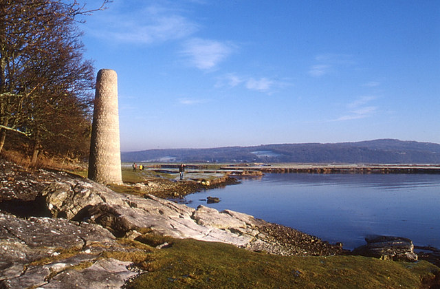
Elmslack Images

Images are sourced within 2km of 54.174464/-2.824922 or Grid Reference SD4675. Thanks to Geograph Open Source API. All images are credited.

Summer House, Hawes Water On the Gait Barrows National Nature Reserve. Restored in 2020 using authentic materials and incorporating bat-friendly features. Also see <a href="https://www.geograph.org.uk/photo/6905993">SD4776 : Cabin at Hawes Water</a> (2021), <a href="https://www.geograph.org.uk/photo/6627450">SD4776 : Attractive to Hansel and Gretel ?</a> (2020) and <a href="https://www.geograph.org.uk/photo/4384183">SD4776 : Ruined building by Hawes Water</a> (2015).
Summer House, Hawes Water
On the Gait Barrows National Nature Reserve. Restored in 2020 using authentic materials and incorporating bat-friendly features. Also see SD4776 : Cabin at Hawes Water (2021), SD4776 : Attractive to Hansel and Gretel ? (2020) and SD4776 : Ruined building by Hawes Water (2015).
Potter Hill area of Silverdale
Benchmark, Leighton Moss, Myers Farm Detail of the Ordnance Survey rivet benchmark with a cut mark arrow on the stone window sill of Myers Farm.  The benchmark marks a height of 9.0258 m above sea level (Ordnance Datum Newlyn) last verified in 1970 (location photograph <a href="https://www.geograph.org.uk/photo/7109835">SD4775 : Myers Farm</a>).
Myers Farm is now the office, visitor centre and café for the Leighton Moss RSPB Reserve.
Benchmark, Leighton Moss, Myers Farm
Detail of the Ordnance Survey rivet benchmark with a cut mark arrow on the stone window sill of Myers Farm. The benchmark marks a height of 9.0258 m above sea level (Ordnance Datum Newlyn) last verified in 1970 (location photograph SD4775 : Myers Farm). Myers Farm is now the office, visitor centre and café for the Leighton Moss RSPB Reserve.
Myers Farm Formerly a working farm, Myers Farm is now the office, visitor centre and café for the Leighton Moss RSPB Reserve.
There is an Ordnance Survey rivet benchmark on the window sill in the centre of the photograph (detail photograph <a href="https://www.geograph.org.uk/photo/7109824">SD4775 : Benchmark, Leighton Moss, Myers Farm</a>).
Myers Farm
Formerly a working farm, Myers Farm is now the office, visitor centre and café for the Leighton Moss RSPB Reserve. There is an Ordnance Survey rivet benchmark on the window sill in the centre of the photograph (detail photograph SD4775 : Benchmark, Leighton Moss, Myers Farm).
Benchmark, Storrs Lane Railway Bridge Detail of the Ordnance Survey cut benchmark on the north parapet of Storrs Lane Railway Bridge.  The benchmark marks a height of 14.8791m above sea level (Ordnance Datum Newlyn) last verified in 1970 (location photograph <a href="https://www.geograph.org.uk/photo/7110063">SD4775 : Bridge Parapet</a>).
Benchmark, Storrs Lane Railway Bridge
Detail of the Ordnance Survey cut benchmark on the north parapet of Storrs Lane Railway Bridge. The benchmark marks a height of 14.8791m above sea level (Ordnance Datum Newlyn) last verified in 1970 (location photograph SD4775 : Bridge Parapet).
Bridge Parapet The parapet of Storrs Lane Railway Bridge with the clubhouse of Silverdale Golf Club in the background.
There is an Ordnance Survey cut benchmark just above ground level at the end of the bridge parapet (photograph <a href="https://www.geograph.org.uk/photo/7110057">SD4775 : Benchmark, Storrs Lane Railway Bridge</a>).
Bridge Parapet
The parapet of Storrs Lane Railway Bridge with the clubhouse of Silverdale Golf Club in the background. There is an Ordnance Survey cut benchmark just above ground level at the end of the bridge parapet (photograph SD4775 : Benchmark, Storrs Lane Railway Bridge).
Silverdale Station Built by the Ulverstone and Lancaster Railway and Silverdale Station opened in 1857.  The station building is now a private house but the platforms beyond are still in use.
There is an Ordnance Survey cut benchmark on one of the stone quoins to the left of the brown door (photograph <a href="https://www.geograph.org.uk/photo/7111705">SD4775 : Benchmark, Silverdale Station House</a>).
Silverdale Station
Built by the Ulverstone and Lancaster Railway and Silverdale Station opened in 1857. The station building is now a private house but the platforms beyond are still in use. There is an Ordnance Survey cut benchmark on one of the stone quoins to the left of the brown door (photograph SD4775 : Benchmark, Silverdale Station House).
Benchmark, Silverdale Station House Detail of the Ordnance Survey cut benchmark beside the door of Silverdale Station House. The benchmark marks a height of 10.2174m above mean sea level (Ordnance Datum Newlyn) last verified in 1970 (location photograph <a href="https://www.geograph.org.uk/photo/7111695">SD4775 : Silverdale Station</a>).
Benchmark, Silverdale Station House
Detail of the Ordnance Survey cut benchmark beside the door of Silverdale Station House. The benchmark marks a height of 10.2174m above mean sea level (Ordnance Datum Newlyn) last verified in 1970 (location photograph SD4775 : Silverdale Station).
Arnside Knott Looking north-northeast over the Kent Estuary. Part of the Kent Viaduct is visible behind the trees in the centre.

Arnside Knott is a National Trust property renowned for its wildlife on this important limestone outcrop.

Position within the square uncertain.
Arnside Knott
Looking north-northeast over the Kent Estuary. Part of the Kent Viaduct is visible behind the trees in the centre. Arnside Knott is a National Trust property renowned for its wildlife on this important limestone outcrop. Position within the square uncertain.
Arnside Knott Looking northeast towards Storth and Sandside Quarry.

Arnside Knott is a National Trust property renowned for its wildlife on this important limestone outcrop.

Position within the square uncertain.
Arnside Knott
Looking northeast towards Storth and Sandside Quarry. Arnside Knott is a National Trust property renowned for its wildlife on this important limestone outcrop. Position within the square uncertain.
View towards Silverdale from Scout Hill
Hawes Water The small marl lake is a SSSI. Info from Wiki here: <span class="nowrap"><a title="https://en.wikipedia.org/wiki/Hawes_Water_(Silverdale)" rel="nofollow ugc noopener" href="https://en.wikipedia.org/wiki/Hawes_Water_(Silverdale)">Link</a><img style="margin-left:2px;" alt="External link" title="External link - shift click to open in new window" src="https://s1.geograph.org.uk/img/external.png" width="10" height="10"/></span>
Hawes Water
The small marl lake is a SSSI. Info from Wiki here: LinkExternal link
The Pepper Pot Stone folly tower built to commemorate the Golden Jubilee of Queen Victoria in 1887.
The Pepper Pot
Stone folly tower built to commemorate the Golden Jubilee of Queen Victoria in 1887.
Silverdale Bowling Club
Silverdale Cove
Silverdale Cove
Coastal houses, Silverdale
Woodwell The stone lined well is served by a spring in the outcrop behind.
Woodwell
The stone lined well is served by a spring in the outcrop behind.
Silverdale Station A Northern service to Barrow-in-Furness arriving at Silverdale.
Silverdale Station
A Northern service to Barrow-in-Furness arriving at Silverdale.
Show me another place!

Elmslack is located at Grid Ref: SD4675 (Lat: 54.174464, Lng: -2.824922)

Administrative County: Lancashire

District: Lancaster

Police Authority: Lancashire

What 3 Words

///condensed.complain.smile. Near Silverdale, Lancashire

Related Wikis

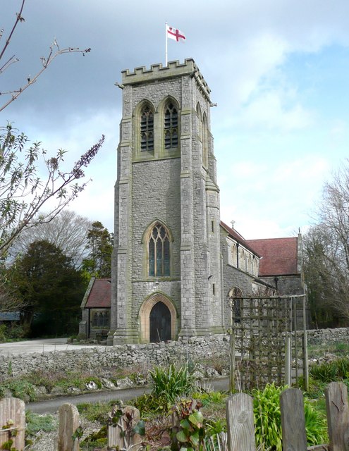
St John's Church, Silverdale

St John's Church is in Emesgate Lane, Silverdale, Lancashire, England. It is an active Anglican parish church in the deanery of Tunstall, the archdeaconry...

Silverdale Hoard

The Silverdale Hoard is a collection of over 200 pieces of silver jewellery and coins discovered near Silverdale, Lancashire, England, in September 2011...

Silverdale, Lancashire

Silverdale is a village and civil parish within the City of Lancaster district of Lancashire, England. The village stands on Morecambe Bay, near the border...

Hazelwood Hall

Hazelwood Hall, sometimes spelt Hazlewood, is a nineteenth-century country house set in 18.5 acres of woodland and gardens in the village of Silverdale...

Nearby Amenities

Located within 500m of 54.174464,-2.824922
Post Box
Collection Times: Mo-Fr 16:00; Sa 11:00
Drive Through: no
Post Box Type: wall
Ref: LA5 34
Royal Cypher: GVIR
Lat/Long: 54.1746133/-2.8309831
Fire Station
Silverdale Fire Station
Operator: LFRS
Lat/Long: 54.1700273/-2.8248106
Post Box
Collection Times: Mo-Fr 16:00; Sa 11:00
Drive Through: no
Post Box Type: wall
Ref: LA5 77
Lat/Long: 54.1716119/-2.8243696
Turning Circle
Lat/Long: 54.1710232/-2.8234422
Silverdale (War Memorial)
Bus: yes
Public Transport: stop_position
Lat/Long: 54.173047/-2.8230203
Barrier: stile
Material: stone
Stile: squeezer
Lat/Long: 54.1714887/-2.8216797
Barrier: stile
Lat/Long: 54.1749237/-2.8299049
Pepper Pot
Historic: memorial
Source: GPS and photo
Lat/Long: 54.1778997/-2.8269238
Tourism: viewpoint
Lat/Long: 54.1779531/-2.8266663
Barrier: squeeze
Lat/Long: 54.1707321/-2.8241725
King Williams Hill
Ele: 94
Natural: peak
Lat/Long: 54.1780591/-2.826989
Barrier: kissing_gate
Source: survey;gps
Lat/Long: 54.1750121/-2.820555
Barrier: stile
Material: stone
Source: survey;gps
Stile: squeezer
Lat/Long: 54.1770535/-2.8283693
Barrier: entrance
Source: survey;gps
Lat/Long: 54.1762356/-2.8252947
Give Way
Direction: forward
Lat/Long: 54.1740578/-2.820601
Generator Method: photovoltaic
Generator Orientation: south
Generator Output Electricity: yes
Generator Solar Modules: 20
Generator Source: solar
Generator Type: solar_photovoltaic_panel
Location: roof
Power: generator
Lat/Long: 54.1702043/-2.8230623
Generator Method: photovoltaic
Generator Orientation: south
Generator Output Electricity: yes
Generator Solar Modules: 12
Generator Source: solar
Generator Type: solar_photovoltaic_panel
Location: roof
Power: generator
Lat/Long: 54.1700017/-2.824821
Generator Method: photovoltaic
Generator Orientation: south
Generator Output Electricity: yes
Generator Solar Modules: 4
Generator Source: solar
Generator Type: solar_photovoltaic_panel
Location: roof
Power: generator
Lat/Long: 54.170906/-2.8245003
Generator Method: photovoltaic
Generator Orientation: east
Generator Output Electricity: yes
Generator Solar Modules: 5
Generator Source: solar
Generator Type: solar_photovoltaic_panel
Location: roof
Power: generator
Lat/Long: 54.1709686/-2.8244494
Generator Method: photovoltaic
Generator Orientation: west
Generator Output Electricity: yes
Generator Solar Modules: 5
Generator Source: solar
Generator Type: solar_photovoltaic_panel
Location: roof
Power: generator
Lat/Long: 54.1709716/-2.8245308
Generator Method: photovoltaic
Generator Orientation: west
Generator Output Electricity: yes
Generator Solar Modules: 8
Generator Source: solar
Generator Type: solar_photovoltaic_panel
Location: roof
Power: generator
Lat/Long: 54.1712234/-2.8244443
Generator Method: photovoltaic
Generator Orientation: east
Generator Output Electricity: yes
Generator Solar Modules: 6
Generator Source: solar
Generator Type: solar_photovoltaic_panel
Location: roof
Power: generator
Lat/Long: 54.171204/-2.8243603
Generator Method: photovoltaic
Generator Orientation: west
Generator Output Electricity: yes
Generator Solar Modules: 20
Generator Source: solar
Generator Type: solar_photovoltaic_panel
Location: roof
Power: generator
Lat/Long: 54.1720905/-2.8235738
Generator Method: photovoltaic
Generator Orientation: south
Generator Output Electricity: yes
Generator Solar Modules: 24
Generator Source: solar
Generator Type: solar_photovoltaic_panel
Location: roof
Power: generator
Lat/Long: 54.1727981/-2.8244316
Generator Method: photovoltaic
Generator Orientation: south_east
Generator Output Electricity: yes
Generator Solar Modules: 14
Generator Source: solar
Generator Type: solar_photovoltaic_panel
Location: roof
Power: generator
Lat/Long: 54.1732555/-2.8235178
Generator Method: photovoltaic
Generator Orientation: west
Generator Output Electricity: yes
Generator Solar Modules: 16
Generator Source: solar
Generator Type: solar_photovoltaic_panel
Location: roof
Power: generator
Lat/Long: 54.1742864/-2.8256278
Generator Method: photovoltaic
Generator Orientation: west
Generator Output Electricity: yes
Generator Solar Modules: 16
Generator Source: solar
Generator Type: solar_photovoltaic_panel
Location: roof
Power: generator
Lat/Long: 54.1730667/-2.8287977
Generator Method: photovoltaic
Generator Orientation: west
Generator Output Electricity: yes
Generator Solar Modules: 18
Generator Source: solar
Generator Type: solar_photovoltaic_panel
Location: roof
Power: generator
Lat/Long: 54.1738929/-2.8287887
Generator Method: photovoltaic
Generator Orientation: south
Generator Output Electricity: yes
Generator Solar Modules: 16
Generator Source: solar
Generator Type: solar_photovoltaic_panel
Location: roof
Power: generator
Lat/Long: 54.1740061/-2.8294676
Generator Method: photovoltaic
Generator Orientation: south
Generator Output Electricity: yes
Generator Solar Modules: 18
Generator Source: solar
Generator Type: solar_photovoltaic_panel
Location: roof
Power: generator
Lat/Long: 54.1745784/-2.8290652
Generator Method: photovoltaic
Generator Orientation: south
Generator Output Electricity: yes
Generator Solar Modules: 18
Generator Source: solar
Generator Type: solar_photovoltaic_panel
Location: roof
Power: generator
Lat/Long: 54.1764761/-2.8276093
Generator Method: photovoltaic
Generator Orientation: south
Generator Output Electricity: yes
Generator Solar Modules: 8
Generator Source: solar
Generator Type: solar_photovoltaic_panel
Location: roof
Power: generator
Lat/Long: 54.1762282/-2.8260216
Generator Method: photovoltaic
Generator Orientation: south_west
Generator Output Electricity: yes
Generator Solar Modules: 14
Generator Source: solar
Generator Type: solar_photovoltaic_panel
Location: roof
Power: generator
Lat/Long: 54.1760614/-2.8255869
Generator Method: photovoltaic
Generator Orientation: south_west
Generator Output Electricity: yes
Generator Solar Modules: 16
Generator Source: solar
Generator Type: solar_photovoltaic_panel
Location: roof
Power: generator
Lat/Long: 54.1746308/-2.823068
Bus Stop
Silverdale (Clevelands Avenue)
Bus: yes
Public Transport: platform
Lat/Long: 54.1738302/-2.8232462
Silverdale (Clevelands Avenue)
Bus: yes
Public Transport: stop_position
Lat/Long: 54.1738561/-2.8232513
Bus Stop
Silverdale (Clevelands Avenue)
Bus: yes
Naptan AtcoCode: 2500981
Naptan NaptanCode: landajwd
Public Transport: platform
Lat/Long: 54.17396/-2.8223431
Silverdale (Clevelands Avenue)
Bus: yes
Public Transport: stop_position
Lat/Long: 54.1739017/-2.8223352
Bus Stop
Silverdale (Cemetery)
Bus: yes
Naptan AtcoCode: 250013117
Naptan NaptanCode: lanajwgj
Public Transport: platform
Lat/Long: 54.1740133/-2.8207058
Silverdale (Cemetery)
Bus: yes
Public Transport: stop_position
Lat/Long: 54.1740589/-2.8207331
Bus Stop
Silverdale (War Memorial)
Bus: yes
Naptan AtcoCode: 2500982
Naptan Bearing: SW
Naptan CommonName: War Memorial
Naptan Indicator: by
Naptan Landmark: War Memorial
Naptan NaptanCode: landajwg
Naptan Street: Emesgate Lane
Public Transport: platform
Lat/Long: 54.1730184/-2.823012
Generator Method: photovoltaic
Generator Output Electricity: yes
Generator Source: solar
Generator Type: solar_photovoltaic_panel
Location: roof
Power: generator
Lat/Long: 54.1755532/-2.8286771
The data included in this document is from www.openstreetmap.org. The data is made available under ODbL.

Have you been to Elmslack?

Leave your review of Elmslack below (or comments, questions and feedback).