Sandbed Moss

Downs, Moorland in Selkirkshire

Scotland

Sandbed Moss

Towards Sundhope The farm access road. There has been some clear-felling here.
Towards Sundhope Credit: Mary and Angus Hogg

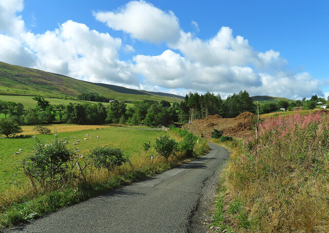
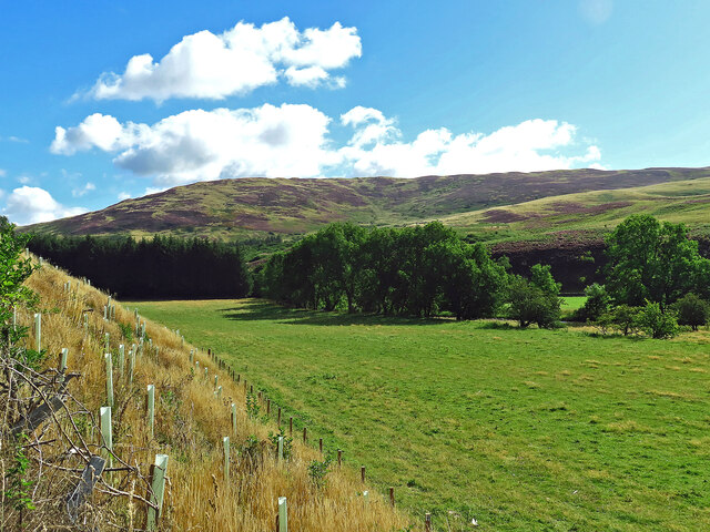
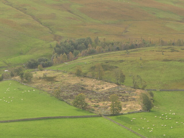
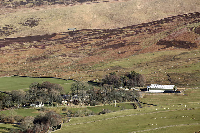
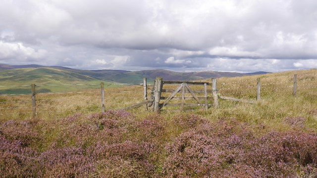
Sandbed Moss is a vast expanse of moorland located in Selkirkshire, Scotland. Spanning across an area of approximately 1,500 acres, it is renowned for its stunning natural beauty and diverse ecosystem. Situated in the southern part of Selkirkshire, the moss is easily accessible by road and is a popular destination for nature enthusiasts and hikers.

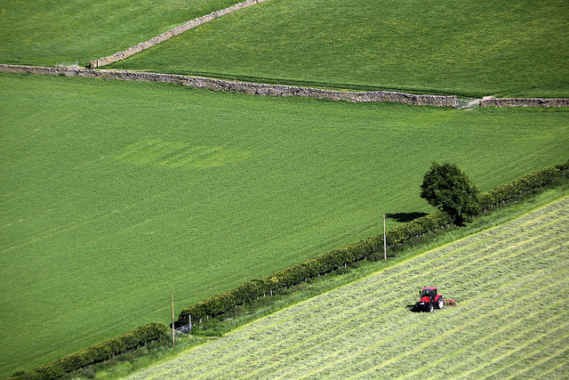
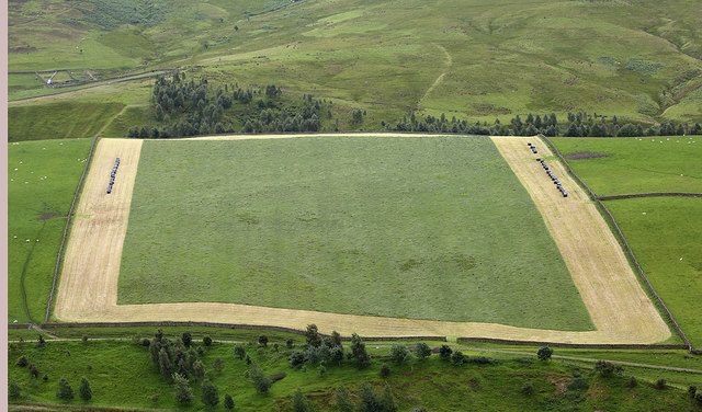
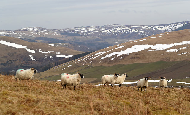
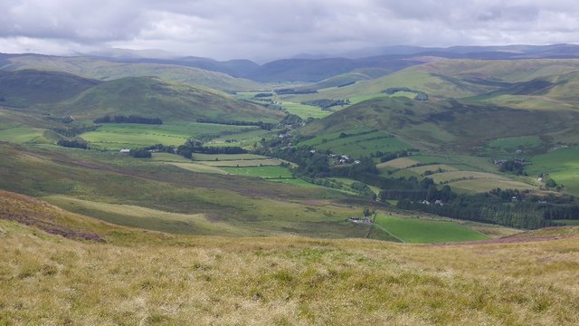
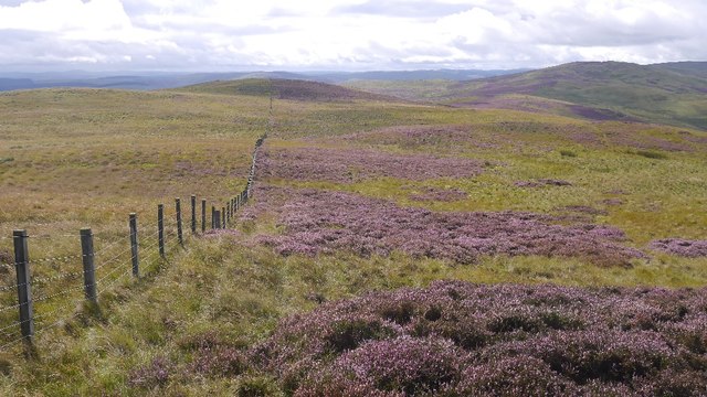
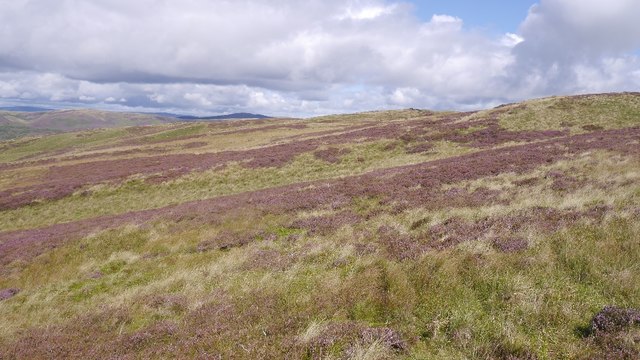
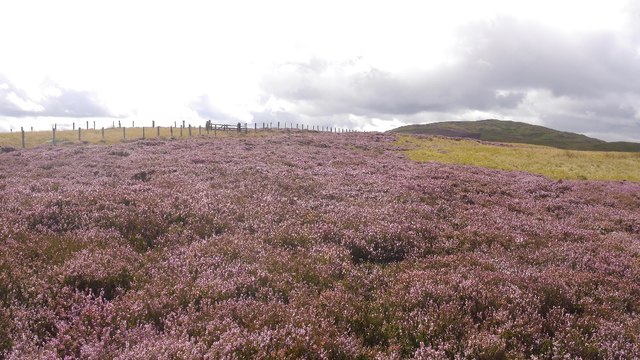
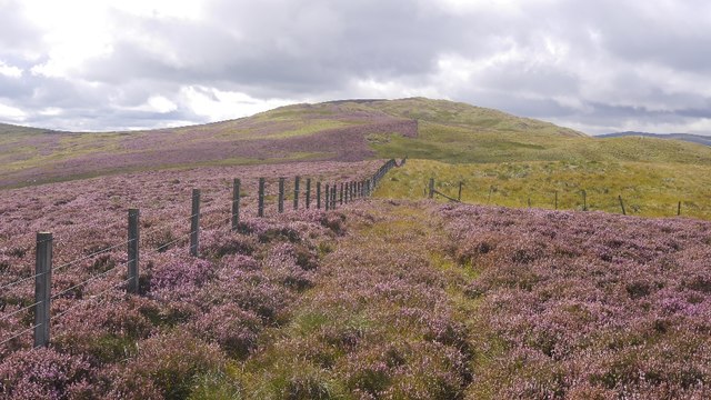
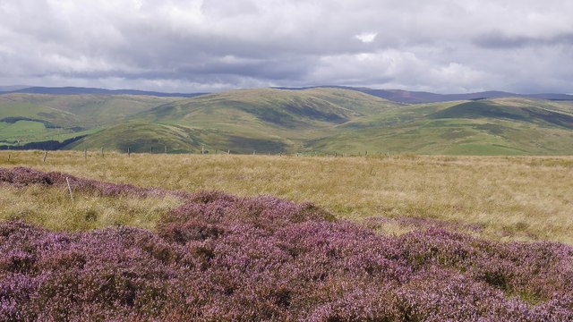
The landscape of Sandbed Moss is characterized by rolling hills, heather-covered moorland, and scattered patches of woodland. The area is dotted with numerous small lochs and bogs, adding to its overall picturesque appeal. The moss is also intersected by several streams and rivers, which provide a vital water source for the local flora and fauna.

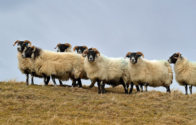
The moss is home to a wide range of plant and animal species, making it a haven for biodiversity. Visitors can spot various bird species, including golden plovers, lapwings, and curlews, which nest in the area during the breeding season. The heather-covered moorland offers a vibrant display of colors, with purple hues dominating the landscape during late summer.

Sandbed Moss is a protected area, managed by local conservation authorities to preserve its natural wonders. Visitors are encouraged to follow designated paths and adhere to the principles of responsible tourism, ensuring the preservation of the delicate ecosystem.

Overall, Sandbed Moss in Selkirkshire offers a unique opportunity to experience the untamed beauty of Scotland's moorland. With its diverse flora and fauna, stunning landscapes, and peaceful ambiance, it provides a truly immersive experience for nature lovers and outdoor enthusiasts.

If you have any feedback on the listing, please let us know in the comments section below.

Sandbed Moss Images

Images are sourced within 2km of 55.509055/-3.0364889 or Grid Reference NT3424. Thanks to Geograph Open Source API. All images are credited.

Towards Sundhope The farm access road. There has been some clear-felling here.
Towards Sundhope
The farm access road. There has been some clear-felling here.
Yarrow Feus view Looking across the Yarrow valley towards a heathery Crook Hill.
Yarrow Feus view
Looking across the Yarrow valley towards a heathery Crook Hill.
Ruined building Under Feuars Hill and above Yarrow Water.
Ruined building
Under Feuars Hill and above Yarrow Water.
Catslackburn
Catslackburn
Felled plantation, Sundhope
A low level RAF Tornado in the Yarrow Valley I photographed this Tornado GR4 from Feuars Hill as it made a turn at Sundhope. It was always exciting to watch these frontline jets fly through the valley at almost 500mph and sometimes at 100 feet above ground level. The final Tornado low level sortie through the valley was a 2-ship on 03/12/2018 with ZA614/076 <a href="https://www.geograph.org.uk/photo/7038623">NT2724 : A low flying Tornado GR4 at Ward Law</a> and ZA607/EB-X <a href="https://www.geograph.org.uk/photo/5994704">NT2724 : A low flying RAF Tornado</a>. This aircraft type was withdrawn from RAF service in early 2019.
A low level RAF Tornado in the Yarrow Valley
I photographed this Tornado GR4 from Feuars Hill as it made a turn at Sundhope. It was always exciting to watch these frontline jets fly through the valley at almost 500mph and sometimes at 100 feet above ground level. The final Tornado low level sortie through the valley was a 2-ship on 03/12/2018 with ZA614/076 NT2724 : A low flying Tornado GR4 at Ward Law and ZA607/EB-X NT2724 : A low flying RAF Tornado. This aircraft type was withdrawn from RAF service in early 2019.
Sundhope Farm This farm in the Yarrow Valley was viewed from Eldinhope Knowe in mid-February.
Sundhope Farm
This farm in the Yarrow Valley was viewed from Eldinhope Knowe in mid-February.
Farmland at Sundhope This was viewed in mid-June from Feuars Hill in the Yarrow Valley.
Farmland at Sundhope
This was viewed in mid-June from Feuars Hill in the Yarrow Valley.
Farmland at Sundhope Silage cutting has started in this field on the west side of Sundhope Farm. This was viewed from Feuars Hill.
Farmland at Sundhope
Silage cutting has started in this field on the west side of Sundhope Farm. This was viewed from Feuars Hill.
Sheep on Feuars Hill in the Yarrow Valley I met the shepherd on the hill who said these ewes will be ready for lambing in two weeks’ time.
Sheep on Feuars Hill in the Yarrow Valley
I met the shepherd on the hill who said these ewes will be ready for lambing in two weeks’ time.
Black-faced ewes on Feuars Hill Sheep normally graze on this hill in the Yarrow Valley but cattle will join them in May after spending the winter inside.
Black-faced ewes on Feuars Hill
Sheep normally graze on this hill in the Yarrow Valley but cattle will join them in May after spending the winter inside.
Yarrow Feus View from Rough Knowe.
Yarrow Feus
View from Rough Knowe.
Fence, Rough Knowe The top strand is electric, but there are the occasional crossing points along this section.
Fence, Rough Knowe
The top strand is electric, but there are the occasional crossing points along this section.
Moorland above Ladhope, Yarrow Looking towards Rough Knowe. Heavy but not desperate going here.
Moorland above Ladhope, Yarrow
Looking towards Rough Knowe. Heavy but not desperate going here.
Ladhope Middle Moorland between Ettrick and Yarrow.
Ladhope Middle
Moorland between Ettrick and Yarrow.
Ladhope Middle A gap in the side fence, but the main ridge fence remains an obstacle (electric).
Ladhope Middle
A gap in the side fence, but the main ridge fence remains an obstacle (electric).
Ladhope Middle View towards the other side of the Yarrow.
Ladhope Middle
View towards the other side of the Yarrow.
Gate, Ladhope Middle A rare break in the electric fence which runs along the ridge.
Gate, Ladhope Middle
A rare break in the electric fence which runs along the ridge.
Show me another place!

Sandbed Moss is located at Grid Ref: NT3424 (Lat: 55.509055, Lng: -3.0364889)

Unitary Authority: The Scottish Borders

Police Authority: The Lothians and Scottish Borders

What 3 Words

///crystals.wager.movements. Near Ettrick, Scottish Borders

Related Wikis

Selkirkshire

Selkirkshire or the County of Selkirk (Scottish Gaelic: Siorrachd Shalcraig) is a historic county and registration county of Scotland. It borders Peeblesshire...

Kirkhope Tower

Kirkhope Tower is a Scottish Pele, located in the Ettrick Valley, in the historic county of Selkirkshire, now a division of the Scottish Borders. The tower...

Yarrow, Scottish Borders

Yarrow is a place and parish in the Scottish Borders area of Scotland and in the former county of Selkirkshire.The name "Yarrow" may derive from the Celtic...

Ettrickbridge

Ettrickbridge (Scottish Gaelic: Drochaid Eadaraig) is a village situated in the Scottish Borders region of Scotland, 7 miles (11 km) from the nearby town...

Related Videos

Yarrow Water With Music On History Visit To The Borders Of Scotland

Tour Scotland short 4K travel video clip, with Scottish fiddle music, of Yarrow Water on ancestry, genealogy, family history visit to ...

Nearby Amenities

Located within 500m of 55.509055,-3.0364889
Wannel Cairn
Man Made: cairn
Lat/Long: 55.5125803/-3.0360776
The data included in this document is from www.openstreetmap.org. The data is made available under ODbL.

Have you been to Sandbed Moss?

Leave your review of Sandbed Moss below (or comments, questions and feedback).