Ministers Moss

Downs, Moorland in Selkirkshire

Scotland

Ministers Moss

Towards Sundhope The farm access road. There has been some clear-felling here.
Towards Sundhope Credit: Mary and Angus Hogg

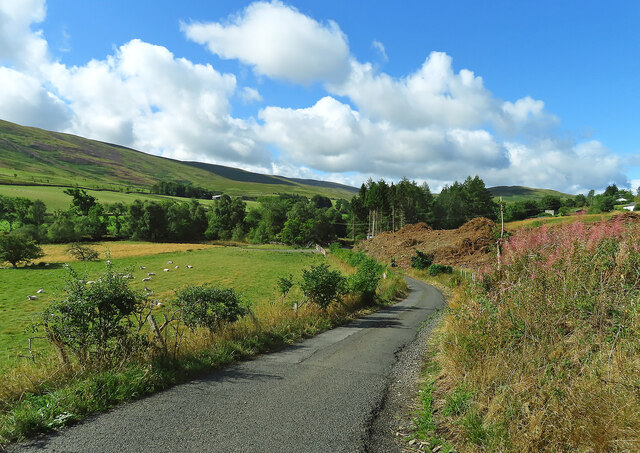
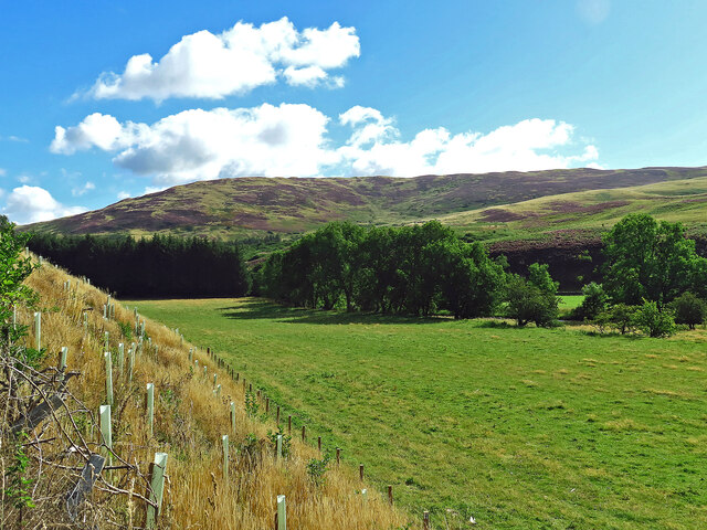
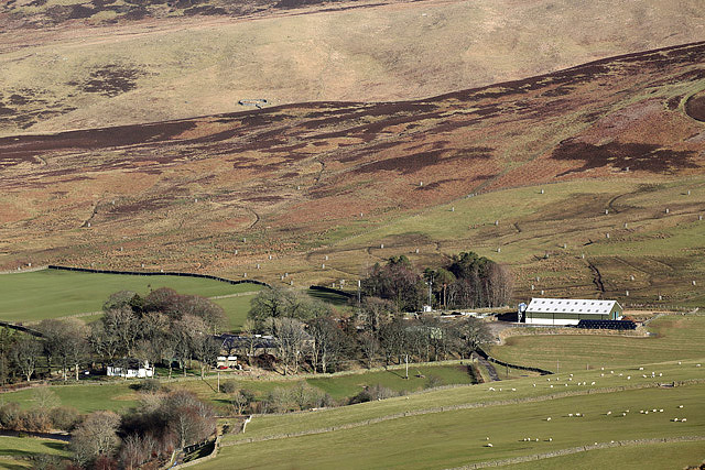
Ministers Moss, Selkirkshire is a picturesque area located in the southern region of Scotland, specifically in the county of Selkirkshire. Situated amidst the breathtaking landscape, it is a part of the larger region called the Downs and Moorland.

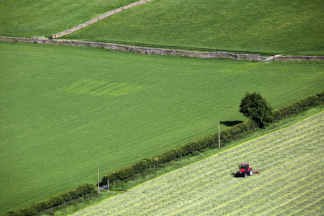
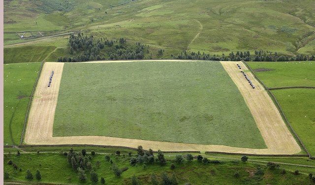
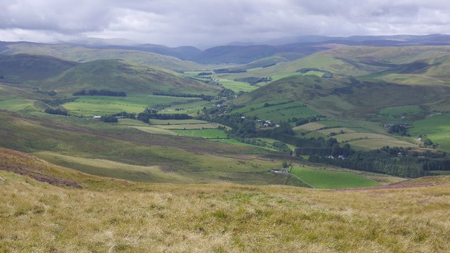
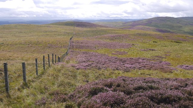
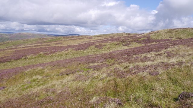
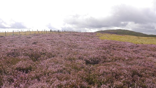
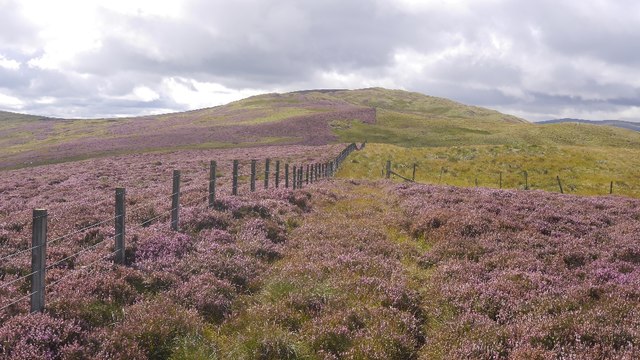
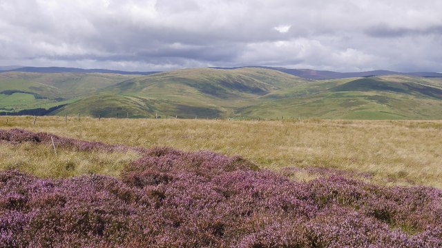
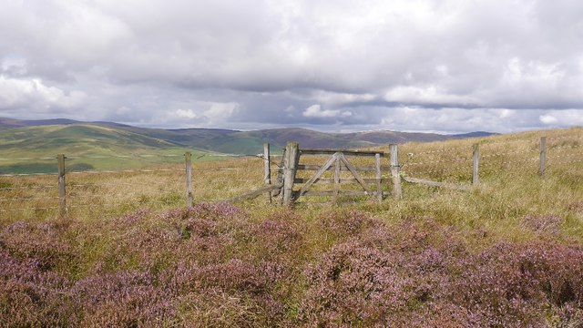
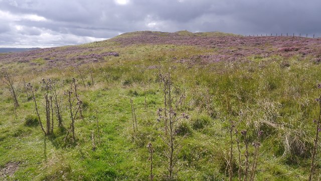
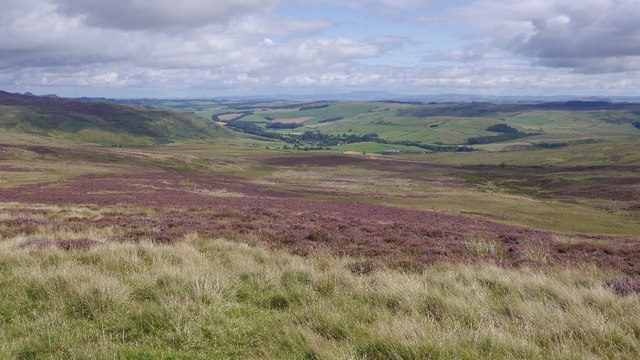
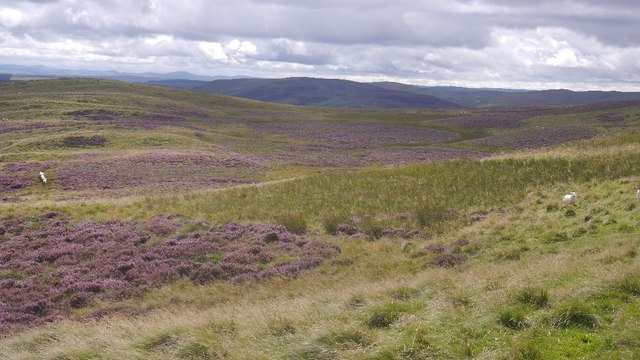
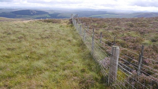
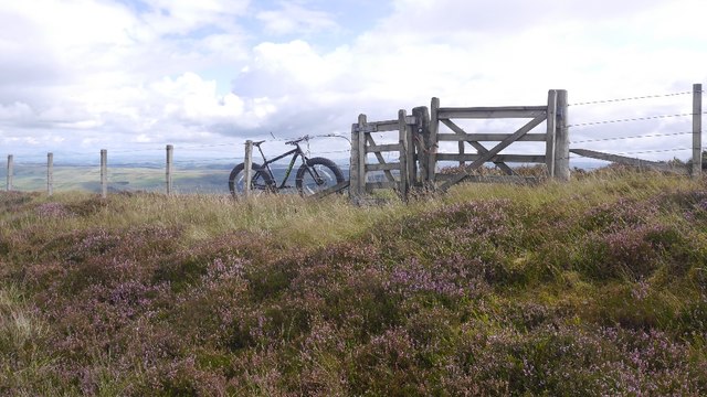
The area is known for its natural beauty, characterized by rolling hills, lush green meadows, and expansive moorlands. It encompasses an impressive area with a diverse range of flora and fauna, making it an ideal destination for nature enthusiasts and outdoor activities.

Ministers Moss is renowned for its tranquil atmosphere, offering a peaceful retreat from the hustle and bustle of city life. It provides ample opportunities for leisurely walks, hiking, and birdwatching, with an array of native bird species frequenting the area.

The region is also home to a variety of plant species, including heather, gorse, and wildflowers, which add vibrant colors to the landscape throughout the year. In addition, the area boasts numerous small streams and rivers that add to its natural charm.

Ministers Moss, Selkirkshire, is relatively secluded, offering visitors a chance to immerse themselves in nature and enjoy the serenity it provides. It is an excellent location for those seeking a peaceful escape, as well as for photographers and artists looking for inspiration in its scenic beauty.

Overall, Ministers Moss, Selkirkshire, is a stunning natural area with its rolling hills, moorlands, and diverse wildlife. It is a must-visit destination for nature lovers and those seeking a tranquil retreat amidst the stunning Scottish landscape.

If you have any feedback on the listing, please let us know in the comments section below.

Ministers Moss Images

Images are sourced within 2km of 55.507193/-3.0324341 or Grid Reference NT3424. Thanks to Geograph Open Source API. All images are credited.

Towards Sundhope The farm access road. There has been some clear-felling here.
Towards Sundhope
The farm access road. There has been some clear-felling here.
Yarrow Feus view Looking across the Yarrow valley towards a heathery Crook Hill.
Yarrow Feus view
Looking across the Yarrow valley towards a heathery Crook Hill.
A low level RAF Tornado in the Yarrow Valley I photographed this Tornado GR4 from Feuars Hill as it made a turn at Sundhope. It was always exciting to watch these frontline jets fly through the valley at almost 500mph and sometimes at 100 feet above ground level. The final Tornado low level sortie through the valley was a 2-ship on 03/12/2018 with ZA614/076 <a href="https://www.geograph.org.uk/photo/7038623">NT2724 : A low flying Tornado GR4 at Ward Law</a> and ZA607/EB-X <a href="https://www.geograph.org.uk/photo/5994704">NT2724 : A low flying RAF Tornado</a>. This aircraft type was withdrawn from RAF service in early 2019.
A low level RAF Tornado in the Yarrow Valley
I photographed this Tornado GR4 from Feuars Hill as it made a turn at Sundhope. It was always exciting to watch these frontline jets fly through the valley at almost 500mph and sometimes at 100 feet above ground level. The final Tornado low level sortie through the valley was a 2-ship on 03/12/2018 with ZA614/076 NT2724 : A low flying Tornado GR4 at Ward Law and ZA607/EB-X NT2724 : A low flying RAF Tornado. This aircraft type was withdrawn from RAF service in early 2019.
Sundhope Farm This farm in the Yarrow Valley was viewed from Eldinhope Knowe in mid-February.
Sundhope Farm
This farm in the Yarrow Valley was viewed from Eldinhope Knowe in mid-February.
Farmland at Sundhope This was viewed in mid-June from Feuars Hill in the Yarrow Valley.
Farmland at Sundhope
This was viewed in mid-June from Feuars Hill in the Yarrow Valley.
Farmland at Sundhope Silage cutting has started in this field on the west side of Sundhope Farm. This was viewed from Feuars Hill.
Farmland at Sundhope
Silage cutting has started in this field on the west side of Sundhope Farm. This was viewed from Feuars Hill.
Yarrow Feus View from Rough Knowe.
Yarrow Feus
View from Rough Knowe.
Fence, Rough Knowe The top strand is electric, but there are the occasional crossing points along this section.
Fence, Rough Knowe
The top strand is electric, but there are the occasional crossing points along this section.
Moorland above Ladhope, Yarrow Looking towards Rough Knowe. Heavy but not desperate going here.
Moorland above Ladhope, Yarrow
Looking towards Rough Knowe. Heavy but not desperate going here.
Ladhope Middle Moorland between Ettrick and Yarrow.
Ladhope Middle
Moorland between Ettrick and Yarrow.
Ladhope Middle A gap in the side fence, but the main ridge fence remains an obstacle (electric).
Ladhope Middle
A gap in the side fence, but the main ridge fence remains an obstacle (electric).
Ladhope Middle View towards the other side of the Yarrow.
Ladhope Middle
View towards the other side of the Yarrow.
Gate, Ladhope Middle A rare break in the electric fence which runs along the ridge.
Gate, Ladhope Middle
A rare break in the electric fence which runs along the ridge.
Sundhope Height A grassy area of the moor with some thistles. Easier going than the heather.
Sundhope Height
A grassy area of the moor with some thistles. Easier going than the heather.
Bleak Burn A moorland bowl above Ettrickdale.
Bleak Burn
A moorland bowl above Ettrickdale.
Minister's Moss Not the stickiest of bogs, but noticeably wetter than the surrounding moorland.
Minister's Moss
Not the stickiest of bogs, but noticeably wetter than the surrounding moorland.
Fences, Sundhope Cairn The south running fence is a double electric - lovely!
Fences, Sundhope Cairn
The south running fence is a double electric - lovely!
Fence junction on Sundhope Height An all important crossing point on the ridge fence.
Fence junction on Sundhope Height
An all important crossing point on the ridge fence.
Show me another place!

Ministers Moss is located at Grid Ref: NT3424 (Lat: 55.507193, Lng: -3.0324341)

Unitary Authority: The Scottish Borders

Police Authority: The Lothians and Scottish Borders

What 3 Words

///indulges.rescuer.ridiculed. Near Ettrick, Scottish Borders

Related Wikis

Selkirkshire

Selkirkshire or the County of Selkirk (Scottish Gaelic: Siorrachd Shalcraig) is a historic county and registration county of Scotland. It borders Peeblesshire...

Kirkhope Tower

Kirkhope Tower is a Scottish Pele, located in the Ettrick Valley, in the historic county of Selkirkshire, now a division of the Scottish Borders. The tower...

Yarrow, Scottish Borders

Yarrow is a place and parish in the Scottish Borders area of Scotland and in the former county of Selkirkshire.The name "Yarrow" may derive from the Celtic...

Ettrickbridge

Ettrickbridge (Scottish Gaelic: Drochaid Eadaraig) is a village situated in the Scottish Borders region of Scotland, 7 miles (11 km) from the nearby town...

Have you been to Ministers Moss?

Leave your review of Ministers Moss below (or comments, questions and feedback).