Wannel Cleuch

Valley in Selkirkshire

Scotland

Wannel Cleuch

Sundhope Farm This farm in the Yarrow Valley was viewed from Eldinhope Knowe in mid-February.
Sundhope Farm Credit: Walter Baxter

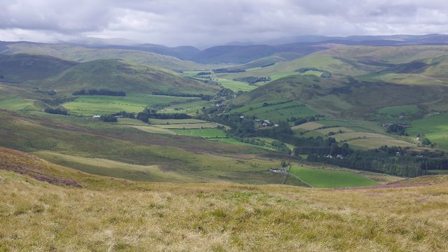
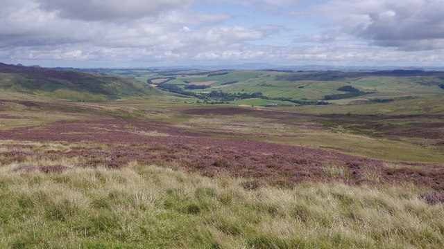
Wannel Cleuch, located in Selkirkshire, Scotland, is a picturesque valley renowned for its natural beauty and historical significance. Nestled within the scenic Southern Uplands, the cleuch stretches for approximately 5 miles, with its gentle slopes and lush greenery offering a serene and idyllic setting for visitors.

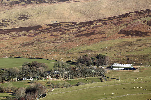
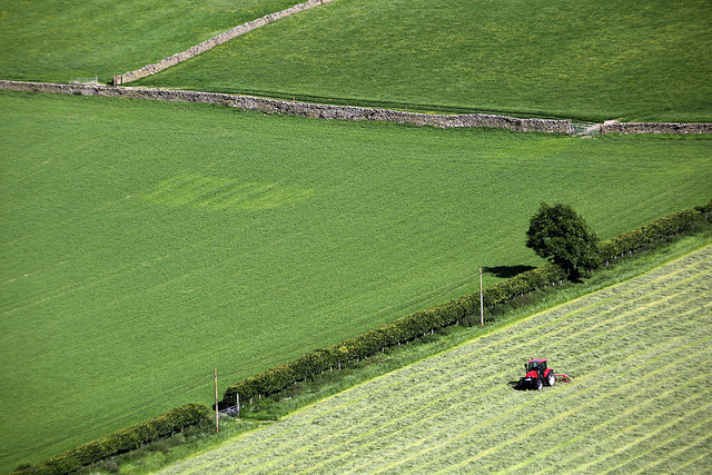
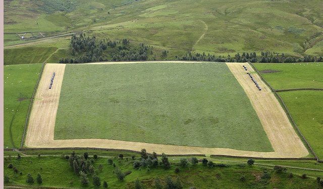
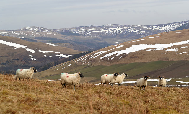
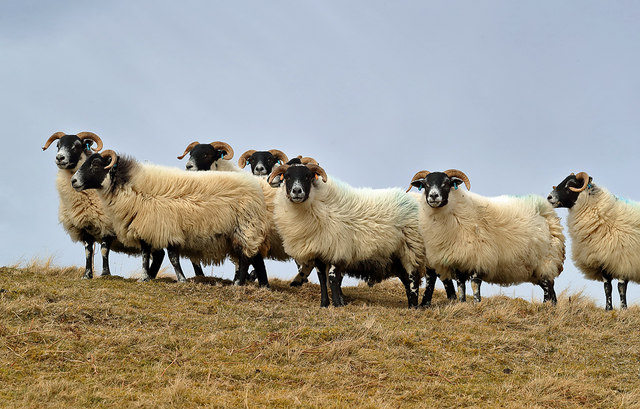
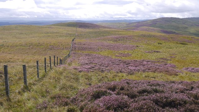
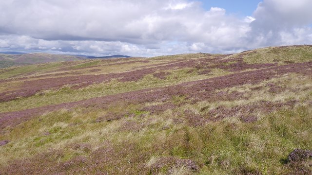
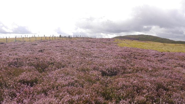
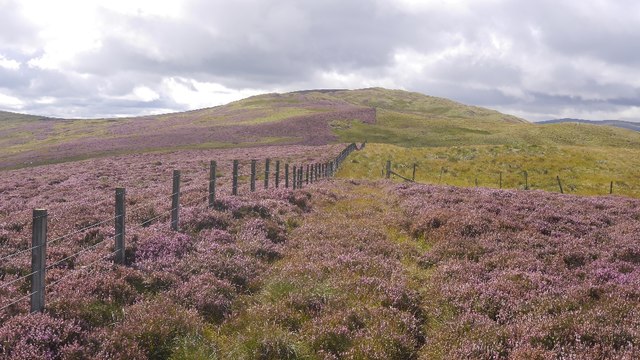
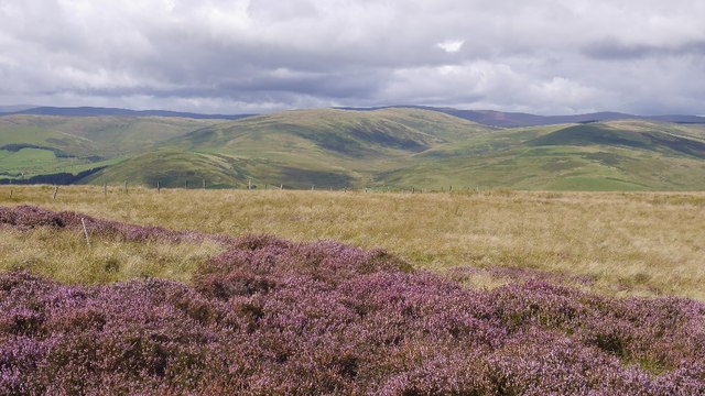
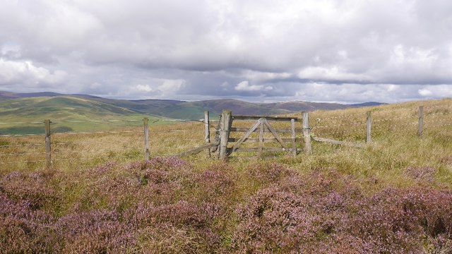
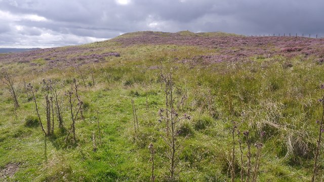
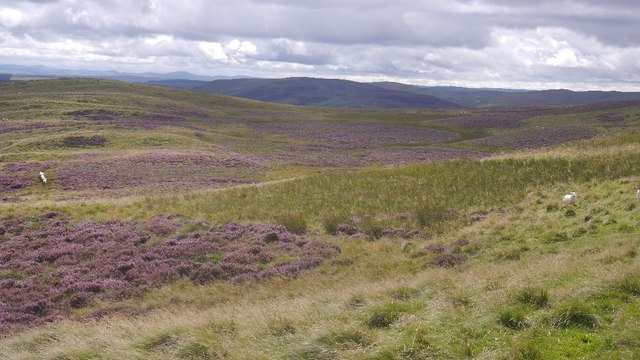
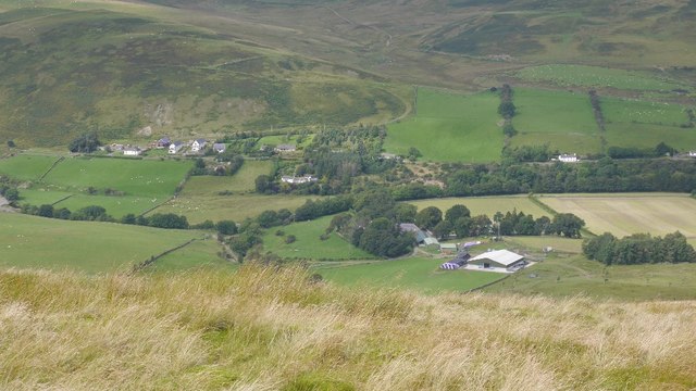
The valley is characterized by its stunning landscape, which includes rolling hills, meandering streams, and dense woodlands. Wannel Cleuch is also dotted with several charming hamlets and farms, adding to its rural charm. The surrounding area is home to a diverse range of flora and fauna, making it a haven for nature enthusiasts and birdwatchers.

Historically, Wannel Cleuch holds great significance as it was a route frequently used by drovers during the 17th and 18th centuries. These drovers would guide their cattle from the Scottish Borders to central markets, traversing the valley's gentle slopes and utilizing its natural resources for sustenance.

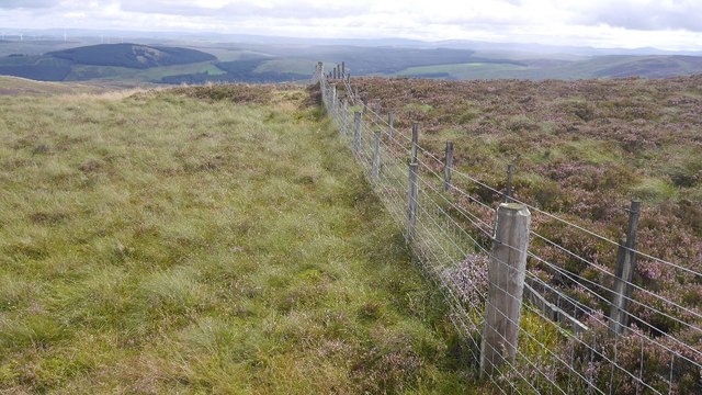
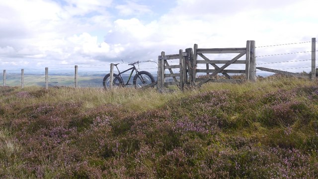
Today, Wannel Cleuch offers a range of outdoor activities, including hiking, cycling, and horseback riding. The valley is crisscrossed by a network of well-maintained trails, providing ample opportunities for exploration and adventure. Visitors can also enjoy picnicking by the streams or simply basking in the tranquility of the surroundings.

In summary, Wannel Cleuch is a captivating valley in Selkirkshire, Scotland, offering a blend of natural beauty, historical significance, and recreational opportunities. Its lush landscapes and peaceful ambience make it a destination to unwind and connect with nature.

If you have any feedback on the listing, please let us know in the comments section below.

Wannel Cleuch Images

Images are sourced within 2km of 55.512746/-3.0420017 or Grid Reference NT3424. Thanks to Geograph Open Source API. All images are credited.

Sundhope Farm This farm in the Yarrow Valley was viewed from Eldinhope Knowe in mid-February.
Sundhope Farm
This farm in the Yarrow Valley was viewed from Eldinhope Knowe in mid-February.
Farmland at Sundhope This was viewed in mid-June from Feuars Hill in the Yarrow Valley.
Farmland at Sundhope
This was viewed in mid-June from Feuars Hill in the Yarrow Valley.
Farmland at Sundhope Silage cutting has started in this field on the west side of Sundhope Farm. This was viewed from Feuars Hill.
Farmland at Sundhope
Silage cutting has started in this field on the west side of Sundhope Farm. This was viewed from Feuars Hill.
Sheep on Feuars Hill in the Yarrow Valley I met the shepherd on the hill who said these ewes will be ready for lambing in two weeks’ time.
Sheep on Feuars Hill in the Yarrow Valley
I met the shepherd on the hill who said these ewes will be ready for lambing in two weeks’ time.
Black-faced ewes on Feuars Hill Sheep normally graze on this hill in the Yarrow Valley but cattle will join them in May after spending the winter inside.
Black-faced ewes on Feuars Hill
Sheep normally graze on this hill in the Yarrow Valley but cattle will join them in May after spending the winter inside.
Yarrow Feus View from Rough Knowe.
Yarrow Feus
View from Rough Knowe.
Fence, Rough Knowe The top strand is electric, but there are the occasional crossing points along this section.
Fence, Rough Knowe
The top strand is electric, but there are the occasional crossing points along this section.
Moorland above Ladhope, Yarrow Looking towards Rough Knowe. Heavy but not desperate going here.
Moorland above Ladhope, Yarrow
Looking towards Rough Knowe. Heavy but not desperate going here.
Ladhope Middle Moorland between Ettrick and Yarrow.
Ladhope Middle
Moorland between Ettrick and Yarrow.
Ladhope Middle A gap in the side fence, but the main ridge fence remains an obstacle (electric).
Ladhope Middle
A gap in the side fence, but the main ridge fence remains an obstacle (electric).
Ladhope Middle View towards the other side of the Yarrow.
Ladhope Middle
View towards the other side of the Yarrow.
Gate, Ladhope Middle A rare break in the electric fence which runs along the ridge.
Gate, Ladhope Middle
A rare break in the electric fence which runs along the ridge.
Sundhope Height A grassy area of the moor with some thistles. Easier going than the heather.
Sundhope Height
A grassy area of the moor with some thistles. Easier going than the heather.
Bleak Burn A moorland bowl above Ettrickdale.
Bleak Burn
A moorland bowl above Ettrickdale.
Minister's Moss Not the stickiest of bogs, but noticeably wetter than the surrounding moorland.
Minister's Moss
Not the stickiest of bogs, but noticeably wetter than the surrounding moorland.
Fences, Sundhope Cairn The south running fence is a double electric - lovely!
Fences, Sundhope Cairn
The south running fence is a double electric - lovely!
Fence junction on Sundhope Height An all important crossing point on the ridge fence.
Fence junction on Sundhope Height
An all important crossing point on the ridge fence.
Sundhope View from Sundhope Height to the south.
Sundhope
View from Sundhope Height to the south.
Show me another place!

Wannel Cleuch is located at Grid Ref: NT3424 (Lat: 55.512746, Lng: -3.0420017)

Unitary Authority: The Scottish Borders

Police Authority: The Lothians and Scottish Borders

What 3 Words

///angry.landlady.only. Near Innerleithen, Scottish Borders

Related Wikis

Selkirkshire

Selkirkshire or the County of Selkirk (Scottish Gaelic: Siorrachd Shalcraig) is a historic county and registration county of Scotland. It borders Peeblesshire...

Yarrow, Scottish Borders

Yarrow is a place and parish in the Scottish Borders area of Scotland and in the former county of Selkirkshire.The name "Yarrow" may derive from the Celtic...

Kirkhope Tower

Kirkhope Tower is a Scottish Pele, located in the Ettrick Valley, in the historic county of Selkirkshire, now a division of the Scottish Borders. The tower...

Ettrickbridge

Ettrickbridge (Scottish Gaelic: Drochaid Eadaraig) is a village situated in the Scottish Borders region of Scotland, 7 miles (11 km) from the nearby town...

Nearby Amenities

Located within 500m of 55.512746,-3.0420017
Wannel Cairn
Man Made: cairn
Lat/Long: 55.5125803/-3.0360776
The data included in this document is from www.openstreetmap.org. The data is made available under ODbL.

Have you been to Wannel Cleuch?

Leave your review of Wannel Cleuch below (or comments, questions and feedback).