Bailbrook

Settlement in Somerset

England

Bailbrook

Balloons over Bath
Balloons over Bath Credit: Anthony Parkes

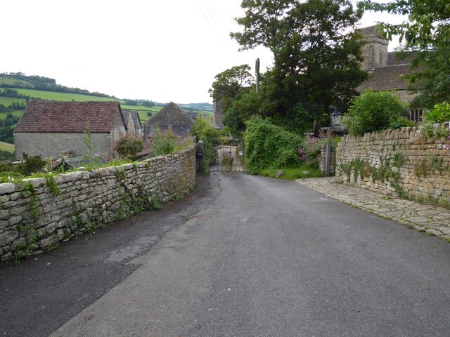
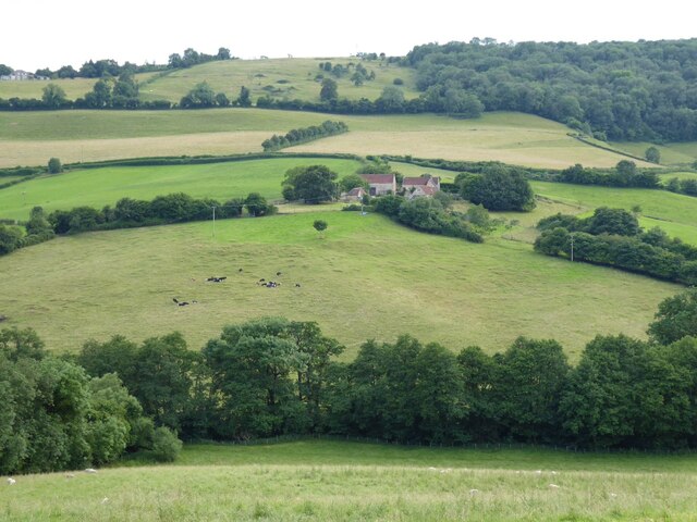
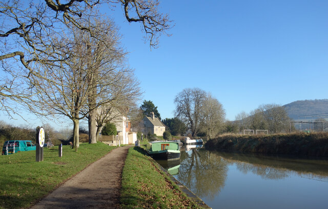
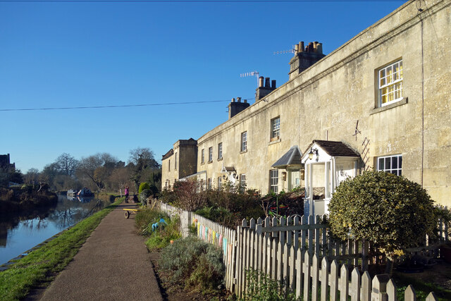
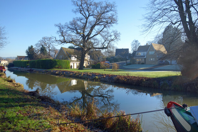
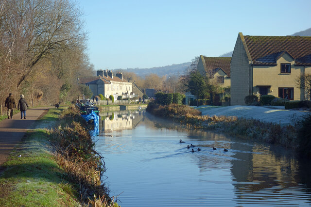
Bailbrook is a small village located in the county of Somerset, England. Situated just a few miles east of the city of Bath, Bailbrook is known for its picturesque setting and historical significance. The village is surrounded by rolling hills and lush green countryside, offering residents and visitors a tranquil and scenic environment.

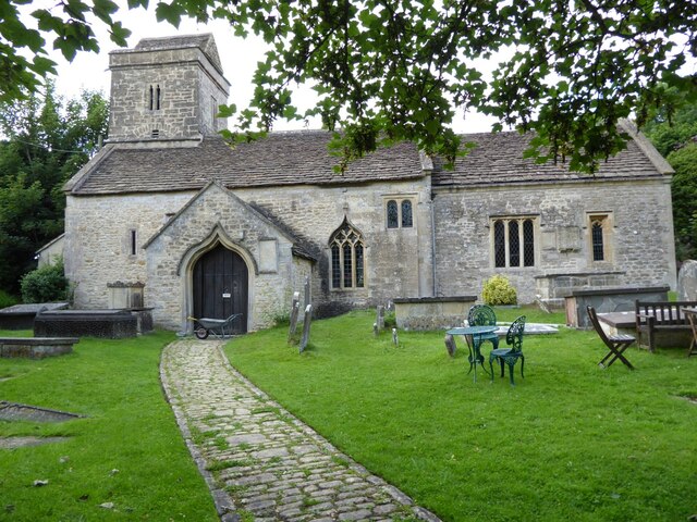
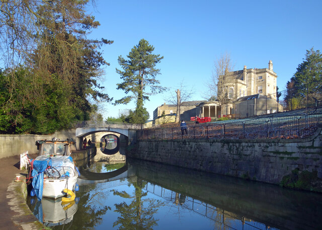
One of the notable landmarks in Bailbrook is Bailbrook House, a magnificent Georgian mansion that has been converted into a hotel. The house was originally built in the late 18th century and is renowned for its elegant architecture and stunning grounds. It is a popular destination for weddings, conferences, and special events.

In addition to its historical charm, Bailbrook also offers convenient access to the city of Bath, which is famous for its Roman-built baths and Georgian architecture. Bath is a UNESCO World Heritage site and attracts millions of tourists each year. Visitors to Bailbrook can easily explore the city's numerous attractions, including the Roman Baths, Bath Abbey, and the Jane Austen Centre.

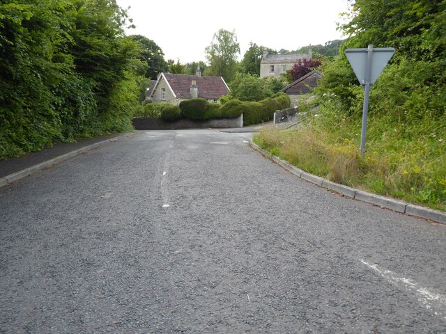
Bailbrook is also well-connected to the rest of Somerset and beyond. The village has good transport links, with the M4 motorway just a short drive away, providing easy access to Bristol, London, and other major cities. The nearby Bath Spa railway station offers regular train services to various destinations across the country.

Overall, Bailbrook offers a charming and peaceful village setting, with its historical landmarks, beautiful surroundings, and convenient location making it an attractive place to live or visit in Somerset.

If you have any feedback on the listing, please let us know in the comments section below.
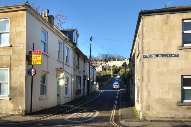
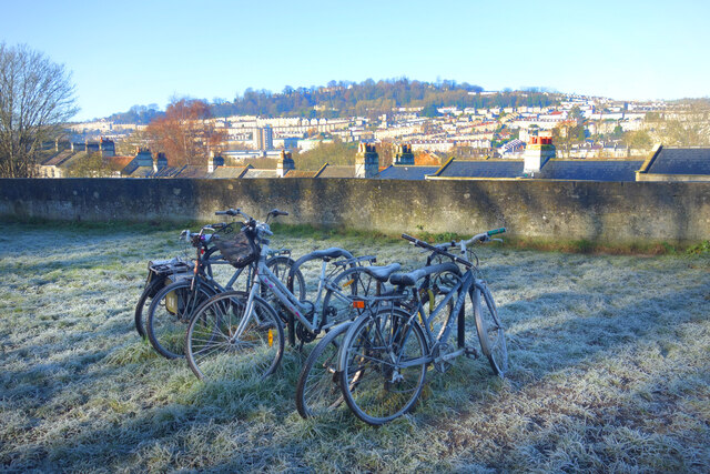
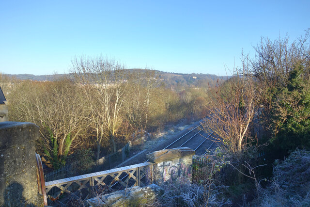
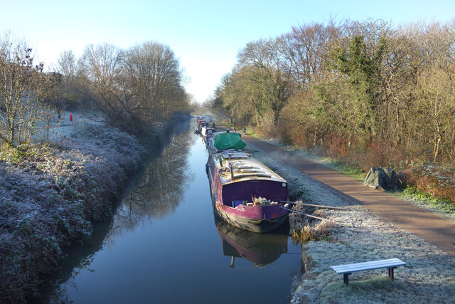
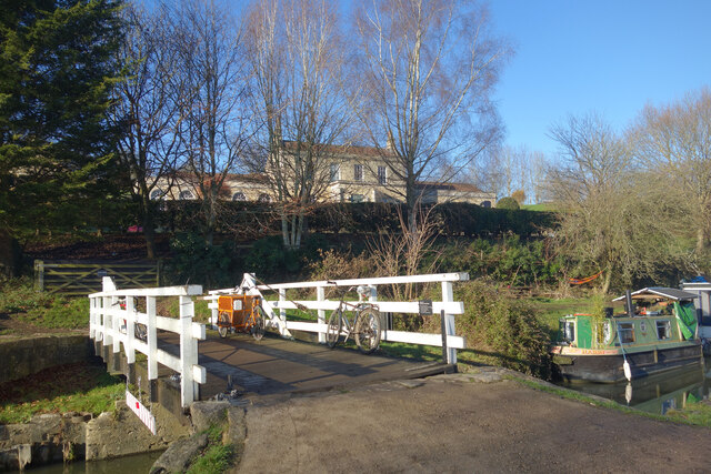
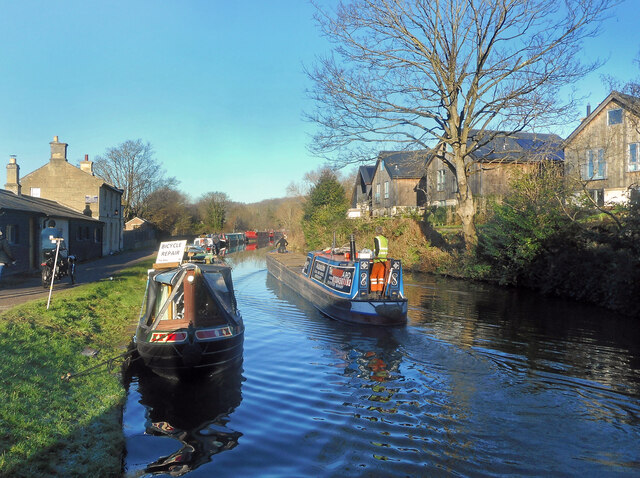
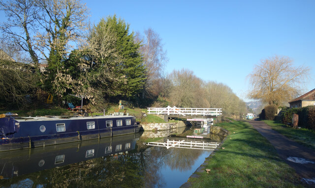
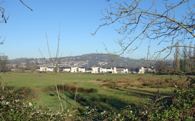
Bailbrook Images

Images are sourced within 2km of 51.401853/-2.337077 or Grid Reference ST7667. Thanks to Geograph Open Source API. All images are credited.

Balloons over Bath
Balloons over Bath
Upper Swainswick church Upper Swainswick church is dedicated to st Mary and is Grade II* listed, see: <span class="nowrap"><a title="https://historicengland.org.uk/listing/the-list/list-entry/1232679?section=official-listing" rel="nofollow ugc noopener" href="https://historicengland.org.uk/listing/the-list/list-entry/1232679?section=official-listing">Link</a><img style="margin-left:2px;" alt="External link" title="External link - shift click to open in new window" src="https://s1.geograph.org.uk/img/external.png" width="10" height="10"/></span>
Upper Swainswick church
Upper Swainswick church is dedicated to st Mary and is Grade II* listed, see: LinkExternal link
The road outside Upper Swainswick church The road outside Upper Swainswick church, the tower of the church can be seen on the right through the trees.
The road outside Upper Swainswick church
The road outside Upper Swainswick church, the tower of the church can be seen on the right through the trees.
Road entering Upper Swainswick The road entering the village of Upper Swainswick from the A49 junction.
Road entering Upper Swainswick
The road entering the village of Upper Swainswick from the A49 junction.
Farmland at Upper Swainswick View across the valley at Upper Swainswick to Crossleaze Farm.
Farmland at Upper Swainswick
View across the valley at Upper Swainswick to Crossleaze Farm.
Upper East Hayes A small residential street going uphill from London Road.
Upper East Hayes
A small residential street going uphill from London Road.
Frosty Bikes by the Canal A scene along the Kennet & Avon Canal towpath on a cold January morning.
Frosty Bikes by the Canal
A scene along the Kennet & Avon Canal towpath on a cold January morning.
Looking down on the Railway Canal and railway are side by side along here, with the canal up on an embankment quite a bit higher than the trains.
Looking down on the Railway
Canal and railway are side by side along here, with the canal up on an embankment quite a bit higher than the trains.
Canal on a Cold Morning A lovely crisp winter morning along the Kennet & Avon Canal.
Canal on a Cold Morning
A lovely crisp winter morning along the Kennet & Avon Canal.
The K&A Canal at Sydney Gardens When built, the canal was required to be as unobtrusive as possible through this fashionable part of Bath.
The K&A Canal at Sydney Gardens
When built, the canal was required to be as unobtrusive as possible through this fashionable part of Bath.
Kennet & Avon Canal at Bathampton
Canal Terrace, Bathampton A terrace of early 19th century canalside houses.
Canal Terrace, Bathampton
A terrace of early 19th century canalside houses.
Kennet Park, Bathampton Houses near the Kennet & Avon Canal.
Kennet Park, Bathampton
Houses near the Kennet & Avon Canal.
Bikes on the Bridge Bathampton Swing Bridge over the Kennet & Avon Canal with Holcombe Villa in the background.
Bikes on the Bridge
Bathampton Swing Bridge over the Kennet & Avon Canal with Holcombe Villa in the background.
Cruising on a fine morning A cloudless winter's day on the Kennet & Avon Canal in Bath. The moored boat on the left offers bicycle repairs.
Cruising on a fine morning
A cloudless winter's day on the Kennet & Avon Canal in Bath. The moored boat on the left offers bicycle repairs.
K&A Canal near Bathampton At Bathampton Swing Bridge.
K&A Canal near Bathampton
At Bathampton Swing Bridge.
Avon Valley near Bathampton A view across the valley towards Bathford. The Avon is on the other side of the nearer buildings.
Avon Valley near Bathampton
A view across the valley towards Bathford. The Avon is on the other side of the nearer buildings.
The Canal at Bathampton The Kennet & Avon Canal on a wintry morning.
The Canal at Bathampton
The Kennet & Avon Canal on a wintry morning.
Show me another place!

Bailbrook is located at Grid Ref: ST7667 (Lat: 51.401853, Lng: -2.337077)

Unitary Authority: Bath and North East Somerset

Police Authority: Avon and Somerset

What 3 Words

///miss.gender.universally. Near Bathford, Somerset

Related Wikis

Lam Brook

The Lam Brook is a stream in the West Country of England, which rises in a number of springs on the southern end of the Cotswold Hills and runs in a generally...

Bathampton Toll Bridge

Bathampton Toll Bridge is an arch bridge in England, carrying a minor road across the River Avon near Bathampton, to the east of Bath. It is a Grade II...

Rondo Theatre

The Rondo Theatre, in Bath, was established in 1989. The theatre is located in the former church hall of St. Saviours Church, Larkhall. The building was...

Larkhall, Bath

Larkhall is a district in the city of Bath, England, north-east of the city centre. The district began to develop in the early 19th century to house the...

Larkhall Athletic F.C.

Larkhall Athletic Football Club is a football club based in the Larkhall area of Bath, Somerset, England. Affiliated to the Somerset County FA, they are...

Solsbury Hill

Little Solsbury Hill (more commonly known as Solsbury Hill) is a small flat-topped hill and the site of an Iron Age hill fort, above the village of Batheaston...

St Saviour's Church, Bath

St Saviour's Church is a Church of England parish church in Larkhall, Bath, Somerset England. The church was founded by Archdeacon Charles Moysey in 1824...

Grosvenor Place, Bath

Grosvenor Place in Bath, Somerset, England was built around 1790 by John Eveleigh. It lies on the south side of the A4 London Road and many of the houses...

Nearby Amenities

Located within 500m of 51.401853,-2.337077
Traffic Signals
Traffic Signals: signal
Traffic Signals Direction: forward
Lat/Long: 51.3984512/-2.337224
Traffic Signals
Traffic Signals: signal
Traffic Signals Direction: forward
Lat/Long: 51.3980716/-2.3365986
Traffic Signals
Traffic Signals: signal
Traffic Signals Direction: forward
Lat/Long: 51.3990471/-2.3368218
Post Box
Mapillary: 357359362866908
Post Box Type: pillar
Survey Date: 2022-04-18
Lat/Long: 51.4008395/-2.3415457
Post Box
Ref: BA1 269
Lat/Long: 51.4027496/-2.3374264
Turning Circle
Lat/Long: 51.400626/-2.3433113
Traffic Signals
Traffic Signals: signal
Traffic Signals Direction: forward
Lat/Long: 51.3987392/-2.3362945
Crossing
Crossing: traffic_signals
Crossing Ref: pelican
Tactile Paving: yes
Traffic Signals Sound: no
Traffic Signals Vibration: no
Lat/Long: 51.3988946/-2.3361607
Barrier: cycle_barrier
Lat/Long: 51.4009208/-2.3427312
Crossing
Button Operated: yes
Crossing: traffic_signals
Crossing Ref: pelican
Tactile Paving: yes
Traffic Signals Sound: no
Traffic Signals Vibration: no
Lat/Long: 51.3983374/-2.3361051
Crossing
Crossing: traffic_signals
Crossing Ref: pelican
Tactile Paving: yes
Traffic Signals Sound: no
Traffic Signals Vibration: no
Lat/Long: 51.3988906/-2.3373619
Crossing
Crossing: traffic_signals
Crossing Ref: pelican
Tactile Paving: yes
Traffic Signals Sound: no
Traffic Signals Vibration: no
Lat/Long: 51.3990167/-2.3367982
Crossing
Button Operated: yes
Crossing: traffic_signals
Crossing Ref: pelican
Tactile Paving: yes
Traffic Signals Sound: no
Traffic Signals Vibration: no
Lat/Long: 51.3981042/-2.3366375
Barrier: kissing_gate
Lat/Long: 51.4036956/-2.3318416
Bus Stop
Bladuds Head
Bench: yes
Bus: yes
Naptan AtcoCode: 0180BAC30533
Naptan Bearing: N
Naptan CommonName: Bladuds Head
Naptan Crossing: Brooklyn Road
Naptan NaptanCode: bthmaga
Naptan PlusbusZoneRef: BATHSPA
Naptan Street: St Saviour's Road
Naptan Verified: no
Public Transport: platform
Shelter: yes
Source: naptan_import
Tactile Paving: no
Lat/Long: 51.4010105/-2.3441197
Bus Stop
Bailbrook House
Bench: no
Bus: yes
Naptan AtcoCode: 0180BAC30541
Naptan Bearing: NE
Naptan CommonName: Bailbrook House
Naptan NaptanCode: bthmapt
Naptan PlusbusZoneRef: BATHSPA
Naptan Street: London Road West
Naptan Verified: no
Public Transport: platform
Shelter: no
Source: naptan_import
Tactile Paving: no
Lat/Long: 51.3995723/-2.3346358
Bus Stop
Clarence Gardens
Bench: no
Bus: yes
Naptan AtcoCode: 0180BAC30542
Naptan Bearing: NE
Naptan CommonName: Clarence Gardens
Naptan NaptanCode: bthmawt
Naptan PlusbusZoneRef: BATHSPA
Naptan Street: London Road West
Naptan Verified: no
Public Transport: platform
Shelter: no
Source: naptan_import
Tactile Paving: no
Lat/Long: 51.4011474/-2.3309384
Bus Stop
Bailbrook House
Bench: no
Bus: yes
Naptan AtcoCode: 0180BAC30573
Naptan Bearing: SW
Naptan CommonName: Bailbrook House
Naptan NaptanCode: bthmatw
Naptan PlusbusZoneRef: BATHSPA
Naptan Street: London Road West
Naptan Verified: no
Public Transport: platform
Shelter: no
Source: naptan_import
Tactile Paving: no
Lat/Long: 51.4000709/-2.3332019
Bus Stop
Elm Grove
Bench: no
Bus: yes
Naptan AtcoCode: 0180BAC30640
Naptan Bearing: W
Naptan CommonName: Elm Grove
Naptan Crossing: Gloucester Road
Naptan NaptanCode: bthmajt
Naptan PlusbusZoneRef: BATHSPA
Naptan Street: Elm Grove
Naptan Verified: no
Public Transport: platform
Shelter: no
Source: naptan_import
Tactile Paving: no
Lat/Long: 51.3999394/-2.3414091
Bus Stop
Elm Grove
Bus: yes
Naptan AtcoCode: 0180BAC30641
Naptan Bearing: N
Naptan CommonName: Elm Grove
Naptan Crossing: Fuller Road
Naptan NaptanCode: bthmajp
Naptan PlusbusZoneRef: BATHSPA
Naptan Street: Gloucester Road
Naptan Verified: no
Public Transport: platform
Source: naptan_import
Lat/Long: 51.4003617/-2.3414985
Bus Stop
Bailbrook Lane
Bus: yes
Naptan AtcoCode: 0180BAC30642
Naptan Bearing: SE
Naptan CommonName: Bailbrook Lane
Naptan Crossing: Bailbrook Lane
Naptan NaptanCode: bthmajm
Naptan PlusbusZoneRef: BATHSPA
Naptan Street: Gloucester Road
Naptan Verified: no
Public Transport: platform
Source: naptan_import
Lat/Long: 51.4022674/-2.341714
Bus Stop
Bailbrook Lane
Bus: yes
Naptan AtcoCode: 0180BAC30643
Naptan Bearing: SW
Naptan CommonName: Bailbrook Lane
Naptan Crossing: Gloucester Road
Naptan NaptanCode: bthmajg
Naptan PlusbusZoneRef: BATHSPA
Naptan Street: Ferndale Road
Naptan Verified: no
Public Transport: platform
Source: naptan_import
Lat/Long: 51.4022131/-2.3418286
Barrier: cycle_barrier
Lat/Long: 51.4018688/-2.3421511
Barrier: bollard
Lat/Long: 51.4043867/-2.3400054
Crossing
Button Operated: yes
Crossing: traffic_signals
Crossing Ref: pelican
Tactile Paving: yes
Traffic Signals Sound: no
Traffic Signals Vibration: no
Lat/Long: 51.3984478/-2.3374413
Traffic Signals
Traffic Signals: signal
Traffic Signals Direction: forward
Lat/Long: 51.3982776/-2.3366131
Crossing
Crossing: traffic_signals
Crossing Ref: pelican
Tactile Paving: yes
Traffic Signals Sound: no
Traffic Signals Vibration: no
Lat/Long: 51.3987628/-2.3361235
Crossing
Button Operated: yes
Crossing: traffic_signals
Crossing Ref: pelican
Tactile Paving: yes
Traffic Signals Sound: no
Traffic Signals Vibration: no
Lat/Long: 51.398251/-2.3374189
Traffic Signals
Traffic Signals: signal
Traffic Signals Direction: forward
Lat/Long: 51.3984163/-2.3374693
Traffic Signals
Traffic Signals: signal
Traffic Signals Direction: forward
Lat/Long: 51.398791/-2.3360946
Traffic Signals
Traffic Signals: signal
Traffic Signals Direction: forward
Lat/Long: 51.3989066/-2.3368569
Motorway Junction
London Road Junction
Lat/Long: 51.4022885/-2.3385406
Addr City: Bath
Addr Housenumber: 77
Addr Street: Bailbrook Lane
Lat/Long: 51.4029119/-2.3373406
Addr City: Bath
Addr Housenumber: 110
Addr Street: Bailbrook Lane
Lat/Long: 51.4027932/-2.336485
Addr City: Bath
Addr Housenumber: Post Box Cottage, 75
Addr Street: Bailbrook Lane
Lat/Long: 51.4028183/-2.3374023
Addr City: Bath
Addr Housenumber: 35
Addr Street: Bailbrook Lane
Lat/Long: 51.4027948/-2.3376719
Addr City: Bath
Addr Housenumber: 75A
Addr Street: Bailbrook Lane
Lat/Long: 51.4028701/-2.3373728
Addr City: Bath
Addr Housenumber: 111
Addr Street: Bailbrook Lane
Lat/Long: 51.4027605/-2.3363402
Addr City: Bath
Addr Housenumber: 111
Addr Street: Bailbrook Lane
Lat/Long: 51.4027747/-2.3364045
Addr City: Bath
Addr Housenumber: 113
Addr Street: Bailbrook Lane
Lat/Long: 51.4027538/-2.3362584
Bailbrook
Name Be: Бейлбрук
Name En: Bailbrook
Name Ru: Бейлбрук
Name Uk: Бейлбрук
Place: suburb
Lat/Long: 51.4021134/-2.3336368
Traffic Calming: rumble_strip
Lat/Long: 51.4008185/-2.3316628
Man Made: surveillance
Surveillance: public
Surveillance Type: camera
Lat/Long: 51.3980572/-2.3377808
Man Made: surveillance
Surveillance: public
Surveillance Type: camera
Lat/Long: 51.398358/-2.3372544
Kitchen
Larkhall School Meals And Community Meals Kitchen
Addr Postcode: BA1 6TD
Disused Fhrs Id: 205433
Lat/Long: 51.4018825/-2.3426753
Bench
Lat/Long: 51.3989799/-2.33989
Bench
Lat/Long: 51.3990972/-2.3398308
Bench
Lat/Long: 51.3992192/-2.3395521
Man Made: flagpole
Lat/Long: 51.3983826/-2.3405389
Bench
Lat/Long: 51.4008647/-2.3437179
Leisure: picnic_table
Lat/Long: 51.4010036/-2.3437702
Waste Basket
Lat/Long: 51.4004932/-2.3438695
Waste Basket
Lat/Long: 51.4009894/-2.3441193
Bench
Lat/Long: 51.3991883/-2.3394046
Bench
Backrest: yes
Lat/Long: 51.3984419/-2.3404816
Waste Basket
Lat/Long: 51.3987791/-2.3395535
Bench
Backrest: yes
Lat/Long: 51.3984863/-2.3403689
Bench
Backrest: yes
Lat/Long: 51.3983992/-2.3406049
Bench
Backrest: yes
Lat/Long: 51.3985323/-2.3402455
Bench
Backrest: yes
Lat/Long: 51.398359/-2.3407149
Bench
Lat/Long: 51.3990753/-2.3392612
Bench
Backrest: yes
Lat/Long: 51.3985741/-2.3401235
Waste Basket
Lat/Long: 51.3982436/-2.3406277
Bench
Lat/Long: 51.3984135/-2.3390654
Waste Basket
Lat/Long: 51.3983866/-2.3391123
Bench
Backrest: yes
Lat/Long: 51.4026318/-2.3387643
Waste Basket
Lat/Long: 51.4026543/-2.3387429
The data included in this document is from www.openstreetmap.org. The data is made available under ODbL.

Have you been to Bailbrook?

Leave your review of Bailbrook below (or comments, questions and feedback).