Baildon

Settlement in Yorkshire

England

Baildon

Potter Brow Road, Baildon Moor
Potter Brow Road, Baildon Moor Credit: habiloid

Baildon is a charming town located in the metropolitan borough of Bradford, in the county of West Yorkshire, England. Situated on the southern slopes of the beautiful Baildon Moor, this picturesque settlement offers breathtaking views of the surrounding countryside. With a population of around 16,000 residents, Baildon retains a strong sense of community and a friendly atmosphere.

The town is well-known for its rich history, dating back to the medieval period when it was a thriving agricultural community. Today, Baildon seamlessly blends its historical heritage with modern amenities, making it an attractive place to live and visit. The architecture in Baildon is diverse, ranging from quaint cottages to elegant Victorian residences.

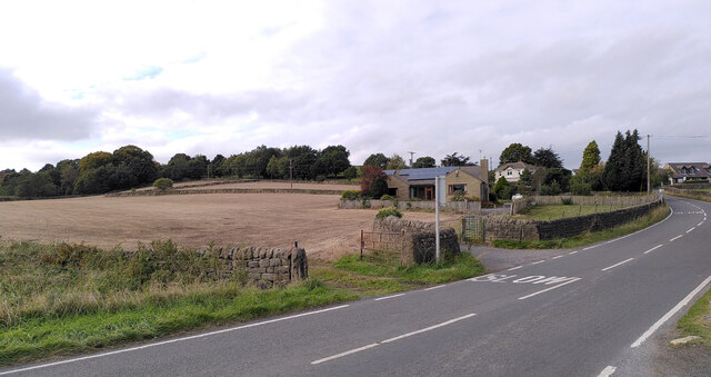
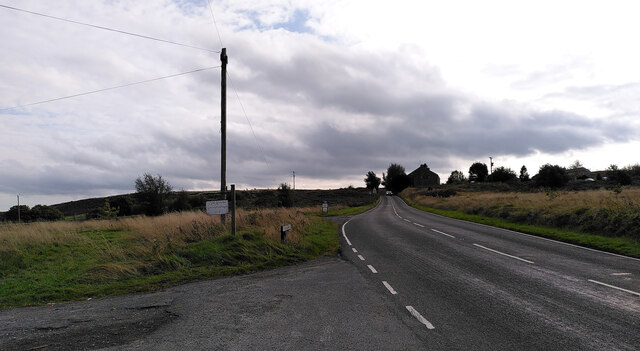
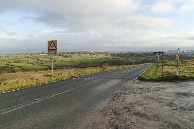
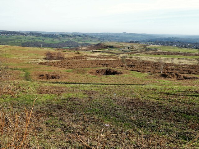
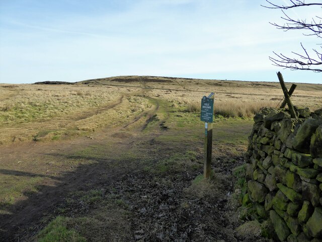
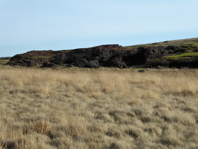
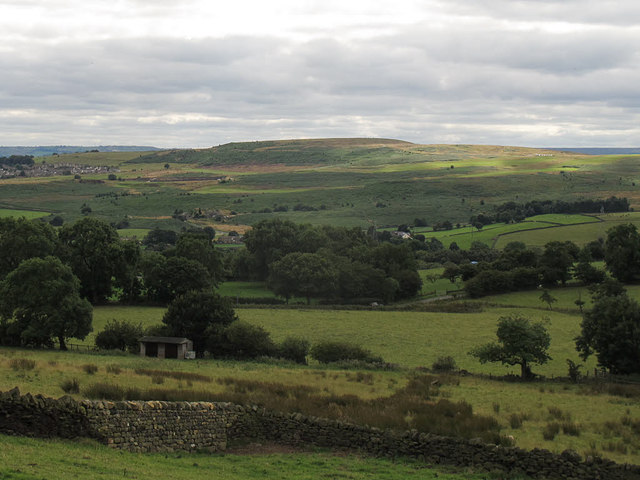
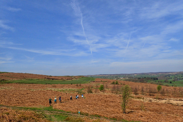
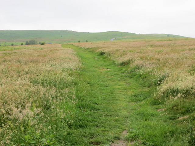
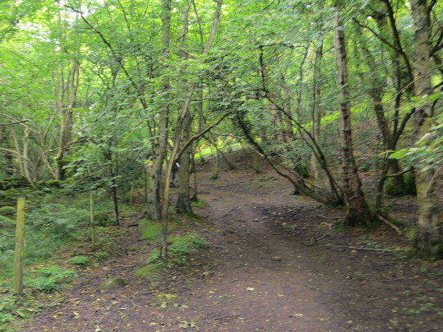
Nature lovers are drawn to Baildon's stunning landscape, which includes the expansive Baildon Moor. This area of natural beauty offers ample opportunities for outdoor activities such as hiking, cycling, and birdwatching. Baildon also boasts several well-maintained parks and green spaces, providing residents with peaceful places to relax and enjoy nature.

The town's vibrant social scene revolves around its community events and local establishments. The annual Baildon Carnival is a highlight, attracting visitors from near and far. Additionally, Baildon hosts a variety of independent shops, cafes, and restaurants, offering residents and visitors a diverse range of choices.

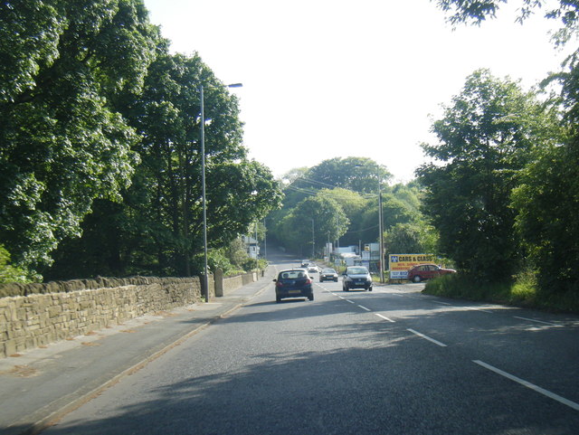
Baildon's convenient location allows for easy access to nearby cities such as Bradford and Leeds. Excellent transportation links, including a railway station and bus services, make commuting and exploring the wider region hassle-free.

In summary, Baildon is a quaint and friendly town nestled amidst the stunning Yorkshire countryside. Its rich history, beautiful surroundings, and strong sense of community make it an appealing destination for both residents and visitors alike.

If you have any feedback on the listing, please let us know in the comments section below.
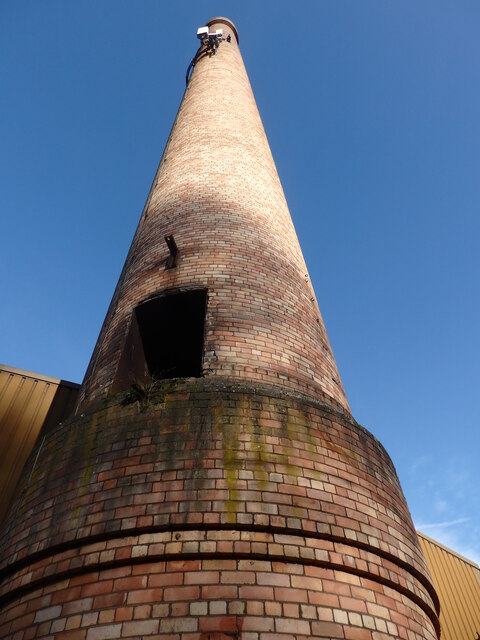
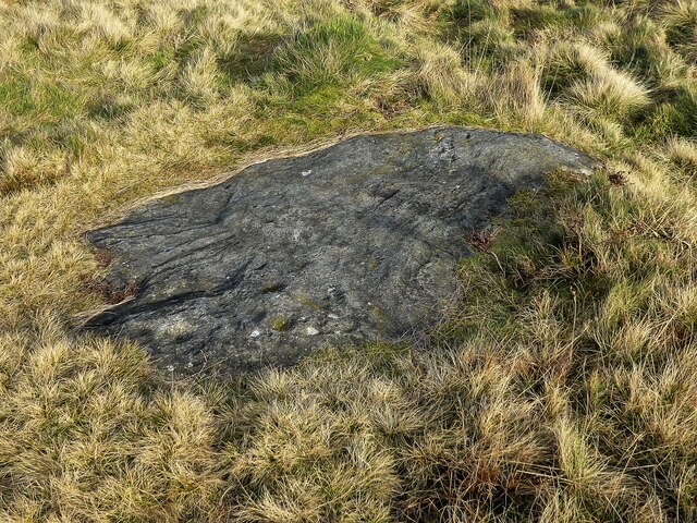
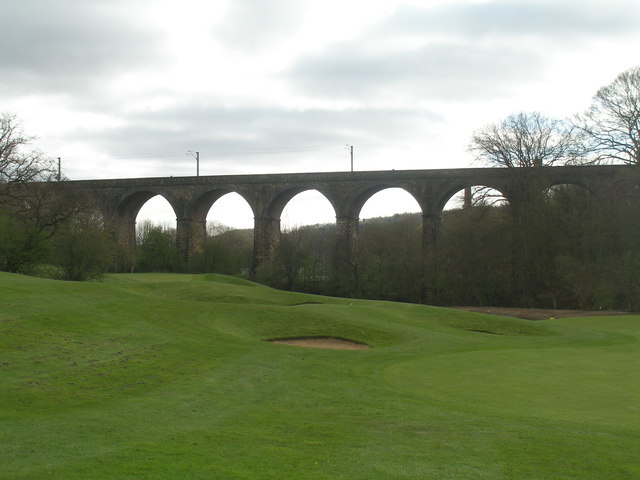
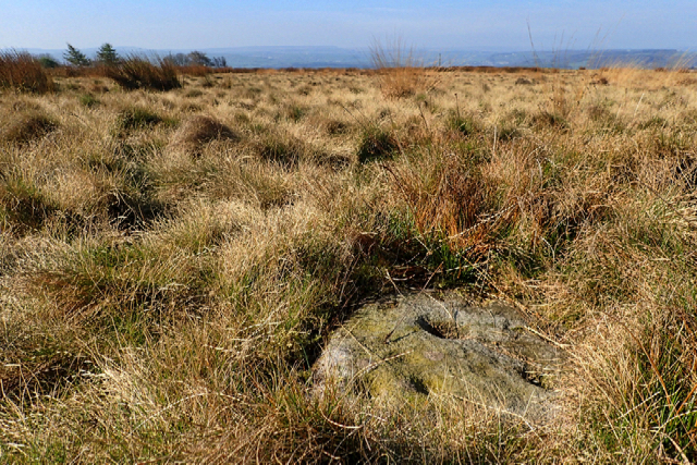
Baildon Images

Images are sourced within 2km of 53.85105/-1.763586 or Grid Reference SE1539. Thanks to Geograph Open Source API. All images are credited.

Potter Brow Road, Baildon Moor
Hawksworth Road, Baildon Moor
Bingley Road, Baildon Moor Approaching the bends near Baildon Golf Club.
Bingley Road, Baildon Moor
Approaching the bends near Baildon Golf Club.
Denbirayne Chimney, Tong Park Industrial Estate, Baildon See <a href="https://www.geograph.org.uk/photo/6887736">SE1640 : The Denbirayne chimney</a> for another view and a brief history. Also see <a href="https://www.geograph.org.uk/photo/7096458">SE1640 : Looking Up the Denbirayne Chimney, Tong Park Industrial Estate, Baildon</a> for a much closer view. Tong Park railway viaduct is in the distance.
Denbirayne Chimney, Tong Park Industrial Estate, Baildon
See SE1640 : The Denbirayne chimney for another view and a brief history. Also see SE1640 : Looking Up the Denbirayne Chimney, Tong Park Industrial Estate, Baildon for a much closer view. Tong Park railway viaduct is in the distance.
Looking Up the Denbirayne Chimney, Tong Park Industrial Estate, Baildon I almost fell over backwards taking this image, but it was something I just had to do. See <a href="https://www.geograph.org.uk/photo/7084813">SE1640 : Denbirayne Chimney, Tong Park Industrial Estate, Baildon</a> for a more distant view.
Looking Up the Denbirayne Chimney, Tong Park Industrial Estate, Baildon
I almost fell over backwards taking this image, but it was something I just had to do. See SE1640 : Denbirayne Chimney, Tong Park Industrial Estate, Baildon for a more distant view.
Old Bell Pit remains View from the bridleway to Dobrudden with the disused Baildon reservoir embankments beyond the pit hollows
Old Bell Pit remains
View from the bridleway to Dobrudden with the disused Baildon reservoir embankments beyond the pit hollows
Bridleway to Baildon Hill At the corner of Dobrudden Caravan Park where bridleways cross one another, with Baildon Hill ahead.
Bridleway to Baildon Hill
At the corner of Dobrudden Caravan Park where bridleways cross one another, with Baildon Hill ahead.
The Cinder Caves An old tip of furnace type waste on Baildon Moor that appears like a lava flow  with hollows and 'caves'.
The Cinder Caves
An old tip of furnace type waste on Baildon Moor that appears like a lava flow with hollows and 'caves'.
Cup marked rock On Baildon Moor described as having four clear cups and one possible cup, possible ring & groove
Cup marked rock
On Baildon Moor described as having four clear cups and one possible cup, possible ring & groove
Baildon Hill Looking across from Hillings Lane on the edge of Rombalds Moor, 3km away.
Baildon Hill
Looking across from Hillings Lane on the edge of Rombalds Moor, 3km away.
Tong Park Viaduct In the foreground is part of the Hollins Hall golf course
Tong Park Viaduct
In the foreground is part of the Hollins Hall golf course
Cup and ring-marked stone, Baildon Moor I persuaded my DoE group to navigate to a prehistoric cup and ring-marked stone marked on the O.S. map, not knowing what to expect.  It was lying on the ground, we almost fell over it. Just 40×40 cm with six clear cups. I was impressed. With both the navigation and the stone. The students’ weren’t though.

Taken from my daily photo blog see <span class="nowrap"><a title="https://fhithich.wordpress.com/2017/04/09/cup-and-ring-marked-stone-baildon-moor/" rel="nofollow ugc noopener" href="https://fhithich.wordpress.com/2017/04/09/cup-and-ring-marked-stone-baildon-moor/">Link</a><img style="margin-left:2px;" alt="External link" title="External link - shift click to open in new window" src="https://s1.geograph.org.uk/img/external.png" width="10" height="10"/></span>
Cup and ring-marked stone, Baildon Moor
I persuaded my DoE group to navigate to a prehistoric cup and ring-marked stone marked on the O.S. map, not knowing what to expect. It was lying on the ground, we almost fell over it. Just 40×40 cm with six clear cups. I was impressed. With both the navigation and the stone. The students’ weren’t though. Taken from my daily photo blog see LinkExternal link
Approaching Bracken Hill on Baildon Moor
Bracken Hill It’s all in the name. On Baildon Moor between the towns of Ilkley, Otley and Bingley but it feels much more remote. Quiet with minimal mobile reception.

Taken from my daily photo blog <span class="nowrap"><a title="https://fhithich.wordpress.com/2017/04/07/bracken-hill/" rel="nofollow ugc noopener" href="https://fhithich.wordpress.com/2017/04/07/bracken-hill/">Link</a><img style="margin-left:2px;" alt="External link" title="External link - shift click to open in new window" src="https://s1.geograph.org.uk/img/external.png" width="10" height="10"/></span>
Bracken Hill
It’s all in the name. On Baildon Moor between the towns of Ilkley, Otley and Bingley but it feels much more remote. Quiet with minimal mobile reception. Taken from my daily photo blog LinkExternal link
A6038 Hollins Hill, Esholt
Locally walked path crossing Baildon Moor Looking westward.
Locally walked path crossing Baildon Moor
Looking westward.
Path through woodland near Hawksworth Spring Looking north-westward.
Path through woodland near Hawksworth Spring
Looking north-westward.
Ordnance Survey Cut Mark This mark can be found on a support post of a stile in Sconce Lane. The benchmark height is recorded as being 175.4551 metres above sea level.
For more detail see : <span class="nowrap"><a title="http://www.bench-marks.org.uk/bm85746" rel="nofollow ugc noopener" href="http://www.bench-marks.org.uk/bm85746">Link</a><img style="margin-left:2px;" alt="External link" title="External link - shift click to open in new window" src="https://s1.geograph.org.uk/img/external.png" width="10" height="10"/></span>
Ordnance Survey Cut Mark
This mark can be found on a support post of a stile in Sconce Lane. The benchmark height is recorded as being 175.4551 metres above sea level. For more detail see : LinkExternal link
Show me another place!

Baildon is located at Grid Ref: SE1539 (Lat: 53.85105, Lng: -1.763586)

Division: West Riding

Unitary Authority: Bradford

Police Authority: West Yorkshire

What 3 Words

///waddled.blaze.ended. Near Baildon, West Yorkshire

Related Wikis

Baildon

Baildon is a town and civil parish in the Bradford Metropolitan Borough in West Yorkshire, England and within the historic boundaries of the West Riding...

Baildon Urban District

Baildon was an urban district in the West Riding of Yorkshire, England between 1894 and 1974. It was enlarged on 1 April 1937 by gaining part of Wharfedale...

Colne Valley Urban District

Colne Valley was an urban district in the West Riding of Yorkshire, England between 1937 and 1974. It takes its name from the River Colne which rises above...

Baildon railway station

Baildon railway station serves the town of Baildon near Shipley in West Yorkshire, England. The station reopened under British Rail on 5 January 1973,...

Nearby Amenities

Located within 500m of 53.85105,-1.763586
Baildon
Is In: UK,England,Yorkshire,West Yorkshire,Airedale
Place: town
Lat/Long: 53.8526169/-1.7656781
Source: landsat
Lat/Long: 53.8551456/-1.7638762
Source: landsat
Lat/Long: 53.8544343/-1.7635212
Source: landsat
Lat/Long: 53.8540169/-1.7632854
Source: landsat
Lat/Long: 53.8534829/-1.7624196
Source: landsat
Lat/Long: 53.8530923/-1.7642973
Source: landsat
Lat/Long: 53.8531372/-1.7654605
Source: landsat
Lat/Long: 53.8531123/-1.7662008
Source: landsat
Lat/Long: 53.8521312/-1.7662652
Source: landsat
Lat/Long: 53.8519161/-1.7663671
Source: landsat
Lat/Long: 53.8514401/-1.7663564
Source: landsat
Lat/Long: 53.8511745/-1.7688669
Source: landsat
Lat/Long: 53.8507291/-1.769736
Source: landsat
Lat/Long: 53.8502168/-1.7702992
Source: landsat
Lat/Long: 53.849664/-1.77053
Source: landsat
Lat/Long: 53.8490533/-1.7694528
Source: landsat
Lat/Long: 53.849161/-1.769569
Source: landsat
Lat/Long: 53.8499714/-1.7692225
Source: landsat
Lat/Long: 53.8504181/-1.7685309
Source: landsat
Lat/Long: 53.8508595/-1.7672975
Source: landsat
Lat/Long: 53.8513466/-1.7664261
Bus Stop
Cliffe Avenue Baildon Road
Bus: yes
Local Ref: 45018882
Naptan AtcoCode: 450018882
Naptan Bearing: SW
Naptan CommonName: Cliffe Avenue Baildon Road
Naptan Crossing: Baildon Road
Naptan Indicator: Stop 45018882
Naptan PlusbusZoneRef: LEEDS
Naptan ShortCommonName: Station Road
Naptan Street: Cliffe Avenue
Naptan Verified: no
Public Transport: platform
Source: naptan_import
Lat/Long: 53.8489159/-1.7677798
Bus Stop
Cliffe Avenue Baildon Road
Bus: yes
Local Ref: 45018883
Naptan AtcoCode: 450018883
Naptan Bearing: NE
Naptan CommonName: Cliffe Avenue Baildon Road
Naptan Crossing: Baildon Road
Naptan Indicator: Stop 45018883
Naptan PlusbusZoneRef: LEEDS
Naptan ShortCommonName: Baildon Road
Naptan Street: Cliffe Avenue
Naptan Verified: no
Public Transport: platform
Source: naptan_import
Lat/Long: 53.8490329/-1.7678247
Bus Stop
Station Road Netherhall Road
Bus: yes
Local Ref: 45018892
Naptan AtcoCode: 450018892
Naptan Bearing: W
Naptan CommonName: Station Road Netherhall Road
Naptan Crossing: Netherhall Road
Naptan Indicator: Stop 45018892
Naptan PlusbusZoneRef: LEEDS
Naptan ShortCommonName: Netherhall Road
Naptan Street: Station Road
Naptan Verified: no
Public Transport: platform
Source: naptan_import
Lat/Long: 53.8491178/-1.7652706
Bus Stop
Station Road Borrins Way
Local Ref: 45018893
Naptan AtcoCode: 450018893
Naptan Bearing: SW
Naptan CommonName: Station Road Borrins Way
Naptan Crossing: Borrins way
Naptan Indicator: Stop 45018893
Naptan PlusbusZoneRef: LEEDS
Naptan ShortCommonName: Borrins Way
Naptan Street: Station Road
Naptan Verified: no
Shelter: no
Source: naptan_import
Lat/Long: 53.8496137/-1.7615284
Bus Stop
Station Road Kirkfields
Bench: no
Bin: no
Lit: yes
Local Ref: 45018894
Naptan AtcoCode: 450018894
Naptan Bearing: W
Naptan CommonName: Station Road Kirkfields
Naptan Crossing: Kirkfields
Naptan Indicator: Stop 45018894
Naptan PlusbusZoneRef: LEEDS
Naptan ShortCommonName: Kirkfields
Naptan Street: Station Road
Naptan Verified: no
Shelter: no
Source: naptan_import
Tactile Paving: no
Lat/Long: 53.8501083/-1.7571324
Bus Stop
Baildon Road Temple Rhydding Drive
Bus: yes
Local Ref: 45020501
Naptan AtcoCode: 450020501
Naptan Bearing: SE
Naptan CommonName: Baildon Road Temple Rhydding Drive
Naptan Crossing: Temple Rhydding Drive
Naptan Indicator: Stop 45020501
Naptan PlusbusZoneRef: LEEDS
Naptan ShortCommonName: Temple Rhydding Dr
Naptan Street: Baildon Road
Naptan Verified: no
Public Transport: platform
Source: naptan_import
Lat/Long: 53.8471943/-1.7652813
Bus Stop
Baildon Road Temple Rhydding Drive
Bus: yes
Local Ref: 45020502
Naptan AtcoCode: 450020502
Naptan Bearing: NW
Naptan CommonName: Baildon Road Temple Rhydding Drive
Naptan Crossing: Temple Rhydding Drive
Naptan Indicator: Stop 45020502
Naptan PlusbusZoneRef: LEEDS
Naptan ShortCommonName: Temple Rhydding Dr
Naptan Street: Baildon Road
Naptan Verified: no
Public Transport: platform
Source: naptan_import
Lat/Long: 53.8472759/-1.7656305
Bus Stop
Baildon Road Sandals Road
Bus: yes
Local Ref: 45020503
Naptan AtcoCode: 450020503
Naptan Bearing: NW
Naptan CommonName: Baildon Road Sandals Road
Naptan Crossing: Nr-At Sandals Road
Naptan Indicator: Stop 45020503
Naptan PlusbusZoneRef: LEEDS
Naptan ShortCommonName: Sandals Road
Naptan Street: Baildon Road
Naptan Verified: no
Network: Metro
Public Transport: platform
Shelter: no
Source: naptan_import
Lat/Long: 53.8485186/-1.7668244
Bus Stop
Baildon Road Station Road
Bus: yes
Local Ref: 45020504
Naptan AtcoCode: 450020504
Naptan Bearing: SE
Naptan CommonName: Baildon Road Station Road
Naptan Crossing: Station Road
Naptan Indicator: Stop 45020504
Naptan Landmark: Post Office
Naptan PlusbusZoneRef: LEEDS
Naptan ShortCommonName: Station Road
Naptan Street: Baildon Road
Naptan Verified: no
Public Transport: platform
Shelter: yes
Source: naptan_import
Lat/Long: 53.8487074/-1.7668385
Bus Stop
Browgate Green Road
Bus: yes
Local Ref: 45020505
Naptan AtcoCode: 450020505
Naptan Bearing: NE
Naptan CommonName: Browgate Green Road
Naptan Crossing: Green Road
Naptan Indicator: Stop 45020505
Naptan PlusbusZoneRef: LEEDS
Naptan ShortCommonName: Browgate
Naptan Street: Browgate
Naptan Verified: no
Public Transport: platform
Source: naptan_import
Lat/Long: 53.8507042/-1.7675875
Bus Stop
Browgate The Croft
Bus: yes
Local Ref: 45020506
Naptan AtcoCode: 450020506
Naptan Bearing: SW
Naptan CommonName: Browgate The Croft
Naptan Crossing: Green Road - At The Croft
Naptan Indicator: Stop 45020506
Naptan PlusbusZoneRef: LEEDS
Naptan ShortCommonName: The Croft
Naptan Street: Browgate
Naptan Verified: no
Public Transport: platform
Source: naptan_import
Lat/Long: 53.8507037/-1.7672987
Bus Stop
Jenny Lane Laburnam Drive
Bus: yes
Local Ref: 45020507
Naptan AtcoCode: 450020507
Naptan Bearing: E
Naptan CommonName: Jenny Lane Laburnam Drive
Naptan Crossing: Laburnum Drive
Naptan Indicator: Stop 45020507
Naptan PlusbusZoneRef: LEEDS
Naptan ShortCommonName: Laburnam Drive
Naptan Street: Jenny Lane
Naptan Verified: no
Public Transport: platform
Source: naptan_import
Lat/Long: 53.8550403/-1.7649334
Bus Stop
Heygate Lane Heygate Close
Bench: yes
Bin: no
Lit: yes
Local Ref: 45020508
Naptan AtcoCode: 450020508
Naptan Bearing: S
Naptan CommonName: Heygate Lane Heygate Close
Naptan Crossing: Heygate Close
Naptan Indicator: Stop 45020508
Naptan Landmark: Unknown
Naptan PlusbusZoneRef: LEEDS
Naptan ShortCommonName: Heygate Close
Naptan Street: Heygate Lane
Naptan Verified: no
Shelter: yes
Source: naptan_import
Tactile Paving: no
Lat/Long: 53.8548915/-1.7623801
Bus Stop
Holden Lane
Local Ref: 45020509
Naptan AtcoCode: 450020509
Naptan Bearing: SE
Naptan CommonName: Holden Lane
Naptan Crossing: The Beeches
Naptan Indicator: Stop 45020509
Naptan PlusbusZoneRef: LEEDS
Naptan ShortCommonName: Kirk Drive
Naptan Street: Holden Lane
Naptan Verified: no
Source: naptan_import
Lat/Long: 53.8526871/-1.7612068
Bus Stop
Kirkfields Fennel Road
Bench: no
Bin: no
Lit: yes
Local Ref: 45020510
Naptan AtcoCode: 450020510
Naptan Bearing: S
Naptan CommonName: Kirkfields Fennel Road
Naptan Crossing: Langley Crescent
Naptan Indicator: Stop 45020510
Naptan PlusbusZoneRef: LEEDS
Naptan ShortCommonName: Ashfield Drive
Naptan Street: Kirkfields
Naptan Verified: no
Shelter: no
Source: naptan_import
Tactile Paving: no
Lat/Long: 53.8514483/-1.7575199
Bus Stop
Westgate Newton Way
Bus: yes
Local Ref: 45020511
Naptan AtcoCode: 450020511
Naptan Bearing: W
Naptan CommonName: Westgate Newton Way
Naptan Crossing: Newton Way
Naptan Indicator: Stop 45020511
Naptan PlusbusZoneRef: LEEDS
Naptan ShortCommonName: Newton Way
Naptan Street: Westgate
Naptan Verified: no
Public Transport: platform
Source: naptan_import
Lat/Long: 53.8525402/-1.7688391
Bus Stop
Newton Way Springfield Road
Bus: yes
Local Ref: 45020512
Naptan AtcoCode: 450020512
Naptan Bearing: NE
Naptan CommonName: Newton Way Springfield Road
Naptan Crossing: Springfield Road
Naptan Indicator: Stop 45020512
Naptan Landmark: The Surgery
Naptan PlusbusZoneRef: LEEDS
Naptan ShortCommonName: West Court
Naptan Street: Newton Way
Naptan Verified: no
Public Transport: platform
Source: naptan_import
Lat/Long: 53.8528912/-1.76905
Bus Stop
Northgate The Grove
Bus: yes
Local Ref: 45024159
Naptan AtcoCode: 450024159
Naptan Bearing: NE
Naptan CommonName: Northgate The Grove
Naptan Crossing: The Grove
Naptan Indicator: Stop 45024159
Naptan Landmark: Library
Naptan PlusbusZoneRef: LEEDS
Naptan ShortCommonName: Towngate Baildon
Naptan Street: Towngate
Naptan Verified: no
Public Transport: platform
Source: naptan_import
Lat/Long: 53.8537489/-1.7664152
Bus Stop
Station Road
Bus: yes
Local Ref: 45024613
Naptan AtcoCode: 450024613
Naptan Bearing: E
Naptan BusStopType: CUS
Naptan CommonName: Station Road
Naptan Crossing: Netherhall Road
Naptan Indicator: Stop 45024613
Naptan PlusbusZoneRef: LEEDS
Naptan ShortCommonName: Netherhall Road
Naptan Street: Station Road
Naptan Verified: no
Public Transport: platform
Source: naptan_import
Lat/Long: 53.8492377/-1.7663188
Bus Stop
Station Road Kirkfields
Bench: yes
Bin: no
Lit: yes
Local Ref: 45024766
Naptan AtcoCode: 450024766
Naptan Bearing: E
Naptan CommonName: Station Road Kirkfields
Naptan Crossing: Kirkfields
Naptan Indicator: Stop 45024766
Naptan PlusbusZoneRef: LEEDS
Naptan ShortCommonName: Kirkfields
Naptan Street: Station Road
Naptan Verified: no
Shelter: yes
Source: naptan_import
Tactile Paving: no
Lat/Long: 53.8501983/-1.7572231
Bus Stop
The Grove Newton Way
Bus: yes
Local Ref: 45027986
Naptan AtcoCode: 450027986
Naptan Bearing: W
Naptan CommonName: The Grove Newton Way
Naptan Crossing: Newton Way
Naptan Indicator: Stop 45027986
Naptan Landmark: Unknown
Naptan PlusbusZoneRef: LEEDS
Naptan ShortCommonName: Newton Way
Naptan Street: The Grove
Naptan Verified: no
Public Transport: platform
Source: naptan_import
Lat/Long: 53.8536091/-1.7684531
Bus Stop
The Grove Newton Way
Bus: yes
Local Ref: 45027996
Naptan AtcoCode: 450027996
Naptan Bearing: E
Naptan BusStopType: CUS
Naptan CommonName: The Grove Newton Way
Naptan Crossing: Newton Way
Naptan Indicator: Stop 45027996
Naptan Landmark: Unknown
Naptan PlusbusZoneRef: LEEDS
Naptan ShortCommonName: Newton Way
Naptan Street: The Grove
Naptan Verified: no
Public Transport: platform
Source: naptan_import
Lat/Long: 53.8537258/-1.7684069
Jenny Lane Laburnam Drive
Local Ref: 45050956
Naptan AtcoCode: 450050956
Naptan Bearing: W
Naptan BusStopType: CUS
Naptan CommonName: Jenny Lane Laburnam Drive
Naptan Indicator: Stop 45050956
Naptan PlusbusZoneRef: LEEDS
Naptan ShortCommonName: Laburnam Drive
Naptan Street: Jenny Lane
Naptan Verified: no
Source: naptan_import
Lat/Long: 53.8549504/-1.7649035
Heygate Lane Heygate Close
Local Ref: 45050957
Naptan AtcoCode: 450050957
Naptan Bearing: N
Naptan BusStopType: CUS
Naptan CommonName: Heygate Lane Heygate Close
Naptan Indicator: Stop 45050957
Naptan PlusbusZoneRef: LEEDS
Naptan ShortCommonName: Heygate Close
Naptan Street: Heygate Lane
Naptan Verified: no
Source: naptan_import
Lat/Long: 53.8548918/-1.7625625
Bus Stop
Holden Lane Baildon
Local Ref: 45050958
Naptan AtcoCode: 450050958
Naptan Bearing: NW
Naptan BusStopType: CUS
Naptan CommonName: Holden Lane Baildon
Naptan Indicator: Stop 45050958
Naptan PlusbusZoneRef: LEEDS
Naptan ShortCommonName: Kirk Drive
Naptan Street: Holden Lane
Naptan Verified: no
Source: naptan_import
Lat/Long: 53.8526153/-1.7612681
Bus Stop
Kirkfields Baildon
Bench: no
Bin: no
Lit: yes
Local Ref: 45050959
Naptan AtcoCode: 450050959
Naptan Bearing: N
Naptan BusStopType: CUS
Naptan CommonName: Kirkfields Baildon
Naptan Indicator: Stop 45050959
Naptan PlusbusZoneRef: LEEDS
Naptan ShortCommonName: Ashfield Drive
Naptan Street: Kirkfields
Naptan Verified: no
Shelter: no
Source: naptan_import
Tactile Paving: no
Lat/Long: 53.8514216/-1.7576417
Bus Stop
Station Road Netherhall Road
Bus: yes
Local Ref: 45050703
Naptan AtcoCode: 450050703
Naptan Bearing: E
Naptan BusStopType: CUS
Naptan CommonName: Station Road Netherhall Road
Naptan Indicator: Stop 45050703
Naptan PlusbusZoneRef: LEEDS
Naptan ShortCommonName: Whitelands Road
Naptan Street: Station Road
Naptan Verified: no
Public Transport: platform
Source: naptan_import
Lat/Long: 53.8492346/-1.7652699
Bus Stop
Station Road Borrins Way
Local Ref: 45050704
Naptan AtcoCode: 450050704
Naptan Bearing: SE
Naptan BusStopType: CUS
Naptan CommonName: Station Road Borrins Way
Naptan Indicator: Stop 45050704
Naptan PlusbusZoneRef: LEEDS
Naptan ShortCommonName: Borrins Way
Naptan Street: Station Road
Naptan Verified: no
Shelter: no
Source: naptan_import
Lat/Long: 53.8496948/-1.7615887
Woodward Nursery
Shop: garden_centre
Lat/Long: 53.8484016/-1.7625263
Fast Food
Mother Hubbard's
Addr City: Shipley
Addr Housenumber: 37-39
Addr Postcode: BD17 6LB
Addr Street: Northgate
Addr Village: Baildon
Opening Hours: Mo-Su 11:00-23:00
Source Addr: FHRS Open Data
Lat/Long: 53.8546288/-1.7662928
Mini Roundabout
Source: Bing
Lat/Long: 53.8535761/-1.7623146
Turning Circle
Lat/Long: 53.8498087/-1.7657127
Mini Roundabout
Source: Bing
Lat/Long: 53.8534955/-1.762132
Baildon Playground
Leisure: playground
Lat/Long: 53.8554296/-1.7627792
Pub
The Malt Shovel
Brand: Greene King
Brand Wikidata: Q5564162
Name En: The Malt Shovel
Website: https://www.greeneking.co.uk/pubs/west-yorkshire/malt-shovel
Wikidata: Q26572320
Lat/Long: 53.8540799/-1.7659088
Bar
Twelve Cafe Bar
Name En: Twelve Cafe Bar
Lat/Long: 53.8538699/-1.766451
The Carpet Company
Addr City: Baildon
Addr Street: Northgate
Shop: carpet
Source: survey
Lat/Long: 53.8538161/-1.765904
Baildon Travel
Addr City: Baildon
Addr Street: Northgate
Shop: travel_agency
Source: survey
Lat/Long: 53.8537703/-1.7658879
Pub
The Bull’s Head
Lat/Long: 53.8529871/-1.7667496
Defibrillator
Access: code
Addr City: Shipley
Addr Postcode: BD17 6LX
Addr Street: Northgate
Addr Village: Baildon
Defibrillator Location: next to the entrance to The Baildon Club
Emergency: defibrillator
Indoor: no
Note: Call 999 for an access code to unlock the box.
Source: survey
Lat/Long: 53.8532465/-1.765709
Post Box
Operator: Royal Mail
Post Box Type: wall
Royal Cypher: EIIR
Royal Cypher Wikidata: Q33102113
Lat/Long: 53.8499274/-1.7599621
Post Box
Collection Times: Mo-Fr 17:00
Operator: Royal Mail
Operator Wikidata: Q638098
Post Box Type: pillar
Ref: BD17 914
Royal Cypher: GR
Royal Cypher Wikidata: Q33102273
Lat/Long: 53.8489159/-1.7668481
Telephone
Plant Pod
Booth: K6
Covered: booth
Man Made: telephone_box
Old Phone: +44 1274 587109
Lat/Long: 53.8488941/-1.7668727
Post Box
Operator: Royal Mail
Operator Wikidata: Q638098
Post Box Type: pillar
Royal Cypher: GVIR
Royal Cypher Wikidata: Q33102169
Lat/Long: 53.8531533/-1.766495
Pub
The Copper Beech Club
Check Date: 2023-11-25
Lat/Long: 53.8542411/-1.7656192
Post Box
Collection Times: Mo-Fr 09:00; Sa 07:00
Operator: Royal Mail
Post Box Type: lamp
Ref: BD17 964D
Royal Cypher: EIIR
Royal Cypher Wikidata: Q33102113
Lat/Long: 53.8536547/-1.7621398
Post Box
Operator: Royal Mail
Post Box Type: pillar
Royal Cypher: GR
Royal Cypher Wikidata: Q33102273
Lat/Long: 53.8532283/-1.76157
Marketplace
Farmers Market
Opening Hours: Sa[4]; Jan off; Dec "different dates"
Lat/Long: 53.8529868/-1.7659308
Crossing
Crossing: zebra
Crossing Island: no
Lat/Long: 53.853607/-1.7660746
Parking
Lat/Long: 53.8535519/-1.7652056
Crossing
Crossing: zebra
Crossing Island: no
Lat/Long: 53.8534442/-1.7665309
Generator Method: photovoltaic
Generator Output Electricity: yes
Generator Source: solar
Generator Type: solar_photovoltaic_panel
Power: generator
Lat/Long: 53.8534488/-1.7687026
Crossing
Crossing: zebra
Crossing Island: no
Tactile Paving: yes
Lat/Long: 53.8529289/-1.7660949
Crossing
Crossing: traffic_signals
Crossing Island: no
Tactile Paving: yes
Lat/Long: 53.849026/-1.7672363
Barrier: bollard
Motor Vehicle: no
Lat/Long: 53.8537739/-1.7666008
Frances Ferrand Memorial Fountain
Historic: monument
Note: Local nickname is The Potted Meat Stick
Source: local knowledge
Lat/Long: 53.8531482/-1.7659101
Crossing: informal
Lat/Long: 53.8522402/-1.7632797
Barrier: lych_gate
Lat/Long: 53.8529977/-1.7647991
Traffic Calming: bump
Lat/Long: 53.8482348/-1.769338
Bench
Backrest: yes
Inscription: Barry Jennings | Horticulturist | 1947 - 2021
Material: wood
Seats: 3
Lat/Long: 53.8536091/-1.7624417
Telephone
Booth: K6
Covered: booth
Phone: +44 1274 587258
Lat/Long: 53.8538515/-1.7662766
Bench
Lat/Long: 53.8536705/-1.7663303
Bench
Lat/Long: 53.853712/-1.7662676
Bench
Lat/Long: 53.8536764/-1.7661959
Bench
Lat/Long: 53.8535809/-1.7663328
Historic: stocks
Lat/Long: 53.8536696/-1.7662648
Bicycle Parking
Bicycle Parking: stands
Capacity: 10
Covered: no
Lat/Long: 53.8530854/-1.7659183
Library
Baildon Library
Check Date: 2023-11-11
Description: Temporary replacement
Internet Access: wlan
Internet Access Fee: no
Operator: City Of Bradford Council
Wheelchair: yes
Lat/Long: 53.8535955/-1.7662809
Place Of Worship
Baildon Moravian Church
Addr Housenumber: 1
Addr Street: West Fold
Check Date: 2023-11-19
Denomination: protestant
Religion: christian
Lat/Long: 53.8525521/-1.7665888
Fixme
Bedlam Steps
Check Date: 2024-03-30
Description: A flight of stairs that connect the Moravian Church to Browgate. The name is commonly known in the area and referenced in history resources such as https://www.baildonwiki.co.uk/wiki/index.php/Browgate
Fixme: Unable to find a category for stairs or a public footpath
Fixme Type: footpath
Wheelchair: no
Lat/Long: 53.8525906/-1.7663919
The data included in this document is from www.openstreetmap.org. The data is made available under ODbL.

Have you been to Baildon?

Leave your review of Baildon below (or comments, questions and feedback).