Low Baildon

Settlement in Yorkshire

England

Low Baildon

The Stocks, Towngate, Baildon
The Stocks, Towngate, Baildon Credit: habiloid

Low Baildon is a small village located in the metropolitan borough of Bradford, West Yorkshire, England. Situated in the picturesque countryside of Yorkshire, it is part of the larger Baildon area. As its name suggests, Low Baildon is situated at a lower elevation compared to its neighboring village, High Baildon.

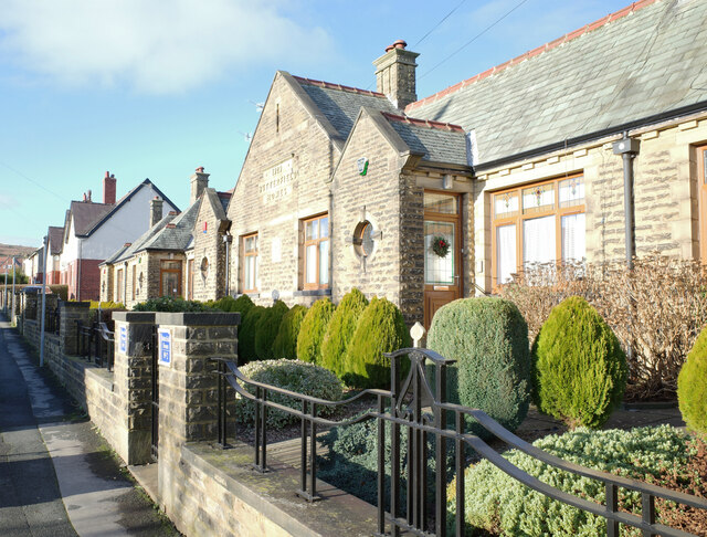
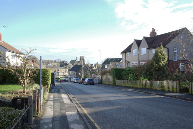
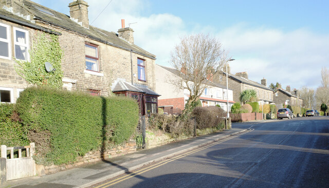
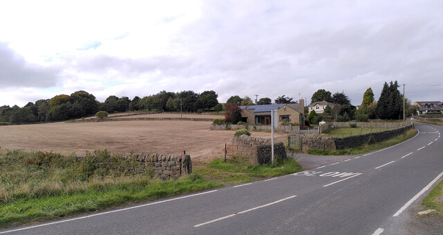
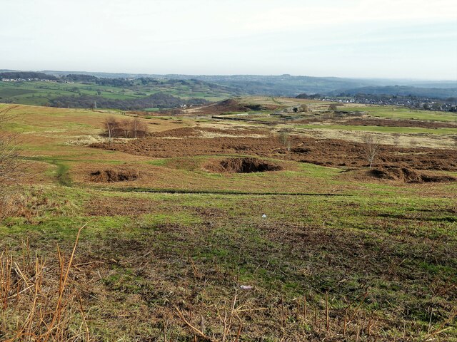
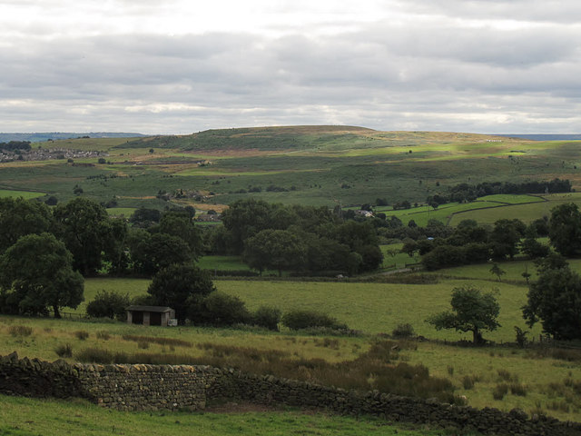
The village is blessed with stunning natural beauty, surrounded by rolling hills, lush green fields, and a tranquil atmosphere. It is primarily a residential area, characterized by charming stone-built houses and cottages that exude a traditional Yorkshire charm. The tight-knit community in Low Baildon is known for its friendly and welcoming nature, creating a warm and inclusive environment for residents and visitors alike.

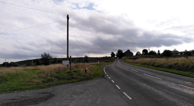
Low Baildon offers a range of amenities to cater to the needs of its residents. The village has a primary school, providing excellent education for the younger generation, while a variety of shops, local businesses, and services are available for daily necessities. The nearby Baildon Moor offers residents the opportunity to enjoy outdoor activities, such as walking, hiking, and birdwatching, providing a welcome escape from the busy urban life.

Transportation in Low Baildon is well-connected, with regular bus services providing easy access to the nearby towns and cities. The village's proximity to Bradford and Leeds ensures that residents have access to a wider range of facilities, including shopping centers, entertainment venues, and employment opportunities.

In conclusion, Low Baildon is a peaceful village located in the heart of the Yorkshire countryside, offering a high quality of life to its residents with its natural beauty, community spirit, and convenient amenities.

If you have any feedback on the listing, please let us know in the comments section below.
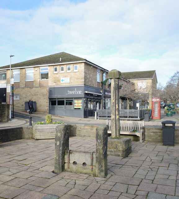
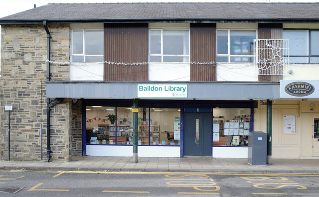
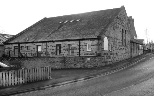
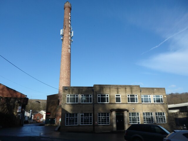
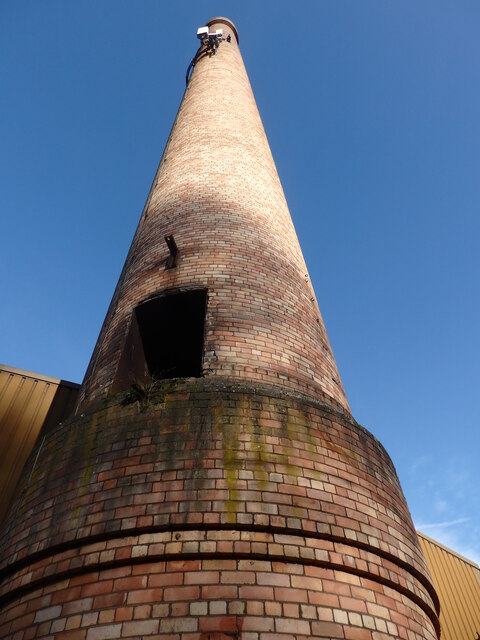
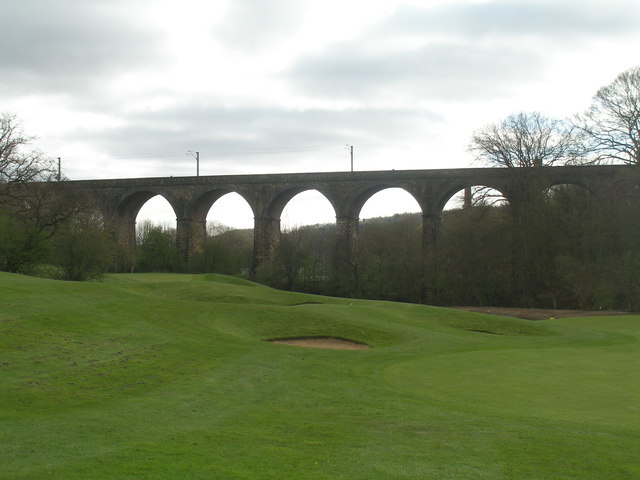
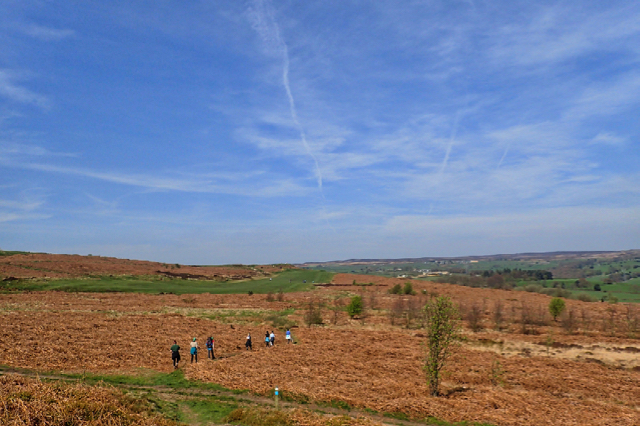
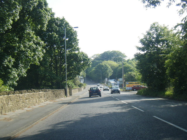
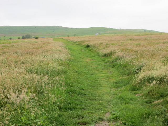
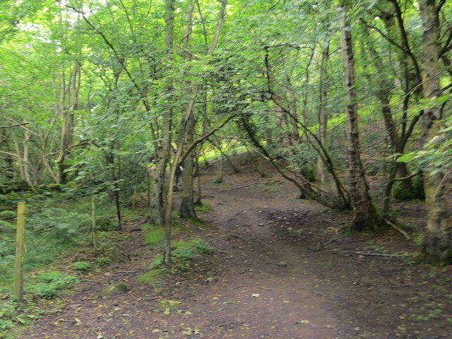
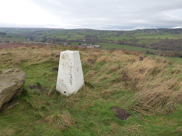
Low Baildon Images

Images are sourced within 2km of 53.849858/-1.7598098 or Grid Reference SE1539. Thanks to Geograph Open Source API. All images are credited.

The Stocks, Towngate, Baildon
Baildon Library
Baildon Library
Baildon Methodist Church, Newton Way, Baildon
Butterfield Homes, The Grove, Baildon
The Grove, Baildon
The Grove, Baildon
Jenny Lane, Baildon
Jenny Lane, Baildon
Potter Brow Road, Baildon Moor
Hawksworth Road, Baildon Moor
Denbirayne Chimney, Tong Park Industrial Estate, Baildon See <a href="https://www.geograph.org.uk/photo/6887736">SE1640 : The Denbirayne chimney</a> for another view and a brief history. Also see <a href="https://www.geograph.org.uk/photo/7096458">SE1640 : Looking Up the Denbirayne Chimney, Tong Park Industrial Estate, Baildon</a> for a much closer view. Tong Park railway viaduct is in the distance.
Denbirayne Chimney, Tong Park Industrial Estate, Baildon
See SE1640 : The Denbirayne chimney for another view and a brief history. Also see SE1640 : Looking Up the Denbirayne Chimney, Tong Park Industrial Estate, Baildon for a much closer view. Tong Park railway viaduct is in the distance.
Looking Up the Denbirayne Chimney, Tong Park Industrial Estate, Baildon I almost fell over backwards taking this image, but it was something I just had to do. See <a href="https://www.geograph.org.uk/photo/7084813">SE1640 : Denbirayne Chimney, Tong Park Industrial Estate, Baildon</a> for a more distant view.
Looking Up the Denbirayne Chimney, Tong Park Industrial Estate, Baildon
I almost fell over backwards taking this image, but it was something I just had to do. See SE1640 : Denbirayne Chimney, Tong Park Industrial Estate, Baildon for a more distant view.
Old Bell Pit remains View from the bridleway to Dobrudden with the disused Baildon reservoir embankments beyond the pit hollows
Old Bell Pit remains
View from the bridleway to Dobrudden with the disused Baildon reservoir embankments beyond the pit hollows
Baildon Hill Looking across from Hillings Lane on the edge of Rombalds Moor, 3km away.
Baildon Hill
Looking across from Hillings Lane on the edge of Rombalds Moor, 3km away.
Tong Park Viaduct In the foreground is part of the Hollins Hall golf course
Tong Park Viaduct
In the foreground is part of the Hollins Hall golf course
Approaching Bracken Hill on Baildon Moor
A6038 Hollins Hill, Esholt
Locally walked path crossing Baildon Moor Looking westward.
Locally walked path crossing Baildon Moor
Looking westward.
Path through woodland near Hawksworth Spring Looking north-westward.
Path through woodland near Hawksworth Spring
Looking north-westward.
Trig pillar above Baildon This location is not as remote as it looks - only a few steps from a car park which itself is only a short distance outside Baildon. The spot height on the map is 194 metres.
Trig pillar above Baildon
This location is not as remote as it looks - only a few steps from a car park which itself is only a short distance outside Baildon. The spot height on the map is 194 metres.
Show me another place!

Low Baildon is located at Grid Ref: SE1539 (Lat: 53.849858, Lng: -1.7598098)

Division: West Riding

Unitary Authority: Bradford

Police Authority: West Yorkshire

What 3 Words

///snow.remote.table. Near Shipley, West Yorkshire

Related Wikis

Baildon

Baildon is a town and civil parish in the Bradford Metropolitan Borough in West Yorkshire, England and within the historic boundaries of the West Riding...

Baildon railway station

Baildon railway station serves the town of Baildon near Shipley in West Yorkshire, England. The station reopened under British Rail on 5 January 1973,...

Baildon Urban District

Baildon was an urban district in the West Riding of Yorkshire, England between 1894 and 1974. It was enlarged on 1 April 1937 by gaining part of Wharfedale...

Colne Valley Urban District

Colne Valley was an urban district in the West Riding of Yorkshire, England between 1937 and 1974. It takes its name from the River Colne which rises above...

Idle railway station (Leeds and Bradford Railway)

Idle railway station was a short-lived station serving Idle, near Bradford, West Yorkshire, England. It was built by the Leeds and Bradford Railway in...

Bradford Beck

Bradford Beck is a river that flows through Bradford, West Yorkshire, England, (then Bradford Dale) and on to the River Aire at Shipley. As it reaches...

Thackley railway station

Thackley railway station was a railway station in Thackley, West Yorkshire, England. == History == During the 1860s, two small railway companies were formed...

Thackley A.F.C.

Thackley A.F.C. are a football club based in Thackley, north Bradford, West Yorkshire, England. The club plays in the Northern Counties East League Premier...

Nearby Amenities

Located within 500m of 53.849858,-1.7598098
Baildon
Naptan AtcoCode: 9100BAILDON
Network: National Rail
Network Website: https://www.nationalrail.co.uk/stations/bld/
Network Wikidata: Q26334
Operator: Northern Rail
Operator Website: https://www.northernrailway.co.uk/stations/baildon
Operator Wikidata: Q85789775
Railway: station
Ref Crs: BLD
Source: NPE
Wheelchair: yes
Wikidata: Q4475770
Wikipedia: en:Baildon railway station
Lat/Long: 53.8501789/-1.7536925
Baildon
Is In: UK,England,Yorkshire,West Yorkshire,Airedale
Place: town
Lat/Long: 53.8526169/-1.7656781
Source: landsat
Lat/Long: 53.8534829/-1.7624196
Source: landsat
Lat/Long: 53.8530923/-1.7642973
Source: landsat
Lat/Long: 53.8521312/-1.7662652
Source: landsat
Lat/Long: 53.8519161/-1.7663671
Source: landsat
Lat/Long: 53.8514401/-1.7663564
Source: landsat
Lat/Long: 53.8468286/-1.760333
Source: landsat
Lat/Long: 53.8458028/-1.7593046
Source: landsat
Lat/Long: 53.8513466/-1.7664261
Bus Stop
Station Road Netherhall Road
Bus: yes
Local Ref: 45018892
Naptan AtcoCode: 450018892
Naptan Bearing: W
Naptan CommonName: Station Road Netherhall Road
Naptan Crossing: Netherhall Road
Naptan Indicator: Stop 45018892
Naptan PlusbusZoneRef: LEEDS
Naptan ShortCommonName: Netherhall Road
Naptan Street: Station Road
Naptan Verified: no
Public Transport: platform
Source: naptan_import
Lat/Long: 53.8491178/-1.7652706
Bus Stop
Station Road Borrins Way
Local Ref: 45018893
Naptan AtcoCode: 450018893
Naptan Bearing: SW
Naptan CommonName: Station Road Borrins Way
Naptan Crossing: Borrins way
Naptan Indicator: Stop 45018893
Naptan PlusbusZoneRef: LEEDS
Naptan ShortCommonName: Borrins Way
Naptan Street: Station Road
Naptan Verified: no
Shelter: no
Source: naptan_import
Lat/Long: 53.8496137/-1.7615284
Bus Stop
Station Road Kirkfields
Bench: no
Bin: no
Lit: yes
Local Ref: 45018894
Naptan AtcoCode: 450018894
Naptan Bearing: W
Naptan CommonName: Station Road Kirkfields
Naptan Crossing: Kirkfields
Naptan Indicator: Stop 45018894
Naptan PlusbusZoneRef: LEEDS
Naptan ShortCommonName: Kirkfields
Naptan Street: Station Road
Naptan Verified: no
Shelter: no
Source: naptan_import
Tactile Paving: no
Lat/Long: 53.8501083/-1.7571324
Bus Stop
Baildon Road Temple Rhydding Drive
Bus: yes
Local Ref: 45020501
Naptan AtcoCode: 450020501
Naptan Bearing: SE
Naptan CommonName: Baildon Road Temple Rhydding Drive
Naptan Crossing: Temple Rhydding Drive
Naptan Indicator: Stop 45020501
Naptan PlusbusZoneRef: LEEDS
Naptan ShortCommonName: Temple Rhydding Dr
Naptan Street: Baildon Road
Naptan Verified: no
Public Transport: platform
Source: naptan_import
Lat/Long: 53.8471943/-1.7652813
Bus Stop
Baildon Road Temple Rhydding Drive
Bus: yes
Local Ref: 45020502
Naptan AtcoCode: 450020502
Naptan Bearing: NW
Naptan CommonName: Baildon Road Temple Rhydding Drive
Naptan Crossing: Temple Rhydding Drive
Naptan Indicator: Stop 45020502
Naptan PlusbusZoneRef: LEEDS
Naptan ShortCommonName: Temple Rhydding Dr
Naptan Street: Baildon Road
Naptan Verified: no
Public Transport: platform
Source: naptan_import
Lat/Long: 53.8472759/-1.7656305
Bus Stop
Baildon Road Sandals Road
Bus: yes
Local Ref: 45020503
Naptan AtcoCode: 450020503
Naptan Bearing: NW
Naptan CommonName: Baildon Road Sandals Road
Naptan Crossing: Nr-At Sandals Road
Naptan Indicator: Stop 45020503
Naptan PlusbusZoneRef: LEEDS
Naptan ShortCommonName: Sandals Road
Naptan Street: Baildon Road
Naptan Verified: no
Network: Metro
Public Transport: platform
Shelter: no
Source: naptan_import
Lat/Long: 53.8485186/-1.7668244
Bus Stop
Baildon Road Station Road
Bus: yes
Local Ref: 45020504
Naptan AtcoCode: 450020504
Naptan Bearing: SE
Naptan CommonName: Baildon Road Station Road
Naptan Crossing: Station Road
Naptan Indicator: Stop 45020504
Naptan Landmark: Post Office
Naptan PlusbusZoneRef: LEEDS
Naptan ShortCommonName: Station Road
Naptan Street: Baildon Road
Naptan Verified: no
Public Transport: platform
Shelter: yes
Source: naptan_import
Lat/Long: 53.8487074/-1.7668385
Bus Stop
Browgate The Croft
Bus: yes
Local Ref: 45020506
Naptan AtcoCode: 450020506
Naptan Bearing: SW
Naptan CommonName: Browgate The Croft
Naptan Crossing: Green Road - At The Croft
Naptan Indicator: Stop 45020506
Naptan PlusbusZoneRef: LEEDS
Naptan ShortCommonName: The Croft
Naptan Street: Browgate
Naptan Verified: no
Public Transport: platform
Source: naptan_import
Lat/Long: 53.8507037/-1.7672987
Bus Stop
Holden Lane
Local Ref: 45020509
Naptan AtcoCode: 450020509
Naptan Bearing: SE
Naptan CommonName: Holden Lane
Naptan Crossing: The Beeches
Naptan Indicator: Stop 45020509
Naptan PlusbusZoneRef: LEEDS
Naptan ShortCommonName: Kirk Drive
Naptan Street: Holden Lane
Naptan Verified: no
Source: naptan_import
Lat/Long: 53.8526871/-1.7612068
Bus Stop
Kirkfields Fennel Road
Bench: no
Bin: no
Lit: yes
Local Ref: 45020510
Naptan AtcoCode: 450020510
Naptan Bearing: S
Naptan CommonName: Kirkfields Fennel Road
Naptan Crossing: Langley Crescent
Naptan Indicator: Stop 45020510
Naptan PlusbusZoneRef: LEEDS
Naptan ShortCommonName: Ashfield Drive
Naptan Street: Kirkfields
Naptan Verified: no
Shelter: no
Source: naptan_import
Tactile Paving: no
Lat/Long: 53.8514483/-1.7575199
Bus Stop
Station Road
Bus: yes
Local Ref: 45024613
Naptan AtcoCode: 450024613
Naptan Bearing: E
Naptan BusStopType: CUS
Naptan CommonName: Station Road
Naptan Crossing: Netherhall Road
Naptan Indicator: Stop 45024613
Naptan PlusbusZoneRef: LEEDS
Naptan ShortCommonName: Netherhall Road
Naptan Street: Station Road
Naptan Verified: no
Public Transport: platform
Source: naptan_import
Lat/Long: 53.8492377/-1.7663188
Kirklands Road
Local Ref: 45024614
Naptan AtcoCode: 450024614
Naptan Bearing: SE
Naptan BusStopType: CUS
Naptan CommonName: Kirklands Road
Naptan Crossing: Hawthorne View
Naptan Indicator: Stop 45024614
Naptan PlusbusZoneRef: LEEDS
Naptan ShortCommonName: Hawthorn Way
Naptan Street: Kirklands Road
Naptan Verified: no
Source: naptan_import
Lat/Long: 53.8484995/-1.7572025
Fyfe Grove
Local Ref: 45024615
Naptan AtcoCode: 450024615
Naptan Bearing: NE
Naptan BusStopType: CUS
Naptan CommonName: Fyfe Grove
Naptan Crossing: Kirklands Lane
Naptan Indicator: Stop 45024615
Naptan PlusbusZoneRef: LEEDS
Naptan ShortCommonName: Kirklands Lane
Naptan Street: Fyfe Grove
Naptan Verified: no
Source: naptan_import
Lat/Long: 53.8478375/-1.7543183
Bus Stop
Station Road Kirkfields
Bench: yes
Bin: no
Lit: yes
Local Ref: 45024766
Naptan AtcoCode: 450024766
Naptan Bearing: E
Naptan CommonName: Station Road Kirkfields
Naptan Crossing: Kirkfields
Naptan Indicator: Stop 45024766
Naptan PlusbusZoneRef: LEEDS
Naptan ShortCommonName: Kirkfields
Naptan Street: Station Road
Naptan Verified: no
Shelter: yes
Source: naptan_import
Tactile Paving: no
Lat/Long: 53.8501983/-1.7572231
Bus Stop
Holden Lane Baildon
Local Ref: 45050958
Naptan AtcoCode: 450050958
Naptan Bearing: NW
Naptan BusStopType: CUS
Naptan CommonName: Holden Lane Baildon
Naptan Indicator: Stop 45050958
Naptan PlusbusZoneRef: LEEDS
Naptan ShortCommonName: Kirk Drive
Naptan Street: Holden Lane
Naptan Verified: no
Source: naptan_import
Lat/Long: 53.8526153/-1.7612681
Bus Stop
Kirkfields Baildon
Bench: no
Bin: no
Lit: yes
Local Ref: 45050959
Naptan AtcoCode: 450050959
Naptan Bearing: N
Naptan BusStopType: CUS
Naptan CommonName: Kirkfields Baildon
Naptan Indicator: Stop 45050959
Naptan PlusbusZoneRef: LEEDS
Naptan ShortCommonName: Ashfield Drive
Naptan Street: Kirkfields
Naptan Verified: no
Shelter: no
Source: naptan_import
Tactile Paving: no
Lat/Long: 53.8514216/-1.7576417
Bus Stop
Station Road Netherhall Road
Bus: yes
Local Ref: 45050703
Naptan AtcoCode: 450050703
Naptan Bearing: E
Naptan BusStopType: CUS
Naptan CommonName: Station Road Netherhall Road
Naptan Indicator: Stop 45050703
Naptan PlusbusZoneRef: LEEDS
Naptan ShortCommonName: Whitelands Road
Naptan Street: Station Road
Naptan Verified: no
Public Transport: platform
Source: naptan_import
Lat/Long: 53.8492346/-1.7652699
Bus Stop
Station Road Borrins Way
Local Ref: 45050704
Naptan AtcoCode: 450050704
Naptan Bearing: SE
Naptan BusStopType: CUS
Naptan CommonName: Station Road Borrins Way
Naptan Indicator: Stop 45050704
Naptan PlusbusZoneRef: LEEDS
Naptan ShortCommonName: Borrins Way
Naptan Street: Station Road
Naptan Verified: no
Shelter: no
Source: naptan_import
Lat/Long: 53.8496948/-1.7615887
Woodward Nursery
Shop: garden_centre
Lat/Long: 53.8484016/-1.7625263
Crossing
Crossing: uncontrolled
Crossing Island: no
Crossing Ref: zebra
Kerb: lowered
Tactile Paving: yes
Lat/Long: 53.85029/-1.7557898
Mini Roundabout
Source: Bing
Lat/Long: 53.8535761/-1.7623146
Turning Circle
Lat/Long: 53.8498087/-1.7657127
Mini Roundabout
Source: Bing
Lat/Long: 53.8534955/-1.762132
Post Box
Operator: Royal Mail
Post Box Type: wall
Royal Cypher: EIIR
Royal Cypher Wikidata: Q33102113
Lat/Long: 53.8499274/-1.7599621
Post Box
Collection Times: 17:00
Operator: Royal Mail
Operator Wikidata: Q638098
Post Box Type: pillar
Ref: BD17 914
Royal Cypher: GR
Royal Cypher Wikidata: Q33102273
Lat/Long: 53.8489159/-1.7668481
Telephone
Plant Pod
Booth: K6
Covered: booth
Man Made: telephone_box
Old Phone: +44 1274 587109
Lat/Long: 53.8488941/-1.7668727
Post Box
Collection Times: Mo-Fr 09:00; Sa 07:00
Operator: Royal Mail
Post Box Type: lamp
Ref: BD17 964D
Royal Cypher: EIIR
Royal Cypher Wikidata: Q33102113
Lat/Long: 53.8536547/-1.7621398
Post Box
Operator: Royal Mail
Post Box Type: pillar
Royal Cypher: GR
Royal Cypher Wikidata: Q33102273
Lat/Long: 53.8532283/-1.76157
Crossing
Crossing: traffic_signals
Crossing Island: no
Tactile Paving: yes
Lat/Long: 53.849026/-1.7672363
Crossing: informal
Lat/Long: 53.8522402/-1.7632797
Barrier: lych_gate
Lat/Long: 53.8529977/-1.7647991
Noexit: yes
Lat/Long: 53.849394/-1.7543669
Noexit: yes
Lat/Long: 53.849422/-1.75431
Noexit: yes
Lat/Long: 53.8494529/-1.7542656
Noexit: yes
Lat/Long: 53.8494682/-1.7542358
Noexit: yes
Lat/Long: 53.849542/-1.7541683
Noexit: yes
Lat/Long: 53.8495622/-1.7541152
Noexit: yes
Lat/Long: 53.8495985/-1.7540591
Noexit: yes
Lat/Long: 53.8496332/-1.7540042
Noexit: yes
Lat/Long: 53.8496478/-1.7539052
Noexit: yes
Lat/Long: 53.8496844/-1.7538561
Noexit: yes
Lat/Long: 53.8497403/-1.7537584
Fixme: continue?
Lat/Long: 53.85034/-1.753236
Bench
Backrest: yes
Inscription: Barry Jennings | Horticulturist | 1947 - 2021
Material: wood
Seats: 3
Lat/Long: 53.8536091/-1.7624417
The data included in this document is from www.openstreetmap.org. The data is made available under ODbL.

Have you been to Low Baildon?

Leave your review of Low Baildon below (or comments, questions and feedback).