Lower Swainswick

Settlement in Somerset

England

Lower Swainswick

Balloons over Bath
Balloons over Bath Credit: Anthony Parkes

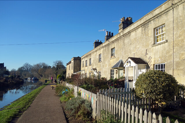
Lower Swainswick is a charming village located in the county of Somerset, England. Situated just 3 miles northeast of the historic city of Bath, this rural settlement offers a peaceful and picturesque setting for its residents. With a population of around 400 people, Lower Swainswick exudes a close-knit community feel.

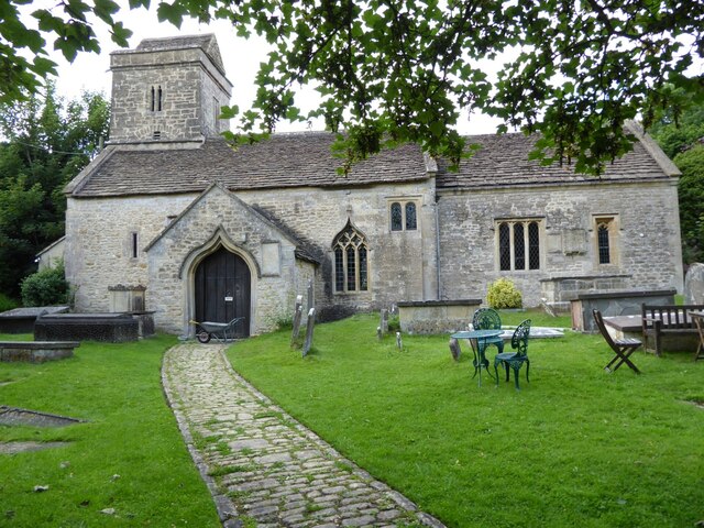
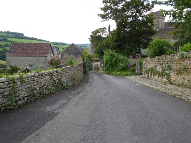
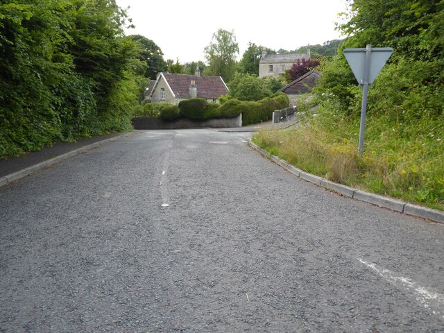
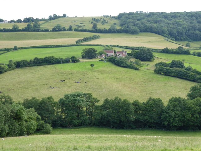
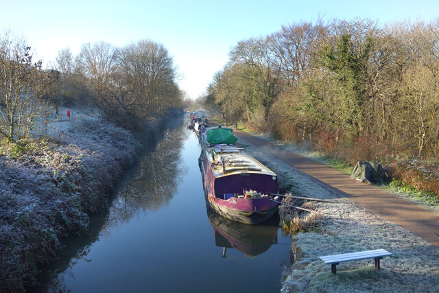
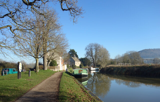
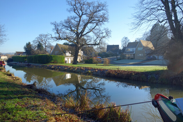
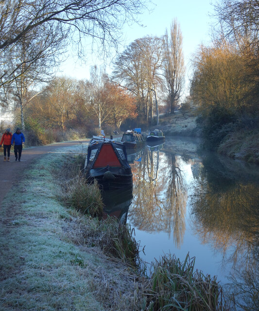
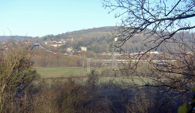
Nestled in the rolling hills of the Cotswolds, Lower Swainswick boasts breathtaking views of the surrounding countryside. The village is characterized by its quaint stone cottages, some of which date back several centuries, lending a sense of historical charm to the area. The winding country lanes are lined with hedgerows, wildflowers, and occasional grazing livestock, enhancing the village's rural ambiance.

Despite its small size, Lower Swainswick has a vibrant community spirit. The village hall serves as a hub for social gatherings, hosting various events throughout the year, including fairs, concerts, and community meetings. The village also has a local pub, The Swainswick Plough, which offers a warm welcome to locals and visitors alike, providing a place to relax and enjoy a traditional pub meal.

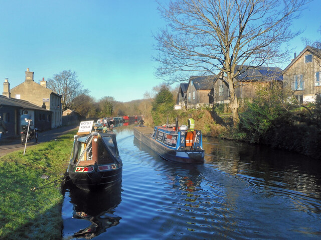
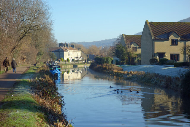
For outdoor enthusiasts, Lower Swainswick offers ample opportunities to explore the natural beauty of the area. The village is surrounded by picturesque walking trails, allowing residents to immerse themselves in the stunning landscapes of Somerset. A short drive away, the World Heritage city of Bath offers a plethora of cultural and recreational activities, including museums, art galleries, and the famous Roman Baths.

In conclusion, Lower Swainswick is a captivating village that combines idyllic countryside living with close proximity to the cultural delights of Bath. Its charming character, breathtaking views, and strong sense of community make it an appealing place for residents and visitors seeking a tranquil escape from the hustle and bustle of urban life.

If you have any feedback on the listing, please let us know in the comments section below.

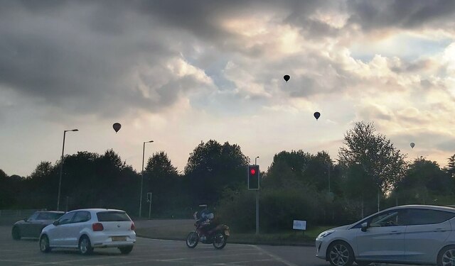
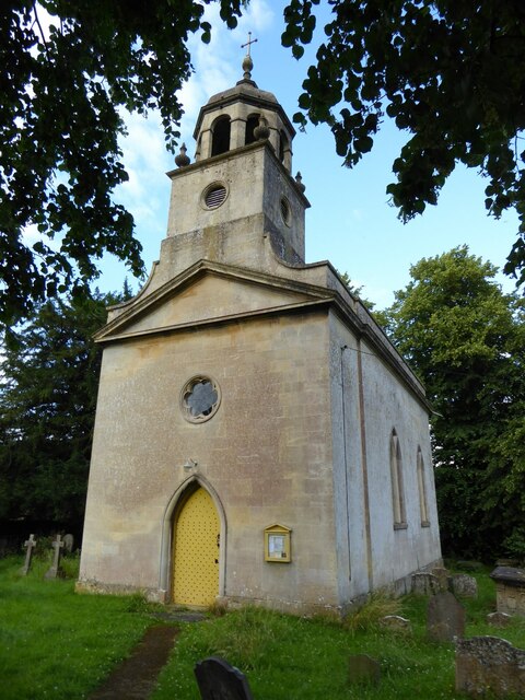
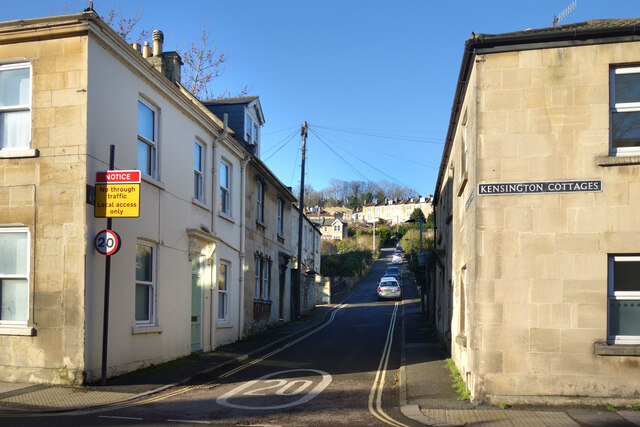
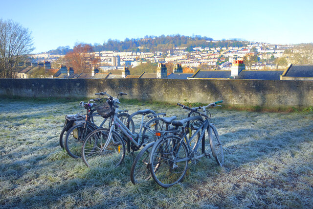
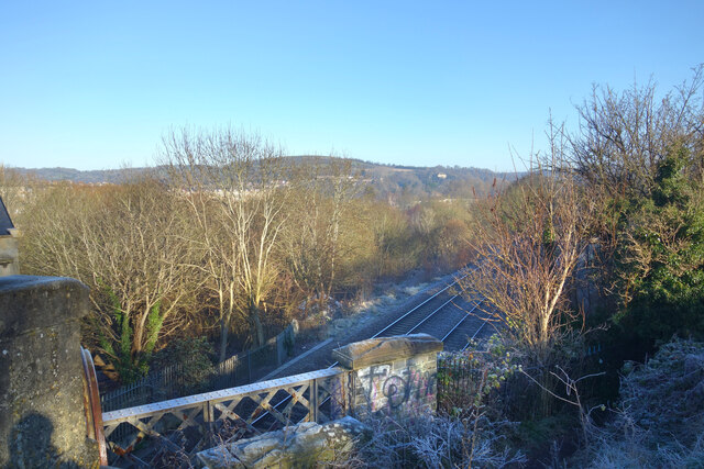
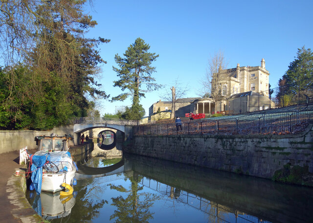
Lower Swainswick Images

Images are sourced within 2km of 51.402189/-2.345417 or Grid Reference ST7667. Thanks to Geograph Open Source API. All images are credited.

Balloons over Bath
Balloons over Bath
Upper Swainswick church Upper Swainswick church is dedicated to st Mary and is Grade II* listed, see: <span class="nowrap"><a title="https://historicengland.org.uk/listing/the-list/list-entry/1232679?section=official-listing" rel="nofollow ugc noopener" href="https://historicengland.org.uk/listing/the-list/list-entry/1232679?section=official-listing">Link</a><img style="margin-left:2px;" alt="External link" title="External link - shift click to open in new window" src="https://s1.geograph.org.uk/img/external.png" width="10" height="10"/></span>
Upper Swainswick church
Upper Swainswick church is dedicated to st Mary and is Grade II* listed, see: LinkExternal link
The road outside Upper Swainswick church The road outside Upper Swainswick church, the tower of the church can be seen on the right through the trees.
The road outside Upper Swainswick church
The road outside Upper Swainswick church, the tower of the church can be seen on the right through the trees.
Road entering Upper Swainswick The road entering the village of Upper Swainswick from the A49 junction.
Road entering Upper Swainswick
The road entering the village of Upper Swainswick from the A49 junction.
Woolley church Woolley church is dedicated to All Saints and was built in 1761 by John Wood, the Younger, of Bath.  The church is Grade I listed, see: <span class="nowrap"><a title="https://historicengland.org.uk/listing/the-list/list-entry/1214256?section=official-listing" rel="nofollow ugc noopener" href="https://historicengland.org.uk/listing/the-list/list-entry/1214256?section=official-listing">Link</a><img style="margin-left:2px;" alt="External link" title="External link - shift click to open in new window" src="https://s1.geograph.org.uk/img/external.png" width="10" height="10"/></span>
Woolley church
Woolley church is dedicated to All Saints and was built in 1761 by John Wood, the Younger, of Bath. The church is Grade I listed, see: LinkExternal link
Farmland at Upper Swainswick View across the valley at Upper Swainswick to Crossleaze Farm.
Farmland at Upper Swainswick
View across the valley at Upper Swainswick to Crossleaze Farm.
Upper East Hayes A small residential street going uphill from London Road.
Upper East Hayes
A small residential street going uphill from London Road.
Frosty Bikes by the Canal A scene along the Kennet & Avon Canal towpath on a cold January morning.
Frosty Bikes by the Canal
A scene along the Kennet & Avon Canal towpath on a cold January morning.
Looking down on the Railway Canal and railway are side by side along here, with the canal up on an embankment quite a bit higher than the trains.
Looking down on the Railway
Canal and railway are side by side along here, with the canal up on an embankment quite a bit higher than the trains.
Canal on a Cold Morning A lovely crisp winter morning along the Kennet & Avon Canal.
Canal on a Cold Morning
A lovely crisp winter morning along the Kennet & Avon Canal.
The K&A Canal at Sydney Gardens When built, the canal was required to be as unobtrusive as possible through this fashionable part of Bath.
The K&A Canal at Sydney Gardens
When built, the canal was required to be as unobtrusive as possible through this fashionable part of Bath.
Kennet & Avon Canal at Bathampton
Canal Terrace, Bathampton A terrace of early 19th century canalside houses.
Canal Terrace, Bathampton
A terrace of early 19th century canalside houses.
Kennet Park, Bathampton Houses near the Kennet & Avon Canal.
Kennet Park, Bathampton
Houses near the Kennet & Avon Canal.
Cruising on a fine morning A cloudless winter's day on the Kennet & Avon Canal in Bath. The moored boat on the left offers bicycle repairs.
Cruising on a fine morning
A cloudless winter's day on the Kennet & Avon Canal in Bath. The moored boat on the left offers bicycle repairs.
The Canal at Bathampton The Kennet & Avon Canal on a wintry morning.
The Canal at Bathampton
The Kennet & Avon Canal on a wintry morning.
Frosty Morning by the Canal
Avon Valley and A46 Looking over the Avon Valley from the Kennet & Avon Canal Path. The A46 crosses the river on a viaduct and heads off round the side of Little Solsbury Hill.
Avon Valley and A46
Looking over the Avon Valley from the Kennet & Avon Canal Path. The A46 crosses the river on a viaduct and heads off round the side of Little Solsbury Hill.
Show me another place!

Lower Swainswick is located at Grid Ref: ST7667 (Lat: 51.402189, Lng: -2.345417)

Unitary Authority: Bath and North East Somerset

Police Authority: Avon and Somerset

What 3 Words

///gown.voting.washed. Near Bath, Somerset

Related Wikis

Larkhall Athletic F.C.

Larkhall Athletic Football Club is a football club based in the Larkhall area of Bath, Somerset, England. Affiliated to the Somerset County FA, they are...

Larkhall, Bath

Larkhall is a district in the city of Bath, England, north-east of the city centre. The district began to develop in the early 19th century to house the...

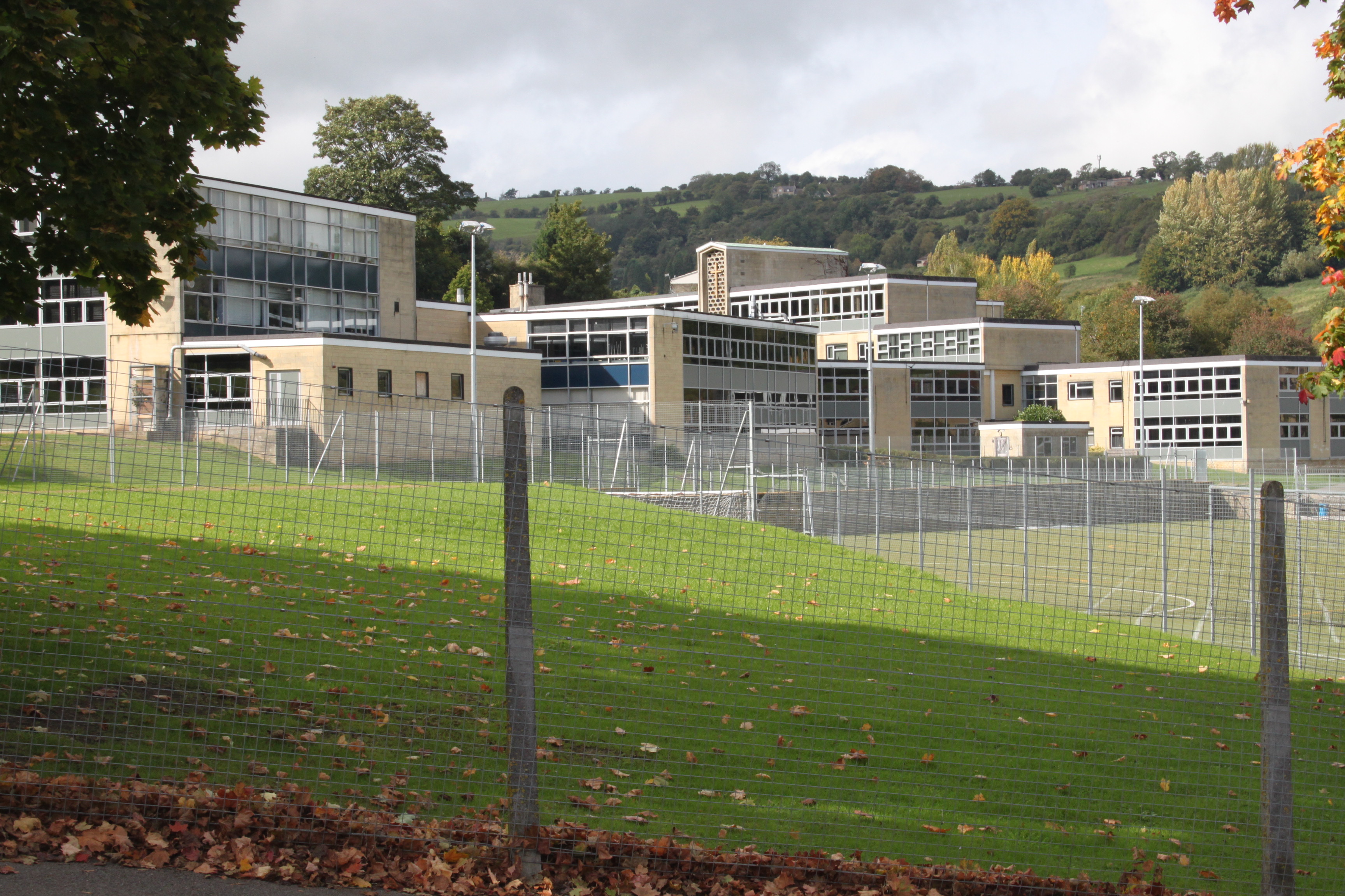
St Mark's School, Bath

St Mark's is a coeducational Church of England secondary school and sixth form located in Bath, Somerset, England. The school attracts pupils from Bath...

Rondo Theatre

The Rondo Theatre, in Bath, was established in 1989. The theatre is located in the former church hall of St. Saviours Church, Larkhall. The building was...

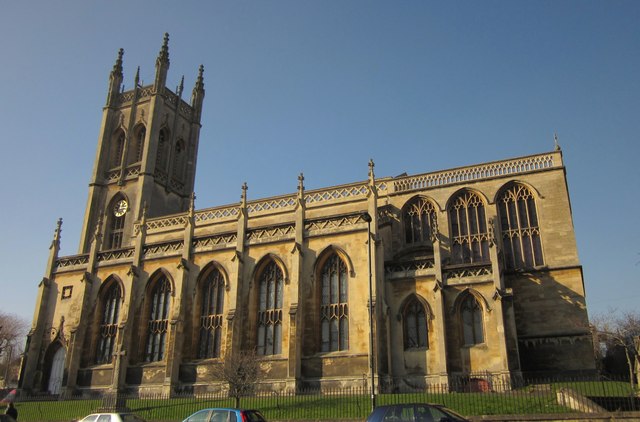
St Saviour's Church, Bath

St Saviour's Church is a Church of England parish church in Larkhall, Bath, Somerset England. The church was founded by Archdeacon Charles Moysey in 1824...

Grosvenor Place, Bath

Grosvenor Place in Bath, Somerset, England was built around 1790 by John Eveleigh. It lies on the south side of the A4 London Road and many of the houses...

Lam Brook

The Lam Brook is a stream in the West Country of England, which rises in a number of springs on the southern end of the Cotswold Hills and runs in a generally...

Charlcombe

Charlcombe is a civil parish and small village just north of Bath in the Bath and North East Somerset unitary authority, Somerset, England. The parish...

Nearby Amenities

Located within 500m of 51.402189,-2.345417
Post Box
Mapillary: 357359362866908
Post Box Type: pillar
Survey Date: 2022-04-18
Lat/Long: 51.4008395/-2.3415457
Turning Circle
Lat/Long: 51.400626/-2.3433113
Barrier: cycle_barrier
Lat/Long: 51.4009208/-2.3427312
Bus Stop
Larkhall Buildings
Bench: yes
Bus: yes
Naptan AtcoCode: 0180BAC30531
Naptan Bearing: N
Naptan CommonName: Larkhall Buildings
Naptan Crossing: Upper Lambridge Street
Naptan NaptanCode: bthmadg
Naptan PlusbusZoneRef: BATHSPA
Naptan Street: St Saviour's Road
Naptan Verified: no
Public Transport: platform
Shelter: yes
Source: naptan_import
Tactile Paving: no
Lat/Long: 51.3977347/-2.3450438
Bus Stop
Otago Terrace
Bench: no
Bus: yes
Naptan AtcoCode: 0180BAC30532
Naptan Bearing: N
Naptan CommonName: Otago Terrace
Naptan Crossing: Dafford's Buildings
Naptan NaptanCode: bthmadt
Naptan PlusbusZoneRef: BATHSPA
Naptan Street: St Saviour's Road
Naptan Verified: no
Public Transport: platform
Shelter: no
Source: naptan_import
Tactile Paving: yes
Lat/Long: 51.3993643/-2.3443517
Bus Stop
Bladuds Head
Bench: yes
Bus: yes
Naptan AtcoCode: 0180BAC30533
Naptan Bearing: N
Naptan CommonName: Bladuds Head
Naptan Crossing: Brooklyn Road
Naptan NaptanCode: bthmaga
Naptan PlusbusZoneRef: BATHSPA
Naptan Street: St Saviour's Road
Naptan Verified: no
Public Transport: platform
Shelter: yes
Source: naptan_import
Tactile Paving: no
Lat/Long: 51.4010105/-2.3441197
Bus Stop
Valley View Close
Bench: yes
Bus: yes
Naptan AtcoCode: 0180BAC30534
Naptan Bearing: SW
Naptan CommonName: Valley View Close
Naptan Crossing: Valley View Close
Naptan NaptanCode: bthjwmd
Naptan PlusbusZoneRef: BATHSPA
Naptan Street: Hill View Road
Naptan Verified: no
Public Transport: platform
Shelter: yes
Source: naptan_import
Tactile Paving: no
Wheelchair: yes
Lat/Long: 51.4016939/-2.3471581
Bus Stop
Hill View Rd
Bus: yes
Naptan AtcoCode: 0180BAC30535
Naptan Bearing: SW
Naptan CommonName: Hill View Rd
Naptan Crossing: Charlcombe Lane
Naptan NaptanCode: bthjwgm
Naptan PlusbusZoneRef: BATHSPA
Naptan Street: Hill View Road
Naptan Verified: no
Public Transport: platform
Source: naptan_import
Wheelchair: yes
Lat/Long: 51.4007088/-2.3488326
Bus Stop
Spring Vale
Bench: yes
Bus: yes
Naptan AtcoCode: 0180BAC30536
Naptan Bearing: SE
Naptan CommonName: Spring Vale
Naptan Crossing: Eldon Place
Naptan NaptanCode: bthjwjm
Naptan PlusbusZoneRef: BATHSPA
Naptan Street: Charlcombe Lane
Naptan Verified: no
Public Transport: platform
Shelter: yes
Source: naptan_import
Tactile Paving: no
Lat/Long: 51.398968/-2.3479575
Bus Stop
Elm Grove
Bench: no
Bus: yes
Naptan AtcoCode: 0180BAC30640
Naptan Bearing: W
Naptan CommonName: Elm Grove
Naptan Crossing: Gloucester Road
Naptan NaptanCode: bthmajt
Naptan PlusbusZoneRef: BATHSPA
Naptan Street: Elm Grove
Naptan Verified: no
Public Transport: platform
Shelter: no
Source: naptan_import
Tactile Paving: no
Lat/Long: 51.3999394/-2.3414091
Bus Stop
Elm Grove
Bus: yes
Naptan AtcoCode: 0180BAC30641
Naptan Bearing: N
Naptan CommonName: Elm Grove
Naptan Crossing: Fuller Road
Naptan NaptanCode: bthmajp
Naptan PlusbusZoneRef: BATHSPA
Naptan Street: Gloucester Road
Naptan Verified: no
Public Transport: platform
Source: naptan_import
Lat/Long: 51.4003617/-2.3414985
Bus Stop
Bailbrook Lane
Bus: yes
Naptan AtcoCode: 0180BAC30642
Naptan Bearing: SE
Naptan CommonName: Bailbrook Lane
Naptan Crossing: Bailbrook Lane
Naptan NaptanCode: bthmajm
Naptan PlusbusZoneRef: BATHSPA
Naptan Street: Gloucester Road
Naptan Verified: no
Public Transport: platform
Source: naptan_import
Lat/Long: 51.4022674/-2.341714
Bus Stop
Bailbrook Lane
Bus: yes
Naptan AtcoCode: 0180BAC30643
Naptan Bearing: SW
Naptan CommonName: Bailbrook Lane
Naptan Crossing: Gloucester Road
Naptan NaptanCode: bthmajg
Naptan PlusbusZoneRef: BATHSPA
Naptan Street: Ferndale Road
Naptan Verified: no
Public Transport: platform
Source: naptan_import
Lat/Long: 51.4022131/-2.3418286
Barrier: cycle_barrier
Lat/Long: 51.4018688/-2.3421511
Barrier: bollard
Lat/Long: 51.4043867/-2.3400054
Barrier: cycle_barrier
Lat/Long: 51.4003498/-2.3452822
Barrier: cycle_barrier
Foot: designated
Lat/Long: 51.4010589/-2.3469126
Motorway Junction
London Road Junction
Lat/Long: 51.4022885/-2.3385406
Bicycle Parking
Bicycle Parking: stands
Capacity: 4
Covered: no
Lat/Long: 51.3977438/-2.345916
Barrier: stile
Foot: designated
Lat/Long: 51.4020246/-2.345522
Lower Swainswick
Place: hamlet
Lat/Long: 51.4023792/-2.3456031
Bench
Lat/Long: 51.3999517/-2.3462649
Barrier: bollard
Lat/Long: 51.4000654/-2.3465223
Bench
Backrest: yes
Lat/Long: 51.4004901/-2.3465509
Barrier: bollard
Lat/Long: 51.3997332/-2.3501507
Toasties (Breakfast And Afterschool Club)
Addr Postcode: BA1 6NY
Club: school
Fhrs Id: 204052
Website: https://www.stsavioursbath.co.uk/
Lat/Long: 51.3986022/-2.3486452
Kindergarten
Little Scribblers
Addr Postcode: BA1 6NS
Facebook: https://www.facebook.com/littlescribblersnursery/
Fhrs Id: 204805
Lat/Long: 51.4006279/-2.3499878
Sol Kitchen
Addr Postcode: BA1 6TF
Club: yes
Fhrs Id: 928750
Fixme: rough location
Lat/Long: 51.4006002/-2.3446219
Kitchen
Larkhall School Meals And Community Meals Kitchen
Addr Postcode: BA1 6TD
Disused Fhrs Id: 205433
Lat/Long: 51.4018825/-2.3426753
St Saviours Junior School The Big Brekkie
Addr Postcode: BA1 6TG
Addr Street: Eldon Place
Club: yes
Fhrs Id: 1052189
Website: http://www.stsaviours-jun.co.uk/the-big-brekkie/
Lat/Long: 51.3985019/-2.3469685
Barrier: bollard
Lat/Long: 51.3979265/-2.3450696
Bench
Lat/Long: 51.4008647/-2.3437179
Charging Station
Capacity: 2
Operator: Revive
Ref: RV01047
Socket: type2
Socket Type2: 2
Lat/Long: 51.3977426/-2.3454047
Leisure: picnic_table
Lat/Long: 51.4010036/-2.3437702
Barrier: cycle_barrier
Lat/Long: 51.3994334/-2.3475095
Waste Basket
Lat/Long: 51.3978486/-2.3449977
Waste Basket
Lat/Long: 51.3977124/-2.3448837
Bicycle Parking
Bicycle Parking: stands
Capacity: 6
Covered: no
Lat/Long: 51.3978471/-2.3448163
Waste Basket
Lat/Long: 51.4004932/-2.3438695
Bench
Backrest: yes
Lat/Long: 51.397861/-2.3457042
Waste Basket
Lat/Long: 51.4006488/-2.3455632
Waste Basket
Lat/Long: 51.4009894/-2.3441193
Barrier: cycle_barrier
Lat/Long: 51.4010894/-2.3453999
Barrier: cycle_barrier
Lat/Long: 51.4012589/-2.3459366
Waste Basket
Lat/Long: 51.398999/-2.3479683
Waste Basket
Lat/Long: 51.4000615/-2.3465491
Bench
Backrest: yes
Lat/Long: 51.3997963/-2.3477319
Waste Basket
Lat/Long: 51.3997076/-2.3475066
Bench
Backrest: yes
Lat/Long: 51.4000749/-2.3476582
Waste Basket
Lat/Long: 51.3981906/-2.3481276
SuperPirates St Saviour's Infant Afterschool Club
Addr Postcode: BA1 6NY
Club: school
Fhrs Id: 1602780
Website: https://www.stsavioursbath.co.uk/
Lat/Long: 51.3985759/-2.3485013
Bench
Backrest: yes
Lat/Long: 51.4026318/-2.3387643
Waste Basket
Lat/Long: 51.4026543/-2.3387429
The data included in this document is from www.openstreetmap.org. The data is made available under ODbL.

Have you been to Lower Swainswick?

Leave your review of Lower Swainswick below (or comments, questions and feedback).