Whitestone Brae

Cliff, Slope in Berwickshire

Scotland

Whitestone Brae

Looking down from Brander Heugh towards Lumsdaine Shore
Looking down from Brander Heugh towards Lumsdaine Shore Credit: Rob Wallace

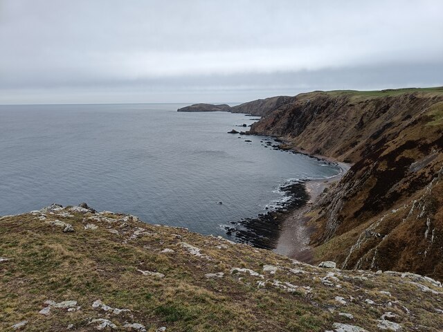
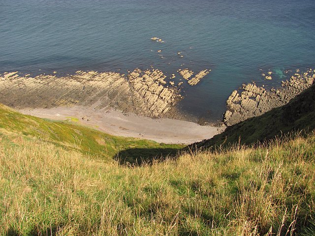
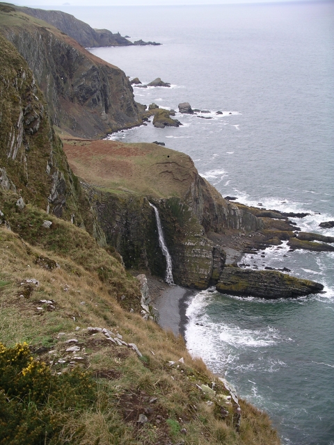
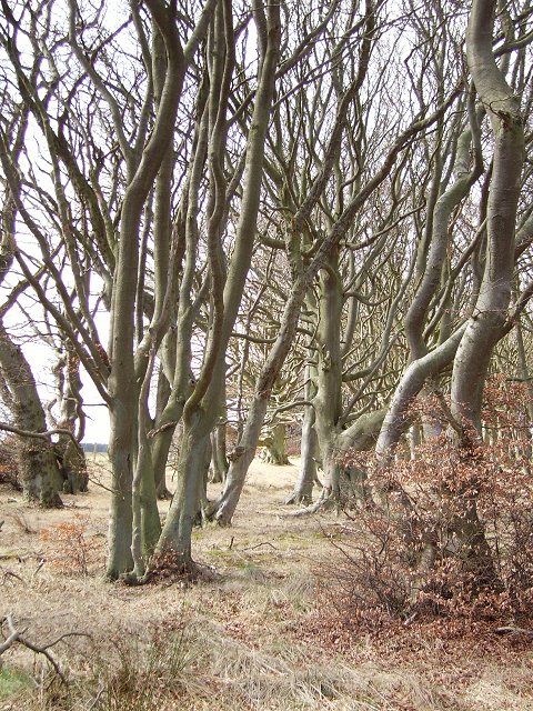
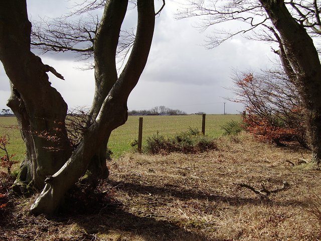
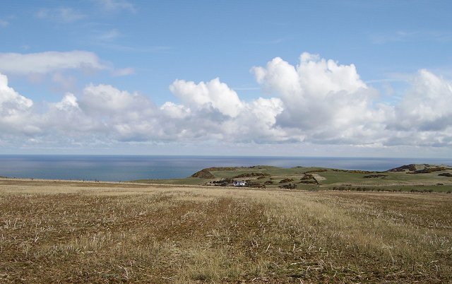
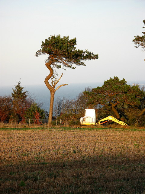
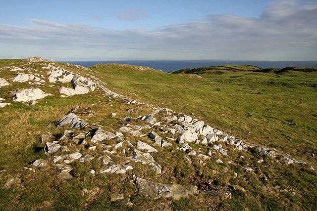
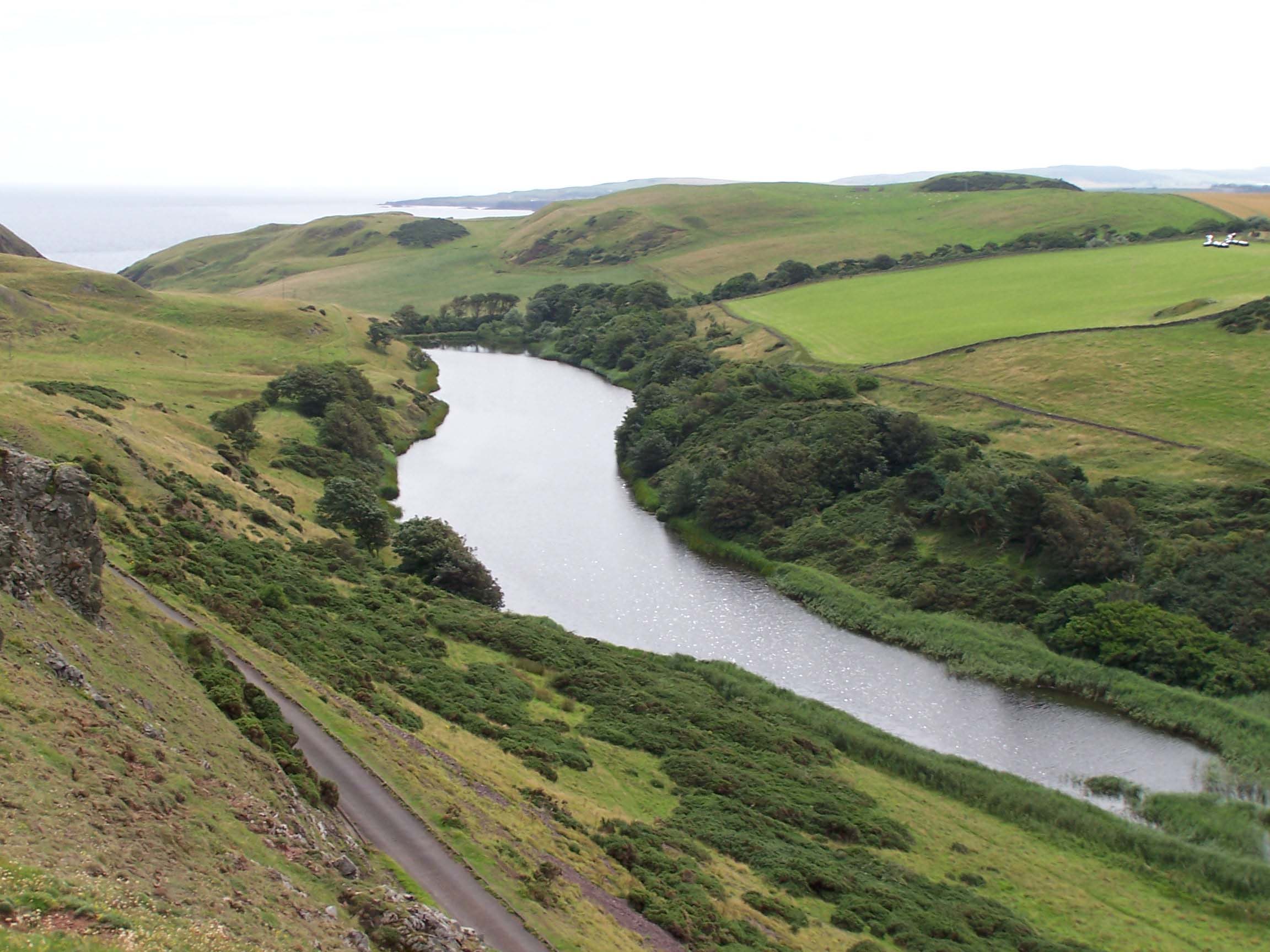
Whitestone Brae is a prominent cliff located in Berwickshire, a historic county in the southeastern part of Scotland. It stands as an impressive natural formation, characterized by its steep slope and rugged limestone cliffs. The cliff is situated near the small village of Cockburnspath, offering visitors and locals alike breathtaking views of the surrounding countryside and the North Sea.

The name "Whitestone Brae" is derived from the white appearance of the limestone rocks that form the cliff. These rocks have been shaped over millions of years by natural processes such as erosion and weathering, resulting in the striking and picturesque landscape that is now admired by many.

The height of Whitestone Brae varies along its length, with some sections reaching up to 200 feet (61 meters). The cliff face is known for its vertical nature, making it a popular spot for rock climbing enthusiasts seeking a challenging ascent. However, caution is advised due to the potentially unstable nature of the limestone.

The surrounding area of Whitestone Brae is primarily rural, with rolling hills and farmland extending towards the inland. The cliff's location near the coast provides visitors with an opportunity to observe various seabirds, including gulls and fulmars, as they soar above the crashing waves of the North Sea.

In summary, Whitestone Brae in Berwickshire offers a captivating natural spectacle, showcasing the power of geological forces and providing a tranquil escape for nature lovers and adventure seekers alike.

If you have any feedback on the listing, please let us know in the comments section below.

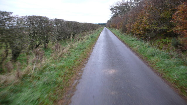
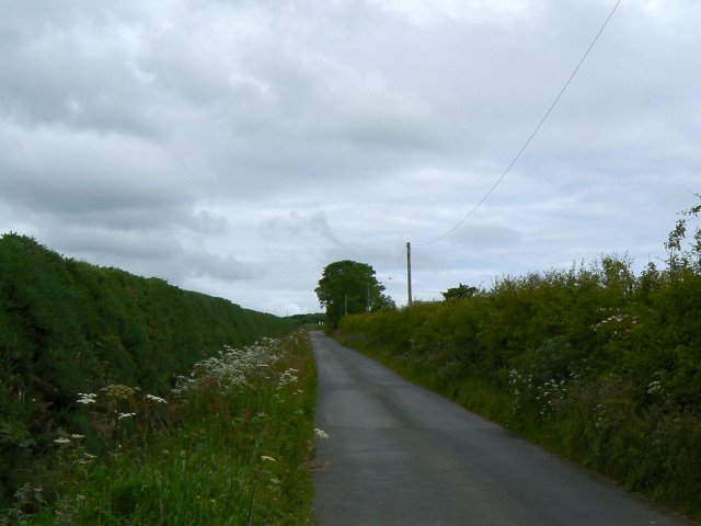
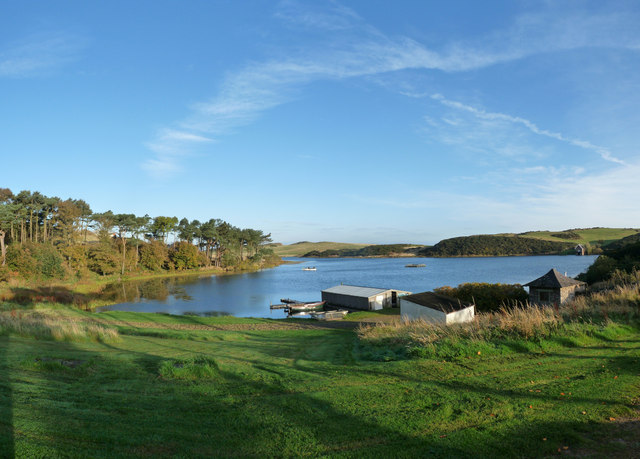
Whitestone Brae Images

Images are sourced within 2km of 55.915289/-2.1713827 or Grid Reference NT8969. Thanks to Geograph Open Source API. All images are credited.

Looking down from Brander Heugh towards Lumsdaine Shore
Lumsdaine Shore A gap in the wave cut platform allows access to the beach from the sea. A path runs up steep slopes from here.
Lumsdaine Shore
A gap in the wave cut platform allows access to the beach from the sea. A path runs up steep slopes from here.
Coldingham Loch
Coldingham Loch
Westerside The farm at the end of the single-track road from Coldingham
Westerside
The farm at the end of the single-track road from Coldingham
Rocks below Step Heugh Fine strata in these coastal rocks make them look like gigantic sliced loaves cast into the sea.
Rocks below Step Heugh
Fine strata in these coastal rocks make them look like gigantic sliced loaves cast into the sea.
Waterfall, Heathery Carr The final leap of the Waterside Dean burn.  Looking WNW from Tun Law
Waterfall, Heathery Carr
The final leap of the Waterside Dean burn. Looking WNW from Tun Law
Gorse hedge near Pilmuir Farm Lining the single track road to Westloch House and Westerside.
Gorse hedge near Pilmuir Farm
Lining the single track road to Westloch House and Westerside.
Stripwood, Buskin. A strip wood with some very wind tortured beech trees. Now a waymarked path, part of a trend making lowland Scotland easily accessible.
Stripwood, Buskin.
A strip wood with some very wind tortured beech trees. Now a waymarked path, part of a trend making lowland Scotland easily accessible.
Buskin. View out of the woods to the roofs of the farm.
Buskin.
View out of the woods to the roofs of the farm.
Stubble, Westerside A field still to be ploughed with a fine view over the sea. Not so good in a winter easterly though.
Stubble, Westerside
A field still to be ploughed with a fine view over the sea. Not so good in a winter easterly though.
Crosslaw Farm View from the farm track leading to Crosslaw Farm.
Crosslaw Farm
View from the farm track leading to Crosslaw Farm.
Minor road to Coldingham Great cycling on quiet roads with only an occasional tractor.
Minor road to Coldingham
Great cycling on quiet roads with only an occasional tractor.
Road to West Loch From near the entrance to Pilmuir farm.
Road to West Loch
From near the entrance to Pilmuir farm.
Coldingham Loch Panorama Boathouse at Coldingham Loch Summer 2009
Coldingham Loch Panorama
Boathouse at Coldingham Loch Summer 2009
A hill fort near Coldingham Loch To the east-southeast of the loch and with good views to the coast.
A hill fort near Coldingham Loch
To the east-southeast of the loch and with good views to the coast.
On the coastal path near St Abb's Head At the head of Uilystrand Brae looking towards St Abb's Head.
On the coastal path near St Abb's Head
At the head of Uilystrand Brae looking towards St Abb's Head.
Coldingham Loch 2009
The west-south Admiralty Distance Pole on Oatlee Hill There are two sets of double poles to the west of St Abbs Head, positioned one nautical mile apart and marked on the Landranger map as a measured mile. Measured miles were used in the past to test new ships during sea trials. This is the west-south pole and the east-north and east-south poles are one nautical mile to the east-southeast <a href="https://www.geograph.org.uk/photo/1552719">NT9068 : Admiralty Distance Poles at St Abb's Head</a>.
The west-south Admiralty Distance Pole on Oatlee Hill
There are two sets of double poles to the west of St Abbs Head, positioned one nautical mile apart and marked on the Landranger map as a measured mile. Measured miles were used in the past to test new ships during sea trials. This is the west-south pole and the east-north and east-south poles are one nautical mile to the east-southeast NT9068 : Admiralty Distance Poles at St Abb's Head.
Show me another place!

Whitestone Brae is located at Grid Ref: NT8969 (Lat: 55.915289, Lng: -2.1713827)

Unitary Authority: The Scottish Borders

Police Authority: The Lothians and Scottish Borders

What 3 Words

///exam.elders.soldiers. Near Eyemouth, Scottish Borders

Related Wikis

Coldingham Loch

Coldingham Loch is a freshwater loch in the parish of Coldingham, in the Scottish Borders area of Scotland, in the former Berwickshire, between Coldingham...

Mire Loch

Mire Loch is a man made freshwater loch situated on St Abb's Head in the Scottish Borders, just over a kilometre NW of the village of St. Abbs at grid...

St Abb's Head Lighthouse

St Abb's Head Lighthouse stands on the cliffs at the rocky promontory of St Abb's Head, near the village of St Abbs in Berwickshire. A signal station was...

St Abb's Head

St Abb's Head is a rocky promontory by the village of St Abbs in Scottish Borders, Scotland, and a national nature reserve administered by the National...
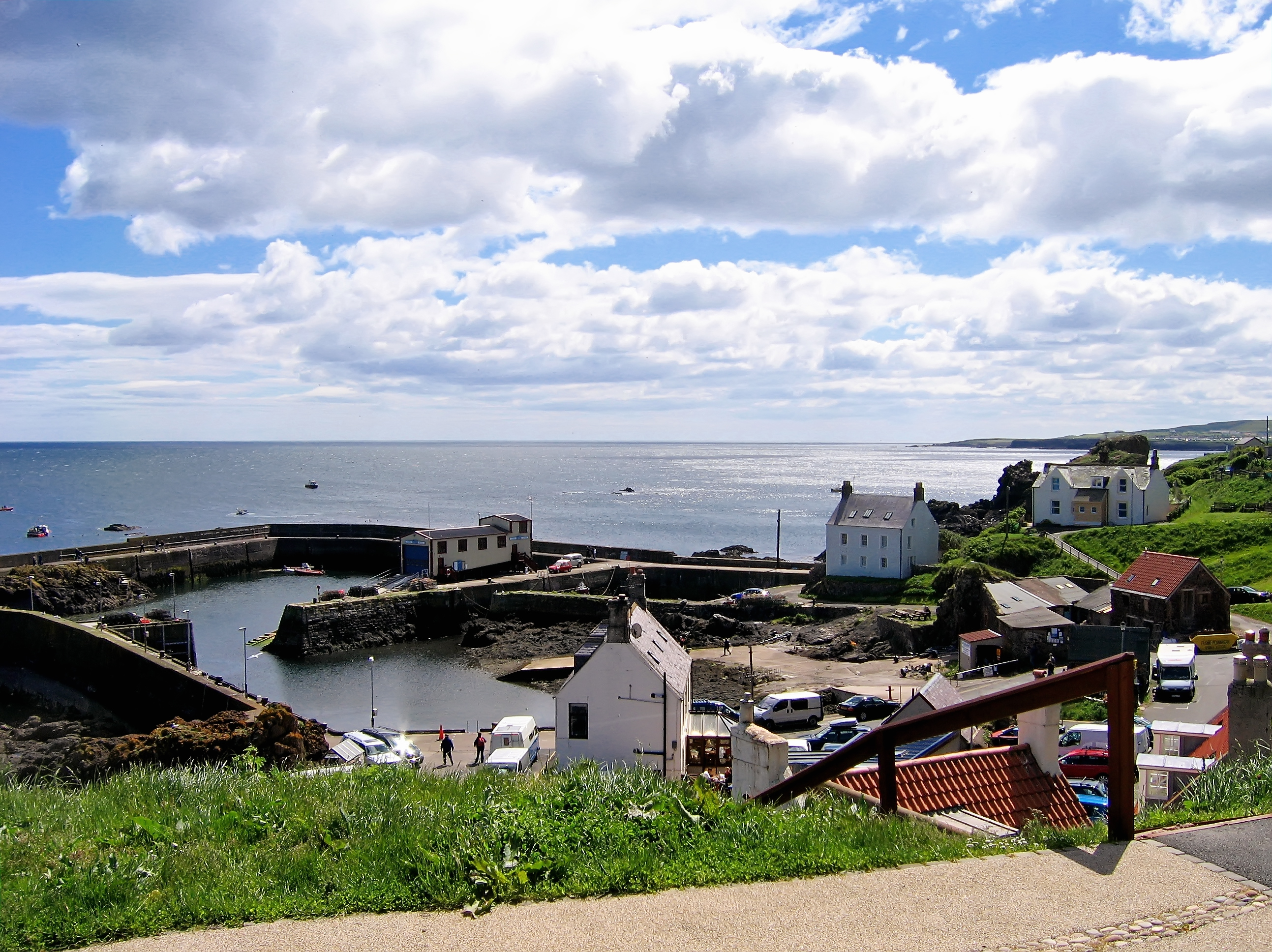
St Abbs

St Abbs is a small fishing village on the southeastern coast of Scotland, within the Coldingham parish of Scottish Borders. The village was originally...

St. Abbs and Eyemouth Voluntary Marine Reserve

St. Abbs and Eyemouth Voluntary Marine Reserve is a Voluntary Marine Reserve—the first established in the United Kingdom. Located in the Scottish Borders...

St Abbs Lifeboat Station

St Abbs Lifeboat is an independent marine-rescue facility in St Abbs, Berwickshire, Scotland. == Independent lifeboat == St Abbs Lifeboat is run as an...
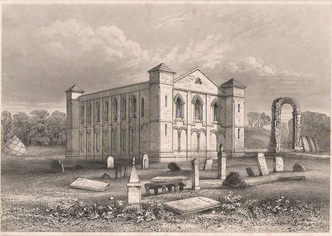
Coldingham Priory

Coldingham Priory was a house of Benedictine monks. It lies on the south-east coast of Scotland, in the village of Coldingham, Berwickshire. Coldingham...

Nearby Amenities

Located within 500m of 55.915289,-2.1713827
Barrier: stile
Stile: stepover
Lat/Long: 55.9130309/-2.1675384
Barrier: stile
Stile: stepover
Lat/Long: 55.9131333/-2.1677177
Barrier: stile
Stile: stepover
Lat/Long: 55.9135505/-2.1665099
Barrier: kissing_gate
Lat/Long: 55.9135892/-2.1679022
Barrier: kissing_gate
Lat/Long: 55.9146092/-2.1771872
Barrier: stile
Foot: yes
Stile: stepover
Lat/Long: 55.9162898/-2.1791482
Waterway: waterfall
Lat/Long: 55.9170556/-2.1777441
The data included in this document is from www.openstreetmap.org. The data is made available under ODbL.

Have you been to Whitestone Brae?

Leave your review of Whitestone Brae below (or comments, questions and feedback).