Pikie's Rock

Island in Berwickshire

Scotland

Pikie's Rock

Looking down from Brander Heugh towards Lumsdaine Shore
Looking down from Brander Heugh towards Lumsdaine Shore Credit: Rob Wallace

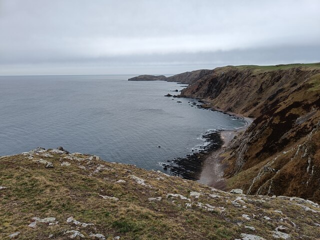
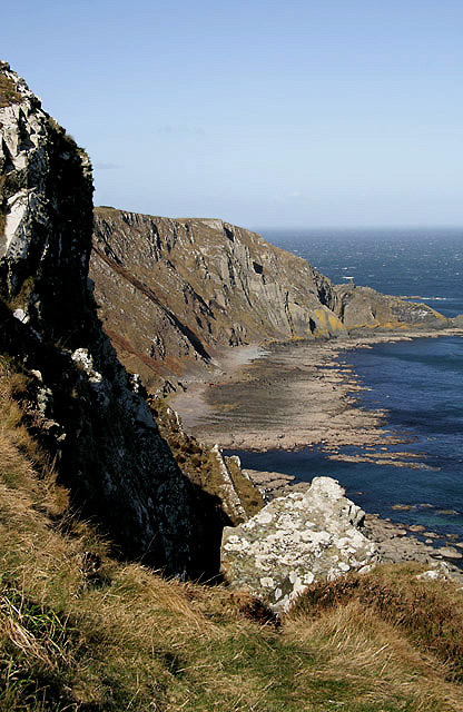
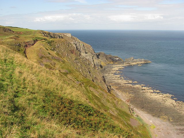
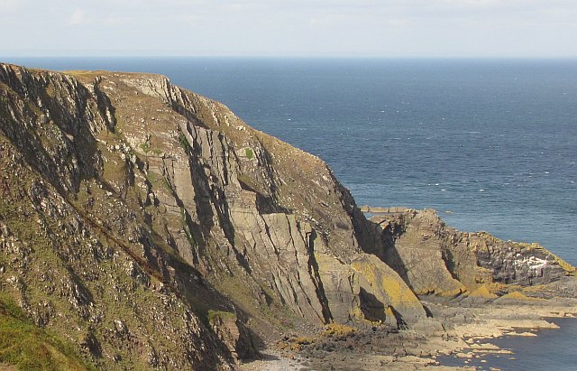
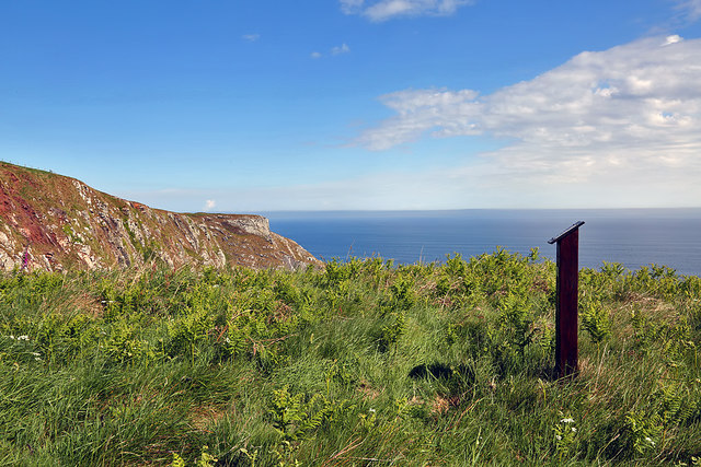
Pikie's Rock is a small uninhabited island located off the coast of Berwickshire, Scotland. Situated in the North Sea, it lies approximately 2 kilometers southeast of the town of Eyemouth. The island is commonly referred to as Pikie's Rock due to its distinctive rocky formation.

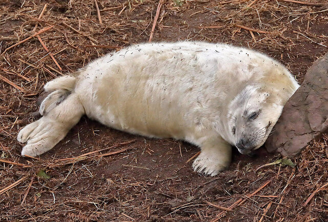
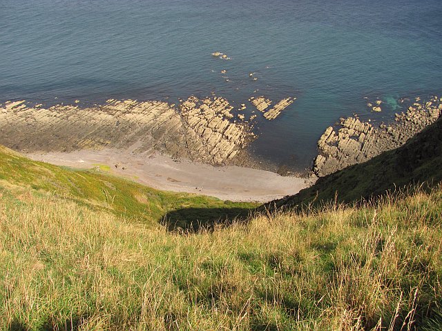
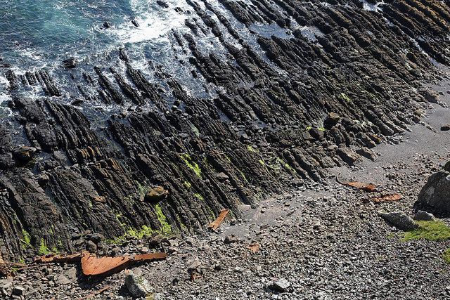
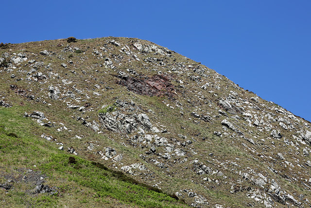
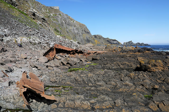
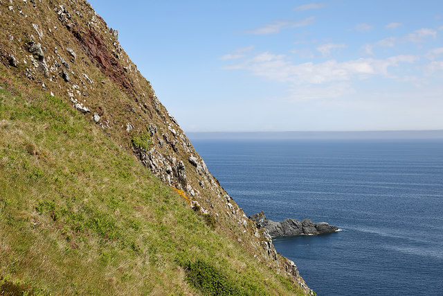
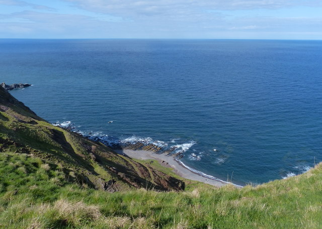
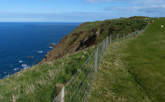
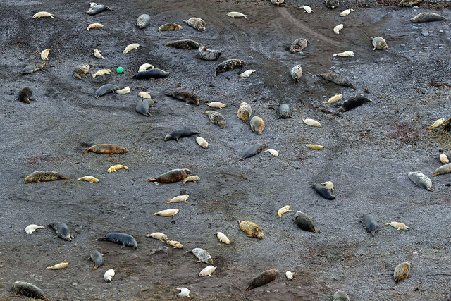
Covering an area of around 0.1 hectares, Pikie's Rock is a rocky outcrop rising up to 15 meters above sea level. It is composed mainly of granite and is known for its dramatic cliffs, caves, and rugged terrain. The island offers a diverse range of flora and fauna, including various seabirds such as puffins and guillemots, as well as seals and other marine life.

Due to its small size and remote location, Pikie's Rock is not easily accessible to the general public. However, it is a popular spot for birdwatchers, photographers, and nature enthusiasts who appreciate its natural beauty and wildlife. The island can be viewed from Eyemouth or explored during low tide by more adventurous visitors.

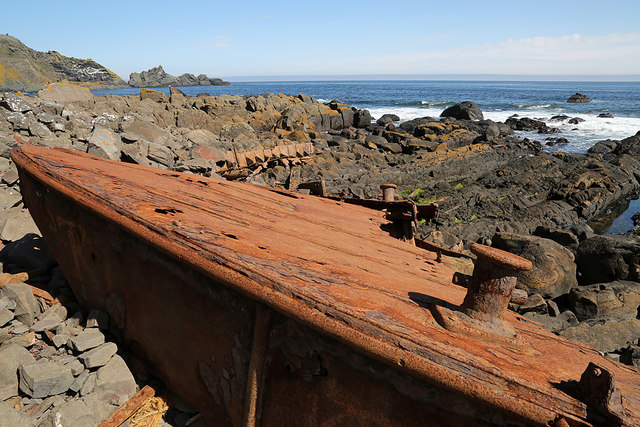
Historically, Pikie's Rock has been associated with folklore and legends, often linked to pirates and hidden treasure. However, there is no concrete evidence to support these claims. Today, the island remains a picturesque landmark, offering stunning views of the surrounding coastline and providing a unique habitat for various species of wildlife.

If you have any feedback on the listing, please let us know in the comments section below.

Pikie's Rock Images

Images are sourced within 2km of 55.917985/-2.1771545 or Grid Reference NT8969. Thanks to Geograph Open Source API. All images are credited.

Looking down from Brander Heugh towards Lumsdaine Shore
A snoozing grey seal pup at Lumsdaine Shore The seal was photographed with a telephoto lens from the hillside above the shore. Most of the grey seal pups were wiped out last year by Storm Arwen, but they were back to normal numbers this year.
A snoozing grey seal pup at Lumsdaine Shore
The seal was photographed with a telephoto lens from the hillside above the shore. Most of the grey seal pups were wiped out last year by Storm Arwen, but they were back to normal numbers this year.
The coastline at Brander A wave cut platform below Brander Heugh viewed from Step Heugh in the adjoining square to the east.
The coastline at Brander
A wave cut platform below Brander Heugh viewed from Step Heugh in the adjoining square to the east.
The coastline at Brander A wave cut platform below Brander Heugh viewed from Step Heugh in the adjoining square to the east.
The coastline at Brander
A wave cut platform below Brander Heugh viewed from Step Heugh in the adjoining square to the east.
Wave cut platform High angle bedding revealed on a wave cut platform beneath Brander Heugh.
Wave cut platform
High angle bedding revealed on a wave cut platform beneath Brander Heugh.
Lumsdaine Shore A gap in the wave cut platform allows access to the beach from the sea. A path runs up steep slopes from here.
Lumsdaine Shore
A gap in the wave cut platform allows access to the beach from the sea. A path runs up steep slopes from here.
Path to Lumsdaine Shore A path and more recently built track descend steep slopes to the shoreline.
Path to Lumsdaine Shore
A path and more recently built track descend steep slopes to the shoreline.
Crags near The Brander The bedding of the rock has produced some cleancut slabs near The Brander.
Crags near The Brander
The bedding of the rock has produced some cleancut slabs near The Brander.
A memorial at Brander Heugh This small wooden memorial is dedicated to Squadron Leader Paul Victor Lloyd who died when his RAF Jaguar fighter jet crashed into fog-shrouded cliffs at Brander Heugh to the west of St Abb’s Head in Berwickshire. He was flying in a Jaguar 2-ship sortie from RAF Coltishall.
The inscriptions read:

In Memory of
5202662T
Squadron Leader
Paul Victor Lloyd RAF
13 April 1989
SEPCAT Jaguar GR1A
XZ359
54 Squadron
RAF

Presented by
Chris Davies
Jack Lloyd
Emma Appleby nee Lloyd
2012
A memorial at Brander Heugh
This small wooden memorial is dedicated to Squadron Leader Paul Victor Lloyd who died when his RAF Jaguar fighter jet crashed into fog-shrouded cliffs at Brander Heugh to the west of St Abb’s Head in Berwickshire. He was flying in a Jaguar 2-ship sortie from RAF Coltishall. The inscriptions read: In Memory of 5202662T Squadron Leader Paul Victor Lloyd RAF 13 April 1989 SEPCAT Jaguar GR1A XZ359 54 Squadron RAF Presented by Chris Davies Jack Lloyd Emma Appleby nee Lloyd 2012
Brander Heugh This is near the edge of the cliffs with a wooden memorial post on the right for an RAF pilot who was killed here in a flying accident in 1989. For details of the memorial, see <a href="https://www.geograph.org.uk/photo/5416724">NT8770 : A memorial at Brander Heugh</a>.
Brander Heugh
This is near the edge of the cliffs with a wooden memorial post on the right for an RAF pilot who was killed here in a flying accident in 1989. For details of the memorial, see NT8770 : A memorial at Brander Heugh.
A wave-cut platform below Brander Heugh The pieces of rusting metal are from a boat wreck.
A wave-cut platform below Brander Heugh
The pieces of rusting metal are from a boat wreck.
The remains of a boat wreck below Brander Heugh This is the largest piece of what appears to have been a fishing boat.
The remains of a boat wreck below Brander Heugh
This is the largest piece of what appears to have been a fishing boat.
Brander Heugh The dark area of rock is the impact point of an RAF jet crash in 1989. A small memorial is situated at the top of Brander Heugh. For details, see <a href="https://www.geograph.org.uk/photo/5416724">NT8770 : A memorial at Brander Heugh</a>.
Brander Heugh
The dark area of rock is the impact point of an RAF jet crash in 1989. A small memorial is situated at the top of Brander Heugh. For details, see NT8770 : A memorial at Brander Heugh.
Boat wreck remains below Brander Heugh The wreckage is probably from a fishing boat.
Boat wreck remains below Brander Heugh
The wreckage is probably from a fishing boat.
Brander Heugh The dark area at the upper left is the impact point of an RAF jet crash in 1989. A small memorial is situated at the top of Brander Heugh. For details, see <a href="https://www.geograph.org.uk/photo/5416724">NT8770 : A memorial at Brander Heugh</a>.
Brander Heugh
The dark area at the upper left is the impact point of an RAF jet crash in 1989. A small memorial is situated at the top of Brander Heugh. For details, see NT8770 : A memorial at Brander Heugh.
Coastline at the Brander Cliffs
Berwickshire Coastal Path at Brander Heugh
Grey seals and pups at Lumsdaine Shore This telephoto shot was taken from the slopes above the beach. Grey seals (Halichoerus grypus) return to the North Sea coastline to give birth to pups in November. The UK has approximately 40% of the global population of grey seals and about 90% live off Scotland.
Grey seals and pups at Lumsdaine Shore
This telephoto shot was taken from the slopes above the beach. Grey seals (Halichoerus grypus) return to the North Sea coastline to give birth to pups in November. The UK has approximately 40% of the global population of grey seals and about 90% live off Scotland.
Show me another place!

Pikie's Rock is located at Grid Ref: NT8969 (Lat: 55.917985, Lng: -2.1771545)

Unitary Authority: The Scottish Borders

Police Authority: The Lothians and Scottish Borders

What 3 Words

///outlast.coping.school. Near Eyemouth, Scottish Borders

Related Wikis

Coldingham Loch

Coldingham Loch is a freshwater loch in the parish of Coldingham, in the Scottish Borders area of Scotland, in the former Berwickshire, between Coldingham...

Mire Loch

Mire Loch is a man made freshwater loch situated on St Abb's Head in the Scottish Borders, just over a kilometre NW of the village of St. Abbs at grid...

St Abb's Head Lighthouse

St Abb's Head Lighthouse stands on the cliffs at the rocky promontory of St Abb's Head, near the village of St Abbs in Berwickshire. A signal station was...

St Abb's Head

St Abb's Head is a rocky promontory by the village of St Abbs in Scottish Borders, Scotland, and a national nature reserve administered by the National...

Nearby Amenities

Located within 500m of 55.917985,-2.1771545
Barrier: kissing_gate
Lat/Long: 55.9146092/-2.1771872
Barrier: kissing_gate
Lat/Long: 55.9164603/-2.1792505
Barrier: kissing_gate
Lat/Long: 55.9166515/-2.1813577
Barrier: stile
Foot: yes
Stile: stepover
Lat/Long: 55.9162898/-2.1791482
Waterway: waterfall
Lat/Long: 55.9170556/-2.1777441
The data included in this document is from www.openstreetmap.org. The data is made available under ODbL.

Have you been to Pikie's Rock?

Leave your review of Pikie's Rock below (or comments, questions and feedback).