Stag Point

Coastal Feature, Headland, Point in Kent Dover

England

Stag Point
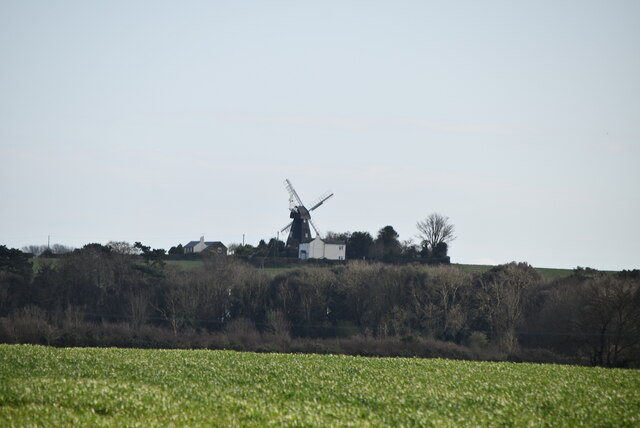
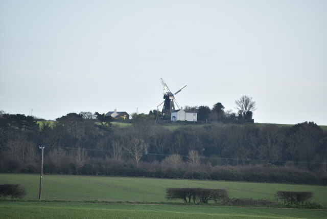
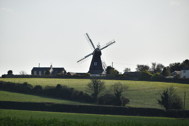
Ripple Mill Grade II listed.
Ripple Mill Credit: N Chadwick

Stag Point is a prominent coastal feature located in the county of Kent, England. Situated on the southeastern coast, it is recognized as a headland and point that juts out into the English Channel. The exact coordinates of Stag Point are approximately 51.237°N latitude and 1.392°E longitude.

This coastal feature is known for its stunning natural beauty and unique geological formations. The headland is characterized by its towering cliffs, which provide visitors with breathtaking panoramic views of the surrounding area. The cliffs are composed of chalk, a distinctive feature of the region, and showcase layers of sedimentary rock dating back millions of years.

Stag Point is a popular destination for outdoor enthusiasts and nature lovers. The area offers various opportunities for hiking, birdwatching, and photography. The headland is home to a diverse range of flora and fauna, including nesting seabirds and rare plant species.

In addition to its natural attractions, Stag Point holds historical significance. The area has witnessed human activity for centuries, with evidence of ancient settlements and archaeological finds dating back to prehistoric times. The headland has also played a role in maritime history, as its strategic location has made it an important landmark for navigation and maritime trade.

Stag Point is easily accessible by road, with nearby parking facilities available for visitors. The local authorities have taken measures to ensure the preservation of this coastal feature, including designated viewing areas and walking trails to protect the fragile ecosystem.

If you have any feedback on the listing, please let us know in the comments section below.

Stag Point Images

Images are sourced within 2km of 51.182706/1.402317 or Grid Reference TR3748. Thanks to Geograph Open Source API. All images are credited.
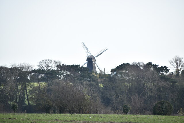
Ripple Mill Grade II listed.
Ripple Mill
Grade II listed.
Ripple Mill Grade II listed.
Ripple Mill
Grade II listed.
Ripple Mill There are three main types of windmill in Great Britain: post mills, smock mills and tower mills.

The smock mill is of a timber-framed construction with weatherboarded, steeply sloping external walls.  It was built on a brick base.  A pivoting wooden top with sails moved independently of the main structure so that the sails could be positioned towards the wind.  This was controlled by a tail fan.

Windmill article <a title="https://www.geograph.org.uk/article/Windmills" href="https://www.geograph.org.uk/article/Windmills">Link</a>
Ripple Mill
There are three main types of windmill in Great Britain: post mills, smock mills and tower mills. The smock mill is of a timber-framed construction with weatherboarded, steeply sloping external walls. It was built on a brick base. A pivoting wooden top with sails moved independently of the main structure so that the sails could be positioned towards the wind. This was controlled by a tail fan. Windmill article Link
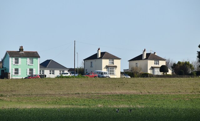
Houses on Dover Rd
Houses on Dover Rd
Ripple Mill Ripple Windmill is a Grade II listed <span class="nowrap"><a title="https://historicengland.org.uk/listing/the-list/list-entry/1237017" rel="nofollow ugc noopener" href="https://historicengland.org.uk/listing/the-list/list-entry/1237017">Link</a><img style="margin-left:2px;" alt="External link" title="External link - shift click to open in new window" src="https://s1.geograph.org.uk/img/external.png" width="10" height="10"/></span>  smock mill in Ringwould, that was built in Drellingore and moved to Ringwould in the early nineteenth century. Having been stripped of machinery and used as a television mast, it is now under restoration as a working windmill.
Wikipedia: <span class="nowrap"><a title="https://en.wikipedia.org/wiki/Ripple_Mill,_Ringwould" rel="nofollow ugc noopener" href="https://en.wikipedia.org/wiki/Ripple_Mill,_Ringwould">Link</a><img style="margin-left:2px;" alt="External link" title="External link - shift click to open in new window" src="https://s1.geograph.org.uk/img/external.png" width="10" height="10"/></span>
Ripple Mill
Ripple Windmill is a Grade II listed LinkExternal link smock mill in Ringwould, that was built in Drellingore and moved to Ringwould in the early nineteenth century. Having been stripped of machinery and used as a television mast, it is now under restoration as a working windmill. Wikipedia: LinkExternal link
Houses on Dover Rd
Houses on Dover Rd
Dover Rd The A258 runs 13.5 miles from Dover to Sandwich, via Deal.
<span class="nowrap"><a title="http://www.sabre-roads.org.uk/wiki/index.php?title=A258" rel="nofollow ugc noopener" href="http://www.sabre-roads.org.uk/wiki/index.php?title=A258">Link</a><img style="margin-left:2px;" alt="External link" title="External link - shift click to open in new window" src="https://s1.geograph.org.uk/img/external.png" width="10" height="10"/></span>
Dover Rd
The A258 runs 13.5 miles from Dover to Sandwich, via Deal. LinkExternal link
Ripple Mill Ripple Windmill is a Grade II listed <span class="nowrap"><a title="https://historicengland.org.uk/listing/the-list/list-entry/1237017" rel="nofollow ugc noopener" href="https://historicengland.org.uk/listing/the-list/list-entry/1237017">Link</a><img style="margin-left:2px;" alt="External link" title="External link - shift click to open in new window" src="https://s1.geograph.org.uk/img/external.png" width="10" height="10"/></span>  smock mill in Ringwould, that was built in Drellingore and moved to Ringwould in the early nineteenth century. Having been stripped of machinery and used as a television mast, it is now under restoration as a working windmill.
Wikipedia: <span class="nowrap"><a title="https://en.wikipedia.org/wiki/Ripple_Mill,_Ringwould" rel="nofollow ugc noopener" href="https://en.wikipedia.org/wiki/Ripple_Mill,_Ringwould">Link</a><img style="margin-left:2px;" alt="External link" title="External link - shift click to open in new window" src="https://s1.geograph.org.uk/img/external.png" width="10" height="10"/></span>
Ripple Mill
Ripple Windmill is a Grade II listed LinkExternal link smock mill in Ringwould, that was built in Drellingore and moved to Ringwould in the early nineteenth century. Having been stripped of machinery and used as a television mast, it is now under restoration as a working windmill. Wikipedia: LinkExternal link
Upper Street, Kingsdown Taken looking downhill from near junction with Chalk Hill Road.
Upper Street, Kingsdown
Taken looking downhill from near junction with Chalk Hill Road.
Footpath through Otty Bottom south of Kingsdown
Footpath through sweetcorn near Kingsdown The footpath through the open downland landscape of Otty Bottom ends in this crop of sweetcorn just before it reaches Victoria Road in Kingsdown.
Footpath through sweetcorn near Kingsdown
The footpath through the open downland landscape of Otty Bottom ends in this crop of sweetcorn just before it reaches Victoria Road in Kingsdown.
A walk from St Margaret’s at Cliffe to Kingsdown and return [9] The path passes through the gate and offers glimpses of the white cliffs in the distance.
Starting from the Dover Patrol Monument, the walk follows the long distance Saxon Shore Way along the top of the cliffs before descending to the bay at Kingsdown.  Heading inland there is an ascent of Wood Hill before various rights of way run across fields to the wonderfully named Otty Bottom, then on to Free Down and a return to the starting point. A little more than 5 miles.
A walk from St Margaret’s at Cliffe to Kingsdown and return [9]
The path passes through the gate and offers glimpses of the white cliffs in the distance. Starting from the Dover Patrol Monument, the walk follows the long distance Saxon Shore Way along the top of the cliffs before descending to the bay at Kingsdown. Heading inland there is an ascent of Wood Hill before various rights of way run across fields to the wonderfully named Otty Bottom, then on to Free Down and a return to the starting point. A little more than 5 miles.
A walk from St Margaret’s at Cliffe to Kingsdown and return [10] Seen from the path is this schooner.
Starting from the Dover Patrol Monument, the walk follows the long distance Saxon Shore Way along the top of the cliffs before descending to the bay at Kingsdown.  Heading inland there is an ascent of Wood Hill before various rights of way run across fields to the wonderfully named Otty Bottom, then on to Free Down and a return to the starting point. A little more than 5 miles.
A walk from St Margaret’s at Cliffe to Kingsdown and return [10]
Seen from the path is this schooner. Starting from the Dover Patrol Monument, the walk follows the long distance Saxon Shore Way along the top of the cliffs before descending to the bay at Kingsdown. Heading inland there is an ascent of Wood Hill before various rights of way run across fields to the wonderfully named Otty Bottom, then on to Free Down and a return to the starting point. A little more than 5 miles.
A walk from St Margaret’s at Cliffe to Kingsdown and return [11] The path continues north along the cliff top with the odd glimpse of the white chalk.
Starting from the Dover Patrol Monument, the walk follows the long distance Saxon Shore Way along the top of the cliffs before descending to the bay at Kingsdown.  Heading inland there is an ascent of Wood Hill before various rights of way run across fields to the wonderfully named Otty Bottom, then on to Free Down and a return to the starting point. A little more than 5 miles.
A walk from St Margaret’s at Cliffe to Kingsdown and return [11]
The path continues north along the cliff top with the odd glimpse of the white chalk. Starting from the Dover Patrol Monument, the walk follows the long distance Saxon Shore Way along the top of the cliffs before descending to the bay at Kingsdown. Heading inland there is an ascent of Wood Hill before various rights of way run across fields to the wonderfully named Otty Bottom, then on to Free Down and a return to the starting point. A little more than 5 miles.
A walk from St Margaret’s at Cliffe to Kingsdown and return [12] A view out to sea and a bench for the weary walker.
Starting from the Dover Patrol Monument, the walk follows the long distance Saxon Shore Way along the top of the cliffs before descending to the bay at Kingsdown.  Heading inland there is an ascent of Wood Hill before various rights of way run across fields to the wonderfully named Otty Bottom, then on to Free Down and a return to the starting point. A little more than 5 miles.
A walk from St Margaret’s at Cliffe to Kingsdown and return [12]
A view out to sea and a bench for the weary walker. Starting from the Dover Patrol Monument, the walk follows the long distance Saxon Shore Way along the top of the cliffs before descending to the bay at Kingsdown. Heading inland there is an ascent of Wood Hill before various rights of way run across fields to the wonderfully named Otty Bottom, then on to Free Down and a return to the starting point. A little more than 5 miles.
A walk from St Margaret’s at Cliffe to Kingsdown and return [13] The path continues to head north along the cliff tops.
Starting from the Dover Patrol Monument, the walk follows the long distance Saxon Shore Way along the top of the cliffs before descending to the bay at Kingsdown.  Heading inland there is an ascent of Wood Hill before various rights of way run across fields to the wonderfully named Otty Bottom, then on to Free Down and a return to the starting point. A little more than 5 miles.
A walk from St Margaret’s at Cliffe to Kingsdown and return [13]
The path continues to head north along the cliff tops. Starting from the Dover Patrol Monument, the walk follows the long distance Saxon Shore Way along the top of the cliffs before descending to the bay at Kingsdown. Heading inland there is an ascent of Wood Hill before various rights of way run across fields to the wonderfully named Otty Bottom, then on to Free Down and a return to the starting point. A little more than 5 miles.
A walk from St Margaret’s at Cliffe to Kingsdown and return [14] Little Green is a house with a view. Seen from the path.
Starting from the Dover Patrol Monument, the walk follows the long distance Saxon Shore Way along the top of the cliffs before descending to the bay at Kingsdown.  Heading inland there is an ascent of Wood Hill before various rights of way run across fields to the wonderfully named Otty Bottom, then on to Free Down and a return to the starting point. A little more than 5 miles.
A walk from St Margaret’s at Cliffe to Kingsdown and return [14]
Little Green is a house with a view. Seen from the path. Starting from the Dover Patrol Monument, the walk follows the long distance Saxon Shore Way along the top of the cliffs before descending to the bay at Kingsdown. Heading inland there is an ascent of Wood Hill before various rights of way run across fields to the wonderfully named Otty Bottom, then on to Free Down and a return to the starting point. A little more than 5 miles.
A walk from St Margaret’s at Cliffe to Kingsdown and return [15] A view south along the path on the top of the cliffs.
Starting from the Dover Patrol Monument, the walk follows the long distance Saxon Shore Way along the top of the cliffs before descending to the bay at Kingsdown.  Heading inland there is an ascent of Wood Hill before various rights of way run across fields to the wonderfully named Otty Bottom, then on to Free Down and a return to the starting point. A little more than 5 miles.
A walk from St Margaret’s at Cliffe to Kingsdown and return [15]
A view south along the path on the top of the cliffs. Starting from the Dover Patrol Monument, the walk follows the long distance Saxon Shore Way along the top of the cliffs before descending to the bay at Kingsdown. Heading inland there is an ascent of Wood Hill before various rights of way run across fields to the wonderfully named Otty Bottom, then on to Free Down and a return to the starting point. A little more than 5 miles.
Show me another place!

Stag Point is located at Grid Ref: TR3748 (Lat: 51.182706, Lng: 1.402317)

Administrative County: Kent

District: Dover

Police Authority: Kent

What 3 Words

///beak.obscuring.pony. Near Deal, Kent

Related Wikis

Kingsdown, Dover

Kingsdown is a village on the English Channel coast of Kent. Parts of the village are built on or behind the shingle beach that runs north to Deal and...

Ringwould with Kingsdown

Ringwould with Kingsdown is a coastal civil parish in the Dover District of Kent, England. The parish contains the villages of Ringwould and Kingsdown...

East Kent Sudbury School

East Kent Sudbury is a home education learning community in Deal, Kent in the United Kingdom. The community operates on Sudbury school principles, that...

St Nicholas Church, Ringwould

St Nicholas Church is the Church of England parish church of the village of Ringwould in east Kent. A Grade I listed building, it was constructed in the...

Nearby Amenities

Located within 500m of 51.182706,1.402317
Millennium Milepost Kingsdown
Bicycle: yes
Description: 1) St. Margaret's 2.75, Dover 7.5 2) Deal 3, Sandwich 8.5
Image: https://www.cyclestreets.net/location/185589/cyclestreets185589.jpg
Information: guidepost
Ncn Milepost: rowe
Sustrans Ref: MP 631
Tourism: information
Lat/Long: 51.1799743/1.4038585
Bus Stop
Jarvist Place
Local Ref: adj
Naptan AtcoCode: 2400A032870A
Naptan Bearing: S
Naptan BusStopType: MKD
Naptan CommonName: Jarvist Place
Naptan Indicator: adj
Naptan Landmark: Jarvist Place
Naptan NaptanCode: kntdjtgm
Naptan RevisionNumber: 3
Naptan Status: act
Naptan Street: Cliffe Road
Naptan Verified: no
Public Transport: platform
Ref: kntdjtgm
Source: naptan_import
Source Date: 2018-02-02
Lat/Long: 51.1871693/1.4029323
Post Box
Collection Times: Mo-Fr 09:00; Sa 07:00
Operator: Royal Mail
Operator Wikidata: Q638098
Post Box Mounting: wooden_post
Post Box Type: lamp
Ref: CT14 68
Royal Cypher: EIIR
Royal Cypher Wikidata: Q33102113
Lat/Long: 51.1826047/1.3955674
Post Box
Ref: CT14 85
Lat/Long: 51.1857465/1.3976356
Pub
King's Head
Addr City: Deal
Addr Place: Kingsdown
Addr Postcode: CT14 8BJ
Addr Street: Upper Street
Fhrs Id: 254372
Free House: yes
Lat/Long: 51.1847287/1.3996601
Post Box
Collection Times: Mo-Fr 16:45; Sa 12:00
Operator: Royal Mail
Operator Wikidata: Q638098
Post Box Mounting: metal_post
Post Box Type: lamp
Ref: CT14 59
Royal Cypher: EIIR
Royal Cypher Wikidata: Q33102113
Lat/Long: 51.1849527/1.3999991
Post Box
Ref: CT14 64
Lat/Long: 51.1801697/1.4036851
Post Office
Kingsdown Post Office
Addr City: Deal
Addr Country: GB
Addr Housenumber: 1
Addr Postcode: CT14 8BJ
Addr Street: Greenbank
Brand: Post Office
Brand Wikidata: Q1783168
Opening Hours: Mo-Fr 07:00-17:30; Sa 09:00-17:30; Su 07:00-12:00
Ref Pol Id: 139878
Source: OS OpenData StreetView
Website: https://www.postoffice.co.uk/branch-finder/2669099/kingsdown
Lat/Long: 51.185012/1.3999257
Toilets
Fee: no
Supervised: no
Wheelchair: yes
Lat/Long: 51.1855145/1.4030024
Kingsdown International Camping Centre
Addr City: Kingsdown
Addr Housename: Kingsdown International Camping Centre
Addr Postcode: CT14 8DU
Addr Street: The Avenue
Camp Site: reception
Contact Email: customerservice@kingsdowncamping.co.uk
Contact Phone: +44 1304 373713
Contact Website: https://www.kingsdowncamping.co.uk
Internet Access: wlan
Internet Access Fee: no
Operator: Kingsdown Holiday Park
Tourism: camp_site
Lat/Long: 51.1823025/1.3999535
Del's Village Shop
Addr City: Deal
Addr Housenumber: 1
Addr Postcode: CT14 8BJ
Addr Street: Greenbank
Opening Hours: Mo-Fr 07:00-17:30; Sa 09:00-17:30; Su 07:00-12:00
Shop: convenience
Lat/Long: 51.184982/1.3999438
Entrance: yes
Lat/Long: 51.1849206/1.4009125
Access: private
Entrance: main
Lat/Long: 51.1829984/1.4022809
Access: private
Entrance: main
Lat/Long: 51.1830319/1.4024663
Access: private
Entrance: main
Lat/Long: 51.1830511/1.4025168
Access: private
Entrance: main
Lat/Long: 51.1830873/1.4017324
Access: private
Entrance: main
Lat/Long: 51.1830971/1.4019978
Access: private
Entrance: main
Wheelchair: no
Lat/Long: 51.1830988/1.4016174
Access: private
Entrance: main
Lat/Long: 51.1831015/1.4013826
Access: private
Entrance: main
Lat/Long: 51.1831163/1.4013268
Access: private
Entrance: main
Wheelchair: no
Lat/Long: 51.1831187/1.4015396
Access: private
Entrance: main
Lat/Long: 51.1831311/1.4019763
Access: private
Entrance: main
Lat/Long: 51.1831311/1.4025294
Direction: 90
Tourism: viewpoint
Lat/Long: 51.1829652/1.4037002
Access: private
Entrance: main
Lat/Long: 51.183164/1.4024943
Access: private
Entrance: main
Lat/Long: 51.1831994/1.4018731
Access: private
Entrance: main
Lat/Long: 51.1832327/1.4023985
Access: private
Entrance: main
Lat/Long: 51.1832356/1.4028328
Access: private
Entrance: main
Lat/Long: 51.1832411/1.4018507
Access: private
Entrance: main
Lat/Long: 51.1832421/1.4014086
Access: private
Entrance: main
Lat/Long: 51.1832532/1.4031458
Access: private
Entrance: main
Lat/Long: 51.1832575/1.4023604
Access: private
Entrance: main
Lat/Long: 51.1832762/1.4013916
Access: private
Entrance: main
Lat/Long: 51.1833001/1.4027233
Access: private
Entrance: main
Lat/Long: 51.1833081/1.4003648
Access: private
Entrance: main
Lat/Long: 51.1833322/1.4026965
Access: private
Entrance: main
Lat/Long: 51.1833388/1.4032295
Access: private
Entrance: main
Lat/Long: 51.1833432/1.4003477
Fire Extinguisher
Emergency: fire_extinguisher
Lat/Long: 51.1833493/1.4007461
Fire Extinguisher
Emergency: fire_extinguisher
Lat/Long: 51.1833544/1.4029741
Fire Extinguisher
Emergency: fire_extinguisher
Lat/Long: 51.1833712/1.4016311
Access: private
Entrance: main
Lat/Long: 51.1833727/1.4018866
Access: private
Entrance: main
Lat/Long: 51.1833752/1.4032374
Access: private
Entrance: main
Lat/Long: 51.1834022/1.4013445
Access: private
Entrance: main
Lat/Long: 51.1834092/1.4018664
Access: private
Entrance: main
Lat/Long: 51.1834249/1.4013016
Access: private
Entrance: main
Lat/Long: 51.1834287/1.400315
Access: private
Entrance: main
Lat/Long: 51.1834456/1.4031677
Access: private
Entrance: main
Lat/Long: 51.1834463/1.400038
Access: private
Entrance: main
Lat/Long: 51.1834479/1.4021253
Access: private
Entrance: main
Lat/Long: 51.1834519/1.4027353
Access: private
Entrance: main
Lat/Long: 51.1834538/1.4011374
Access: private
Entrance: main
Lat/Long: 51.1834732/1.3999955
Access: private
Entrance: main
Lat/Long: 51.1834738/1.4010888
Fire Hydrant
Emergency: fire_hydrant
Operator: Kingsdown Holiday Park
Lat/Long: 51.1834784/1.4020793
Access: private
Entrance: main
Lat/Long: 51.1834818/1.4031528
Access: private
Entrance: main
Lat/Long: 51.1834859/1.4017955
Access: private
Entrance: main
Lat/Long: 51.1834892/1.4027455
Access: private
Entrance: main
Lat/Long: 51.1835221/1.4017691
Access: private
Entrance: main
Lat/Long: 51.183533/1.400942
Access: private
Entrance: main
Lat/Long: 51.1835635/1.4008983
Fire Hydrant
Emergency: fire_hydrant
Operator: Kingsdown Holiday Park
Lat/Long: 51.1835669/1.4005016
Access: private
Entrance: main
Lat/Long: 51.1835676/1.4031582
Access: private
Entrance: main
Lat/Long: 51.1835812/1.4002301
Access: private
Entrance: main
Lat/Long: 51.1835816/1.4016464
Access: private
Entrance: main
Lat/Long: 51.1836018/1.403133
Access: private
Entrance: main
Lat/Long: 51.1836142/1.4016156
Access: private
Entrance: main
Lat/Long: 51.1836182/1.400221
Fire Extinguisher
Emergency: fire_extinguisher
Lat/Long: 51.1836223/1.401827
Access: private
Entrance: main
Lat/Long: 51.1836334/1.4008054
Access: private
Entrance: main
Lat/Long: 51.1836462/1.4026495
Access: private
Entrance: main
Lat/Long: 51.1836554/1.4014141
Access: private
Entrance: main
Lat/Long: 51.1836644/1.4007678
Access: private
Entrance: main
Lat/Long: 51.1836845/1.4013815
Access: private
Entrance: main
Lat/Long: 51.1837029/1.4001684
Fire Extinguisher
Emergency: fire_extinguisher
Lat/Long: 51.1837079/1.4010376
Access: private
Entrance: main
Lat/Long: 51.1837381/1.4001593
Access: private
Entrance: main
Lat/Long: 51.1837441/1.4024996
Fire Extinguisher
Emergency: fire_extinguisher
Lat/Long: 51.1837471/1.4004098
Access: private
Entrance: main
Lat/Long: 51.1837482/1.4007218
Access: private
Entrance: main
Lat/Long: 51.1837526/1.4012895
Entrance: yes
Wheelchair: yes
Lat/Long: 51.1837582/1.4020307
Access: private
Entrance: main
Lat/Long: 51.1837826/1.4025094
Access: private
Entrance: main
Lat/Long: 51.1837851/1.4007055
Access: private
Entrance: main
Lat/Long: 51.183791/1.4012697
Access: private
Entrance: main
Lat/Long: 51.183798/1.4029851
Access: private
Entrance: main
Lat/Long: 51.183827/1.4001624
Access: private
Entrance: main
Lat/Long: 51.1838346/1.4029587
Access: private
Entrance: main
Lat/Long: 51.1838635/1.4001622
Access: private
Entrance: main
Lat/Long: 51.1838638/1.4006992
Access: private
Entrance: main
Lat/Long: 51.18387/1.4012396
Leisure: water_park
Opening Hours: Mo-Su 09:00-17:00
Operator: Kingsdown Holiday Park
Sport: swimming
Lat/Long: 51.1838722/1.4020868
Access: private
Entrance: main
Lat/Long: 51.1838743/1.4024747
Access: private
Entrance: main
Lat/Long: 51.1838962/1.4028668
Access: private
Entrance: main
Lat/Long: 51.183907/1.4006952
Access: private
Entrance: main
Lat/Long: 51.1839087/1.4026355
Access: private
Entrance: main
Lat/Long: 51.1839108/1.4026975
Access: private
Entrance: main
Lat/Long: 51.183913/1.4024868
Access: private
Entrance: main
Lat/Long: 51.1839171/1.4014335
Access: private
Entrance: main
Lat/Long: 51.1839215/1.4028171
Access: private
Entrance: main
Lat/Long: 51.1839456/1.4001361
Access: private
Entrance: main
Lat/Long: 51.18395/1.4014583
Access: private
Entrance: main
Lat/Long: 51.1839826/1.4001326
Access: private
Entrance: main
Lat/Long: 51.1839826/1.4007505
Access: private
Entrance: main
Lat/Long: 51.1839903/1.4015514
Access: private
Entrance: main
Lat/Long: 51.184011/1.4016022
Access: private
Entrance: main
Lat/Long: 51.1840183/1.4007686
Access: private
Entrance: main
Lat/Long: 51.184025/1.4017523
Access: private
Entrance: main
Lat/Long: 51.1840549/1.4009285
Access: private
Entrance: main
Lat/Long: 51.1840588/1.4001773
Access: private
Entrance: main
Lat/Long: 51.184063/1.4011709
Access: private
Entrance: main
Lat/Long: 51.1840861/1.400955
Access: private
Entrance: main
Lat/Long: 51.1840913/1.4012102
Access: private
Entrance: main
Lat/Long: 51.1840931/1.400203
Leisure: playground
Operator: Kingsdown Holiday Park
Lat/Long: 51.184106/1.4028942
Fire Hydrant
Emergency: fire_hydrant
Operator: Kingsdown Holiday Park
Lat/Long: 51.1841098/1.4015299
Access: private
Entrance: main
Lat/Long: 51.1841475/1.4003203
Access: private
Entrance: main
Lat/Long: 51.184149/1.4013406
Access: private
Entrance: main
Lat/Long: 51.1841735/1.4013876
Access: private
Entrance: main
Lat/Long: 51.1841739/1.400555
Access: private
Entrance: main
Lat/Long: 51.184175/1.4003634
Access: private
Entrance: main
Lat/Long: 51.1841867/1.4006122
Access: private
Entrance: main
Lat/Long: 51.1841879/1.4015738
Access: private
Entrance: main
Lat/Long: 51.1842138/1.401617
Access: private
Entrance: main
Lat/Long: 51.1843532/1.4026832
Trolley Bay
Lat/Long: 51.1843563/1.4015759
Access: private
Entrance: main
Lat/Long: 51.1843592/1.4024723
Access: private
Entrance: main
Lat/Long: 51.1843771/1.4024239
Access: private
Entrance: main
Lat/Long: 51.1843896/1.4027015
Fire Extinguisher
Emergency: fire_extinguisher
Lat/Long: 51.1844019/1.4009287
Access: private
Entrance: main
Lat/Long: 51.184473/1.4027246
Barrier: bollard
Foot: yes
Lat/Long: 51.1844991/1.4015714
Fire Extinguisher
Emergency: fire_extinguisher
Lat/Long: 51.1845058/1.4024866
Access: private
Entrance: main
Lat/Long: 51.1845104/1.4027367
Access: private
Entrance: main
Lat/Long: 51.1845118/1.4021278
Access: private
Entrance: main
Lat/Long: 51.1845839/1.4026953
Access: private
Entrance: main
Lat/Long: 51.1846198/1.4026709
Access: private
Entrance: main
Lat/Long: 51.184668/1.4025312
Access: private
Entrance: main
Lat/Long: 51.1847197/1.4021555
Access: private
Entrance: main
Lat/Long: 51.1847519/1.4025012
Access: private
Entrance: main
Lat/Long: 51.1847721/1.4022653
Access: private
Entrance: main
Lat/Long: 51.1847751/1.4024513
Access: private
Entrance: main
Lat/Long: 51.18478/1.402325
Rose Garden
Leisure: garden
Name De: Rosengarten
Lat/Long: 51.1848878/1.4020563
Kingsdown
Place: village
Population: 1964
Wikidata: Q2577801
Wikipedia: en:Kingsdown, Dover
Lat/Long: 51.186841/1.4027375
Generator Method: photovoltaic
Generator Output Electricity: yes
Generator Source: solar
Generator Type: solar_photovoltaic_panel
Location: roof
Power: generator
Lat/Long: 51.1850452/1.3966839
Generator Method: photovoltaic
Generator Output Electricity: yes
Generator Source: solar
Generator Type: solar_photovoltaic_panel
Location: roof
Power: generator
Lat/Long: 51.1835783/1.3954326
Generator Method: photovoltaic
Generator Output Electricity: yes
Generator Source: solar
Generator Type: solar_photovoltaic_panel
Location: roof
Power: generator
Lat/Long: 51.1814186/1.3969172
Post Box
Collection Times: Mo-Fr 09:00, Sa 07:00
Operator: Royal Mail
Ref: CT14 39
Royal Cypher: VR
Royal Cypher Wikidata: Q33102356
Lat/Long: 51.1859703/1.4043564
Generator Method: photovoltaic
Generator Output Electricity: yes
Generator Source: solar
Generator Type: solar_photovoltaic_panel
Location: roof
Power: generator
Lat/Long: 51.1798886/1.3985011
Generator Method: photovoltaic
Generator Output Electricity: yes
Generator Source: solar
Generator Type: solar_photovoltaic_panel
Location: roof
Power: generator
Lat/Long: 51.181554/1.3961542
Generator Method: photovoltaic
Generator Output Electricity: yes
Generator Source: solar
Generator Type: solar_photovoltaic_panel
Location: roof
Power: generator
Lat/Long: 51.1806242/1.3962373
Generator Method: photovoltaic
Generator Output Electricity: yes
Generator Source: solar
Generator Type: solar_photovoltaic_panel
Location: roof
Power: generator
Lat/Long: 51.1828856/1.3980532
Generator Method: photovoltaic
Generator Output Electricity: yes
Generator Source: solar
Generator Type: solar_photovoltaic_panel
Location: roof
Power: generator
Lat/Long: 51.1858043/1.3974416
Generator Method: photovoltaic
Generator Output Electricity: yes
Generator Source: solar
Generator Type: solar_photovoltaic_panel
Location: roof
Power: generator
Lat/Long: 51.1858211/1.3978708
Pub
The Rising Sun
Addr County: Kent
Addr Postcode: CT14 8AH
Addr Street: Cliffe Road
Addr Village: Kingsdown
Fhrs Id: 1051016
Source Addr: FHRS Open Data
Lat/Long: 51.1863331/1.4031986
Traffic Calming: bump
Lat/Long: 51.1824165/1.4000367
Barrier: lift_gate
Lat/Long: 51.1823098/1.4000353
Bus Stop
Victoria Road
Local Ref: N-bound
Naptan AtcoCode: 2400A071710A
Naptan Bearing: N
Naptan BusStopType: CUS
Naptan CommonName: Victoria Road
Naptan Indicator: N-bound
Naptan Landmark: Kingsdown Hill
Naptan NaptanCode: kntgdpgp
Naptan RevisionNumber: 3
Naptan Status: act
Naptan Street: Victoria Road
Naptan Verified: no
Public Transport: platform
Ref: kntgdpgp
Source: naptan_import
Source Date: 2018-02-02
Lat/Long: 51.1819019/1.3956892
Camera Type: panning
Man Made: surveillance
Operator: RNLI
Surveillance: public
Surveillance Type: camera
Surveillance Zone: sea
Lat/Long: 51.1787515/1.4037173
Height: ~10
Man Made: tower
Tower Type: radar
Lat/Long: 51.1790857/1.4035517
Height: ~20
Man Made: tower
Tower Type: communication
Lat/Long: 51.1828243/1.4017412
Height: ~20
Man Made: tower
Tower Type: communication
Lat/Long: 51.1828148/1.4014981
Disused Amenity: post_box
Post Box Mounting: brick_pillar
Post Box Type: wall
Royal Cypher: EIIR
Lat/Long: 51.1847716/1.399529
Telephone
Booth: K6
Covered: booth
Operator: BT
Operator Wikidata: Q593786
Payment Coins: yes
Payment Credit Cards: yes
Payment Debit Cards: yes
Phone: +44 1304 373501
Lat/Long: 51.1847826/1.3995236
Generator Method: photovoltaic
Generator Output Electricity: yes
Generator Source: solar
Generator Type: solar_photovoltaic_panel
Location: roof
Power: generator
Lat/Long: 51.1866272/1.4046903
Generator Method: photovoltaic
Generator Output Electricity: yes
Generator Source: solar
Generator Type: solar_photovoltaic_panel
Location: roof
Power: generator
Lat/Long: 51.1819626/1.3972056
Generator Method: photovoltaic
Generator Output Electricity: yes
Generator Source: solar
Generator Type: solar_photovoltaic_panel
Location: roof
Power: generator
Lat/Long: 51.1797163/1.3970393
Generator Method: photovoltaic
Generator Output Electricity: yes
Generator Source: solar
Generator Type: solar_photovoltaic_panel
Location: roof
Power: generator
Lat/Long: 51.1797062/1.3971412
Generator Method: photovoltaic
Generator Output Electricity: yes
Generator Source: solar
Generator Type: solar_photovoltaic_panel
Location: roof
Power: generator
Lat/Long: 51.1808394/1.398308
Generator Method: photovoltaic
Generator Output Electricity: yes
Generator Source: solar
Generator Type: solar_photovoltaic_panel
Location: roof
Power: generator
Lat/Long: 51.180905/1.3965726
Generator Method: photovoltaic
Generator Output Electricity: yes
Generator Source: solar
Generator Type: solar_photovoltaic_panel
Location: roof
Power: generator
Lat/Long: 51.1827965/1.3959356
Generator Method: photovoltaic
Generator Output Electricity: yes
Generator Source: solar
Generator Type: solar_photovoltaic_panel
Location: roof
Power: generator
Lat/Long: 51.1831042/1.3962963
Generator Method: photovoltaic
Generator Output Electricity: yes
Generator Source: solar
Generator Type: solar_photovoltaic_panel
Location: roof
Power: generator
Lat/Long: 51.1799357/1.4029388
Generator Method: photovoltaic
Generator Output Electricity: yes
Generator Source: solar
Generator Type: solar_photovoltaic_panel
Location: roof
Power: generator
Lat/Long: 51.1791202/1.3984971
Generator Method: photovoltaic
Generator Output Electricity: yes
Generator Source: solar
Generator Type: solar_photovoltaic_panel
Location: roof
Power: generator
Lat/Long: 51.1793447/1.397671
Defibrillator
Access: yes
Defibrillator Location: outside Kingsdown Village Hall
Emergency: defibrillator
Indoor: no
Lat/Long: 51.1851164/1.4008126
The data included in this document is from www.openstreetmap.org. The data is made available under ODbL.

Have you been to Stag Point?

Leave your review of Stag Point below (or comments, questions and feedback).