Cock Point

Coastal Feature, Headland, Point in Lancashire South Lakeland

England

Cock Point

Coniston village sign This road sign on the A593 was erected by Lancashire County Council, pre-dating the formation of Cumbria in 1974 which incorporated that part of Lancashire north of Morecambe Bay.
Located at Park Gate, the sign is unusually far from the village, being almost 1.6km (1 mile) south of the centre of Coniston.
Coniston village sign Credit: Adrian Taylor

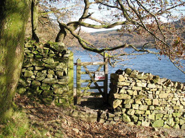
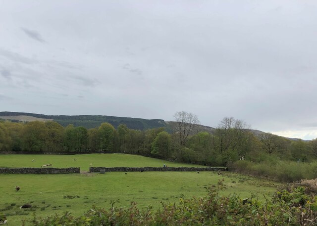
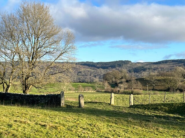
Cock Point is a prominent headland located in Lancashire, England. Situated along the coastline, this geographical feature stands as a defining landmark in the region. Named for its distinctive shape resembling the head of a rooster, Cock Point is a popular destination for locals and visitors alike.

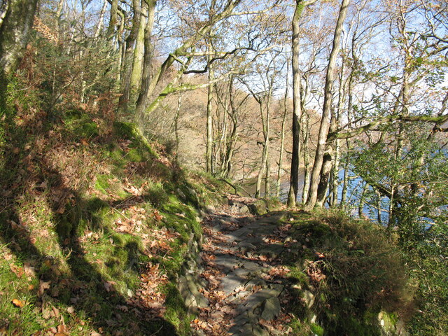
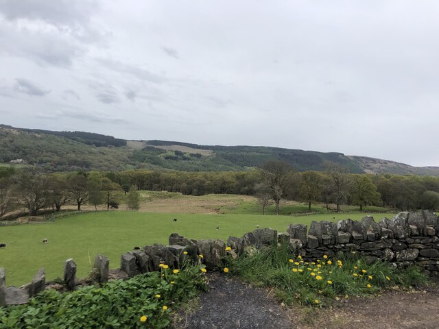
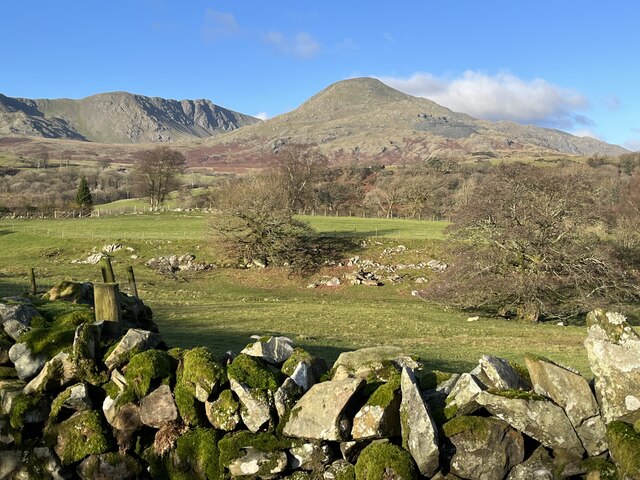
The headland is formed by a combination of sedimentary rocks, predominantly sandstone, which have been shaped over thousands of years by the forces of erosion from the Irish Sea. This geological composition gives Cock Point its characteristic rugged cliffs, which provide stunning views of the surrounding coastline.

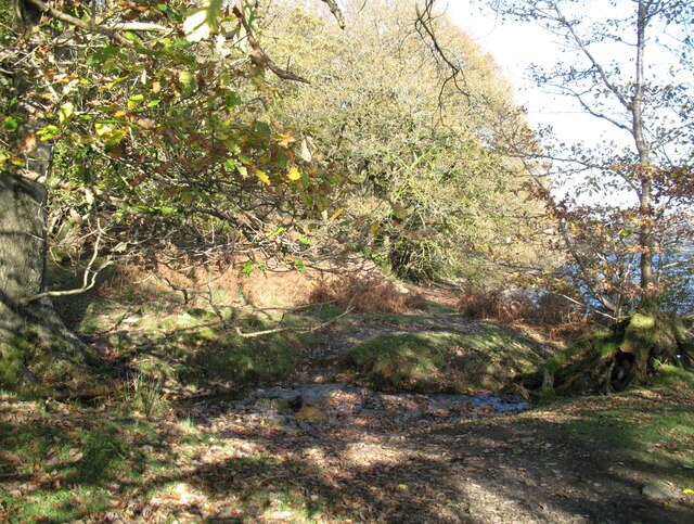
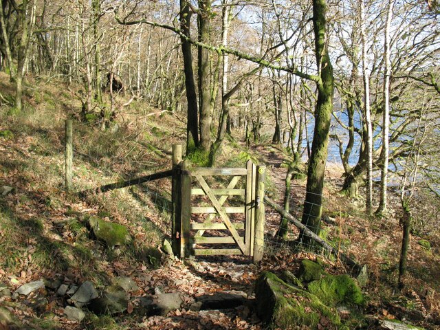
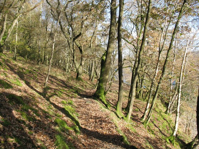
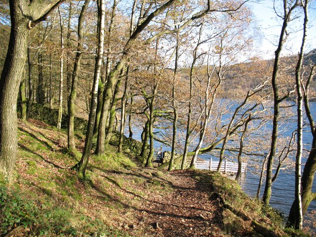
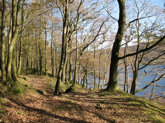
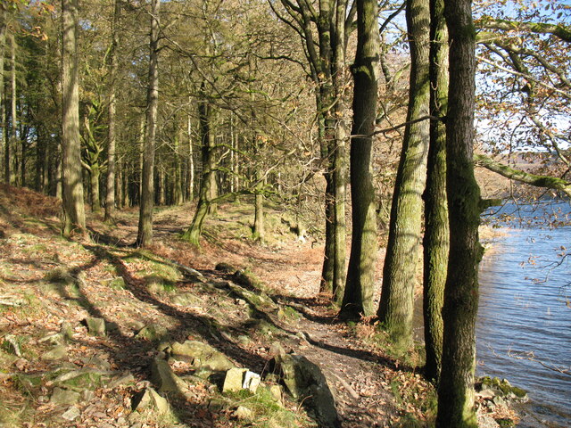
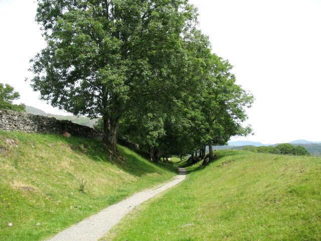
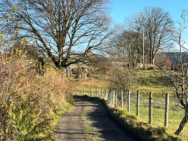
The headland is accessible via a coastal path that winds its way around the cliffs, offering visitors an opportunity to explore the area's diverse flora and fauna. The path also leads to a small beach nestled beneath the towering cliffs, providing a secluded spot for sunbathing and picnicking.

Cock Point is renowned for its natural beauty and is a haven for birdwatchers. The headland serves as a nesting ground for various seabirds, including gulls, cormorants, and puffins. Bird enthusiasts can often spot these magnificent creatures perched atop the steep cliffs or soaring gracefully above the crashing waves.

The headland's strategic location also makes it an important navigational point for maritime activities. Ships and boats frequently pass by Cock Point, taking advantage of its prominent position to guide them along the coastline.

In conclusion, Cock Point in Lancashire is a striking coastal feature that boasts rugged cliffs, sandy beaches, and diverse wildlife. Its unique shape and breathtaking views make it a must-visit destination for nature lovers and those seeking a glimpse of Lancashire's stunning coastline.

If you have any feedback on the listing, please let us know in the comments section below.
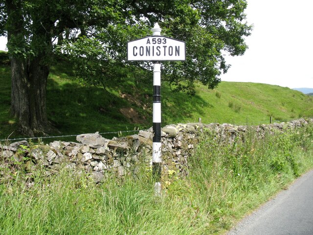
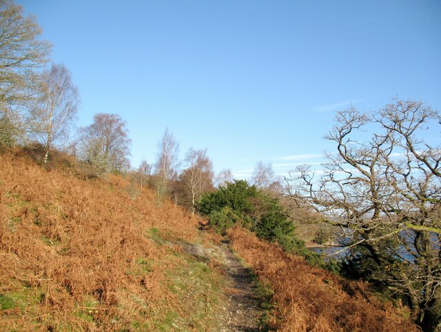
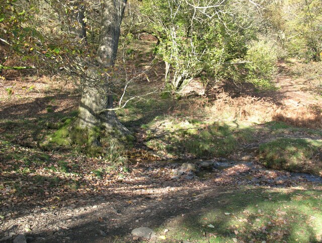
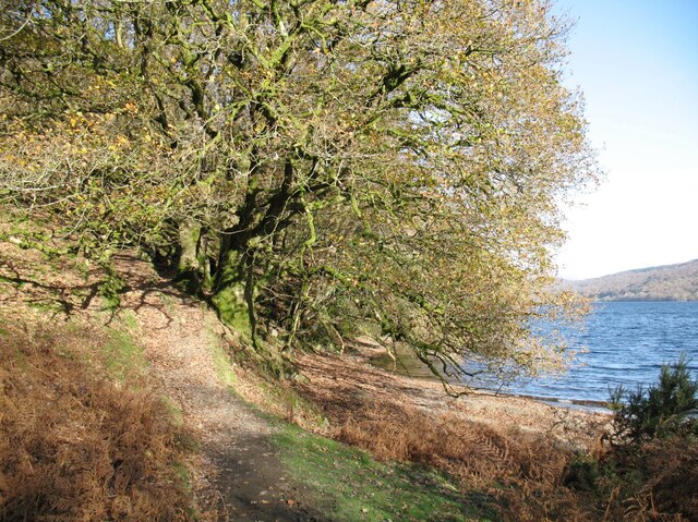
Cock Point Images

Images are sourced within 2km of 54.343319/-3.0663909 or Grid Reference SD3094. Thanks to Geograph Open Source API. All images are credited.

Coniston village sign This road sign on the A593 was erected by Lancashire County Council, pre-dating the formation of Cumbria in 1974 which incorporated that part of Lancashire north of Morecambe Bay.
Located at Park Gate, the sign is unusually far from the village, being almost 1.6km (1 mile) south of the centre of Coniston.
Coniston village sign
This road sign on the A593 was erected by Lancashire County Council, pre-dating the formation of Cumbria in 1974 which incorporated that part of Lancashire north of Morecambe Bay. Located at Park Gate, the sign is unusually far from the village, being almost 1.6km (1 mile) south of the centre of Coniston.
The Cumbria Way near Bellman’s Hole This path above the shore of Coniston Water is the public footpath from Delicars to Coniston. It is the route of The Cumbria Way long distance path from Ulverston to Carlisle (next photograph <a href="https://www.geograph.org.uk/photo/7003650">SD2993 : Moor Gill Foot Ford</a>).
The Cumbria Way near Bellman’s Hole
This path above the shore of Coniston Water is the public footpath from Delicars to Coniston. It is the route of The Cumbria Way long distance path from Ulverston to Carlisle (next photograph SD2993 : Moor Gill Foot Ford).
Moor Gill Foot Ford Moor Gill rises on Torver Back Common and drains into Coniston Water just below this small ford.  The public footpath from Delicars to Coniston which is also the route of The Cumbria Way crosses the ford.
Moor Gill Foot Ford
Moor Gill rises on Torver Back Common and drains into Coniston Water just below this small ford. The public footpath from Delicars to Coniston which is also the route of The Cumbria Way crosses the ford.
The Cumbria Way, Moor Gill Foot The Cumbria Way follows the western shore of Coniston Water through woodland below Torver Back Common (next photograph <a href="https://www.geograph.org.uk/photo/7004202">SD2993 : The Cumbria Way in Torver Common Wood</a>).
The Cumbria Way, Moor Gill Foot
The Cumbria Way follows the western shore of Coniston Water through woodland below Torver Back Common (next photograph SD2993 : The Cumbria Way in Torver Common Wood).
Moor Gill Foot Ford Moor Gill rises on Torver Back Common and drains into Coniston Water just below this small ford.  The public footpath from Delicars to Coniston crosses the ford; it  is the route of The Cumbria Way long distance path (next photograph <a href="https://www.geograph.org.uk/photo/7003649">SD2993 : The Cumbria Way, Moor Gill Foot</a>).
Moor Gill Foot Ford
Moor Gill rises on Torver Back Common and drains into Coniston Water just below this small ford. The public footpath from Delicars to Coniston crosses the ford; it is the route of The Cumbria Way long distance path (next photograph SD2993 : The Cumbria Way, Moor Gill Foot).
Gate in Torver Common Wood The gate crosses a public footpath from Delicars to Coniston which is also the route of The Cumbria Way long distance trail.
Coniston Water can be glimpsed through the trees (next photograph <a href="https://www.geograph.org.uk/photo/7004844">SD2994 : Rocky path in Torver Common Wood</a>).
Gate in Torver Common Wood
The gate crosses a public footpath from Delicars to Coniston which is also the route of The Cumbria Way long distance trail. Coniston Water can be glimpsed through the trees (next photograph SD2994 : Rocky path in Torver Common Wood).
The Cumbria Way in Torver Common Wood The Cumbria Way follows a public footpath along the western shore of Coniston Water through Torver Common Wood (next photograph <a href="https://www.geograph.org.uk/photo/7004120">SD2994 : Gate in Torver Common Wood</a>).
The Cumbria Way in Torver Common Wood
The Cumbria Way follows a public footpath along the western shore of Coniston Water through Torver Common Wood (next photograph SD2994 : Gate in Torver Common Wood).
Rocky path in Torver Common Wood The Cumbria Way follows a public footpath along the western shore of Coniston Water through Torver Common Wood, rounding a rocky spur above the lake shortly before reaching Harrison’s Coppice (next photograph <a href="https://www.geograph.org.uk/photo/7005690">SD2994 : Paths in Torver Common Wood</a>).
Rocky path in Torver Common Wood
The Cumbria Way follows a public footpath along the western shore of Coniston Water through Torver Common Wood, rounding a rocky spur above the lake shortly before reaching Harrison’s Coppice (next photograph SD2994 : Paths in Torver Common Wood).
Gate beside Coniston Water The public footpath from Delicars to Coniston passes through the gate leading from Torver Common Wood into Harrison Coppice.
The waymark on the right hand gatepost indicates that this is the route of The Cumbria Way (next photograph <a href="https://www.geograph.org.uk/photo/7006419">SD2994 : The Cumbria Way, Harrison Coppice</a>).
Gate beside Coniston Water
The public footpath from Delicars to Coniston passes through the gate leading from Torver Common Wood into Harrison Coppice. The waymark on the right hand gatepost indicates that this is the route of The Cumbria Way (next photograph SD2994 : The Cumbria Way, Harrison Coppice).
The Cumbria Way near Coniston Water The Cumbria Way follows the public footpath from Delicars to Coniston along the western shore of Coniston Water (next photograph <a href="https://www.geograph.org.uk/photo/7005687">SD2994 : Gate beside Coniston Water</a>).
The Cumbria Way near Coniston Water
The Cumbria Way follows the public footpath from Delicars to Coniston along the western shore of Coniston Water (next photograph SD2994 : Gate beside Coniston Water).
Paths in Torver Common Wood The path on the left doubles back up through the wood towards the top of Torver Back Common.  The public footpath from Delicars to Coniston and The Cumbria Way follow the path dropping down to the right towards the shore of Coniston Water (next photograph <a href="https://www.geograph.org.uk/photo/7005689">SD2994 : The Cumbria Way near Coniston Water</a>).
Paths in Torver Common Wood
The path on the left doubles back up through the wood towards the top of Torver Back Common. The public footpath from Delicars to Coniston and The Cumbria Way follow the path dropping down to the right towards the shore of Coniston Water (next photograph SD2994 : The Cumbria Way near Coniston Water).
Pasture south of Coniston Park coppice behind and Grizedale Forest on the hills
Pasture south of Coniston
Park coppice behind and Grizedale Forest on the hills
Grazing near Coniston Park Coppice
The Cumbria Way, Harrison Coppice The Cumbria Way follows the public footpath from Delicars to Coniston along the western shore of Coniston Water through Harrison Coppice (next photograph <a href="https://www.geograph.org.uk/photo/7006411">SD3094 : Ford in Harrison Coppice</a>).
The Cumbria Way, Harrison Coppice
The Cumbria Way follows the public footpath from Delicars to Coniston along the western shore of Coniston Water through Harrison Coppice (next photograph SD3094 : Ford in Harrison Coppice).
The Coniston Branch near Park Gate Now only used by walkers and sheep, this is the route of the former Furness Railway branch line from Foxfield to Coniston.
The last passenger service ran on 4 October 1958 with a final enthusiasts’ special train on the 27 August 1961.  The last freight train ran during the week ending 29 April 1962 and the track was lifted early in 1963.
The Coniston Branch near Park Gate
Now only used by walkers and sheep, this is the route of the former Furness Railway branch line from Foxfield to Coniston. The last passenger service ran on 4 October 1958 with a final enthusiasts’ special train on the 27 August 1961. The last freight train ran during the week ending 29 April 1962 and the track was lifted early in 1963.
Dow Crag and Coniston Old Man In winter sunshine, Dow Crag and Coniston Old Man are viewed from the lane near Grass Guards.
Dow Crag and Coniston Old Man
In winter sunshine, Dow Crag and Coniston Old Man are viewed from the lane near Grass Guards.
Occupation crossing, Little Arrow Still bearing their hinges but with the gates long gone, only four round topped slate gateposts remain from a farmer’s occupation crossing over the Coniston Branch railway at Little Arrow.
The last passenger service ran on 4 October 1958 with a final enthusiasts’ special train on the 27 August 1961. The last freight train ran during the week ending 29 April 1962 and the track was lifted early in 1963.
Occupation crossing, Little Arrow
Still bearing their hinges but with the gates long gone, only four round topped slate gateposts remain from a farmer’s occupation crossing over the Coniston Branch railway at Little Arrow. The last passenger service ran on 4 October 1958 with a final enthusiasts’ special train on the 27 August 1961. The last freight train ran during the week ending 29 April 1962 and the track was lifted early in 1963.
Lane near Brackenbarrow Farm The access lane to Brackenbarrow (formerly spelled Bracken Barrow) Farm forms a part of the public footpath from Brigg House Bridge on the A593 to Napping Tree Coppice beside Coniston Water.
Lane near Brackenbarrow Farm
The access lane to Brackenbarrow (formerly spelled Bracken Barrow) Farm forms a part of the public footpath from Brigg House Bridge on the A593 to Napping Tree Coppice beside Coniston Water.
Show me another place!

Cock Point is located at Grid Ref: SD3094 (Lat: 54.343319, Lng: -3.0663909)

Administrative County: Cumbria

District: South Lakeland

Police Authority: Cumbria

What 3 Words

///shield.blitz.disbanded. Near Windermere, Cumbria

Related Wikis

Coniston Water

Coniston Water is a lake in the Lake District in North West England. It is the third largest by volume, after Windermere and Ullswater, and the fifth-largest...

Lawson Park

Lawson Park is a remote English Lake District hillfarm, leased by Grizedale Arts (a contemporary art commissioner) from the Forestry Commission. It is...

Brantwood

Brantwood is a historic house museum in Cumbria, England, overlooking Coniston Water. It has been the home of a number of prominent people. The house and...

Coniston Hall

Coniston Hall is a former house on the west bank of Coniston Water in the English Lake District. It is recorded in the National Heritage List for England...

Bowmanstead

Bowmanstead is a village in Cumbria, England. It is situated 1 mile to the south of Coniston and contains a Catholic church and a pub - The Ship Inn, it...

Carron Crag

Carron Crag is a small fell in Grizedale Forest in the English Lake District with a height of 314 metres (1,030 ft). Adjacent to the trig point is a large...

Torver railway station

Torver railway station served the village of Torver, in Lancashire, England (now in Cumbria). It was on the branch line to Coniston. == History == Authorised...

Yewdale Beck

Yewdale Beck is a river in Lake District, Cumbria, England. The Yewdale Beck arises from the confluence of Henfoot Beck and Swallow Scar Beck, as well...

Nearby Amenities

Located within 500m of 54.343319,-3.0663909
Parking
Source: OS OpenData StreetView
Lat/Long: 54.3453552/-3.0640112
Cock Point
Source: OS OpenData StreetView
Lat/Long: 54.3430787/-3.0667578
Power: pole
Lat/Long: 54.3446008/-3.060087
Power: pole
Lat/Long: 54.3432791/-3.0603366
Power: pole
Lat/Long: 54.3427456/-3.0611471
Power: pole
Lat/Long: 54.3423667/-3.0614739
Power: pole
Lat/Long: 54.3418901/-3.0622214
Power: pole
Lat/Long: 54.3412534/-3.0627217
Power: pole
Lat/Long: 54.340898/-3.0632197
Power: pole
Lat/Long: 54.3403645/-3.0636142
Power: pole
Lat/Long: 54.3399038/-3.0640563
Power: pole
Lat/Long: 54.33938/-3.0648466
Power: pole
Lat/Long: 54.3395068/-3.0656892
Power: pole
Lat/Long: 54.3399724/-3.0655086
Power: pole
Lat/Long: 54.340871/-3.0651437
The data included in this document is from www.openstreetmap.org. The data is made available under ODbL.

Have you been to Cock Point?

Leave your review of Cock Point below (or comments, questions and feedback).