Lands Point

Coastal Feature, Headland, Point in Lancashire South Lakeland

England

Lands Point

Coniston village sign This road sign on the A593 was erected by Lancashire County Council, pre-dating the formation of Cumbria in 1974 which incorporated that part of Lancashire north of Morecambe Bay.
Located at Park Gate, the sign is unusually far from the village, being almost 1.6km (1 mile) south of the centre of Coniston.
Coniston village sign Credit: Adrian Taylor

Lands Point, located in Lancashire, England, is a prominent coastal feature known for its stunning headland that juts out into the Irish Sea. This picturesque point is situated between the towns of Blackpool and Fleetwood, offering breathtaking views of the surrounding landscape.

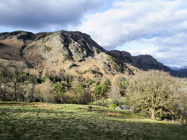
The headland at Lands Point is characterized by its rugged cliffs and rocky shoreline, making it a popular destination for nature enthusiasts and photographers alike. The area is home to a diverse range of flora and fauna, including various species of seabirds that nest in the cliffs.

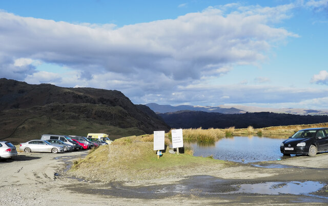
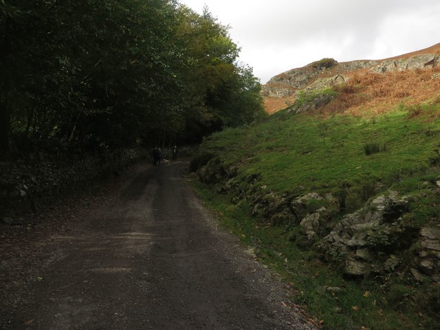
Visitors to Lands Point can enjoy a leisurely stroll along the coastal path that winds its way around the headland, providing access to several vantage points offering panoramic vistas of the sea and the nearby coastline. On a clear day, it is even possible to catch a glimpse of the Isle of Man in the distance.

The point also holds historical significance, with remnants of World War II defenses still visible, including concrete pillboxes and gun emplacements. These remnants serve as a reminder of the area's past and attract history enthusiasts seeking to learn more about the region's wartime activities.

Overall, Lands Point in Lancashire is a natural wonder that combines stunning coastal scenery with a touch of history. Its rugged cliffs, diverse wildlife, and panoramic views make it a must-visit destination for anyone seeking to explore the beauty of the English coastline.

If you have any feedback on the listing, please let us know in the comments section below.

Lands Point Images

Images are sourced within 2km of 54.356751/-3.069878 or Grid Reference SD3096. Thanks to Geograph Open Source API. All images are credited.

Coniston village sign This road sign on the A593 was erected by Lancashire County Council, pre-dating the formation of Cumbria in 1974 which incorporated that part of Lancashire north of Morecambe Bay.
Located at Park Gate, the sign is unusually far from the village, being almost 1.6km (1 mile) south of the centre of Coniston.
Coniston village sign
This road sign on the A593 was erected by Lancashire County Council, pre-dating the formation of Cumbria in 1974 which incorporated that part of Lancashire north of Morecambe Bay. Located at Park Gate, the sign is unusually far from the village, being almost 1.6km (1 mile) south of the centre of Coniston.
Pasture south of Coniston Park coppice behind and Grizedale Forest on the hills
Pasture south of Coniston
Park coppice behind and Grizedale Forest on the hills
Grazing near Coniston Park Coppice
The Coniston Branch near Park Gate Now only used by walkers and sheep, this is the route of the former Furness Railway branch line from Foxfield to Coniston.
The last passenger service ran on 4 October 1958 with a final enthusiasts’ special train on the 27 August 1961.  The last freight train ran during the week ending 29 April 1962 and the track was lifted early in 1963.
The Coniston Branch near Park Gate
Now only used by walkers and sheep, this is the route of the former Furness Railway branch line from Foxfield to Coniston. The last passenger service ran on 4 October 1958 with a final enthusiasts’ special train on the 27 August 1961. The last freight train ran during the week ending 29 April 1962 and the track was lifted early in 1963.
Roughly grassed field at Dixon Ground Dixon Ground is an area of land lying west of Coniston. The view here is from the publicly accessible part of the Walna Scar Road which has risen from the village.
The steep, broken slope beyond lies across Church Beck and rises ultimately to Wetherlam.
Roughly grassed field at Dixon Ground
Dixon Ground is an area of land lying west of Coniston. The view here is from the publicly accessible part of the Walna Scar Road which has risen from the village. The steep, broken slope beyond lies across Church Beck and rises ultimately to Wetherlam.
Road heading for Coppermines Valley The valley is actually that of Church Beck but is popularly known as the Coppermines Valley because of the extensive disused mine workings there. The road is private but is used to access accommodation in the valley including houses, a youth hostel and two climbing club huts. The road is also a public footpath.
Coniston Old Man is the mountain seen against the sky.
Road heading for Coppermines Valley
The valley is actually that of Church Beck but is popularly known as the Coppermines Valley because of the extensive disused mine workings there. The road is private but is used to access accommodation in the valley including houses, a youth hostel and two climbing club huts. The road is also a public footpath. Coniston Old Man is the mountain seen against the sky.
Have you paid and displayed? The 'waste ground' here at the end of the publicly motorable stretch of the Walna Scar Road was for years accepted as a free car parking area for visitors and walkers, the photographer has used it a number of times in the past. Now, (early 2022), the Rydal estate levies a charge of £8 for all day parking! There are no facilities, no surfacing to the area, in fact no improvement to the space other than the embedding of a few logs to demarcate some spaces. As can be seen, at least one vehicle has even had to be parked with the driver's side of it including the driver's exit, in a flood!
Have you paid and displayed?
The 'waste ground' here at the end of the publicly motorable stretch of the Walna Scar Road was for years accepted as a free car parking area for visitors and walkers, the photographer has used it a number of times in the past. Now, (early 2022), the Rydal estate levies a charge of £8 for all day parking! There are no facilities, no surfacing to the area, in fact no improvement to the space other than the embedding of a few logs to demarcate some spaces. As can be seen, at least one vehicle has even had to be parked with the driver's side of it including the driver's exit, in a flood!
Minor road near Coniston
Bowmanstead
Bowmanstead
Farmland near Torver
The A593 near Torver The A593 to the north of Torver.
The A593 near Torver
The A593 to the north of Torver.
Dixon Ground Cottages and workshops on the outskirts of Coniston.  The low cottage on the right goes under the name "Bend or Bump" - see <a href="https://www.geograph.org.uk/photo/4700054">SD2997 : Bend or Bump</a>.
Dixon Ground
Cottages and workshops on the outskirts of Coniston. The low cottage on the right goes under the name "Bend or Bump" - see SD2997 : Bend or Bump.
Bend or Bump Cottage in Dixon Ground (see <a href="https://www.geograph.org.uk/photo/4700037">SD2997 : Dixon Ground</a>) with very low door - hence the name.
Bend or Bump
Cottage in Dixon Ground (see SD2997 : Dixon Ground) with very low door - hence the name.
Path crossing Scrow Beck Path from Miners Bridge crossing Scrow Beck
Path crossing Scrow Beck
Path from Miners Bridge crossing Scrow Beck
The Scrows These "little" pointed hills at the base of the Old Man of Coniston, are Willy Scrow, Dixon Scrow and Foul Scrow. The lower landscape is alternately small grassland pastures and areas of bracken.

Viewpoint is the car park at the base of the climb to the Old Man of Coniston.
The Scrows
These "little" pointed hills at the base of the Old Man of Coniston, are Willy Scrow, Dixon Scrow and Foul Scrow. The lower landscape is alternately small grassland pastures and areas of bracken. Viewpoint is the car park at the base of the climb to the Old Man of Coniston.
Tarn by the car park On the Walna Scar Road.
Tarn by the car park
On the Walna Scar Road.
Heading for the hills Walkers on the Walna Scar Road.
Heading for the hills
Walkers on the Walna Scar Road.
Track to Coppermines Valley Looking along the track which connects Coniston village with the Coppermines Valley. The track is a popular route for walkers heading to the nearby Coniston fells.
Track to Coppermines Valley
Looking along the track which connects Coniston village with the Coppermines Valley. The track is a popular route for walkers heading to the nearby Coniston fells.
Show me another place!

Lands Point is located at Grid Ref: SD3096 (Lat: 54.356751, Lng: -3.069878)

Administrative County: Cumbria

District: South Lakeland

Police Authority: Cumbria

What 3 Words

///measuring.straddled.instincts. Near Windermere, Cumbria

Related Wikis

Coniston Hall

Coniston Hall is a former house on the west bank of Coniston Water in the English Lake District. It is recorded in the National Heritage List for England...

Coniston Water

Coniston Water is a lake in the Lake District in North West England. It is the third largest by volume, after Windermere and Ullswater, and the fifth-largest...

Brantwood

Brantwood is a historic house museum in Cumbria, England, overlooking Coniston Water. It has been the home of a number of prominent people. The house and...

Cat Bank

Cat Bank is a hamlet in Cumbria, England. == References ==

Nearby Amenities

Located within 500m of 54.356751,-3.069878
Source: NPE tracing
Lat/Long: 54.3587698/-3.071173
Source: NPE tracing
Lat/Long: 54.3572051/-3.0698254
Source: NPE tracing
Lat/Long: 54.3605991/-3.0710399
Source: NPE tracing
Lat/Long: 54.3604241/-3.0710185
Source: NPE tracing
Lat/Long: 54.3591932/-3.0715635
Source: NPE tracing
Lat/Long: 54.356517/-3.0690694
Source: NPE tracing
Lat/Long: 54.3583856/-3.0712882
Source: NPE tracing
Lat/Long: 54.3608311/-3.0706408
Source: NPE tracing
Lat/Long: 54.3577499/-3.0709246
Source: NPE tracing
Lat/Long: 54.3568925/-3.0688384
Source: NPE tracing
Lat/Long: 54.3610312/-3.0704692
Source: NPE tracing
Lat/Long: 54.3570051/-3.0692246
Source: NPE tracing
Lat/Long: 54.3575802/-3.0707052
Source: NPE tracing
Lat/Long: 54.3547042/-3.0705764
Source: NPE tracing
Lat/Long: 54.3524838/-3.0720592
Source: NPE tracing
Lat/Long: 54.3530091/-3.0717588
Source: NPE tracing
Lat/Long: 54.3536343/-3.0710292
Source: NPE tracing
Lat/Long: 54.3542346/-3.0709004
Source: NPE tracing
Lat/Long: 54.3566299/-3.0688813
Source: NPE tracing
Lat/Long: 54.3553795/-3.0701473
Source: NPE tracing
Lat/Long: 54.3556789/-3.0702567
Source: NPE tracing
Lat/Long: 54.3563385/-3.0692922
Source: NPE tracing
Lat/Long: 54.3597809/-3.0719712
Source: NPE tracing
Lat/Long: 54.3560672/-3.0700829
Barrier: lift_gate
Bicycle: yes
Foot: yes
Source: survey
Lat/Long: 54.3577188/-3.0726246
Power: pole
Lat/Long: 54.3564547/-3.0740207
Power: pole
Lat/Long: 54.3562296/-3.0750011
Power: pole
Lat/Long: 54.3564336/-3.0768438
Power: pole
Lat/Long: 54.3560295/-3.0759117
Power: pole
Lat/Long: 54.3553519/-3.0761008
Power: pole
Lat/Long: 54.3547462/-3.0765916
Defibrillator
Access: yes
Defibrillator Location: On the outside wall of the old hall.
Emergency: defibrillator
Indoor: no
Lat/Long: 54.3578643/-3.0720189
The data included in this document is from www.openstreetmap.org. The data is made available under ODbL.

Have you been to Lands Point?

Leave your review of Lands Point below (or comments, questions and feedback).