Napping Tree Coppice

Wood, Forest in Lancashire South Lakeland

England

Napping Tree Coppice

The Cumbria Way, Torver Back Common The Cumbria Way follows the public footpath from Delicars to Coniston above the shore of Coniston Water (next photograph <a href="https://www.geograph.org.uk/photo/7003403">SD2993 : The Cumbria Way near Bellman’s Hole</a>).
The Cumbria Way, Torver Back Common Credit: Adrian Taylor

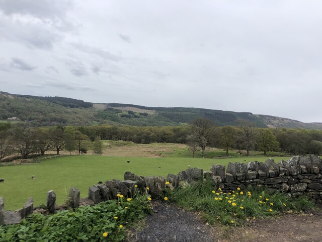
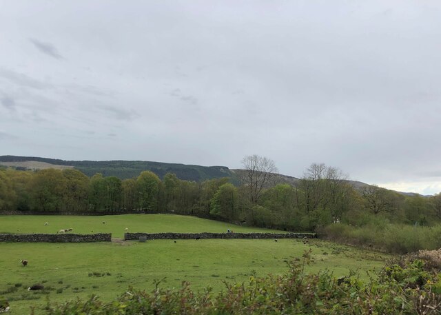
Napping Tree Coppice is a charming woodland located in Lancashire, England. Stretching across an area of approximately 50 acres, this coppice is a true haven for nature enthusiasts and those seeking tranquility in the midst of beautiful surroundings.

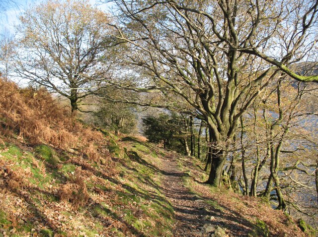
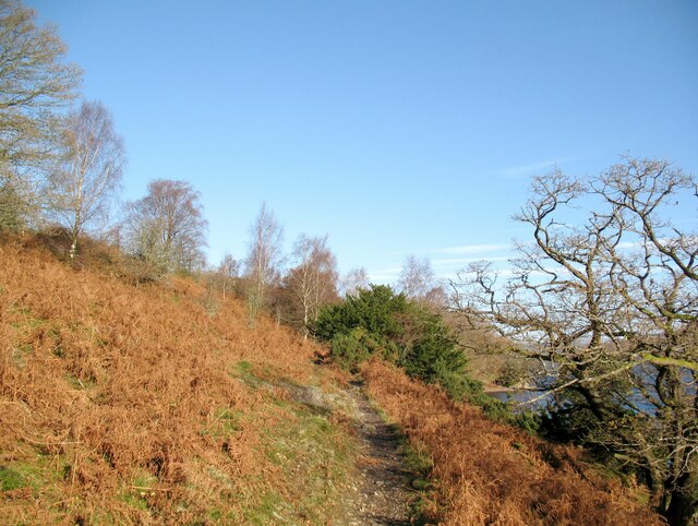
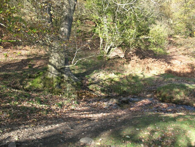
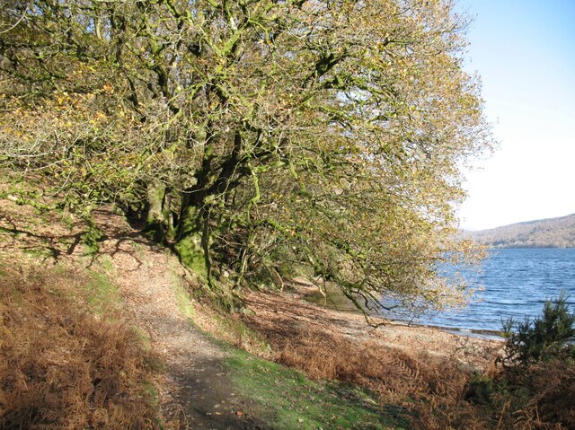
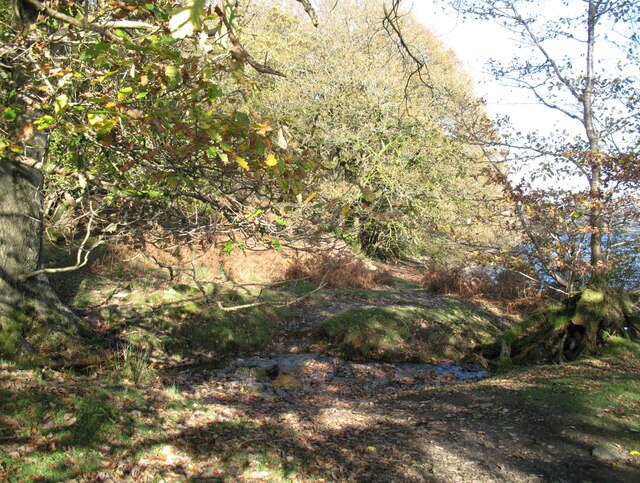
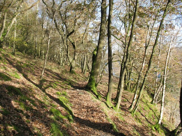
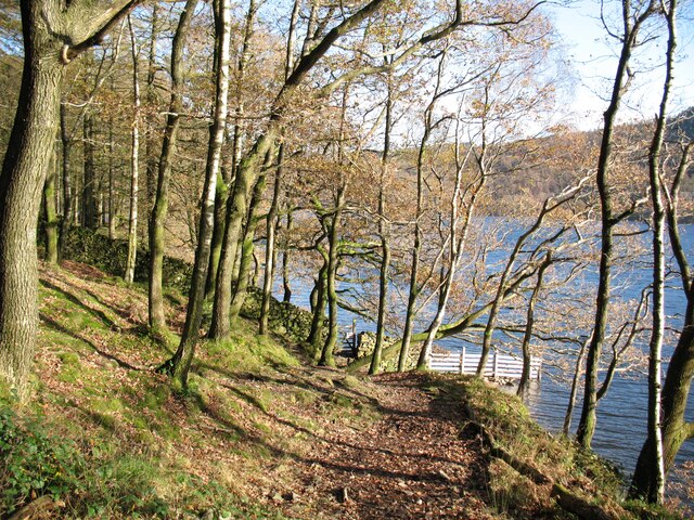
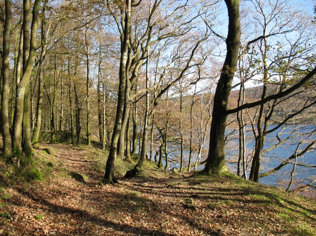
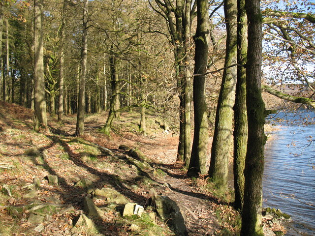
The woodland is predominantly composed of broadleaf trees, including oak, beech, ash, and birch, which create a rich and diverse ecosystem. The dense canopy provides a sheltered habitat for various bird species, such as woodpeckers, owls, and thrushes, making it a popular spot for birdwatchers. Additionally, small mammals, such as squirrels, rabbits, and hedgehogs, can often be spotted scurrying through the undergrowth.

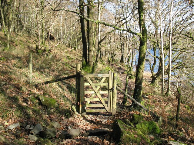
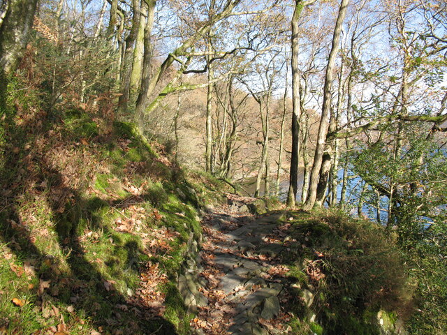
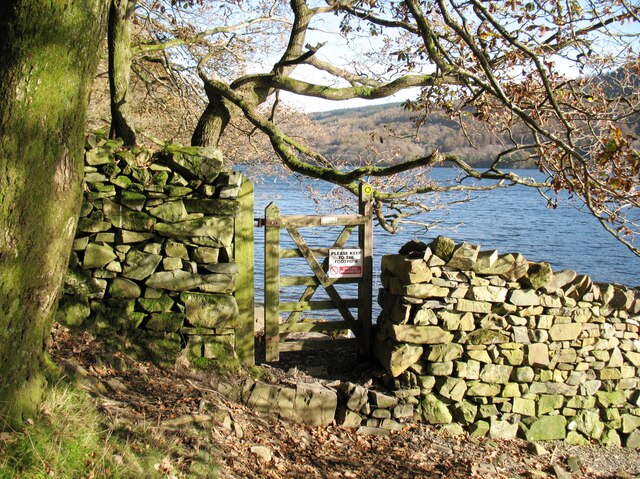
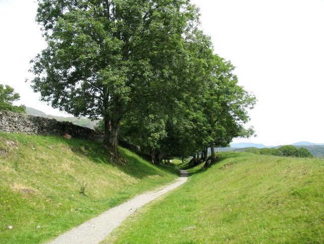
Napping Tree Coppice is crisscrossed with numerous walking trails, allowing visitors to explore its natural wonders. As they stroll through the woodland, visitors may encounter a variety of wildflowers, ferns, and mosses, adding to the aesthetic appeal of the area. The paths wind their way through the trees, leading to secluded clearings and peaceful spots where one can sit and enjoy the serenity of nature.

Managed by the local forestry commission, Napping Tree Coppice is well-maintained, ensuring the preservation of its natural beauty. It provides an excellent opportunity for educational visits, as there are informative signs throughout the woodland that offer insights into the local flora and fauna.

Overall, Napping Tree Coppice offers a picturesque and serene experience for nature lovers, providing a tranquil escape from the hustle and bustle of everyday life.

If you have any feedback on the listing, please let us know in the comments section below.

Napping Tree Coppice Images

Images are sourced within 2km of 54.343041/-3.0774286 or Grid Reference SD3094. Thanks to Geograph Open Source API. All images are credited.

The Cumbria Way, Torver Back Common The Cumbria Way follows the public footpath from Delicars to Coniston above the shore of Coniston Water (next photograph <a href="https://www.geograph.org.uk/photo/7003403">SD2993 : The Cumbria Way near Bellman’s Hole</a>).
The Cumbria Way, Torver Back Common
The Cumbria Way follows the public footpath from Delicars to Coniston above the shore of Coniston Water (next photograph SD2993 : The Cumbria Way near Bellman’s Hole).
The Cumbria Way near Bellman’s Hole This path above the shore of Coniston Water is the public footpath from Delicars to Coniston. It is the route of The Cumbria Way long distance path from Ulverston to Carlisle (next photograph <a href="https://www.geograph.org.uk/photo/7003650">SD2993 : Moor Gill Foot Ford</a>).
The Cumbria Way near Bellman’s Hole
This path above the shore of Coniston Water is the public footpath from Delicars to Coniston. It is the route of The Cumbria Way long distance path from Ulverston to Carlisle (next photograph SD2993 : Moor Gill Foot Ford).
Moor Gill Foot Ford Moor Gill rises on Torver Back Common and drains into Coniston Water just below this small ford.  The public footpath from Delicars to Coniston which is also the route of The Cumbria Way crosses the ford.
Moor Gill Foot Ford
Moor Gill rises on Torver Back Common and drains into Coniston Water just below this small ford. The public footpath from Delicars to Coniston which is also the route of The Cumbria Way crosses the ford.
The Cumbria Way, Moor Gill Foot The Cumbria Way follows the western shore of Coniston Water through woodland below Torver Back Common (next photograph <a href="https://www.geograph.org.uk/photo/7004202">SD2993 : The Cumbria Way in Torver Common Wood</a>).
The Cumbria Way, Moor Gill Foot
The Cumbria Way follows the western shore of Coniston Water through woodland below Torver Back Common (next photograph SD2993 : The Cumbria Way in Torver Common Wood).
Moor Gill Foot Ford Moor Gill rises on Torver Back Common and drains into Coniston Water just below this small ford.  The public footpath from Delicars to Coniston crosses the ford; it  is the route of The Cumbria Way long distance path (next photograph <a href="https://www.geograph.org.uk/photo/7003649">SD2993 : The Cumbria Way, Moor Gill Foot</a>).
Moor Gill Foot Ford
Moor Gill rises on Torver Back Common and drains into Coniston Water just below this small ford. The public footpath from Delicars to Coniston crosses the ford; it is the route of The Cumbria Way long distance path (next photograph SD2993 : The Cumbria Way, Moor Gill Foot).
Gate in Torver Common Wood The gate crosses a public footpath from Delicars to Coniston which is also the route of The Cumbria Way long distance trail.
Coniston Water can be glimpsed through the trees (next photograph <a href="https://www.geograph.org.uk/photo/7004844">SD2994 : Rocky path in Torver Common Wood</a>).
Gate in Torver Common Wood
The gate crosses a public footpath from Delicars to Coniston which is also the route of The Cumbria Way long distance trail. Coniston Water can be glimpsed through the trees (next photograph SD2994 : Rocky path in Torver Common Wood).
The Cumbria Way in Torver Common Wood The Cumbria Way follows a public footpath along the western shore of Coniston Water through Torver Common Wood (next photograph <a href="https://www.geograph.org.uk/photo/7004120">SD2994 : Gate in Torver Common Wood</a>).
The Cumbria Way in Torver Common Wood
The Cumbria Way follows a public footpath along the western shore of Coniston Water through Torver Common Wood (next photograph SD2994 : Gate in Torver Common Wood).
Rocky path in Torver Common Wood The Cumbria Way follows a public footpath along the western shore of Coniston Water through Torver Common Wood, rounding a rocky spur above the lake shortly before reaching Harrison’s Coppice (next photograph <a href="https://www.geograph.org.uk/photo/7005690">SD2994 : Paths in Torver Common Wood</a>).
Rocky path in Torver Common Wood
The Cumbria Way follows a public footpath along the western shore of Coniston Water through Torver Common Wood, rounding a rocky spur above the lake shortly before reaching Harrison’s Coppice (next photograph SD2994 : Paths in Torver Common Wood).
Gate beside Coniston Water The public footpath from Delicars to Coniston passes through the gate leading from Torver Common Wood into Harrison Coppice.
The waymark on the right hand gatepost indicates that this is the route of The Cumbria Way (next photograph <a href="https://www.geograph.org.uk/photo/7006419">SD2994 : The Cumbria Way, Harrison Coppice</a>).
Gate beside Coniston Water
The public footpath from Delicars to Coniston passes through the gate leading from Torver Common Wood into Harrison Coppice. The waymark on the right hand gatepost indicates that this is the route of The Cumbria Way (next photograph SD2994 : The Cumbria Way, Harrison Coppice).
The Cumbria Way near Coniston Water The Cumbria Way follows the public footpath from Delicars to Coniston along the western shore of Coniston Water (next photograph <a href="https://www.geograph.org.uk/photo/7005687">SD2994 : Gate beside Coniston Water</a>).
The Cumbria Way near Coniston Water
The Cumbria Way follows the public footpath from Delicars to Coniston along the western shore of Coniston Water (next photograph SD2994 : Gate beside Coniston Water).
Paths in Torver Common Wood The path on the left doubles back up through the wood towards the top of Torver Back Common.  The public footpath from Delicars to Coniston and The Cumbria Way follow the path dropping down to the right towards the shore of Coniston Water (next photograph <a href="https://www.geograph.org.uk/photo/7005689">SD2994 : The Cumbria Way near Coniston Water</a>).
Paths in Torver Common Wood
The path on the left doubles back up through the wood towards the top of Torver Back Common. The public footpath from Delicars to Coniston and The Cumbria Way follow the path dropping down to the right towards the shore of Coniston Water (next photograph SD2994 : The Cumbria Way near Coniston Water).
Pasture south of Coniston Park coppice behind and Grizedale Forest on the hills
Pasture south of Coniston
Park coppice behind and Grizedale Forest on the hills
Grazing near Coniston Park Coppice
Cragg Cottage On the northern outskirts of Torver. In the process of making a new parking area.
Cragg Cottage
On the northern outskirts of Torver. In the process of making a new parking area.
The Wilsons Arms, Torver Public House with attached Deli
The Wilsons Arms, Torver
Public House with attached Deli
The Cumbria Way, Harrison Coppice The Cumbria Way follows the public footpath from Delicars to Coniston along the western shore of Coniston Water through Harrison Coppice (next photograph <a href="https://www.geograph.org.uk/photo/7006411">SD3094 : Ford in Harrison Coppice</a>).
The Cumbria Way, Harrison Coppice
The Cumbria Way follows the public footpath from Delicars to Coniston along the western shore of Coniston Water through Harrison Coppice (next photograph SD3094 : Ford in Harrison Coppice).
The Coniston Branch near Park Gate Now only used by walkers and sheep, this is the route of the former Furness Railway branch line from Foxfield to Coniston.
The last passenger service ran on 4 October 1958 with a final enthusiasts’ special train on the 27 August 1961.  The last freight train ran during the week ending 29 April 1962 and the track was lifted early in 1963.
The Coniston Branch near Park Gate
Now only used by walkers and sheep, this is the route of the former Furness Railway branch line from Foxfield to Coniston. The last passenger service ran on 4 October 1958 with a final enthusiasts’ special train on the 27 August 1961. The last freight train ran during the week ending 29 April 1962 and the track was lifted early in 1963.
Old Bridge Marker on Hollage Bridge, Torver Bridge Marker cut in the north parapet of Hollage Bridge, Torver Beck, on the A5084. Torver parish. Inscription reads C C HOLLAGE BRIDGE / REBUILT 1903.

Milestone Society National ID: LA_TORV01br
Old Bridge Marker on Hollage Bridge, Torver
Bridge Marker cut in the north parapet of Hollage Bridge, Torver Beck, on the A5084. Torver parish. Inscription reads C C HOLLAGE BRIDGE / REBUILT 1903. Milestone Society National ID: LA_TORV01br
Show me another place!

Napping Tree Coppice is located at Grid Ref: SD3094 (Lat: 54.343041, Lng: -3.0774286)

Administrative County: Cumbria

District: South Lakeland

Police Authority: Cumbria

What 3 Words

///documents.brush.booklets. Near Windermere, Cumbria

Related Wikis

Coniston Water

Coniston Water is a lake in the Lake District in North West England. It is the third largest by volume, after Windermere and Ullswater, and the fifth-largest...

Bowmanstead

Bowmanstead is a village in Cumbria, England. It is situated 1 mile to the south of Coniston and contains a Catholic church and a pub - The Ship Inn, it...
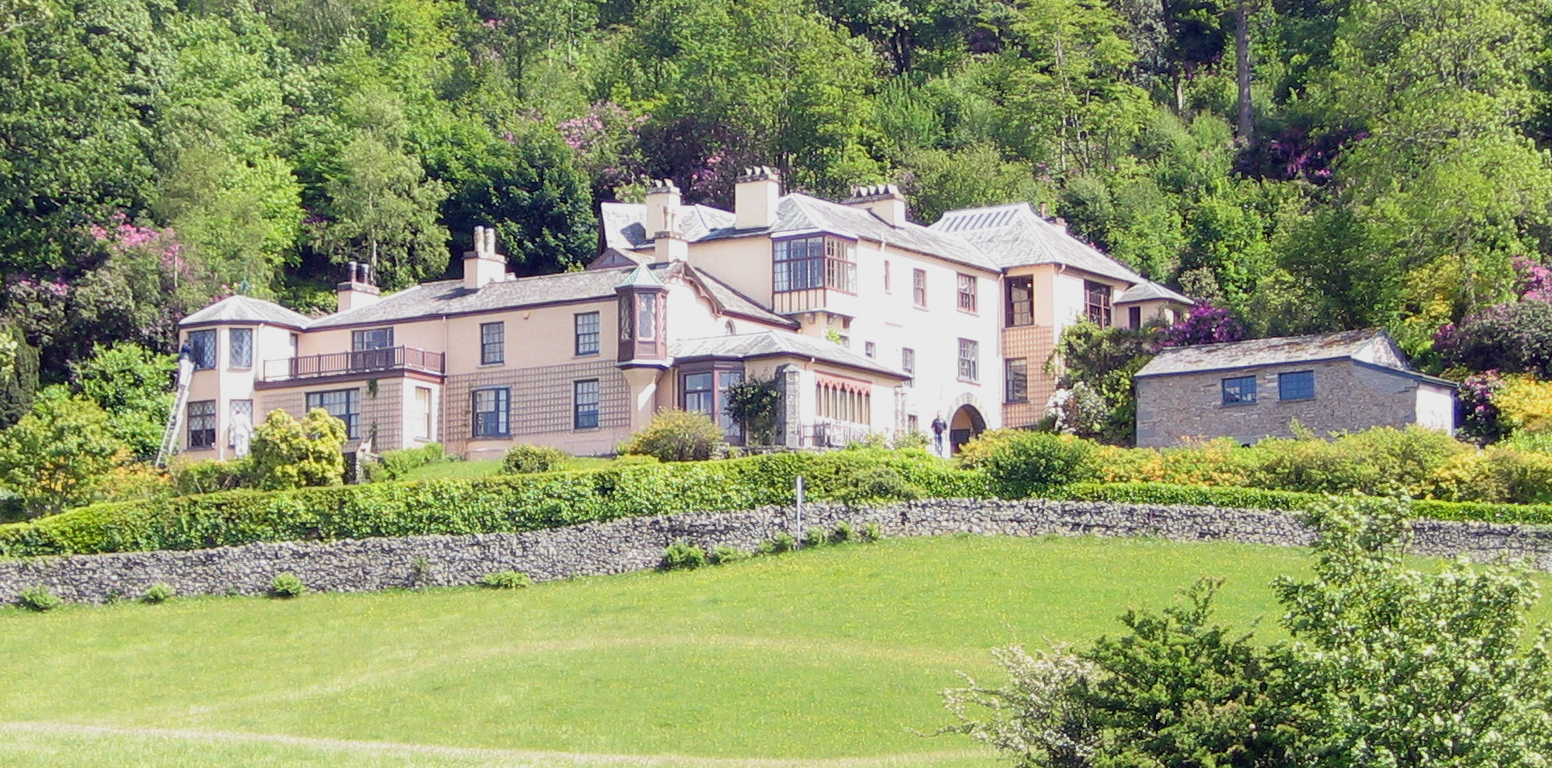
Brantwood

Brantwood is a historic house museum in Cumbria, England, overlooking Coniston Water. It has been the home of a number of prominent people. The house and...

Torver railway station

Torver railway station served the village of Torver, in Lancashire, England (now in Cumbria). It was on the branch line to Coniston. == History == Authorised...

Nearby Amenities

Located within 500m of 54.343041,-3.0774286
Source: NPE tracing
Lat/Long: 54.3450049/-3.0758143
Source: NPE tracing
Lat/Long: 54.343654/-3.0768013
Source: NPE tracing
Lat/Long: 54.3445869/-3.0760006
Source: NPE tracing
Lat/Long: 54.3389433/-3.0794707
Source: NPE tracing
Lat/Long: 54.3467661/-3.0759461
Source: NPE tracing
Lat/Long: 54.3460993/-3.0756855
Source: NPE tracing
Lat/Long: 54.3456428/-3.0757713
Source: NPE tracing
Lat/Long: 54.3427972/-3.0768335
Source: NPE tracing
Lat/Long: 54.3419529/-3.0770373
Source: NPE tracing
Lat/Long: 54.3405055/-3.0777114
Source: NPE tracing
Lat/Long: 54.3412712/-3.0772948
Source: NPE tracing
Lat/Long: 54.3415088/-3.0770159
Source: NPE tracing
Lat/Long: 54.3433537/-3.0767118
Source: NPE tracing
Lat/Long: 54.3433385/-3.0763845
Barrier: cattle_grid
Lat/Long: 54.347416/-3.0781945
Access: private
Leisure: slipway
Source: survey
Lat/Long: 54.346815/-3.0759508
Barrier: kissing_gate
Lat/Long: 54.3424999/-3.0797241
Source: NPE tracing
Lat/Long: 54.3393658/-3.0787706
Source: NPE tracing
Lat/Long: 54.3409522/-3.077606
Barrier: cattle_grid
Lat/Long: 54.3470754/-3.0789305
Barrier: cattle_grid
Lat/Long: 54.3464031/-3.0820446
The data included in this document is from www.openstreetmap.org. The data is made available under ODbL.

Have you been to Napping Tree Coppice?

Leave your review of Napping Tree Coppice below (or comments, questions and feedback).