Coniston Water

Lake, Pool, Pond, Freshwater Marsh in Lancashire South Lakeland

England

Coniston Water

Torver Goods Yard The old railway goods yard at Torver is now used by a local builder for storage.  The stone built goods shed contained a loading platform upon which was mounted a 1 ton hand operated crane manufactured by R. Kitchen ironfounders in Warrington.  The crane has subsequently been relocated to the rear of The Wilson’s Arms.  The goods shed was used as a hay barn after the railway closed but lost its roof in a fire and stood derelict for a number of years before being repaired, altered and re-roofed and brought back into use.
Torver Goods Yard Credit: Adrian Taylor

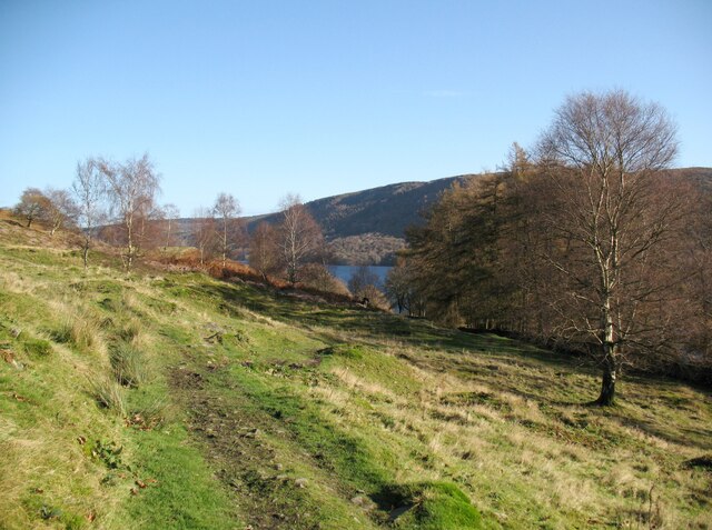
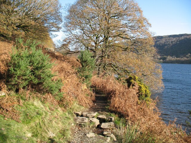
Coniston Water is a large body of water located in the county of Lancashire, England. It is commonly referred to as a lake due to its size and characteristics. With a length of approximately 8 kilometers, it is one of the largest lakes in the Lake District National Park.

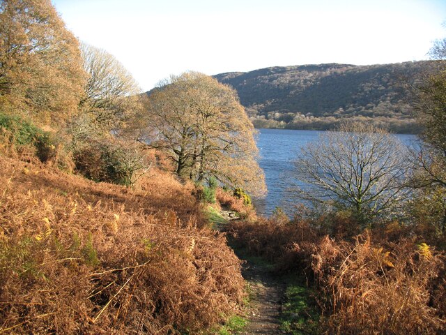
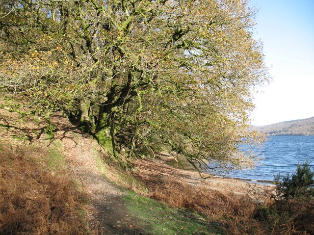
Nestled amidst the picturesque landscape of the Coniston Fells, the lake offers breathtaking views of the surrounding mountains and lush greenery. The water is a vibrant shade of blue, reflecting the skies above and creating a serene and tranquil atmosphere.

Coniston Water is a freshwater lake, fed by various streams and rivers that flow from the nearby hills. It has a maximum depth of around 56 meters, making it a popular destination for water-based activities such as sailing, kayaking, and fishing. The lake is home to a variety of fish species, including perch, pike, and trout, attracting anglers from far and wide.

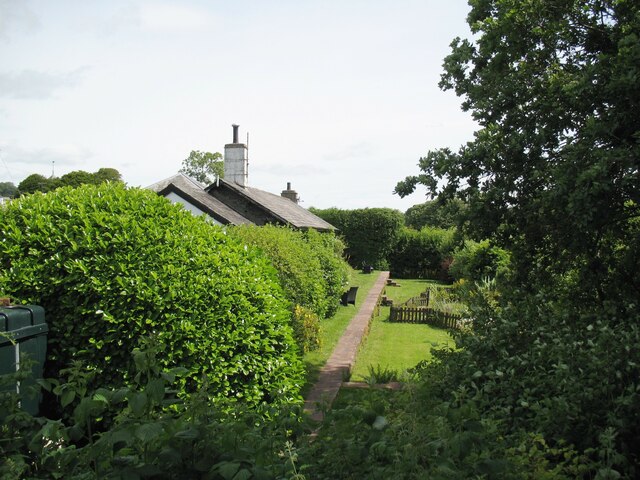
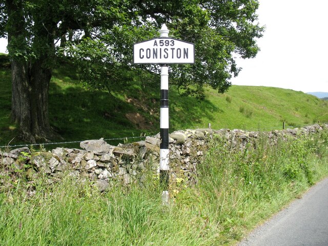
Surrounding the lake are several small villages and towns, including Coniston and Hawkshead, which provide access points and facilities for visitors. The lake is also famous for its association with the renowned speed record breaker, Sir Donald Campbell, who tragically lost his life while attempting to break the water speed record on Coniston Water in 1967.

In addition to its recreational and scenic value, Coniston Water plays a vital role in the local ecosystem. It supports a diverse range of plant and animal life, including reed beds, freshwater marshes, and bird species such as herons and ospreys.

Overall, Coniston Water is a natural gem within the heart of Lancashire, attracting visitors with its beauty, tranquility, and opportunities for outdoor recreation.

If you have any feedback on the listing, please let us know in the comments section below.

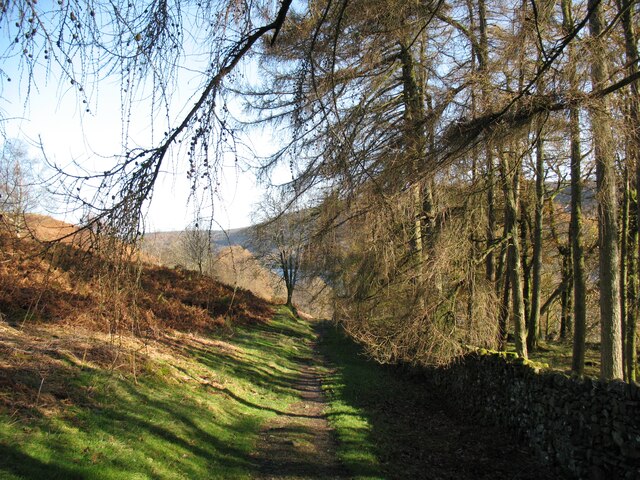
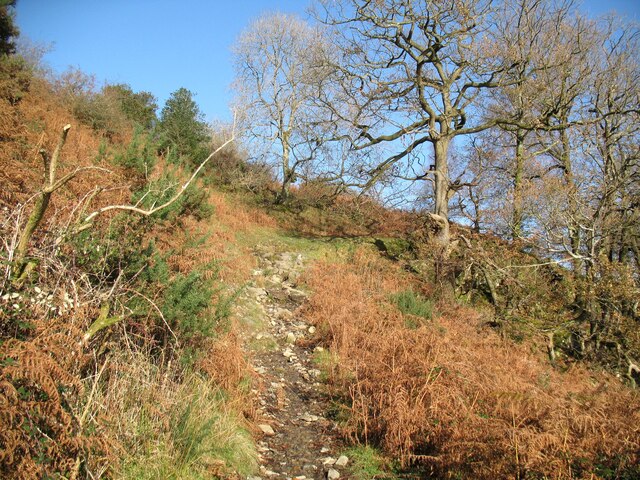
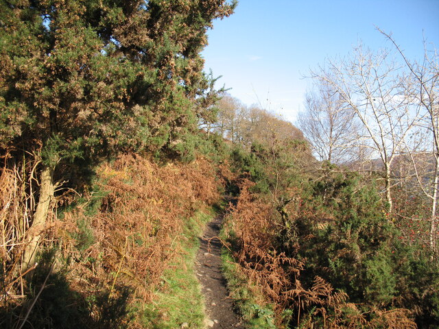
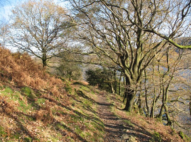
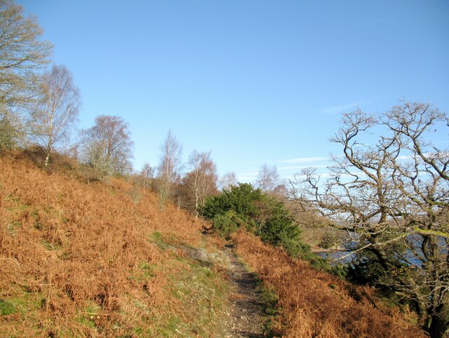
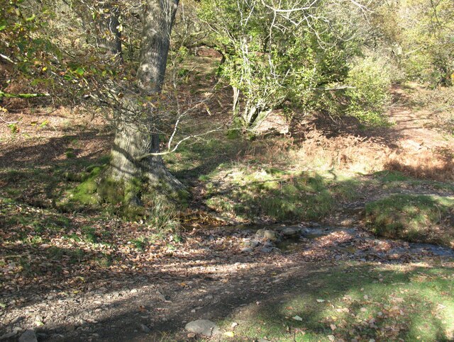
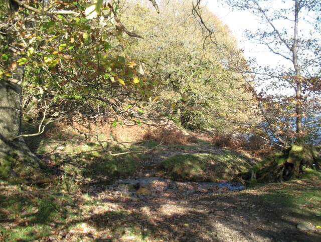
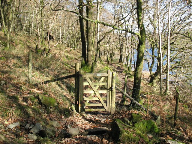
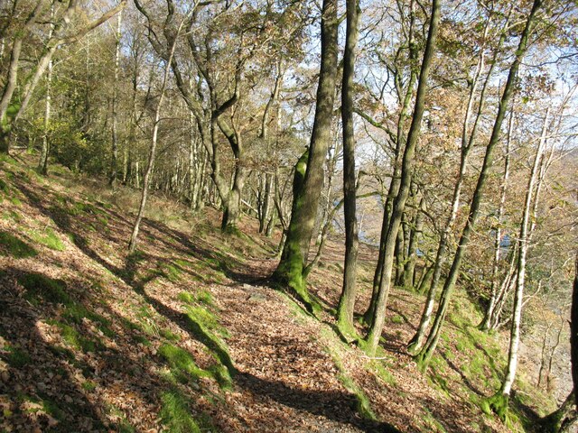
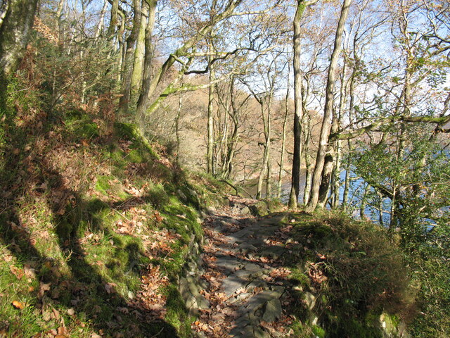
Coniston Water Images

Images are sourced within 2km of 54.340183/-3.0743544 or Grid Reference SD3094. Thanks to Geograph Open Source API. All images are credited.

Torver Goods Yard The old railway goods yard at Torver is now used by a local builder for storage.  The stone built goods shed contained a loading platform upon which was mounted a 1 ton hand operated crane manufactured by R. Kitchen ironfounders in Warrington.  The crane has subsequently been relocated to the rear of The Wilson’s Arms.  The goods shed was used as a hay barn after the railway closed but lost its roof in a fire and stood derelict for a number of years before being repaired, altered and re-roofed and brought back into use.
Torver Goods Yard
The old railway goods yard at Torver is now used by a local builder for storage. The stone built goods shed contained a loading platform upon which was mounted a 1 ton hand operated crane manufactured by R. Kitchen ironfounders in Warrington. The crane has subsequently been relocated to the rear of The Wilson’s Arms. The goods shed was used as a hay barn after the railway closed but lost its roof in a fire and stood derelict for a number of years before being repaired, altered and re-roofed and brought back into use.
Torver The road here passing in front of the cottages and The Wilson Arms was originally the A593 road until it was realigned between a point near Torver Station and Dalton Road Gates level crossing, taking advantage of the alignment of the former railway.
Torver
The road here passing in front of the cottages and The Wilson Arms was originally the A593 road until it was realigned between a point near Torver Station and Dalton Road Gates level crossing, taking advantage of the alignment of the former railway.
Torver Station The station building is now let as a holiday cottage and the old platform is still visible.  The platform and track bed have been converted into a garden with a fenced pond.
Torver station was on the Foxfield to Coniston branch of The Furness Railway.  It was only provided with a single low platform; the red sandstone coping stones still bear a few faint traces of white paint on the platform edge more than 60 years after the line closed to passengers.
Torver Station
The station building is now let as a holiday cottage and the old platform is still visible. The platform and track bed have been converted into a garden with a fenced pond. Torver station was on the Foxfield to Coniston branch of The Furness Railway. It was only provided with a single low platform; the red sandstone coping stones still bear a few faint traces of white paint on the platform edge more than 60 years after the line closed to passengers.
Coniston village sign This road sign on the A593 was erected by Lancashire County Council, pre-dating the formation of Cumbria in 1974 which incorporated that part of Lancashire north of Morecambe Bay.
Located at Park Gate, the sign is unusually far from the village, being almost 1.6km (1 mile) south of the centre of Coniston.
Coniston village sign
This road sign on the A593 was erected by Lancashire County Council, pre-dating the formation of Cumbria in 1974 which incorporated that part of Lancashire north of Morecambe Bay. Located at Park Gate, the sign is unusually far from the village, being almost 1.6km (1 mile) south of the centre of Coniston.
The Cumbria Way near Boat House Wood The Cumbria Way long distance path leaves the grassy farmer’s track it has been following and descends towards Coniston Water (next photograph <a href="https://www.geograph.org.uk/photo/6974093">SD2992 : The Cumbria Way by Boat House Wood</a>).
The Cumbria Way near Boat House Wood
The Cumbria Way long distance path leaves the grassy farmer’s track it has been following and descends towards Coniston Water (next photograph SD2992 : The Cumbria Way by Boat House Wood).
The Cumbria Way near Boat House Wood The Cumbria Way long distance path from Ulverston to Carlisle descends towards the shore of Coniston Water near Boat House Wood (next photograph <a href="https://www.geograph.org.uk/photo/6975744">SD2992 : The Cumbria Way near Sunny Bank Jetty</a>).
Out of sight at the bottom of the hill is Sunny Bank Jetty, used by Coniston Launch services during the summer months.
The Cumbria Way near Boat House Wood
The Cumbria Way long distance path from Ulverston to Carlisle descends towards the shore of Coniston Water near Boat House Wood (next photograph SD2992 : The Cumbria Way near Sunny Bank Jetty). Out of sight at the bottom of the hill is Sunny Bank Jetty, used by Coniston Launch services during the summer months.
The Cumbria Way by Boat House Wood The Cumbria Way follows a public footpath alongside Boat House Wood on the approach to Coniston Water (next photograph <a href="https://www.geograph.org.uk/photo/6974085">SD2992 : The Cumbria Way near Boat House Wood</a>).
The Cumbria Way by Boat House Wood
The Cumbria Way follows a public footpath alongside Boat House Wood on the approach to Coniston Water (next photograph SD2992 : The Cumbria Way near Boat House Wood).
The Cumbria Way, Torver Back Common The Cumbria Way long distance path follows the shore of Coniston Water along the public footpath from Delicars to Coniston.  At this point it climbs away from the lake as it approaches a wooded section of the shoreline (next photograph <a href="https://www.geograph.org.uk/photo/7002618">SD2993 : The Cumbria Way, Torver Back Common</a>).
The Cumbria Way, Torver Back Common
The Cumbria Way long distance path follows the shore of Coniston Water along the public footpath from Delicars to Coniston. At this point it climbs away from the lake as it approaches a wooded section of the shoreline (next photograph SD2993 : The Cumbria Way, Torver Back Common).
The Cumbria Way near Sunny Bank Jetty The path is a public footpath from Delicars to Coniston.  It is also the route of The Cumbria Way long distance trail from Ulverston to Carlisle (next photograph <a href="https://www.geograph.org.uk/photo/6975735">SD2993 : The Cumbria Way, Torver Back Common</a>).
The Cumbria Way near Sunny Bank Jetty
The path is a public footpath from Delicars to Coniston. It is also the route of The Cumbria Way long distance trail from Ulverston to Carlisle (next photograph SD2993 : The Cumbria Way, Torver Back Common).
The Cumbria Way near Sunny Bank Jetty The Cumbria Way follows the public footpath from Delicars to Coniston alongside Coniston Water, crossing a small stream near Sunny Bank Jetty (next photograph <a href="https://www.geograph.org.uk/photo/6975737">SD2993 : The Cumbria Way near Sunny Bank Jetty</a>).
The Cumbria Way near Sunny Bank Jetty
The Cumbria Way follows the public footpath from Delicars to Coniston alongside Coniston Water, crossing a small stream near Sunny Bank Jetty (next photograph SD2993 : The Cumbria Way near Sunny Bank Jetty).
The Cumbria Way, Torver Back Common The Cumbria Way follows the public footpath from Delicars to Coniston above the shore of Coniston Water (next photograph <a href="https://www.geograph.org.uk/photo/7003403">SD2993 : The Cumbria Way near Bellman’s Hole</a>).
The Cumbria Way, Torver Back Common
The Cumbria Way follows the public footpath from Delicars to Coniston above the shore of Coniston Water (next photograph SD2993 : The Cumbria Way near Bellman’s Hole).
The Cumbria Way near Bellman’s Hole This path above the shore of Coniston Water is the public footpath from Delicars to Coniston. It is the route of The Cumbria Way long distance path from Ulverston to Carlisle (next photograph <a href="https://www.geograph.org.uk/photo/7003650">SD2993 : Moor Gill Foot Ford</a>).
The Cumbria Way near Bellman’s Hole
This path above the shore of Coniston Water is the public footpath from Delicars to Coniston. It is the route of The Cumbria Way long distance path from Ulverston to Carlisle (next photograph SD2993 : Moor Gill Foot Ford).
Moor Gill Foot Ford Moor Gill rises on Torver Back Common and drains into Coniston Water just below this small ford.  The public footpath from Delicars to Coniston which is also the route of The Cumbria Way crosses the ford.
Moor Gill Foot Ford
Moor Gill rises on Torver Back Common and drains into Coniston Water just below this small ford. The public footpath from Delicars to Coniston which is also the route of The Cumbria Way crosses the ford.
The Cumbria Way, Moor Gill Foot The Cumbria Way follows the western shore of Coniston Water through woodland below Torver Back Common (next photograph <a href="https://www.geograph.org.uk/photo/7004202">SD2993 : The Cumbria Way in Torver Common Wood</a>).
The Cumbria Way, Moor Gill Foot
The Cumbria Way follows the western shore of Coniston Water through woodland below Torver Back Common (next photograph SD2993 : The Cumbria Way in Torver Common Wood).
Moor Gill Foot Ford Moor Gill rises on Torver Back Common and drains into Coniston Water just below this small ford.  The public footpath from Delicars to Coniston crosses the ford; it  is the route of The Cumbria Way long distance path (next photograph <a href="https://www.geograph.org.uk/photo/7003649">SD2993 : The Cumbria Way, Moor Gill Foot</a>).
Moor Gill Foot Ford
Moor Gill rises on Torver Back Common and drains into Coniston Water just below this small ford. The public footpath from Delicars to Coniston crosses the ford; it is the route of The Cumbria Way long distance path (next photograph SD2993 : The Cumbria Way, Moor Gill Foot).
Gate in Torver Common Wood The gate crosses a public footpath from Delicars to Coniston which is also the route of The Cumbria Way long distance trail.
Coniston Water can be glimpsed through the trees (next photograph <a href="https://www.geograph.org.uk/photo/7004844">SD2994 : Rocky path in Torver Common Wood</a>).
Gate in Torver Common Wood
The gate crosses a public footpath from Delicars to Coniston which is also the route of The Cumbria Way long distance trail. Coniston Water can be glimpsed through the trees (next photograph SD2994 : Rocky path in Torver Common Wood).
The Cumbria Way in Torver Common Wood The Cumbria Way follows a public footpath along the western shore of Coniston Water through Torver Common Wood (next photograph <a href="https://www.geograph.org.uk/photo/7004120">SD2994 : Gate in Torver Common Wood</a>).
The Cumbria Way in Torver Common Wood
The Cumbria Way follows a public footpath along the western shore of Coniston Water through Torver Common Wood (next photograph SD2994 : Gate in Torver Common Wood).
Rocky path in Torver Common Wood The Cumbria Way follows a public footpath along the western shore of Coniston Water through Torver Common Wood, rounding a rocky spur above the lake shortly before reaching Harrison’s Coppice (next photograph <a href="https://www.geograph.org.uk/photo/7005690">SD2994 : Paths in Torver Common Wood</a>).
Rocky path in Torver Common Wood
The Cumbria Way follows a public footpath along the western shore of Coniston Water through Torver Common Wood, rounding a rocky spur above the lake shortly before reaching Harrison’s Coppice (next photograph SD2994 : Paths in Torver Common Wood).
Show me another place!

Coniston Water is located at Grid Ref: SD3094 (Lat: 54.340183, Lng: -3.0743544)

Administrative County: Cumbria

District: South Lakeland

Police Authority: Cumbria

What 3 Words

///outcasts.fencing.currently. Near Windermere, Cumbria

Related Wikis

Coniston Water

Coniston Water is a lake in the Lake District in North West England. It is the third largest by volume, after Windermere and Ullswater, and the fifth-largest...

Bowmanstead

Bowmanstead is a village in Cumbria, England. It is situated 1 mile to the south of Coniston and contains a Catholic church and a pub - The Ship Inn, it...

Lawson Park

Lawson Park is a remote English Lake District hillfarm, leased by Grizedale Arts (a contemporary art commissioner) from the Forestry Commission. It is...

Kelly Hall Tarn

Kelly Hall Tarn is a pool in Cumbria, England, to the west of Coniston Water. It is located about one km south-south-east of the village of Torver, on...

Nearby Amenities

Located within 500m of 54.340183,-3.0743544
Source: NPE tracing
Lat/Long: 54.343654/-3.0768013
Source: NPE tracing
Lat/Long: 54.3389433/-3.0794707
Source: NPE tracing
Lat/Long: 54.3427972/-3.0768335
Source: NPE tracing
Lat/Long: 54.3419529/-3.0770373
Source: NPE tracing
Lat/Long: 54.3405055/-3.0777114
Source: NPE tracing
Lat/Long: 54.3412712/-3.0772948
Source: NPE tracing
Lat/Long: 54.3415088/-3.0770159
Source: NPE tracing
Lat/Long: 54.3433537/-3.0767118
Source: NPE tracing
Lat/Long: 54.3433385/-3.0763845
Barrier: kissing_gate
Lat/Long: 54.3424999/-3.0797241
Source: NPE tracing
Lat/Long: 54.3376533/-3.0804409
Source: NPE tracing
Lat/Long: 54.3381513/-3.0798251
Source: NPE tracing
Lat/Long: 54.3393658/-3.0787706
Source: NPE tracing
Lat/Long: 54.3409522/-3.077606
The data included in this document is from www.openstreetmap.org. The data is made available under ODbL.

Have you been to Coniston Water?

Leave your review of Coniston Water below (or comments, questions and feedback).