Captain's Pit Pond

Lake, Pool, Pond, Freshwater Marsh in Cheshire

England

Captain's Pit Pond

Graffiti Gallery - underneath Junction 1 M53
Graffiti Gallery - underneath Junction 1 M53 Credit: Colin Park

Captain's Pit Pond is a picturesque freshwater body located in Cheshire, England. It is a popular recreational spot for both locals and tourists, offering a serene and tranquil environment for various outdoor activities. With an area of approximately 10 acres, the pond is surrounded by lush greenery, providing a scenic backdrop to the surroundings.

The pond itself is fed by natural springs and rainfall, ensuring a constant supply of fresh water. It boasts crystal-clear waters that are home to a diverse range of aquatic life, including fish, amphibians, and waterfowl. Anglers are often seen casting their lines into the pond, hoping to catch species such as carp, pike, and perch.

In addition to fishing, Captain's Pit Pond offers opportunities for boating and kayaking. Visitors can bring their own watercraft or rent one from the nearby facilities. Exploring the pond by boat allows visitors to fully appreciate the beauty of the surrounding landscape and observe the wildlife that thrives in and around the water.

The pond is also a haven for birdwatchers, attracting numerous species of water birds throughout the year. Ducks, swans, herons, and kingfishers are commonly spotted, making it a paradise for bird enthusiasts and nature photographers.

Surrounding the pond, there are well-maintained walking trails that offer peaceful strolls and scenic views. The area is also equipped with picnic spots and benches, inviting visitors to relax and enjoy a leisurely lunch amidst nature's beauty.

Overall, Captain's Pit Pond in Cheshire is a delightful destination for nature lovers, offering a mix of recreational activities, stunning landscapes, and abundant wildlife.

If you have any feedback on the listing, please let us know in the comments section below.

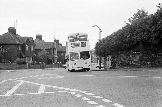
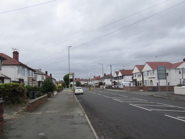
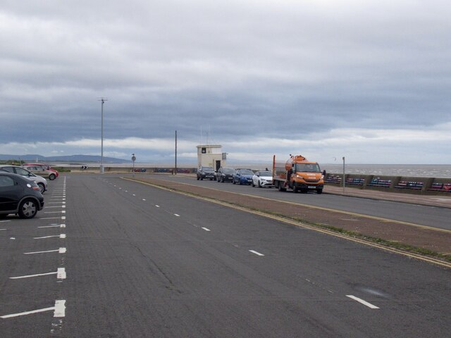
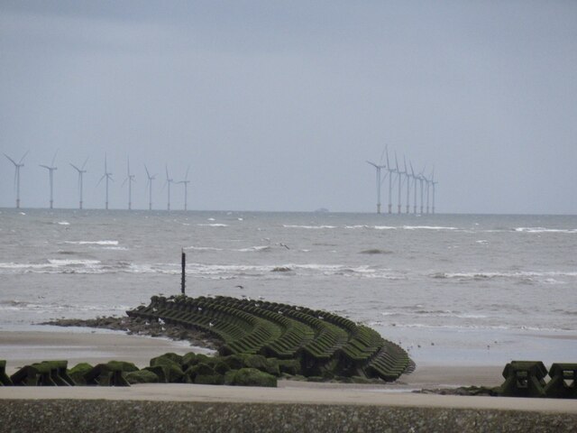
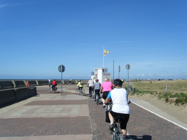
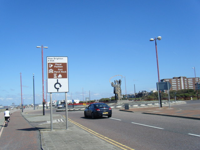
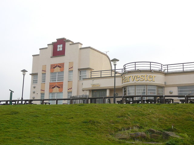
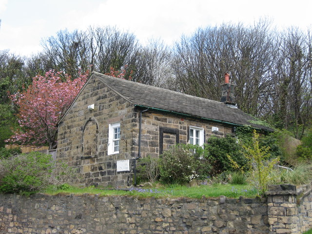
Captain's Pit Pond Images

Images are sourced within 2km of 53.429334/-3.0522213 or Grid Reference SJ3093. Thanks to Geograph Open Source API. All images are credited.

Graffiti Gallery - underneath Junction 1 M53
Leaning into St Hilary Brow – 1970 Wallasey Corporation bus 12 was one of the first production batch of Leyland Atlanteans, built in 1958.

This is one of a series of views featuring buses in the 60s, 70s, and 80s. <a title="https://www.geograph.org.uk/search.php?i=137652761" href="https://www.geograph.org.uk/search.php?i=137652761">Link</a>
Leaning into St Hilary Brow – 1970
Wallasey Corporation bus 12 was one of the first production batch of Leyland Atlanteans, built in 1958. This is one of a series of views featuring buses in the 60s, 70s, and 80s. Link
Bayswater Road, Wallasey
King's Parade, Wallasey A one way loop on the sea front. A great feeling of space here.
King's Parade, Wallasey
A one way loop on the sea front. A great feeling of space here.
Breakwater, Mockbeggar Wharf Coastal defences, Wallasey with the Burbo Bank windfarm in the background.
Breakwater, Mockbeggar Wharf
Coastal defences, Wallasey with the Burbo Bank windfarm in the background.
Cycle path, King's Parade Wallasey - New Brighton coast path and defences.
Cycle path, King's Parade
Wallasey - New Brighton coast path and defences.
Beach, Wallasey Wind, rain - Summer at the English seaside.
Beach, Wallasey
Wind, rain - Summer at the English seaside.
King's Parade, New Brighton
Breakwater, New Brighton
The Cliff, New Brighton Flats with a view.  Between the towers and sea there is a large area of undeveloped links.
The Cliff, New Brighton
Flats with a view. Between the towers and sea there is a large area of undeveloped links.
Derby Pool Harvester public house at Wallasey.
Derby Pool
Harvester public house at Wallasey.
Colourful benches by King's Parade, New Brighton
Kingsway Tunnel Approach near Bidston Moss
Kings Parade and Lifeguard Station
Kings Parade roundabout
The Derby Pool Public House (Harvester)
'Welcome to New Brighton' Clown sign on roundabout
The Original Wallasey Grammar School This cottage in Breck Road was erected as Wallasey Grammar school from 1799 replacing the original school set up in St Hilary's Parish Church which had been in existence since 1656. The school was transferred to a new premises in St George's Road in 1864 and from 1873 the school was based in Withens Lane in a building that later became a college of further education. The school moved to Birkett Lane in Leasowe in 1967 and later became known as Wallasey School. This original school building was later converted into a house. Grammar Schools were set up in the 15th century to provide free education to poor children and were generally founded by philanthropists, charitable organisations and guilds.
The Original Wallasey Grammar School
This cottage in Breck Road was erected as Wallasey Grammar school from 1799 replacing the original school set up in St Hilary's Parish Church which had been in existence since 1656. The school was transferred to a new premises in St George's Road in 1864 and from 1873 the school was based in Withens Lane in a building that later became a college of further education. The school moved to Birkett Lane in Leasowe in 1967 and later became known as Wallasey School. This original school building was later converted into a house. Grammar Schools were set up in the 15th century to provide free education to poor children and were generally founded by philanthropists, charitable organisations and guilds.
Show me another place!

Captain's Pit Pond is located at Grid Ref: SJ3093 (Lat: 53.429334, Lng: -3.0522213)

Unitary Authority: Wirral

Police Authority: Merseyside

What 3 Words

///lowest.from.split. Near Wallasey, Merseyside

Nearby Locations

Captain's Pit Pond

Related Wikis

New Brighton, Merseyside

New Brighton is a seaside resort and suburb of Wallasey, at the northeastern tip of the Wirral peninsula. It lies in the traditional county of Cheshire...

William Thomas Turner

Captain William Thomas Turner (23 October 1856 – 23 June 1933) was a British merchant navy captain. He is best known as the captain of RMS Lusitania when...

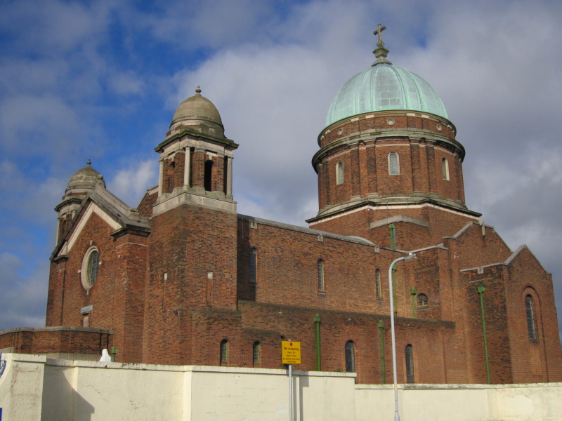
St Peter and St Paul's Church, New Brighton

The Sacred Shrine of Ss. Peter, Paul and St. Philomena is a Grade II listed Church in Atherton Street, New Brighton, Wirral, England. It has a green dome...

Sandheys Park

Sandheys Park was a football ground in New Brighton, England. It was the home ground of New Brighton A.F.C. from 1921 until World War II. == History... ==

Related Videos

Lets Walk 2023 New Brighton 4K HDR

NewBrighton #Wirral #4K #HDR.

walking in the seafront in Liverpool 4K ASMR

walking in the seafront in Liverpool (New Brighton)

Nearby Amenities

Located within 500m of 53.429334,-3.0522213
Noexit: yes
Source: bing
Lat/Long: 53.4268374/-3.0488216
Addr Housenumber: 13C
Cemetery: sector
Note: with permission by email 2009.08.09
Ref: 13C
Source: Friends of Rake Lane Cemetery
Website: http://www.wallaseycemetery.co.uk/Cemetery%20Plan.htm
Lat/Long: 53.4263253/-3.0476305
Addr Housenumber: 16G
Note: with permission by email 2009.08.09
Source: Friends of Rake Lane Cemetery
Website: http://www.wallaseycemetery.co.uk/Cemetery%20Plan.htm
Lat/Long: 53.4266884/-3.0471756
Addr Housenumber: 11R
Cemetery: sector
Note: with permission by email 2009.08.09
Ref: 11R
Source: Friends of Rake Lane Cemetery
Website: http://www.wallaseycemetery.co.uk/Cemetery%20Plan.htm
Lat/Long: 53.4264992/-3.0486776
Addr Housenumber: 17G
Cemetery: sector
Note: with permission by email 2009.08.09
Ref: 17G
Source: Friends of Rake Lane Cemetery
Website: http://www.wallaseycemetery.co.uk/Cemetery%20Plan.htm
Lat/Long: 53.4268726/-3.0480768
Addr Housenumber: 15C
Cemetery: sector
Note: with permission by email 2009.08.09
Ref: 15C
Source: Friends of Rake Lane Cemetery
Website: http://www.wallaseycemetery.co.uk/Cemetery%20Plan.htm
Lat/Long: 53.4268726/-3.0460169
Addr Housenumber: 20C
Cemetery: sector
Note: with permission by email 2009.08.09
Ref: 20C
Source: Friends of Rake Lane Cemetery
Website: http://www.wallaseycemetery.co.uk/Cemetery%20Plan.htm
Lat/Long: 53.4274044/-3.0457165
Addr Housenumber: 19C
Cemetery: sector
Note: with permission by email 2009.08.09
Ref: 19C
Source: Friends of Rake Lane Cemetery
Website: http://www.wallaseycemetery.co.uk/Cemetery%20Plan.htm
Lat/Long: 53.4276295/-3.0466778
Addr Housenumber: 18C
Cemetery: sector
Note: with permission by email 2009.08.09
Ref: 18C
Source: Friends of Rake Lane Cemetery
Website: http://www.wallaseycemetery.co.uk/Cemetery%20Plan.htm
Lat/Long: 53.4277317/-3.0473644
Addr Housenumber: 17C
Cemetery: sector
Note: with permission by email 2009.08.09
Ref: 17C
Source: Friends of Rake Lane Cemetery
Website: http://www.wallaseycemetery.co.uk/Cemetery%20Plan.htm
Lat/Long: 53.4272663/-3.0478193
Addr Housenumber: 16C
Cemetery: sector
Note: with permission by email 2009.08.09
Ref: 18C
Source: Friends of Rake Lane Cemetery
Website: http://www.wallaseycemetery.co.uk/Cemetery%20Plan.htm
Lat/Long: 53.4270669/-3.0469009
Addr Housenumber: 12G
Cemetery: sector
Note: with permission by email 2009.08.09
Ref: 12G
Source: Friends of Rake Lane Cemetery
Website: http://www.wallaseycemetery.co.uk/Cemetery%20Plan.htm
Lat/Long: 53.4317234/-3.0461996
Bus Stop
GROVE ROAD/WARREN DRIVE
Bus: yes
Naptan AtcoCode: 2800S23021A
Naptan Bearing: W
Naptan CommonName: GROVE ROAD/WARREN DRIVE
Naptan Indicator: GROVE ROAD/WARREN DRIVE
Naptan Landmark: O/S 132A
Naptan NaptanCode: merapamt
Naptan Notes: No Notes
Naptan ShortCommonName: Gr Rd/Warren Dr
Naptan Street: GROVE ROAD
Naptan Verified: no
Public Transport: platform
Source: naptan_import
Lat/Long: 53.430307/-3.0575971
Bus Stop
GROVE ROAD/LYNDHURST ROAD
Bus: yes
Naptan AtcoCode: 2800S23021B
Naptan Bearing: E
Naptan CommonName: GROVE ROAD/LYNDHURST ROAD
Naptan Indicator: GROVE ROAD/WARREN DRIVE
Naptan Landmark: OPP LYNDHURST ROAD
Naptan NaptanCode: merapamw
Naptan Notes: No Notes
Naptan ShortCommonName: Gr Rd/Lyndhurst Rd
Naptan Street: GROVE ROAD
Naptan Verified: no
Public Transport: platform
Source: naptan_import
Lat/Long: 53.430443/-3.057465
Bus Stop
GROVE ROAD/WARREN DRIVE
Bus: yes
Naptan AtcoCode: 2800S23021C
Naptan Bearing: W
Naptan CommonName: GROVE ROAD/WARREN DRIVE
Naptan Indicator: GROVE ROAD/WARREN DRIVE
Naptan Landmark: CLOSE TO THE WARREN CLUB
Naptan NaptanCode: mergmaga
Naptan Notes: No Notes
Naptan ShortCommonName: The Warren Club
Naptan Street: GROVE ROAD
Naptan Verified: no
Public Transport: platform
Source: naptan_import
Lat/Long: 53.4303945/-3.0558382
Bus Stop
WARREN DRIVE/GROVE ROAD
Bus: yes
Naptan AtcoCode: 2800S23021D
Naptan Bearing: N
Naptan CommonName: WARREN DRIVE/GROVE ROAD
Naptan Indicator: WARREN DRIVE/GROVE ROAD
Naptan Landmark: O/S 1
Naptan NaptanCode: merapapa
Naptan Notes: No Notes
Naptan ShortCommonName: Warren Dr/Gr Rd
Naptan Street: WARREN DRIVE
Naptan Verified: no
Public Transport: platform
Source: naptan_import
Lat/Long: 53.4308517/-3.0565926
Bus Stop
HAMILTON ROAD/MOUNT ROAD
Bus: yes
Naptan AtcoCode: 2800S23037B
Naptan Bearing: SW
Naptan CommonName: HAMILTON ROAD/MOUNT ROAD
Naptan Indicator: HAMILTON ROAD/MOUNT ROAD
Naptan Landmark: OPP MOUNT PRIMARY SCHOOL
Naptan NaptanCode: merapdjm
Naptan Notes: No Notes
Naptan ShortCommonName: Mount Primary Sch
Naptan Street: HAMILTON ROAD
Naptan Verified: no
Public Transport: platform
Source: naptan_import
Lat/Long: 53.4338133/-3.0524458
Bus Stop
MOUNT ROAD/STONEBY DRIVE
Bus: yes
Naptan AtcoCode: 2800S23038A
Naptan Bearing: NW
Naptan CommonName: MOUNT ROAD/STONEBY DRIVE
Naptan Indicator: MOUNT ROAD
Naptan Landmark: CORNER STONEBY DRIVE O/S 36
Naptan NaptanCode: merapdjp
Naptan Notes: No Notes
Naptan ShortCommonName: Mount Rd/Stoneby Dr
Naptan Street: MOUNT ROAD
Naptan Verified: no
Public Transport: platform
Source: naptan_import
Lat/Long: 53.4325122/-3.0511643
Bus Stop
MOUNT ROAD/STONEBY DRIVE
Bus: yes
Naptan AtcoCode: 2800S23038B
Naptan Bearing: SE
Naptan CommonName: MOUNT ROAD/STONEBY DRIVE
Naptan Indicator: MOUNT ROAD
Naptan Landmark: OPP STONEBY DRIVE OPP 36
Naptan NaptanCode: merapdjt
Naptan Notes: No Notes
Naptan ShortCommonName: Mount Rd/Stoneby Dr
Naptan Street: MOUNT ROAD
Naptan Verified: no
Public Transport: platform
Source: naptan_import
Lat/Long: 53.4325853/-3.0510306
Bus Stop
Mount Pleasant Road/mount Road
Bus: yes
Naptan AtcoCode: 2800S23039A
Naptan Bearing: SW
Naptan CommonName: Mount Pleasant Road/mount Road
Naptan Indicator: Mount Pleasant Road/mount Road
Naptan Landmark: O/s 64
Naptan NaptanCode: merapdjw
Naptan Notes: No Notes
Naptan ShortCommonName: Mount Pleasant Rd
Naptan Street: Mount Pleasant Road
Naptan Verified: no
Public Transport: platform
Source: naptan_import
Lat/Long: 53.4306509/-3.0471297
Bus Stop
MOUNT PLEASANR ROAD/KIRKWAY
Bus: yes
Naptan AtcoCode: 2800S23039C
Naptan Bearing: SW
Naptan CommonName: MOUNT PLEASANR ROAD/KIRKWAY
Naptan Indicator: MOUNT PLEASANT ROAD/MOUNT ROAD
Naptan Landmark: O/S 59
Naptan NaptanCode: merapdma
Naptan Notes: No Notes
Naptan ShortCommonName: Mount Pleasant Rd
Naptan Street: MOUNT PLEASANT ROAD
Naptan Verified: no
Public Transport: platform
Source: naptan_import
Lat/Long: 53.4302403/-3.047827
Bus Stop
SEAVIEW ROAD/HOSESIDE ROAD
Bus: yes
Naptan AtcoCode: 2800S23040B
Naptan Bearing: SW
Naptan CommonName: SEAVIEW ROAD/HOSESIDE ROAD
Naptan Indicator: SEAVIEW ROAD/HOSESIDE ROAD
Naptan Landmark: OPP 237
Naptan NaptanCode: merapdmd
Naptan Notes: No Notes
Naptan ShortCommonName: Hoseside Rd
Naptan Street: SEAVIEW ROAD
Naptan Verified: no
Public Transport: platform
Source: naptan_import
Lat/Long: 53.4283351/-3.0518589
Bus Stop
SEAVIEW ROAD/HOSESIDE ROAD
Bus: yes
Naptan AtcoCode: 2800S23040C
Naptan Bearing: NE
Naptan CommonName: SEAVIEW ROAD/HOSESIDE ROAD
Naptan Indicator: SEAVIEW ROAD/HOSESIDE ROAD
Naptan Landmark: O/S 239
Naptan NaptanCode: merapdmg
Naptan Notes: No Notes
Naptan ShortCommonName: Hoseside Rd
Naptan Street: SEAVIEW ROAD
Naptan Verified: no
Public Transport: platform
Source: naptan_import
Lat/Long: 53.4284419/-3.051982
Bus Stop
HOSESIDE ROAD/ELLERAY PARK
Bus: yes
Naptan AtcoCode: 2800S23048A
Naptan Bearing: NW
Naptan CommonName: HOSESIDE ROAD/ELLERAY PARK
Naptan Indicator: HOSESIDE ROAD/GROVE ROAD
Naptan Landmark: OPP ELLERAY PARK O/S 25
Naptan NaptanCode: merapdpw
Naptan Notes: No Notes
Naptan ShortCommonName: Eleray Park
Naptan Street: HOSESIDE ROAD
Naptan Verified: no
Public Transport: platform
Source: naptan_import
Lat/Long: 53.4297857/-3.0535203
Bus Stop
HOSESIDE ROAD/ELLERAY PARK
Bus: yes
Naptan AtcoCode: 2800S23048B
Naptan Bearing: SE
Naptan CommonName: HOSESIDE ROAD/ELLERAY PARK
Naptan Indicator: HOSESIDE ROAD/GROVE ROAD
Naptan Landmark: O/S ELLERAY PARK OPP 31/33
Naptan NaptanCode: merapdta
Naptan Notes: No Notes
Naptan ShortCommonName: Eleray Park
Naptan Street: HOSESIDE ROAD
Naptan Verified: no
Public Transport: platform
Source: naptan_import
Lat/Long: 53.4300367/-3.0536018
Bus Stop
EARLSTON RD/WALLASEY LIBRARY
Bus: yes
Naptan AtcoCode: 2800S23074C
Naptan Bearing: SW
Naptan CommonName: EARLSTON RD/WALLASEY LIBRARY
Naptan Indicator: EARLSTON ROAD OPP KIRKWAY
Naptan Landmark: ADJ LIBRARY
Naptan NaptanCode: merapgda
Naptan Notes: No Notes
Naptan ShortCommonName: Wallasey Library
Naptan Street: EARLSTON ROAD
Naptan Verified: no
Public Transport: platform
Source: naptan_import
Lat/Long: 53.4290923/-3.0465043
Bus Stop
EARLSTON RD/WALLASEY LIBRARY
Bus: yes
Naptan AtcoCode: 2800S23074D
Naptan Bearing: NE
Naptan CommonName: EARLSTON RD/WALLASEY LIBRARY
Naptan Indicator: EARLSTON ROAD/KIRKWAY
Naptan Landmark: OPP LIBRARY
Naptan NaptanCode: merapgdg
Naptan Notes: No Notes
Naptan ShortCommonName: Wallasey Library
Naptan Street: EARLSTON ROAD
Naptan Verified: no
Public Transport: platform
Source: naptan_import
Lat/Long: 53.4293541/-3.0463753
Bus Stop
SEAVIEW ROAD/EARLSTON ROAD
Bus: yes
Naptan AtcoCode: 2800S24008A
Naptan CommonName: SEAVIEW ROAD/EARLSTON ROAD
Naptan Indicator: SEAVIEW ROAD/EARLSTON ROAD
Naptan Landmark: O/S 141
Naptan NaptanCode: merapgtp
Naptan Notes: No Notes
Naptan ShortCommonName: Earlston Rd
Naptan Street: SEAVIEW ROAD
Naptan Verified: no
Public Transport: platform
Source: naptan_import
Lat/Long: 53.426009/-3.0495741
Bus Stop
SEAVIEW ROAD/EARLSTON ROAD
Bus: yes
Naptan AtcoCode: 2800S24008B
Naptan Bearing: SE
Naptan CommonName: SEAVIEW ROAD/EARLSTON ROAD
Naptan Indicator: SEAVIEW ROAD/EARLSTON ROAD
Naptan Landmark: OPP 139 O/S CEMETERY
Naptan NaptanCode: merapgtw
Naptan Notes: No Notes
Naptan ShortCommonName: Earlston Rd
Naptan Street: SEAVIEW ROAD
Naptan Verified: no
Public Transport: platform
Source: naptan_import
Lat/Long: 53.4260112/-3.0493183
Off The Rock Cycles
Shop: bicycle
Lat/Long: 53.4281584/-3.0526175
Addr Housenumber: 2
Addr Postcode: CH45 0LG
Addr Street: Stoneby Drive
Source: local_knowledge
Lat/Long: 53.4326337/-3.0517052
Post Box
Brand: Royal Mail
Brand Wikidata: Q638098
Brand Wikipedia: en:Royal Mail
Collection Times: Mo-Fr 09:00; Sa 07:00
Description: QE II post box CH45 184 at the junction of Hoseside Road, Grove Road and Rockland Road.
Old Post Box Type: pillar
Operator: Royal Mail
Operator Wikidata: Q638098
Post Box Type: lamp
Ref: CH45 184D
Royal Cypher: EIIR
Royal Cypher Wikidata: Q33102113
Wikimedia Commons: File:Post box, Hoseside Road.jpg
Lat/Long: 53.4303791/-3.0541708
Post Box
Brand: Royal Mail
Brand Wikidata: Q638098
Brand Wikipedia: en:Royal Mail
Description: QE II post box CH45 302 on Seaview Road, Wallasey, near to Malpas Road. Royal Mail have this as being at Malpas Road Post Office, but it has obviously long gone.
Operator: Royal Mail
Operator Wikidata: Q638098
Post Box Type: pillar
Ref: CH45 302
Royal Cypher: EIIR
Royal Cypher Wikidata: Q33102113
Wikimedia Commons: File:Post box, Malpas Road.jpg
Lat/Long: 53.4277765/-3.0522141
Traffic Signals
Lat/Long: 53.430352/-3.058687
Turning Circle
Lat/Long: 53.4257957/-3.0547316
Post Box
Brand: Royal Mail
Brand Wikidata: Q638098
Brand Wikipedia: en:Royal Mail
Description: QE II pole mounted post box CH45 73 on Oarside Drive, Wallasey, at junction with Kirkway.
Operator: Royal Mail
Operator Wikidata: Q638098
Post Box Mounting: pier
Post Box Type: lamp
Ref: CH45 73
Royal Cypher: EIIR
Royal Cypher Wikidata: Q33102113
Wikimedia Commons: File:Post box on Oarside Drive, Wallasey.jpg
Lat/Long: 53.4298329/-3.0468212
Addr Housenumber: 11A
Addr Postcode: CH45 0LS
Addr Street: Langdale Road
Building Levels: 1
Entrance: main
Lat/Long: 53.4335318/-3.0541515
Addr Housenumber: 11
Addr Postcode: CH45 0LS
Addr Street: Langdale Road
Building Levels: 0
Entrance: main
Lat/Long: 53.4336201/-3.0541948
Addr Housenumber: 2A
Addr Postcode: CH45 0LS
Addr Street: Dovedale Road
Building Levels: 1
Entrance: main
Source: survey
Lat/Long: 53.4336429/-3.0531918
Post Box
Collection Times: Mo-Fr 09:00; Sa 07:00
Description: QE II post box CH45 194 by Carron Company on Mount Road at its junction with Hamilton Road.
Manufacturer: Carron Company
Operator: Royal Mail
Operator Wikidata: Q638098
Post Box Type: pillar
Ref: CH45 194D
Royal Cypher: EIIR
Royal Cypher Wikidata: Q33102113
Source: survey
Wikimedia Commons: File:Post box on Mount Road, New Brighton.jpg
Lat/Long: 53.4336341/-3.0528235
Addr Housenumber: 52
Addr Street: Mount Road
Source: survey
Lat/Long: 53.432728/-3.0517993
Addr Housenumber: 43
Addr Street: Hamilton Road
Source: survey
Lat/Long: 53.4337522/-3.0522579
Addr Housenumber: 73
Addr Street: Mount Road
Source: survey
Lat/Long: 53.4335333/-3.0525849
Addr Housenumber: 36
Addr Street: Mount Road
Source: survey
Lat/Long: 53.4324483/-3.0512414
Addr Housenumber: 50
Addr Street: Mount Road
Source: survey
Lat/Long: 53.4326849/-3.0517537
Addr Housenumber: 71
Addr Street: Mount Road
Source: survey
Lat/Long: 53.4334294/-3.052424
Addr Housenumber: 75
Addr Street: Mount Road
Source: survey
Lat/Long: 53.4336036/-3.0526734
Addr Housenumber: 45
Addr Street: Hamilton Road
Source: survey
Lat/Long: 53.4336623/-3.0525393
Milestone
Source: survey
Lat/Long: 53.4304076/-3.0576638
Care Home
Eaton Court
Addr Housenumber: 128-130
Addr Postcode: CH45 0JF
Addr Street: Grove Road
Cqc Location Id: 1-112575923
Fhrs Id: 394313
Source: survey
Source Postcode: FHRS Open Data
Lat/Long: 53.4301135/-3.0581087
Addr Housenumber: 134A
Addr Street: Grove Road
Source: survey
Lat/Long: 53.4301198/-3.0574625
Addr Housenumber: 134
Addr Street: Grove Road
Source: survey
Lat/Long: 53.4301262/-3.0573606
Addr Housenumber: 132
Addr Street: Grove Road
Source: survey
Lat/Long: 53.4301054/-3.0576798
Addr Housenumber: 126
Addr Street: Grove Road
Source: survey
Lat/Long: 53.4301293/-3.058844
Addr Housenumber: 122
Addr Street: Grove Road
Source: survey
Lat/Long: 53.4301391/-3.0593375
Addr Housenumber: 132A
Addr Street: Grove Road
Source: survey
Lat/Long: 53.4301086/-3.0575752
Addr Housenumber: 120
Addr Street: Grove Road
Source: survey
Lat/Long: 53.4301261/-3.0594556
Addr Housenumber: 124
Addr Street: Grove Road
Source: survey
Lat/Long: 53.4301293/-3.0590264
Mini Roundabout
Source: OS-OpenData_StreetView
Lat/Long: 53.4285673/-3.0517197
Post Box
Brand: Royal Mail
Brand Wikidata: Q638098
Brand Wikipedia: en:Royal Mail
Collection Times: Mo-Fr 09:00; Sa 07:00
Description: QE II post box CH45 286 on Lyndhurst Road at its junction with Rolleston Drive, Wallasey.
Operator: Royal Mail
Operator Wikidata: Q638098
Post Box Type: pillar
Ref: CH45 286
Royal Cypher: EIIR
Royal Cypher Wikidata: Q33102113
Source: survey
Wikimedia Commons: File:Post box on Lyndhurst Road.jpg
Lat/Long: 53.4291089/-3.0577457
Generator Method: photovoltaic
Generator Output Electricity: yes
Generator Source: solar
Generator Type: solar_photovoltaic_panel
Location: roof
Power: generator
Source: survey
Lat/Long: 53.4251128/-3.0548294
Addr Housenumber: 11
Addr Street: Lyndhurst Road
Lat/Long: 53.4291008/-3.0570664
Addr Housenumber: 9
Addr Street: Lyndhurst Road
Lat/Long: 53.4291271/-3.0569496
Direction: 255
Generator Method: photovoltaic
Generator Output Electricity: yes
Generator Solar Modules: 8
Generator Source: solar
Generator Type: solar_photovoltaic_panel
Location: roof
Power: generator
Source: survey
Lat/Long: 53.4310931/-3.0561382
Bench
Backrest: yes
Material: wood
Seats: 4
Source: survey
Lat/Long: 53.4308457/-3.0566218
John Nuthall
Addr Housenumber: 156
Addr Street: Belvidere Road
Shop: hairdresser
Source: survey
Source Addr: interpolation
Lat/Long: 53.4251687/-3.0548659
Addr Housenumber: 136
Addr Postcode: CH45 0JF
Addr Street: Grove Road
Source Addr: interpolation
Lat/Long: 53.4301254/-3.0567581
Addr Housenumber: 158
Addr Street: Belvidere Road
Source Addr: survey
Lat/Long: 53.4252887/-3.0549557
Direction: 170
Generator Method: photovoltaic
Generator Output Electricity: yes
Generator Solar Modules: 17
Generator Source: solar
Generator Type: solar_photovoltaic_panel
Location: roof
Power: generator
Source: survey
Lat/Long: 53.4300994/-3.0565183
Addr Housenumber: 166
Addr Street: Belvidere Road
Source: survey
Source Addr: interpolation
Lat/Long: 53.4257738/-3.0552999
Addr Housenumber: 154
Addr Street: Belvidere Road
Source Addr: survey
Lat/Long: 53.4251172/-3.0548068
Generator Method: photovoltaic
Generator Output Electricity: yes
Generator Source: solar
Generator Type: solar_photovoltaic_panel
Location: roof
Power: generator
Lat/Long: 53.426007/-3.05464
Direction: SE
Generator Method: photovoltaic
Generator Output Electricity: yes
Generator Solar Modules: 12
Generator Source: solar
Generator Type: solar_photovoltaic_panel
Location: roof
Power: generator
Lat/Long: 53.4265451/-3.0533112
Direction: SSE
Generator Method: photovoltaic
Generator Output Electricity: yes
Generator Solar Modules: 12
Generator Source: solar
Generator Type: solar_photovoltaic_panel
Location: roof
Power: generator
Lat/Long: 53.4306999/-3.0551197
Direction: 150
Generator Method: photovoltaic
Generator Output Electricity: yes
Generator Solar Modules: 12
Generator Source: solar
Generator Type: solar_photovoltaic_panel
Location: roof
Power: generator
Lat/Long: 53.4327536/-3.0480415
Direction: 145
Generator Method: photovoltaic
Generator Output Electricity: yes
Generator Solar Modules: 13
Generator Source: solar
Generator Type: solar_photovoltaic_panel
Location: roof
Power: generator
Lat/Long: 53.4317079/-3.0551359
Direction: SSE
Generator Method: photovoltaic
Generator Output Electricity: yes
Generator Solar Modules: 10
Generator Source: solar
Generator Type: solar_photovoltaic_panel
Location: roof
Power: generator
Lat/Long: 53.426249/-3.0545859
Direction: 150
Generator Method: photovoltaic
Generator Output Electricity: yes
Generator Solar Modules: 16
Generator Source: solar
Generator Type: solar_photovoltaic_panel
Location: roof
Power: generator
Lat/Long: 53.43233/-3.0477582
Direction: SSE
Generator Method: photovoltaic
Generator Output Electricity: yes
Generator Solar Modules: 14
Generator Source: solar
Generator Type: solar_photovoltaic_panel
Location: roof
Power: generator
Lat/Long: 53.4307911/-3.0552028
Direction: 125
Generator Method: photovoltaic
Generator Output Electricity: yes
Generator Solar Modules: 12
Generator Source: solar
Generator Type: solar_photovoltaic_panel
Location: roof
Power: generator
Lat/Long: 53.4270563/-3.0489947
Direction: SSE
Generator Method: photovoltaic
Generator Output Electricity: yes
Generator Solar Modules: 14
Generator Source: solar
Generator Type: solar_photovoltaic_panel
Location: roof
Power: generator
Lat/Long: 53.4277687/-3.0545386
Direction: 92
Generator Method: photovoltaic
Generator Output Electricity: yes
Generator Solar Modules: 16
Generator Source: solar
Generator Type: solar_photovoltaic_panel
Location: roof
Power: generator
Lat/Long: 53.4279577/-3.0541792
Direction: 190
Generator Method: photovoltaic
Generator Output Electricity: yes
Generator Solar Modules: 8
Generator Source: solar
Generator Type: solar_photovoltaic_panel
Location: roof
Power: generator
Lat/Long: 53.432056/-3.0512564
Direction: 235
Generator Method: photovoltaic
Generator Output Electricity: yes
Generator Solar Modules: 10
Generator Source: solar
Generator Type: solar_photovoltaic_panel
Location: roof
Power: generator
Lat/Long: 53.4315397/-3.0466329
Generator Method: photovoltaic
Generator Output Electricity: yes
Generator Source: solar
Generator Type: solar_photovoltaic_panel
Location: roof
Power: generator
Lat/Long: 53.4329086/-3.0561917
Direction: WSW
Generator Method: photovoltaic
Generator Output Electricity: yes
Generator Solar Modules: 14
Generator Source: solar
Generator Type: solar_photovoltaic_panel
Location: roof
Power: generator
Lat/Long: 53.4314432/-3.0555573
Direction: 165
Generator Method: photovoltaic
Generator Output Electricity: yes
Generator Solar Modules: 12
Generator Source: solar
Generator Type: solar_photovoltaic_panel
Location: roof
Power: generator
Lat/Long: 53.4306238/-3.0557921
Direction: 165
Generator Method: photovoltaic
Generator Output Electricity: yes
Generator Solar Modules: 12
Generator Source: solar
Generator Type: solar_photovoltaic_panel
Location: roof
Power: generator
Lat/Long: 53.430611/-3.0559161
Direction: 150
Generator Method: photovoltaic
Generator Output Electricity: yes
Generator Solar Modules: 14
Generator Source: solar
Generator Type: solar_photovoltaic_panel
Location: roof
Power: generator
Lat/Long: 53.4337139/-3.0510289
Direction: 305
Generator Method: photovoltaic
Generator Output Electricity: yes
Generator Solar Modules: 16
Generator Source: solar
Generator Type: solar_photovoltaic_panel
Location: roof
Power: generator
Lat/Long: 53.4280123/-3.0505492
Direction: SE
Generator Method: photovoltaic
Generator Output Electricity: yes
Generator Solar Modules: 4
Generator Source: solar
Generator Type: solar_photovoltaic_panel
Location: roof
Power: generator
Tilt Angle: 0
Lat/Long: 53.4265105/-3.0532609
Direction: ENE
Generator Method: photovoltaic
Generator Output Electricity: yes
Generator Solar Modules: 7
Generator Source: solar
Generator Type: solar_photovoltaic_panel
Location: roof
Power: generator
Lat/Long: 53.4261906/-3.055534
Direction: WSW
Generator Method: photovoltaic
Generator Output Electricity: yes
Generator Solar Modules: 7
Generator Source: solar
Generator Type: solar_photovoltaic_panel
Location: roof
Power: generator
Lat/Long: 53.4261698/-3.0556159
Direction: 235
Generator Method: photovoltaic
Generator Output Electricity: yes
Generator Solar Modules: 16
Generator Source: solar
Generator Type: solar_photovoltaic_panel
Location: roof
Power: generator
Lat/Long: 53.4284338/-3.0542727
Direction: 145
Generator Method: photovoltaic
Generator Output Electricity: yes
Generator Solar Modules: 12
Generator Source: solar
Generator Type: solar_photovoltaic_panel
Location: roof
Power: generator
Lat/Long: 53.4256316/-3.0495599
Direction: 235
Generator Method: photovoltaic
Generator Output Electricity: yes
Generator Solar Modules: 10
Generator Source: solar
Generator Type: solar_photovoltaic_panel
Location: roof
Power: generator
Lat/Long: 53.4301744/-3.0474647
Direction: 145
Generator Method: photovoltaic
Generator Output Electricity: yes
Generator Solar Modules: 6
Generator Source: solar
Generator Type: solar_photovoltaic_panel
Location: roof
Power: generator
Lat/Long: 53.4301946/-3.0475787
Direction: SSE
Generator Method: photovoltaic
Generator Output Electricity: yes
Generator Solar Modules: 8
Generator Source: solar
Generator Type: solar_photovoltaic_panel
Location: roof
Power: generator
Source: Bing
Lat/Long: 53.4251362/-3.0547277
Direction: WSW
Generator Method: photovoltaic
Generator Output Electricity: yes
Generator Solar Modules: 8
Generator Source: solar
Generator Type: solar_photovoltaic_panel
Location: roof
Power: generator
Source: survey
Lat/Long: 53.4309939/-3.055706
Direction: 145
Generator Method: photovoltaic
Generator Output Electricity: yes
Generator Solar Modules: 8
Generator Source: solar
Generator Type: solar_photovoltaic_panel
Location: roof
Power: generator
Lat/Long: 53.429954/-3.0494693
Barrier: bollard
Lat/Long: 53.4315954/-3.0477111
Barrier: bollard
Lat/Long: 53.4313485/-3.0484059
Addr Housenumber: 54
Addr Street: Mount Road
Source: survey
Lat/Long: 53.4329493/-3.0522797
Addr Housenumber: 55
Addr Street: Mount Road
Source: survey
Lat/Long: 53.4329948/-3.0514951
Addr Housenumber: 57
Addr Street: Mount Road
Source: survey
Lat/Long: 53.4330739/-3.0516212
Addr Housenumber: 59
Addr Street: Mount Road
Source: survey
Lat/Long: 53.4331299/-3.0517674
Addr Housenumber: 63
Addr Street: Mount Road
Source: survey
Lat/Long: 53.4331914/-3.0519042
Addr Housenumber: 65
Addr Street: Mount Road
Source: survey
Lat/Long: 53.4332561/-3.0520275
Addr Housenumber: 67
Addr Street: Mount Road
Source: survey
Lat/Long: 53.4333368/-3.0521777
Addr Housenumber: 56
Addr Street: Mount Road
Source: survey
Lat/Long: 53.4330356/-3.0525117
Addr Housenumber: 58
Addr Street: Mount Road
Source: survey
Lat/Long: 53.4332201/-3.0528228
Addr Housenumber: 69
Addr Street: Mount Road
Source: survey
Lat/Long: 53.4334015/-3.0523387
Addr Housenumber: 38
Addr Street: Mount Road
Source: survey
Lat/Long: 53.4324953/-3.0513725
Addr Housenumber: 34
Addr Street: Mount Road
Source: survey
Lat/Long: 53.4321118/-3.0505799
Addr Housenumber: 32
Addr Street: Mount Road
Source: survey
Lat/Long: 53.4320144/-3.0503975
Addr Housenumber: 30
Addr Street: Mount Road
Source: survey
Lat/Long: 53.4319768/-3.050309
Addr Housenumber: 28
Addr Street: Mount Road
Source: survey
Lat/Long: 53.4318865/-3.0501252
Addr Housenumber: 26
Addr Street: Mount Road
Source: survey
Lat/Long: 53.4318418/-3.0500166
Addr Housenumber: 24
Addr Street: Mount Road
Source: survey
Lat/Long: 53.4317427/-3.0498061
Addr Housenumber: 22
Addr Street: Mount Road
Source: survey
Lat/Long: 53.4317099/-3.0497283
Addr Housenumber: 20
Addr Street: Mount Road
Source: survey
Lat/Long: 53.4316212/-3.0495191
Addr Housenumber: 18
Addr Street: Mount Road
Source: survey
Lat/Long: 53.4315765/-3.0494493
Addr Housenumber: 16
Addr Street: Mount Road
Source: survey
Lat/Long: 53.4314926/-3.0492495
Addr Housenumber: 14
Addr Street: Mount Road
Source: survey
Lat/Long: 53.4314487/-3.0491409
Addr Housenumber: 12
Addr Street: Mount Road
Source: survey
Lat/Long: 53.4313712/-3.0489826
Addr Housenumber: 10
Addr Street: Mount Road
Source: survey
Lat/Long: 53.4313216/-3.048929
Addr Housenumber: 8
Addr Street: Mount Road
Source: survey
Lat/Long: 53.4312721/-3.0488364
Addr Housenumber: 6
Addr Street: Mount Road
Source: survey
Lat/Long: 53.4312241/-3.0487761
Addr Housenumber: 5
Addr Street: Mount Road
Source: survey
Lat/Long: 53.4309021/-3.0475248
Addr Housenumber: 19
Addr Street: Mount Road
Source: survey
Lat/Long: 53.431471/-3.0481981
Addr Housenumber: 7
Addr Street: Mount Road
Source: survey
Lat/Long: 53.4309996/-3.047659
Addr Housenumber: 9
Addr Street: Mount Road
Source: survey
Lat/Long: 53.4310635/-3.047726
Addr Housenumber: 11
Addr Street: Mount Road
Source: survey
Lat/Long: 53.431153/-3.0478574
Addr Housenumber: 13
Addr Street: Mount Road
Source: survey
Lat/Long: 53.4312209/-3.0479312
Addr Housenumber: 15
Addr Street: Mount Road
Source: survey
Lat/Long: 53.4313144/-3.0480465
Addr Housenumber: 17
Addr Street: Mount Road
Source: survey
Lat/Long: 53.4313775/-3.0481203
Addr Housenumber: 21
Addr Street: Mount Road
Source: survey
Lat/Long: 53.431519/-3.0482557
Addr Housenumber: 23
Addr Street: Mount Road
Source: survey
Lat/Long: 53.4315605/-3.0483054
Addr Housenumber: 25
Addr Street: Mount Road
Source: survey
Lat/Long: 53.4316037/-3.0483456
Addr Housenumber: 27
Addr Street: Mount Road
Source: survey
Lat/Long: 53.4316532/-3.0483858
Addr Housenumber: 29
Addr Street: Mount Road
Source: survey
Lat/Long: 53.4317291/-3.0488391
Direction: 190
Generator Method: photovoltaic
Generator Output Electricity: yes
Generator Solar Modules: 5
Generator Source: solar
Generator Type: solar_photovoltaic_panel
Location: roof
Power: generator
Lat/Long: 53.4320506/-3.0511712
Direction: 145
Generator Method: photovoltaic
Generator Output Electricity: yes
Generator Solar Modules: 10
Generator Source: solar
Generator Type: solar_photovoltaic_panel
Location: roof
Power: generator
Lat/Long: 53.4323118/-3.0553476
The data included in this document is from www.openstreetmap.org. The data is made available under ODbL.

Have you been to Captain's Pit Pond?

Leave your review of Captain's Pit Pond below (or comments, questions and feedback).