Lotman's Dyke
Lake, Pool, Pond, Freshwater Marsh in Suffolk East Suffolk
England
Lotman's Dyke
Lotman's Dyke is a freshwater marsh located in Suffolk, England, known for its picturesque landscape and rich biodiversity. It is situated in close proximity to the market town of Beccles and covers an area of approximately 50 acres.
The dyke itself is a man-made waterway dating back to the medieval period, originally constructed to drain the surrounding marshland for agricultural purposes. Over time, the area has transformed into a unique wetland habitat, attracting a diverse range of plant and animal species.
The marsh is characterized by its calm, still waters and abundant vegetation, including reeds, sedges, and water lilies. These plants provide an important nesting and feeding ground for various bird species, such as herons, coots, and mallards. In addition to avian life, Lotman's Dyke is also home to a variety of amphibians, including frogs and newts, which thrive in the marsh's wet environment.
The surrounding area offers several walking trails and observation points, allowing visitors to explore and observe the abundant wildlife. The peaceful atmosphere and serene beauty of Lotman's Dyke make it a popular destination for nature enthusiasts, birdwatchers, and photographers.
The marsh is managed by a local conservation group, who work diligently to maintain the delicate balance of the ecosystem and preserve the natural habitat. Their efforts have led to the protection and restoration of several endangered plant and animal species within the area.
Lotman's Dyke serves as a valuable reminder of the importance of wetland conservation and the significant role these habitats play in supporting a wide range of flora and fauna.
If you have any feedback on the listing, please let us know in the comments section below.
Lotman's Dyke Images
Images are sourced within 2km of 52.462773/1.5912489 or Grid Reference TM4491. Thanks to Geograph Open Source API. All images are credited.


Lotman's Dyke is located at Grid Ref: TM4491 (Lat: 52.462773, Lng: 1.5912489)
Administrative County: Suffolk
District: East Suffolk
Police Authority: Suffolk
What 3 Words
///sprayer.tagging.gripes. Near Beccles, Suffolk
Nearby Locations
Related Wikis

Worlingham Hall
Worlingham Hall is a Grade I listed Georgian country house in Worlingham, 1 mile (1.6 km) to the east of Beccles in the English county of Suffolk. The...

Worlingham
Worlingham is a village and civil parish in the East Suffolk district of the English county of Suffolk. It is about 1.3 miles (2.1 km) east of Beccles...

Beccles Town F.C.
Beccles Town Football Club is an English football club based in Beccles, Suffolk. They are nicknamed 'The Wherrymen', because Beccles was once a busy trading...
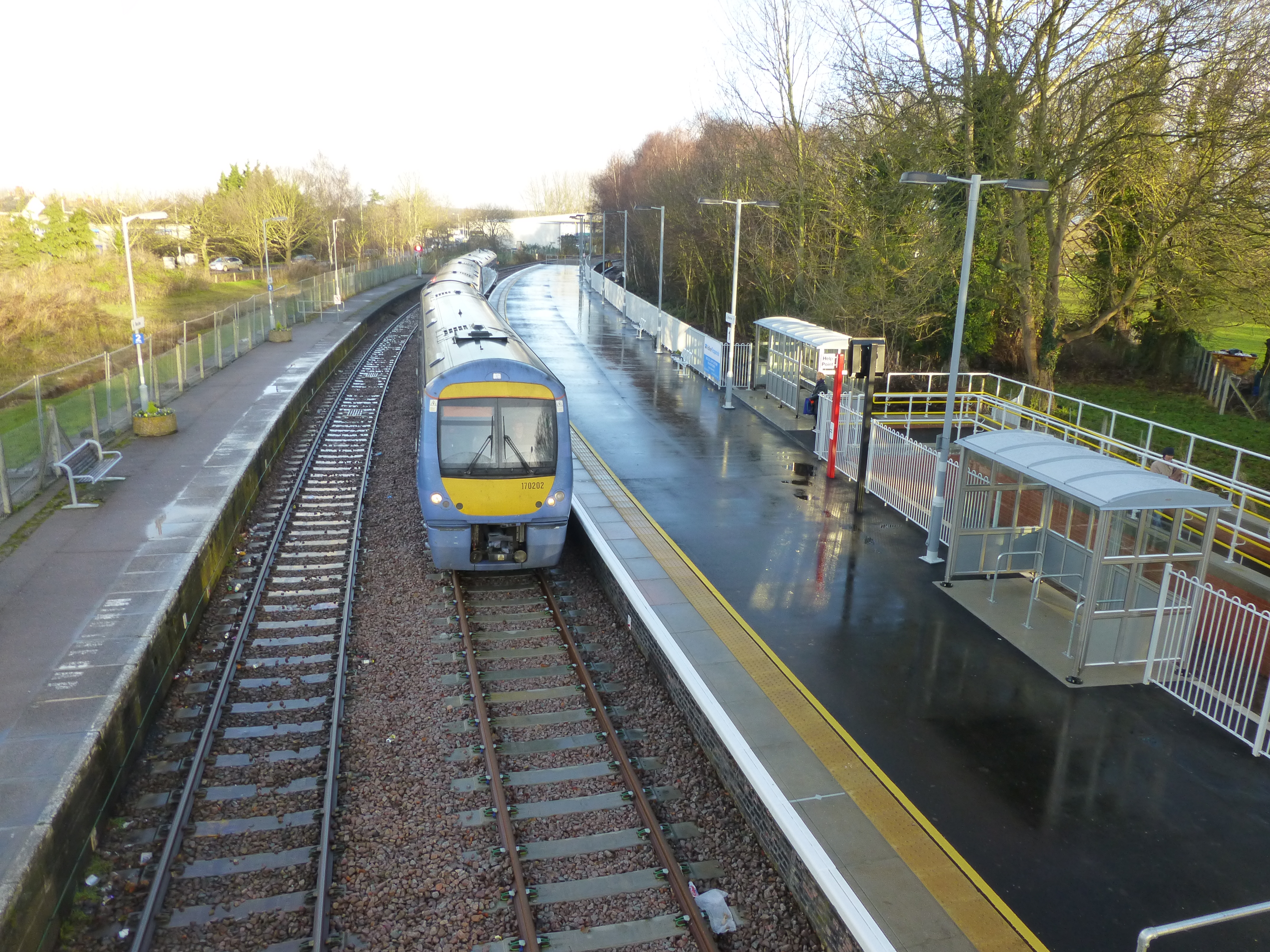
Beccles railway station
Beccles railway station is on the East Suffolk Line in the east of England, serving the town of Beccles, Suffolk. It is 40 miles 34 chains (65.1 km) down...
SET Beccles School
SET Beccles School (formerly Beccles Free School) is a coeducational secondary free school located in Beccles in the English county of Suffolk. == History... ==

Stanley and Alder Carrs, Aldeby
Stanley and Alder Carrs, Aldeby is a 42.7-hectare (106-acre) biological Site of Special Scientific Interest east of Gillingham in Norfolk. It is part of...
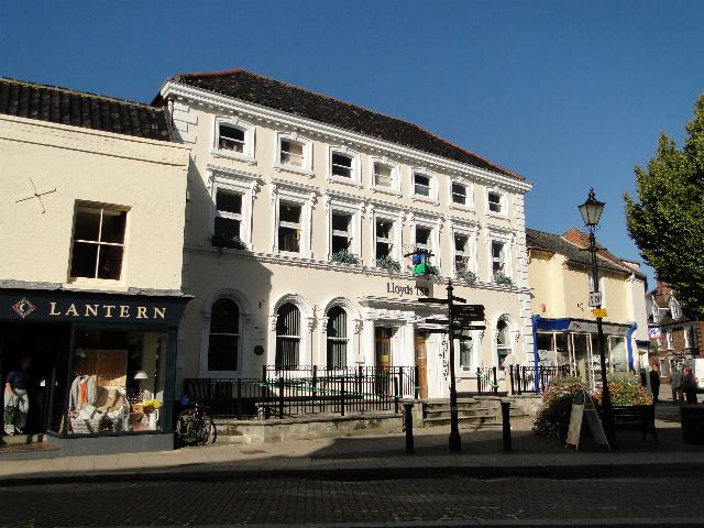
Corn Exchange, Beccles
The Corn Exchange is a commercial building in Exchange Square in Beccles, Suffolk, England. The structure, which is now used as a branch of Lloyds Bank...

Beccles
Beccles ( BEK-əlz) is a market town and civil parish in the English county of Suffolk. The town is shown on the milestone as 109 miles (175 km) from London...
Have you been to Lotman's Dyke?
Leave your review of Lotman's Dyke below (or comments, questions and feedback).