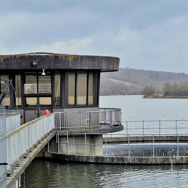
Ardingly Reservoir
Lake, Pool, Pond, Freshwater Marsh in Sussex Mid Sussex
England
Ardingly Reservoir
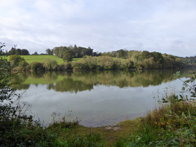
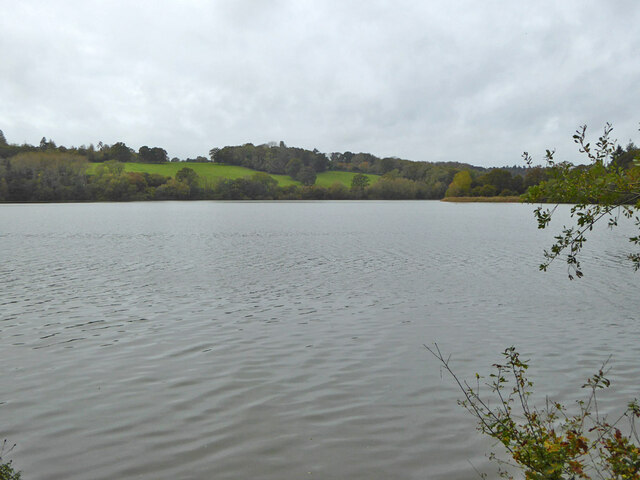
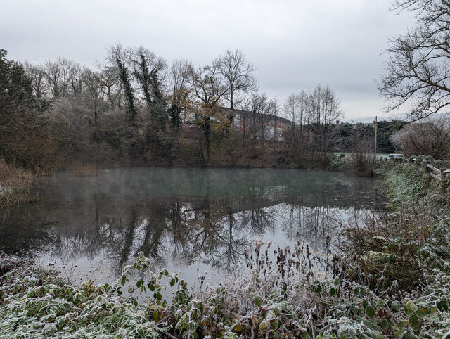
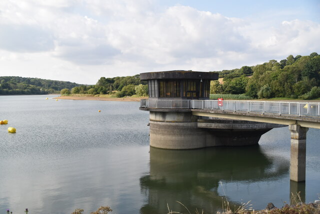
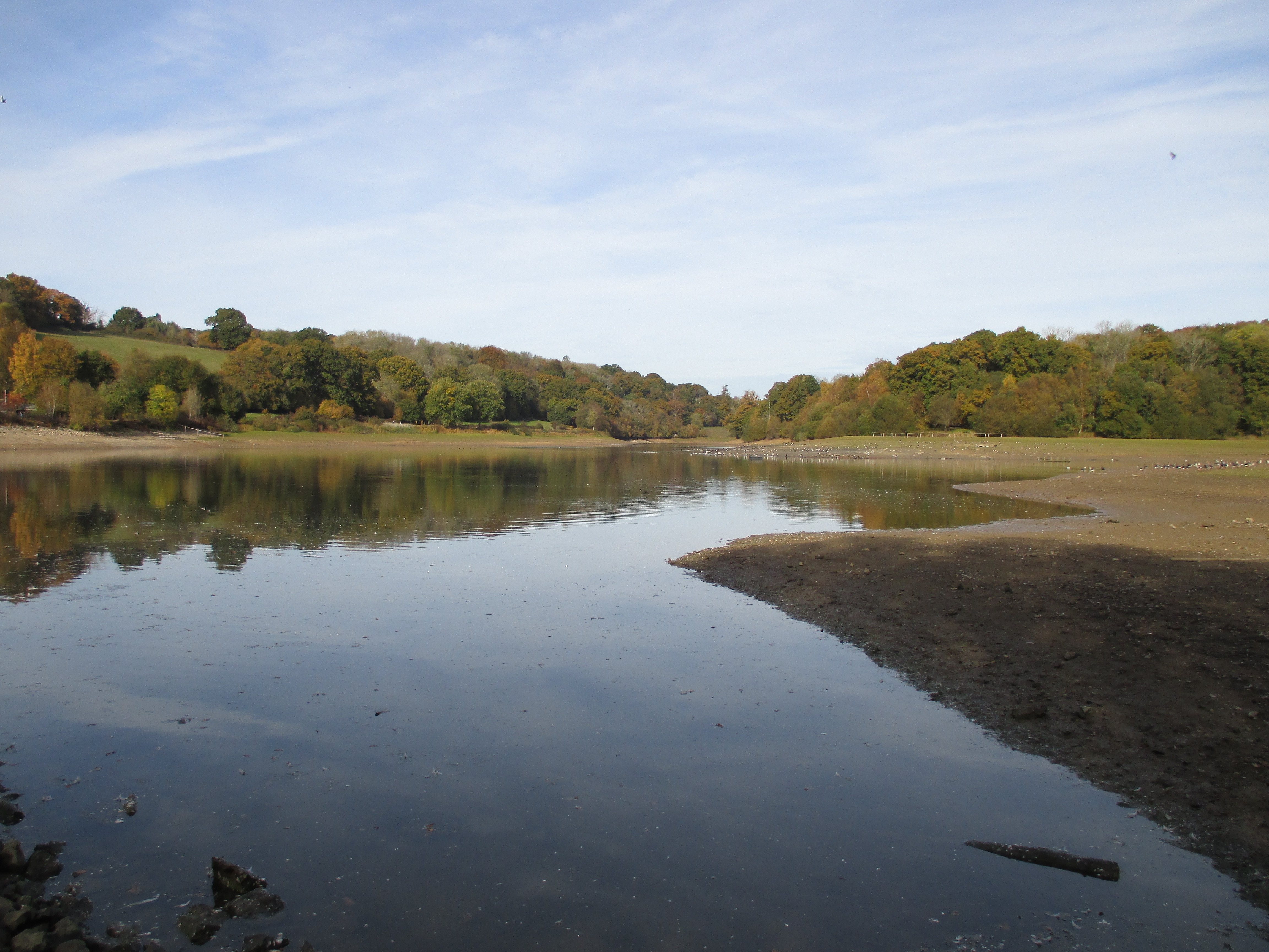
Ardingly Reservoir, located in Sussex, England, is a man-made freshwater reservoir that serves as a vital water source for the surrounding area. Covering an area of approximately 230 acres, the reservoir is situated within the scenic High Weald Area of Outstanding Natural Beauty.
Originally constructed in the 1970s, Ardingly Reservoir was created by damming the River Ouse. The reservoir provides drinking water to over 400,000 people in the region, as well as supporting various wildlife habitats and recreational activities.
The reservoir's water is sourced from rainfall and runoff, which is collected and stored in the reservoir. It is carefully managed to ensure a sustainable supply of water throughout the year. The water is treated before distribution to ensure it meets the necessary quality standards.
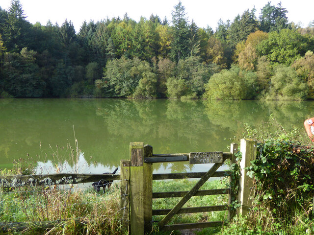
Ardingly Reservoir is not only valued for its practical purposes but also for its ecological importance. The surrounding area includes a diverse range of habitats, including open water, reed beds, and wet woodland. These habitats provide a home to a wide array of plant and animal species, including several rare and protected species.
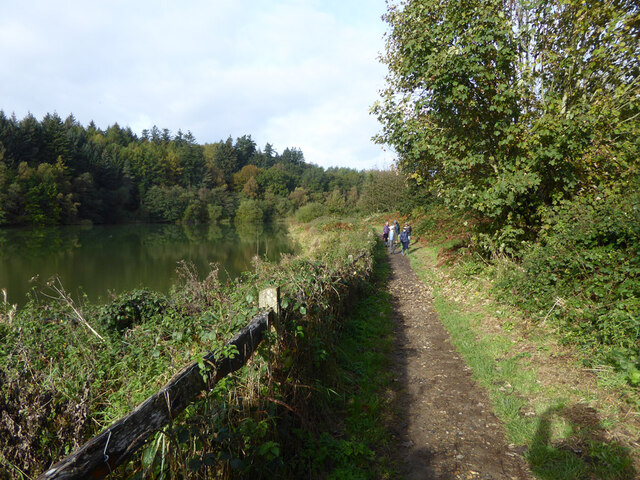
The reservoir attracts a variety of bird species, making it a popular spot for birdwatchers. Visitors can often spot waterfowl such as swans, ducks, and grebes, as well as migratory birds during certain seasons. Additionally, the reservoir offers opportunities for angling, sailing, and windsurfing, providing recreational activities for both locals and tourists alike.
Overall, Ardingly Reservoir plays a crucial role in water supply, conservation, and recreational activities, making it an important and cherished feature of Sussex's landscape.
If you have any feedback on the listing, please let us know in the comments section below.
Ardingly Reservoir Images
Images are sourced within 2km of 51.050049/-0.10877478 or Grid Reference TQ3229. Thanks to Geograph Open Source API. All images are credited.


Ardingly Reservoir is located at Grid Ref: TQ3229 (Lat: 51.050049, Lng: -0.10877478)
Administrative County: West Sussex
District: Mid Sussex
Police Authority: Sussex
What 3 Words
///jogged.bluff.widely. Near Balcombe, West Sussex
Nearby Locations
Related Wikis
Ardingly Reservoir
Ardingly Reservoir is west of Ardingly in West Sussex. The southern end is a 74.5-hectare (184-acre) Local Nature Reserve owned and managed by South East...

Balcombe Place
Balcombe Place is a Grade II* Listed Building, built in 1856 in West Sussex, with a south view across the Ouse Valley. It now forms part of The Balcombe...

St Peter's Church, Ardingly
St Peter's Church is the Church of England parish church of the parish of Ardingly in Mid Sussex, one of seven local government districts in the English...

South of England Show
The South of England Show is a county show held annually at its own showground in Ardingly, Sussex during June.The show was founded in 1967 and is organised...
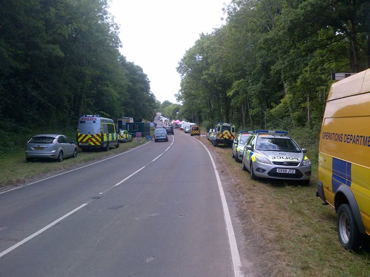
Balcombe drilling protest
The Balcombe drilling protest occurred when test drilling and possible fracking for petroleum were proposed in 2012 near Balcombe, a village in West Sussex...
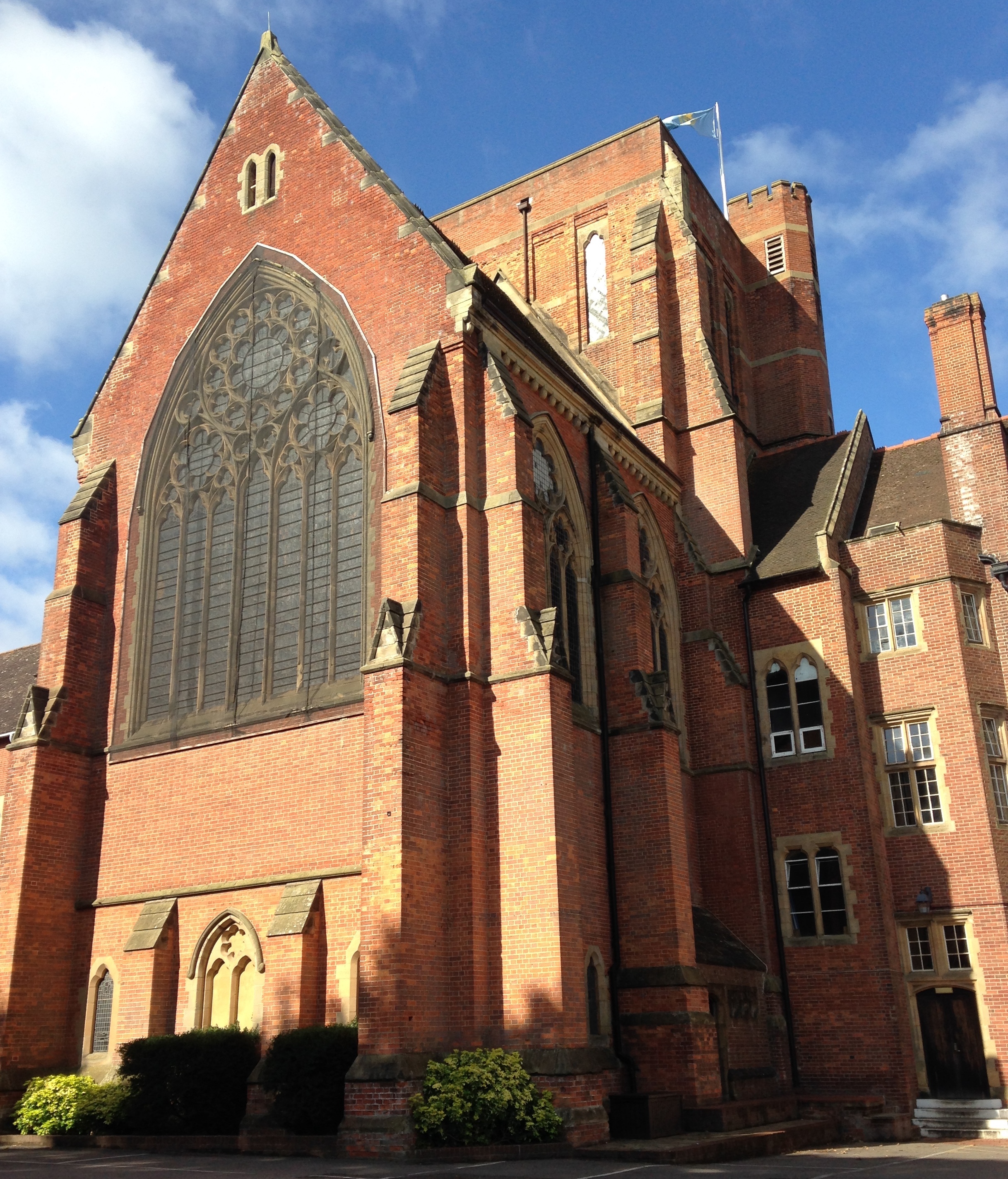
Ardingly College Chapel
The Chapel of S. Saviour is the chapel to Ardingly College in West Sussex, England, and is considered an example of Gothic Revival architecture. The chapel...

Ardingly College
Ardingly College () is a fee-charging boarding and day school in the English public school tradition located near Ardingly, West Sussex, England. The school...
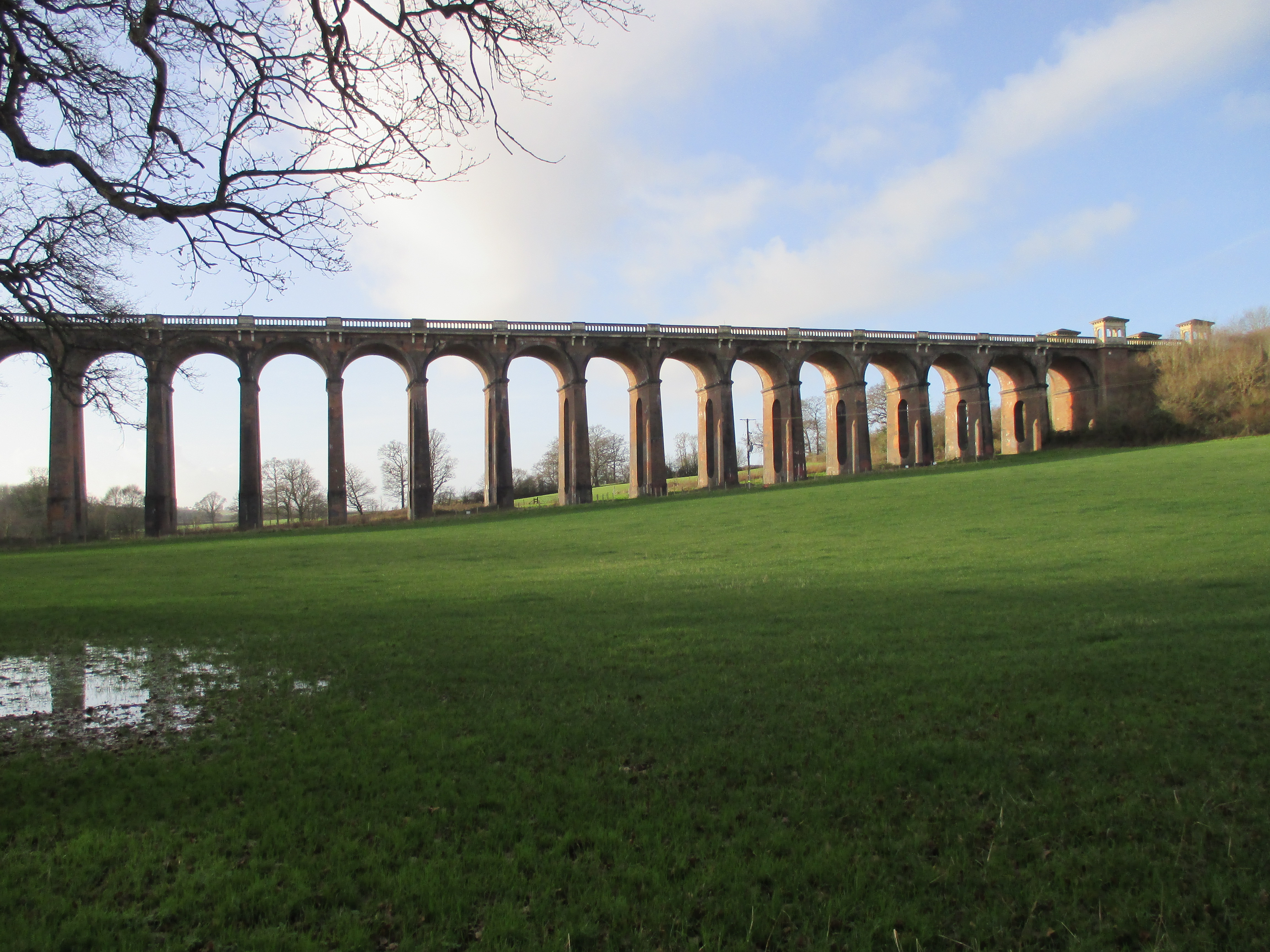
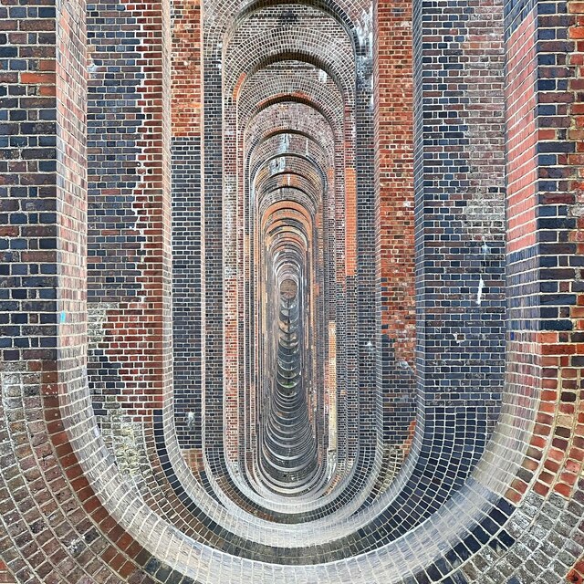
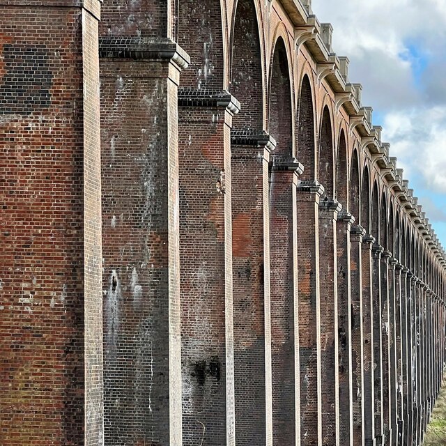
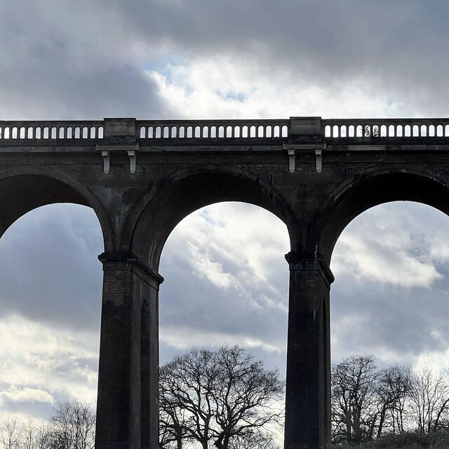
Ouse Valley Viaduct
The Ouse Valley Viaduct (or the Balcombe Viaduct) carries the London-Brighton Railway Line over the River Ouse in Sussex. It is located to the north of...
Nearby Amenities
Located within 500m of 51.050049,-0.10877478Have you been to Ardingly Reservoir?
Leave your review of Ardingly Reservoir below (or comments, questions and feedback).