Environment Lake
Lake, Pool, Pond, Freshwater Marsh in Hertfordshire Stevenage
England
Environment Lake

Environment Lake is a stunning freshwater body located in Hertfordshire, England. Covering an area of approximately 10 acres, it serves as a prominent attraction for nature enthusiasts and wildlife lovers alike. The lake is nestled within a picturesque landscape, surrounded by lush greenery and diverse flora and fauna.
Characterized by its calm and serene atmosphere, Environment Lake provides a peaceful retreat from the hustle and bustle of everyday life. Its crystal-clear waters reflect the beauty of the surrounding environment, creating a visually captivating sight. The lake is primarily fed by freshwater streams, ensuring a constant flow of clean water throughout the year.
The lake's diverse ecosystem supports a wide range of aquatic life. It is home to various species of fish, including carp, perch, and roach, making it a popular spot for fishing enthusiasts. Additionally, the lake attracts a plethora of bird species, such as swans, ducks, and herons, which can often be seen gracefully gliding across the water or nesting along the shores.
The surrounding area of Environment Lake comprises a mix of densely vegetated areas and open spaces, providing habitats for numerous terrestrial species. Freshwater marshes, reed beds, and pools can also be found nearby, further enriching the biodiversity of the area.
Visitors to Environment Lake can enjoy a range of recreational activities, including fishing, birdwatching, and leisurely walks along the shoreline. The lake is equipped with facilities such as picnic areas and benches, allowing visitors to relax and soak in the natural beauty of the surroundings.
Overall, Environment Lake is a haven of tranquility and a haven for wildlife, offering visitors a chance to connect with nature and escape the stresses of modern life.
If you have any feedback on the listing, please let us know in the comments section below.
Environment Lake Images
Images are sourced within 2km of 51.905448/-0.17925171 or Grid Reference TL2524. Thanks to Geograph Open Source API. All images are credited.


Environment Lake is located at Grid Ref: TL2524 (Lat: 51.905448, Lng: -0.17925171)
Administrative County: Hertfordshire
District: Stevenage
Police Authority: Hertfordshire
What 3 Words
///submit.wires.spike. Near Stevenage, Hertfordshire
Nearby Locations
Related Wikis

Marriotts School
Marriotts School is a secondary school in Stevenage, Hertfordshire, England. The school was rebuilt along with Lonsdale School (for special needs children...
The Nobel School
The Nobel School is a co-educational secondary school and sixth form located in Stevenage in the English county of Hertfordshire. == History == The Nobel...

List of local nature reserves in Hertfordshire
Hertfordshire is a county in eastern England. It is bordered by Bedfordshire to the north, Cambridgeshire to the north-east, Essex to the east, Buckinghamshire...

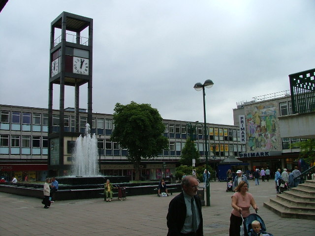
Stevenage Clock Tower
Stevenage Clock Tower is a Grade II listed structure in Town Square in the centre of Stevenage New Town. A panel on the tower records the visit of Elizabeth...

Stevenage
Stevenage ( STEE-vən-ij) is a large town and borough in Hertfordshire, England, about 27 miles (43 km) north of London. Stevenage is east of junctions...

Shephall
Shephall (SHEP-all) is a neighbourhood of the new town of Stevenage in Hertfordshire. It was formerly a separate village and parish, being absorbed into...
North Hertfordshire College
North Hertfordshire College ("NHC") is a further education and higher education college operating in Stevenage, Hitchin, and Letchworth Garden City. NHC...

The Heathcote School
The Heathcote School was an 11-18 comprehensive school in Stevenage, Hertfordshire. The school was founded in the 1950s. It was awarded Specialist Engineering...
Nearby Amenities
Located within 500m of 51.905448,-0.17925171Have you been to Environment Lake?
Leave your review of Environment Lake below (or comments, questions and feedback).