Blacknell's Spring

Wood, Forest in Hertfordshire Stevenage

England

Blacknell's Spring

Hydean Way Shops Typical of local shops in Stevenage new town.  Above a parade of shops including a small supermarket, take away food outlet and Post Office there are maisonettes accessed from the rear.  To the right there are 2/3 bedroomed homes.
Hydean Way Shops Credit: Robin Hall

Blacknell's Spring is a captivating woodland and a hidden gem located in Hertfordshire, England. Spanning over a vast area, this enchanting forest is a true sanctuary for nature enthusiasts and outdoor adventurers alike.

The woodland is characterized by its dense canopy of towering trees, predominantly consisting of oak, beech, and birch. These majestic trees create a tranquil atmosphere and provide a habitat for a diverse range of flora and fauna. Throughout the forest, visitors can witness a stunning display of wildflowers, including bluebells, primroses, and violets, adding vibrant colors to the landscape.

One of the main attractions of Blacknell's Spring is the natural spring that gives the woodland its name. The crystal-clear water emerges from the ground, creating a small stream that meanders through the forest. This serene feature not only adds to the beauty of the area but also serves as a water source for various wildlife species.

The woodland offers numerous trails and walking paths, allowing visitors to explore its hidden corners and discover its natural wonders. It is a popular destination for hikers, joggers, and dog walkers, who can enjoy the peaceful atmosphere and the opportunity to spot wildlife such as deer, squirrels, and a variety of bird species.

Blacknell's Spring is a cherished natural haven that offers a retreat from the hustle and bustle of everyday life. With its breathtaking beauty and diverse wildlife, it provides an ideal location for nature lovers to immerse themselves in the wonders of the Hertfordshire countryside.

If you have any feedback on the listing, please let us know in the comments section below.

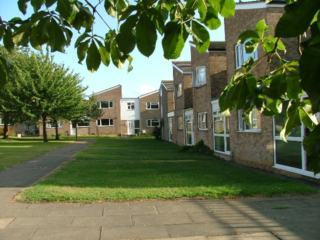
Blacknell's Spring Images

Images are sourced within 2km of 51.905156/-0.17607988 or Grid Reference TL2524. Thanks to Geograph Open Source API. All images are credited.

Hydean Way Shops Typical of local shops in Stevenage new town.  Above a parade of shops including a small supermarket, take away food outlet and Post Office there are maisonettes accessed from the rear.  To the right there are 2/3 bedroomed homes.
Hydean Way Shops
Typical of local shops in Stevenage new town. Above a parade of shops including a small supermarket, take away food outlet and Post Office there are maisonettes accessed from the rear. To the right there are 2/3 bedroomed homes.
South end of Fairlands Valley Park. This photograph was taken facing north into Fairlands Valley Park from the car park used for Stevenage Borough FC (see TL2422).  This park is also used for travelling fairs and circuses.
South end of Fairlands Valley Park.
This photograph was taken facing north into Fairlands Valley Park from the car park used for Stevenage Borough FC (see TL2422). This park is also used for travelling fairs and circuses.
Fairlands Valley Park This large lake is used by sailors and fishermen.  This photo is taken facing south.  To the rear there are two smaller lakes.  The park is very popular in the summer.
Fairlands Valley Park
This large lake is used by sailors and fishermen. This photo is taken facing south. To the rear there are two smaller lakes. The park is very popular in the summer.
Silam Rd. To the right are houses not untypical of Stevenage new town.  Looming over Silam Rd is one of a pair of high rise flats close to the town centre.
Silam Rd.
To the right are houses not untypical of Stevenage new town. Looming over Silam Rd is one of a pair of high rise flats close to the town centre.
Parishes Mead. Parishes mead is a newer development on the east side of Stevenage.  There is a mixture of private and social housing here.
Parishes Mead.
Parishes mead is a newer development on the east side of Stevenage. There is a mixture of private and social housing here.
Mildmay Road. These houses were built in a variety of styles.  These are not untypical but some of the architectural styles bring their own maintenance problems.
Mildmay Road.
These houses were built in a variety of styles. These are not untypical but some of the architectural styles bring their own maintenance problems.
Fortuna Close One of the more modern parts of Stevenage and with some more imaginative building - three storeys!
Fortuna Close
One of the more modern parts of Stevenage and with some more imaginative building - three storeys!
Hampson Park / Pin Green Water Tower. Although this water tower is right on the edge of this square I have used it because it dominates the locality.  The large flat construction on the left, behind the fence, is a covered reservoir.  The tower is now bristling with aerials of all sorts.
Hampson Park / Pin Green Water Tower.
Although this water tower is right on the edge of this square I have used it because it dominates the locality. The large flat construction on the left, behind the fence, is a covered reservoir. The tower is now bristling with aerials of all sorts.
Ferrier Rd This could be any road in this area.  Plans seem to have been bought as a job lot.
Ferrier Rd
This could be any road in this area. Plans seem to have been bought as a job lot.
Telford Avenue. On the edge of TL2525..  I wasn't going any further into this estate.  I always get lost even though it's not that big by local standards.  This estate, in common with others in the area suffers from the increase in car ownership.  Parking is awkward, the roads not wide and the layout is twisting.
Telford Avenue.
On the edge of TL2525.. I wasn't going any further into this estate. I always get lost even though it's not that big by local standards. This estate, in common with others in the area suffers from the increase in car ownership. Parking is awkward, the roads not wide and the layout is twisting.
Football pitches These are to the north west of the running track.
Football pitches
These are to the north west of the running track.
The Crown, Aston End
Trig point at Lonsdale School I swear that tree was not there when I took the photo.

This Trig point is in the playing field of a special needs school caring for 75 children between the ages of 2 and 19 from London, Bedfordshire and Hertfordshire.
Trig point at Lonsdale School
I swear that tree was not there when I took the photo. This Trig point is in the playing field of a special needs school caring for 75 children between the ages of 2 and 19 from London, Bedfordshire and Hertfordshire.
Stevenage Library Charactaristic of many of the buildings in this area.  Most of this end of the town is due for demolition.
Stevenage Library
Charactaristic of many of the buildings in this area. Most of this end of the town is due for demolition.
Stevenage Bus Station. Taken from the Matalan car park.
Stevenage Bus Station.
Taken from the Matalan car park.
Stevenage Swimming Pool The bus to the right is dropping children off for a drowning lesson.
Stevenage Swimming Pool
The bus to the right is dropping children off for a drowning lesson.
Religious Society of Friends meeting house Unprepossessing and in the shadow (almost literally) of the larger, church next door (St Andrew and St George)
Religious Society of Friends meeting house
Unprepossessing and in the shadow (almost literally) of the larger, church next door (St Andrew and St George)
Parish Church of St Andrew and St George - Stevenage. Below the church is Stevenage museum.
Parish Church of St Andrew and St George - Stevenage.
Below the church is Stevenage museum.
Show me another place!

Blacknell's Spring is located at Grid Ref: TL2524 (Lat: 51.905156, Lng: -0.17607988)

Administrative County: Hertfordshire

District: Stevenage

Police Authority: Hertfordshire

What 3 Words

///salon.gladiators.teams. Near Stevenage, Hertfordshire

Related Wikis

Marriotts School

Marriotts School is a secondary school in Stevenage, Hertfordshire, England. The school was rebuilt along with Lonsdale School (for special needs children...

The Nobel School

The Nobel School is a co-educational secondary school and sixth form located in Stevenage in the English county of Hertfordshire. == History == The Nobel...

Shephall

Shephall (SHEP-all) is a neighbourhood of the new town of Stevenage in Hertfordshire. It was formerly a separate village and parish, being absorbed into...

The Heathcote School

The Heathcote School was an 11-18 comprehensive school in Stevenage, Hertfordshire. The school was founded in the 1950s. It was awarded Specialist Engineering...

Barnwell School

Barnwell School is a coeducational secondary school and sixth form that was established in 1959 and is situated in the south of Stevenage, Hertfordshire...

List of local nature reserves in Hertfordshire

Hertfordshire is a county in eastern England. It is bordered by Bedfordshire to the north, Cambridgeshire to the north-east, Essex to the east, Buckinghamshire...

Stevenage Clock Tower

Stevenage Clock Tower is a Grade II listed structure in Town Square in the centre of Stevenage New Town. A panel on the tower records the visit of Elizabeth...

Stevenage

Stevenage ( STEE-vən-ij) is a large town and borough in Hertfordshire, England, about 27 miles (43 km) north of London. Stevenage is east of junctions...

Nearby Amenities

Located within 500m of 51.905156,-0.17607988
Barrier: bollard
Lat/Long: 51.9070454/-0.1795894
Barrier: bollard
Lat/Long: 51.9069891/-0.1792729
Crossing
Crossing: unmarked
Crossing Island: no
Kerb: lowered
Tactile Paving: no
Lat/Long: 51.905682/-0.1819944
Crossing
Bicycle: yes
Crossing: unmarked
Crossing Island: yes
Kerb: lowered
Tactile Paving: no
Lat/Long: 51.906855/-0.1827599
Cafe
Costello's Cafe
Source: GPS Bicyle survey
Lat/Long: 51.9014544/-0.1784467
Fairlands Valley Farmhouse
Alt Name: Digswell Arts Trust
Building: yes
Lat/Long: 51.9080019/-0.1802468
Note: View from wooden walkway over lake
Tourism: viewpoint
Lat/Long: 51.9055087/-0.1791446
Bicycle Parking
Capacity: 8
Lat/Long: 51.9028413/-0.1784624
Post Box
Collection Times: Mo-Fr 18:00; Sa 12:15
Post Box Type: pillar
Ref: SG2 346
Lat/Long: 51.9085085/-0.1755718
Post Box
Collection Times: Mo-Fr 17:30; Sa 12:00
Post Box Type: pillar
Ref: SG1 290
Royal Cypher: EIIR
Royal Cypher Wikidata: Q33102113
Lat/Long: 51.904922/-0.183047
Barrier: entrance
Lat/Long: 51.9016798/-0.1744923
Bench
Backrest: yes
Colour: gray
Material: metal
Seats: 3
Lat/Long: 51.9069337/-0.1787899
Bench
Backrest: yes
Colour: gray
Material: metal
Seats: 3
Lat/Long: 51.906968/-0.1787434
Crossing
Crossing: unmarked
Crossing Island: no
Kerb: lowered
Tactile Paving: no
Lat/Long: 51.9063735/-0.1822409
Traffic Calming: island
Lat/Long: 51.9060679/-0.1820434
Access: private
Barrier: lift_gate
Lat/Long: 51.9010236/-0.1757694
Newton General Stores
Addr City: Stevenage
Addr Housenumber: 48
Addr Postcode: SG2 0BX
Addr Street: Newton Road
Fhrs Id: 717280
Shop: convenience
Source Addr: FHRS Open Data
Lat/Long: 51.9086473/-0.1753381
Bicycle Parking
Bicycle parking, Fairlands playground
Capacity: 3
Covered: no
Lat/Long: 51.9033498/-0.1814833
Marriotts Gymnastics
Leisure: sports_centre
Sport: gymnastics
Lat/Long: 51.9056678/-0.1768036
Toilets
Source: survey
Lat/Long: 51.901222/-0.1783918
Toilets
Source: survey
Lat/Long: 51.9035562/-0.1803977
Bench
Backrest: yes
Colour: silver
Material: metal
Seats: 3
Lat/Long: 51.9019657/-0.1802853
Bench
Backrest: yes
Colour: silver
Material: metal
Seats: 3
Lat/Long: 51.901058/-0.1790286
Bench
Backrest: yes
Colour: silver
Material: metal
Seats: 3
Lat/Long: 51.9034345/-0.1799401
Bench
Backrest: no
Colour: silver
Material: metal
Seats: 3
Lat/Long: 51.9086723/-0.1802007
Bench
Backrest: yes
Colour: silver
Material: metal
Seats: 3
Lat/Long: 51.903498/-0.1799462
Bench
Backrest: no
Colour: silver
Material: metal
Seats: 3
Lat/Long: 51.9084977/-0.1801979
Bench
Backrest: yes
Colour: silver
Material: metal
Seats: 3
Lat/Long: 51.9041291/-0.1795488
Bench
Backrest: yes
Colour: silver
Material: metal
Seats: 3
Lat/Long: 51.9041529/-0.1788043
Bench
Memorial Bench
Backrest: yes
Colour: silver
Material: metal
Seats: 3
Lat/Long: 51.9030825/-0.1784199
Bench
Backrest: yes
Colour: silver
Material: metal
Seats: 3
Lat/Long: 51.907434/-0.179109
Doctors
Bedwell Surgery
Lat/Long: 51.9040333/-0.1823274
Bench
Backrest: yes
Lat/Long: 51.9042473/-0.1789585
Bench
Backrest: yes
Lat/Long: 51.903368/-0.1780042
Leisure: slipway
Lat/Long: 51.9018104/-0.178956
Bench
Lat/Long: 51.9063767/-0.179799
Bench
Lat/Long: 51.9059939/-0.1799685
Bench
Lat/Long: 51.9054681/-0.1800431
Bench
Backrest: yes
Lat/Long: 51.9051249/-0.1786342
Bench
Backrest: yes
Lat/Long: 51.9078123/-0.17925
Barrier: entrance
Lat/Long: 51.9024297/-0.175717
Crossing
Crossing: uncontrolled
Crossing Ref: zebra
Lat/Long: 51.9024209/-0.1756542
Crossing
Crossing: uncontrolled
Crossing Ref: zebra
Lat/Long: 51.9024061/-0.1753629
Bench
Backrest: yes
Lat/Long: 51.9063913/-0.1693319
Waste Basket
Lat/Long: 51.9064103/-0.1697879
Waste Basket
Lat/Long: 51.9064235/-0.1702586
Waste Basket
Lat/Long: 51.9064914/-0.1705335
Waste Basket
Lat/Long: 51.9060123/-0.1707897
Waste Basket
Lat/Long: 51.905587/-0.1700735
Grit Bin
Lat/Long: 51.9040522/-0.169301
Traffic Calming: island
Lat/Long: 51.9046534/-0.1831352
Crossing
Crossing: unmarked
Crossing Island: no
Kerb: lowered
Tactile Paving: no
Lat/Long: 51.9049637/-0.182634
Traffic Calming: island
Lat/Long: 51.9053009/-0.1821822
Waste Basket
Lat/Long: 51.9063747/-0.182303
Traffic Calming: island
Lat/Long: 51.9066214/-0.1824937
Waste Basket
Lat/Long: 51.9085507/-0.1756458
Waste Basket
Lat/Long: 51.9070912/-0.1741786
Grit Bin
Lat/Long: 51.9056342/-0.1727383
Waste Basket
Lat/Long: 51.9056003/-0.1729032
The data included in this document is from www.openstreetmap.org. The data is made available under ODbL.

Have you been to Blacknell's Spring?

Leave your review of Blacknell's Spring below (or comments, questions and feedback).