Ashtree Wood

Wood, Forest in Hertfordshire Stevenage

England

Ashtree Wood

Hydean Way Shops Typical of local shops in Stevenage new town.  Above a parade of shops including a small supermarket, take away food outlet and Post Office there are maisonettes accessed from the rear.  To the right there are 2/3 bedroomed homes.
Hydean Way Shops Credit: Robin Hall

Ashtree Wood is a picturesque woodland located in the county of Hertfordshire, England. Spread across an area of approximately 100 acres, it is a part of the larger Hertfordshire Forest, which encompasses several woodlands and green spaces.

The wood is characterized by its dense canopy of diverse tree species, with ash trees being particularly abundant, hence the name Ashtree Wood. Other tree varieties found here include oak, beech, and birch, creating a rich and vibrant ecosystem. The forest floor is carpeted with a variety of wildflowers, ferns, and mosses, adding to its natural beauty.

Ashtree Wood is a haven for wildlife enthusiasts and nature lovers alike. The wood is home to a wide range of animal species, including deer, foxes, badgers, and various bird species such as woodpeckers, owls, and thrushes. It provides an important habitat for these creatures, offering shelter, food, and breeding grounds.

The woodland is crisscrossed by a network of well-maintained footpaths, allowing visitors to explore its beauty while enjoying a peaceful walk or hike. The paths wind through the forest, offering glimpses of enchanting vistas and tranquil spots. It is a popular destination for family outings, dog walkers, and nature photographers.

Managed by the local authorities, Ashtree Wood is carefully preserved to maintain its natural splendor and ecological balance. It is a valuable resource for the local community, providing a tranquil escape from the bustling urban lifestyle and serving as an important green lung for the region.

Overall, Ashtree Wood in Hertfordshire is a captivating woodland that offers a serene and immersive experience in nature, making it a cherished destination for both locals and visitors alike.

If you have any feedback on the listing, please let us know in the comments section below.
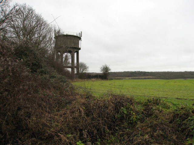
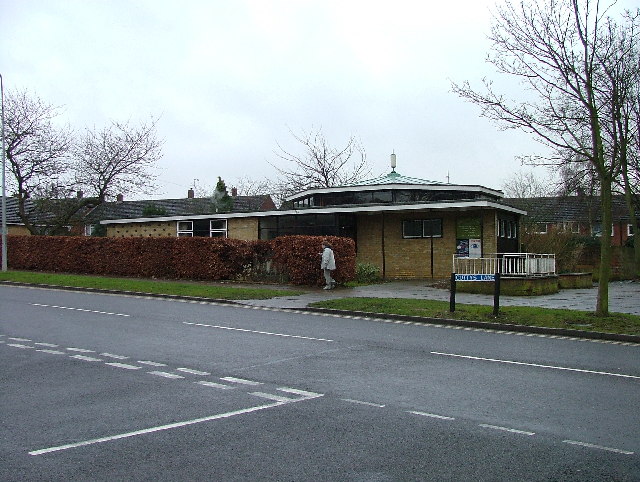
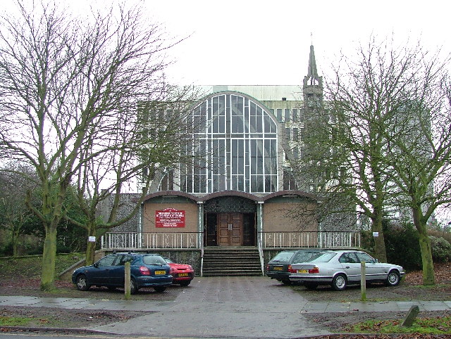
Ashtree Wood Images

Images are sourced within 2km of 51.901487/-0.17314688 or Grid Reference TL2524. Thanks to Geograph Open Source API. All images are credited.

Hydean Way Shops Typical of local shops in Stevenage new town.  Above a parade of shops including a small supermarket, take away food outlet and Post Office there are maisonettes accessed from the rear.  To the right there are 2/3 bedroomed homes.
Hydean Way Shops
Typical of local shops in Stevenage new town. Above a parade of shops including a small supermarket, take away food outlet and Post Office there are maisonettes accessed from the rear. To the right there are 2/3 bedroomed homes.
South end of Fairlands Valley Park. This photograph was taken facing north into Fairlands Valley Park from the car park used for Stevenage Borough FC (see TL2422).  This park is also used for travelling fairs and circuses.
South end of Fairlands Valley Park.
This photograph was taken facing north into Fairlands Valley Park from the car park used for Stevenage Borough FC (see TL2422). This park is also used for travelling fairs and circuses.
Fairlands Valley Park This large lake is used by sailors and fishermen.  This photo is taken facing south.  To the rear there are two smaller lakes.  The park is very popular in the summer.
Fairlands Valley Park
This large lake is used by sailors and fishermen. This photo is taken facing south. To the rear there are two smaller lakes. The park is very popular in the summer.
Silam Rd. To the right are houses not untypical of Stevenage new town.  Looming over Silam Rd is one of a pair of high rise flats close to the town centre.
Silam Rd.
To the right are houses not untypical of Stevenage new town. Looming over Silam Rd is one of a pair of high rise flats close to the town centre.
Parishes Mead. Parishes mead is a newer development on the east side of Stevenage.  There is a mixture of private and social housing here.
Parishes Mead.
Parishes mead is a newer development on the east side of Stevenage. There is a mixture of private and social housing here.
Fortuna Close One of the more modern parts of Stevenage and with some more imaginative building - three storeys!
Fortuna Close
One of the more modern parts of Stevenage and with some more imaginative building - three storeys!
Hampson Park / Pin Green Water Tower. Although this water tower is right on the edge of this square I have used it because it dominates the locality.  The large flat construction on the left, behind the fence, is a covered reservoir.  The tower is now bristling with aerials of all sorts.
Hampson Park / Pin Green Water Tower.
Although this water tower is right on the edge of this square I have used it because it dominates the locality. The large flat construction on the left, behind the fence, is a covered reservoir. The tower is now bristling with aerials of all sorts.
Ferrier Rd This could be any road in this area.  Plans seem to have been bought as a job lot.
Ferrier Rd
This could be any road in this area. Plans seem to have been bought as a job lot.
Telford Avenue. On the edge of TL2525..  I wasn't going any further into this estate.  I always get lost even though it's not that big by local standards.  This estate, in common with others in the area suffers from the increase in car ownership.  Parking is awkward, the roads not wide and the layout is twisting.
Telford Avenue.
On the edge of TL2525.. I wasn't going any further into this estate. I always get lost even though it's not that big by local standards. This estate, in common with others in the area suffers from the increase in car ownership. Parking is awkward, the roads not wide and the layout is twisting.
Ridlins Athletics Track This photo of the Ridlins Athletics track shows the west corner and the Bert Hill stand.  The back of the stand has space for community groups such as playgroups.
Ridlins Athletics Track
This photo of the Ridlins Athletics track shows the west corner and the Bert Hill stand. The back of the stand has space for community groups such as playgroups.
Football pitches These are to the north west of the running track.
Football pitches
These are to the north west of the running track.
Longmeadow Evangelical Church Many of Stevenage's churche seem to thrive and this is one of them.
Longmeadow Evangelical Church
Many of Stevenage's churche seem to thrive and this is one of them.
Aston Water Tower The Water Tower and surrounding countryside from the lane to Aston End
Aston Water Tower
The Water Tower and surrounding countryside from the lane to Aston End
The Crown, Aston End
Trig point at Lonsdale School I swear that tree was not there when I took the photo.

This Trig point is in the playing field of a special needs school caring for 75 children between the ages of 2 and 19 from London, Bedfordshire and Hertfordshire.
Trig point at Lonsdale School
I swear that tree was not there when I took the photo. This Trig point is in the playing field of a special needs school caring for 75 children between the ages of 2 and 19 from London, Bedfordshire and Hertfordshire.
Stevenage Swimming Pool The bus to the right is dropping children off for a drowning lesson.
Stevenage Swimming Pool
The bus to the right is dropping children off for a drowning lesson.
Religious Society of Friends meeting house Unprepossessing and in the shadow (almost literally) of the larger, church next door (St Andrew and St George)
Religious Society of Friends meeting house
Unprepossessing and in the shadow (almost literally) of the larger, church next door (St Andrew and St George)
Parish Church of St Andrew and St George - Stevenage. Below the church is Stevenage museum.
Parish Church of St Andrew and St George - Stevenage.
Below the church is Stevenage museum.
Show me another place!

Ashtree Wood is located at Grid Ref: TL2524 (Lat: 51.901487, Lng: -0.17314688)

Administrative County: Hertfordshire

District: Stevenage

Police Authority: Hertfordshire

What 3 Words

///shops.items.skill. Near Stevenage, Hertfordshire

Related Wikis

Marriotts School

Marriotts School is a secondary school in Stevenage, Hertfordshire, England. The school was rebuilt along with Lonsdale School (for special needs children...

The Nobel School

The Nobel School is a co-educational secondary school and sixth form located in Stevenage in the English county of Hertfordshire. == History == The Nobel...

Shephall

Shephall (SHEP-all) is a neighbourhood of the new town of Stevenage in Hertfordshire. It was formerly a separate village and parish, being absorbed into...

Barnwell School

Barnwell School is a coeducational secondary school and sixth form that was established in 1959 and is situated in the south of Stevenage, Hertfordshire...

The Heathcote School

The Heathcote School was an 11-18 comprehensive school in Stevenage, Hertfordshire. The school was founded in the 1950s. It was awarded Specialist Engineering...

Aston End

Aston End is a hamlet in Hertfordshire, England. It is in the civil parish of Aston. It features a pub and a butchers, as well as a few houses. == References... ==

Shephall Manor

Shephall Manor, also known as Shephalbury Manor, is a Grade II listed building in Stevenage, a town in Hertfordshire, England. The house was designed by...

List of local nature reserves in Hertfordshire

Hertfordshire is a county in eastern England. It is bordered by Bedfordshire to the north, Cambridgeshire to the north-east, Essex to the east, Buckinghamshire...

Nearby Amenities

Located within 500m of 51.901487,-0.17314688
Traffic Calming: island
Lat/Long: 51.9015614/-0.1688201
Created By: osmeditor2
Lat/Long: 51.9011167/-0.1708767
Created By: osmeditor2
Lat/Long: 51.9009/-0.1716933
Created By: osmeditor2
Lat/Long: 51.9007133/-0.17224
Created By: osmeditor2
Lat/Long: 51.901255/-0.170235
Created By: osmeditor2
Lat/Long: 51.9004057/-0.1729653
Created By: osmeditor2
Lat/Long: 51.8997917/-0.1739583
Crossing
Crossing: uncontrolled
Crossing Island: yes
Tactile Paving: no
Lat/Long: 51.8991959/-0.1750857
Cafe
Costello's Cafe
Source: GPS Bicyle survey
Lat/Long: 51.9014544/-0.1784467
Crossing
Crossing: unmarked
Crossing Island: no
Kerb: lowered
Tactile Paving: no
Lat/Long: 51.9016948/-0.167227
Bus Stop
Burwell Road
Bench: yes
Bin: yes
Lit: yes
Naptan AtcoCode: 210021201500
Naptan Bearing: NW
Naptan CommonName: Burwell Road
Naptan Crossing: Little Hyde
Naptan Indicator: opp
Naptan Landmark: Little Hyde
Naptan NaptanCode: hrtgadmd
Naptan PlusbusZoneRef: STEVNGE
Naptan ShortCommonName: NA
Naptan Street: Shephall Way
Naptan Verified: no
Shelter: yes
Source: naptan_import
Tactile Paving: yes
Lat/Long: 51.8977891/-0.172449
Bus Stop
Marlboro Road
Bench: yes
Bin: yes
Bus: yes
Lit: yes
Local Ref: NR
Naptan AtcoCode: 210021201660
Naptan Bearing: SW
Naptan CommonName: Marlboro Road
Naptan Crossing: Great Collens Wood
Naptan Indicator: nr
Naptan Landmark: Great Collens Wood
Naptan NaptanCode: hrtgadgm
Naptan PlusbusZoneRef: STEVNGE
Naptan ShortCommonName: NA
Naptan Street: Six Hills Way
Naptan Verified: no
Public Transport: platform
Shelter: yes
Source: naptan_import
Tactile Paving: yes
Lat/Long: 51.9015662/-0.168429
Bus Stop
Shephall Way
Bench: yes
Bin: yes
Bus: yes
Lit: yes
Local Ref: NR
Naptan AtcoCode: 210021201680
Naptan Bearing: SW
Naptan CommonName: Shephall Way
Naptan Crossing: Brittain Way
Naptan Indicator: nr
Naptan Landmark: Brittain Way
Naptan NaptanCode: hrtgadgp
Naptan PlusbusZoneRef: STEVNGE
Naptan ShortCommonName: NA
Naptan Street: Six Hills Way
Naptan Verified: no
Public Transport: platform
Shelter: yes
Source: naptan_import
Tactile Paving: yes
Lat/Long: 51.8999818/-0.1735229
Bus Stop
Shephall Way
Bench: yes
Bin: yes
Bus: yes
Lit: yes
Naptan AtcoCode: 210021202980
Naptan Bearing: NE
Naptan CommonName: Shephall Way
Naptan Crossing: Brittain Way
Naptan Indicator: opp
Naptan Landmark: Brittain Way
Naptan NaptanCode: hrtdwmjm
Naptan PlusbusZoneRef: STEVNGE
Naptan ShortCommonName: NA
Naptan Street: Six Hills Way
Naptan Verified: no
Public Transport: platform
Shelter: yes
Source: naptan_import
Tactile Paving: yes
Lat/Long: 51.899608/-0.1743521
Bus Stop
Marlboro Road
Bench: yes
Bin: no
Bus: yes
Lit: yes
Naptan AtcoCode: 210021203000
Naptan Bearing: NE
Naptan CommonName: Marlboro Road
Naptan Crossing: Collens Leg Wood
Naptan Indicator: opp
Naptan Landmark: Collens Leg Wood
Naptan NaptanCode: hrtdwmjp
Naptan PlusbusZoneRef: STEVNGE
Naptan ShortCommonName: NA
Naptan Street: Six Hills Way
Naptan Verified: no
Public Transport: platform
Shelter: yes
Source: naptan_import
Tactile Paving: yes
Lat/Long: 51.9018692/-0.1676753
Bus Stop
Six Hills Way
Bench: no
Bin: no
Bus: yes
Lit: yes
Naptan AtcoCode: 210021203160
Naptan Bearing: SE
Naptan CommonName: Six Hills Way
Naptan Crossing: Dovedale
Naptan Indicator: S-bound
Naptan Landmark: Dovedale
Naptan NaptanCode: hrtdwmgt
Naptan PlusbusZoneRef: STEVNGE
Naptan ShortCommonName: NA
Naptan Street: Shephall Way
Naptan Verified: no
Public Transport: platform
Shelter: no
Source: naptan_import
Tactile Paving: no
Lat/Long: 51.8988759/-0.1741056
Bus Stop
Burwell Road
Bench: yes
Bin: yes
Bus: yes
Lit: yes
Naptan AtcoCode: 210021203180
Naptan Bearing: SE
Naptan CommonName: Burwell Road
Naptan Crossing: Burwell Road
Naptan Indicator: adj
Naptan Landmark: Burwell Road
Naptan NaptanCode: hrtdwmja
Naptan PlusbusZoneRef: STEVNGE
Naptan ShortCommonName: NA
Naptan Street: Shephall Way
Naptan Verified: no
Public Transport: platform
Shelter: yes
Source: naptan_import
Tactile Paving: yes
Lat/Long: 51.8974062/-0.1715343
Mini Roundabout
Lat/Long: 51.8971649/-0.1711825
Bicycle Parking
Capacity: 8
Lat/Long: 51.9028413/-0.1784624
Disused Amenity: pub
Note: Building new house. Pub is closed and being converted/building a house.
Lat/Long: 51.8974262/-0.1706568
Post Box
Check Date: 2021-02-13
Collection Times: Mo-Fr 17:30; Sa 12:30
Post Box Type: pillar
Ref: SG2 334
Lat/Long: 51.897312/-0.170666
Post Box
Collection Times: Mo-Fr 17:30; Sa 12:15
Post Box Type: pillar
Ref: SG2 15
Lat/Long: 51.899971/-0.176108
Post Box
Collection Times: Mo-Fr 09:00; Sa 07:00
Post Box Type: lamp
Ref: SG2 339
Royal Cypher: EIIR
Royal Cypher Wikidata: Q33102113
Lat/Long: 51.902641/-0.168357
Post Box
Check Date: 2021-02-06
Collection Times: Mo-Fr 09:00; Sa 07:00
Post Box Type: pillar
Ref: SG2 374
Royal Cypher: EIIR
Royal Cypher Wikidata: Q33102113
Lat/Long: 51.901382/-0.16704
Barrier: entrance
Lat/Long: 51.9016798/-0.1744923
Crossing
Crossing: unmarked
Crossing Island: yes
Tactile Paving: no
Lat/Long: 51.8989983/-0.1744792
Access: private
Barrier: lift_gate
Lat/Long: 51.9010236/-0.1757694
Crossing
Crossing: unmarked
Crossing Island: yes
Tactile Paving: yes
Lat/Long: 51.901722/-0.1680726
Toilets
Source: survey
Lat/Long: 51.901222/-0.1783918
Parking
Lat/Long: 51.9024943/-0.1699335
Bench
Backrest: yes
Colour: silver
Material: metal
Seats: 3
Lat/Long: 51.9019657/-0.1802853
Bench
Backrest: yes
Colour: silver
Material: metal
Seats: 3
Lat/Long: 51.901058/-0.1790286
Bench
Backrest: yes
Colour: silver
Material: metal
Seats: 3
Lat/Long: 51.9009121/-0.1790552
Bench
Backrest: no
Colour: silver
Material: metal
Seats: 3
Lat/Long: 51.9008924/-0.1788108
Bench
Backrest: no
Colour: silver
Material: metal
Seats: 3
Lat/Long: 51.9007786/-0.1788942
Bench
Backrest: yes
Colour: silver
Material: metal
Seats: 3
Lat/Long: 51.9000405/-0.1792442
Bench
Backrest: yes
Colour: silver
Material: metal
Seats: 3
Lat/Long: 51.9041529/-0.1788043
Bench
Memorial Bench
Backrest: yes
Colour: silver
Material: metal
Seats: 3
Lat/Long: 51.9030825/-0.1784199
Bench
Backrest: yes
Lat/Long: 51.903368/-0.1780042
Leisure: slipway
Lat/Long: 51.9018104/-0.178956
Barrier: entrance
Lat/Long: 51.9024297/-0.175717
Crossing
Crossing: uncontrolled
Crossing Ref: zebra
Lat/Long: 51.9024209/-0.1756542
Crossing
Crossing: uncontrolled
Crossing Ref: zebra
Lat/Long: 51.9024061/-0.1753629
Waste Basket
Lat/Long: 51.8995474/-0.1744066
Waste Basket
Lat/Long: 51.9000009/-0.1735041
Waste Basket
Lat/Long: 51.9010468/-0.171487
Waste Basket
Lat/Long: 51.9015806/-0.1683328
Waste Basket
Lat/Long: 51.9017163/-0.1673001
Crossing
Crossing: unmarked
Crossing Island: yes
Tactile Paving: no
Lat/Long: 51.899235/-0.1746088
Crossing
Crossing: unmarked
Crossing Island: yes
Tactile Paving: no
Lat/Long: 51.8989117/-0.1750747
Traffic Calming: table
Lat/Long: 51.898707/-0.173952
Traffic Calming: cushion
Lat/Long: 51.8984324/-0.1734323
Waste Basket
Lat/Long: 51.8978385/-0.1724929
Traffic Calming: table
Lat/Long: 51.8981149/-0.1728379
Traffic Calming: table
Lat/Long: 51.8975205/-0.1717704
Waste Basket
Lat/Long: 51.8973917/-0.1715045
Grit Bin
Lat/Long: 51.9040522/-0.169301
Kerb: raised
Lat/Long: 51.9027347/-0.1685533
Waste Basket
Lat/Long: 51.9020307/-0.1671083
Traffic Calming: island
Lat/Long: 51.9019356/-0.1670493
Grit Bin
Lat/Long: 51.9056342/-0.1727383
Waste Basket
Lat/Long: 51.9056003/-0.1729032
Grit Bin
Lat/Long: 51.9028706/-0.1679117
Bench
Backrest: yes
Lat/Long: 51.9002483/-0.1735684
Waste Basket
Lat/Long: 51.8975059/-0.170795
Waste Basket
Lat/Long: 51.8978054/-0.1744267
Bus Stop
Colts Corner
Bench: no
Bin: no
Bus: yes
Lit: yes
Naptan AtcoCode: 210021204640
Naptan NaptanCode: hrtgtdma
Public Transport: platform
Shelter: no
Tactile Paving: no
Lat/Long: 51.8983723/-0.1738917
Waste Basket
Lat/Long: 51.8979949/-0.1706918
Bus Stop
Chertsey Rise
Bus: yes
Naptan AtcoCode: 210021203175
Naptan NaptanCode: hrtgtdgp
Public Transport: platform
Lat/Long: 51.8975704/-0.1699528
The data included in this document is from www.openstreetmap.org. The data is made available under ODbL.

Have you been to Ashtree Wood?

Leave your review of Ashtree Wood below (or comments, questions and feedback).