Pestcotts Wood

Wood, Forest in Hertfordshire Stevenage

England

Pestcotts Wood

Hydean Way Shops Typical of local shops in Stevenage new town.  Above a parade of shops including a small supermarket, take away food outlet and Post Office there are maisonettes accessed from the rear.  To the right there are 2/3 bedroomed homes.
Hydean Way Shops Credit: Robin Hall

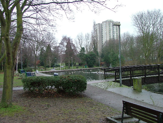
Pestcotts Wood is a beautiful woodland located in Hertfordshire, England. Covering an area of approximately 50 acres, it is a popular destination for nature lovers and hikers alike. The wood is situated within close proximity to the village of Pestcotts, which adds to its charm and accessibility.

The woodland boasts a diverse range of tree species, including oak, beech, and birch, creating a rich and vibrant ecosystem. The trees provide a picturesque canopy, allowing for dappled sunlight to filter through the leaves, casting a magical ambiance over the wood. These trees also provide a habitat for various bird species, making it a haven for birdwatchers.

Pestcotts Wood is crisscrossed with numerous walking paths, allowing visitors to explore its natural beauty at their own pace. The paths are well maintained and clearly signposted, ensuring that visitors can navigate their way through the wood with ease. There are also information boards along the way, providing interesting facts about the flora and fauna found in the wood.

Wildlife is abundant in Pestcotts Wood, with sightings of deer, squirrels, and rabbits being quite common. The tranquil atmosphere and natural surroundings make it an ideal location for wildlife photography and observation.

Overall, Pestcotts Wood is a hidden gem in Hertfordshire, offering a peaceful and immersive experience in nature. With its picturesque scenery, well-maintained paths, and abundant wildlife, it is a must-visit destination for nature enthusiasts and those seeking a break from the hustle and bustle of everyday life.

If you have any feedback on the listing, please let us know in the comments section below.

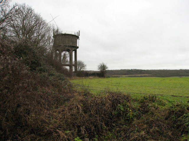
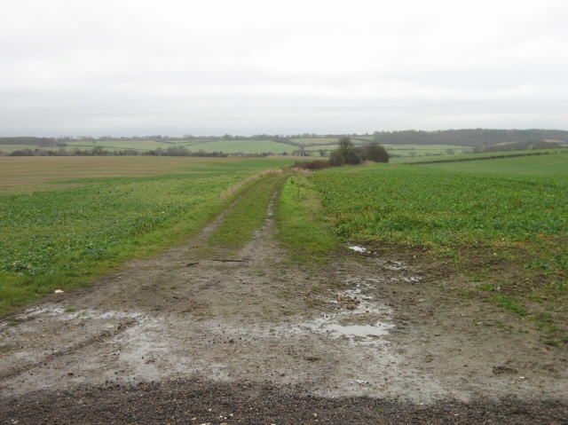
Pestcotts Wood Images

Images are sourced within 2km of 51.904391/-0.17080491 or Grid Reference TL2524. Thanks to Geograph Open Source API. All images are credited.

Hydean Way Shops Typical of local shops in Stevenage new town.  Above a parade of shops including a small supermarket, take away food outlet and Post Office there are maisonettes accessed from the rear.  To the right there are 2/3 bedroomed homes.
Hydean Way Shops
Typical of local shops in Stevenage new town. Above a parade of shops including a small supermarket, take away food outlet and Post Office there are maisonettes accessed from the rear. To the right there are 2/3 bedroomed homes.
South end of Fairlands Valley Park. This photograph was taken facing north into Fairlands Valley Park from the car park used for Stevenage Borough FC (see TL2422).  This park is also used for travelling fairs and circuses.
South end of Fairlands Valley Park.
This photograph was taken facing north into Fairlands Valley Park from the car park used for Stevenage Borough FC (see TL2422). This park is also used for travelling fairs and circuses.
Fairlands Valley Park This large lake is used by sailors and fishermen.  This photo is taken facing south.  To the rear there are two smaller lakes.  The park is very popular in the summer.
Fairlands Valley Park
This large lake is used by sailors and fishermen. This photo is taken facing south. To the rear there are two smaller lakes. The park is very popular in the summer.
Silam Rd. To the right are houses not untypical of Stevenage new town.  Looming over Silam Rd is one of a pair of high rise flats close to the town centre.
Silam Rd.
To the right are houses not untypical of Stevenage new town. Looming over Silam Rd is one of a pair of high rise flats close to the town centre.
Parishes Mead. Parishes mead is a newer development on the east side of Stevenage.  There is a mixture of private and social housing here.
Parishes Mead.
Parishes mead is a newer development on the east side of Stevenage. There is a mixture of private and social housing here.
Fortuna Close One of the more modern parts of Stevenage and with some more imaginative building - three storeys!
Fortuna Close
One of the more modern parts of Stevenage and with some more imaginative building - three storeys!
Hampson Park / Pin Green Water Tower. Although this water tower is right on the edge of this square I have used it because it dominates the locality.  The large flat construction on the left, behind the fence, is a covered reservoir.  The tower is now bristling with aerials of all sorts.
Hampson Park / Pin Green Water Tower.
Although this water tower is right on the edge of this square I have used it because it dominates the locality. The large flat construction on the left, behind the fence, is a covered reservoir. The tower is now bristling with aerials of all sorts.
Ferrier Rd This could be any road in this area.  Plans seem to have been bought as a job lot.
Ferrier Rd
This could be any road in this area. Plans seem to have been bought as a job lot.
Telford Avenue. On the edge of TL2525..  I wasn't going any further into this estate.  I always get lost even though it's not that big by local standards.  This estate, in common with others in the area suffers from the increase in car ownership.  Parking is awkward, the roads not wide and the layout is twisting.
Telford Avenue.
On the edge of TL2525.. I wasn't going any further into this estate. I always get lost even though it's not that big by local standards. This estate, in common with others in the area suffers from the increase in car ownership. Parking is awkward, the roads not wide and the layout is twisting.
Ridlins Athletics Track This photo of the Ridlins Athletics track shows the west corner and the Bert Hill stand.  The back of the stand has space for community groups such as playgroups.
Ridlins Athletics Track
This photo of the Ridlins Athletics track shows the west corner and the Bert Hill stand. The back of the stand has space for community groups such as playgroups.
Football pitches These are to the north west of the running track.
Football pitches
These are to the north west of the running track.
Aston Water Tower The Water Tower and surrounding countryside from the lane to Aston End
Aston Water Tower
The Water Tower and surrounding countryside from the lane to Aston End
The Crown, Aston End
Just Outside Stevenage On the Stevenage boundary, looking across TL2725 from Stevenage Road and you are in open country.
Just Outside Stevenage
On the Stevenage boundary, looking across TL2725 from Stevenage Road and you are in open country.
Trig point at Lonsdale School I swear that tree was not there when I took the photo.

This Trig point is in the playing field of a special needs school caring for 75 children between the ages of 2 and 19 from London, Bedfordshire and Hertfordshire.
Trig point at Lonsdale School
I swear that tree was not there when I took the photo. This Trig point is in the playing field of a special needs school caring for 75 children between the ages of 2 and 19 from London, Bedfordshire and Hertfordshire.
Religious Society of Friends meeting house Unprepossessing and in the shadow (almost literally) of the larger, church next door (St Andrew and St George)
Religious Society of Friends meeting house
Unprepossessing and in the shadow (almost literally) of the larger, church next door (St Andrew and St George)
Parish Church of St Andrew and St George - Stevenage. Below the church is Stevenage museum.
Parish Church of St Andrew and St George - Stevenage.
Below the church is Stevenage museum.
Town Park The 1940's map shows a stream running through this square and park.  All that remains visible is this long duck pond
Town Park
The 1940's map shows a stream running through this square and park. All that remains visible is this long duck pond
Show me another place!

Pestcotts Wood is located at Grid Ref: TL2524 (Lat: 51.904391, Lng: -0.17080491)

Administrative County: Hertfordshire

District: Stevenage

Police Authority: Hertfordshire

What 3 Words

///moment.fell.thin. Near Stevenage, Hertfordshire

Related Wikis

Marriotts School

Marriotts School is a secondary school in Stevenage, Hertfordshire, England. The school was rebuilt along with Lonsdale School (for special needs children...

The Nobel School

The Nobel School is a co-educational secondary school and sixth form located in Stevenage in the English county of Hertfordshire. == History == The Nobel...

Aston End

Aston End is a hamlet in Hertfordshire, England. It is in the civil parish of Aston. It features a pub and a butchers, as well as a few houses. == References... ==

Shephall

Shephall (SHEP-all) is a neighbourhood of the new town of Stevenage in Hertfordshire. It was formerly a separate village and parish, being absorbed into...

Barnwell School

Barnwell School is a coeducational secondary school and sixth form that was established in 1959 and is situated in the south of Stevenage, Hertfordshire...

The Heathcote School

The Heathcote School was an 11-18 comprehensive school in Stevenage, Hertfordshire. The school was founded in the 1950s. It was awarded Specialist Engineering...

Pryor's Wood

Pryor's Wood is an 8.7-hectare (21-acre) nature reserve in Great Ashby, near Stevenage in Hertfordshire. It was formerly managed by the Herts and Middlesex...

List of local nature reserves in Hertfordshire

Hertfordshire is a county in eastern England. It is bordered by Bedfordshire to the north, Cambridgeshire to the north-east, Essex to the east, Buckinghamshire...

Nearby Amenities

Located within 500m of 51.904391,-0.17080491
Traffic Calming: island
Lat/Long: 51.9015614/-0.1688201
Created By: osmeditor2
Lat/Long: 51.9011167/-0.1708767
Created By: osmeditor2
Lat/Long: 51.9009/-0.1716933
Created By: osmeditor2
Lat/Long: 51.9007133/-0.17224
Created By: osmeditor2
Lat/Long: 51.901255/-0.170235
Created By: osmeditor2
Lat/Long: 51.9004057/-0.1729653
Crossing
Crossing: unmarked
Crossing Island: no
Tactile Paving: no
Traffic Calming: hump
Lat/Long: 51.9082492/-0.1699957
Traffic Calming: island
Lat/Long: 51.9068308/-0.167265
Mini Roundabout
Direction: clockwise
Lat/Long: 51.9053334/-0.1662823
Crossing
Crossing: unmarked
Crossing Island: no
Kerb: lowered
Tactile Paving: no
Lat/Long: 51.9016948/-0.167227
Bus Stop
Warwick Road
Bench: yes
Bin: yes
Bus: yes
Lit: yes
Naptan AtcoCode: 210021201620
Naptan Bearing: SE
Naptan CommonName: Warwick Road
Naptan Crossing: Siddons Road
Naptan Indicator: opp
Naptan Landmark: Siddons Road
Naptan NaptanCode: hrtgadgd
Naptan PlusbusZoneRef: STEVNGE
Naptan ShortCommonName: NA
Naptan Street: Chells Way
Naptan Verified: no
Public Transport: platform
Shelter: yes
Source: naptan_import
Tactile Paving: yes
Lat/Long: 51.9061312/-0.1664988
Bus Stop
The Squirrel PH
Bench: yes
Bin: yes
Bus: yes
Lit: yes
Local Ref: NR
Naptan AtcoCode: 210021201640
Naptan Bearing: SE
Naptan CommonName: The Squirrel PH
Naptan Crossing: Ferrier Road
Naptan Indicator: nr
Naptan Landmark: Ferrier Road
Naptan NaptanCode: hrtgadgj
Naptan PlusbusZoneRef: STEVNGE
Naptan ShortCommonName: NA
Naptan Street: Chells Way
Naptan Verified: no
Public Transport: platform
Shelter: yes
Source: naptan_import
Tactile Paving: yes
Lat/Long: 51.904227/-0.165486
Bus Stop
Marlboro Road
Bench: yes
Bin: yes
Bus: yes
Lit: yes
Local Ref: NR
Naptan AtcoCode: 210021201660
Naptan Bearing: SW
Naptan CommonName: Marlboro Road
Naptan Crossing: Great Collens Wood
Naptan Indicator: nr
Naptan Landmark: Great Collens Wood
Naptan NaptanCode: hrtgadgm
Naptan PlusbusZoneRef: STEVNGE
Naptan ShortCommonName: NA
Naptan Street: Six Hills Way
Naptan Verified: no
Public Transport: platform
Shelter: yes
Source: naptan_import
Tactile Paving: yes
Lat/Long: 51.9015662/-0.168429
Bus Stop
Marlboro Road
Bench: yes
Bin: no
Bus: yes
Lit: yes
Naptan AtcoCode: 210021203000
Naptan Bearing: NE
Naptan CommonName: Marlboro Road
Naptan Crossing: Collens Leg Wood
Naptan Indicator: opp
Naptan Landmark: Collens Leg Wood
Naptan NaptanCode: hrtdwmjp
Naptan PlusbusZoneRef: STEVNGE
Naptan ShortCommonName: NA
Naptan Street: Six Hills Way
Naptan Verified: no
Public Transport: platform
Shelter: yes
Source: naptan_import
Tactile Paving: yes
Lat/Long: 51.9018692/-0.1676753
Bus Stop
The Squirrel PH
Bench: yes
Bin: no
Bus: yes
Lit: yes
Naptan AtcoCode: 210021203020
Naptan Bearing: NW
Naptan CommonName: The Squirrel PH
Naptan Crossing: Pankhurst Crescent
Naptan Indicator: opp
Naptan Landmark: Pankhurst Crescent
Naptan NaptanCode: hrtdwmpa
Naptan PlusbusZoneRef: STEVNGE
Naptan ShortCommonName: NA
Naptan Street: Chells Way
Naptan Verified: no
Public Transport: platform
Shelter: yes
Source: naptan_import
Tactile Paving: yes
Lat/Long: 51.9042313/-0.165762
Bus Stop
Warwick Road
Bench: no
Bin: no
Bus: yes
Lit: yes
Local Ref: NR
Naptan AtcoCode: 210021203040
Naptan Bearing: NW
Naptan CommonName: Warwick Road
Naptan Crossing: Camps Hill JMI School
Naptan Indicator: nr
Naptan Landmark: Camps Hill JMI School
Naptan NaptanCode: hrtdwmpd
Naptan PlusbusZoneRef: STEVNGE
Naptan ShortCommonName: NA
Naptan Street: Chells Way
Naptan Verified: no
Public Transport: platform
Shelter: no
Source: naptan_import
Tactile Paving: yes
Lat/Long: 51.9069749/-0.1675548
Mini Roundabout
Direction: clockwise
Lat/Long: 51.9056205/-0.1662825
Mini Roundabout
Direction: clockwise
Lat/Long: 51.9036922/-0.1650495
Crossing
Crossing: unmarked
Crossing Island: no
Kerb: lowered
Tactile Paving: no
Lat/Long: 51.9028891/-0.1644187
Mini Roundabout
Direction: clockwise
Lat/Long: 51.9039095/-0.1652858
Crossing
Button Operated: yes
Crossing: traffic_signals
Crossing Island: no
Tactile Paving: yes
Traffic Signals Sound: yes
Traffic Signals Vibration: yes
Lat/Long: 51.9045927/-0.165918
Pub
Squirrel Tavern
Lat/Long: 51.9045025/-0.1656058
Traffic Calming: island
Lat/Long: 51.9079681/-0.1693687
Post Box
Check Date: 2021-01-28
Collection Times: Mo-Fr 16:30, Sa 11:30
Post Box Type: pillar
Ref: SG2 344
Lat/Long: 51.9085319/-0.1700958
Post Box
Check Date: 2021-01-23
Collection Times: Mo-Fr 18:30; Sa 12:30
Post Box Type: pillar
Ref: SG2 340
Lat/Long: 51.904644/-0.16583
Post Box
Collection Times: Mo-Fr 09:00; Sa 07:00
Post Box Type: lamp
Ref: SG2 339
Royal Cypher: EIIR
Royal Cypher Wikidata: Q33102113
Lat/Long: 51.902641/-0.168357
Post Box
Check Date: 2021-02-06
Collection Times: Mo-Fr 09:00; Sa 07:00
Post Box Type: pillar
Ref: SG2 374
Royal Cypher: EIIR
Royal Cypher Wikidata: Q33102113
Lat/Long: 51.901382/-0.16704
Library
Stevenage Mobile Library
Opening Hours: Th 10:00-13:00,14:00-16:30
Operator: Hertfordshire County Council
Wheelchair: yes
Lat/Long: 51.908349/-0.1700572
Barrier: entrance
Lat/Long: 51.9016798/-0.1744923
Crossing
Crossing: unmarked
Crossing Island: yes
Tactile Paving: yes
Lat/Long: 51.901722/-0.1680726
Marriotts Gymnastics
Leisure: sports_centre
Sport: gymnastics
Lat/Long: 51.9056678/-0.1768036
Parking
Lat/Long: 51.9024943/-0.1699335
Restaurant
Gangnam
Addr City: Stevenage
Addr Housenumber: 22-24
Addr Parentstreet: Chells Way
Addr Postcode: SG2 0DJ
Addr Street: The Glebe
Cuisine: korean
Email: gangnamstevenage@gmail.com
Fhrs Id: 927237
Opening Hours: Mo-Sa 18:00-22:00
Phone: +44 1438 747 215
Website: https://www.gangnamstevenage.co.uk
Lat/Long: 51.9087724/-0.1703283
Siobhan's
Addr City: Stevenage
Addr Parentstreet: Chells Way
Addr Street: The Glebe
Shop: hairdresser
Lat/Long: 51.9088122/-0.1705939
Nisa Local
Addr City: Stevenage
Addr Housenumber: 7-9
Addr Parentstreet: Chells Way
Addr Postcode: SG2 0DL
Addr Street: The Glebe
Fhrs Id: 349211
Shop: convenience
Source Addr: FHRS Open Data
Lat/Long: 51.9088494/-0.1705456
Fast Food
Golden Fry
Addr City: Stevenage
Addr Housenumber: 3
Addr Parentstreet: Chells Way
Addr Postcode: SG2 0DL
Addr Street: The Glebe
Cuisine: fish_and_chips
Fhrs Id: 743764
Source Addr: FHRS Open Data
Lat/Long: 51.9087716/-0.1706502
Stevenage Halal Meat & Groceries
Addr City: Stevenage
Addr Parentstreet: Chells Way
Addr Street: The Glebe
Shop: butcher
Lat/Long: 51.9087319/-0.1706971
Note: 'Under Consultation' from 20191103 - may be removed in 42 days
Old Phone: +44 1438 314034
Removed Amenity: telephone
Lat/Long: 51.9087299/-0.1705535
Crossing
Crossing: unmarked
Crossing Island: no
Tactile Paving: no
Lat/Long: 51.9071966/-0.1676895
Barrier: entrance
Lat/Long: 51.9024297/-0.175717
Crossing
Crossing: uncontrolled
Crossing Ref: zebra
Lat/Long: 51.9024209/-0.1756542
Crossing
Crossing: uncontrolled
Crossing Ref: zebra
Lat/Long: 51.9024061/-0.1753629
Waste Basket
Lat/Long: 51.9010468/-0.171487
Waste Basket
Lat/Long: 51.9015806/-0.1683328
Waste Basket
Lat/Long: 51.9017163/-0.1673001
Grit Bin
Lat/Long: 51.908765/-0.1708353
Crossing
Crossing: unmarked
Crossing Island: yes
Tactile Paving: no
Traffic Calming: hump
Lat/Long: 51.9086429/-0.1707942
Waste Basket
Lat/Long: 51.9084638/-0.1705483
Crossing
Crossing: unmarked
Crossing Island: yes
Tactile Paving: no
Lat/Long: 51.9081348/-0.169803
Crossing
Crossing: unmarked
Crossing Island: no
Tactile Paving: no
Lat/Long: 51.9077818/-0.1688703
Waste Basket
Lat/Long: 51.9077465/-0.1688585
Waste Basket
Lat/Long: 51.907186/-0.1677735
Crossing
Crossing: unmarked
Crossing Island: yes
Tactile Paving: no
Lat/Long: 51.9074817/-0.1679948
Waste Basket
Lat/Long: 51.9061033/-0.1664572
Waste Basket
Lat/Long: 51.9041829/-0.1653991
Artwork Type: sculpture
Tourism: artwork
Lat/Long: 51.9073444/-0.1655674
Waste Basket
Lat/Long: 51.9073428/-0.1658852
Waste Basket
Lat/Long: 51.9087758/-0.1705335
Bench
Backrest: no
Material: metal
Lat/Long: 51.9088182/-0.1704698
Bench
Backrest: yes
Lat/Long: 51.9082562/-0.169759
Bench
Backrest: yes
Lat/Long: 51.9063913/-0.1693319
Waste Basket
Lat/Long: 51.9064103/-0.1697879
Waste Basket
Lat/Long: 51.9064235/-0.1702586
Waste Basket
Lat/Long: 51.9064914/-0.1705335
Waste Basket
Lat/Long: 51.9060123/-0.1707897
Waste Basket
Lat/Long: 51.905587/-0.1700735
Grit Bin
Lat/Long: 51.9040522/-0.169301
Kerb: raised
Lat/Long: 51.9027347/-0.1685533
Waste Basket
Lat/Long: 51.9020307/-0.1671083
Traffic Calming: island
Lat/Long: 51.9019356/-0.1670493
Bench
Backrest: yes
Material: metal
Lat/Long: 51.9086277/-0.1701774
Waste Basket
Lat/Long: 51.9086454/-0.1702137
Waste Basket
Lat/Long: 51.9087303/-0.1703773
Grit Bin
Lat/Long: 51.9085867/-0.1699404
Bicycle Parking
Bicycle Parking: stands
Capacity: 8
Covered: no
Lat/Long: 51.9085242/-0.1700557
Waste Basket
Lat/Long: 51.9084899/-0.1701
Atm
Lat/Long: 51.9086941/-0.1701774
Addr City: Stevenage
Addr Parentstreet: Chells Way
Addr Street: The Glebe
Shop: vacant
Lat/Long: 51.9085209/-0.1699421
Home Improvement Centre
Addr City: Stevenage
Addr Housenumber: 2
Addr Parentstreet: Chells Way
Addr Street: The Glebe
Phone: +44 1438 745 511
Shop: doityourself
Lat/Long: 51.9084581/-0.1700185
Restaurant
Gate of India
Addr City: Stevenage
Addr Parentstreet: Chells Way
Addr Street: The Glebe
Cuisine: indian
Phone: +44 1438 317 619
Lat/Long: 51.9087394/-0.1702492
Addr City: Stevenage
Addr Housenumber: 18
Addr Parentstreet: Chells Way
Addr Street: The Glebe
Shop: yes
Lat/Long: 51.9086988/-0.1701821
Restaurant
Golden's Place
Addr City: Stevenage
Addr Parentstreet: Chells Way
Addr Street: The Glebe
Cuisine: chinese
Lat/Long: 51.9086756/-0.1701312
The Living Room
Addr City: Stevenage
Addr Parentstreet: Chells Way
Addr Street: The Glebe
Shop: charity
Lat/Long: 51.9086426/-0.1700655
Pharmacy
Coopers Pharmacy
Addr City: Stevenage
Addr Housenumber: 12
Addr Parentstreet: Chells Way
Addr Street: The Glebe
Fixme: Check the phone number the picture was not clear.
Phone: +44 1438 354 395
Lat/Long: 51.9086095/-0.1700011
Waste Basket
Lat/Long: 51.9070912/-0.1741786
Grit Bin
Lat/Long: 51.9056342/-0.1727383
Waste Basket
Lat/Long: 51.9056003/-0.1729032
Grit Bin
Lat/Long: 51.9028706/-0.1679117
Grit Bin
Lat/Long: 51.9039694/-0.1642317
Bench
Backrest: yes
Lat/Long: 51.9002483/-0.1735684
Waste Basket
Lat/Long: 51.9034263/-0.1646542
The data included in this document is from www.openstreetmap.org. The data is made available under ODbL.

Have you been to Pestcotts Wood?

Leave your review of Pestcotts Wood below (or comments, questions and feedback).