Stamford Pond

Lake, Pool, Pond, Freshwater Marsh in Surrey Epsom and Ewell

England

Stamford Pond

Cycle route along the edge of Newton Wood
Cycle route along the edge of Newton Wood Credit: David Martin

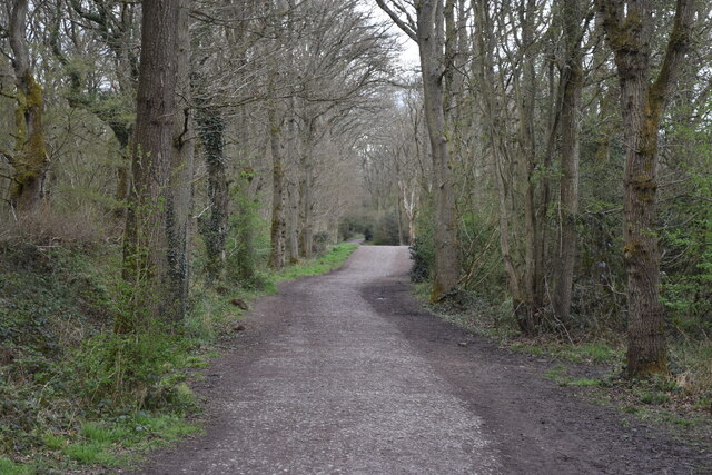
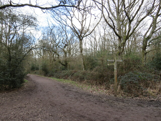
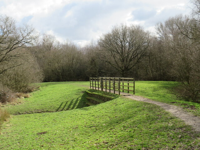
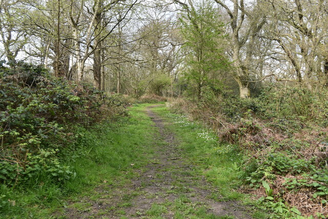
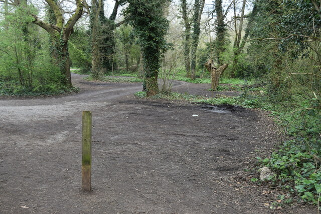
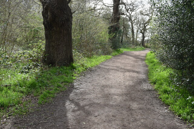
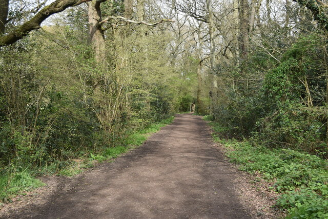
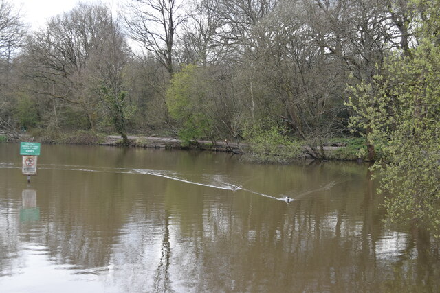
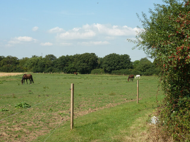
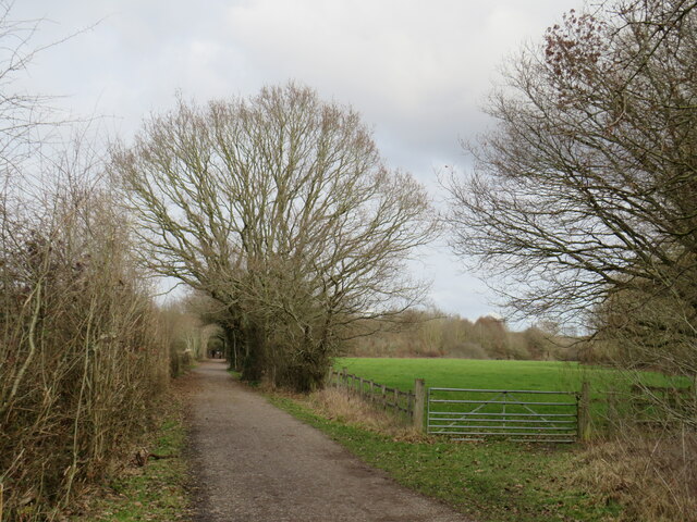
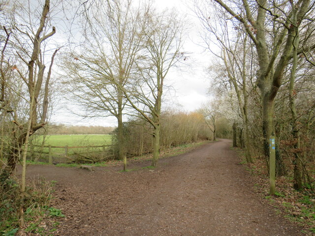
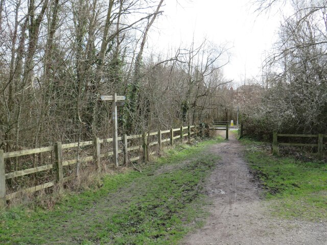
Stamford Pond is a picturesque freshwater pond located in the county of Surrey, England. Spanning approximately 10 acres, it is a popular destination for nature enthusiasts and locals alike. The pond is nestled amidst the serene surroundings of Stamford Common, providing a tranquil escape from the bustling city life.

The pond is characterized by its crystal-clear water, which is sourced from natural springs and rainwater runoff. It serves as a vital habitat for various aquatic plants and a diverse array of wildlife. The pond is home to several species of fish, including carp, perch, and roach, making it a favorite spot for fishing enthusiasts.

Surrounding the pond is a lush green landscape, adorned with a variety of native flora and fauna. The pond's banks are lined with reeds and lily pads, creating a beautiful sight during the warmer months when they bloom. This rich vegetation attracts a plethora of bird species, including ducks, swans, and herons, making it a haven for birdwatching enthusiasts.

Stamford Pond offers a range of recreational activities for visitors. There are several designated areas for picnicking and relaxation, providing a perfect spot for families and friends to enjoy a sunny day out. The pond also offers opportunities for boating and kayaking, allowing visitors to explore its serene waters and admire the surrounding natural beauty.

Overall, Stamford Pond is a hidden gem in Surrey, offering a peaceful retreat for those seeking solace in nature. Whether it's fishing, birdwatching, or simply enjoying a serene day out, this freshwater pond provides a delightful experience for all who visit.

If you have any feedback on the listing, please let us know in the comments section below.

Stamford Pond Images

Images are sourced within 2km of 51.333571/-0.28148434 or Grid Reference TQ1960. Thanks to Geograph Open Source API. All images are credited.

Cycle route along the edge of Newton Wood
Path near Ashtead A path leading onto Ashtead Common, in Surrey.

This image was taken during the month of February.  Trees were bare for the winter season.
Path near Ashtead
A path leading onto Ashtead Common, in Surrey. This image was taken during the month of February. Trees were bare for the winter season.
Path over The Rye Brook on Ashtead Common A path on Ashtead Common, crossing The Rye Brook, which flows beneath through a duct.

This image was taken during the month of February.  Trees were bare for the winter season.
Path over The Rye Brook on Ashtead Common
A path on Ashtead Common, crossing The Rye Brook, which flows beneath through a duct. This image was taken during the month of February. Trees were bare for the winter season.
Path on Epsom Common
Empty car park on Epsom Common
Bridleway on edge of Epsom Common
Stew Pond, Epsom Common
Field with horses A bridleway follows the field edge around the corner to the right and along the far hedge.
Field with horses
A bridleway follows the field edge around the corner to the right and along the far hedge.
Thames Down Link near Chessington A view along a public bridleway in Surrey, close to the Greater London boundary.  The bridleway is on the route of the Thames Down Link.

This image was taken on a February day.  Trees were bare for the winter months.
Thames Down Link near Chessington
A view along a public bridleway in Surrey, close to the Greater London boundary. The bridleway is on the route of the Thames Down Link. This image was taken on a February day. Trees were bare for the winter months.
Thames Down Link near Chessington A junction of two public bridleways near Chessington.  The bridleway to the left is on the route of the Thames Down Link.

This image was taken on a February day.  Trees were bare for the winter months.
Thames Down Link near Chessington
A junction of two public bridleways near Chessington. The bridleway to the left is on the route of the Thames Down Link. This image was taken on a February day. Trees were bare for the winter months.
Paths meet near Chessington A junction of bridleways and a footpath in Surrey countryside, close to the border with Greater London.  The path ahead and continuing to the left is on the route of the Thames Down Link.

Trees were bare, a clear indication that this image was taken during the winter months.
Paths meet near Chessington
A junction of bridleways and a footpath in Surrey countryside, close to the border with Greater London. The path ahead and continuing to the left is on the route of the Thames Down Link. Trees were bare, a clear indication that this image was taken during the winter months.
Public footpath near Epsom A public footpath in Surrey, photographed on a dull February day.

Trees were bare for the winter season.
Public footpath near Epsom
A public footpath in Surrey, photographed on a dull February day. Trees were bare for the winter season.
Thames Down Link near Epsom Two bridleways meet in Surrey countryside close to the border with Greater London.  The bridleway heading straight on is on the route of the Thames Down Link.

This image was taken on a February day.  Trees were bare for the winter season.
Thames Down Link near Epsom
Two bridleways meet in Surrey countryside close to the border with Greater London. The bridleway heading straight on is on the route of the Thames Down Link. This image was taken on a February day. Trees were bare for the winter season.
Thames Down Link near Epsom A gate on a bridleway near Epsom in Surrey.  The bridleway is on the route of the Thames Down Link.

This image was taken on a February day.  Trees were bare for the winter season.
Thames Down Link near Epsom
A gate on a bridleway near Epsom in Surrey. The bridleway is on the route of the Thames Down Link. This image was taken on a February day. Trees were bare for the winter season.
Cottage and Thames Down Link near Epsom A cottage in Surrey countryside near Epsom.  The track passing the cottage is a public right of way as a bridleway, which is on the route of the Thames Down Link.   

This image was taken on a February day.  Trees were bare for the winter months.
Cottage and Thames Down Link near Epsom
A cottage in Surrey countryside near Epsom. The track passing the cottage is a public right of way as a bridleway, which is on the route of the Thames Down Link. This image was taken on a February day. Trees were bare for the winter months.
Public bridleway near Epsom A public bridleway leading to and past a cottage in Surrey countryside, near Epsom.

This image was taken during the month of February.  Trees were bare for the winter season.
Public bridleway near Epsom
A public bridleway leading to and past a cottage in Surrey countryside, near Epsom. This image was taken during the month of February. Trees were bare for the winter season.
Path near Epsom A short path linking a public bridleway and a nearby road in Surrey countryside, near Epsom.

Trees were bare, indicating that this image was taken during the winter.
Path near Epsom
A short path linking a public bridleway and a nearby road in Surrey countryside, near Epsom. Trees were bare, indicating that this image was taken during the winter.
Show me another place!

Stamford Pond is located at Grid Ref: TQ1960 (Lat: 51.333571, Lng: -0.28148434)

Administrative County: Surrey

District: Epsom and Ewell

Police Authority: Surrey

What 3 Words

///pushes.upper.slides. Near Epsom, Surrey

Related Wikis

Kingswood House School

Kingswood House School is a private school in Epsom, Surrey in the United Kingdom. It was founded in 1899 and moved to its present site in West Hill in...

Rosebery School for Girls

Rosebery School is an all-girls school located in Epsom, Surrey. It consists of a lower school for those aged between 11 and 16, and a sixth form for those...

Manor Hospital, Epsom

The Manor Hospital, formerly The Manor Asylum and The Manor Certified Institution was a mental handicap and psychiatric hospital in Horton, near Epsom...

Epsom railway station

Epsom railway station serves the town of Epsom in Surrey, England. It is located off Waterloo Road and is less than two minutes' walk from the town's high...

The Ashley Centre

The Ashley Centre (for a brief period rebranded The Mall Ashley) is a shopping centre, in Epsom, Surrey. The Ashley Centre was opened on 24 October 1984...

Epsom (UK Parliament constituency)

Epsom was a borough constituency represented in the House of Commons of the Parliament of the United Kingdom. It elected one Member of Parliament (MP)...

Epsom and Ewell (UK Parliament constituency)

Epsom and Ewell is a constituency in Surrey represented in the House of Commons of the UK Parliament since 2001 by Chris Grayling, a Conservative. �...

Epsom

Epsom is a town in the Borough of Epsom and Ewell in Surrey, England, about 14 miles (22 kilometres) south of central London. The town is first recorded...

Nearby Amenities

Located within 500m of 51.333571,-0.28148434
Crossing: no
Lat/Long: 51.331839/-0.2863452
Post Box
Brand: Royal Mail
Brand Wikidata: Q638098
Brand Wikipedia: en:Royal Mail
Collection Times: Mo-Fr 09:00; Sa 07:00; Su off
Drive Through: no
Operator: Royal Mail
Operator Wikidata: Q638098
Post Box Type: pillar
Ref: KT19 127D
Royal Cypher: EIIR
Royal Cypher Wikidata: Q33102113
Source: survey
Lat/Long: 51.3372193/-0.2797995
Post Box
Brand: Royal Mail
Brand Wikidata: Q638098
Brand Wikipedia: en:Royal Mail
Collection Times: Mo-Fr 09:00; Sa 07:00; Su off
Drive Through: no
Operator: Royal Mail
Operator Wikidata: Q638098
Post Box Type: wall
Ref: KT19 107D
Royal Cypher: VR
Royal Cypher Wikidata: Q33102356
Source: survey
Lat/Long: 51.3354078/-0.2767987
Post Box
Collection Times: Mo-Fr 09:00; Sa 07:00
Operator: Royal Mail
Post Box Type: pillar
Ref: KT18 53D
Royal Cypher: GVIR
Royal Cypher Wikidata: Q33102169
Lat/Long: 51.3298507/-0.2804599
Crossing
Bicycle: yes
Crossing: traffic_signals
Crossing Ref: toucan
Lat/Long: 51.3341419/-0.2816238
Post Box
Collection Times: Mo-Fr 09:00; Sa 07:00
Operator: Royal Mail
Post Box Type: pillar
Ref: KT18 58D
Royal Cypher: EIIR
Royal Cypher Wikidata: Q33102113
Lat/Long: 51.3326636/-0.2824719
Pub
The Jolly Coopers
Addr Housenumber: 84
Addr Postcode: KT18 7SD
Addr Street: Wheelers Lane
Facebook: jollycoopersepsom
Fhrs Id: 972346
Instagram: jolly_coopers
Microbrewery: yes
Source Addr: FHRS Open Data
Twitter: jolly_coopers
Website: https://jollycoopers.co.uk/
Lat/Long: 51.3311789/-0.2817364
Bus Stop
Christ Church
Naptan AtcoCode: 40004406030A
Naptan Bearing: E
Naptan CommonName: Christ Church
Naptan Indicator: Opp
Naptan Landmark: Christ Church
Naptan NaptanCode: surajmgd
Naptan Street: Christ Church Road
Naptan Verified: no
Public Transport: platform
Source: naptan_import
Lat/Long: 51.3354292/-0.2875249
Bus Stop
Christ Church
Naptan AtcoCode: 40004406030B
Naptan Bearing: W
Naptan CommonName: Christ Church
Naptan Indicator: O/s
Naptan Landmark: Christ Church
Naptan NaptanCode: surajmgj
Naptan Street: Christ Church Road
Naptan Verified: no
Public Transport: platform
Source: naptan_import
Lat/Long: 51.3352811/-0.2876751
Bus Stop
Stamford Green
Naptan AtcoCode: 40004406031A
Naptan Bearing: E
Naptan CommonName: Stamford Green
Naptan Indicator: Opp
Naptan Landmark: Stamford Green
Naptan NaptanCode: surajmgm
Naptan Street: Christ Church Road
Naptan Verified: no
Public Transport: platform
Source: naptan_import
Lat/Long: 51.3344222/-0.2828382
Bus Stop
Stamford Green
Naptan AtcoCode: 40004406031B
Naptan Bearing: W
Naptan CommonName: Stamford Green
Naptan Indicator: adj
Naptan Landmark: Stamford Green
Naptan NaptanCode: surajmgp
Naptan Street: Christ Church Road
Naptan Verified: no
Public Transport: platform
Source: naptan_import
Lat/Long: 51.3344104/-0.283198
Bus Stop
Meadway
Naptan AtcoCode: 40004406156A
Naptan Bearing: W
Naptan CommonName: Meadway
Naptan Indicator: Just after
Naptan Landmark: West Hill / Meadway
Naptan NaptanCode: surgdwpa
Naptan Street: West Hill
Naptan Verified: no
Public Transport: platform
Source: naptan_import
Lat/Long: 51.3341538/-0.2784294
Bus Stop
Meadway
Naptan AtcoCode: 40004406156B
Naptan Bearing: E
Naptan CommonName: Meadway
Naptan Indicator: Just Before
Naptan Landmark: West Hill / Meadway
Naptan NaptanCode: surgdwpd
Naptan Street: West Hill
Naptan Verified: no
Public Transport: platform
Source: naptan_import
Lat/Long: 51.334251/-0.2783392
Bench
Lat/Long: 51.3336409/-0.2861598
Crossing
Bicycle: yes
Crossing: traffic_signals
Crossing Ref: toucan
Lat/Long: 51.3351863/-0.2871465
Speed Camera
Lat/Long: 51.3346308/-0.2835684
Railway: buffer_stop
Lat/Long: 51.3309947/-0.2763926
Railway: buffer_stop
Lat/Long: 51.3310542/-0.276541
Post Box
Collection Times: Mo-Fr 09:00; Sa 07:00
Operator: Royal Mail
Post Box Type: pillar
Ref: KT18 13D
Royal Cypher: GR
Royal Cypher Wikidata: Q33102273
Lat/Long: 51.3340538/-0.280256
Post Box
Brand: Royal Mail
Brand Wikidata: Q638098
Brand Wikipedia: en:Royal Mail
Collection Times: Mo-Fr 09:00; Sa 07:00; Su off
Drive Through: no
Operator: Royal Mail
Operator Wikidata: Q638098
Post Box Type: pillar
Ref: KT19 166D
Royal Cypher: GVIR
Royal Cypher Wikidata: Q33102169
Source: survey
Lat/Long: 51.3336597/-0.2758512
Kindergarten
Little Hands Nursery, Forest School
Lat/Long: 51.334549/-0.2853921
The data included in this document is from www.openstreetmap.org. The data is made available under ODbL.

Have you been to Stamford Pond?

Leave your review of Stamford Pond below (or comments, questions and feedback).