Epsom Common

Wood, Forest in Surrey Epsom and Ewell

England

Epsom Common

Very muddy path on Ashtead Common
Very muddy path on Ashtead Common Credit: David Martin

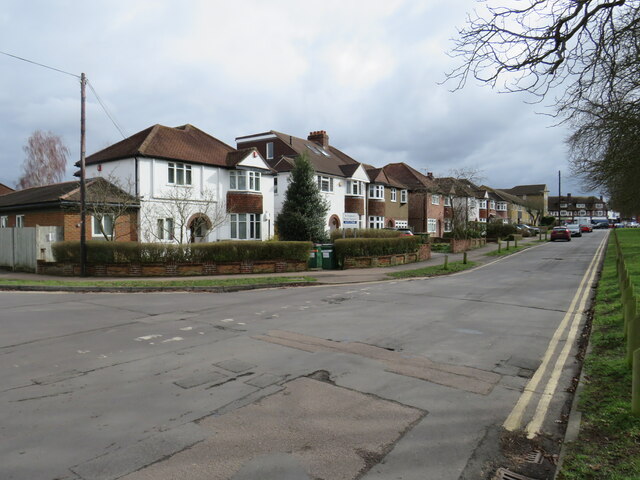
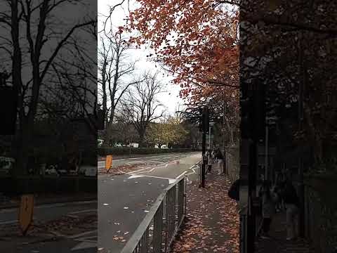
Epsom Common, located in Surrey, England, is a picturesque and diverse area of woodland and open space. Covering an area of approximately 430 acres, this common is a cherished natural haven for both locals and visitors.

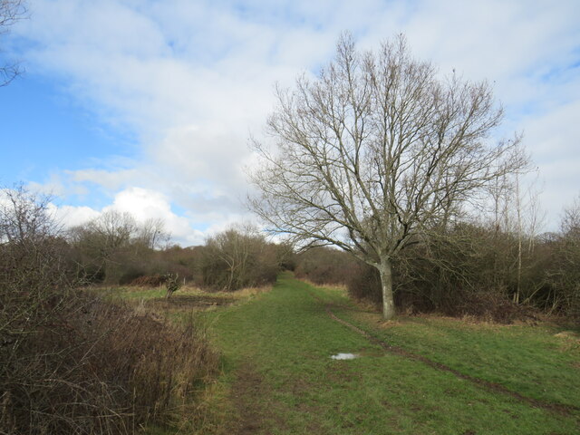
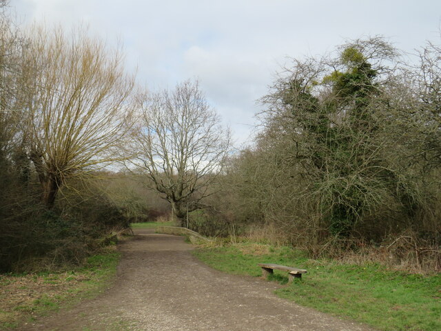
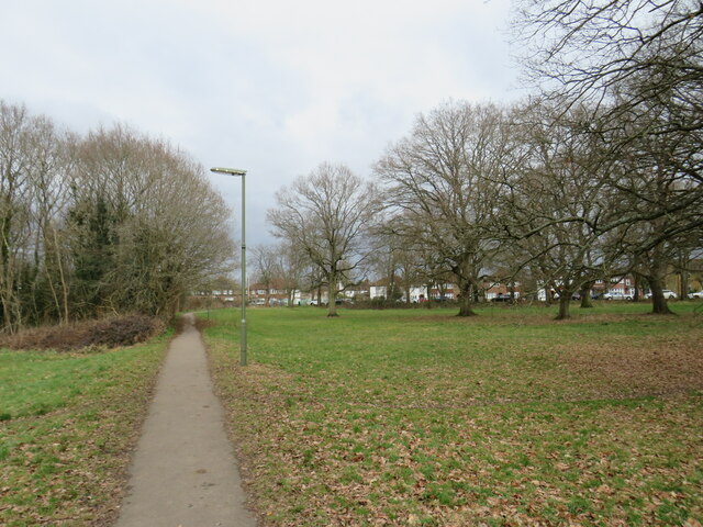
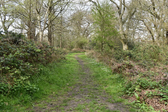
The common is characterized by its dense woodland, which is predominantly made up of oak and birch trees. These towering trees create a tranquil and shady environment, perfect for leisurely walks and picnics. The forest floor is adorned with a vibrant array of wildflowers, such as bluebells and primroses, adding a splash of color to the landscape during the spring months.

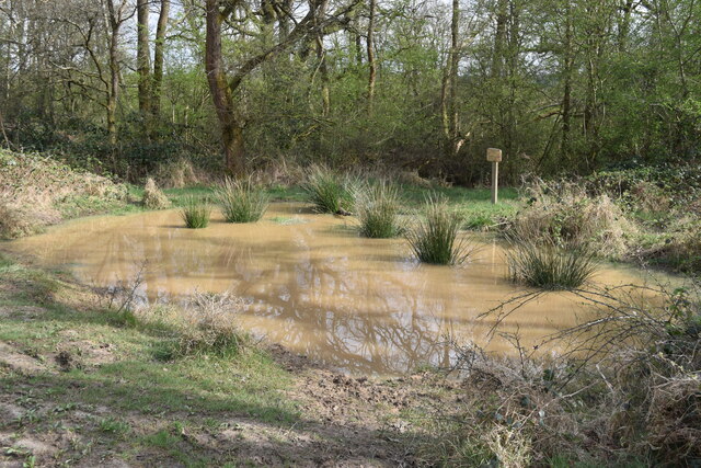
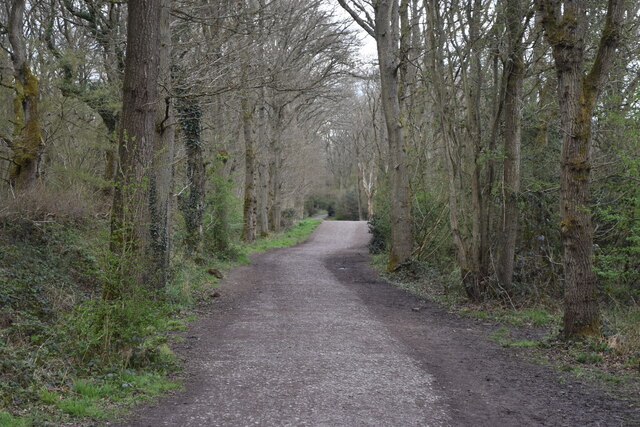
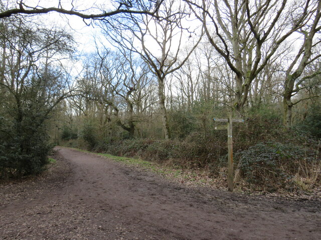
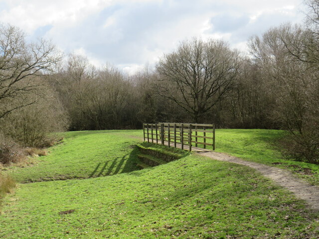
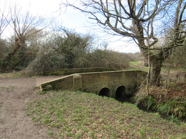
Within Epsom Common, there are several well-maintained footpaths and trails, allowing visitors to explore the area at their own pace. These paths wind through the woodland, offering glimpses of local wildlife, including deer, foxes, and a variety of bird species. The common is also home to a number of ponds and streams, providing habitats for frogs, newts, and dragonflies.

In addition to its natural beauty, Epsom Common holds historical significance. The common was once used as a training ground for soldiers during World War II and remnants of old training trenches can still be seen today.

Epsom Common is actively managed by the Epsom and Ewell Borough Council to preserve its ecological value and protect its diverse flora and fauna. The council also organizes educational events and guided walks to help visitors learn more about the common's natural and historical heritage.

Overall, Epsom Common is a captivating woodland area in Surrey that offers a tranquil escape from the hustle and bustle of everyday life, providing a place for nature enthusiasts and history buffs alike to immerse themselves in its beauty and serenity.

If you have any feedback on the listing, please let us know in the comments section below.

Epsom Common Images

Images are sourced within 2km of 51.331911/-0.29216898 or Grid Reference TQ1960. Thanks to Geograph Open Source API. All images are credited.

Very muddy path on Ashtead Common
Shaun's Puddle A small pond created in 2016 to aid with drainage of a very muddy area.
Shaun's Puddle
A small pond created in 2016 to aid with drainage of a very muddy area.
Cycle route along the edge of Newton Wood
Path near Ashtead A path leading onto Ashtead Common, in Surrey.

This image was taken during the month of February.  Trees were bare for the winter season.
Path near Ashtead
A path leading onto Ashtead Common, in Surrey. This image was taken during the month of February. Trees were bare for the winter season.
Path over The Rye Brook on Ashtead Common A path on Ashtead Common, crossing The Rye Brook, which flows beneath through a duct.

This image was taken during the month of February.  Trees were bare for the winter season.
Path over The Rye Brook on Ashtead Common
A path on Ashtead Common, crossing The Rye Brook, which flows beneath through a duct. This image was taken during the month of February. Trees were bare for the winter season.
Path on Ashtead Common A path on Ashtead Common in Surrey.  The path is a public bridleway.

This image was taken in the month of February.  Trees were bare for the winter season.
Path on Ashtead Common
A path on Ashtead Common in Surrey. The path is a public bridleway. This image was taken in the month of February. Trees were bare for the winter season.
Bridge over The Rye Brook, Ashtead Common A bridge taking a bridleway over The Rye Brook on Ashtead Common, in Surrey.

This image was taken in the month of February.  Trees were bare for the winter season.
Bridge over The Rye Brook, Ashtead Common
A bridge taking a bridleway over The Rye Brook on Ashtead Common, in Surrey. This image was taken in the month of February. Trees were bare for the winter season.
Track onto Ashtead Common A track leading onto Ashtead Common in Surrey.  The track is a public right of way as a bridleway.

This image was taken in the month of February.  Trees were bare for the winter season.
Track onto Ashtead Common
A track leading onto Ashtead Common in Surrey. The track is a public right of way as a bridleway. This image was taken in the month of February. Trees were bare for the winter season.
Level crossing at Ashtead A level crossing at Ashtead in Surrey.  Cars and pedestrians wait as a train passes through.

This image was taken in the month of February.  Trees were bare for the winter season.
Level crossing at Ashtead
A level crossing at Ashtead in Surrey. Cars and pedestrians wait as a train passes through. This image was taken in the month of February. Trees were bare for the winter season.
Woodfield Lane, Ashtead Woodfield Lane is a residential road in the village of Ashtead in Surrey.
Woodfield Lane, Ashtead
Woodfield Lane is a residential road in the village of Ashtead in Surrey.
Path on Wood Field, Ashtead A path across Wood Field in the village of Ashtead in Surrey.

This image was taken in the month of February.  Trees were bare for the winter season.
Path on Wood Field, Ashtead
A path across Wood Field in the village of Ashtead in Surrey. This image was taken in the month of February. Trees were bare for the winter season.
Level crossing at Ashtead A level crossing taking a railway across the road in the village of Ashtead in Surrey.

This image was taken in the month of February.  Trees were bare for the winter season.
Level crossing at Ashtead
A level crossing taking a railway across the road in the village of Ashtead in Surrey. This image was taken in the month of February. Trees were bare for the winter season.
Overdale, Ashtead Overdale is a residential road in the village of Ashtead in Surrey.
Overdale, Ashtead
Overdale is a residential road in the village of Ashtead in Surrey.
Bridleway on Ashtead Common A public bridleway leading onto Ashtead Common, in Surrey.

This image was taken on a February day.  Trees were bare for the winter season.
Bridleway on Ashtead Common
A public bridleway leading onto Ashtead Common, in Surrey. This image was taken on a February day. Trees were bare for the winter season.
Paths diverge on Ashtead Common Paths diverging on Ashtead Common.

Both are public rights of way.  The path to the left is a footpath while the path on the right is a bridleway, open to horse riders and cyclists as well as walkers.

This image was taken in the month of February.  Trees were bare for the winter season.
Paths diverge on Ashtead Common
Paths diverging on Ashtead Common. Both are public rights of way. The path to the left is a footpath while the path on the right is a bridleway, open to horse riders and cyclists as well as walkers. This image was taken in the month of February. Trees were bare for the winter season.
Paths join in woods near Ashtead A junction of footpaths in woodland on Ashtead Common, in Surrey.

This image was taken in the month of February.  Trees were bare for the winter season.
Paths join in woods near Ashtead
A junction of footpaths in woodland on Ashtead Common, in Surrey. This image was taken in the month of February. Trees were bare for the winter season.
Ashtead Common A clearing in woodland on Ashtead Common, in Surrey.  A footpath leads into the woods to the left.

This image was taken in the month of February.  Trees were bare for the winter season.
Ashtead Common
A clearing in woodland on Ashtead Common, in Surrey. A footpath leads into the woods to the left. This image was taken in the month of February. Trees were bare for the winter season.
Path on Epsom Common
Show me another place!

Epsom Common is located at Grid Ref: TQ1960 (Lat: 51.331911, Lng: -0.29216898)

Administrative County: Surrey

District: Epsom and Ewell

Police Authority: Surrey

What 3 Words

///judge.fleet.master. Near Epsom, Surrey

Related Wikis

Epsom Common

Epsom Common is a 177.4-hectare (438-acre) Local Nature Reserve in Epsom, Surrey, England. It is owned and managed by Epsom and Ewell Borough Council...

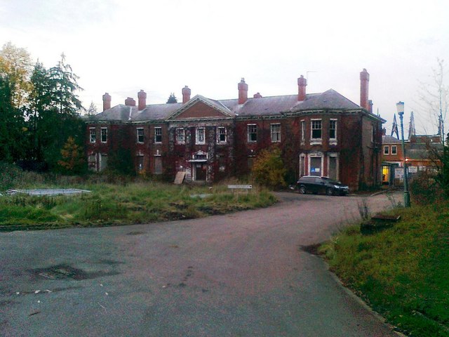
Manor Hospital, Epsom

The Manor Hospital, formerly The Manor Asylum and The Manor Certified Institution was a mental handicap and psychiatric hospital in Horton, near Epsom...

West Park Hospital, Epsom

West Park Hospital (sometimes erroneously referred to as West Park Asylum) was a large psychiatric hospital in Epsom, Surrey. == History == === Origins... ===

Kingswood House School

Kingswood House School is a private school in Epsom, Surrey in the United Kingdom. It was founded in 1899 and moved to its present site in West Hill in...

Related Videos

Epsom Town Centre Street View, UK, England 🇬🇧, 4K HDR

DATE RECORDED - 23 August 2022 LOCATION - https://goo.gl/maps/Y6cUN42KNvSRDEfp7 #Surrey #UK #England ...

⁴ᴷ EPSOM Walking Tour, Surrey ENGLAND 🇬🇧 GB

It is warm Friday afternoon, 13th of August 2021. Let's take a walk together around Epsom Thank you to my father for sharing ...

Nearby Amenities

Located within 500m of 51.331911,-0.29216898
Crossing: no
Lat/Long: 51.331839/-0.2863452
Bus Stop
Wells Estate Shops
Naptan AtcoCode: 40004406021A
Naptan Bearing: SE
Naptan CommonName: Wells Estate Shops
Naptan Indicator: Just after
Naptan Landmark: Wells Estate Shops
Naptan NaptanCode: surajmdj
Naptan Street: The Greenway
Naptan Verified: no
Public Transport: platform
Source: naptan_import
Lat/Long: 51.3280562/-0.288536
Bus Stop
Wells Estate Shops
Naptan AtcoCode: 40004406021B
Naptan Bearing: NE
Naptan CommonName: Wells Estate Shops
Naptan Indicator: Opp
Naptan Landmark: Wells Estate Shops
Naptan NaptanCode: surajmdm
Naptan Street: Wells Road
Naptan Verified: no
Public Transport: platform
Source: naptan_import
Lat/Long: 51.3283733/-0.2887525
Bus Stop
Christ Church
Naptan AtcoCode: 40004406030B
Naptan Bearing: W
Naptan CommonName: Christ Church
Naptan Indicator: O/s
Naptan Landmark: Christ Church
Naptan NaptanCode: surajmgj
Naptan Street: Christ Church Road
Naptan Verified: no
Public Transport: platform
Source: naptan_import
Lat/Long: 51.3352811/-0.2876751
Crossing
Lat/Long: 51.3354881/-0.2910481
Crossing
Lat/Long: 51.3355524/-0.2912203
Crossing
Lat/Long: 51.335625/-0.2905299
Barrier: swing_gate
Lat/Long: 51.3275748/-0.2909852
Bench
Lat/Long: 51.3346463/-0.2906981
Bench
Lat/Long: 51.3325331/-0.2886462
Bench
Lat/Long: 51.3340247/-0.2896951
Barrier: cycle_barrier
Lat/Long: 51.333919/-0.2917844
Barrier: cycle_barrier
Lat/Long: 51.333351/-0.2920956
Bench
Lat/Long: 51.332575/-0.2889493
Barrier: cycle_barrier
Lat/Long: 51.3339819/-0.2902152
Bench
Lat/Long: 51.3308556/-0.2924979
Bench
Lat/Long: 51.3336409/-0.2861598
Bench
Lat/Long: 51.3330795/-0.2942065
Barrier: cycle_barrier
Lat/Long: 51.3337932/-0.2903255
Post Box
Collection Times: Mo-Fr 17:45; Sa 10:30
Operator: Royal Mail
Post Box Type: pillar
Ref: KT18 150
Royal Cypher: GR
Royal Cypher Wikidata: Q33102273
Lat/Long: 51.3281284/-0.288653
Crossing
Lat/Long: 51.3356867/-0.2905004
Barrier: bollard
Lat/Long: 51.3354127/-0.2896167
Description: charcoal kiln
Historic: charcoal_pile
Lat/Long: 51.3346885/-0.2965573
The data included in this document is from www.openstreetmap.org. The data is made available under ODbL.

Have you been to Epsom Common?

Leave your review of Epsom Common below (or comments, questions and feedback).