Hammond's Wood

Wood, Forest in Hertfordshire St. Albans

England

Hammond's Wood

Sandridge : "Queens Head" public house Grade II listed - <span class="nowrap"><a title="https://historicengland.org.uk/listing/the-list/list-entry/1102874?section=official-list-entry" rel="nofollow ugc noopener" href="https://historicengland.org.uk/listing/the-list/list-entry/1102874?section=official-list-entry">Link</a><img style="margin-left:2px;" alt="External link" title="External link - shift click to open in new window" src="https://s1.geograph.org.uk/img/external.png" width="10" height="10"/></span>.
Sandridge : "Queens Head" public house Credit: Jim Osley

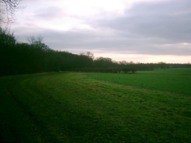
Hammond's Wood is a picturesque woodland located in Hertfordshire, England. Covering an area of approximately 100 hectares, it is a popular destination for nature lovers and outdoor enthusiasts. The wood is situated near the village of Hammond's End, providing a tranquil escape from the bustling city life.

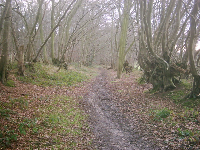
The woodland is predominantly composed of deciduous trees such as oak, beech, and birch, which create a stunning canopy of greenery during the summer months. This diverse ecosystem supports a wide range of flora and fauna, making it an ideal spot for wildlife observation and bird watching. Visitors may spot various species of birds, including woodpeckers, thrushes, and finches.

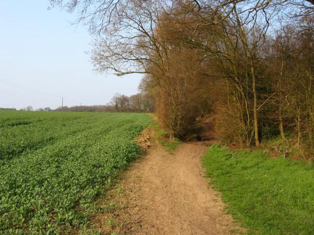
The wood features several well-maintained walking trails that offer visitors the opportunity to explore its natural beauty. These trails wind through the woodland, providing glimpses of enchanting wildflowers, ancient trees, and meandering streams. In addition to walking, Hammond's Wood is a fantastic location for cycling, picnicking, and family outings.

The wood is managed by the local authorities, ensuring the preservation of its natural resources and the protection of its wildlife. Visitors are encouraged to follow the designated paths and respect the environment by disposing of litter appropriately.

Overall, Hammond's Wood offers a peaceful retreat for individuals seeking solace in nature. Its stunning landscapes, diverse flora and fauna, and well-maintained facilities make it a perfect destination for outdoor enthusiasts and those looking to escape the urban hustle and bustle.

If you have any feedback on the listing, please let us know in the comments section below.

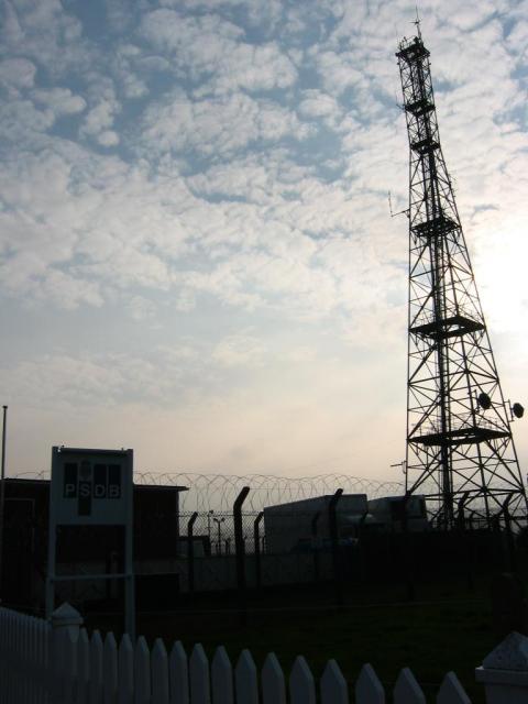
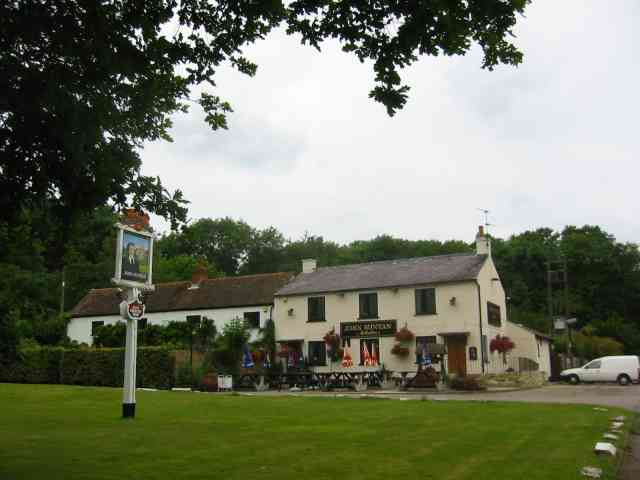
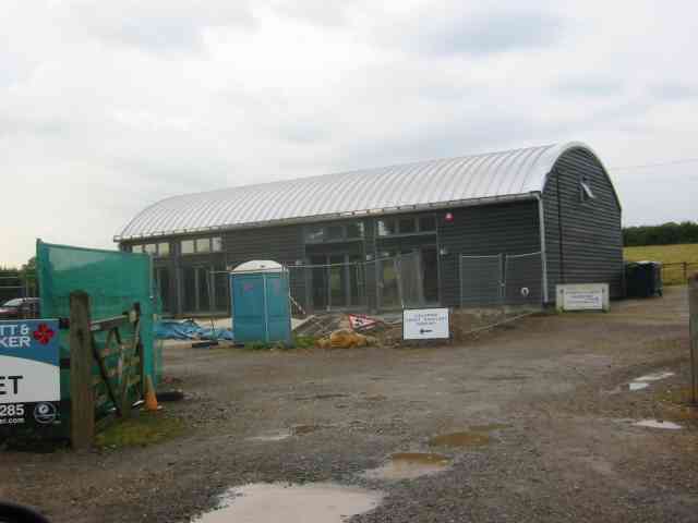
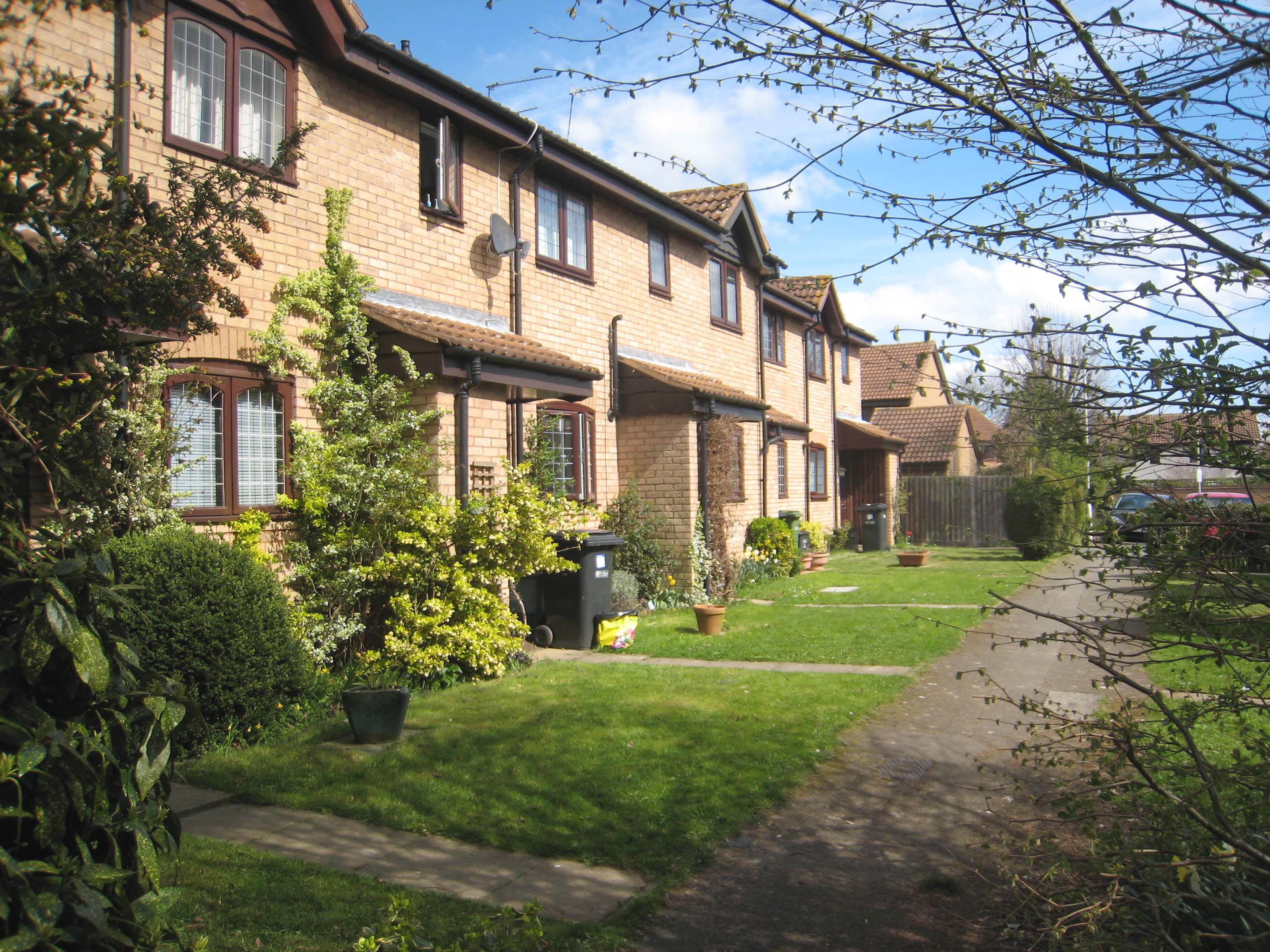
Hammond's Wood Images

Images are sourced within 2km of 51.781765/-0.27533672 or Grid Reference TL1910. Thanks to Geograph Open Source API. All images are credited.

Sandridge : "Queens Head" public house Grade II listed - <span class="nowrap"><a title="https://historicengland.org.uk/listing/the-list/list-entry/1102874?section=official-list-entry" rel="nofollow ugc noopener" href="https://historicengland.org.uk/listing/the-list/list-entry/1102874?section=official-list-entry">Link</a><img style="margin-left:2px;" alt="External link" title="External link - shift click to open in new window" src="https://s1.geograph.org.uk/img/external.png" width="10" height="10"/></span>.
Sandridge : "Queens Head" public house
Grade II listed - LinkExternal link.
Sandridge : Queens Head and flag
Sandridge : Church of St Leonard Grade II* listed church : description at this <span class="nowrap"><a title="https://historicengland.org.uk/listing/the-list/list-entry/1308298?section=official-list-entry" rel="nofollow ugc noopener" href="https://historicengland.org.uk/listing/the-list/list-entry/1308298?section=official-list-entry">Link</a><img style="margin-left:2px;" alt="External link" title="External link - shift click to open in new window" src="https://s1.geograph.org.uk/img/external.png" width="10" height="10"/></span>.
Sandridge : Church of St Leonard
Grade II* listed church : description at this LinkExternal link.
Sandridge : lych-gate to Church of St Leonard "Built 1920, dedicated as a war memorial 1921" - <span class="nowrap"><a title="https://historicengland.org.uk/listing/the-list/list-entry/1102872?section=official-list-entry" rel="nofollow ugc noopener" href="https://historicengland.org.uk/listing/the-list/list-entry/1102872?section=official-list-entry">Link</a><img style="margin-left:2px;" alt="External link" title="External link - shift click to open in new window" src="https://s1.geograph.org.uk/img/external.png" width="10" height="10"/></span>.
Sandridge : lych-gate to Church of St Leonard
"Built 1920, dedicated as a war memorial 1921" - LinkExternal link.
Open land near Long Grove Plantation The photograph is taken just south of Upper Cromer Hyde Farm looking south towards long grove plantation. The plantation straddles TL2012 and TL2011
Open land near Long Grove Plantation
The photograph is taken just south of Upper Cromer Hyde Farm looking south towards long grove plantation. The plantation straddles TL2012 and TL2011
Old Road in Long Grove Plantation This wide footpath runs south from near Upper Cromer Hyde Farm to Symondshyde Farm. This section is wide with evidence of ditches and banks topped with laid hedges. It appears to have been a maintained as a road or track. As the path leaves the plantation it narrows and becomes a narrow footpath.
Old Road in Long Grove Plantation
This wide footpath runs south from near Upper Cromer Hyde Farm to Symondshyde Farm. This section is wide with evidence of ditches and banks topped with laid hedges. It appears to have been a maintained as a road or track. As the path leaves the plantation it narrows and becomes a narrow footpath.
Old laid hedge in Long Grove Plantation This is taken on the footpath/old road from Upper Cromer Hyde Farm to Symondshyde Farm in Long Grove Plantation. The photograph seems to show evidence of a very old laid hedge alongside the path. There are similar remains on both sides of the path.
Old laid hedge in Long Grove Plantation
This is taken on the footpath/old road from Upper Cromer Hyde Farm to Symondshyde Farm in Long Grove Plantation. The photograph seems to show evidence of a very old laid hedge alongside the path. There are similar remains on both sides of the path.
Derelict Cottage This ruined building lies at a kink in the farm track which runs from Symondshyde Farm to Whitegate Cottages on the road from Welwyn Garden City to St Albans. The building is not very old probably originating in WW2. On the horizon is the chimney of what was the Roche Product factory.
Derelict Cottage
This ruined building lies at a kink in the farm track which runs from Symondshyde Farm to Whitegate Cottages on the road from Welwyn Garden City to St Albans. The building is not very old probably originating in WW2. On the horizon is the chimney of what was the Roche Product factory.
Conveyor Belt Conveyor belt from the pit near Green Lanes by Coopers Green Lane
Conveyor Belt
Conveyor belt from the pit near Green Lanes by Coopers Green Lane
St Leonard's church, Sandridge Looking East from TL171106 to St Leonard's church (with a steeple).
St Leonard's church, Sandridge
Looking East from TL171106 to St Leonard's church (with a steeple).
Signal mast Looking E to the signal mast at TL184103.
Signal mast
Looking E to the signal mast at TL184103.
Signal mast and razor wire Looking almost straight into the sun from TL185104 at the signal mast on the road coming east out of Sandridge.
No normal phone mast this; the thing's ringed with two layers of razor wire fence and has a sign at the entrance with a royal coat of arms on it. Photo notes: for better results take photo in morning, not afternoon like I did - the mast's partially obscured by trees from the west, so better to be east of it with the sun behind you.
Signal mast and razor wire
Looking almost straight into the sun from TL185104 at the signal mast on the road coming east out of Sandridge. No normal phone mast this; the thing's ringed with two layers of razor wire fence and has a sign at the entrance with a royal coat of arms on it. Photo notes: for better results take photo in morning, not afternoon like I did - the mast's partially obscured by trees from the west, so better to be east of it with the sun behind you.
Fork in the path Looking North from TL188105, the path forking right into Symondshyde Great Wood
Fork in the path
Looking North from TL188105, the path forking right into Symondshyde Great Wood
Road through Symondshyde Great Wood Looking East from TL194115 along the road running through Symondshyde Great Wood
Road through Symondshyde Great Wood
Looking East from TL194115 along the road running through Symondshyde Great Wood
Picnic area, Symonshyde Great Wood Taken looking West from the road at TL199107, toward the entrance of what might win a prize for being Britain's Least Welcoming Picnic Area.
Picnic area, Symonshyde Great Wood
Taken looking West from the road at TL199107, toward the entrance of what might win a prize for being Britain's Least Welcoming Picnic Area.
Coleman Green This is the John Bunyan pub
Coleman Green
This is the John Bunyan pub
Ramp into tunnel under the road called Woodcockhill There is evidence of sand pit workings on both sides of the road.The trees in the distance are in Symondshydes Great Wood
Ramp into tunnel under the road called Woodcockhill
There is evidence of sand pit workings on both sides of the road.The trees in the distance are in Symondshydes Great Wood
New Dutch Barn workshops Fairfolds Farm This is obviously a farm refurbished as business premises
New Dutch Barn workshops Fairfolds Farm
This is obviously a farm refurbished as business premises
Show me another place!

Hammond's Wood is located at Grid Ref: TL1910 (Lat: 51.781765, Lng: -0.27533672)

Administrative County: Hertfordshire

District: St. Albans

Police Authority: Hertfordshire

What 3 Words

///adopt.jokes.hears. Near Wheathampstead, Hertfordshire

Related Wikis

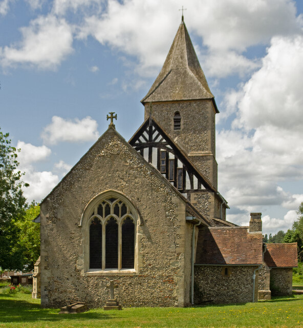
St Leonard's Church, Sandridge

St Leonard's Church is in Sandridge, a village in Hertfordshire, England. It is an active Anglican parish church. The building is Grade II* listed: notable...

Sandridge

Sandridge is a village and civil parish between the city centre of St Albans (2.5 miles (4.0 km) to the south-west) and Wheathampstead in Hertfordshire...
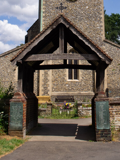
Sandridge Lychgate

Sandridge Lychgate is a war memorial in the village of Sandridge, Hertfordshire, England. The timber lychgate with its flanking walls is listed Grade II...

Jersey Farm

Jersey Farm is a residential neighbourhood in the civil parish of Sandridge centred 1.5 miles (2.4 km) north-east of the city centre of St Albans. It is...

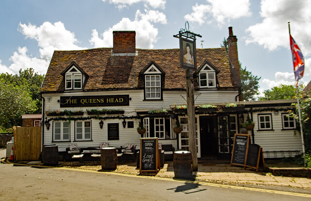
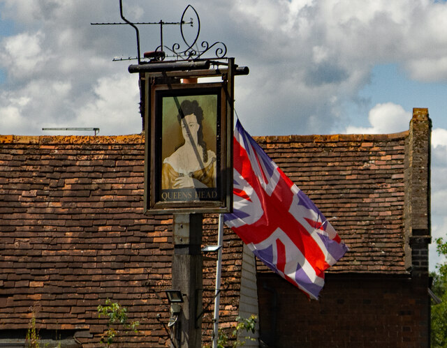
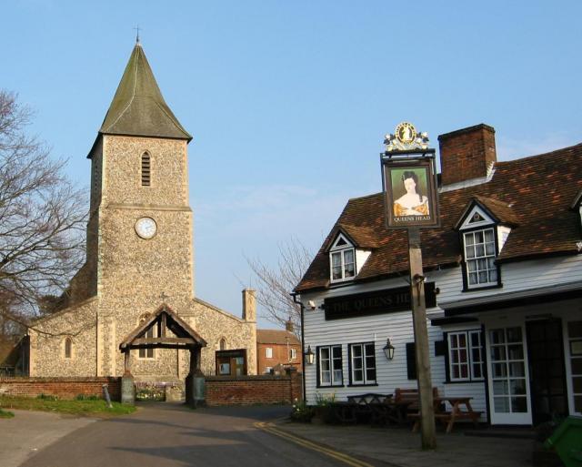
The Queen's Head, Sandridge

The Queens Head is a public house in the village of Sandridge to the north of St Albans, Hertfordshire, England. The timber framed building is weather...

Sandridge Rovers F.C.

Sandridge Rovers Football Club is an English football club based in Sandridge, Hertfordshire. They currently compete in the Herts County League Premier...

Hatfield Aerodrome

Hatfield Aerodrome (IATA: HTF, ICAO: EGTH) was a private airfield and aircraft factory located in the English town of Hatfield in Hertfordshire from 1930...

Sandringham School

Sandringham School is a secondary school with academy status in Marshalswick, St Albans, Hertfordshire. It was established in 1988 following a merger of...

Nearby Amenities

Located within 500m of 51.781765,-0.27533672
Power: pole
Lat/Long: 51.7849255/-0.2748157
Power: pole
Lat/Long: 51.7846707/-0.2759465
Power: pole
Lat/Long: 51.7859166/-0.2760431
Power: pole
Lat/Long: 51.7835542/-0.275852
Power: pole
Lat/Long: 51.7827899/-0.276313
Power: pole
Lat/Long: 51.7818595/-0.2768775
Power: pole
Lat/Long: 51.7795489/-0.2782888
Material: wood
Power: pole
Lat/Long: 51.7777434/-0.2784653
Material: wood
Power: pole
Lat/Long: 51.777413/-0.2771802
Barrier: entrance
Lat/Long: 51.7830154/-0.2803413
Power: pole
Lat/Long: 51.7807009/-0.2775852
Power: pole
Lat/Long: 51.7851308/-0.2739085
Power: pole
Lat/Long: 51.7784511/-0.2789611
The data included in this document is from www.openstreetmap.org. The data is made available under ODbL.

Have you been to Hammond's Wood?

Leave your review of Hammond's Wood below (or comments, questions and feedback).