South Wood

Wood, Forest in Sussex Horsham

England

South Wood

Road Junction near Wimland Farm, Faygate, West Sussex All narrow (single track) roads. The sign was a bit dilapidated - the central limb (to Faygate) was missing.
Road Junction near Wimland Farm, Faygate, West Sussex Credit: Pete Chapman

South Wood, Sussex is a picturesque forest located in the southern part of Sussex County, England. Covering an area of approximately 10 square kilometers, this woodland is known for its stunning natural beauty and diverse range of flora and fauna.

The forest is characterized by its dense canopy of tall, ancient trees, primarily consisting of oak, ash, and beech. These trees provide a habitat for a variety of wildlife, including deer, foxes, badgers, and a wide array of bird species. Walking through the forest, visitors can often catch glimpses of these animals in their natural habitat, adding to the enchanting atmosphere of South Wood.

The forest is crisscrossed by a network of well-maintained trails, making it a popular destination for hikers, nature enthusiasts, and families looking for a tranquil escape from the hustle and bustle of everyday life. These trails offer different levels of difficulty, catering to both casual strollers and more experienced hikers.

In addition to its natural beauty, South Wood also boasts a rich history. It is believed that the forest has been in existence for centuries, with evidence of human habitation dating back to the Iron Age. Remnants of ancient settlements, such as burial mounds and earthworks, can still be found scattered throughout the woodland, offering a glimpse into the region's past.

Overall, South Wood, Sussex is a captivating destination that combines natural splendor, an abundance of wildlife, and a fascinating history. It offers visitors a chance to immerse themselves in the tranquility of nature while exploring the rich heritage of the area.

If you have any feedback on the listing, please let us know in the comments section below.
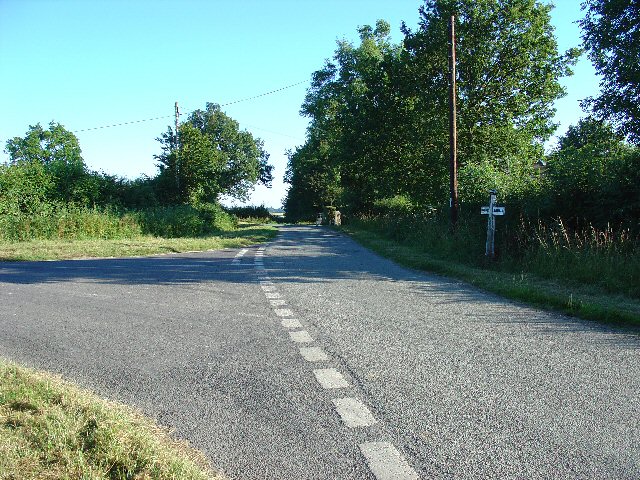
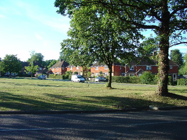
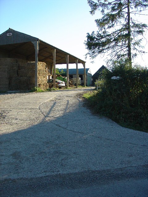
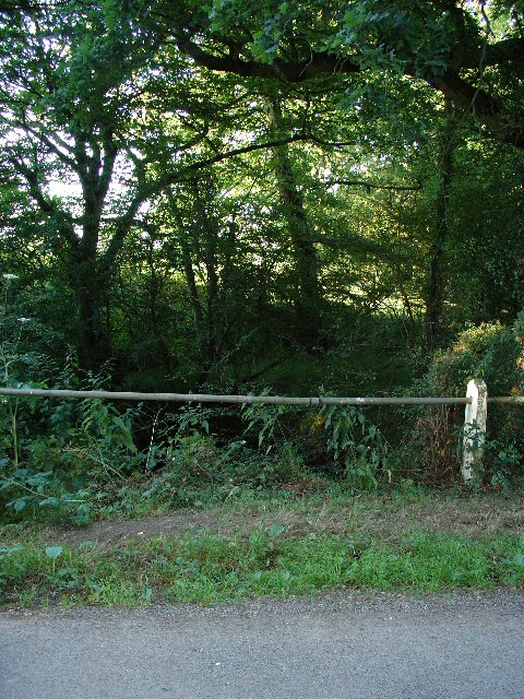
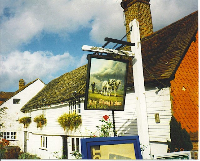
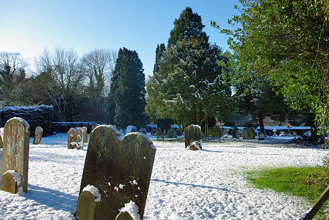
South Wood Images

Images are sourced within 2km of 51.110541/-0.30052754 or Grid Reference TQ1935. Thanks to Geograph Open Source API. All images are credited.

Road Junction near Wimland Farm, Faygate, West Sussex All narrow (single track) roads. The sign was a bit dilapidated - the central limb (to Faygate) was missing.
Road Junction near Wimland Farm, Faygate, West Sussex
All narrow (single track) roads. The sign was a bit dilapidated - the central limb (to Faygate) was missing.
Houses at Gardeners Green, Rusper, West Sussex On the outskirts of the village of Rusper. This is a private estate of houses. This is an example of ribbon development along the existing rural roads. Viewed from Horsham Road looking N.
Houses at Gardeners Green, Rusper, West Sussex
On the outskirts of the village of Rusper. This is a private estate of houses. This is an example of ribbon development along the existing rural roads. Viewed from Horsham Road looking N.
Barn at Coombers Farm, Faygate, West Sussex Many of the farms marked on the map in this area have now become solely residential properties, with no indication of any farming activity. Coombers Farm, however, has this sturdy (and used) modern style barn.
Barn at Coombers Farm, Faygate, West Sussex
Many of the farms marked on the map in this area have now become solely residential properties, with no indication of any farming activity. Coombers Farm, however, has this sturdy (and used) modern style barn.
Tributary of River Mole, Near Coombers Farm, Faygate, West Sussex. The River Mole is one of the main rivers in the area. This is a very young tributary. The stream runs through a narrow strip of trees for around 2km at this point. See the River Mole again in grid square TQ2337.
Tributary of River Mole, Near Coombers Farm, Faygate, West Sussex.
The River Mole is one of the main rivers in the area. This is a very young tributary. The stream runs through a narrow strip of trees for around 2km at this point. See the River Mole again in grid square TQ2337.
The Plough Inn, Rusper. A fine, old, weather-boarded village pub.
The Plough Inn, Rusper.
A fine, old, weather-boarded village pub.
A snowy Rusper churchyard It is surprising that this photogenic and accessible village has so few geographs.
A snowy Rusper churchyard
It is surprising that this photogenic and accessible village has so few geographs.
Winter Wimlands Lane This lane runs along a ridge caused by harder strata in the Weald Clay.
Winter Wimlands Lane
This lane runs along a ridge caused by harder strata in the Weald Clay.
Enigmatic premises The sign warns of demolition, but this seems unlikely. The woodland, Rusper Copse, seems too small to support a forestry enterprise.
Enigmatic premises
The sign warns of demolition, but this seems unlikely. The woodland, Rusper Copse, seems too small to support a forestry enterprise.
Gardeners Green, Rusper The last residential development in Rusper, going towards Horsham.
Gardeners Green, Rusper
The last residential development in Rusper, going towards Horsham.
Horsham Road, Rusper Attractive tile-hung cottages near the centre of Rusper village.
Horsham Road, Rusper
Attractive tile-hung cottages near the centre of Rusper village.
Rusper, West Sussex Village scene with horse riders passing one of the village pubs, The Star Inn.
Rusper, West Sussex
Village scene with horse riders passing one of the village pubs, The Star Inn.
Pond at Baldhorns Park Farm with small reservoir just below the source of the River Mole at Rusper.
Pond at Baldhorns Park
Farm with small reservoir just below the source of the River Mole at Rusper.
Footbridge over the River Mole Substantial wooden bridge taking the bridleway over a very narrow River Mole near Rusper.
Footbridge over the River Mole
Substantial wooden bridge taking the bridleway over a very narrow River Mole near Rusper.
Bridleway near Baldhorns Park Wide bridleway which has dried out after two dry weeks in the Weald. Hawthorn is flowering in the hedgerow.
Bridleway near Baldhorns Park
Wide bridleway which has dried out after two dry weeks in the Weald. Hawthorn is flowering in the hedgerow.
Eye-catching, Baldhorns Park Unusual mirror sculpture with super reflections of surrounding vegetation.
Eye-catching, Baldhorns Park
Unusual mirror sculpture with super reflections of surrounding vegetation.
Ponds at Baldhorns Park Spring sunshine on the landscaped ponds at Baldhorns Park in the Weald south of Rusper.
Ponds at Baldhorns Park
Spring sunshine on the landscaped ponds at Baldhorns Park in the Weald south of Rusper.
River Mole at Baldhorns Park Arcadian scene on the Mole about 1 mile below its source at Rusper.
River Mole at Baldhorns Park
Arcadian scene on the Mole about 1 mile below its source at Rusper.
Baldhorns Park Farm Wealden farm near the source of the River Mole at Rusper.
Baldhorns Park Farm
Wealden farm near the source of the River Mole at Rusper.
Show me another place!

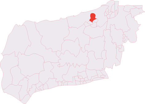
South Wood is located at Grid Ref: TQ1935 (Lat: 51.110541, Lng: -0.30052754)

Administrative County: West Sussex

District: Horsham

Police Authority: Sussex

What 3 Words

///thousands.chatters.fastening. Near Warnham, West Sussex

Related Wikis

Warnham SSSI

Warnham SSSI is a 28.5-hectare (70-acre) geological Site of Special Scientific Interest north of Horsham in West Sussex. It is a Geological Conservation...

Rusper

Rusper is a village and civil parish in the Horsham District of West Sussex, England. It lies 4.1 miles (6.6 km) north of the town of Horsham and 4.2 miles...

Bohunt Horsham

Bohunt Horsham is a coeducational all-through school located in Horsham, West Sussex, England. The school opened to 120 students in Year 7 in 2019 in temporary...

Holbrook (electoral division)

Holbrook is an electoral division of West Sussex in the United Kingdom and returns one member to sit on West Sussex County Council. The current County...

Graylands

Graylands is a hamlet in the Horsham district of West Sussex, England. The largely rural hamlet is located north of Holbrook beyond the A264. It is bordered...

Old Holbrook

Old Holbrook (formerly known as Northlands) is a hamlet in the Horsham district of West Sussex, England. This rural hamlet is located north of the Horsham...

Shiremark Mill, Capel

Shiremark Mill, also known as Kingsfold Mill or Capel Mill was a listed Smock mill at Capel, Surrey, England, which was burnt down in 1972. == History... ==

Lambs Green

Lambs Green is a hamlet in the civil parish of Rusper and the Horsham District of West Sussex, England. It lies on the Rusper to Ifield road 3.1 miles...

Nearby Amenities

Located within 500m of 51.110541,-0.30052754
Horsham Road
Naptan AtcoCode: 4400HR0584
Naptan Bearing: W
Naptan BusStopType: CUS
Naptan CommonName: Horsham Road
Naptan Indicator: HAR
Naptan Landmark: Hail & Ride
Naptan NaptanCode: wsxdtmpd
Naptan Street: Horsham Lane
Naptan Verified: no
Source: naptan_import
Lat/Long: 51.1115091/-0.2938371
Barrier: entrance
Lat/Long: 51.1077224/-0.2968334
Nunnery Farm
Place: farm
Lat/Long: 51.1136498/-0.3036692
The Nunnery
Place: isolated_dwelling
Lat/Long: 51.114472/-0.3010887
Curtis Farm
Place: farm
Lat/Long: 51.1092034/-0.3032519
Turning Circle
Lat/Long: 51.1140814/-0.3008595
Fountain
Lat/Long: 51.114096/-0.3002488
Power: pole
Lat/Long: 51.1089196/-0.3068817
Power: pole
Lat/Long: 51.108815/-0.3061521
Power: pole
Lat/Long: 51.1087022/-0.3053912
Power: pole
Lat/Long: 51.1085911/-0.3046608
Nelsons Farm
Place: farm
Lat/Long: 51.1091091/-0.2949675
The data included in this document is from www.openstreetmap.org. The data is made available under ODbL.

Have you been to South Wood?

Leave your review of South Wood below (or comments, questions and feedback).