The Wells

Settlement in Surrey Epsom and Ewell

England

The Wells

Very muddy path on Ashtead Common
Very muddy path on Ashtead Common Credit: David Martin

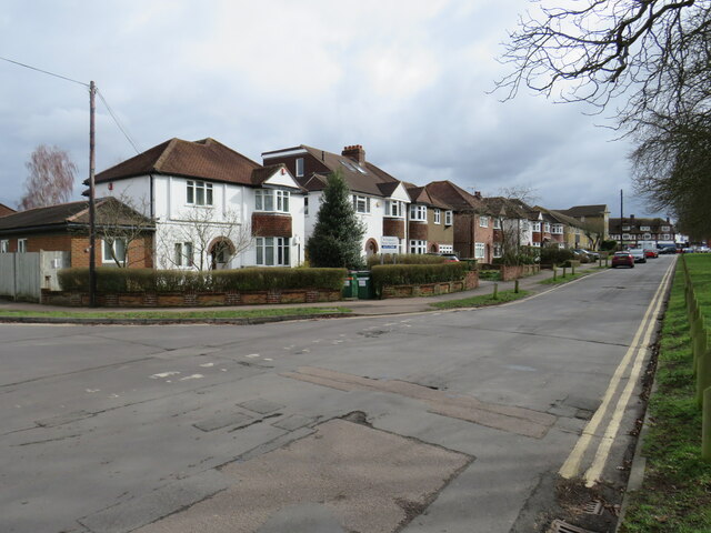
The Wells is a picturesque village located in the borough of Surrey, England. Situated in the southeastern part of the country, it is nestled amidst the stunning landscape of the Surrey Hills Area of Outstanding Natural Beauty. The village is renowned for its tranquil atmosphere, traditional charm, and rich historical heritage.

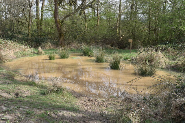
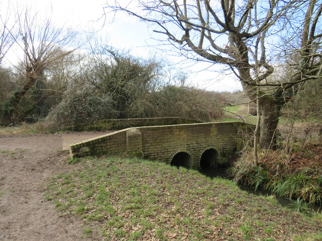
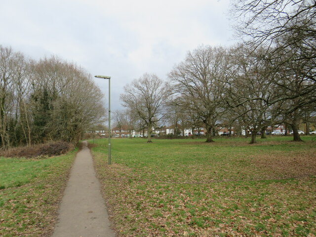
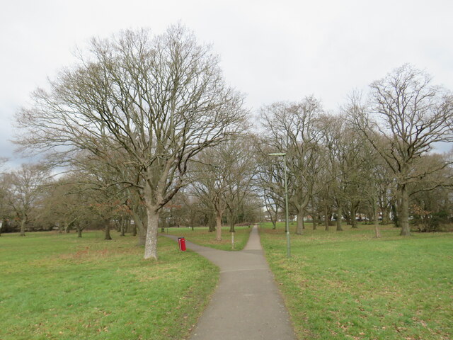
One of the most notable features of The Wells is its close proximity to the River Mole, which meanders through the village, adding to its idyllic setting. The river not only provides a beautiful backdrop for leisurely walks and picnics, but it also offers recreational activities such as fishing and boating.

The architecture in The Wells is predominantly traditional English, with a mix of charming cottages and grand houses. The village center is home to a variety of local amenities, including a few quaint shops, a post office, and a village hall. Additionally, there is a well-regarded primary school that serves the local community.

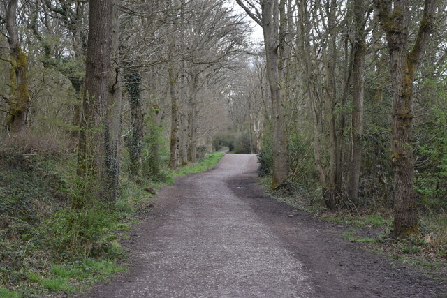
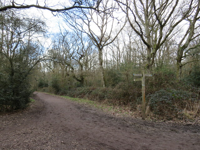
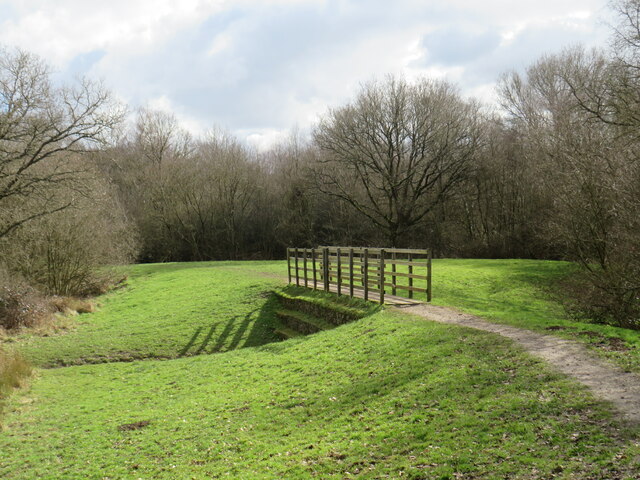
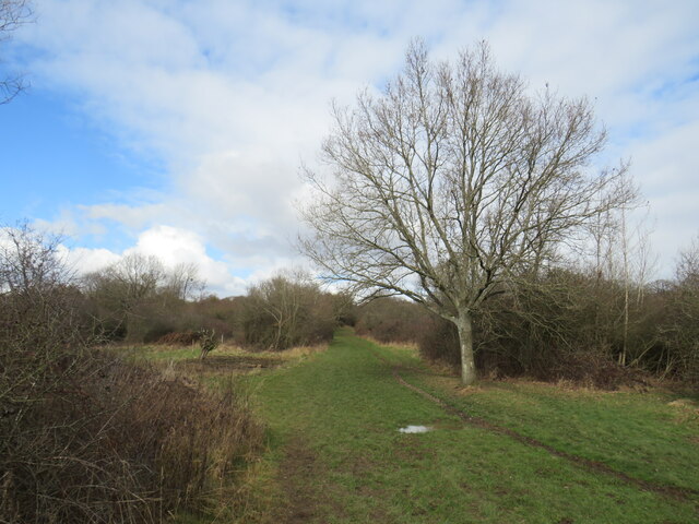
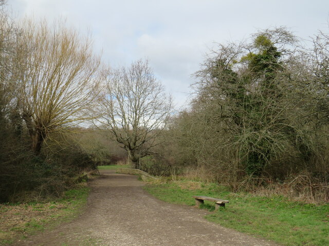
The surrounding countryside of The Wells offers a wealth of opportunities for outdoor enthusiasts. The area is crisscrossed with walking and cycling trails, allowing visitors to explore the stunning natural beauty of the Surrey Hills. The nearby Box Hill, a famous viewpoint and National Trust property, offers breathtaking vistas of the surrounding landscape.

Overall, The Wells is a delightful village that offers a peaceful retreat from the hustle and bustle of city life. Its natural beauty, rich history, and community spirit make it an appealing destination for both residents and visitors seeking a slice of rural English charm.

If you have any feedback on the listing, please let us know in the comments section below.

The Wells Images

Images are sourced within 2km of 51.328182/-0.288874 or Grid Reference TQ1960. Thanks to Geograph Open Source API. All images are credited.

Very muddy path on Ashtead Common
Shaun's Puddle A small pond created in 2016 to aid with drainage of a very muddy area.
Shaun's Puddle
A small pond created in 2016 to aid with drainage of a very muddy area.
Cycle route along the edge of Newton Wood
Path near Ashtead A path leading onto Ashtead Common, in Surrey.

This image was taken during the month of February.  Trees were bare for the winter season.
Path near Ashtead
A path leading onto Ashtead Common, in Surrey. This image was taken during the month of February. Trees were bare for the winter season.
Path over The Rye Brook on Ashtead Common A path on Ashtead Common, crossing The Rye Brook, which flows beneath through a duct.

This image was taken during the month of February.  Trees were bare for the winter season.
Path over The Rye Brook on Ashtead Common
A path on Ashtead Common, crossing The Rye Brook, which flows beneath through a duct. This image was taken during the month of February. Trees were bare for the winter season.
Path on Ashtead Common A path on Ashtead Common in Surrey.  The path is a public bridleway.

This image was taken in the month of February.  Trees were bare for the winter season.
Path on Ashtead Common
A path on Ashtead Common in Surrey. The path is a public bridleway. This image was taken in the month of February. Trees were bare for the winter season.
Bridge over The Rye Brook, Ashtead Common A bridge taking a bridleway over The Rye Brook on Ashtead Common, in Surrey.

This image was taken in the month of February.  Trees were bare for the winter season.
Bridge over The Rye Brook, Ashtead Common
A bridge taking a bridleway over The Rye Brook on Ashtead Common, in Surrey. This image was taken in the month of February. Trees were bare for the winter season.
Track onto Ashtead Common A track leading onto Ashtead Common in Surrey.  The track is a public right of way as a bridleway.

This image was taken in the month of February.  Trees were bare for the winter season.
Track onto Ashtead Common
A track leading onto Ashtead Common in Surrey. The track is a public right of way as a bridleway. This image was taken in the month of February. Trees were bare for the winter season.
Level crossing at Ashtead A level crossing at Ashtead in Surrey.  Cars and pedestrians wait as a train passes through.

This image was taken in the month of February.  Trees were bare for the winter season.
Level crossing at Ashtead
A level crossing at Ashtead in Surrey. Cars and pedestrians wait as a train passes through. This image was taken in the month of February. Trees were bare for the winter season.
Woodfield Lane, Ashtead Woodfield Lane is a residential road in the village of Ashtead in Surrey.
Woodfield Lane, Ashtead
Woodfield Lane is a residential road in the village of Ashtead in Surrey.
Path on Wood Field, Ashtead A path across Wood Field in the village of Ashtead in Surrey.

This image was taken in the month of February.  Trees were bare for the winter season.
Path on Wood Field, Ashtead
A path across Wood Field in the village of Ashtead in Surrey. This image was taken in the month of February. Trees were bare for the winter season.
Paths on Wood Field, Ashtead Footpaths across Wood Field in the village of Ashtead in Surrey.

This image was taken in the month of February.  Trees were bare for the winter season.
Paths on Wood Field, Ashtead
Footpaths across Wood Field in the village of Ashtead in Surrey. This image was taken in the month of February. Trees were bare for the winter season.
Level crossing at Ashtead A level crossing taking a railway across the road in the village of Ashtead in Surrey.

This image was taken in the month of February.  Trees were bare for the winter season.
Level crossing at Ashtead
A level crossing taking a railway across the road in the village of Ashtead in Surrey. This image was taken in the month of February. Trees were bare for the winter season.
Overdale, Ashtead Overdale is a residential road in the village of Ashtead in Surrey.
Overdale, Ashtead
Overdale is a residential road in the village of Ashtead in Surrey.
Bridleway on Ashtead Common A public bridleway leading onto Ashtead Common, in Surrey.

This image was taken on a February day.  Trees were bare for the winter season.
Bridleway on Ashtead Common
A public bridleway leading onto Ashtead Common, in Surrey. This image was taken on a February day. Trees were bare for the winter season.
Paths diverge on Ashtead Common Paths diverging on Ashtead Common.

Both are public rights of way.  The path to the left is a footpath while the path on the right is a bridleway, open to horse riders and cyclists as well as walkers.

This image was taken in the month of February.  Trees were bare for the winter season.
Paths diverge on Ashtead Common
Paths diverging on Ashtead Common. Both are public rights of way. The path to the left is a footpath while the path on the right is a bridleway, open to horse riders and cyclists as well as walkers. This image was taken in the month of February. Trees were bare for the winter season.
Paths join in woods near Ashtead A junction of footpaths in woodland on Ashtead Common, in Surrey.

This image was taken in the month of February.  Trees were bare for the winter season.
Paths join in woods near Ashtead
A junction of footpaths in woodland on Ashtead Common, in Surrey. This image was taken in the month of February. Trees were bare for the winter season.
Ashtead Common A clearing in woodland on Ashtead Common, in Surrey.  A footpath leads into the woods to the left.

This image was taken in the month of February.  Trees were bare for the winter season.
Ashtead Common
A clearing in woodland on Ashtead Common, in Surrey. A footpath leads into the woods to the left. This image was taken in the month of February. Trees were bare for the winter season.
Show me another place!

The Wells is located at Grid Ref: TQ1960 (Lat: 51.328182, Lng: -0.288874)

Administrative County: Surrey

District: Epsom and Ewell

Police Authority: Surrey

What 3 Words

///sulk.face.hopes. Near Epsom, Surrey

Related Wikis

Epsom Common

Epsom Common is a 177.4-hectare (438-acre) Local Nature Reserve in Epsom, Surrey, England. It is owned and managed by Epsom and Ewell Borough Council...

Rosebery School for Girls

Rosebery School is an all-girls school located in Epsom, Surrey. It consists of a lower school for those aged between 11 and 16, and a sixth form for those...

Kingswood House School

Kingswood House School is a private school in Epsom, Surrey in the United Kingdom. It was founded in 1899 and moved to its present site in West Hill in...
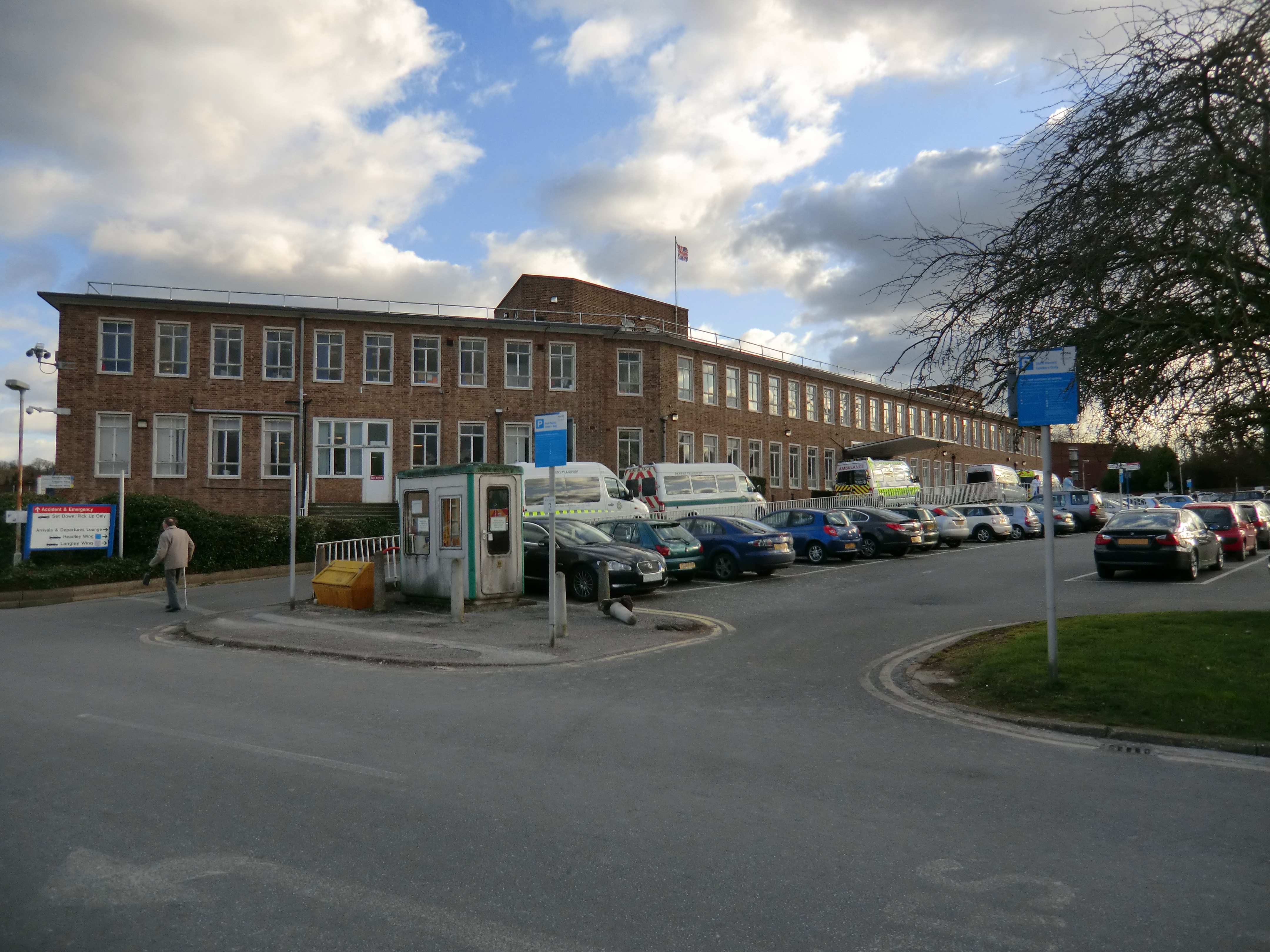
Epsom Hospital

Epsom Hospital is a teaching hospital in Epsom, Surrey, England. The hospital is situated on Dorking Road 1 kilometre (0.62 mi) south east of the centre...

Nearby Amenities

Located within 500m of 51.328182,-0.288874
Turning Circle
Lat/Long: 51.3273774/-0.2922225
Turning Circle
Lat/Long: 51.3270014/-0.2902552
Site of original Epsom Salts well
Tourism: attraction
Lat/Long: 51.3270878/-0.2902488
Crossing: no
Lat/Long: 51.331839/-0.2863452
Post Box
Collection Times: Mo-Fr 09:00; Sa 07:00
Operator: Royal Mail
Post Box Mounting: pier
Post Box Type: lamp
Ref: KT18 128D
Royal Cypher: EIIR
Royal Cypher Wikidata: Q33102113
Lat/Long: 51.325676/-0.2855515
Bus Stop
Woodlands Road
Naptan AtcoCode: 40004406020A
Naptan Bearing: S
Naptan CommonName: Woodlands Road
Naptan Indicator: Opp
Naptan Landmark: Woodlands Road
Naptan NaptanCode: surajmda
Naptan Street: Wells Road
Naptan Verified: no
Public Transport: platform
Source: naptan_import
Lat/Long: 51.3252006/-0.2848019
Bus Stop
Woodlands Road
Naptan AtcoCode: 40004406020B
Naptan Bearing: NW
Naptan CommonName: Woodlands Road
Naptan Indicator: adj
Naptan Landmark: Woodlands Road
Naptan NaptanCode: surajmdg
Naptan Street: Wells Road
Naptan Verified: no
Public Transport: platform
Source: naptan_import
Lat/Long: 51.3259633/-0.285744
Bus Stop
Wells Estate Shops
Naptan AtcoCode: 40004406021A
Naptan Bearing: SE
Naptan CommonName: Wells Estate Shops
Naptan Indicator: Just after
Naptan Landmark: Wells Estate Shops
Naptan NaptanCode: surajmdj
Naptan Street: The Greenway
Naptan Verified: no
Public Transport: platform
Source: naptan_import
Lat/Long: 51.3280562/-0.288536
Bus Stop
Wells Estate Shops
Naptan AtcoCode: 40004406021B
Naptan Bearing: NE
Naptan CommonName: Wells Estate Shops
Naptan Indicator: Opp
Naptan Landmark: Wells Estate Shops
Naptan NaptanCode: surajmdm
Naptan Street: Wells Road
Naptan Verified: no
Public Transport: platform
Source: naptan_import
Lat/Long: 51.3283733/-0.2887525
Bus Stop
The Greenway
Naptan AtcoCode: 40004406022A
Naptan Bearing: SW
Naptan CommonName: The Greenway
Naptan Indicator: O/s 65
Naptan Landmark: The Greenway
Naptan NaptanCode: surajmdp
Naptan Street: The Greenway
Naptan Verified: no
Public Transport: platform
Source: naptan_import
Lat/Long: 51.3257409/-0.2886281
Bus Stop
The Crescent
Naptan AtcoCode: 40004406023A
Naptan Bearing: SE
Naptan CommonName: The Crescent
Naptan Indicator: On
Naptan Landmark: The Crescent
Naptan NaptanCode: surajmdt
Naptan Street: The Crescent
Naptan Verified: no
Public Transport: platform
Source: naptan_import
Lat/Long: 51.3264951/-0.2916293
Map board
Tourism: information
Lat/Long: 51.3240161/-0.2904756
Barrier: swing_gate
Lat/Long: 51.3275748/-0.2909852
Ford: yes
Lat/Long: 51.3252573/-0.2926347
Power: tower
Lat/Long: 51.3248921/-0.2916617
Bench
Lat/Long: 51.3325331/-0.2886462
Bench
Lat/Long: 51.332575/-0.2889493
Bench
Lat/Long: 51.3308556/-0.2924979
Post Box
Collection Times: Mo-Fr 09:00; Sa 07:00
Operator: Royal Mail
Post Box Type: pillar
Ref: KT18 195D
Royal Cypher: GVIR
Royal Cypher Wikidata: Q33102169
Lat/Long: 51.3263102/-0.2926285
Post Box
Collection Times: Mo-Fr 17:45; Sa 10:30
Operator: Royal Mail
Post Box Type: pillar
Ref: KT18 150
Royal Cypher: GR
Royal Cypher Wikidata: Q33102273
Lat/Long: 51.3281284/-0.288653
The Wells
Place: village
Lat/Long: 51.3273608/-0.2909097
Leisure: playground
Lat/Long: 51.3273815/-0.2915911
Historic: yes
Man Made: water_well
Lat/Long: 51.3271439/-0.2902265
Information: history
Tourism: information
Lat/Long: 51.3270627/-0.2902871
Ford: yes
Lat/Long: 51.3251958/-0.2923193
Description: white post, yellow hat with black stripe
Marker: aerial
Utility: oil
Lat/Long: 51.3252938/-0.284887
Colour: yellow
Direction: 60
Marker: post
Material: concrete
Utility: gas
Lat/Long: 51.3252252/-0.2850605
Colour: yellow
Direction: 150
Marker: post
Material: concrete
Utility: gas
Lat/Long: 51.3257545/-0.2853279
Colour: white
Direction: -30
Marker: post
Material: concrete
Utility: oil
Lat/Long: 51.3257879/-0.2853713
The data included in this document is from www.openstreetmap.org. The data is made available under ODbL.

Have you been to The Wells?

Leave your review of The Wells below (or comments, questions and feedback).