North Lake

Lake, Pool, Pond, Freshwater Marsh in Hertfordshire St. Albans

England

North Lake

Rolling farmland Farmland occupies most of the western half of TL1804, partially rape fields, but also a children's open farm called Willow's Farm
Rolling farmland Credit: Mike Hartley

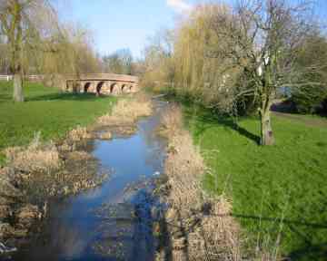
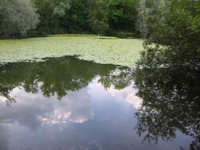
North Lake is a picturesque freshwater body located in Hertfordshire, England. It is nestled within a lush natural landscape, surrounded by rolling hills and dense woodland, creating a serene and tranquil setting for visitors to enjoy.

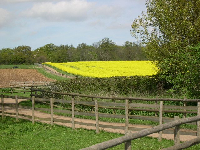
Covering an area of approximately 10 acres, North Lake boasts crystal-clear waters and is renowned for its exceptional water quality. The lake is fed by numerous streams and springs that flow down from the nearby hills, ensuring a constant supply of fresh water. Its depth varies across different sections, ranging from shallow areas where submerged vegetation thrives, to deeper parts suitable for fishing and water sports.

The lake offers a diverse ecosystem, supporting a wide range of flora and fauna. Its shores are lined with a variety of trees and shrubs, providing habitat for numerous bird species, including ducks, swans, and herons. Fish such as carp, pike, and perch can also be found in abundance, attracting fishing enthusiasts from near and far.

Adjacent to the lake, a freshwater marsh further enhances the natural beauty of the area. This marshland is home to a rich diversity of wetland plants, such as reeds, sedges, and water lilies. It acts as a vital habitat for various amphibians, insects, and waterfowl, contributing to the region's biodiversity.

North Lake is a popular destination for outdoor activities. Visitors can partake in fishing, boating, and kayaking, or simply take a leisurely stroll along its tranquil shores. The surrounding area also offers scenic trails, picnic spots, and nature reserves, making it an ideal location for nature lovers and those seeking a peaceful retreat amidst the beauty of Hertfordshire's countryside.

If you have any feedback on the listing, please let us know in the comments section below.
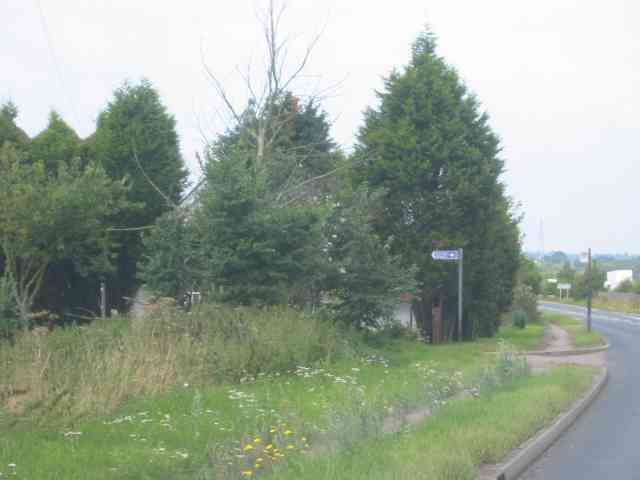
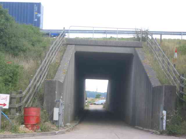
North Lake Images

Images are sourced within 2km of 51.717761/-0.29638997 or Grid Reference TL1703. Thanks to Geograph Open Source API. All images are credited.

Rolling farmland Farmland occupies most of the western half of TL1804, partially rape fields, but also a children's open farm called Willow's Farm
Rolling farmland
Farmland occupies most of the western half of TL1804, partially rape fields, but also a children's open farm called Willow's Farm
Tyttenhanger House This grade 1 listed building, now converted to offices, sits in Tyttenhanger Park, which occupied most of the square
Tyttenhanger House
This grade 1 listed building, now converted to offices, sits in Tyttenhanger Park, which occupied most of the square
Road Bridge at London Colney Three years ago this area was flooded and much damage was caused to buildings.
Road Bridge at London Colney
Three years ago this area was flooded and much damage was caused to buildings.
Pastoral Centre  Broad Colney The complex was once a convent, built in 1899 for an Anglican order. It was sold to the Roman Catholic Diocese of Westminster in the mid-1970s and became a Retreat/Conference/Training Centre with residential accommodation.
Pastoral Centre Broad Colney
The complex was once a convent, built in 1899 for an Anglican order. It was sold to the Roman Catholic Diocese of Westminster in the mid-1970s and became a Retreat/Conference/Training Centre with residential accommodation.
Harperbury Hospital  Herts This was a mental hospital complex but has now been run down to ancillary projects
Harperbury Hospital Herts
This was a mental hospital complex but has now been run down to ancillary projects
Napsbury Hospital London Colney This is now a housing development called the Arboretum  Expensive prices.
Napsbury Hospital London Colney
This is now a housing development called the Arboretum Expensive prices.
Napsbury Hospital London Colney The site is now a housing project, The water tower is being left until last in the hopes that a keen
person with half a million pounds will purchase it
Napsbury Hospital London Colney
The site is now a housing project, The water tower is being left until last in the hopes that a keen person with half a million pounds will purchase it
London Colney Bypass  A1081 What a difference a bypass can make to a town
London Colney Bypass A1081
What a difference a bypass can make to a town
De Havilland aircraft museum Hertfordshire. The wooden framed Mosquito was built at this factory so the museum has a heritage status.
De Havilland aircraft museum Hertfordshire.
The wooden framed Mosquito was built at this factory so the museum has a heritage status.
Salisbury Hall with moat.   near Ridgehill Herts The hall and moat are visible on the map but not the museum.  The building is now converted into apartments.
Salisbury Hall with moat. near Ridgehill Herts
The hall and moat are visible on the map but not the museum. The building is now converted into apartments.
The Cemetery  St Albans Was surprised by the heart shaped balloon flying over that gravestone.
The Cemetery St Albans
Was surprised by the heart shaped balloon flying over that gravestone.
The Cottages at Shenleybury This group of houses was erected for workers at the
adjoining hospital
The Cottages at Shenleybury
This group of houses was erected for workers at the adjoining hospital
Entrance to Salisbury Hall and the Mosquito Museum The house hidden behind the trees was probably the lodge. Despite being a B road this road has a fairly heavy flow.
Entrance to Salisbury Hall and the Mosquito Museum
The house hidden behind the trees was probably the lodge. Despite being a B road this road has a fairly heavy flow.
Tunnel under the M25  opposite Access to Salisbury Hall This photo illustrates the large amount of filling required to keep the gradient to a reasonable angle.
Tunnel under the M25 opposite Access to Salisbury Hall
This photo illustrates the large amount of filling required to keep the gradient to a reasonable angle.
Van in the River Colne This section of the River Colne is a kilometre from a highway but via a locked farm gate and farmtrack this van was deposited by joy riders. The van originated from the remote village of Foulness
Van in the River Colne
This section of the River Colne is a kilometre from a highway but via a locked farm gate and farmtrack this van was deposited by joy riders. The van originated from the remote village of Foulness
Lake at Broad Colney Lakes This one is fed from the main lake which is also the course of the River Colne.
Lake at Broad Colney Lakes
This one is fed from the main lake which is also the course of the River Colne.
Graffiti on M25 Bridge This is a section of an effort which ran out of steam or perhaps ...
Graffiti on M25 Bridge
This is a section of an effort which ran out of steam or perhaps ...
Graffiti on a bridge over M25 or did they have only a small quantity of red spray
Graffiti on a bridge over M25
or did they have only a small quantity of red spray
Show me another place!

North Lake is located at Grid Ref: TL1703 (Lat: 51.717761, Lng: -0.29638997)

Administrative County: Hertfordshire

District: St. Albans

Police Authority: Hertfordshire

What 3 Words

///filled.full.aside. Near Shenley, Hertfordshire

Related Wikis

Fir and Pond Woods

Fir and Pond Woods is a 29 hectare nature reserve in Potters Bar in Hertfordshire. It is managed by the Herts and Middlesex Wildlife Trust. It is two separate...

Broad Colney Lakes

Broad Colney Lakes is an 11 hectare nature reserve previously managed by Herts and Middlesex Wildlife Trust in London Colney in Hertfordshire. It has recently...

All Saints Pastoral Centre

All Saints Pastoral Centre is a complex of buildings at London Colney on the southern outskirts of St Albans, Hertfordshire, England. It was built as a...

London Colney

London Colney () is a village and civil parish in Hertfordshire, England. It is located to the north of London, close to Junction 22 of the M25 motorway...

Arsenal Training Centre

The Arsenal Training Centre, often referred to as its geographical location London Colney in Hertfordshire, is the training ground of Arsenal Football...
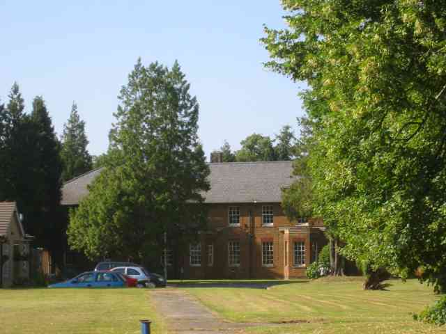
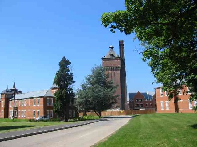
Napsbury Hospital

Napsbury Hospital was a mental health facility near London Colney in Hertfordshire. It had two sister institutions, Harperbury Hospital and Shenley Hospital...
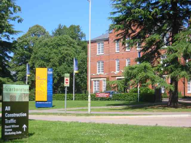
Napsbury Park

Napsbury Park is a residential development in Hertfordshire, England. It is located to the north of London, at Junction 22 of the M25 motorway and Junction...

London Colney F.C.

London Colney Football Club is a football club based in London Colney, near St Albans, England. They are currently members of the Combined Counties League...

Nearby Amenities

Located within 500m of 51.717761,-0.29638997
Created By: YahooApplet 1.0
Lat/Long: 51.7221168/-0.2969566
Traffic Calming: table
Lat/Long: 51.7200946/-0.2963322
Crossing
Crossing: uncontrolled
Crossing Island: no
Crossing Ref: zebra
Tactile Paving: yes
Lat/Long: 51.7200163/-0.2964362
Bus Stop
War Memorial
Bus: yes
Naptan AtcoCode: 210021504760
Naptan Bearing: SE
Naptan CommonName: War Memorial
Naptan Crossing: opp Golden Lion PH
Naptan Indicator: opp
Naptan Landmark: opp Golden Lion PH
Naptan NaptanCode: hrtawmap
Naptan PlusbusZoneRef: RADLETT;STALBCY
Naptan ShortCommonName: NA
Naptan Street: High Street
Naptan Verified: no
Public Transport: platform
Shelter: yes
Source: naptan_import
Lat/Long: 51.721783/-0.2934164
Bus Stop
Walsingham Way
Bus: yes
Naptan AtcoCode: 210021504860
Naptan Bearing: SE
Naptan CommonName: Walsingham Way
Naptan Crossing: opp South Farm Cottages
Naptan Indicator: adj
Naptan Landmark: opp South Farm Cottages
Naptan NaptanCode: hrtawjtp
Naptan PlusbusZoneRef: RADLETT;STALBCY
Naptan ShortCommonName: NA
Naptan Street: Shenley Lane
Naptan Verified: no
Public Transport: platform
Shelter: no
Source: naptan_import
Lat/Long: 51.719364/-0.3019694
Bus Stop
Caledon Road
Bus: yes
Naptan AtcoCode: 210021504880
Naptan Bearing: NE
Naptan CommonName: Caledon Road
Naptan Crossing: Chicken Lane
Naptan Indicator: adj
Naptan Landmark: Chicken Lane
Naptan NaptanCode: hrtawjtw
Naptan PlusbusZoneRef: RADLETT;STALBCY
Naptan ShortCommonName: NA
Naptan Street: St Annes Road
Naptan Verified: no
Public Transport: platform
Shelter: no
Source: naptan_import
Lat/Long: 51.7199413/-0.2965701
Bus Stop
High Street
Bus: yes
Naptan AtcoCode: 210021504890
Naptan Bearing: NE
Naptan CommonName: High Street
Naptan Crossing: opp The White Lion PH
Naptan Indicator: NE-bound
Naptan Landmark: opp The White Lion PH
Naptan NaptanCode: hrtawjwa
Naptan PlusbusZoneRef: RADLETT;STALBCY
Naptan ShortCommonName: NA
Naptan Street: St Annes Road
Naptan Verified: no
Public Transport: platform
Shelter: no
Source: naptan_import
Lat/Long: 51.7208375/-0.2931466
Bus Stop
High Street
Bus: yes
Naptan AtcoCode: 210021504950
Naptan Bearing: SW
Naptan CommonName: High Street
Naptan Crossing: The White Lion PH
Naptan Indicator: SW-bound
Naptan Landmark: The White Lion PH
Naptan NaptanCode: hrtawjwp
Naptan PlusbusZoneRef: RADLETT;STALBCY
Naptan ShortCommonName: NA
Naptan Street: St Annes Road
Naptan Verified: no
Public Transport: platform
Shelter: no
Source: naptan_import
Lat/Long: 51.7206707/-0.2932969
Caledon Road
Naptan AtcoCode: 210021504955
Naptan Bearing: SW
Naptan BusStopType: CUS
Naptan CommonName: Caledon Road
Naptan Crossing: Heather Cottages
Naptan Indicator: opp
Naptan Landmark: Heather Cottages
Naptan NaptanCode: hrtawjwt
Naptan PlusbusZoneRef: RADLETT;STALBCY
Naptan ShortCommonName: NA
Naptan Street: St Annes Road
Naptan Verified: no
Source: naptan_import
Lat/Long: 51.7194275/-0.2969929
Bus Stop
War Memorial
Naptan AtcoCode: 210021507080
Naptan Bearing: NW
Naptan CommonName: War Memorial
Naptan Crossing: St Annes Road
Naptan Indicator: adj
Naptan Landmark: St Annes Road
Naptan NaptanCode: hrtawdgd
Naptan PlusbusZoneRef: RADLETT;STALBCY
Naptan ShortCommonName: NA
Naptan Street: High Street
Naptan Verified: no
Public Transport: platform
Source: naptan_import
Lat/Long: 51.7213838/-0.2931812
Turning Circle
Lat/Long: 51.7202646/-0.2910256
Traffic Calming: table
Lat/Long: 51.7201563/-0.2962151
Crossing
Crossing: traffic_signals
Crossing Ref: pelican
Lat/Long: 51.720672/-0.2923018
Broad Colney Lakes Nature Reserve
Leisure: nature_reserve
Website: https://www.hertswildlifetrust.org.uk/reserves/broad-colney-lakes
Lat/Long: 51.717171/-0.2966034
Pub
The Green Dragon
Addr City: London Colney
Addr Postcode: AL2 1RB
Addr Street: Waterside
Fhrs Authority: St Albans City
Fhrs Id: 306295
Outdoor Seating: yes
Website: http://www.the-green-dragon-london-colney.co.uk/
Wikidata: Q26469339
Lat/Long: 51.719286/-0.2911223
Barrier: kissing_gate
Foot: yes
Source: GPS
Lat/Long: 51.7160655/-0.2908626
Barrier: kissing_gate
Foot: yes
Source: GPS
Lat/Long: 51.7173799/-0.2930035
Bench
Backrest: yes
Source: GPS
Lat/Long: 51.7177653/-0.2954287
Bench
Backrest: yes
Source: GPS
Lat/Long: 51.7180229/-0.2943723
Barrier: kissing_gate
Foot: yes
Source: GPS
Lat/Long: 51.718399/-0.2906606
Ford: yes
Lat/Long: 51.7192179/-0.2900735
Coal tax post
Historic: boundary_stone
Inscription: 24 VICT
Material: iron
Note: Coal tax boundary marker 37
Lat/Long: 51.7195346/-0.2907347
Coal tax post
Historic: boundary_stone
Inscription: 24 VICT
Material: iron
Note: Coal tax boundary marker 38
Lat/Long: 51.7153479/-0.2997596
Traffic Calming: cushion
Lat/Long: 51.7197398/-0.3023752
Traffic Calming: cushion
Lat/Long: 51.7186043/-0.3013752
Post Box
Collection Times: Mo-Fr 09:00; Sa 07:00
Operator: Royal Mail
Post Box Type: lamp
Ref: AL2 297D
Royal Cypher: EIIR
Royal Cypher Wikidata: Q33102113
Lat/Long: 51.7198544/-0.2966908
Post Box
Collection Times: Mo-Fr 09:00; Sa 07:00
Operator: Royal Mail
Post Box Type: pillar
Ref: AL2 105D
Royal Cypher: EIIR
Royal Cypher Wikidata: Q33102113
Lat/Long: 51.7195415/-0.2907736
Direction: both
Give Way: forward
Traffic Calming: choker
Lat/Long: 51.7218673/-0.2983062
Generator Method: photovoltaic
Generator Output Electricity: yes
Generator Solar Modules: 16
Generator Source: solar
Generator Type: solar_photovoltaic_panel
Location: roof
Power: generator
Tilted: no
Lat/Long: 51.7144496/-0.2981514
Man Made: utility_pole
Lat/Long: 51.7175969/-0.3005357
Man Made: utility_pole
Lat/Long: 51.7180302/-0.3007048
Traffic Calming: cushion
Lat/Long: 51.7180189/-0.3008289
Traffic Calming: cushion
Lat/Long: 51.7191712/-0.3018626
Direction: 140
Generator Method: photovoltaic
Generator Output Electricity: yes
Generator Solar Modules: 8
Generator Source: solar
Generator Type: solar_photovoltaic_panel
Location: roof
Power: generator
Lat/Long: 51.7185509/-0.2938443
Parking
Lat/Long: 51.7179554/-0.2946623
Traffic Calming: hump
Lat/Long: 51.721339/-0.3004855
Direction: 145
Generator Method: photovoltaic
Generator Output Electricity: yes
Generator Solar Modules: 9
Generator Source: solar
Generator Type: solar_photovoltaic_panel
Location: roof
Power: generator
Lat/Long: 51.7214631/-0.2995085
Traffic Calming: hump
Lat/Long: 51.7218193/-0.2993459
Traffic Calming: island
Lat/Long: 51.7194472/-0.2902896
Generator Method: photovoltaic
Generator Output Electricity: yes
Generator Solar Modules: 5
Generator Source: solar
Generator Type: solar_photovoltaic_panel
Location: roof
Power: generator
Tilted: no
Lat/Long: 51.7189058/-0.289872
Direction: 150
Generator Method: photovoltaic
Generator Output Electricity: yes
Generator Solar Modules: 7
Generator Source: solar
Generator Type: solar_photovoltaic_panel
Location: roof
Power: generator
Lat/Long: 51.7189409/-0.2899011
Addr Housenumber: 54A
Lat/Long: 51.7209526/-0.2921326
Addr Housenumber: 54
Lat/Long: 51.7209249/-0.2922088
Bench
Lat/Long: 51.7190628/-0.2906334
The data included in this document is from www.openstreetmap.org. The data is made available under ODbL.

Have you been to North Lake?

Leave your review of North Lake below (or comments, questions and feedback).