Canal Pond

Lake, Pool, Pond, Freshwater Marsh in Lincolnshire East Lindsey

England

Canal Pond

Hainton Hall and Park: aerial 2021 See <span class="nowrap"><a title="https://www.heritagegateway.org.uk/Gateway/Results_Single.aspx?uid=MLI40365&resourceID=1006" rel="nofollow ugc noopener" href="https://www.heritagegateway.org.uk/Gateway/Results_Single.aspx?uid=MLI40365&resourceID=1006">Link</a><img style="margin-left:2px;" alt="External link" title="External link - shift click to open in new window" src="https://s1.geograph.org.uk/img/external.png" width="10" height="10"/></span>

Hainton Hall dates to the 17th century and is the residence of the Heneage family. The present house was built in 1638 and underwent additions in the 18th and 19th century. The south wing dates from 1729 and the west wing was rebuilt in 1800. The porch of the hall dates from 1875. The Hall was demolished and rebuilt in 1973. There is also a chapel 100 metres to the east of hall which was erected in 1836. The park was landscaped in the mid to late 18th century by Capability Brown.
Hainton Hall and Park: aerial 2021 Credit: Chris

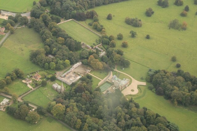
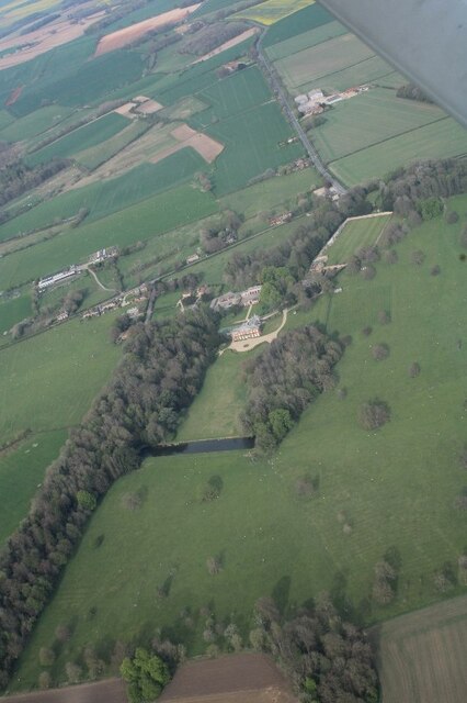
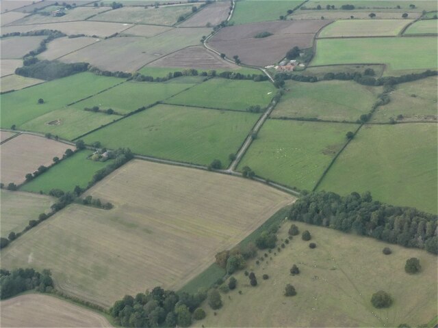
Canal Pond is a freshwater body located in Lincolnshire, England. It can be categorized as a pond, lake, or pool due to its size and characteristics. Covering an area of approximately 10 acres, the pond is surrounded by lush greenery and offers a serene and picturesque landscape.

The water in Canal Pond is sourced from various streams and rivers that flow into the area. It is a freshwater body, meaning that it contains low levels of salt content. This makes it an ideal habitat for a diverse range of aquatic flora and fauna.

The pond is home to several species of fish, including carp, pike, and roach. These fish provide ample opportunities for recreational fishing, attracting anglers from the local area and beyond. The presence of fish also supports a rich birdlife, with various species of waterfowl and wading birds visiting the pond.

Surrounding the pond is a freshwater marsh, characterized by its marshy vegetation and wetland habitat. This marshland is a vital ecosystem that supports a multitude of plant and animal life, including reeds, rushes, and water lilies. It serves as a breeding ground for amphibians and provides a habitat for insects and small mammals.

Canal Pond is a popular destination for nature enthusiasts, offering opportunities for birdwatching, fishing, and leisurely walks. Its tranquil setting and diverse ecosystem make it a haven for wildlife and a place of natural beauty in Lincolnshire.

If you have any feedback on the listing, please let us know in the comments section below.
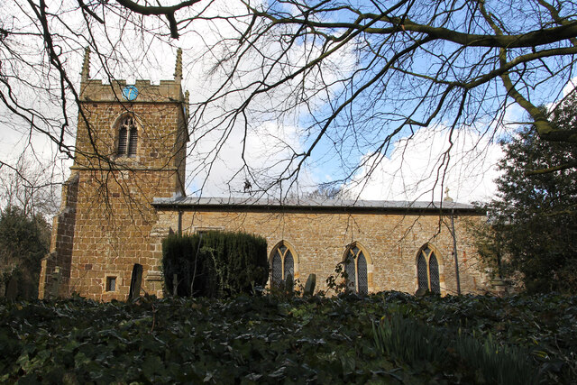
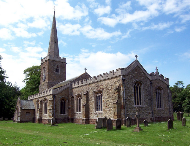
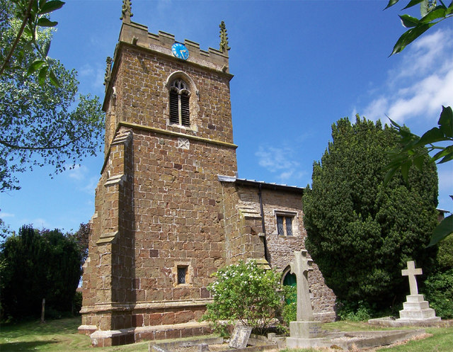
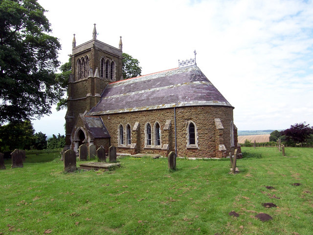
Canal Pond Images

Images are sourced within 2km of 53.342139/-0.23268457 or Grid Reference TF1784. Thanks to Geograph Open Source API. All images are credited.

Hainton Hall and Park: aerial 2021 See <span class="nowrap"><a title="https://www.heritagegateway.org.uk/Gateway/Results_Single.aspx?uid=MLI40365&resourceID=1006" rel="nofollow ugc noopener" href="https://www.heritagegateway.org.uk/Gateway/Results_Single.aspx?uid=MLI40365&resourceID=1006">Link</a><img style="margin-left:2px;" alt="External link" title="External link - shift click to open in new window" src="https://s1.geograph.org.uk/img/external.png" width="10" height="10"/></span>

Hainton Hall dates to the 17th century and is the residence of the Heneage family. The present house was built in 1638 and underwent additions in the 18th and 19th century. The south wing dates from 1729 and the west wing was rebuilt in 1800. The porch of the hall dates from 1875. The Hall was demolished and rebuilt in 1973. There is also a chapel 100 metres to the east of hall which was erected in 1836. The park was landscaped in the mid to late 18th century by Capability Brown.
Hainton Hall and Park: aerial 2021
See LinkExternal link Hainton Hall dates to the 17th century and is the residence of the Heneage family. The present house was built in 1638 and underwent additions in the 18th and 19th century. The south wing dates from 1729 and the west wing was rebuilt in 1800. The porch of the hall dates from 1875. The Hall was demolished and rebuilt in 1973. There is also a chapel 100 metres to the east of hall which was erected in 1836. The park was landscaped in the mid to late 18th century by Capability Brown.
Hainton Hall: aerial 2021 See <span class="nowrap"><a title="https://www.heritagegateway.org.uk/Gateway/Results_Single.aspx?uid=MLI40365&resourceID=1006" rel="nofollow ugc noopener" href="https://www.heritagegateway.org.uk/Gateway/Results_Single.aspx?uid=MLI40365&resourceID=1006">Link</a><img style="margin-left:2px;" alt="External link" title="External link - shift click to open in new window" src="https://s1.geograph.org.uk/img/external.png" width="10" height="10"/></span>

Hainton Hall dates to the 17th century and is the residence of the Heneage family. The present house was built in 1638 and underwent additions in the 18th and 19th century. The south wing dates from 1729 and the west wing was rebuilt in 1800. The porch of the hall dates from 1875. The Hall was demolished and rebuilt in 1973. There is also a chapel 100 metres to the east of hall which was erected in 1836. The park was landscaped in the mid to late 18th century by Capability Brown.

Regular courtyard with multiple regular yards. The farmhouse is detached from the main working complex. There has been a partial loss (less than 50%) of traditional buildings. Located within a Church and/or Manor farm group.
Hainton Hall: aerial 2021
See LinkExternal link Hainton Hall dates to the 17th century and is the residence of the Heneage family. The present house was built in 1638 and underwent additions in the 18th and 19th century. The south wing dates from 1729 and the west wing was rebuilt in 1800. The porch of the hall dates from 1875. The Hall was demolished and rebuilt in 1973. There is also a chapel 100 metres to the east of hall which was erected in 1836. The park was landscaped in the mid to late 18th century by Capability Brown. Regular courtyard with multiple regular yards. The farmhouse is detached from the main working complex. There has been a partial loss (less than 50%) of traditional buildings. Located within a Church and/or Manor farm group.
Holds Hill to Sixhills: aerial 2022
Hainton Hall: aerial 2022 (1)
Hainton Hall: aerial 2022 (2)
Ridge and furrow and earthworks, near Eastlands Farm, East Barkwith: aerial 2022 (2) See also <a href="https://www.geograph.org.uk/photo/7166470">TF1682 : Ridge and furrow and earthworks, near Eastlands Farm, East Barkwith: aerial 2022 (1)</a>.
Ridge and furrow and earthworks, near Eastlands Farm, East Barkwith: aerial 2022 (2)
Hainton Hall: aerial 2022 See: <span class="nowrap"><a title="https://www.heritagegateway.org.uk/Gateway/Results_Single.aspx?uid=MLI40365&resourceID=1006" rel="nofollow ugc noopener" href="https://www.heritagegateway.org.uk/Gateway/Results_Single.aspx?uid=MLI40365&resourceID=1006">Link</a><img style="margin-left:2px;" alt="External link" title="External link - shift click to open in new window" src="https://s1.geograph.org.uk/img/external.png" width="10" height="10"/></span> and 
<span class="nowrap"><a title="https://heritage-explorer.lincolnshire.gov.uk/Monument/MLI40365" rel="nofollow ugc noopener" href="https://heritage-explorer.lincolnshire.gov.uk/Monument/MLI40365">Link</a><img style="margin-left:2px;" alt="External link" title="External link - shift click to open in new window" src="https://s1.geograph.org.uk/img/external.png" width="10" height="10"/></span>

Hainton Hall dates to the 17th century and is the residence of the Heneage family. The present house was built in 1638 and underwent additions in the 18th and 19th century.
Hainton Hall: aerial 2022
See: LinkExternal link and LinkExternal link Hainton Hall dates to the 17th century and is the residence of the Heneage family. The present house was built in 1638 and underwent additions in the 18th and 19th century.
Ridge and furrow fields, Hainton: aerial 2022 (1) See: <span class="nowrap"><a title="https://www.heritagegateway.org.uk/Gateway/Results_Single.aspx?uid=MLI85532&resourceID=1006" rel="nofollow ugc noopener" href="https://www.heritagegateway.org.uk/Gateway/Results_Single.aspx?uid=MLI85532&resourceID=1006">Link</a><img style="margin-left:2px;" alt="External link" title="External link - shift click to open in new window" src="https://s1.geograph.org.uk/img/external.png" width="10" height="10"/></span> and
<span class="nowrap"><a title="https://www.heritagegateway.org.uk/Gateway/Results_Single.aspx?uid=MLI85531&resourceID=1006" rel="nofollow ugc noopener" href="https://www.heritagegateway.org.uk/Gateway/Results_Single.aspx?uid=MLI85531&resourceID=1006">Link</a><img style="margin-left:2px;" alt="External link" title="External link - shift click to open in new window" src="https://s1.geograph.org.uk/img/external.png" width="10" height="10"/></span>
Ridge and furrow fields, Hainton: aerial 2022 (1)
See: LinkExternal link and LinkExternal link
Ridge and furrow fields, Hainton: aerial 2022 (2) See: <span class="nowrap"><a title="https://www.heritagegateway.org.uk/Gateway/Results_Single.aspx?uid=MLI85532&resourceID=1006" rel="nofollow ugc noopener" href="https://www.heritagegateway.org.uk/Gateway/Results_Single.aspx?uid=MLI85532&resourceID=1006">Link</a><img style="margin-left:2px;" alt="External link" title="External link - shift click to open in new window" src="https://s1.geograph.org.uk/img/external.png" width="10" height="10"/></span> and
<span class="nowrap"><a title="https://www.heritagegateway.org.uk/Gateway/Results_Single.aspx?uid=MLI85531&resourceID=1006" rel="nofollow ugc noopener" href="https://www.heritagegateway.org.uk/Gateway/Results_Single.aspx?uid=MLI85531&resourceID=1006">Link</a><img style="margin-left:2px;" alt="External link" title="External link - shift click to open in new window" src="https://s1.geograph.org.uk/img/external.png" width="10" height="10"/></span>
Ridge and furrow fields, Hainton: aerial 2022 (2)
See: LinkExternal link and LinkExternal link
Ridge and furrow fields, Hainton: aerial 2022 (3) See: <span class="nowrap"><a title="https://www.heritagegateway.org.uk/Gateway/Results_Single.aspx?uid=MLI85532&resourceID=1006" rel="nofollow ugc noopener" href="https://www.heritagegateway.org.uk/Gateway/Results_Single.aspx?uid=MLI85532&resourceID=1006">Link</a><img style="margin-left:2px;" alt="External link" title="External link - shift click to open in new window" src="https://s1.geograph.org.uk/img/external.png" width="10" height="10"/></span> and
<span class="nowrap"><a title="https://www.heritagegateway.org.uk/Gateway/Results_Single.aspx?uid=MLI85531&resourceID=1006" rel="nofollow ugc noopener" href="https://www.heritagegateway.org.uk/Gateway/Results_Single.aspx?uid=MLI85531&resourceID=1006">Link</a><img style="margin-left:2px;" alt="External link" title="External link - shift click to open in new window" src="https://s1.geograph.org.uk/img/external.png" width="10" height="10"/></span>
Ridge and furrow fields, Hainton: aerial 2022 (3)
See: LinkExternal link and LinkExternal link
Woodbine Cottage Grade II listed 17th century cottage in South Willingham.
Woodbine Cottage
Grade II listed 17th century cottage in South Willingham.
Woodbine Cottage Grade II listed 17th century cottage in South Willingham.
Woodbine Cottage
Grade II listed 17th century cottage in South Willingham.
St. Martin's church Grade II* listed parish church, largely 14th century with a nave rebuild in 1848 and restoration 1885.
St. Martin's church
Grade II* listed parish church, largely 14th century with a nave rebuild in 1848 and restoration 1885.
St. Martin's church nave View east in the grade II* listed parish church, largely 14th century with a nave rebuild in 1848 and restoration 1885. The Perpendicular rood screen is much restored but interesting nonetheless.
St. Martin's church nave
View east in the grade II* listed parish church, largely 14th century with a nave rebuild in 1848 and restoration 1885. The Perpendicular rood screen is much restored but interesting nonetheless.
St. Martin's church nave View west in the grade II* listed parish church, largely 14th century with a nave rebuild in 1848 and restoration 1885.
St. Martin's church nave
View west in the grade II* listed parish church, largely 14th century with a nave rebuild in 1848 and restoration 1885.
Matthew Ridley Corbet memorial Memorial to artist Matthew Ridley Corbet ARA <span class="nowrap"><a title="https://en.wikisource.org/wiki/Dictionary_of_National_Biography,_1912_supplement/Corbet,_Matthew_Ridley" rel="nofollow ugc noopener" href="https://en.wikisource.org/wiki/Dictionary_of_National_Biography,_1912_supplement/Corbet,_Matthew_Ridley">Link</a><img style="margin-left:2px;" alt="External link" title="External link - shift click to open in new window" src="https://s1.geograph.org.uk/img/external.png" width="10" height="10"/></span> on St. Martin's church. His father Rev. Andrew Corbet was Rector of St. Martin's church.

Matthew Ridley Corbet
Born here at the Rectory
XX May MDCCCL
Died at his home at
St. John's Wood, London
XXV June MDCCCCII

So Long a worshipper of nature
Hither came unwearied in that service

In Loving Memory
Matthew Ridley Corbet memorial
Memorial to artist Matthew Ridley Corbet ARA LinkExternal link on St. Martin's church. His father Rev. Andrew Corbet was Rector of St. Martin's church. Matthew Ridley Corbet Born here at the Rectory XX May MDCCCL Died at his home at St. John's Wood, London XXV June MDCCCCII So Long a worshipper of nature Hither came unwearied in that service In Loving Memory
The Quadrant Plantation
Road to Beck House Farm
Show me another place!

Canal Pond is located at Grid Ref: TF1784 (Lat: 53.342139, Lng: -0.23268457)

Administrative County: Lincolnshire

District: East Lindsey

Police Authority: Lincolnshire

What 3 Words

///mingles.opposing.adhesive. Near Wragby, Lincolnshire

Nearby Locations

Canal Pond The Wilderness

Related Wikis

Hainton

Hainton is a village and civil parish in the East Lindsey district of Lincolnshire, England. It is situated on the A157 road, 10 miles (16 km) west from...

South Willingham

South Willingham is a village and civil parish in the East Lindsey district of Lincolnshire, England, and partly within the Lincolnshire Wolds Area of...

South Willingham and Hainton railway station

South Willingham and Hainton railway station was a railway station that served the village of South Willingham, Lincolnshire, England between 1874 and...

Sixhills

Sixhills is a village in the West Lindsey district of Lincolnshire, England, about 3 miles (4.8 km) south-east from Market Rasen. It lies just south of...

Nearby Amenities

Located within 500m of 53.342139,-0.23268457
Hainton Park
Place: locality
Source: Bing
Lat/Long: 53.3398597/-0.2299476
The data included in this document is from www.openstreetmap.org. The data is made available under ODbL.

Have you been to Canal Pond?

Leave your review of Canal Pond below (or comments, questions and feedback).