Long Lake

Lake, Pool, Pond, Freshwater Marsh in Hertfordshire St. Albans

England

Long Lake

Shenley Lane, London Colney
Shenley Lane, London Colney Credit: David Howard

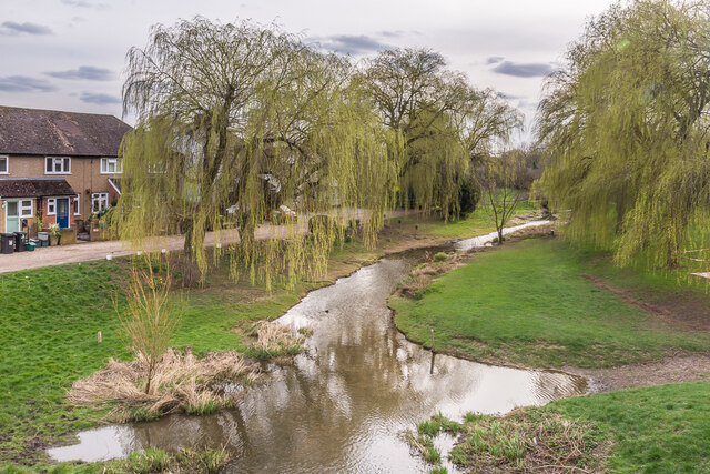
Long Lake, located in Hertfordshire, is a prominent freshwater marsh that offers a serene and picturesque setting. Spanning approximately 50 acres, the lake is an exceptional example of a vibrant and diverse ecosystem, attracting both wildlife enthusiasts and nature lovers alike.

Surrounded by lush greenery and bordered by reeds and tall grasses, Long Lake is a haven for various bird species, including herons, ducks, and swans, making it a popular spot for birdwatching. The lake's calm waters provide an ideal habitat for an array of aquatic life, such as fish, frogs, and water insects.

The lake's water is sourced primarily from rainfall and underground springs, ensuring a constant supply of fresh water throughout the year. The lake's depth varies, with some areas reaching up to 10 feet, providing ample opportunities for water activities such as fishing and boating.

Long Lake is also home to a variety of plant species, including water lilies, reed beds, and submerged aquatic plants. These plants not only enhance the lake's aesthetic appeal but also contribute to the overall health of the ecosystem by providing essential habitat and food sources for the resident wildlife.

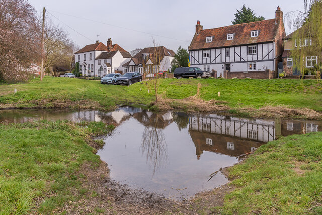
Visitors to Long Lake can enjoy a leisurely stroll along its well-maintained footpaths, which offer panoramic views of the surrounding landscape. The lake is equipped with several seating areas and picnic spots, allowing visitors to relax and immerse themselves in the tranquility of the surroundings.

Long Lake, with its abundant wildlife, diverse plant life, and serene atmosphere, is a cherished natural gem in Hertfordshire, providing a peaceful retreat for both locals and visitors seeking a connection with nature.

If you have any feedback on the listing, please let us know in the comments section below.
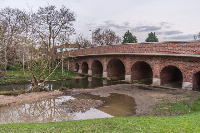
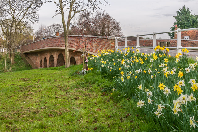
Long Lake Images

Images are sourced within 2km of 51.717364/-0.29446501 or Grid Reference TL1703. Thanks to Geograph Open Source API. All images are credited.

Shenley Lane, London Colney
Entering London Colney on Shenley Lane London Colney is on the River Colne just behind this spot.
Entering London Colney on Shenley Lane
London Colney is on the River Colne just behind this spot.
Cafe on Shenley Lane, London Colney By the River Colne
Cafe on Shenley Lane, London Colney
By the River Colne
River Colne The River Colne in London Colney.  In the foreground is the original ford across the river, superseded in 1774 when the adjacent road bridge was built.
River Colne
The River Colne in London Colney. In the foreground is the original ford across the river, superseded in 1774 when the adjacent road bridge was built.
River Colne The River Colne in London Colney, at the site of the original ford across the river, superseded in 1774 when the adjacent road bridge was built.  In the left background are Colne House (c.1800) and the adjacent Riverside Cottage (early - mid 19th Century) and in the right background is Waterside House (early 18th Century).  All three are grade II listed - see <span class="nowrap"><a title="https://historicengland.org.uk/listing/the-list/list-entry/1102982?section=official-list-entry," rel="nofollow ugc noopener" href="https://historicengland.org.uk/listing/the-list/list-entry/1102982?section=official-list-entry,">Link</a><img style="margin-left:2px;" alt="External link" title="External link - shift click to open in new window" src="https://s1.geograph.org.uk/img/external.png" width="10" height="10"/></span> <span class="nowrap"><a title="https://historicengland.org.uk/listing/the-list/list-entry/1295622?section=official-list-entry" rel="nofollow ugc noopener" href="https://historicengland.org.uk/listing/the-list/list-entry/1295622?section=official-list-entry">Link</a><img style="margin-left:2px;" alt="External link" title="External link - shift click to open in new window" src="https://s1.geograph.org.uk/img/external.png" width="10" height="10"/></span> and <span class="nowrap"><a title="https://historicengland.org.uk/listing/the-list/list-entry/1102941?section=official-list-entry" rel="nofollow ugc noopener" href="https://historicengland.org.uk/listing/the-list/list-entry/1102941?section=official-list-entry">Link</a><img style="margin-left:2px;" alt="External link" title="External link - shift click to open in new window" src="https://s1.geograph.org.uk/img/external.png" width="10" height="10"/></span> respectively.
River Colne
The River Colne in London Colney, at the site of the original ford across the river, superseded in 1774 when the adjacent road bridge was built. In the left background are Colne House (c.1800) and the adjacent Riverside Cottage (early - mid 19th Century) and in the right background is Waterside House (early 18th Century). All three are grade II listed - see LinkExternal link LinkExternal link and LinkExternal link respectively.
Telford's Bridge Bridge over the River Colne in London Colney, once on the A6 from St Albans to London until bypassed by the London Colney Bypass (now the A1081) in 1959.  The plaque on the far left (see <a href="https://www.geograph.org.uk/photo/7125038">TL1803 : Plaque, Telford's Bridge</a> for close up) states that it was built c.1775 (other sources give a year of 1774) and restored in 1998.  Although the name might seem to point to Thomas Telford as the designer/builder, the fact that he was  born in 1757 and so would have been only 17 or 18 at the time of building, and still serving his apprenticeship in his native Scotland, it is considered extremely unlikely that it was in fact his work.  Grade II listed - see <span class="nowrap"><a title="https://historicengland.org.uk/listing/the-list/list-entry/1174667?section=official-list-entry" rel="nofollow ugc noopener" href="https://historicengland.org.uk/listing/the-list/list-entry/1174667?section=official-list-entry">Link</a><img style="margin-left:2px;" alt="External link" title="External link - shift click to open in new window" src="https://s1.geograph.org.uk/img/external.png" width="10" height="10"/></span>.
Telford's Bridge
Bridge over the River Colne in London Colney, once on the A6 from St Albans to London until bypassed by the London Colney Bypass (now the A1081) in 1959. The plaque on the far left (see TL1803 : Plaque, Telford's Bridge for close up) states that it was built c.1775 (other sources give a year of 1774) and restored in 1998. Although the name might seem to point to Thomas Telford as the designer/builder, the fact that he was born in 1757 and so would have been only 17 or 18 at the time of building, and still serving his apprenticeship in his native Scotland, it is considered extremely unlikely that it was in fact his work. Grade II listed - see LinkExternal link.
Plaque, Telford's Bridge Plaque on the Telford's Bridge (see <a href="https://www.geograph.org.uk/photo/7125036">TL1803 : Telford's Bridge</a>).  It reads "Telfords Bridge  Built c 1775  Restored 1998".
Plaque, Telford's Bridge
Plaque on the Telford's Bridge (see TL1803 : Telford's Bridge). It reads "Telfords Bridge Built c 1775 Restored 1998".
Telford's Bridge Bridge over the River Colne in London Colney, once on the A6 from St Albans to London until bypassed by the London Colney Bypass (now the A1081) in 1959.  A plaque on the other side of the bridge (see <a href="https://www.geograph.org.uk/photo/7125038">TL1803 : Plaque, Telford's Bridge</a>) states that it was built c.1775 (other sources give a year of 1774) and restored in 1998.  Although the name might seem to point to Thomas Telford as the designer/builder, the fact that he was  born in 1757 and so would have been only 17 or 18 at the time of building, and still serving his apprenticeship in his native Scotland, it is considered extremely unlikely that it was in fact his work.  Grade II listed - see <span class="nowrap"><a title="https://historicengland.org.uk/listing/the-list/list-entry/1174667?section=official-list-entry" rel="nofollow ugc noopener" href="https://historicengland.org.uk/listing/the-list/list-entry/1174667?section=official-list-entry">Link</a><img style="margin-left:2px;" alt="External link" title="External link - shift click to open in new window" src="https://s1.geograph.org.uk/img/external.png" width="10" height="10"/></span>.
Telford's Bridge
Bridge over the River Colne in London Colney, once on the A6 from St Albans to London until bypassed by the London Colney Bypass (now the A1081) in 1959. A plaque on the other side of the bridge (see TL1803 : Plaque, Telford's Bridge) states that it was built c.1775 (other sources give a year of 1774) and restored in 1998. Although the name might seem to point to Thomas Telford as the designer/builder, the fact that he was born in 1757 and so would have been only 17 or 18 at the time of building, and still serving his apprenticeship in his native Scotland, it is considered extremely unlikely that it was in fact his work. Grade II listed - see LinkExternal link.
Telford's Bridge Daffodils on the approach to Telford's Bridge over the River Colne in London Colney, once on the A6 from St Albans to London until bypassed by the London Colney Bypass (now the A1081) in 1959.  A plaque on the other side of the bridge (see <a href="https://www.geograph.org.uk/photo/7125038">TL1803 : Plaque, Telford's Bridge</a>) states that it was built c.1775 (other sources give a year of 1774) and restored in 1998.  Although the name might seem to point to Thomas Telford as the designer/builder, the fact that he was  born in 1757 and so would have been only 17 or 18 at the time of building, and still serving his apprenticeship in his native Scotland, it is considered extremely unlikely that it was in fact his work.  Grade II listed - see <span class="nowrap"><a title="https://historicengland.org.uk/listing/the-list/list-entry/1174667?section=official-list-entry" rel="nofollow ugc noopener" href="https://historicengland.org.uk/listing/the-list/list-entry/1174667?section=official-list-entry">Link</a><img style="margin-left:2px;" alt="External link" title="External link - shift click to open in new window" src="https://s1.geograph.org.uk/img/external.png" width="10" height="10"/></span>.
Telford's Bridge
Daffodils on the approach to Telford's Bridge over the River Colne in London Colney, once on the A6 from St Albans to London until bypassed by the London Colney Bypass (now the A1081) in 1959. A plaque on the other side of the bridge (see TL1803 : Plaque, Telford's Bridge) states that it was built c.1775 (other sources give a year of 1774) and restored in 1998. Although the name might seem to point to Thomas Telford as the designer/builder, the fact that he was born in 1757 and so would have been only 17 or 18 at the time of building, and still serving his apprenticeship in his native Scotland, it is considered extremely unlikely that it was in fact his work. Grade II listed - see LinkExternal link.
Telford's Bridge Looking towards Telford's Bridge over the River Colne in London Colney, once on the A6 from St Albans to London until bypassed by the London Colney Bypass (now the A1081) in 1959.  A plaque on the side of the bridge (see <a href="https://www.geograph.org.uk/photo/7125038">TL1803 : Plaque, Telford's Bridge</a>) states that it was built c.1775 (other sources give a year of 1774) and restored in 1998.  Although the name might seem to point to Thomas Telford as the designer/builder, the fact that he was  born in 1757 and so would have been only 17 or 18 at the time of building, and still serving his apprenticeship in his native Scotland, it is considered extremely unlikely that it was in fact his work.  Grade II listed - see <span class="nowrap"><a title="https://historicengland.org.uk/listing/the-list/list-entry/1174667?section=official-list-entry" rel="nofollow ugc noopener" href="https://historicengland.org.uk/listing/the-list/list-entry/1174667?section=official-list-entry">Link</a><img style="margin-left:2px;" alt="External link" title="External link - shift click to open in new window" src="https://s1.geograph.org.uk/img/external.png" width="10" height="10"/></span>.

Note the Google Street View car crossing the bridge.
Telford's Bridge
Looking towards Telford's Bridge over the River Colne in London Colney, once on the A6 from St Albans to London until bypassed by the London Colney Bypass (now the A1081) in 1959. A plaque on the side of the bridge (see TL1803 : Plaque, Telford's Bridge) states that it was built c.1775 (other sources give a year of 1774) and restored in 1998. Although the name might seem to point to Thomas Telford as the designer/builder, the fact that he was born in 1757 and so would have been only 17 or 18 at the time of building, and still serving his apprenticeship in his native Scotland, it is considered extremely unlikely that it was in fact his work. Grade II listed - see LinkExternal link. Note the Google Street View car crossing the bridge.
Post box EIIR post box with gold painted cypher, sited on the High Street below Telford's Bridge.
Post box
EIIR post box with gold painted cypher, sited on the High Street below Telford's Bridge.
Coal Tax Post no 37 This Coal Tax Post (no 37 on the list linked to below) is alongside High Street, at the northern end of Telford's Bridge.  For wider views see <a href="https://www.geograph.org.uk/photo/7138245">TL1803 : Coal Tax Post no 37</a> and <a href="https://www.geograph.org.uk/photo/7138253">TL1803 : Coal Tax Post no 37</a>.
Coal Tax Post no 37
This Coal Tax Post (no 37 on the list linked to below) is alongside High Street, at the northern end of Telford's Bridge. For wider views see TL1803 : Coal Tax Post no 37 and TL1803 : Coal Tax Post no 37.
Coal Tax Post no 37 At the top of the bank on the left of the photo is a Coal Tax Post (no 37 on the list linked to below), situated alongside High Street, at the northern end of Telford's Bridge (in the background).  For a close up of the post see <a href="https://www.geograph.org.uk/photo/7138242">TL1803 : Coal Tax Post no 37</a>.
Coal Tax Post no 37
At the top of the bank on the left of the photo is a Coal Tax Post (no 37 on the list linked to below), situated alongside High Street, at the northern end of Telford's Bridge (in the background). For a close up of the post see TL1803 : Coal Tax Post no 37.
Coal Tax Post no 37 At the top of the bank on the right of the photo is a Coal Tax Post (no 37 on the list linked to below), situated alongside High Street, at the northern end of Telford's Bridge.  In the background is St Peter's Church.  For a close up of the post see <a href="https://www.geograph.org.uk/photo/7138242">TL1803 : Coal Tax Post no 37</a>.
Coal Tax Post no 37
At the top of the bank on the right of the photo is a Coal Tax Post (no 37 on the list linked to below), situated alongside High Street, at the northern end of Telford's Bridge. In the background is St Peter's Church. For a close up of the post see TL1803 : Coal Tax Post no 37.
High Street, London Colney, across the North Orbital Road The houses seen across the road are at the north end of London Colney's High Street, which, before it was severed by the building of the North Orbital Road and other pre-motorway arterial roads, was the old A6 linking Barnet to St Albans.
High Street, London Colney, across the North Orbital Road
The houses seen across the road are at the north end of London Colney's High Street, which, before it was severed by the building of the North Orbital Road and other pre-motorway arterial roads, was the old A6 linking Barnet to St Albans.
Footbridge over the Clockwise M25 Officially named the London Orbital and frequently derided as nothing more than a very big car park, the M25 is a 117-mile orbital motorway that encircles London; one of the world's biggest ring roads (Europe's second longest orbital road after the Berliner Ring, which is 122 miles). It is not, however, a continuous loop of motorway as the Dartford Crossing section (comprising the Dartford Tunnels and the Queen Elizabeth II Bridge) over the Thames and its approach roads are designated as the A282. 

Constructed between 1975 and 1986, the M25 is reputedly the most expensive motorway Britain ever built, costing a total of £909m or roughly £7.5m per mile, but at the time of its planning, the demand for the road was considerably underestimated so that when it was finally completed in 1986, it was already out of date. Demand outstripped capacity within a few years and ever since then it's been very heavily congested. 

The M25 is one of the UK’s busiest motorways, carrying up to 200,000 vehicles and 10,000 HGVs per day (AADT - Annual Average Daily Traffic flow) on the section near to Heathrow Airport. Since its opening in the 1980s, the southern, western and eastern sections have been widened to largely dual four lane (D4M) standard, but much of the motorway retains its dual three lane road (D3M) cross-section as originally built. 

The M25 was home to England's first Variable Speed Limits on motorways between the A3 and M4 in the early 1990s.

<span class="nowrap"><a title="http://www.cbrd.co.uk/motorway/m25/" rel="nofollow ugc noopener" href="http://www.cbrd.co.uk/motorway/m25/">Link</a><img style="margin-left:2px;" alt="External link" title="External link - shift click to open in new window" src="https://s1.geograph.org.uk/img/external.png" width="10" height="10"/></span>  cbrd
<span class="nowrap"><a title="http://www.sabre-roads.org.uk/wiki/index.php?title=M25" rel="nofollow ugc noopener" href="http://www.sabre-roads.org.uk/wiki/index.php?title=M25">Link</a><img style="margin-left:2px;" alt="External link" title="External link - shift click to open in new window" src="https://s1.geograph.org.uk/img/external.png" width="10" height="10"/></span>  SABRE
Footbridge over the Clockwise M25
Officially named the London Orbital and frequently derided as nothing more than a very big car park, the M25 is a 117-mile orbital motorway that encircles London; one of the world's biggest ring roads (Europe's second longest orbital road after the Berliner Ring, which is 122 miles). It is not, however, a continuous loop of motorway as the Dartford Crossing section (comprising the Dartford Tunnels and the Queen Elizabeth II Bridge) over the Thames and its approach roads are designated as the A282. Constructed between 1975 and 1986, the M25 is reputedly the most expensive motorway Britain ever built, costing a total of £909m or roughly £7.5m per mile, but at the time of its planning, the demand for the road was considerably underestimated so that when it was finally completed in 1986, it was already out of date. Demand outstripped capacity within a few years and ever since then it's been very heavily congested. The M25 is one of the UK’s busiest motorways, carrying up to 200,000 vehicles and 10,000 HGVs per day (AADT - Annual Average Daily Traffic flow) on the section near to Heathrow Airport. Since its opening in the 1980s, the southern, western and eastern sections have been widened to largely dual four lane (D4M) standard, but much of the motorway retains its dual three lane road (D3M) cross-section as originally built. The M25 was home to England's first Variable Speed Limits on motorways between the A3 and M4 in the early 1990s. LinkExternal link cbrd LinkExternal link SABRE
Show me another place!

Long Lake is located at Grid Ref: TL1703 (Lat: 51.717364, Lng: -0.29446501)

Administrative County: Hertfordshire

District: St. Albans

Police Authority: Hertfordshire

What 3 Words

///loud.models.means. Near Shenley, Hertfordshire

Related Wikis

Fir and Pond Woods

Fir and Pond Woods is a 29 hectare nature reserve in Potters Bar in Hertfordshire. It is managed by the Herts and Middlesex Wildlife Trust. It is two separate...

Broad Colney Lakes

Broad Colney Lakes is an 11 hectare nature reserve previously managed by Herts and Middlesex Wildlife Trust in London Colney in Hertfordshire. It has recently...

All Saints Pastoral Centre

All Saints Pastoral Centre is a complex of buildings at London Colney on the southern outskirts of St Albans, Hertfordshire, England. It was built as a...

Arsenal Training Centre

The Arsenal Training Centre, branded as the Sobha Realty Training Centre for sponsorship reasons, and often referred to as its geographical location London...

Related Videos

🇮🇳Indian Girl vs London Girl | Who’s The Best In Hitchhiking? #londonvlog #indianinlondon

I convinced the girls to hitchhike with me from Radlett to Watford, in England. Both the towns are 30 mins away from central ...

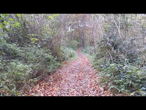
Short walk near Radlett

Went for a short walk this morning from Radlett to Shenley and back. Here's a short section through an autumnal woodland just ...

Holiday Inn Express, St Albans | October 2021

A quick look around the Holiday Inn Express in St Albans, Hertfordshire (also known as London Colney for those that are local to ...

Nearby Amenities

Located within 500m of 51.717364,-0.29446501
Barrier: lift_gate
Maxwidth: 6'6"
Lat/Long: 51.7195451/-0.2884181
Traffic Calming: table
Lat/Long: 51.7200946/-0.2963322
Crossing
Crossing: uncontrolled
Crossing Island: no
Crossing Ref: zebra
Tactile Paving: yes
Lat/Long: 51.7200163/-0.2964362
Bus Stop
War Memorial
Bus: yes
Naptan AtcoCode: 210021504760
Naptan Bearing: SE
Naptan CommonName: War Memorial
Naptan Crossing: opp Golden Lion PH
Naptan Indicator: opp
Naptan Landmark: opp Golden Lion PH
Naptan NaptanCode: hrtawmap
Naptan PlusbusZoneRef: RADLETT;STALBCY
Naptan ShortCommonName: NA
Naptan Street: High Street
Naptan Verified: no
Public Transport: platform
Shelter: yes
Source: naptan_import
Lat/Long: 51.721783/-0.2934164
Bus Stop
Caledon Road
Bus: yes
Naptan AtcoCode: 210021504880
Naptan Bearing: NE
Naptan CommonName: Caledon Road
Naptan Crossing: Chicken Lane
Naptan Indicator: adj
Naptan Landmark: Chicken Lane
Naptan NaptanCode: hrtawjtw
Naptan PlusbusZoneRef: RADLETT;STALBCY
Naptan ShortCommonName: NA
Naptan Street: St Annes Road
Naptan Verified: no
Public Transport: platform
Shelter: no
Source: naptan_import
Lat/Long: 51.7199413/-0.2965701
Bus Stop
High Street
Bus: yes
Naptan AtcoCode: 210021504890
Naptan Bearing: NE
Naptan CommonName: High Street
Naptan Crossing: opp The White Lion PH
Naptan Indicator: NE-bound
Naptan Landmark: opp The White Lion PH
Naptan NaptanCode: hrtawjwa
Naptan PlusbusZoneRef: RADLETT;STALBCY
Naptan ShortCommonName: NA
Naptan Street: St Annes Road
Naptan Verified: no
Public Transport: platform
Shelter: no
Source: naptan_import
Lat/Long: 51.7208375/-0.2931466
Bus Stop
Willowside
Bus: yes
Naptan AtcoCode: 210021504900
Naptan Bearing: SE
Naptan CommonName: Willowside
Naptan Crossing: Colne Gardens
Naptan Indicator: opp
Naptan Landmark: Colne Gardens
Naptan NaptanCode: hrtawjwd
Naptan PlusbusZoneRef: RADLETT;STALBCY
Naptan ShortCommonName: NA
Naptan Street: Barnet Road
Naptan Verified: no
Public Transport: platform
Shelter: yes
Source: naptan_import
Lat/Long: 51.7192694/-0.2880116
Bus Stop
High Street
Bus: yes
Naptan AtcoCode: 210021504950
Naptan Bearing: SW
Naptan CommonName: High Street
Naptan Crossing: The White Lion PH
Naptan Indicator: SW-bound
Naptan Landmark: The White Lion PH
Naptan NaptanCode: hrtawjwp
Naptan PlusbusZoneRef: RADLETT;STALBCY
Naptan ShortCommonName: NA
Naptan Street: St Annes Road
Naptan Verified: no
Public Transport: platform
Shelter: no
Source: naptan_import
Lat/Long: 51.7206707/-0.2932969
Caledon Road
Naptan AtcoCode: 210021504955
Naptan Bearing: SW
Naptan BusStopType: CUS
Naptan CommonName: Caledon Road
Naptan Crossing: Heather Cottages
Naptan Indicator: opp
Naptan Landmark: Heather Cottages
Naptan NaptanCode: hrtawjwt
Naptan PlusbusZoneRef: RADLETT;STALBCY
Naptan ShortCommonName: NA
Naptan Street: St Annes Road
Naptan Verified: no
Source: naptan_import
Lat/Long: 51.7194275/-0.2969929
Bus Stop
War Memorial
Naptan AtcoCode: 210021507080
Naptan Bearing: NW
Naptan CommonName: War Memorial
Naptan Crossing: St Annes Road
Naptan Indicator: adj
Naptan Landmark: St Annes Road
Naptan NaptanCode: hrtawdgd
Naptan PlusbusZoneRef: RADLETT;STALBCY
Naptan ShortCommonName: NA
Naptan Street: High Street
Naptan Verified: no
Public Transport: platform
Source: naptan_import
Lat/Long: 51.7213838/-0.2931812
Turning Circle
Lat/Long: 51.7202646/-0.2910256
Traffic Calming: island
Lat/Long: 51.7193589/-0.2895474
Traffic Calming: table
Lat/Long: 51.7201563/-0.2962151
Crossing
Crossing: traffic_signals
Crossing Ref: pelican
Lat/Long: 51.720672/-0.2923018
Broad Colney Lakes Nature Reserve
Leisure: nature_reserve
Website: https://www.hertswildlifetrust.org.uk/reserves/broad-colney-lakes
Lat/Long: 51.717171/-0.2966034
Pub
The Green Dragon
Addr City: London Colney
Addr Postcode: AL2 1RB
Addr Street: Waterside
Fhrs Authority: St Albans City
Fhrs Id: 306295
Outdoor Seating: yes
Website: http://www.the-green-dragon-london-colney.co.uk/
Wikidata: Q26469339
Lat/Long: 51.719286/-0.2911223
Barrier: kissing_gate
Foot: yes
Source: GPS
Lat/Long: 51.7160655/-0.2908626
Barrier: kissing_gate
Foot: yes
Source: GPS
Lat/Long: 51.7173799/-0.2930035
Bench
Backrest: yes
Source: GPS
Lat/Long: 51.7177653/-0.2954287
Bench
Backrest: yes
Source: GPS
Lat/Long: 51.7180229/-0.2943723
Barrier: kissing_gate
Foot: yes
Source: GPS
Lat/Long: 51.718399/-0.2906606
Ford: yes
Lat/Long: 51.7192179/-0.2900735
Coal tax post
Historic: boundary_stone
Inscription: 24 VICT
Material: iron
Note: Coal tax boundary marker 37
Lat/Long: 51.7195346/-0.2907347
Coal tax post
Historic: boundary_stone
Inscription: 24 VICT
Material: iron
Note: Coal tax boundary marker 38
Lat/Long: 51.7153479/-0.2997596
Traffic Calming: cushion
Lat/Long: 51.7186043/-0.3013752
Post Box
Collection Times: Mo-Fr 09:00; Sa 07:00
Operator: Royal Mail
Post Box Type: lamp
Ref: AL2 297D
Royal Cypher: EIIR
Royal Cypher Wikidata: Q33102113
Lat/Long: 51.7198544/-0.2966908
Post Box
Collection Times: Mo-Fr 09:00; Sa 07:00
Operator: Royal Mail
Post Box Type: pillar
Ref: AL2 105D
Royal Cypher: EIIR
Royal Cypher Wikidata: Q33102113
Lat/Long: 51.7195415/-0.2907736
Generator Method: photovoltaic
Generator Output Electricity: yes
Generator Solar Modules: 16
Generator Source: solar
Generator Type: solar_photovoltaic_panel
Location: roof
Power: generator
Tilted: no
Lat/Long: 51.7144496/-0.2981514
Man Made: utility_pole
Lat/Long: 51.7175969/-0.3005357
Man Made: utility_pole
Lat/Long: 51.7180302/-0.3007048
Traffic Calming: cushion
Lat/Long: 51.7180189/-0.3008289
Direction: 140
Generator Method: photovoltaic
Generator Output Electricity: yes
Generator Solar Modules: 8
Generator Source: solar
Generator Type: solar_photovoltaic_panel
Location: roof
Power: generator
Lat/Long: 51.7185509/-0.2938443
Parking
Lat/Long: 51.7179554/-0.2946623
Traffic Calming: island
Lat/Long: 51.7194472/-0.2902896
Generator Method: photovoltaic
Generator Output Electricity: yes
Generator Solar Modules: 5
Generator Source: solar
Generator Type: solar_photovoltaic_panel
Location: roof
Power: generator
Tilted: no
Lat/Long: 51.7189058/-0.289872
Direction: 150
Generator Method: photovoltaic
Generator Output Electricity: yes
Generator Solar Modules: 7
Generator Source: solar
Generator Type: solar_photovoltaic_panel
Location: roof
Power: generator
Lat/Long: 51.7189409/-0.2899011
Direction: 215
Fixme: survey for panel count
Generator Method: photovoltaic
Generator Output Electricity: yes
Generator Solar Modules: 8
Generator Source: solar
Generator Type: solar_photovoltaic_panel
Location: roof
Power: generator
Lat/Long: 51.7189624/-0.2879664
Addr Housenumber: 54A
Lat/Long: 51.7209526/-0.2921326
Addr Housenumber: 54
Lat/Long: 51.7209249/-0.2922088
Bench
Lat/Long: 51.7190628/-0.2906334
The data included in this document is from www.openstreetmap.org. The data is made available under ODbL.

Have you been to Long Lake?

Leave your review of Long Lake below (or comments, questions and feedback).