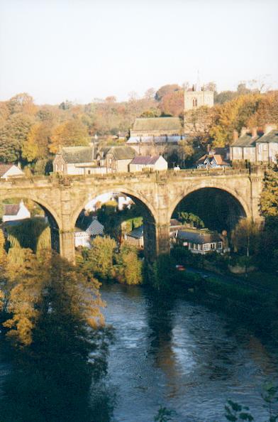
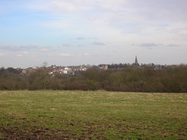
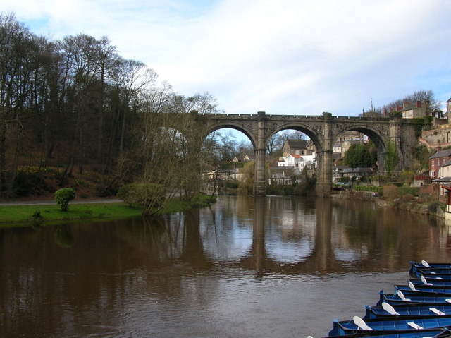
The Basin

Lake, Pool, Pond, Freshwater Marsh in Yorkshire Harrogate

England

The Basin

Hardware Shop, Castlegate, Knaresborough
Hardware Shop, Castlegate, Knaresborough Credit: Doug Elliot

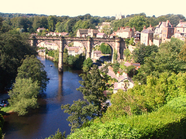
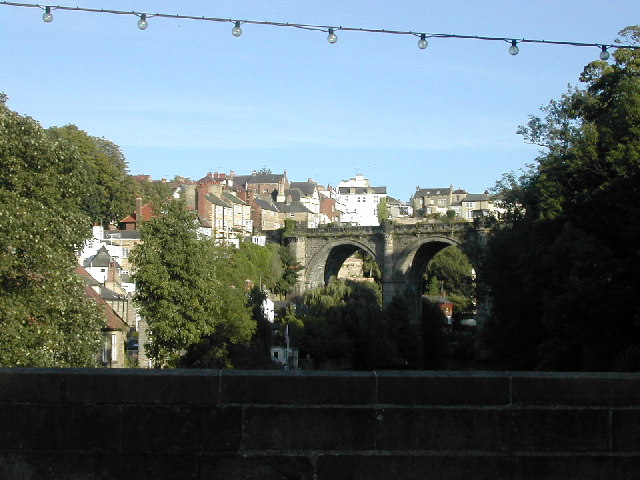
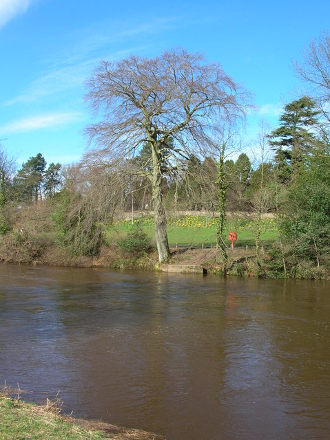
The Basin, located in Yorkshire, is a picturesque freshwater marsh encompassing a diverse range of aquatic habitats. Spanning over a vast area, it offers an array of features including a lake, pool, pond, and marshland. The Basin is renowned for its breathtaking natural beauty and ecological significance.

The lake, situated at the heart of the Basin, is a large expanse of calm water that serves as a crucial habitat for various flora and fauna. Its tranquil ambiance attracts numerous birds, making it a favored spot for birdwatchers and nature enthusiasts. The lake offers a haven for various waterfowl species, such as ducks, geese, and swans, and provides a breeding ground for aquatic plants.

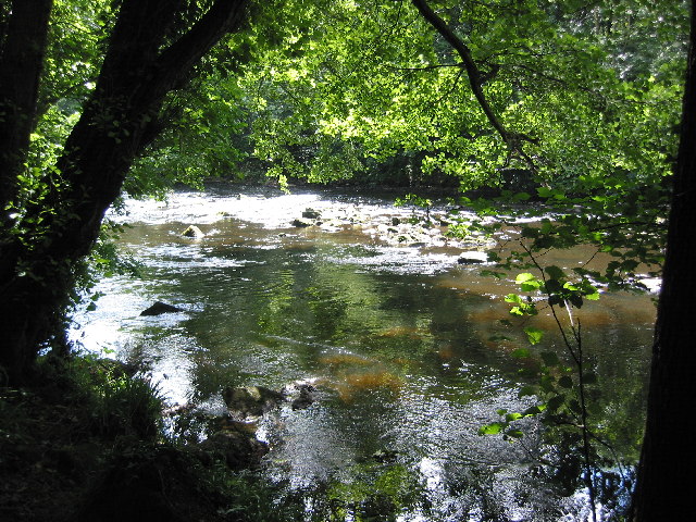
Adjacent to the lake, there is a pool which is characterized by its shallow and clear water. The pool is teeming with an abundance of aquatic life, including fish, amphibians, and invertebrates. Its calm and inviting nature make it an ideal spot for angling and recreational activities.

The Basin also features a smaller pond, which is a haven for aquatic plants and insects. The pond's still water provides an ideal environment for the growth of water lilies, reeds, and other emergent vegetation. It serves as a crucial breeding ground for dragonflies, frogs, and various species of water insects.

The freshwater marsh, an integral part of the Basin, is an expansive wetland that supports a diverse range of plant and animal life. Its nutrient-rich soil nurtures a variety of marsh plants, creating a lush habitat for waterfowl, mammals, and insects. The marshland plays a vital role in water filtration and flood prevention, contributing to the overall health of the ecosystem.

In conclusion, the Basin in Yorkshire offers a unique combination of a lake, pool, pond, and freshwater marsh. Its diverse aquatic habitats provide a rich and thriving ecosystem, attracting a wide array of wildlife and offering a captivating natural experience for visitors.

If you have any feedback on the listing, please let us know in the comments section below.
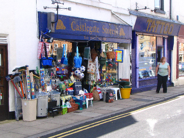
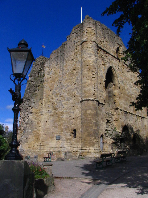
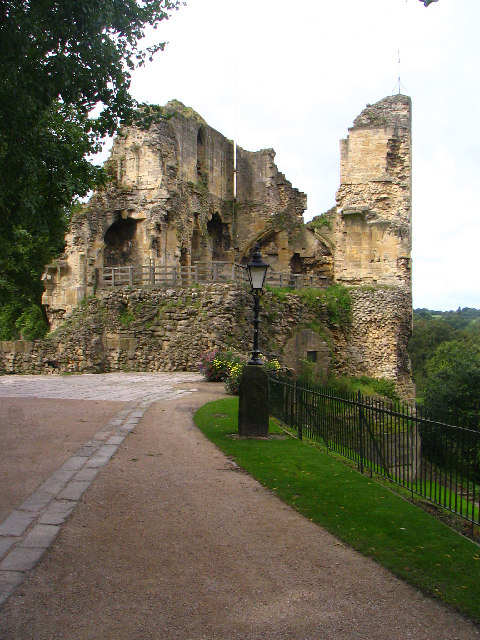
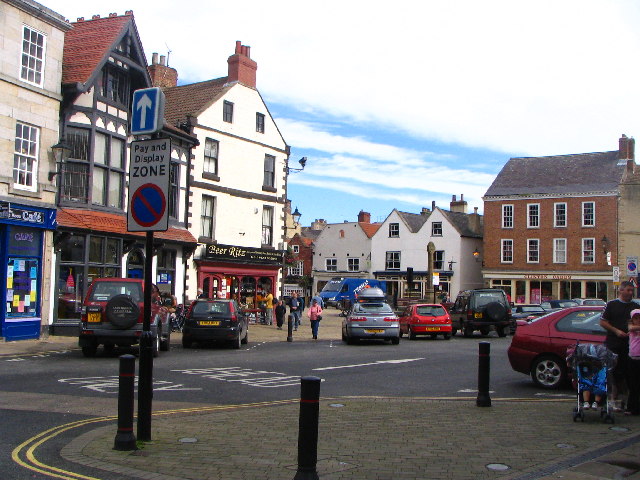
The Basin Images

Images are sourced within 2km of 54.017521/-1.4758331 or Grid Reference SE3458. Thanks to Geograph Open Source API. All images are credited.

Hardware Shop, Castlegate, Knaresborough
Knaresborough Castle
Approach to Knaresborough Castle
Market Square, Knaresborough
Victorian Railway Viaduct, Knaresborough View of River Nidd from Castle Plateau.
Victorian Railway Viaduct, Knaresborough
View of River Nidd from Castle Plateau.
Hannah's House, Castlegate, Knaresborough Dated 1622, one of the oldest buildings in Knaresborough.  Now a restaurant.
Hannah's House, Castlegate, Knaresborough
Dated 1622, one of the oldest buildings in Knaresborough. Now a restaurant.
Footbridge over the river Nidd Bilton Banks Footbridge.
Footbridge over the river Nidd
Bilton Banks Footbridge.
River Nidd near Knaresborough The Nidd flows through a steep tree lined gorge.
River Nidd near Knaresborough
The Nidd flows through a steep tree lined gorge.
Knaresborough from the A59 road bridge This bridge view is from the A59 looking South down the river valley towards the rail bridge.
Knaresborough from the A59 road bridge
This bridge view is from the A59 looking South down the river valley towards the rail bridge.
Silver Street Knaresborough View from High Street of the Junction / mini traffic island between the cobbled Silver Street (leading to Market Place) and Fisher Street
Silver Street Knaresborough
View from High Street of the Junction / mini traffic island between the cobbled Silver Street (leading to Market Place) and Fisher Street
Knaresborough Castle Knaresborough Castle seen through an arch of the railway bridge, from a rowing boat on the River Nidd. (You will have to imagine the boat hire landing stages which were on the bottom of the original picture which I cut off, along with the rower's face!)
Knaresborough Castle
Knaresborough Castle seen through an arch of the railway bridge, from a rowing boat on the River Nidd. (You will have to imagine the boat hire landing stages which were on the bottom of the original picture which I cut off, along with the rower's face!)
The Dropping Well and Mother Shipton's Cave I was amazed to find that this grid square for Knaresborough didn't have a picture of The Dropping Well and Mother Shipton's Cave, so here it is.
The Dropping Well in the foreground calcifies objects left hanging underneath the water dripping down the cliff. Plenty of teddy bears have been turned to stone, and various hats. In the background is the entrance to Mother Shipton's cave - she was reputed to be a prophetess 500 years ago.
For more information see
<span class="nowrap"><a title="https://www.knaresboroughonline.com/local-attractions.html" rel="nofollow ugc noopener" href="https://www.knaresboroughonline.com/local-attractions.html">Link</a><img style="margin-left:2px;" alt="External link" title="External link - shift click to open in new window" src="https://s1.geograph.org.uk/img/external.png" width="10" height="10"/></span>
and
<span class="nowrap"><a title="http://www.mothershiptonscave.com/intro.php" rel="nofollow ugc noopener" href="http://www.mothershiptonscave.com/intro.php">Link</a><img style="margin-left:2px;" alt="External link" title="External link - shift click to open in new window" src="https://s1.geograph.org.uk/img/external.png" width="10" height="10"/></span>
The Dropping Well and Mother Shipton's Cave
I was amazed to find that this grid square for Knaresborough didn't have a picture of The Dropping Well and Mother Shipton's Cave, so here it is. The Dropping Well in the foreground calcifies objects left hanging underneath the water dripping down the cliff. Plenty of teddy bears have been turned to stone, and various hats. In the background is the entrance to Mother Shipton's cave - she was reputed to be a prophetess 500 years ago. For more information see LinkExternal link and LinkExternal link
Knaresborough railway viaduct. The 1840's railway viaduct over the River Nidd was considered to be one of the 'railway crimes of England' at the time of its construction, but now it adds to the picturesque scene along with the medieval church.
Knaresborough railway viaduct.
The 1840's railway viaduct over the River Nidd was considered to be one of the 'railway crimes of England' at the time of its construction, but now it adds to the picturesque scene along with the medieval church.
View towards Knaresborough From the Beryl Burton Cycleway, before the descent down to the Nidd. Nice run down, hard work to come back up!
View towards Knaresborough
From the Beryl Burton Cycleway, before the descent down to the Nidd. Nice run down, hard work to come back up!
Across the Nidd Taken from the Beryl Burton cycleway, looking across the Nidd towards the grounds of Conyngham Hall.
Across the Nidd
Taken from the Beryl Burton cycleway, looking across the Nidd towards the grounds of Conyngham Hall.
Abbey Road The Overhanging cliffs along Abbey Road in the Nidd Gorge. The river is to the left.
Abbey Road
The Overhanging cliffs along Abbey Road in the Nidd Gorge. The river is to the left.
Nidd Viaduct Taken from below the Castle. To the left the railway runs to Harrogate, and to the right to York.
Nidd Viaduct
Taken from below the Castle. To the left the railway runs to Harrogate, and to the right to York.
Ye Oldest Chymist Shoppe In England Apparently, this is the oldest chemist shop in England, in Market Place in Knaresborough. It sells sweets and cakes now, with tea rooms upstairs. Very quaint!
Ye Oldest Chymist Shoppe In England
Apparently, this is the oldest chemist shop in England, in Market Place in Knaresborough. It sells sweets and cakes now, with tea rooms upstairs. Very quaint!
Show me another place!

The Basin is located at Grid Ref: SE3458 (Lat: 54.017521, Lng: -1.4758331)

Division: West Riding

Administrative County: North Yorkshire

District: Harrogate

Police Authority: North Yorkshire

What 3 Words

///irrigated.truckload.teacher. Near Knaresborough, North Yorkshire

Related Wikis

Jacob Smith Park

Jacob Smith Park is a park owned by Harrogate Borough Council in the outskirts of Knaresborough, North Yorkshire, England. It is located in Scriven, and...

Scriven

Scriven is a village and civil parish in the Harrogate district of North Yorkshire, England, close to the town of Knaresborough. From 1947 to 1998 Scriven...

Knaresborough Zoo

Knaresborough Zoo was a zoo located in the grounds of Conyngham Hall, Knaresborough, a small market town within the district of Harrogate, North Yorkshire...

Nidd Gorge

Nidd Gorge makes up a section of the River Nidd in North Yorkshire, England, in which the river enters a deep ravine with sheer tree-covered valley sides...

St John the Baptist Church, Knaresborough

St John the Baptist Church is a parish church in the Church of England located in Knaresborough, North Yorkshire. It is the largest church in the town...

Mother Shipton's Cave

Mother Shipton's Cave (or "Old Mother Shipton's Cave") is at Knaresborough, North Yorkshire, England, near the River Nidd. Nearby is a petrifying well...

Knaresborough railway station

Knaresborough railway station is a Grade II listed station serving the town of Knaresborough in North Yorkshire, England. It is located on the Harrogate...

Nidderdale Rural District

Nidderdale was a rural district in the West Riding of Yorkshire from 1938 to 1974. It was created from the combination of most of the disbanded rural districts...

Nearby Amenities

Located within 500m of 54.017521,-1.4758331
Turning Circle
Lat/Long: 54.0136868/-1.4722099
Turning Circle
Lat/Long: 54.0142232/-1.472762
Post Box
Source: survey
Lat/Long: 54.0143731/-1.4748283
Turning Circle
Lat/Long: 54.0154709/-1.4729614
Turning Circle
Lat/Long: 54.014694/-1.4715708
Turning Circle
Lat/Long: 54.0161503/-1.471688
Tentergate
Place: neighbourhood
Lat/Long: 54.014791/-1.4706755
The data included in this document is from www.openstreetmap.org. The data is made available under ODbL.

Have you been to The Basin?

Leave your review of The Basin below (or comments, questions and feedback).