Angram Reservoir

Lake, Pool, Pond, Freshwater Marsh in Yorkshire Harrogate

England

Angram Reservoir

Dam of Angram Reservoir The reservoir was completed in 1919 and is the highest of several along the course of the River Nidd.
Little Whernside is the hill beyond the dam.
Dam of Angram Reservoir Credit: Trevor Littlewood

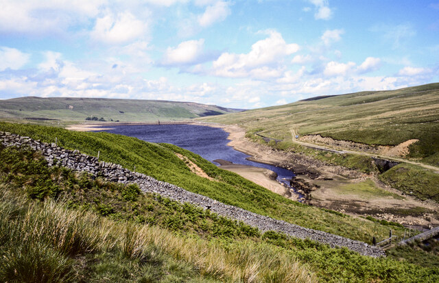
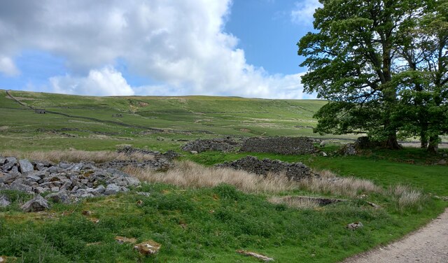
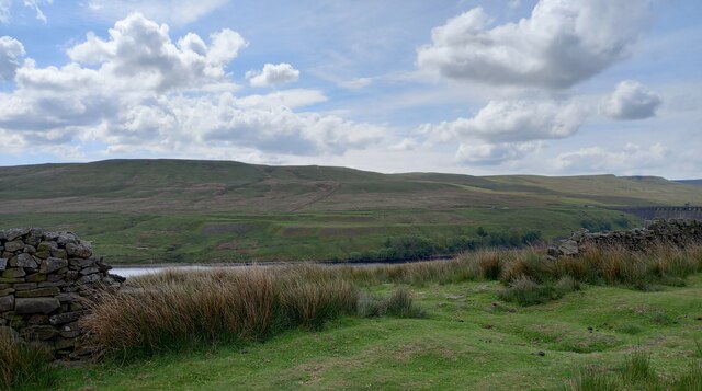
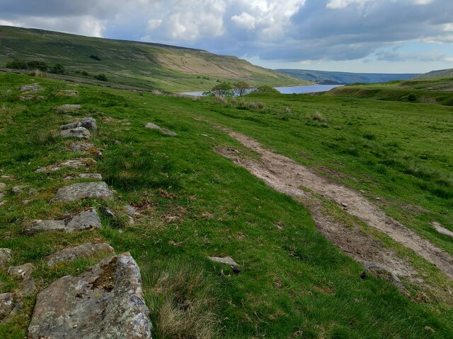
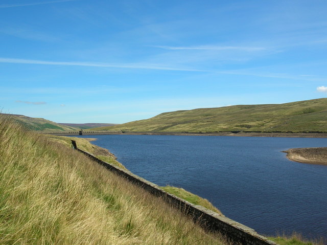
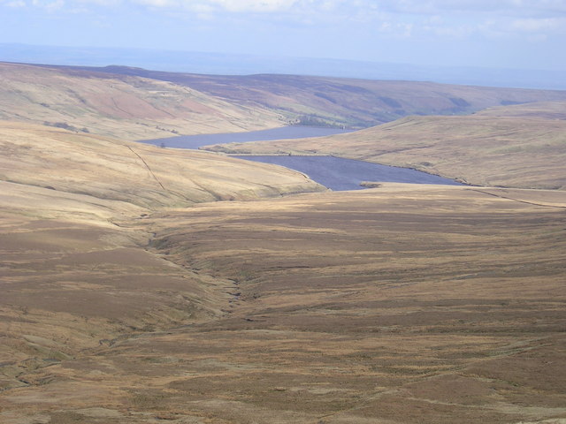
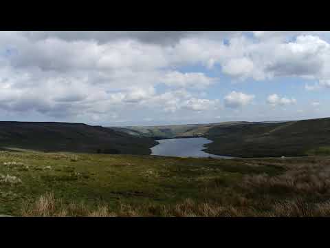
Angram Reservoir is a picturesque freshwater lake located in the county of Yorkshire, England. Situated in the Nidderdale Area of Outstanding Natural Beauty, it is a popular destination for tourists and locals alike. The reservoir is nestled in a tranquil valley surrounded by rolling hills and lush greenery, offering a serene and peaceful atmosphere.

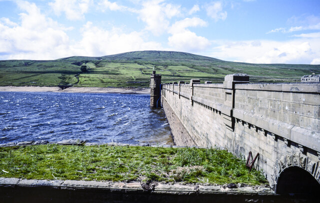
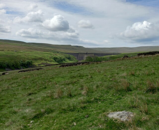
Covering an area of approximately 37 hectares, Angram Reservoir is a man-made water body created in the early 20th century to supply drinking water to the nearby city of York. It is fed by several small streams and springs, ensuring a constant flow of fresh water. The reservoir is surrounded by a dam, which not only serves to retain the water but also provides a stunning backdrop to the landscape.

The lake itself is known for its crystal-clear waters, making it a haven for various aquatic species. Anglers are often seen casting their lines in search of the abundant fish, including trout and perch, that inhabit the reservoir. Birdwatchers also flock to Angram Reservoir, as it attracts a diverse array of avian species, including ducks, geese, herons, and even the occasional kingfisher.

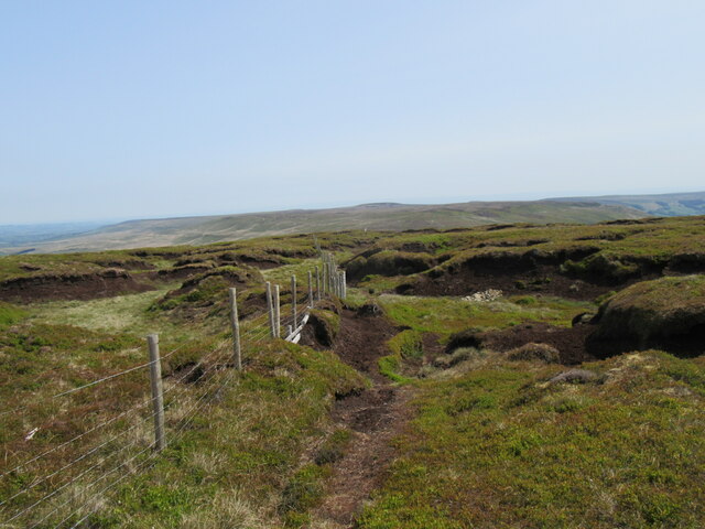
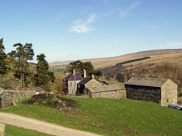
Surrounding the lake, there are several walking trails and picnic areas, allowing visitors to fully immerse themselves in the natural beauty of the area. The reservoir is also a popular spot for sailing and canoeing, with boat rental facilities available on-site.

In summary, Angram Reservoir is a stunning freshwater lake nestled in the scenic Yorkshire countryside. With its tranquil ambiance, diverse wildlife, and various recreational opportunities, it offers a perfect escape for nature enthusiasts and outdoor lovers.

If you have any feedback on the listing, please let us know in the comments section below.

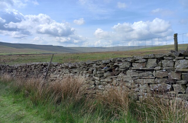
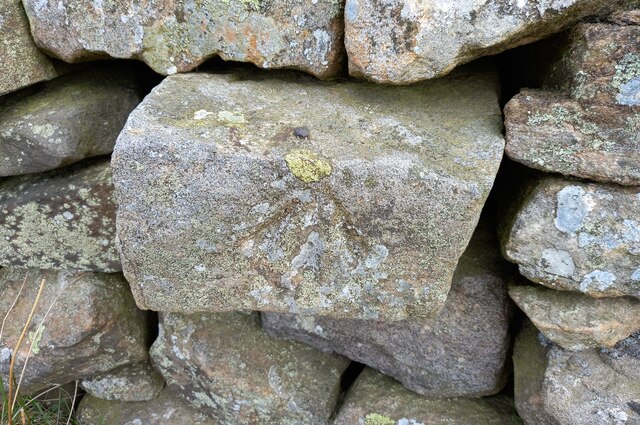
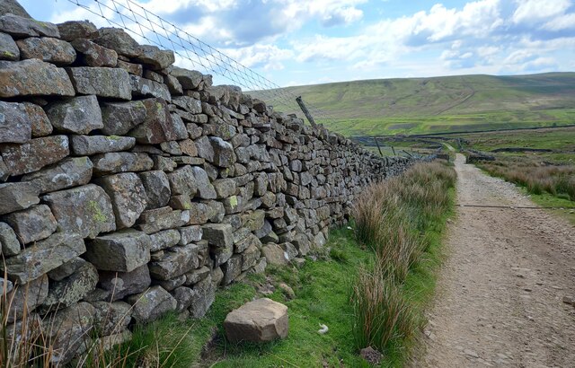
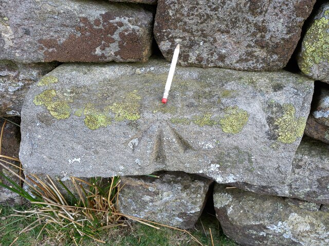
Angram Reservoir Images

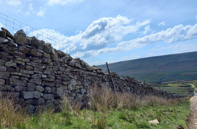
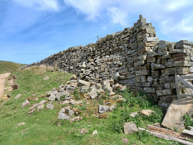
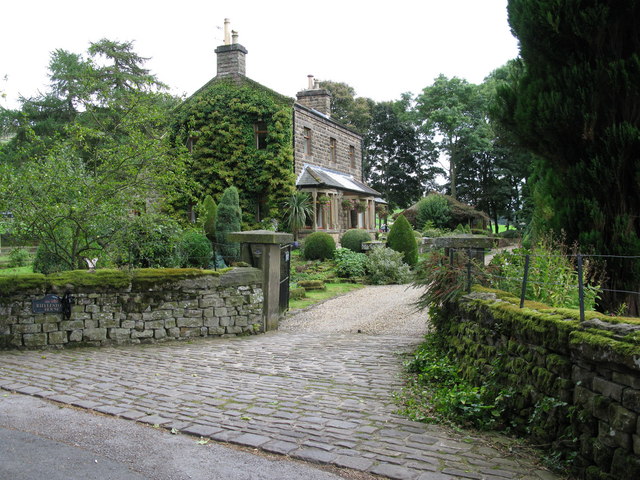
Images are sourced within 2km of 54.180047/-1.9421422 or Grid Reference SE0376. Thanks to Geograph Open Source API. All images are credited.

Dam of Angram Reservoir The reservoir was completed in 1919 and is the highest of several along the course of the River Nidd.
Little Whernside is the hill beyond the dam.
Dam of Angram Reservoir
The reservoir was completed in 1919 and is the highest of several along the course of the River Nidd. Little Whernside is the hill beyond the dam.
Low water at south-western arm of Angram Reservoir Stone Beck enters Angram reservoir at the lower right corner of the image where there's also a weir. At the time the image was recorded there was a distinct 'rim' at the shore due to a low level of water.
Low water at south-western arm of Angram Reservoir
Stone Beck enters Angram reservoir at the lower right corner of the image where there's also a weir. At the time the image was recorded there was a distinct 'rim' at the shore due to a low level of water.
Little Whernside summit The summit of Little Whernside at 604m.
Little Whernside summit
The summit of Little Whernside at 604m.
Remains of demolished barn, Scar House Reservoir According to the 1910 map there was a benchmark cut into a field barn at this location. Today only the tumbled remains of the building are left.
Remains of demolished barn, Scar House Reservoir
According to the 1910 map there was a benchmark cut into a field barn at this location. Today only the tumbled remains of the building are left.
Remains of Lodge hamlet, Nidderdale According to the 1910 map there was a benchmark cut into a building at this location. Today only the tumbled remains of the building are left.
Remains of Lodge hamlet, Nidderdale
According to the 1910 map there was a benchmark cut into a building at this location. Today only the tumbled remains of the building are left.
Western end of Scar house Reservoir According to the 1910 map there was a benchmark cut into the wall enclosure at this location. Today there is a large gap in the field boundary and the benchmark has gone.
Western end of Scar house Reservoir
According to the 1910 map there was a benchmark cut into the wall enclosure at this location. Today there is a large gap in the field boundary and the benchmark has gone.
Benchmark cut into boulder, Nidderdale The benchmark is cut into a lone boulder in a field enclose on the north-west side of Scar House Reservoir. Wider view <a href="https://www.geograph.org.uk/photo/7556070">SE0476 : Dam at Angram Reservoir, Nidderdale</a>
Benchmark cut into boulder, Nidderdale
The benchmark is cut into a lone boulder in a field enclose on the north-west side of Scar House Reservoir. Wider view SE0476 : Dam at Angram Reservoir, Nidderdale
Dam at Angram Reservoir, Nidderdale There is a benchmark cut into the lone boulder in the field enclosure on the north-west side of Scar House Reservoir. Closer view <a href="https://www.geograph.org.uk/photo/7556065">SE0477 : Benchmark cut into boulder, Nidderdale</a>
Dam at Angram Reservoir, Nidderdale
There is a benchmark cut into the lone boulder in the field enclosure on the north-west side of Scar House Reservoir. Closer view SE0477 : Benchmark cut into boulder, Nidderdale
Benchmark cut into drystone wall, Nidderdale The pivot benchmark is cut into the drystone wall on the north-west side of Scar House Reservoir. Wider view <a href="https://www.geograph.org.uk/photo/7556079">SE0476 : Dam at Angram Reservoir, Nidderdale</a>
Benchmark cut into drystone wall, Nidderdale
The pivot benchmark is cut into the drystone wall on the north-west side of Scar House Reservoir. Wider view SE0476 : Dam at Angram Reservoir, Nidderdale
Dam at Angram Reservoir, Nidderdale There is a pivot benchmark cut into the drystone wall on the north-west side of Scar House Reservoir. Closer view <a href="https://www.geograph.org.uk/photo/7556075">SE0476 : Benchmark cut into drystone wall, Nidderdale</a>
Dam at Angram Reservoir, Nidderdale
There is a pivot benchmark cut into the drystone wall on the north-west side of Scar House Reservoir. Closer view SE0476 : Benchmark cut into drystone wall, Nidderdale
Scar House Reservoir and remains of drystone wall According to the 1910 map there was a benchmark cut into the drystone wall or a gatepost at this location. The wall has gone and only the foundations remain.
Scar House Reservoir and remains of drystone wall
According to the 1910 map there was a benchmark cut into the drystone wall or a gatepost at this location. The wall has gone and only the foundations remain.
Benchmark cut into drystone wall, Nidderdale The benchmark is cut into the drystone wall on the west side of the track which leads from Scar House Reservoir to Horsehouse. Wider view <a href="https://www.geograph.org.uk/photo/7556200">SE0477 : Stonebeck Up, Nidderdale</a>
Benchmark cut into drystone wall, Nidderdale
The benchmark is cut into the drystone wall on the west side of the track which leads from Scar House Reservoir to Horsehouse. Wider view SE0477 : Stonebeck Up, Nidderdale
Stonebeck Up, Nidderdale There is a benchmark cut into the drystone wall on the west side of the track which leads from Scar House Reservoir to Horsehouse. In the distance is Stonebeck Up, south of Scar House Reservoir. Closer view <a href="https://www.geograph.org.uk/photo/7556193">SE0477 : Benchmark cut into drystone wall, Nidderdale</a>
Stonebeck Up, Nidderdale
There is a benchmark cut into the drystone wall on the west side of the track which leads from Scar House Reservoir to Horsehouse. In the distance is Stonebeck Up, south of Scar House Reservoir. Closer view SE0477 : Benchmark cut into drystone wall, Nidderdale
Benchmark cut into drystone wall, Nidderdale The benchmark is cut into the drystone wall on the east side of the track which leads from Scar House Reservoir to Horsehouse. Wider view <a href="https://www.geograph.org.uk/photo/7556202">SE0477 : Track leading from Scar House to Horsehouse</a>
Benchmark cut into drystone wall, Nidderdale
The benchmark is cut into the drystone wall on the east side of the track which leads from Scar House Reservoir to Horsehouse. Wider view SE0477 : Track leading from Scar House to Horsehouse
Track leading from Scar House to Horsehouse There is a rivet benchmark cut into the drystone wall on the east side of the track which leads from Scar House Reservoir to Horsehouse. Closer view <a href="https://www.geograph.org.uk/photo/7556201">SE0477 : Benchmark cut into drystone wall, Nidderdale</a>
Track leading from Scar House to Horsehouse
There is a rivet benchmark cut into the drystone wall on the east side of the track which leads from Scar House Reservoir to Horsehouse. Closer view SE0477 : Benchmark cut into drystone wall, Nidderdale
Benchmark cut into drystone wall, Nidderdale The pivot benchmark is cut into the drystone wall on the east side of the track which leads from Scar House Reservoir to Horsehouse. Wider view <a href="https://www.geograph.org.uk/photo/7556204">SE0477 : Track with adjacent wall leading from Scar House to Horsehouse</a>
Benchmark cut into drystone wall, Nidderdale
The pivot benchmark is cut into the drystone wall on the east side of the track which leads from Scar House Reservoir to Horsehouse. Wider view SE0477 : Track with adjacent wall leading from Scar House to Horsehouse
Track with adjacent wall leading from Scar House to Horsehouse There is a pivot benchmark cut into the drystone wall on the east side of the track which leads from Scar House Reservoir to Horsehouse. Closer view <a href="https://www.geograph.org.uk/photo/7556203">SE0477 : Benchmark cut into drystone wall, Nidderdale</a>
Track with adjacent wall leading from Scar House to Horsehouse
There is a pivot benchmark cut into the drystone wall on the east side of the track which leads from Scar House Reservoir to Horsehouse. Closer view SE0477 : Benchmark cut into drystone wall, Nidderdale
Remains of demolished barn, Nidderdale According to the 1910 map there was a benchmark cut into the face of a stone barn at this location. Only broken stone remains and the benchmark has probably been destroyed.
Remains of demolished barn, Nidderdale
According to the 1910 map there was a benchmark cut into the face of a stone barn at this location. Only broken stone remains and the benchmark has probably been destroyed.
Show me another place!

Angram Reservoir is located at Grid Ref: SE0376 (Lat: 54.180047, Lng: -1.9421422)

Division: West Riding

Administrative County: North Yorkshire

District: Harrogate

Police Authority: North Yorkshire

What 3 Words

///consumed.freely.ripples. Near Grassington, North Yorkshire

Related Wikis

Related Videos

Battered by winds at Scar House Reservoir #reservoirs #walking

welcome back to another group walk. We revisit the stunning Scar House Reservoir in Nidderdale. We had no idea that this would ...

Scar House and Angram Reservoirs and the lost village #yorkshire #walking #wellness #ellofawalk

We take a circular walk around Scar House and Angram Reservoirs. Based in Nidderdale, North Yorkshire it is designated an are ...

Down the Nidd, part Minus Two: bridleway?

The long green dashes on the map indicate that you have the legal right to travel that route on foot, on horseback or on a bicycle.

Have you been to Angram Reservoir?

Leave your review of Angram Reservoir below (or comments, questions and feedback).