Lane End Dam

Lake, Pool, Pond, Freshwater Marsh in Yorkshire

England

Lane End Dam

Clapper Bridge Bridge now repaired after collapse some time ago.
Clapper Bridge Credit: Stephen Shaw

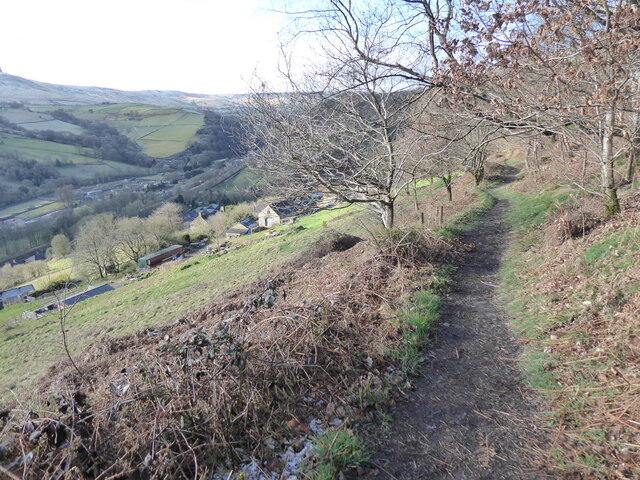
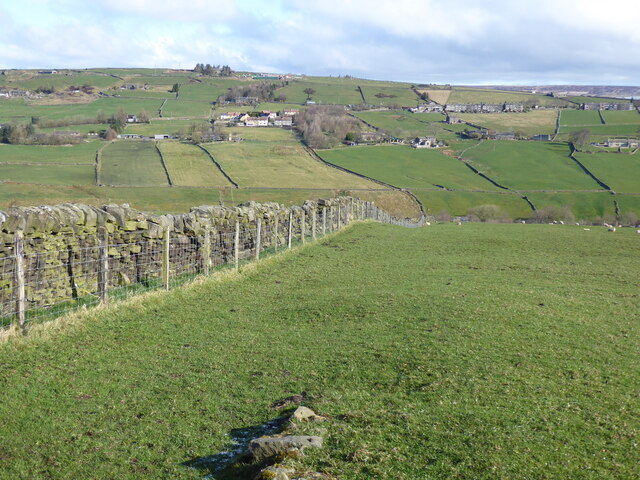
Lane End Dam is a picturesque freshwater marsh located in Yorkshire, England. Situated amidst rolling hills and lush greenery, this natural oasis offers a serene and tranquil environment for visitors to enjoy. Spanning over an area of approximately 2 hectares, the dam is primarily composed of a large lake, with smaller pools and ponds scattered throughout.

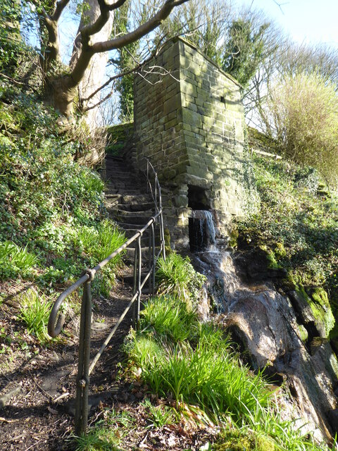
The main lake at Lane End Dam is a captivating sight, with its crystal-clear freshwater reflecting the surrounding landscape. It serves as a vital habitat for a variety of aquatic flora and fauna, including water lilies, reeds, and numerous species of fish and amphibians. The calm waters also attract a diverse range of birdlife, making it a popular spot for birdwatching enthusiasts.

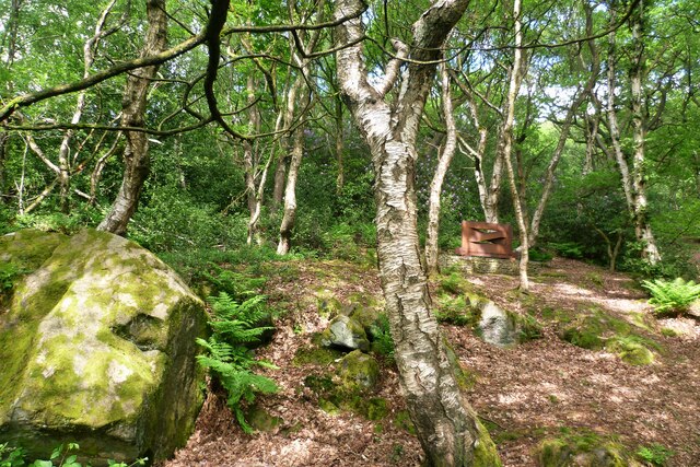
In addition to the lake, Lane End Dam boasts smaller pools and ponds that add to the overall charm of the area. These smaller bodies of water often teem with aquatic plants and insects, creating a vibrant ecosystem that supports a wide array of wildlife. Visitors can observe dragonflies darting across the water's surface or marvel at the delicate beauty of water lilies blooming in the ponds.

The surrounding freshwater marshland is a haven for an assortment of plant species, including rushes, sedges, and various types of grasses. This rich vegetation provides a habitat for numerous small mammals, such as voles and shrews, as well as reptiles like frogs and newts.

Lane End Dam is a cherished natural gem in Yorkshire, offering visitors the chance to immerse themselves in a captivating combination of lakes, pools, ponds, and freshwater marshes. Whether it's birdwatching, wildlife spotting, or simply enjoying the peaceful atmosphere, this idyllic destination is sure to leave a lasting impression on all who visit.

If you have any feedback on the listing, please let us know in the comments section below.

Lane End Dam Images

Images are sourced within 2km of 53.739068/-2.0504473 or Grid Reference SD9626. Thanks to Geograph Open Source API. All images are credited.

Clapper Bridge Bridge now repaired after collapse some time ago.
Clapper Bridge
Bridge now repaired after collapse some time ago.
Halifax Road at Calderside View from rail line on Whiteley Arches
Halifax Road at Calderside
View from rail line on Whiteley Arches
Oakville Road at Calderside View from Rochdale to Leeds railway
Oakville Road at Calderside
View from Rochdale to Leeds railway
Seat at eastern end of Horsehold Wood & view over Calderside A seat with a view.
Seat at eastern end of Horsehold Wood & view over Calderside
A seat with a view.
View towards Hebden Bridge from eastern end of Horsehold Wood
Old Boundary Marker in Stoodley Glen, Calderdale Township Boundary Marker above Stoodley Glen and south of Stoodley Lane. Formerly on the boundary of Langfield and Sowerby townships in Halifax parish. It marked the boundary of the Sowerby Ramble, a narrow strip of land along the Calder valley and up Stoodley Glen between Erringden and Stansfield townships and Erringden and Langfield township. Sowerby Ramble was part of Sowerby township but in 1850 it became part of Erringden township, later parish. In 1897 Langfield and Stansfield became part of Todmorden parish and in 1937 this part of Erringden parish also became part of Todmorden parish. 

Milestone Society National ID: YW_LANSOW02pb
Old Boundary Marker in Stoodley Glen, Calderdale
Township Boundary Marker above Stoodley Glen and south of Stoodley Lane. Formerly on the boundary of Langfield and Sowerby townships in Halifax parish. It marked the boundary of the Sowerby Ramble, a narrow strip of land along the Calder valley and up Stoodley Glen between Erringden and Stansfield townships and Erringden and Langfield township. Sowerby Ramble was part of Sowerby township but in 1850 it became part of Erringden township, later parish. In 1897 Langfield and Stansfield became part of Todmorden parish and in 1937 this part of Erringden parish also became part of Todmorden parish. Milestone Society National ID: YW_LANSOW02pb
Old Boundary Marker in Stoodley Glen, Calderdale Parish Boundary Marker in Stoodley Glen below Height Wood. Formerly on the boundary of Langfield and Sowerby townships in Halifax parish. It marked the boundary of the Sowerby Ramble, a narrow strip of land along the Calder valley and up Stoodley Glen between Erringden and Stansfield townships and Erringden and Langfield township. Sowerby Ramble was part of Sowerby township but in 1850 it became part of Erringden township, later parish. In 1897 Langfield and Stansfield became part of Todmorden parish and in 1937 this part of Erringden parish also became part of Todmorden parish..

Milestone Society National ID: YW_SOWERR01pb
Old Boundary Marker in Stoodley Glen, Calderdale
Parish Boundary Marker in Stoodley Glen below Height Wood. Formerly on the boundary of Langfield and Sowerby townships in Halifax parish. It marked the boundary of the Sowerby Ramble, a narrow strip of land along the Calder valley and up Stoodley Glen between Erringden and Stansfield townships and Erringden and Langfield township. Sowerby Ramble was part of Sowerby township but in 1850 it became part of Erringden township, later parish. In 1897 Langfield and Stansfield became part of Todmorden parish and in 1937 this part of Erringden parish also became part of Todmorden parish.. Milestone Society National ID: YW_SOWERR01pb
Rawtonstall Wood The wood with a view to the memorial to Jeffery Stinson, an architect
Rawtonstall Wood
The wood with a view to the memorial to Jeffery Stinson, an architect
Oakville Road and Railway View towards Hebden Bridge where road and rail are hardly separated. A rail track cleaning train is going over Whiteley Arches
Oakville Road and Railway
View towards Hebden Bridge where road and rail are hardly separated. A rail track cleaning train is going over Whiteley Arches
Savile Road The road is cut into the hillside of Rawtonstall Wood
Savile Road
The road is cut into the hillside of Rawtonstall Wood
Mytholm Mill Chimney The chimney is isolated high above the former mill in the valley bottom. This is the view from Bank Terrace
Mytholm Mill Chimney
The chimney is isolated high above the former mill in the valley bottom. This is the view from Bank Terrace
The Pennine Way and Bridleway crossing the A646
The Pennine Way leaving the A646
The Pennine Way near Higher Underbank Farm
The Pennine Way near Knott Wood
The Pennine Way near Badger Fields Farm
The Pennine Way on Pry Hill
Show me another place!

Lane End Dam is located at Grid Ref: SD9626 (Lat: 53.739068, Lng: -2.0504473)

Division: West Riding

Unitary Authority: Calderdale

Police Authority: West Yorkshire

What 3 Words

///appear.starter.aliens. Near Hebden Bridge, West Yorkshire

Related Wikis

South Pennines Regional Park

The South Pennines Regional Park (or South Pennines Park) is a proposed national park that would cover the South Pennines area in Northern England, encompassing...

Eastwood (L&Y) railway station

Eastwood Railway Station served the village of Eastwood in the civil parish of Todmorden, West Yorkshire, England. The station opened with the line on...

Eastwood, West Yorkshire

Eastwood is a place within the civil parish of Todmorden and Metropolitan Borough of Calderdale, in West Yorkshire, England. It lies 8 miles (12.9 km)...

Colden, West Yorkshire

Colden is a hamlet in the civil parish of Heptonstall in Calderdale, West Yorkshire, England. Historically part of the West Riding of Yorkshire, the hamlet...

Heptonstall

Heptonstall is a small village and civil parish within the Calderdale borough of West Yorkshire, England, historically part of the West Riding of Yorkshire...

Blackshaw

Blackshaw is a civil parish in the Calderdale metropolitan borough of West Yorkshire, England. It contains the village of Blackshaw Head. According to...

Hepton Rural District

Hepton was a rural district in the West Riding of Yorkshire, England, from 1894 to 1974. The district included four civil parishes: Heptonstall, Blackshaw...

Battle of Heptonstall

The Battle of Heptonstall occurred in November 1643 during the First English Civil War at Hebden Bridge and Heptonstall, Yorkshire. During the battle,...

Nearby Amenities

Located within 500m of 53.739068,-2.0504473
Barrier: stile
Steps: 2
Stile: stepover
Lat/Long: 53.7358371/-2.0490263
Waterway: waterfall
Lat/Long: 53.7382707/-2.0450341
Barrier: stile
Stile: squeezer
Lat/Long: 53.743491/-2.0507388
Barrier: stile
Stile: squeezer
Lat/Long: 53.7435371/-2.0507509
Power: pole
Lat/Long: 53.7433655/-2.0482904
Power: pole
Lat/Long: 53.7427063/-2.0477003
Waterway: waterfall
Lat/Long: 53.7378257/-2.0450311
Power: pole
Lat/Long: 53.7374768/-2.0556436
Power: pole
Lat/Long: 53.7379051/-2.0548913
Power: pole
Lat/Long: 53.738301/-2.0535247
Power: pole
Lat/Long: 53.7385976/-2.0525832
Power: pole
Lat/Long: 53.7385913/-2.0435093
Power: pole
Lat/Long: 53.74219/-2.0471773
Power: pole
Lat/Long: 53.7415729/-2.0466489
Power: pole
Lat/Long: 53.7410209/-2.0460856
Power: pole
Lat/Long: 53.7404815/-2.0454928
Power: pole
Lat/Long: 53.739858/-2.0448357
Power: pole
Lat/Long: 53.7392489/-2.0441759
Power: pole
Lat/Long: 53.7387174/-2.0436555
Power: pole
Lat/Long: 53.7388967/-2.0514983
Power: pole
Lat/Long: 53.7395233/-2.0494142
Power: pole
Lat/Long: 53.7398009/-2.0484594
Power: pole
Lat/Long: 53.7400183/-2.047703
Power: pole
Lat/Long: 53.7403974/-2.0463914
Power: pole
Lat/Long: 53.740729/-2.0452943
Power: pole
Lat/Long: 53.740986/-2.044495
The data included in this document is from www.openstreetmap.org. The data is made available under ODbL.

Have you been to Lane End Dam?

Leave your review of Lane End Dam below (or comments, questions and feedback).