Dean Wood

Wood, Forest in Yorkshire

England

Dean Wood

Clapper Bridge Bridge now repaired after collapse some time ago.
Clapper Bridge Credit: Stephen Shaw

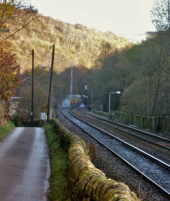
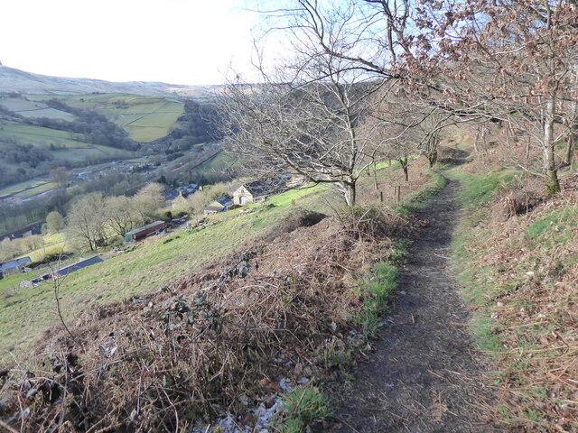
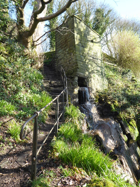
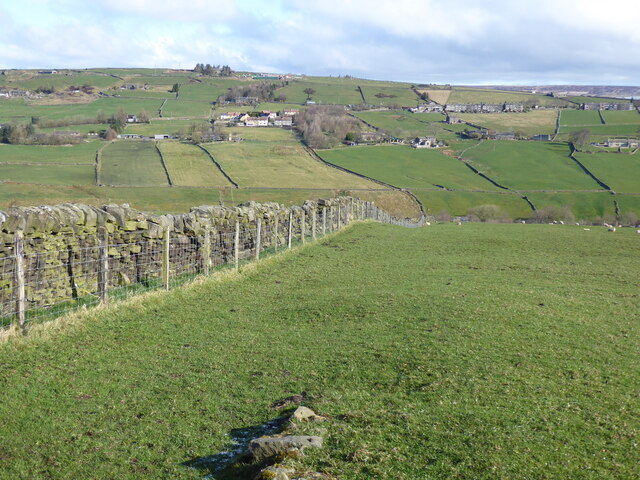
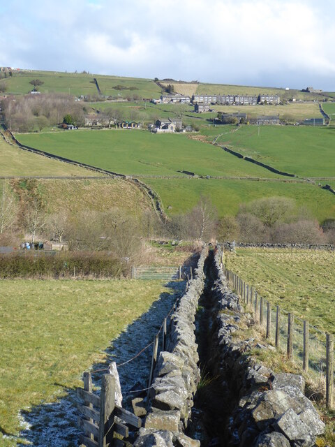
Dean Wood is a small village located in the county of Yorkshire, England. Situated in the heart of the Yorkshire Dales, it is surrounded by picturesque landscapes and lush greenery. The village is known for its dense woodland and beautiful forest, which attract nature enthusiasts and hikers from far and wide.

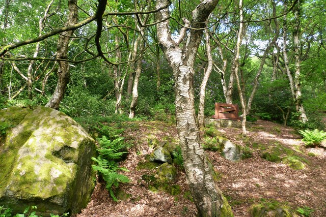
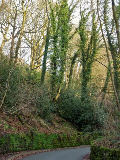
The woodland in Dean Wood is home to an array of flora and fauna, including ancient oak trees, vibrant wildflowers, and a variety of bird species. The forest provides a tranquil and peaceful atmosphere, making it a popular spot for those seeking solace in nature. The surrounding area offers numerous walking trails and scenic spots, allowing visitors to immerse themselves in the natural beauty of the region.

In addition to its natural attractions, Dean Wood also boasts a rich history and heritage. The village has a small population, with a close-knit community that takes pride in preserving its traditions. Visitors can explore the charming village center, which features traditional stone cottages and a quaint village pub.

Dean Wood is also conveniently located near other popular tourist destinations in Yorkshire. Just a short drive away, visitors can explore the historic market town of Skipton or take a scenic drive through the stunning Yorkshire Dales National Park.

Overall, Dean Wood offers a peaceful retreat in the heart of the Yorkshire countryside, where visitors can experience the beauty of nature and immerse themselves in the rich history and culture of the region.

If you have any feedback on the listing, please let us know in the comments section below.

Dean Wood Images

Images are sourced within 2km of 53.737913/-2.0583747 or Grid Reference SD9626. Thanks to Geograph Open Source API. All images are credited.

Clapper Bridge Bridge now repaired after collapse some time ago.
Clapper Bridge
Bridge now repaired after collapse some time ago.
Halifax Road at Calderside View from rail line on Whiteley Arches
Halifax Road at Calderside
View from rail line on Whiteley Arches
Oakville Road at Calderside View from Rochdale to Leeds railway
Oakville Road at Calderside
View from Rochdale to Leeds railway
Old Boundary Marker in Stoodley Glen, Calderdale Township Boundary Marker above Stoodley Glen and south of Stoodley Lane. Formerly on the boundary of Langfield and Sowerby townships in Halifax parish. It marked the boundary of the Sowerby Ramble, a narrow strip of land along the Calder valley and up Stoodley Glen between Erringden and Stansfield townships and Erringden and Langfield township. Sowerby Ramble was part of Sowerby township but in 1850 it became part of Erringden township, later parish. In 1897 Langfield and Stansfield became part of Todmorden parish and in 1937 this part of Erringden parish also became part of Todmorden parish. 

Milestone Society National ID: YW_LANSOW02pb
Old Boundary Marker in Stoodley Glen, Calderdale
Township Boundary Marker above Stoodley Glen and south of Stoodley Lane. Formerly on the boundary of Langfield and Sowerby townships in Halifax parish. It marked the boundary of the Sowerby Ramble, a narrow strip of land along the Calder valley and up Stoodley Glen between Erringden and Stansfield townships and Erringden and Langfield township. Sowerby Ramble was part of Sowerby township but in 1850 it became part of Erringden township, later parish. In 1897 Langfield and Stansfield became part of Todmorden parish and in 1937 this part of Erringden parish also became part of Todmorden parish. Milestone Society National ID: YW_LANSOW02pb
Old Boundary Marker in Stoodley Glen, Calderdale Parish Boundary Marker in Stoodley Glen below Height Wood. Formerly on the boundary of Langfield and Sowerby townships in Halifax parish. It marked the boundary of the Sowerby Ramble, a narrow strip of land along the Calder valley and up Stoodley Glen between Erringden and Stansfield townships and Erringden and Langfield township. Sowerby Ramble was part of Sowerby township but in 1850 it became part of Erringden township, later parish. In 1897 Langfield and Stansfield became part of Todmorden parish and in 1937 this part of Erringden parish also became part of Todmorden parish..

Milestone Society National ID: YW_SOWERR01pb
Old Boundary Marker in Stoodley Glen, Calderdale
Parish Boundary Marker in Stoodley Glen below Height Wood. Formerly on the boundary of Langfield and Sowerby townships in Halifax parish. It marked the boundary of the Sowerby Ramble, a narrow strip of land along the Calder valley and up Stoodley Glen between Erringden and Stansfield townships and Erringden and Langfield township. Sowerby Ramble was part of Sowerby township but in 1850 it became part of Erringden township, later parish. In 1897 Langfield and Stansfield became part of Todmorden parish and in 1937 this part of Erringden parish also became part of Todmorden parish.. Milestone Society National ID: YW_SOWERR01pb
Old Boundary Marker Estate Boundary Marker set in a stone wall on Matthew Lane, a green lane. In the former Stansfield township and parish, absorbed into Todmorden parish in 1897. Not on any township or parish boundary so is thought to mark an estate boundary.

Milestone Society National ID: YW_TOD10em
Old Boundary Marker
Estate Boundary Marker set in a stone wall on Matthew Lane, a green lane. In the former Stansfield township and parish, absorbed into Todmorden parish in 1897. Not on any township or parish boundary so is thought to mark an estate boundary. Milestone Society National ID: YW_TOD10em
Old Boundary Marker on Baulk Head Lane, Todmorden Estate Boundary Marker set in a stone wall on Baulk Head Lane, a green lane. In the former Stansfield township and parish, absorbed into Todmorden parish in 1897. Not on any township or parish boundary so is thought to mark an estate boundary.

Milestone Society National ID: YW_TOD11em
Old Boundary Marker on Baulk Head Lane, Todmorden
Estate Boundary Marker set in a stone wall on Baulk Head Lane, a green lane. In the former Stansfield township and parish, absorbed into Todmorden parish in 1897. Not on any township or parish boundary so is thought to mark an estate boundary. Milestone Society National ID: YW_TOD11em
Rawtonstall Wood The wood with a view to the memorial to Jeffery Stinson, an architect
Rawtonstall Wood
The wood with a view to the memorial to Jeffery Stinson, an architect
Oakville Road and Railway View towards Hebden Bridge where road and rail are hardly separated. A rail track cleaning train is going over Whiteley Arches
Oakville Road and Railway
View towards Hebden Bridge where road and rail are hardly separated. A rail track cleaning train is going over Whiteley Arches
Savile Road The road is cut into the hillside of Rawtonstall Wood
Savile Road
The road is cut into the hillside of Rawtonstall Wood
The Pennine Way and Bridleway crossing the A646
The Pennine Way leaving the A646
The Pennine Way near Higher Underbank Farm
The Pennine Way near Knott Wood
The Pennine Way near Badger Fields Farm
The Pennine Way on Pry Hill
The Pennine Way descending Pry Hill
Show me another place!

Dean Wood is located at Grid Ref: SD9626 (Lat: 53.737913, Lng: -2.0583747)

Division: West Riding

Unitary Authority: Calderdale

Police Authority: West Yorkshire

What 3 Words

///bared.shuttled.challenge. Near Hebden Bridge, West Yorkshire

Related Wikis

South Pennines Regional Park

The South Pennines Regional Park (or South Pennines Park) is a proposed national park that would cover the South Pennines area in Northern England, encompassing...

Eastwood (L&Y) railway station

Eastwood Railway Station served the village of Eastwood in the civil parish of Todmorden, West Yorkshire, England. The station opened with the line on...

Eastwood, West Yorkshire

Eastwood is a place within the civil parish of Todmorden and Metropolitan Borough of Calderdale, in West Yorkshire, England. It lies 8 miles (12.9 km)...

Colden, West Yorkshire

Colden is a hamlet in the civil parish of Heptonstall in Calderdale, West Yorkshire, England. Historically part of the West Riding of Yorkshire, the hamlet...

Blackshaw

Blackshaw is a civil parish in the Calderdale metropolitan borough of West Yorkshire, England. It contains the village of Blackshaw Head. According to...

Heptonstall

Heptonstall is a small village and civil parish within the Calderdale borough of West Yorkshire, England, historically part of the West Riding of Yorkshire...

Stoodley Pike

Stoodley Pike is a 1,300-foot (400 m) hill in the south Pennines in West Yorkshire in northern England. It is noted for the 121-foot (37 m) Stoodley Pike...

Hepton Rural District

Hepton was a rural district in the West Riding of Yorkshire, England, from 1894 to 1974. The district included four civil parishes: Heptonstall, Blackshaw...

Related Videos

Scotland, Ireland, England: Student Travel

Check out our high school trip to Scotland, Ireland, and England! Teachers, find out how you can go on amazing trips like this for ...

Adventuring Across England and Wales | Spring 2019

Finally sharing our England and Wales trip from spring of last year. It was an exhilarating experience, and I look forward to going ...

A warm welcome to 4 season backpacking

A warm welcome to everyone. My channel is for you guys. I make these videos for free for your entertainment and maybe we can ...

TRAVELING AROUND THE WORLD: Great Britain & Ireland 2018

3 weeks on the road with my girlfriend in Great Britain and Ireland, spending the nights in the most beautiful Airbnbs. We were in ...

Nearby Amenities

Located within 500m of 53.737913,-2.0583747
Barrier: stile
Bicycle: no
Foot: yes
Horse: no
Material: wood
Motor Vehicle: no
Stile: ladder
Lat/Long: 53.7388224/-2.065529
Barrier: stile
Material: stone
Stile: squeezer
Lat/Long: 53.7407743/-2.0637156
Power: pole
Lat/Long: 53.734172/-2.0592673
Power: pole
Lat/Long: 53.7359355/-2.0578042
Power: pole
Lat/Long: 53.7365542/-2.0572677
Power: pole
Lat/Long: 53.7374768/-2.0556436
Power: pole
Lat/Long: 53.7379051/-2.0548913
Power: pole
Lat/Long: 53.738301/-2.0535247
Power: pole
Lat/Long: 53.7385976/-2.0525832
Power: pole
Lat/Long: 53.7388967/-2.0514983
The data included in this document is from www.openstreetmap.org. The data is made available under ODbL.

Have you been to Dean Wood?

Leave your review of Dean Wood below (or comments, questions and feedback).