Back o'th' Brook

Settlement in Staffordshire Staffordshire Moorlands

England

Back o'th' Brook

Main Road near Cauldon Looking east with one of the chimneys associated with the cement works visible.
Main Road near Cauldon Credit: Jonathan Clitheroe

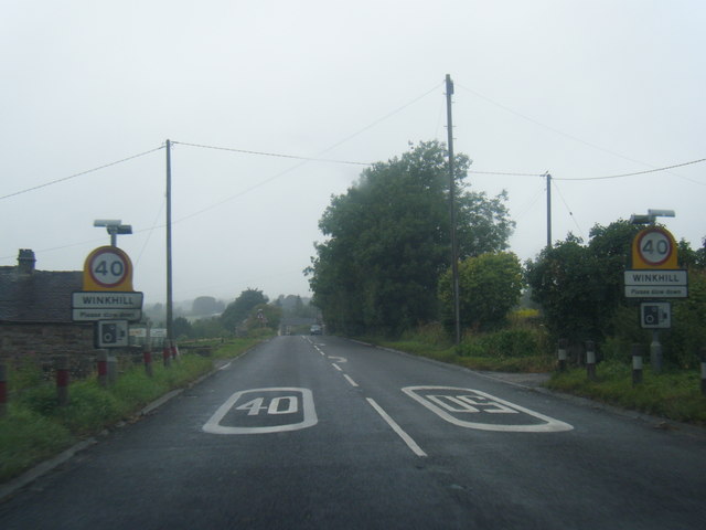
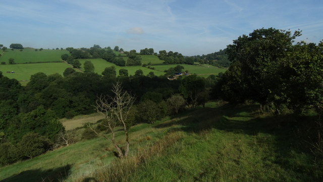
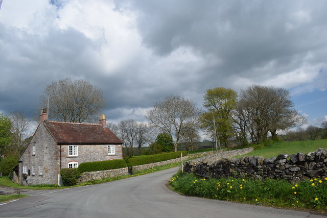
Back o'th' Brook is a small village located in the county of Staffordshire, England. Situated in the West Midlands region, it is nestled in a picturesque valley surrounded by rolling hills and lush green countryside. The village is part of the larger civil parish of Kingsley, and it is approximately 8 miles south-west of the market town of Leek.

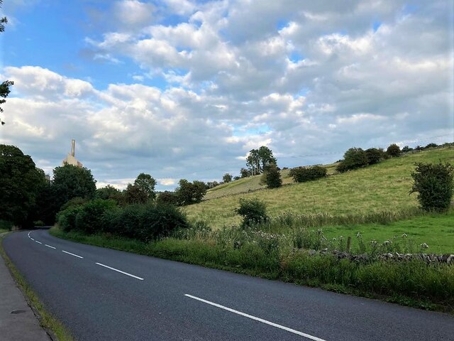
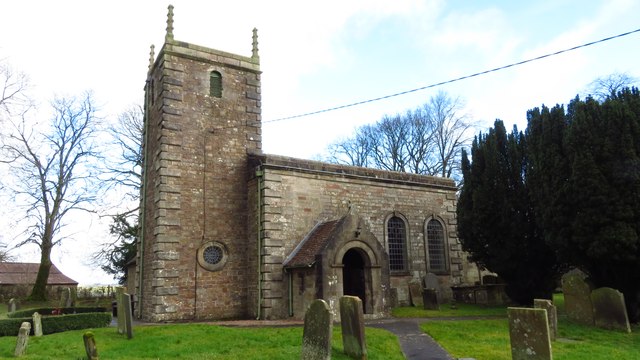
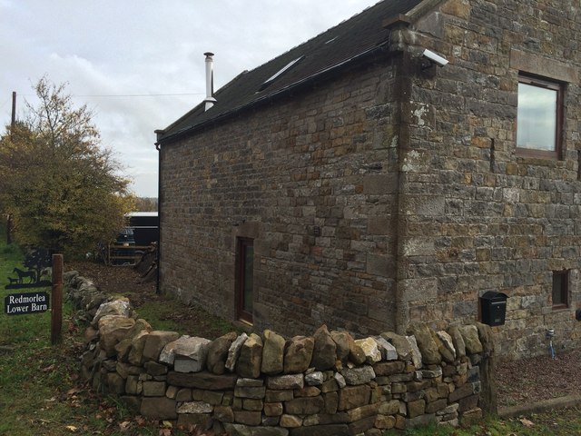
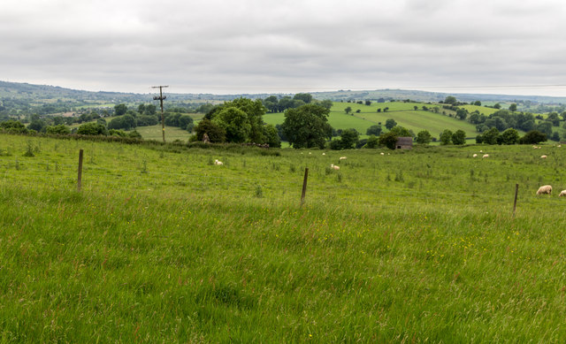
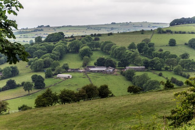
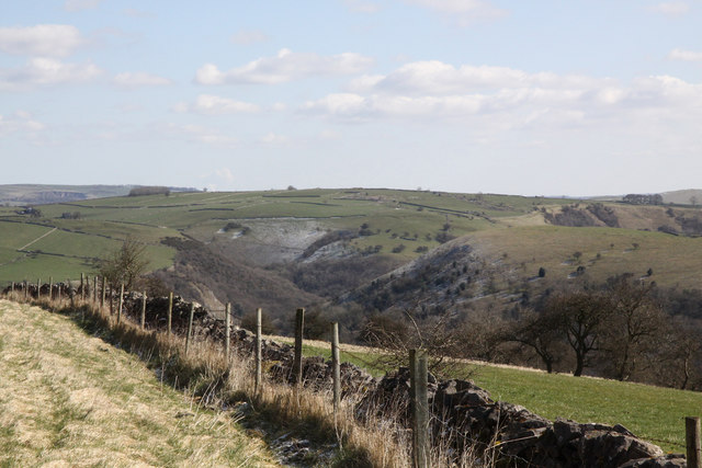
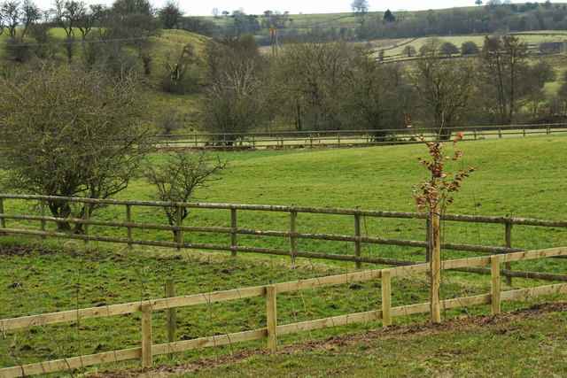
Back o'th' Brook is known for its tranquility and rural charm, making it an ideal destination for those seeking a peaceful retreat from the hustle and bustle of city life. The village is characterized by its traditional stone-built cottages, many of which date back to the 18th and 19th centuries, giving it a timeless and nostalgic atmosphere.

The village is home to a tight-knit community that takes great pride in its local heritage. Residents often participate in community events and gatherings, fostering a strong sense of camaraderie. The village also has a charming village hall, which serves as a hub for social activities and meetings.

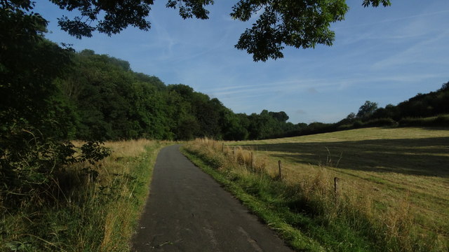
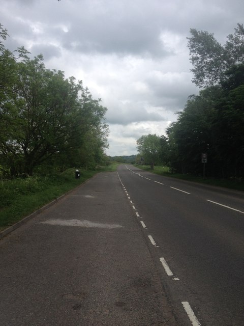
Nature enthusiasts will find plenty to explore in Back o'th' Brook and its surrounding areas. There are numerous walking trails and footpaths that wind through the countryside, offering breathtaking views of the Staffordshire Moorlands. The nearby River Churnet provides opportunities for fishing and boating, while the nearby Peak District National Park offers a wealth of outdoor activities, such as hiking, cycling, and wildlife spotting.

In summary, Back o'th' Brook is a tranquil and picturesque village in Staffordshire, offering a delightful escape for those seeking a peaceful countryside retreat. With its charming architecture, strong community spirit, and access to beautiful natural surroundings, it is a hidden gem waiting to be discovered.

If you have any feedback on the listing, please let us know in the comments section below.

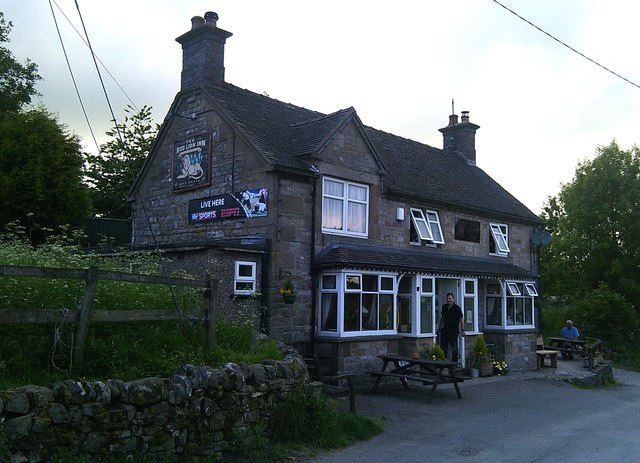
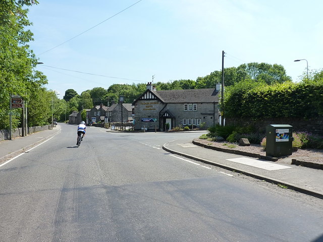
Back o'th' Brook Images

Images are sourced within 2km of 53.056195/-1.882093 or Grid Reference SK0851. Thanks to Geograph Open Source API. All images are credited.

Main Road near Cauldon Looking east with one of the chimneys associated with the cement works visible.
Main Road near Cauldon
Looking east with one of the chimneys associated with the cement works visible.
Cauldon - St Mary & St Laurence Church
Brown End Quarry car park
Redmorlea Lower Barn
Calton Fields near Calton.
Calton
Fields near Calton.
Redway Redway Barn and Redway Farm.
Redway
Redway Barn and Redway Farm.
A523 at Winkhill village boundary
Manifold Valley above Waterhouses
On the path to Calton above Manifold Valley
Old railway buildings at Waterhouse
Cottage in Waterfall At the junction of Waterfall Lane and Rocester Lane.
Cottage in Waterfall
At the junction of Waterfall Lane and Rocester Lane.
Election poster There is a general election on, and I would have expected a great many more posters.  But while crossing the southern Pennines, I saw posters only for one candidate in one constituency.  That one constituency was scattered with a lot of posters for that candidate.

See <a href="https://www.geograph.org.uk/photo/5401375">SK0850 : Election poster</a> for a closeup of the poster
Election poster
There is a general election on, and I would have expected a great many more posters. But while crossing the southern Pennines, I saw posters only for one candidate in one constituency. That one constituency was scattered with a lot of posters for that candidate. See SK0850 : Election poster for a closeup of the poster
Election poster The election poster seen in <a href="https://www.geograph.org.uk/photo/5401371">SK0850 : Election poster</a>
Election poster
The election poster seen in SK0850 : Election poster
Lay-by on the A523
Lay-by on the A523
Near to Waterhouses Looking down into the valley of the River Hamps close by Waterhouses.
Near to Waterhouses
Looking down into the valley of the River Hamps close by Waterhouses.
Crowtrees Fields
Crowtrees Fields
The Red Lion in Waterfall Another must-visit pub tucked away on a minor road in the Staffordshire peaks.
The Red Lion in Waterfall
Another must-visit pub tucked away on a minor road in the Staffordshire peaks.
Right turn into Earlsway by the Old Crown Hotel
Show me another place!

Back o'th' Brook is located at Grid Ref: SK0851 (Lat: 53.056195, Lng: -1.882093)

Administrative County: Staffordshire

District: Staffordshire Moorlands

Police Authority: Staffordshire

What 3 Words

///gravest.slightly.joystick. Near Mayfield, Staffordshire

Related Wikis

Back o'th' Brook

Back o'th' Brook is a village in Staffordshire, England. The population for the 2011 census can be found under Waterhouses

Waterhouses, Staffordshire

Waterhouses is a village in the south of the Staffordshire Peak District in England. It is around 8 miles from Leek and Ashbourne, being nearly the halfway...

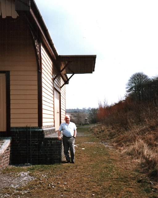
Waterhouses railway station (Staffordshire)

Waterhouses railway station was a railway station that served the village of Waterhouses, Staffordshire. It was opened jointly by the North Staffordshire...

Brown End Quarry

Brown End Quarry is a nature reserve of the Staffordshire Wildlife Trust, near the village of Waterhouses in Staffordshire, England. It is designated a...

Leek and Manifold Valley Light Railway

The Leek and Manifold Valley Light Railway (L&MVLR) was a narrow gauge railway in Staffordshire, England that operated between 1904 and 1934. The line...

Sparrowlee railway station

Sparrowlee was the name of a railway station on the Leek and Manifold Valley Light Railway, a 2 ft 6 in (762 mm) narrow gauge line which ran for 8 miles...

Caldon Low Halt railway station

Caldon Low Halt railway station was a railway station near the hamlet of Cauldon, Staffordshire. It was opened by the North Staffordshire Railway (NSR...

Cauldon

Cauldon or Caldon is a village and former civil parish, 19 miles (31 km) north east of Stafford, now in the parish of Waterhouses, in the Staffordshire...

Nearby Amenities

Located within 500m of 53.056195,-1.882093
Bus Stop
Waterhouses School
Bus: yes
Naptan AtcoCode: 3800C813200
Naptan Bearing: N
Naptan CommonName: Waterhouses School
Naptan Indicator: Adj
Naptan Landmark: School
Naptan Street: Waterfall Lane
Naptan Verified: no
Public Transport: platform
Source: naptan_import
Lat/Long: 53.0546685/-1.8838057
Waterhouses School
Naptan AtcoCode: 3800C813201
Naptan Bearing: S
Naptan BusStopType: CUS
Naptan CommonName: Waterhouses School
Naptan Indicator: Opp
Naptan Landmark: Waterhouses Sch
Naptan Street: Waterfall Lane
Naptan Verified: no
Source: naptan_import
Lat/Long: 53.0545721/-1.8845828
Bus Stop
Breech Close
Bus: yes
Naptan AtcoCode: 3800C817901
Naptan Bearing: N
Naptan CommonName: Breech Close
Naptan Indicator: Adj
Naptan Landmark: Breech Close
Naptan Street: Waterfall Lane
Naptan Verified: no
Public Transport: platform
Source: naptan_import
Lat/Long: 53.0555945/-1.8839375
Turning Circle
Lat/Long: 53.0524247/-1.8855804
Post Box
Post Box Type: wall
Lat/Long: 53.0602704/-1.8811441
Barrier: stile
Material: stone
Source: survey;gps
Stile: squeezer
Lat/Long: 53.0589719/-1.8783914
Barrier: stile
Material: stone
Source: survey;gps
Stile: squeezer
Lat/Long: 53.0605146/-1.88062
Barrier: stile
Material: stone
Source: survey;gps
Stile: squeezer
Lat/Long: 53.0558839/-1.8769726
Barrier: stile
Material: stone
Source: survey;gps
Stile: squeezer
Lat/Long: 53.0570867/-1.8778052
Barrier: stile
Material: stone
Source: survey;gps
Stile: squeezer
Lat/Long: 53.0592254/-1.8783644
Fixme: sign but no stile. footpath obstructed by barbed wire fence.
Lat/Long: 53.0576454/-1.8751863
Barrier: stile
Material: stone
Source: survey;gps
Stile: squeezer
Lat/Long: 53.0518154/-1.8809302
Barrier: stile
Material: wood
Source: survey;gps
Stile: stepover
Lat/Long: 53.0538359/-1.8799576
Barrier: stile
Material: stone
Source: survey;gps
Stile: squeezer
Lat/Long: 53.0546349/-1.8799783
Barrier: stile
Material: stone
Source: survey;gps
Stile: squeezer
Lat/Long: 53.0552757/-1.8802866
Barrier: stile
Source: survey;gps
Stile: squeezer
Lat/Long: 53.0560127/-1.8805718
Barrier: entrance
Source: survey;gps
Lat/Long: 53.0573255/-1.8783685
Bench
Source: survey;gps
Lat/Long: 53.0574385/-1.8818502
Barrier: entrance
Source: survey;gps
Lat/Long: 53.0575892/-1.8790647
Barrier: stile
Material: stone
Source: survey;gps
Stile: squeezer
Lat/Long: 53.0578791/-1.879537
Barrier: stile
Material: wood
Source: survey;gps
Stile: stepover
Lat/Long: 53.0580897/-1.8815234
Barrier: stile
Material: stone
Source: survey;gps
Stile: squeezer
Lat/Long: 53.0590711/-1.8806367
Barrier: stile
Material: stone
Source: survey;gps
Stile: squeezer
Lat/Long: 53.0598659/-1.8814079
Barrier: stile
Material: stone
Source: survey;gps
Stile: squeezer
Lat/Long: 53.0563776/-1.8848618
Barrier: stile
Material: stone
Source: survey;gps
Stile: squeezer
Lat/Long: 53.0579314/-1.8861699
Barrier: stile
Source: survey;gps
Stile: squeezer
Lat/Long: 53.058718/-1.8825751
Barrier: stile
Material: stone
Source: survey;gps
Stile: squeezer
Lat/Long: 53.0588624/-1.8870341
Barrier: stile
Material: wood
Source: survey;gps
Stile: stepover
Lat/Long: 53.0533629/-1.8776332
Barrier: stile
Material: stone
Source: survey;gps
Stile: stepover
Lat/Long: 53.0540605/-1.8774536
Bench
Backrest: yes
Seats: 9
Lat/Long: 53.0528648/-1.8811164
Shelter
Lat/Long: 53.0535566/-1.880624
Advertising: board
Lat/Long: 53.0587293/-1.8825968
Post Box
Post Box Type: lamp
Lat/Long: 53.0545077/-1.883671
Barrier: bollard
Lat/Long: 53.0541901/-1.8839165
The data included in this document is from www.openstreetmap.org. The data is made available under ODbL.

Have you been to Back o'th' Brook?

Leave your review of Back o'th' Brook below (or comments, questions and feedback).